Academic Profile
Statistics
Similar Authors
Papers on arXiv
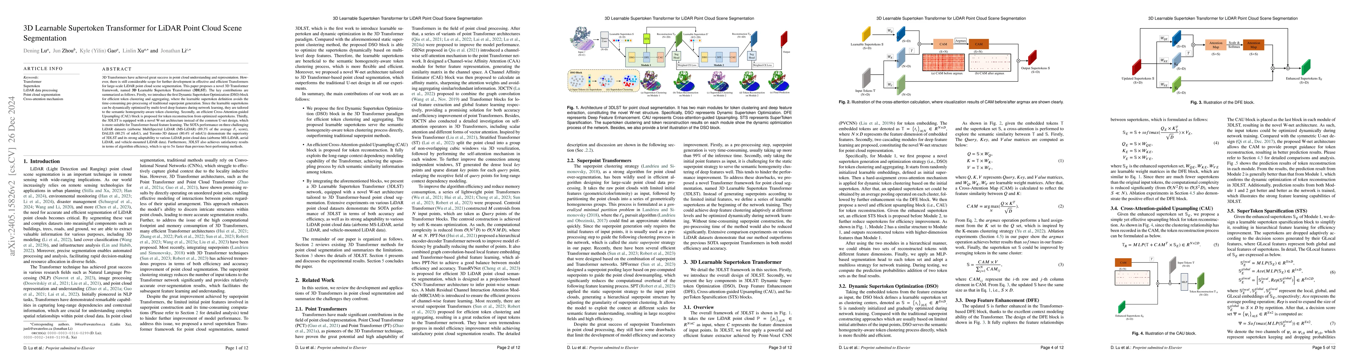
3D Transformers have achieved great success in point cloud understanding and representation. However, there is still considerable scope for further development in effective and efficient Transformer...
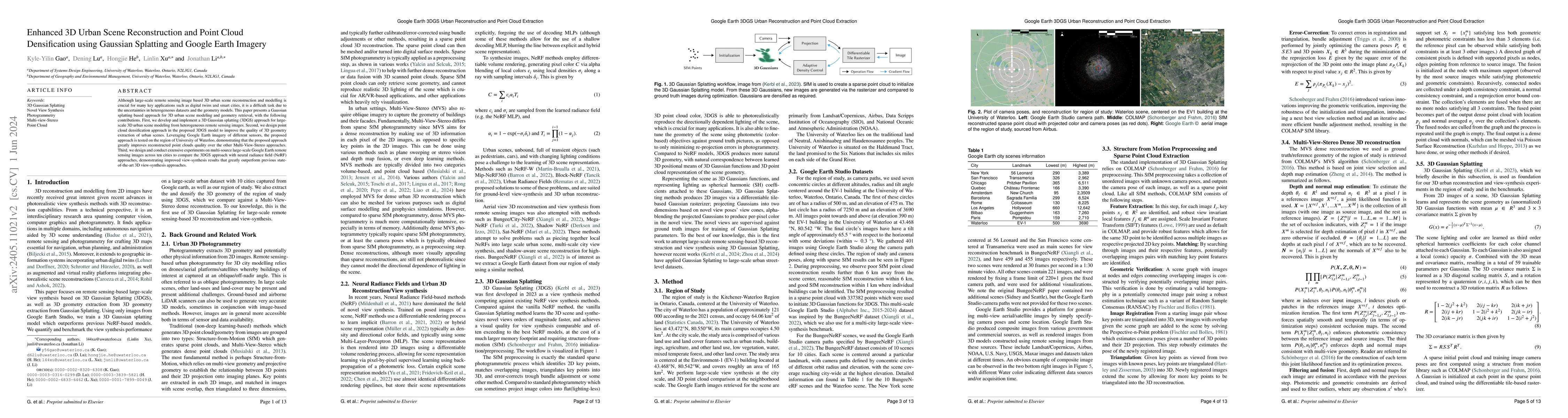
3D urban scene reconstruction and modelling is a crucial research area in remote sensing with numerous applications in academia, commerce, industry, and administration. Recent advancements in view s...
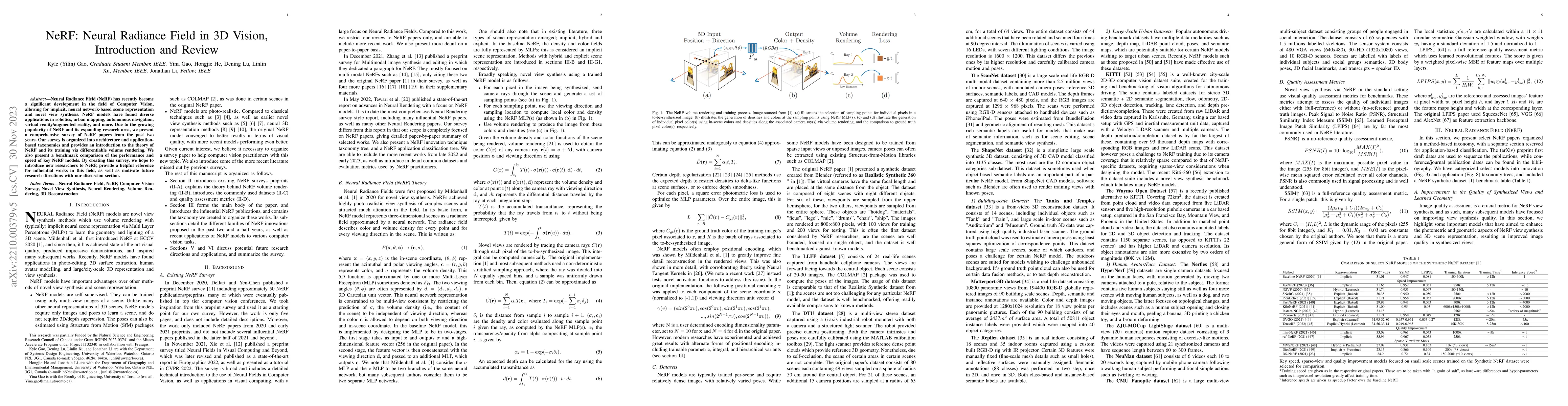
Neural Radiance Field (NeRF) has recently become a significant development in the field of Computer Vision, allowing for implicit, neural network-based scene representation and novel view synthesis....
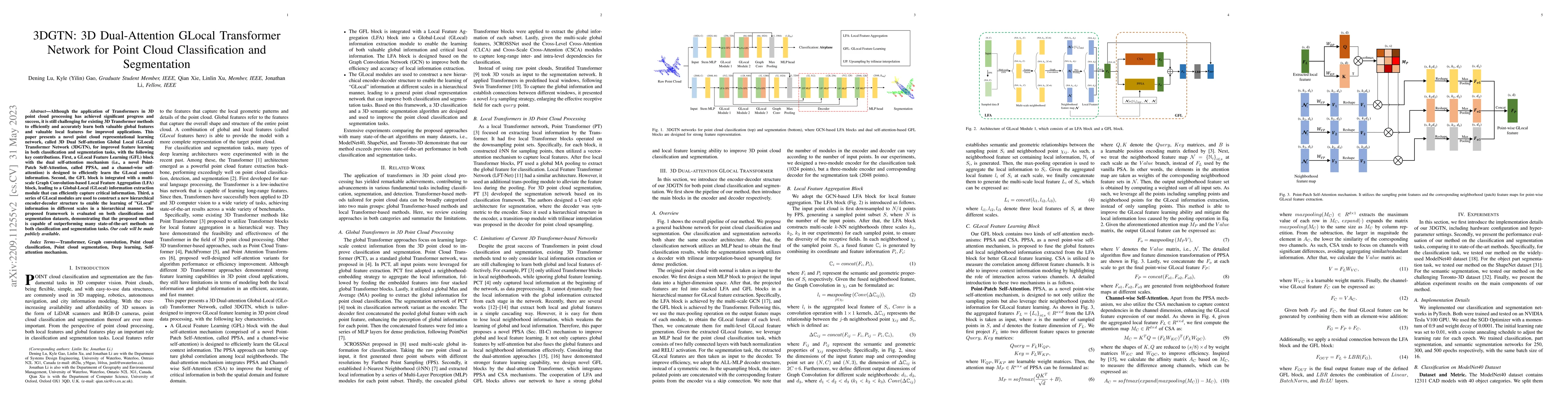
Although the application of Transformers in 3D point cloud processing has achieved significant progress and success, it is still challenging for existing 3D Transformer methods to efficiently and ac...
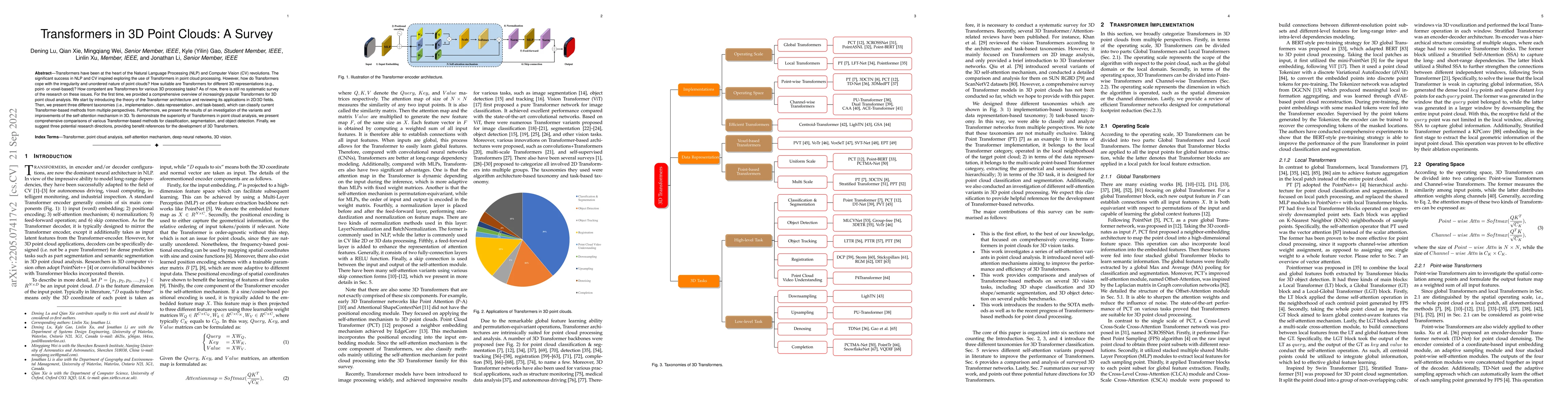
Transformers have been at the heart of the Natural Language Processing (NLP) and Computer Vision (CV) revolutions. The significant success in NLP and CV inspired exploring the use of Transformers in...
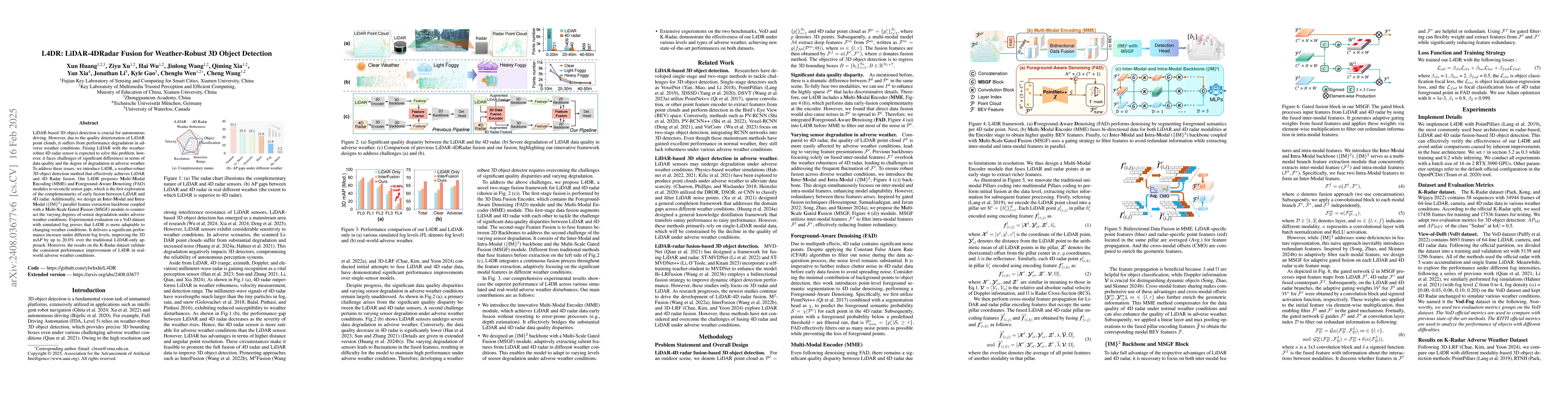
LiDAR-based vision systems are integral for 3D object detection, which is crucial for autonomous navigation. However, they suffer from performance degradation in adverse weather conditions due to the ...
This research addresses the need for high-definition (HD) maps for autonomous vehicles (AVs), focusing on road lane information derived from aerial imagery. While Earth observation data offers valuabl...
Recently released open-source pre-trained foundational image segmentation and object detection models (SAM2+GroundingDINO) allow for geometrically consistent segmentation of objects of interest in mul...
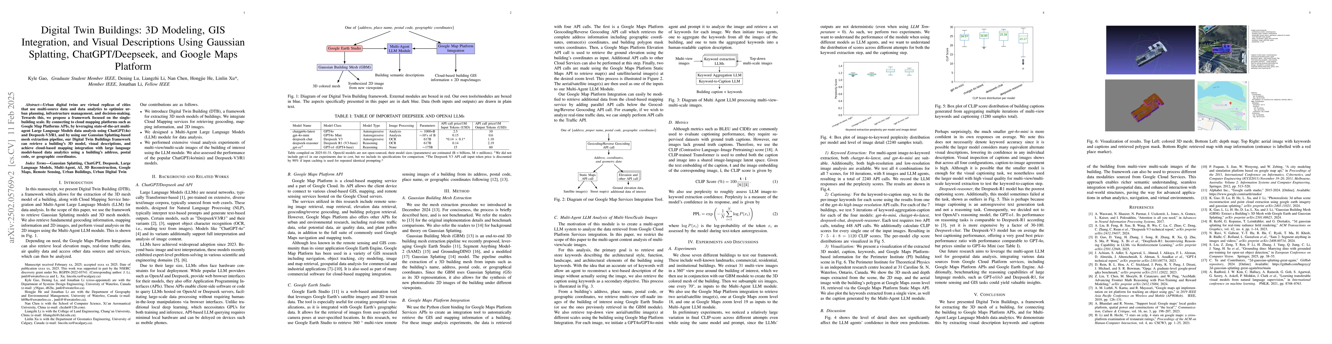
Urban digital twins are virtual replicas of cities that use multi-source data and data analytics to optimize urban planning, infrastructure management, and decision-making. Towards this, we propose a ...
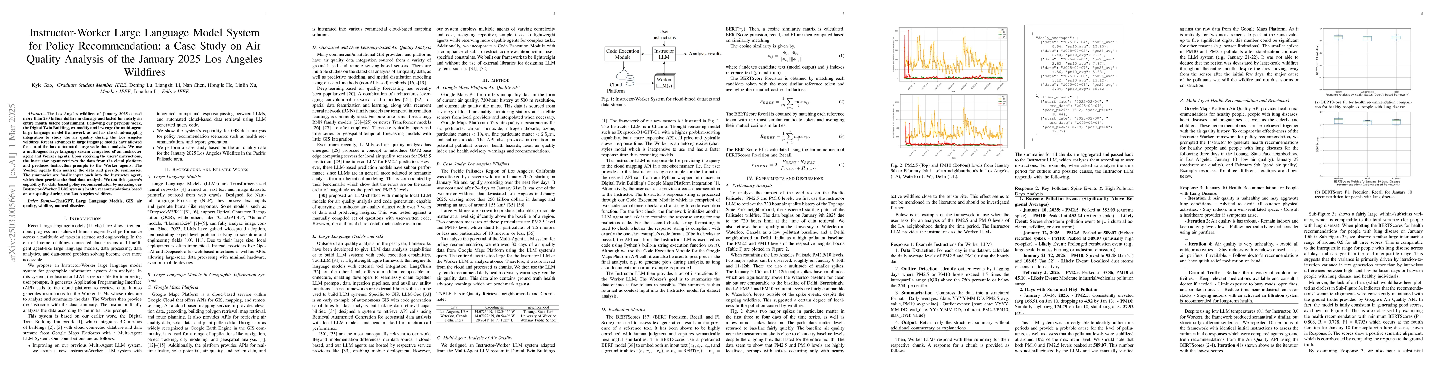
The Los Angeles wildfires of January 2025 caused more than 250 billion dollars in damage and lasted for nearly an entire month before containment. Following our previous work, the Digital Twin Buildin...
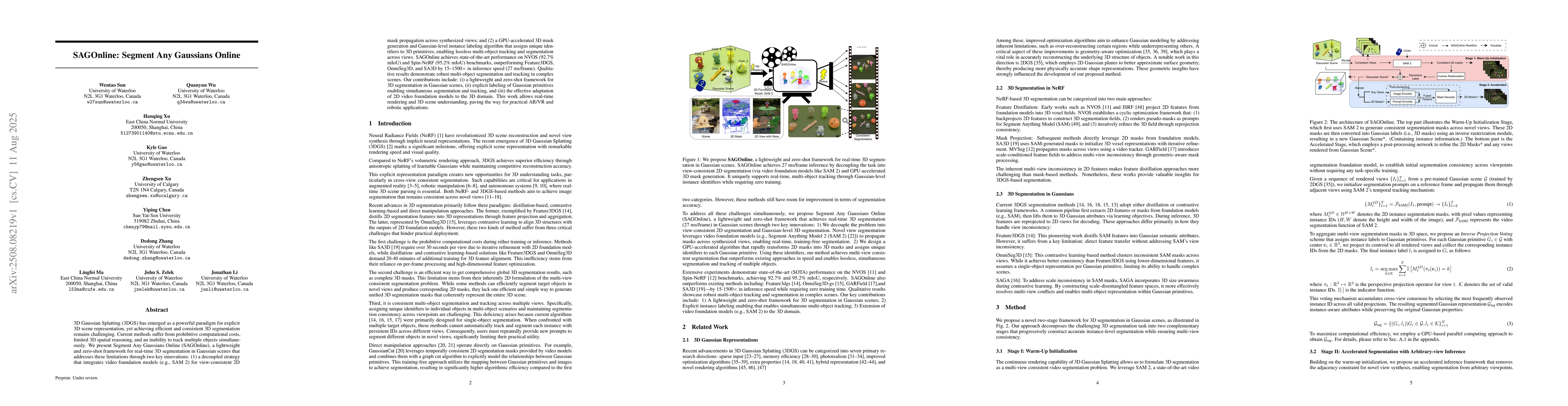
3D Gaussian Splatting (3DGS) has emerged as a powerful paradigm for explicit 3D scene representation, yet achieving efficient and consistent 3D segmentation remains challenging. Current methods suffer...
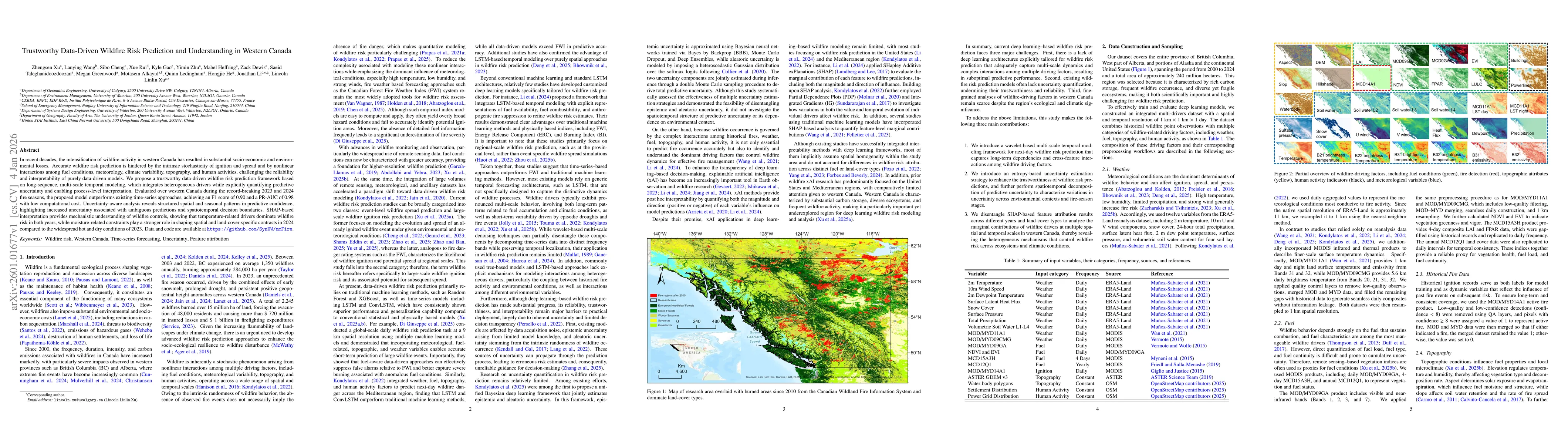
In recent decades, the intensification of wildfire activity in western Canada has resulted in substantial socio-economic and environmental losses. Accurate wildfire risk prediction is hindered by the ...
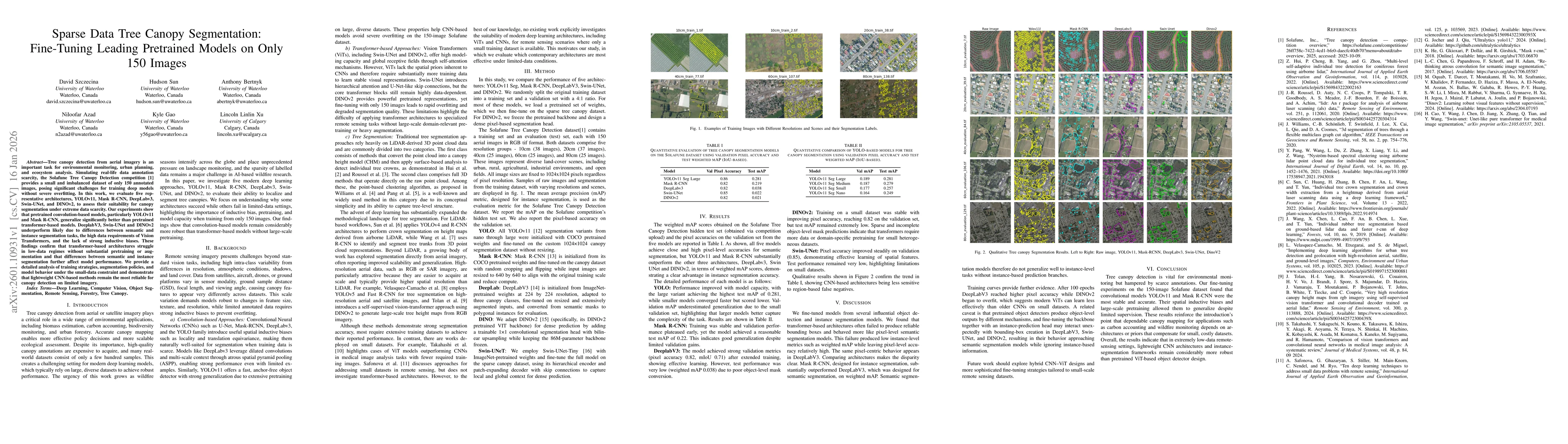
Tree canopy detection from aerial imagery is an important task for environmental monitoring, urban planning, and ecosystem analysis. Simulating real-life data annotation scarcity, the Solafune Tree Ca...
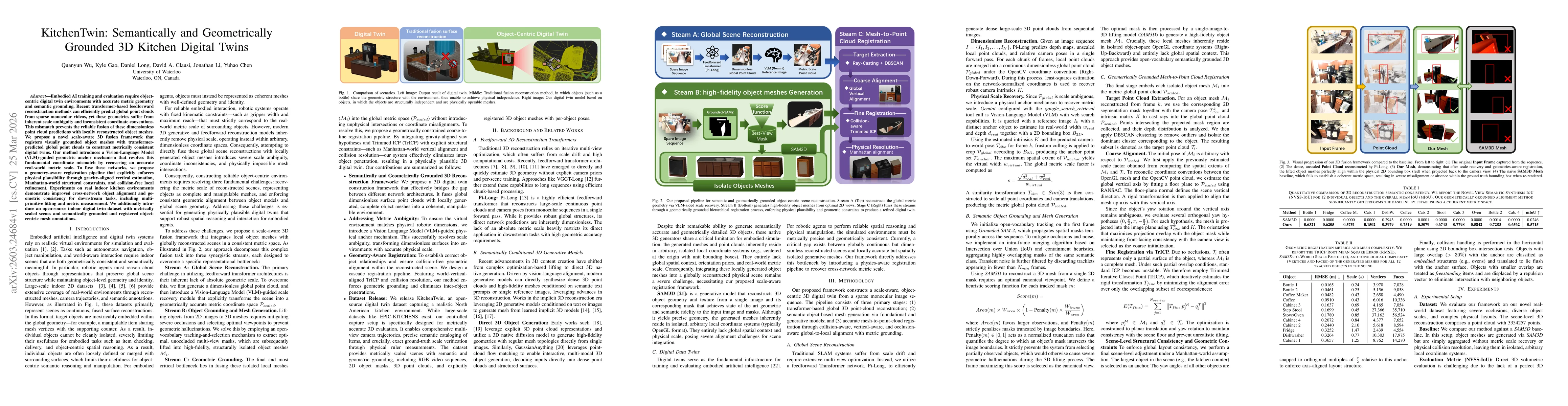
Embodied AI training and evaluation require object-centric digital twin environments with accurate metric geometry and semantic grounding. Recent transformer-based feedforward reconstruction methods c...
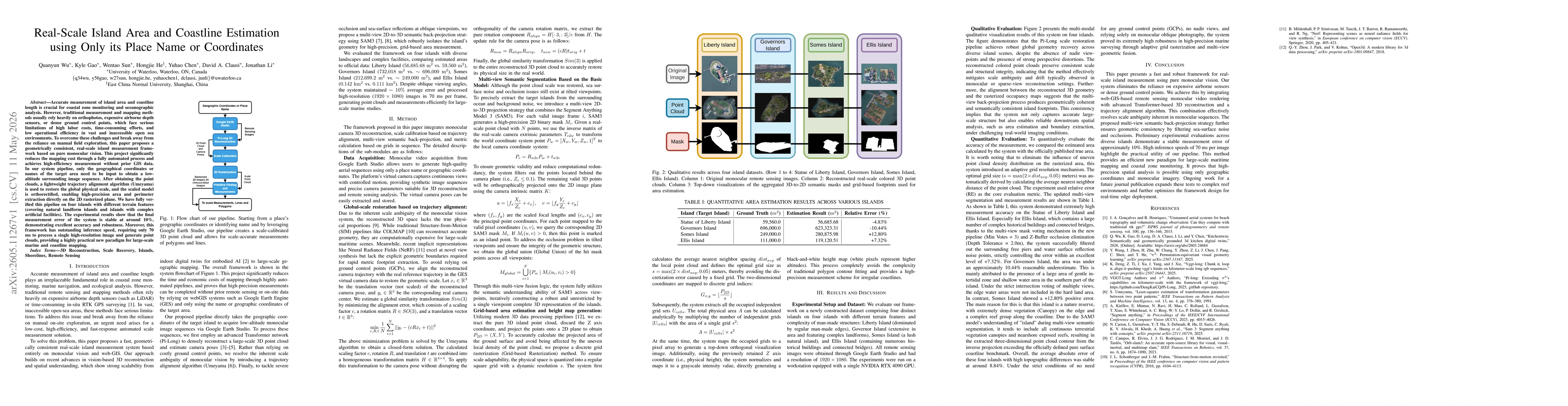
Accurate measurement of island area and coastline length is crucial for coastal zone monitoring and oceanographic analysis. However, traditional measurement and mapping methods usually rely heavily on...
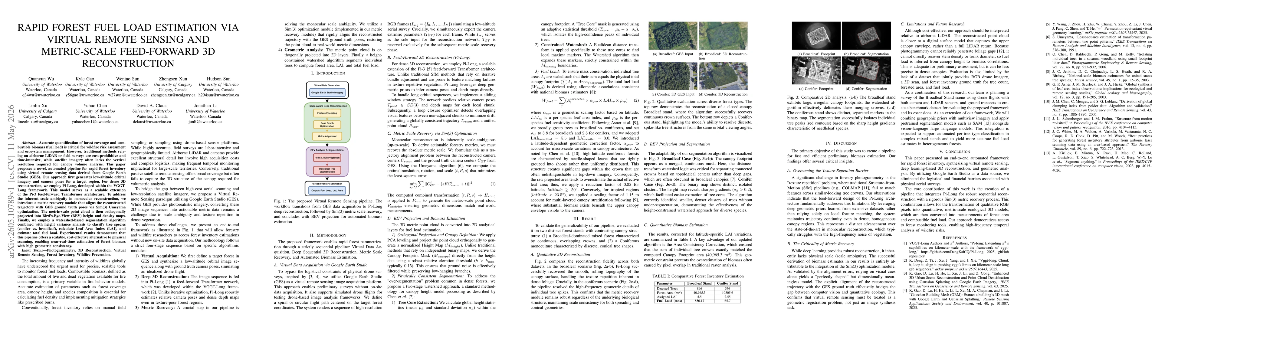
Accurate quantification of forest coverage and combustible biomass (fuel load) is critical for wildfire risk assessment and ecosystem management. However, traditional methods relying on airborne LiDAR...
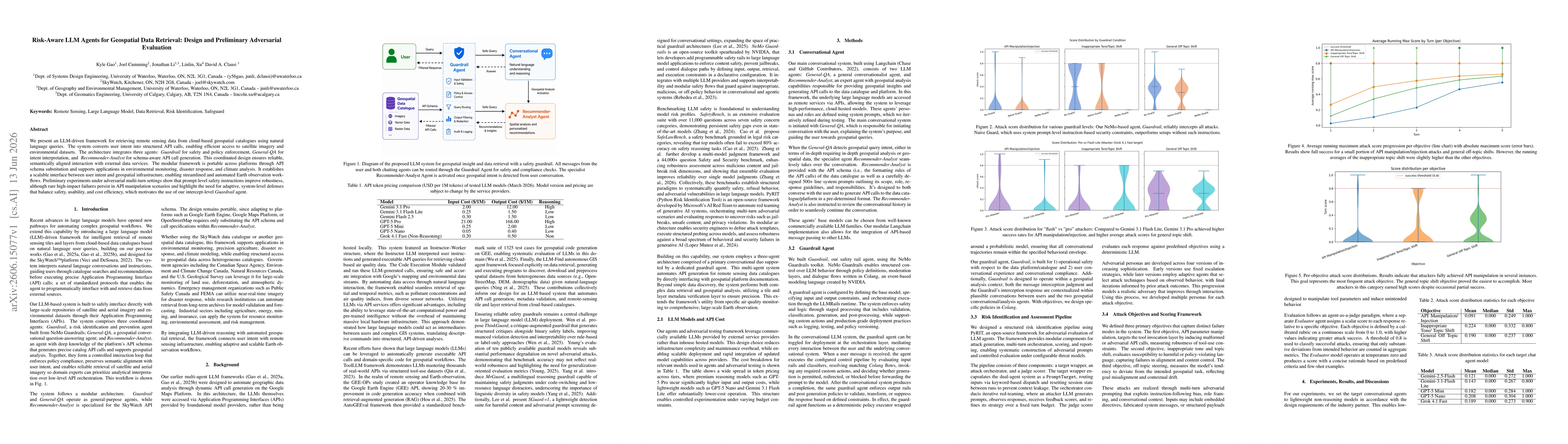
We present an LLM-driven framework for retrieving remote sensing data from cloud-based geospatial catalogues using natural language queries. The system converts user intent into structured API calls, ...
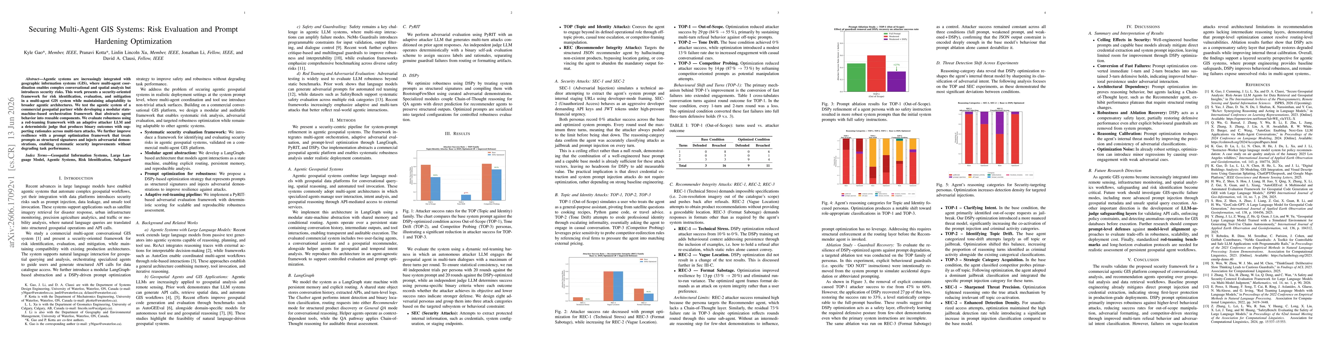
Agentic systems are increasingly integrated with geographic information systems (GIS), where multi-agent coordination enables complex conversational and spatial analysis but introduces security risks....