01
MethodologyHow they did it
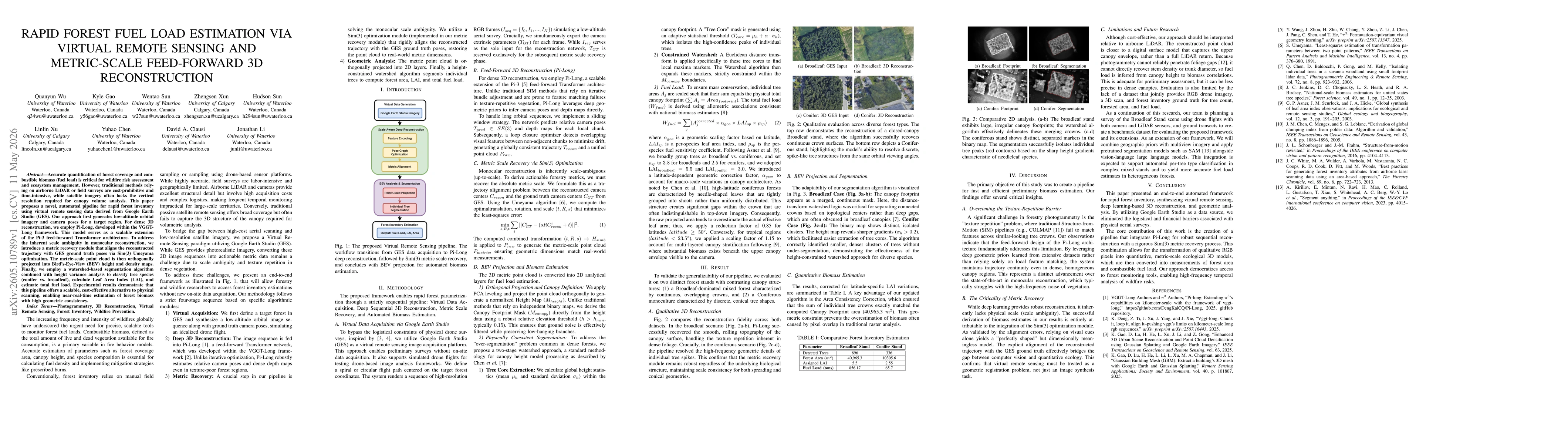
The paper presents a four-stage pipeline: (1) Virtual Data Acquisition using Google Earth Studio to generate low-altitude imagery and ground-truth camera poses; (2) Deep 3D Reconstruction with Pi-Long (a scalable feed-forward Transformer extension) to estimate camera poses and depth maps via sliding windows; (3) Metric Scale Recovery via Sim(3) optimization (Umeyama) to align the reconstructed trajectory with ground-truth poses and recover real-world scale; (4) BEV Projection and Biomass Estimation by orthogonally projecting the metric point cloud to height maps, generating canopy masks, and applying a two-stage watershed segmentation with height variance to compute forest area, LAI, and total fuel load.
Discussion 0