Academic Profile
Statistics
Similar Authors
Papers on arXiv
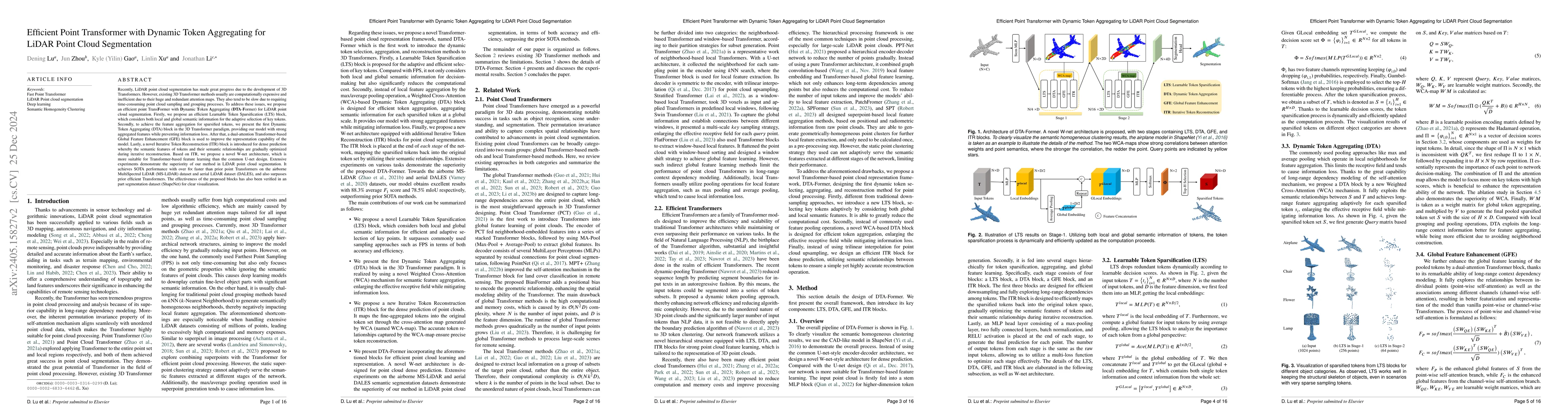
Recently, point cloud processing and analysis have made great progress due to the development of 3D Transformers. However, existing 3D Transformer methods usually are computationally expensive and i...
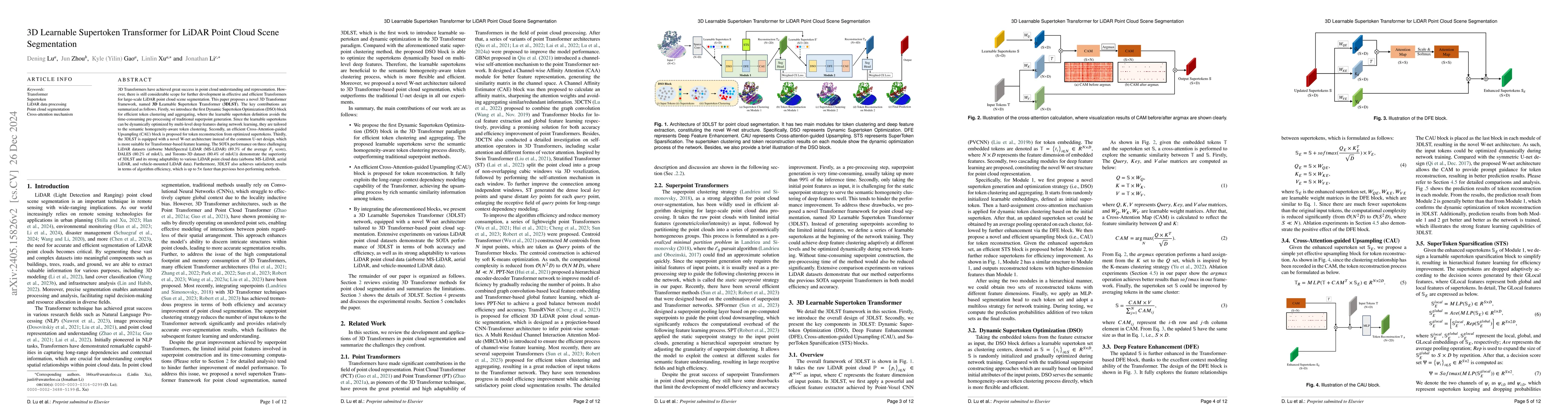
3D Transformers have achieved great success in point cloud understanding and representation. However, there is still considerable scope for further development in effective and efficient Transformer...
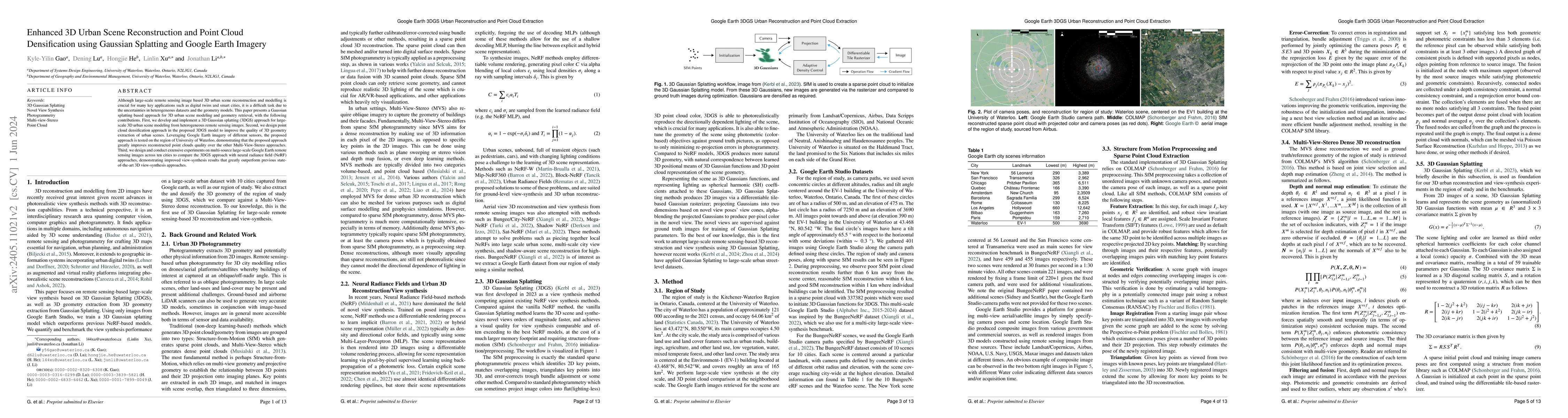
3D urban scene reconstruction and modelling is a crucial research area in remote sensing with numerous applications in academia, commerce, industry, and administration. Recent advancements in view s...
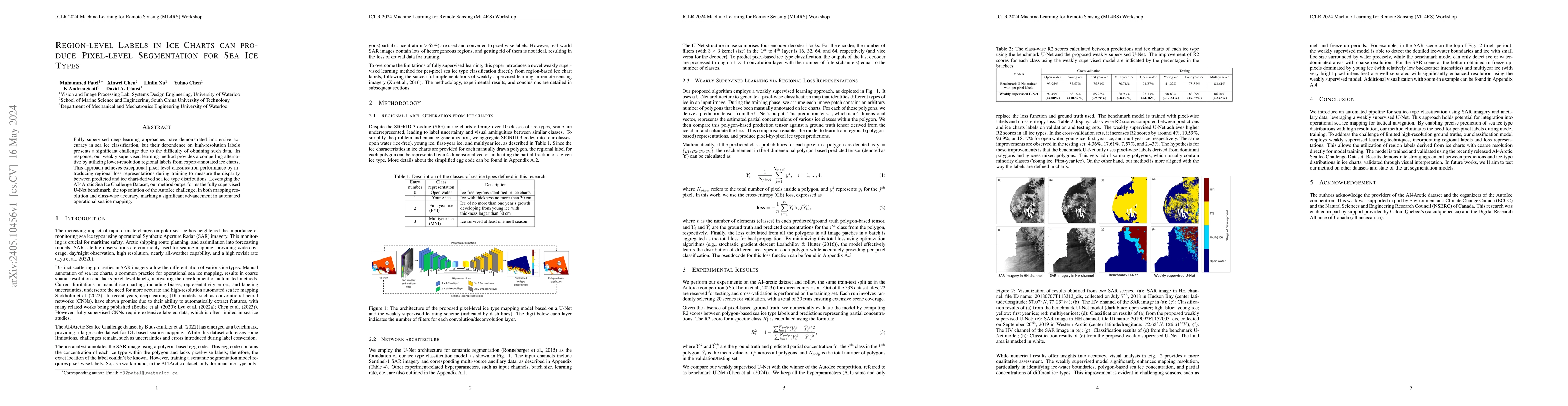
Fully supervised deep learning approaches have demonstrated impressive accuracy in sea ice classification, but their dependence on high-resolution labels presents a significant challenge due to the ...
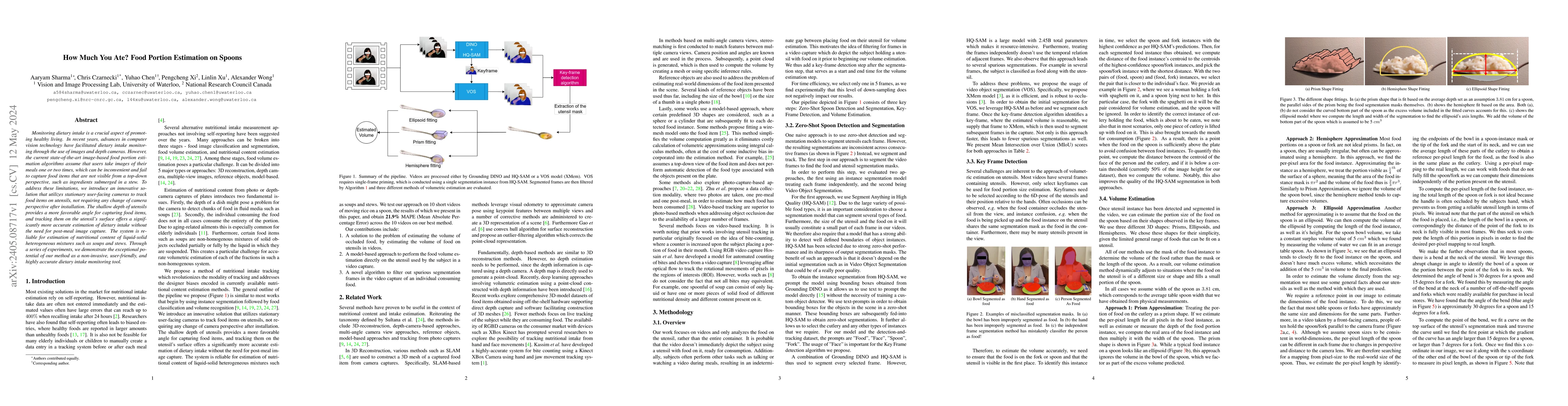
Monitoring dietary intake is a crucial aspect of promoting healthy living. In recent years, advances in computer vision technology have facilitated dietary intake monitoring through the use of image...
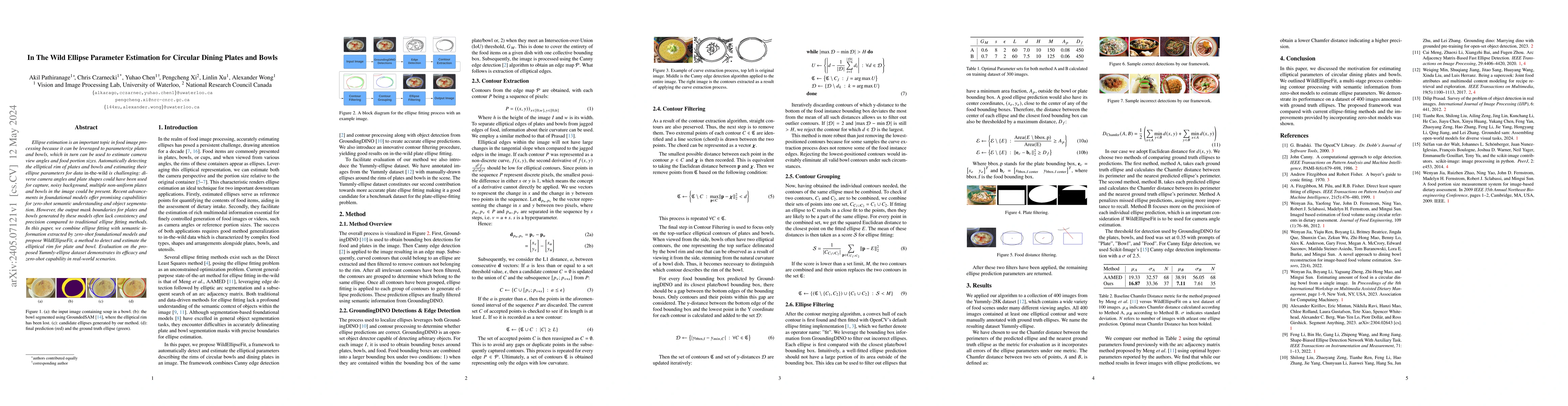
Ellipse estimation is an important topic in food image processing because it can be leveraged to parameterize plates and bowls, which in turn can be used to estimate camera view angles and food port...
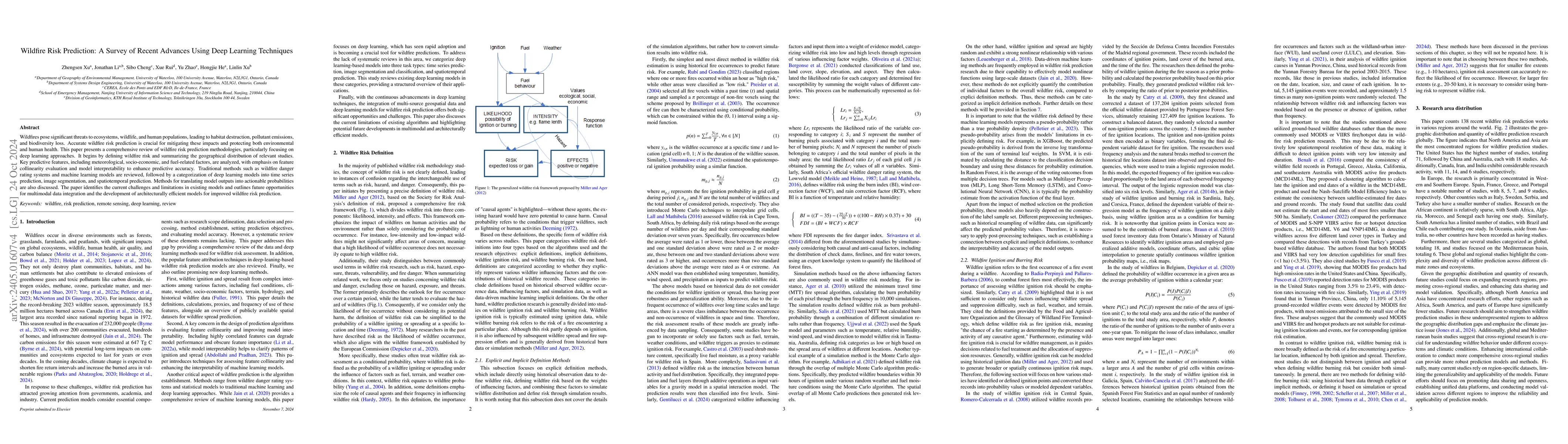
Wildfires have significant impacts on global vegetation, wildlife, and humans. They destroy plant communities and wildlife habitats and contribute to increased emissions of carbon dioxide, nitrogen ...
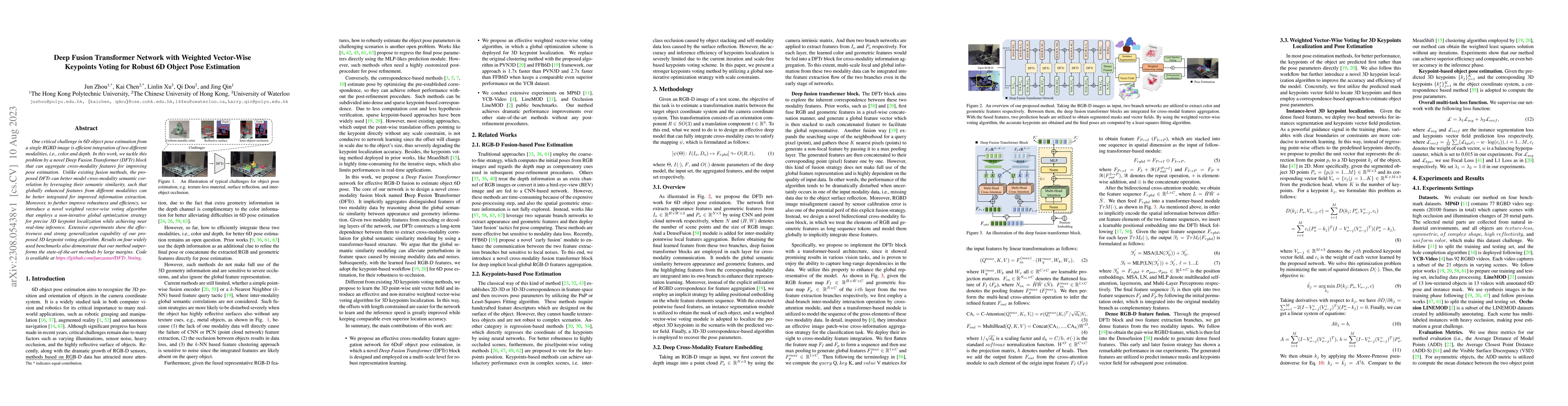
One critical challenge in 6D object pose estimation from a single RGBD image is efficient integration of two different modalities, i.e., color and depth. In this work, we tackle this problem by a no...
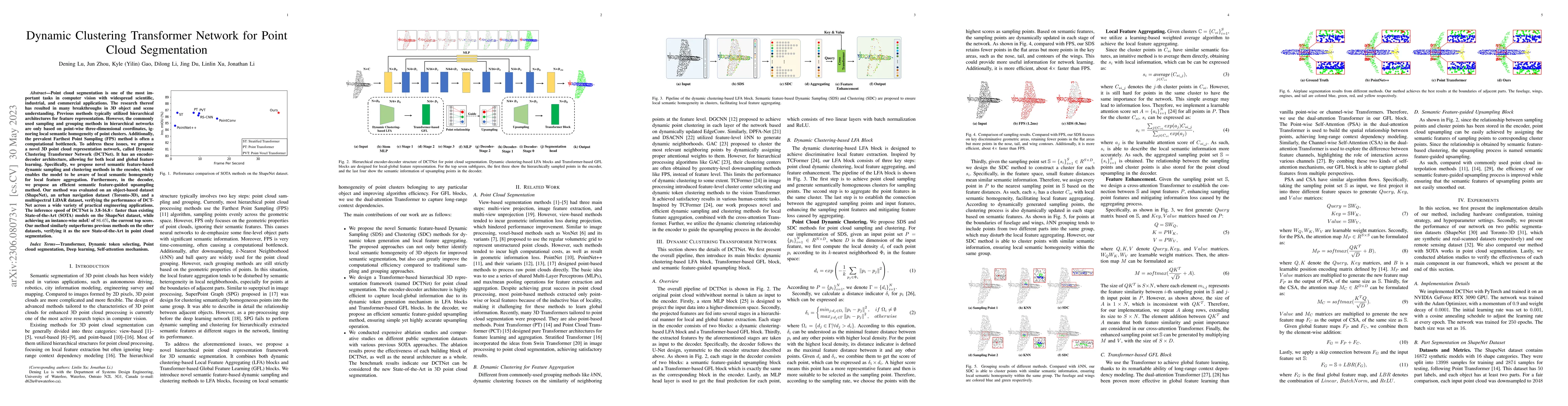
Point cloud segmentation is one of the most important tasks in computer vision with widespread scientific, industrial, and commercial applications. The research thereof has resulted in many breakthr...
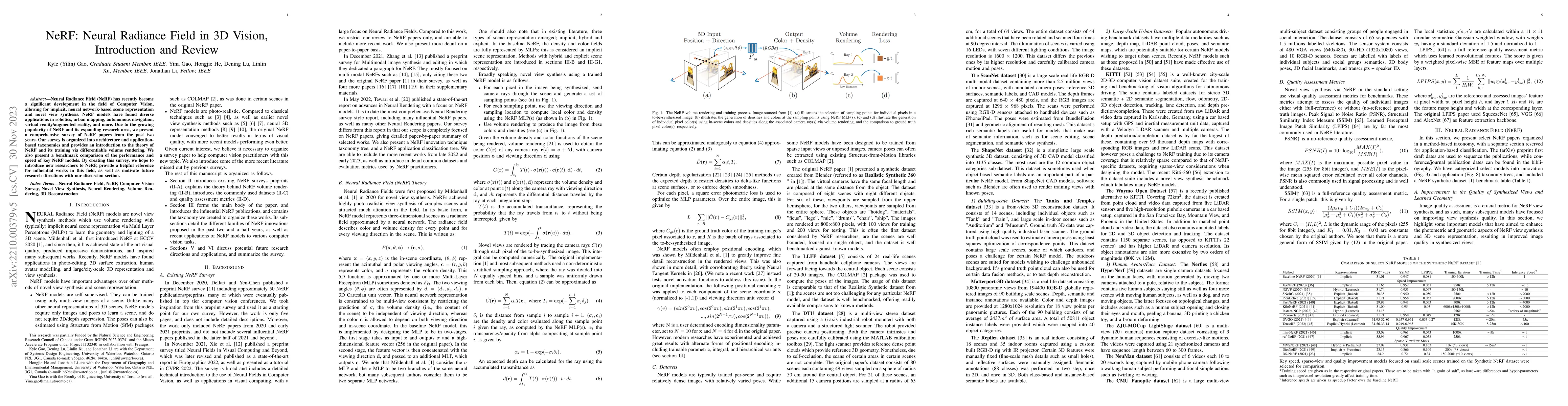
Neural Radiance Field (NeRF) has recently become a significant development in the field of Computer Vision, allowing for implicit, neural network-based scene representation and novel view synthesis....
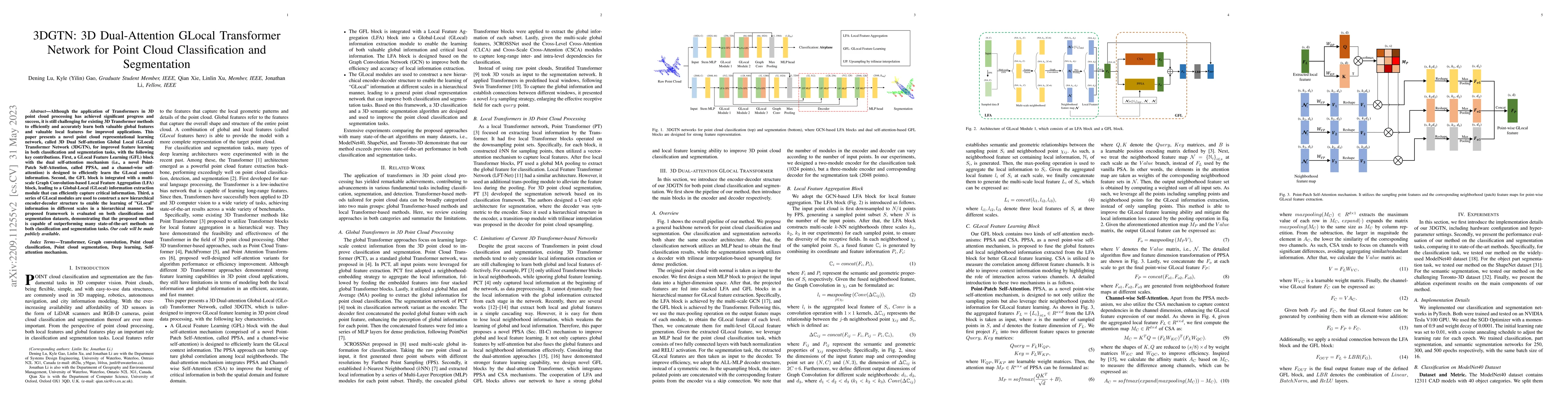
Although the application of Transformers in 3D point cloud processing has achieved significant progress and success, it is still challenging for existing 3D Transformer methods to efficiently and ac...
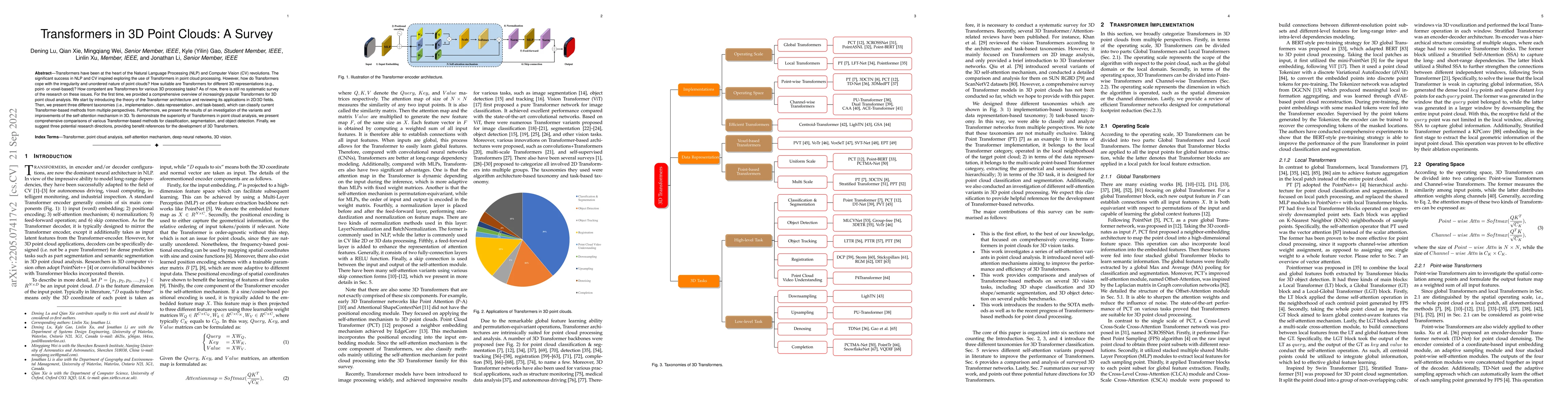
Transformers have been at the heart of the Natural Language Processing (NLP) and Computer Vision (CV) revolutions. The significant success in NLP and CV inspired exploring the use of Transformers in...
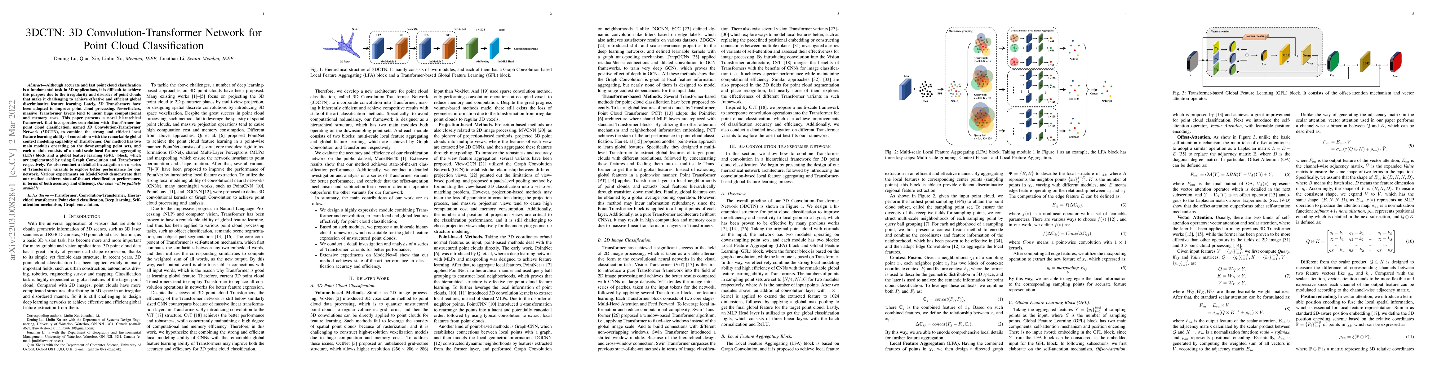
Although accurate and fast point cloud classification is a fundamental task in 3D applications, it is difficult to achieve this purpose due to the irregularity and disorder of point clouds that make...
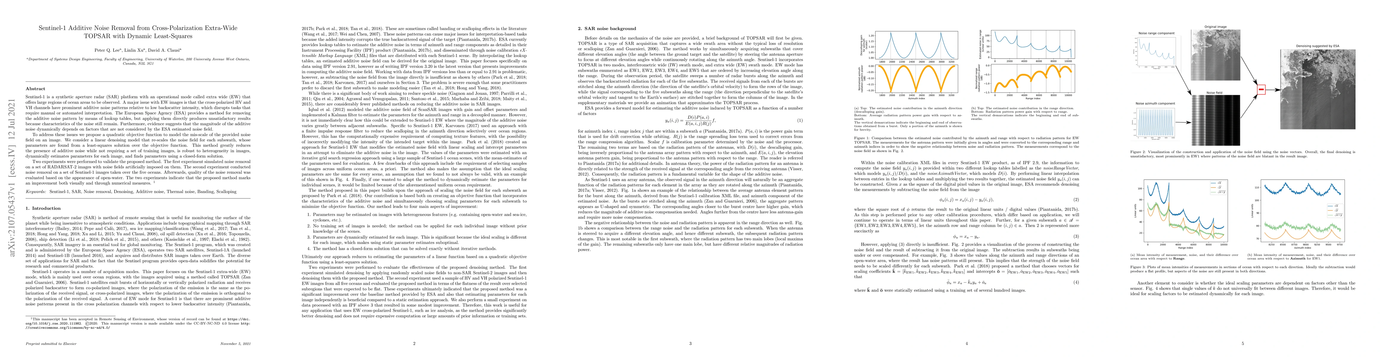
Sentinel-1 is a synthetic aperture radar (SAR) platform with an operational mode called extra wide (EW) that offers large regions of ocean areas to be observed. A major issue with EW images is that ...
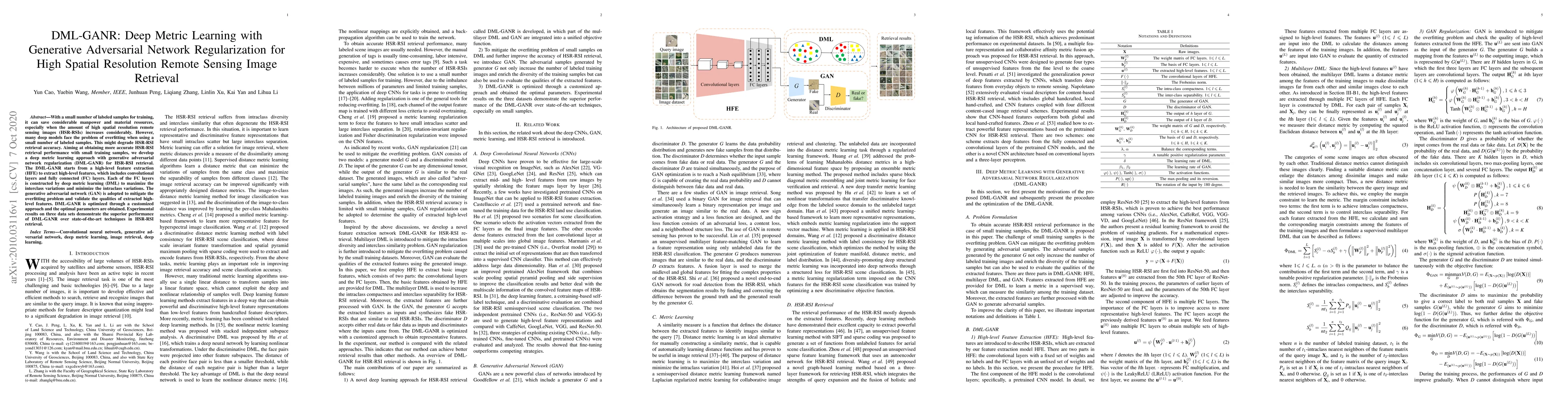
With a small number of labeled samples for training, it can save considerable manpower and material resources, especially when the amount of high spatial resolution remote sensing images (HSR-RSIs) ...

Building footprint extraction in remote sensing data benefits many important applications, such as urban planning and population estimation. Recently, rapid development of Convolutional Neural Netwo...
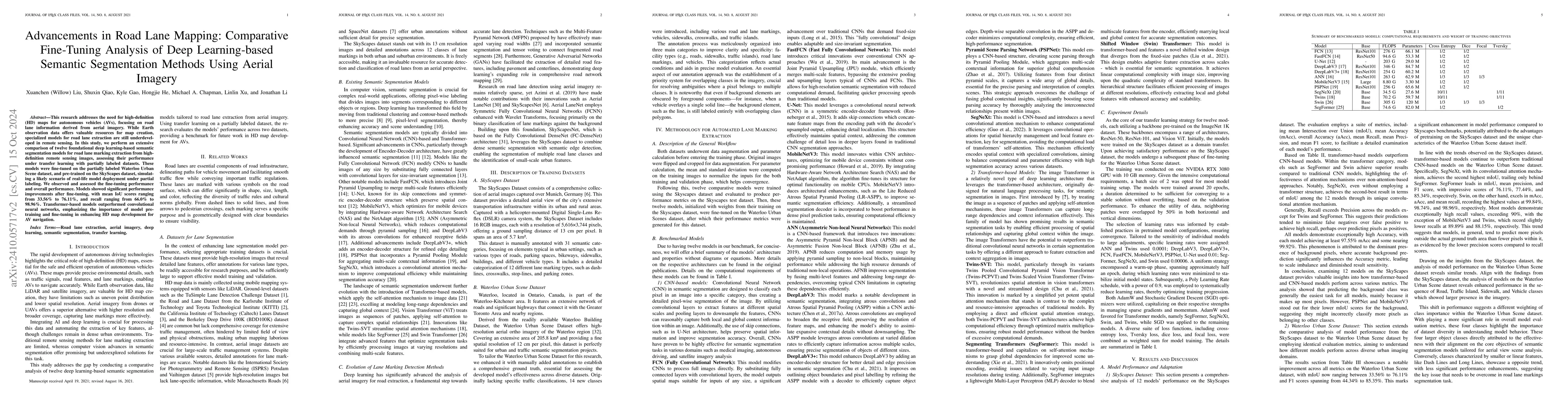
This research addresses the need for high-definition (HD) maps for autonomous vehicles (AVs), focusing on road lane information derived from aerial imagery. While Earth observation data offers valuabl...
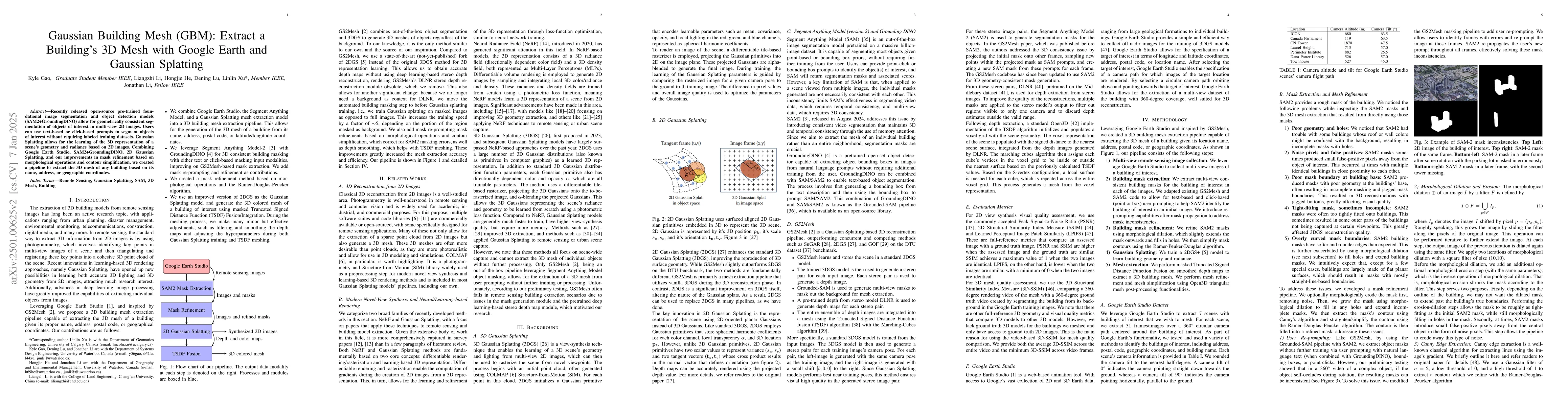
Recently released open-source pre-trained foundational image segmentation and object detection models (SAM2+GroundingDINO) allow for geometrically consistent segmentation of objects of interest in mul...
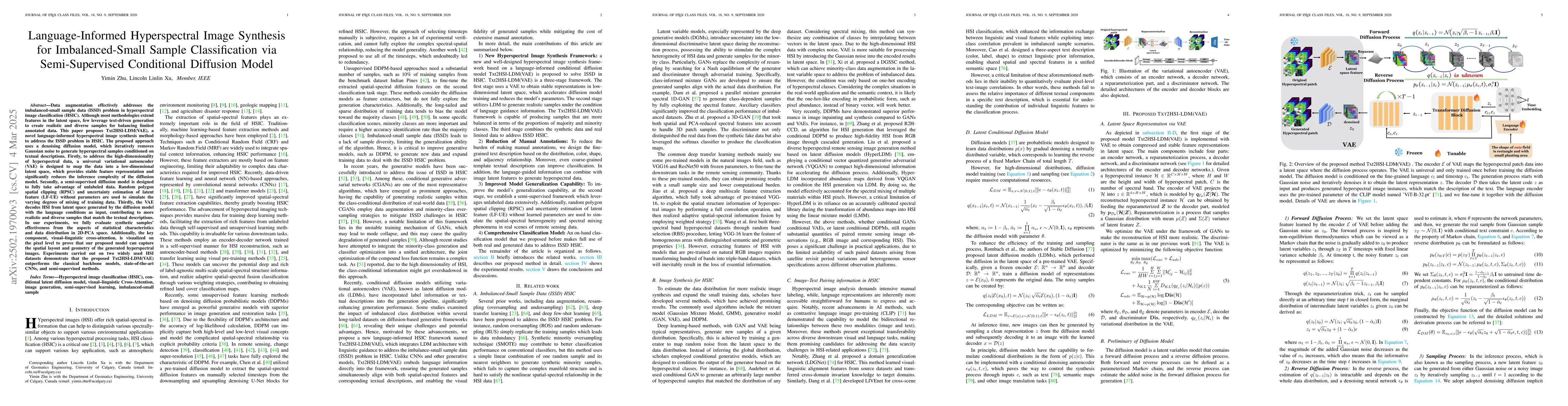
Although data augmentation is an effective method to address the imbalanced-small sample data (ISSD) problem in hyperspectral image classification (HSIC), most methodologies extend features in the lat...
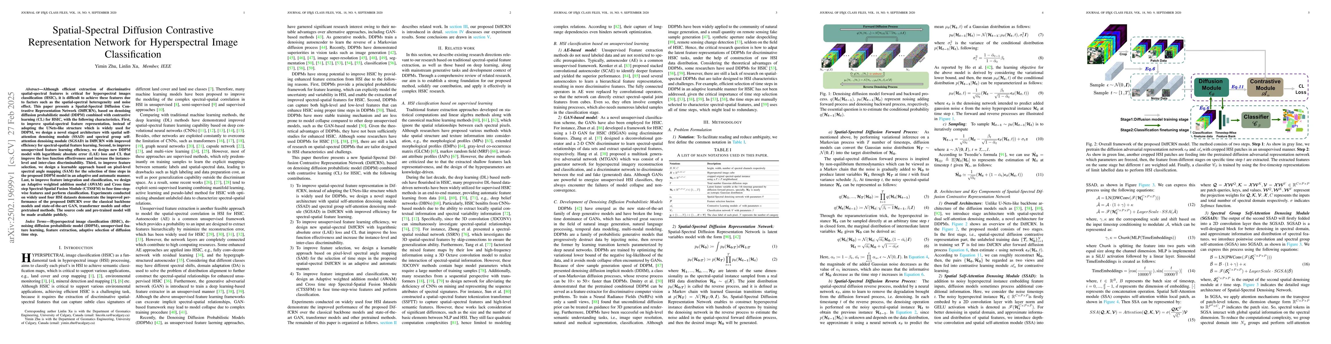
Although efficient extraction of discriminative spatial-spectral features is critical for hyperspectral images classification (HSIC), it is difficult to achieve these features due to factors such as t...
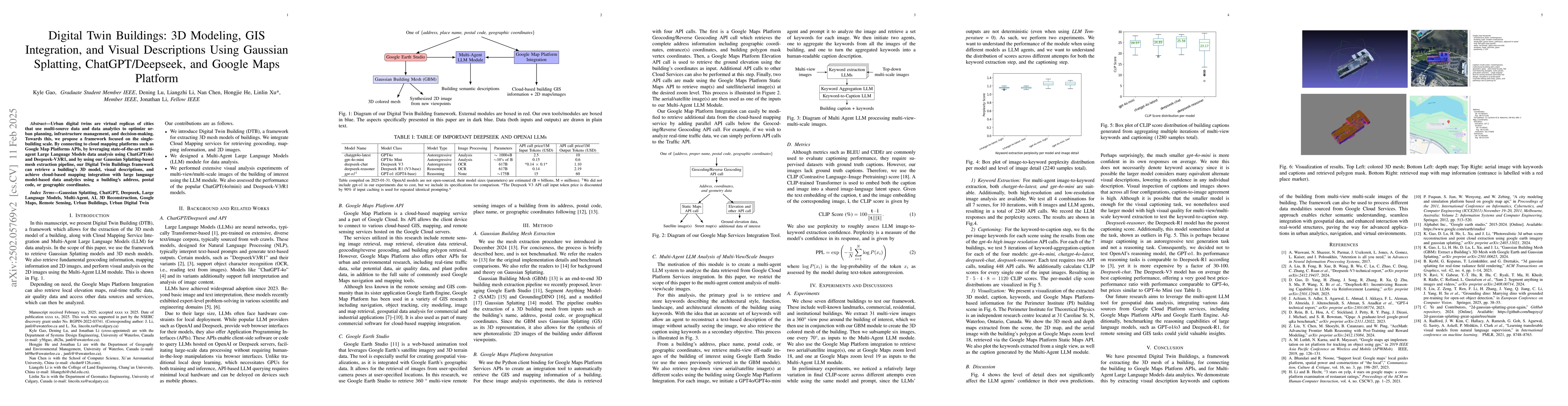
Urban digital twins are virtual replicas of cities that use multi-source data and data analytics to optimize urban planning, infrastructure management, and decision-making. Towards this, we propose a ...
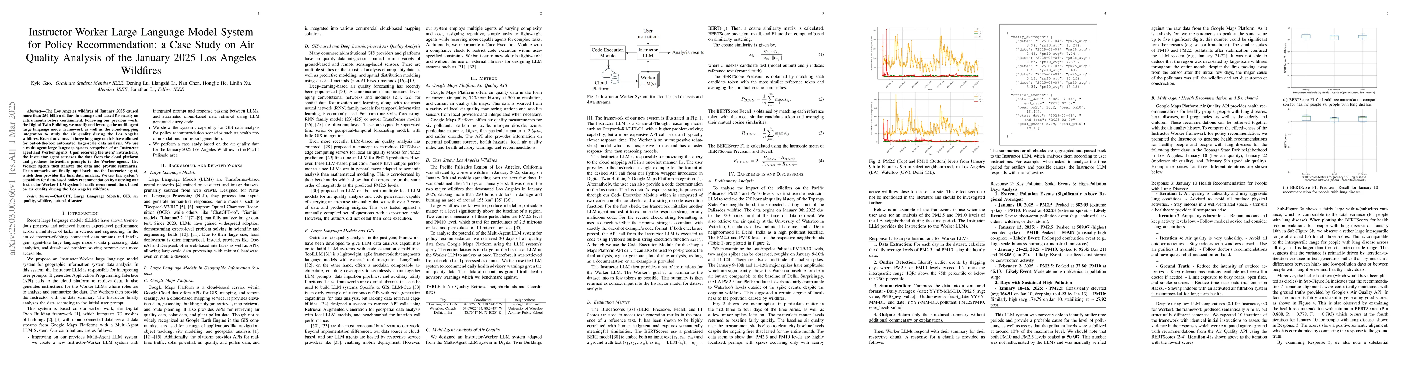
The Los Angeles wildfires of January 2025 caused more than 250 billion dollars in damage and lasted for nearly an entire month before containment. Following our previous work, the Digital Twin Buildin...
Facing the escalating threat of global wildfires, numerous computer vision techniques using remote sensing data have been applied in this area. However, the selection of deep learning methods for wild...
We introduce OpenWildlife (OW), an open-vocabulary wildlife detector designed for multi-species identification in diverse aerial imagery. While existing automated methods perform well in specific sett...
Accurate quantification of forest coverage and combustible biomass (fuel load) is critical for wildfire risk assessment and ecosystem management. However, traditional methods relying on airborne LiDAR...
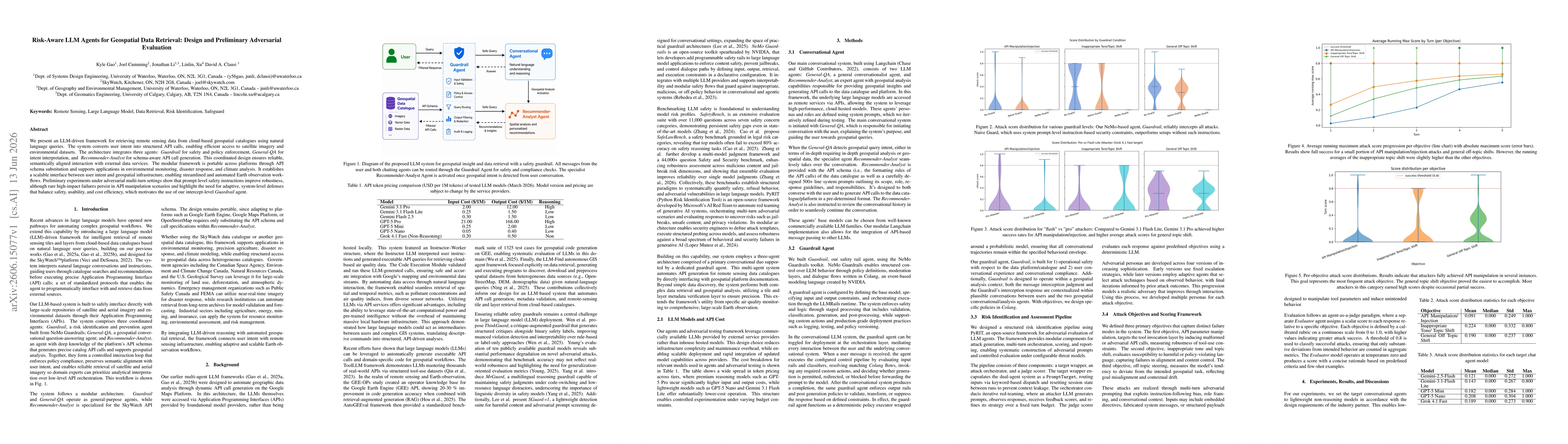
We present an LLM-driven framework for retrieving remote sensing data from cloud-based geospatial catalogues using natural language queries. The system converts user intent into structured API calls, ...
Agentic systems are increasingly integrated with geographic information systems (GIS), where multi-agent coordination enables complex conversational and spatial analysis but introduces security risks....