Academic Profile
Statistics
Similar Authors
Papers on arXiv
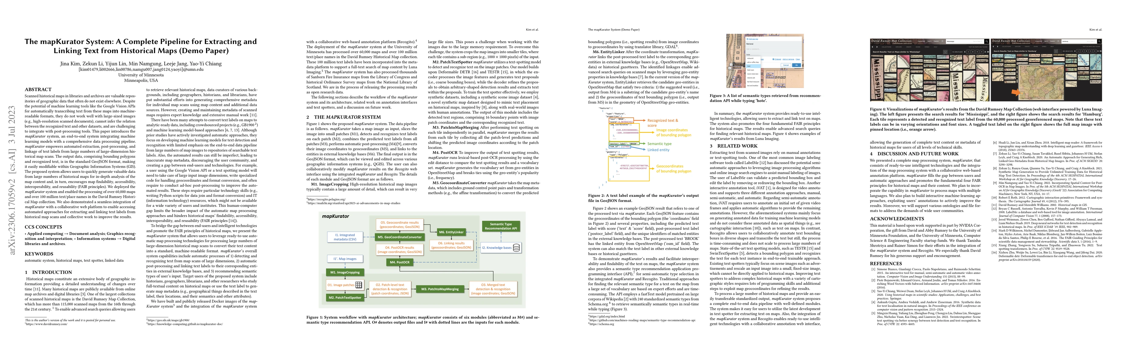
Scanned historical maps in libraries and archives are valuable repositories of geographic data that often do not exist elsewhere. Despite the potential of machine learning tools like the Google Visi...
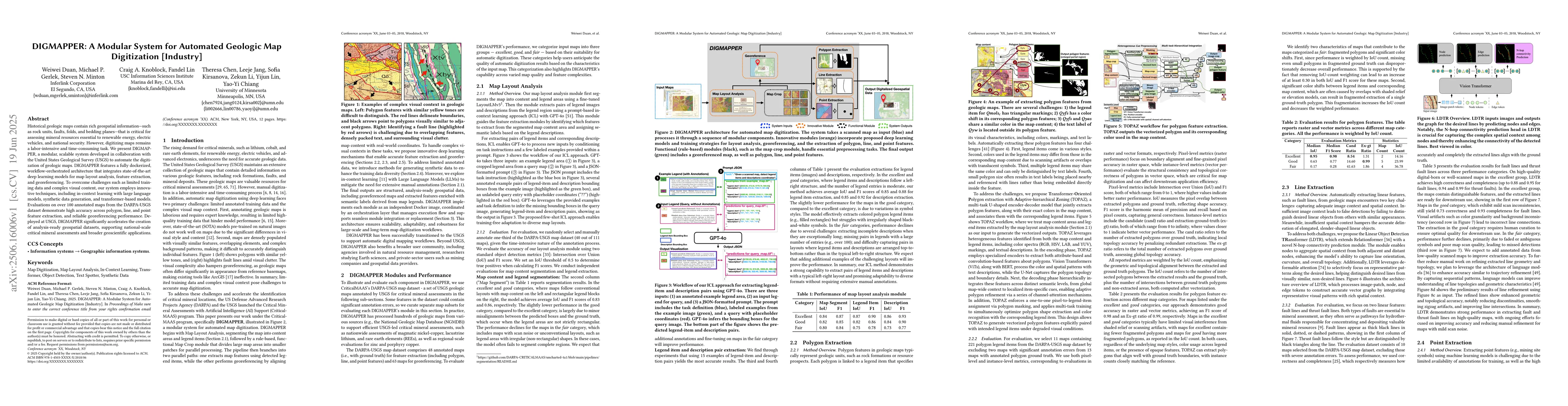
Historical geologic maps contain rich geospatial information, such as rock units, faults, folds, and bedding planes, that is critical for assessing mineral resources essential to renewable energy, ele...
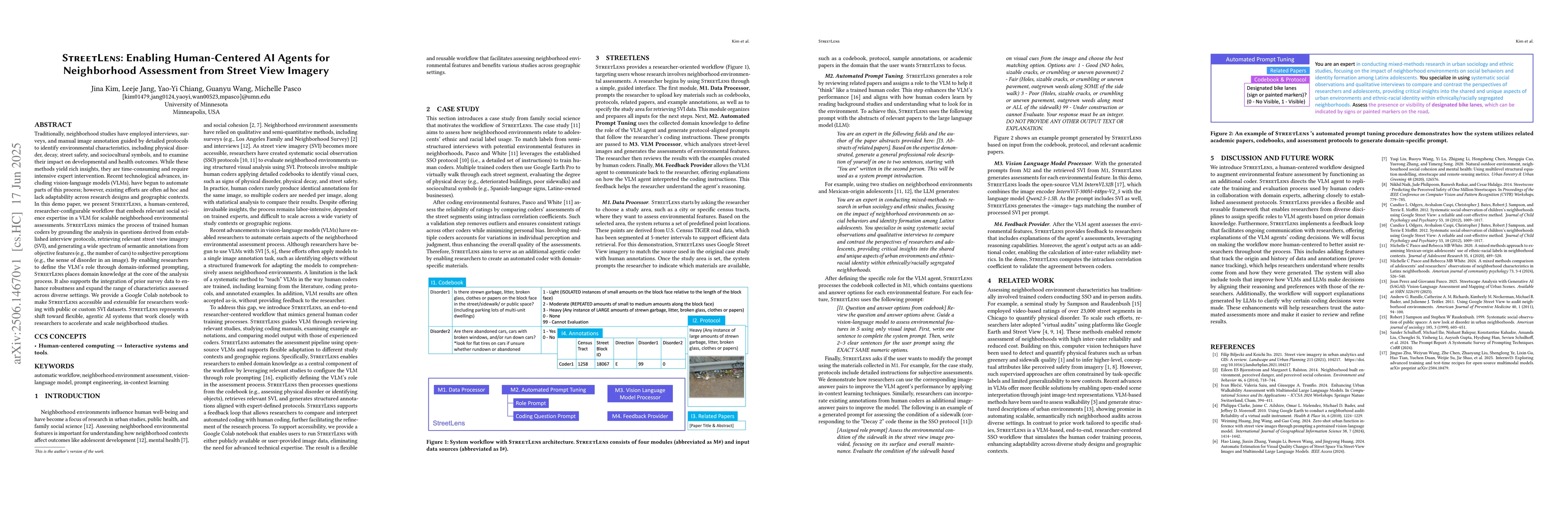
Traditionally, neighborhood studies have employed interviews, surveys, and manual image annotation guided by detailed protocols to identify environmental characteristics, including physical disorder, ...
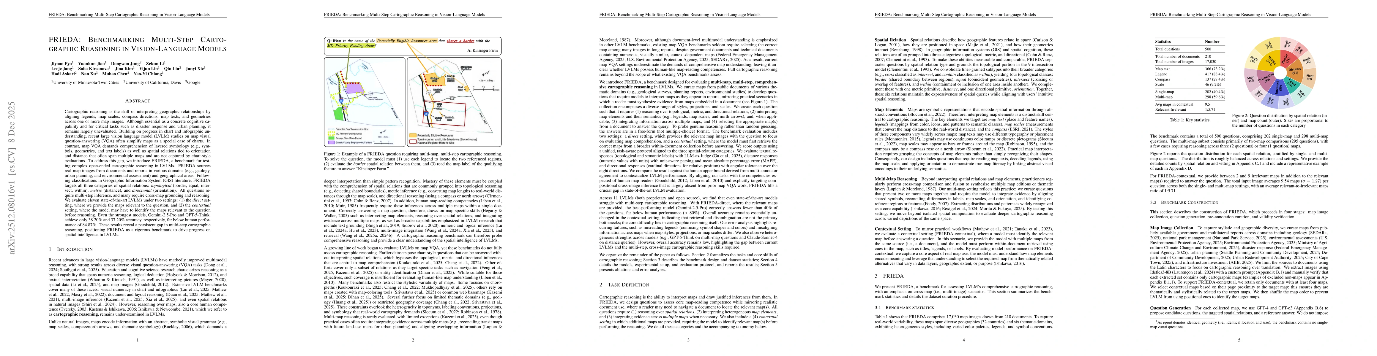
Cartographic reasoning is the skill of interpreting geographic relationships by aligning legends, map scales, compass directions, map texts, and geometries across one or more map images. Although esse...
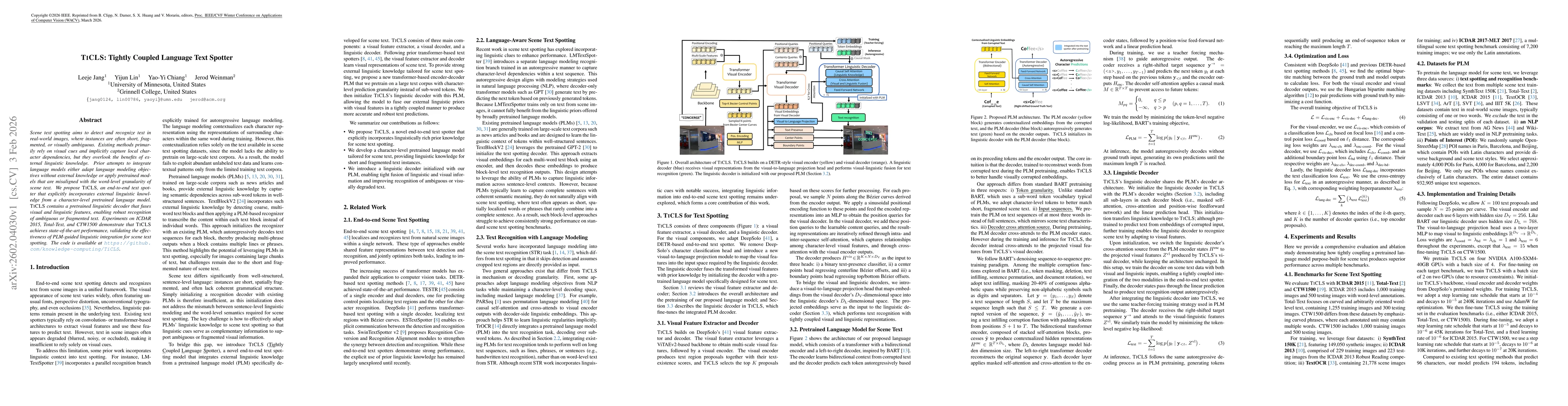
Scene text spotting aims to detect and recognize text in real-world images, where instances are often short, fragmented, or visually ambiguous. Existing methods primarily rely on visual cues and impli...
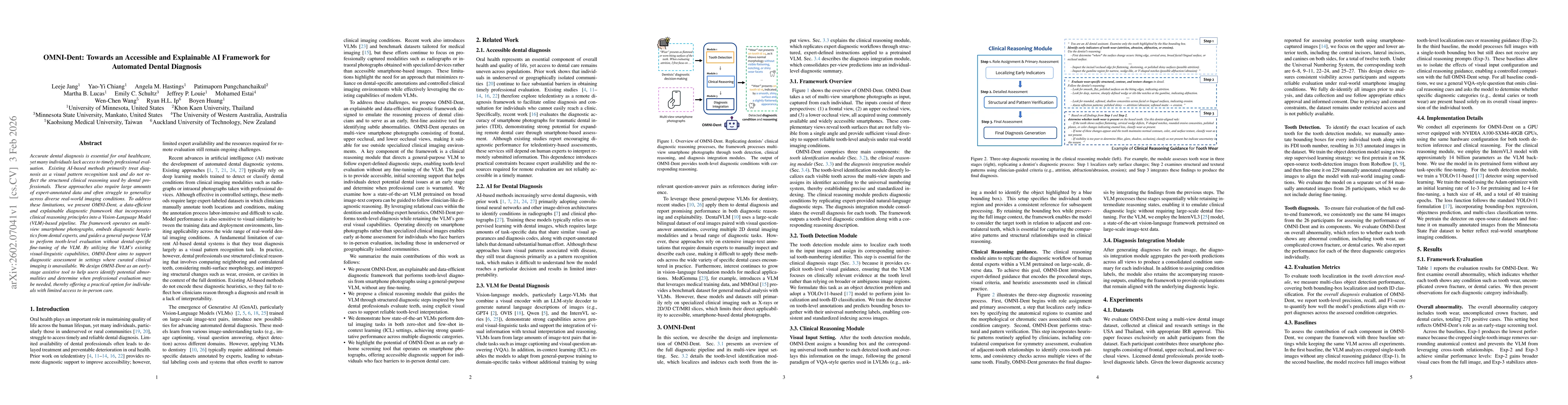
Accurate dental diagnosis is essential for oral healthcare, yet many individuals lack access to timely professional evaluation. Existing AI-based methods primarily treat diagnosis as a visual pattern ...