Academic Profile
Statistics
Similar Authors
Papers on arXiv
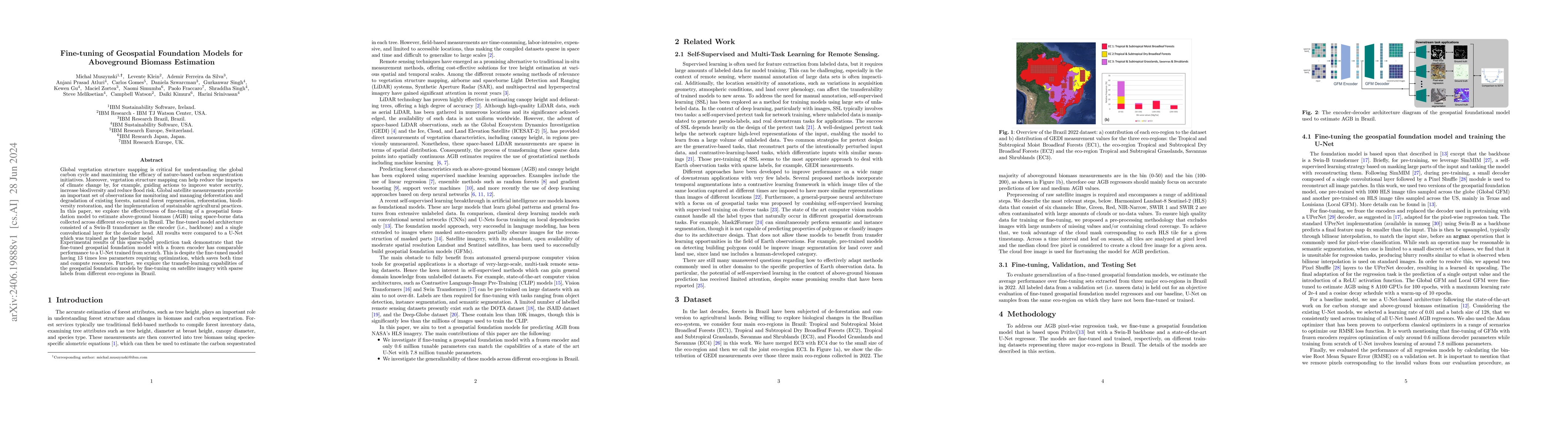
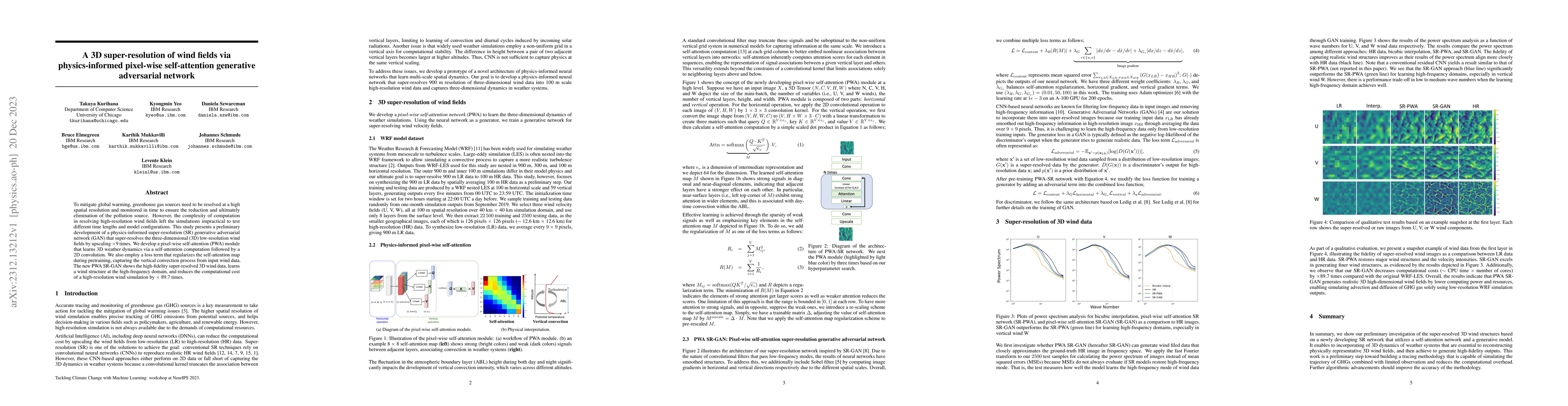
Global vegetation structure mapping is critical for understanding the global carbon cycle and maximizing the efficacy of nature-based carbon sequestration initiatives. Moreover, vegetation structure m...
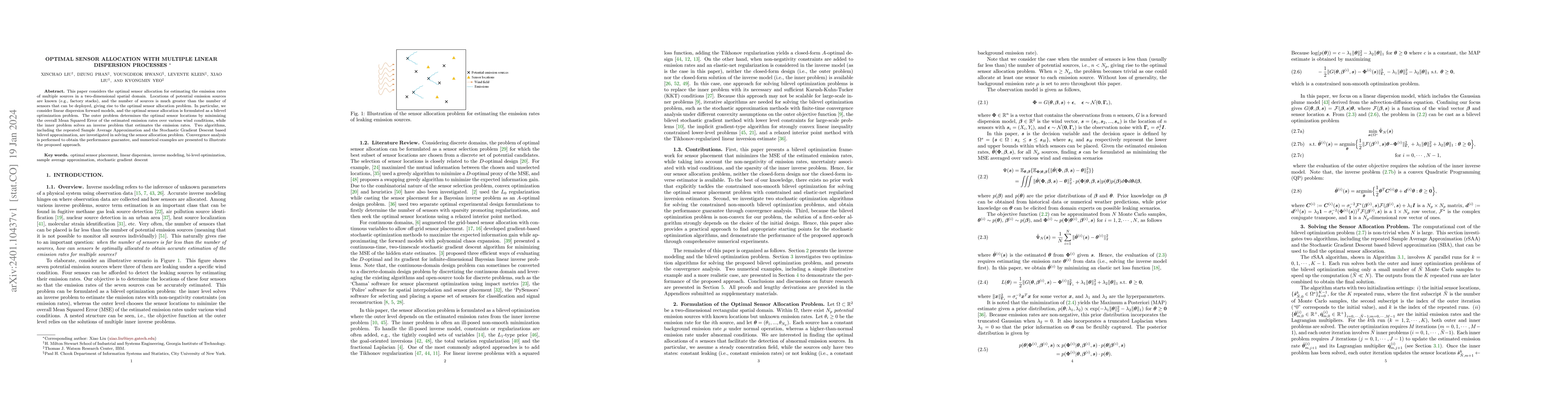
This paper considers the optimal sensor allocation for estimating the emission rates of multiple sources in a two-dimensional spatial domain. Locations of potential emission sources are known (e.g.,...
To mitigate global warming, greenhouse gas sources need to be resolved at a high spatial resolution and monitored in time to ensure the reduction and ultimately elimination of the pollution source. ...
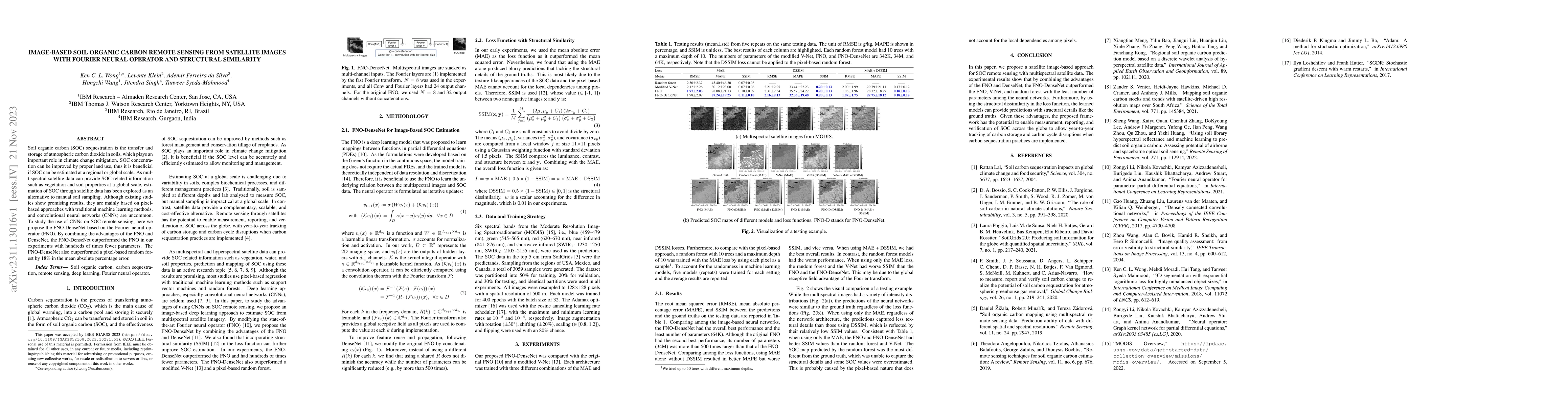
Soil organic carbon (SOC) sequestration is the transfer and storage of atmospheric carbon dioxide in soils, which plays an important role in climate change mitigation. SOC concentration can be impro...
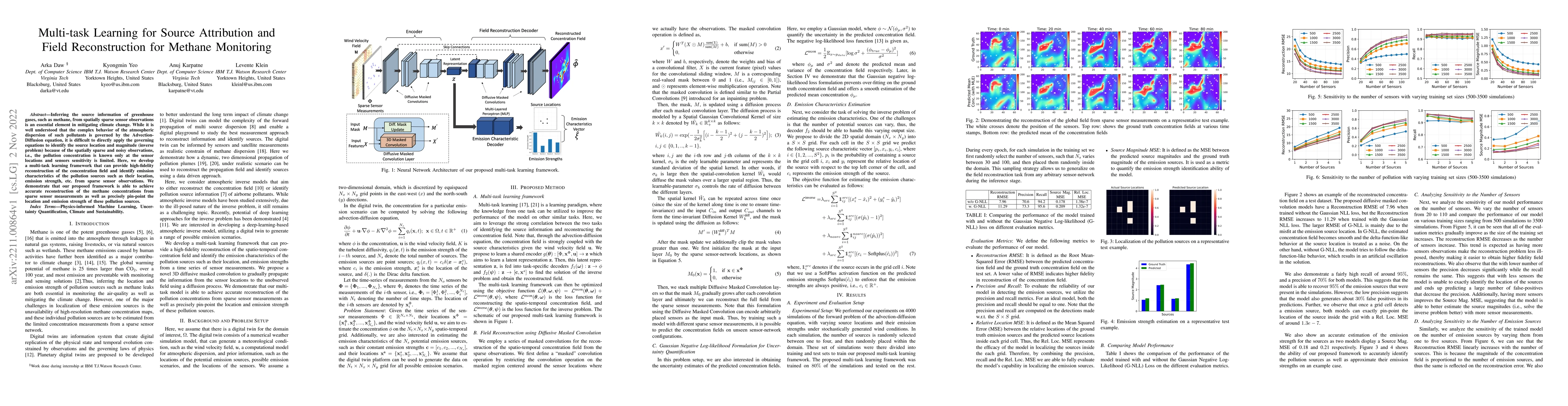
Inferring the source information of greenhouse gases, such as methane, from spatially sparse sensor observations is an essential element in mitigating climate change. While it is well understood tha...
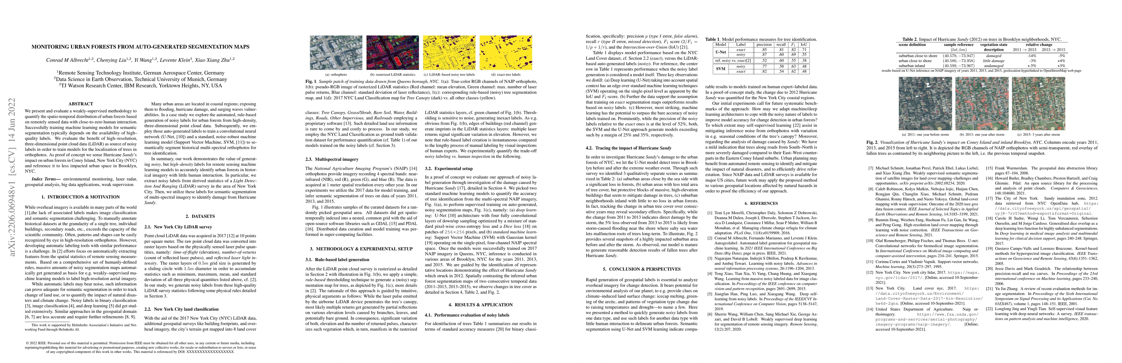
We present and evaluate a weakly-supervised methodology to quantify the spatio-temporal distribution of urban forests based on remotely sensed data with close-to-zero human interaction. Successfully...
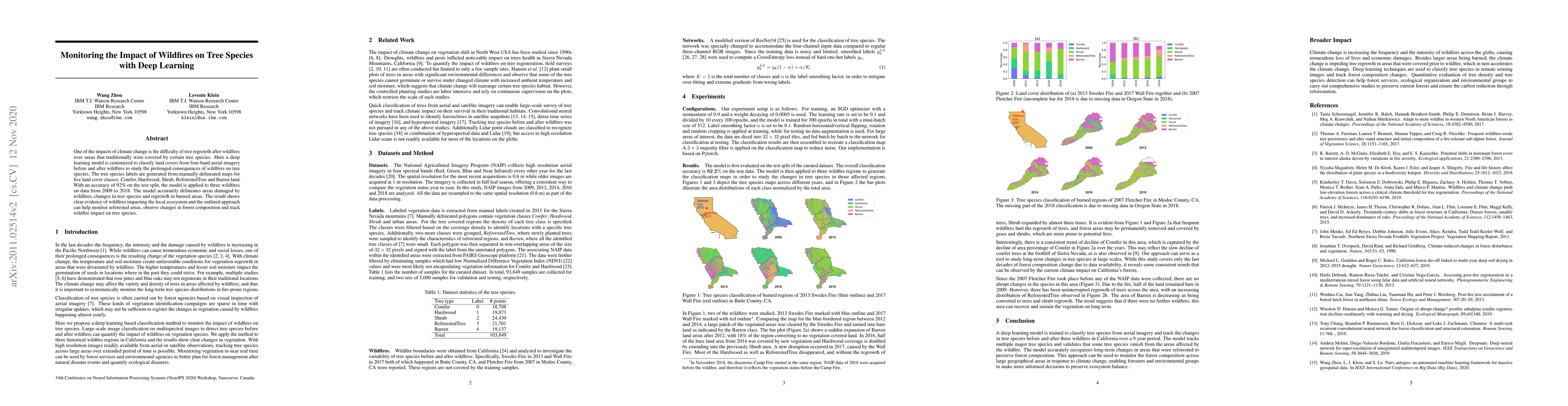
One of the impacts of climate change is the difficulty of tree regrowth after wildfires over areas that traditionally were covered by certain tree species. Here a deep learning model is customized t...
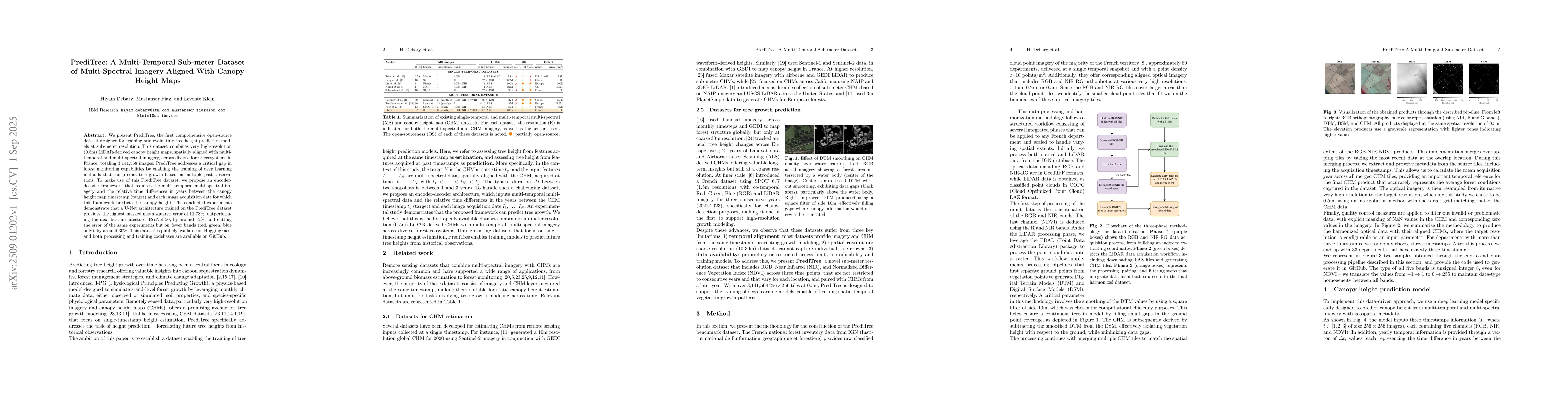
We present PrediTree, the first comprehensive open-source dataset designed for training and evaluating tree height prediction models at sub-meter resolution. This dataset combines very high-resolution...
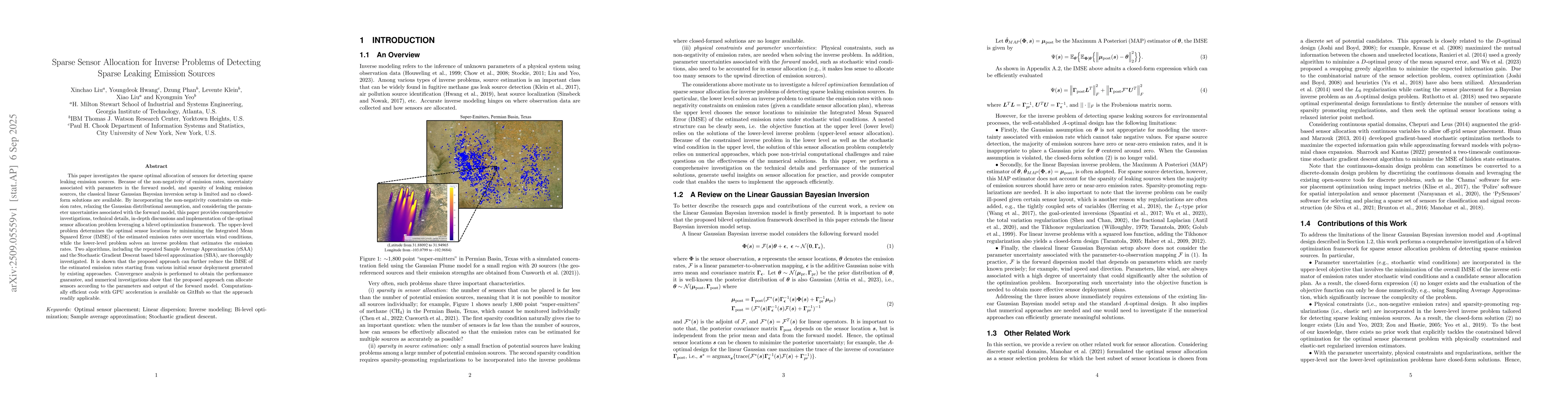
This paper investigates the sparse optimal allocation of sensors for detecting sparse leaking emission sources. Because of the non-negativity of emission rates, uncertainty associated with parameters ...
We show that AI foundation models that are pretrained on numerical solutions to a diverse corpus of partial differential equations can be adapted and fine-tuned to obtain skillful predictive weather e...
Geospatial foundation models (GFMs) are a fast-emerging paradigm for various geospatial tasks, such as ecological mapping. However, the utility of GFMs has not been fully explored for high-value use c...