Academic Profile
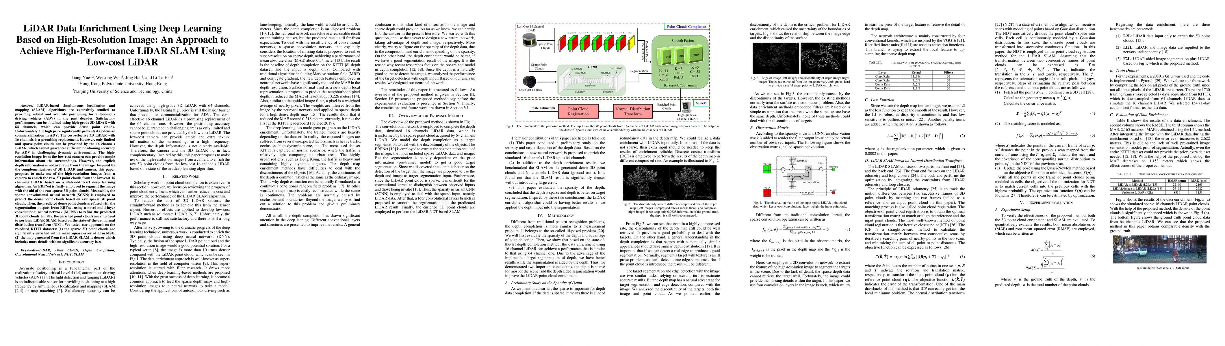
Statistics
Similar Authors
Papers on arXiv
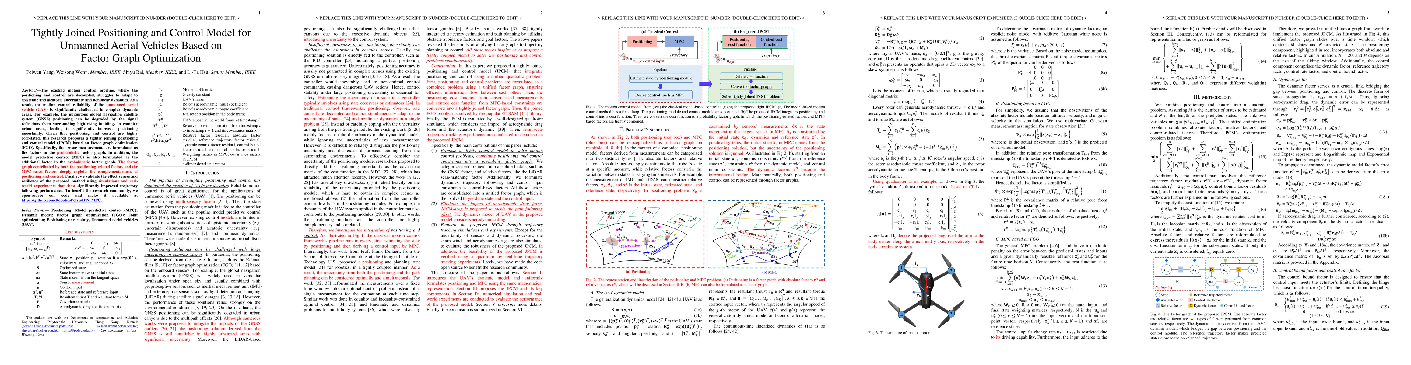
The execution of flight missions by unmanned aerial vehicles (UAV) primarily relies on navigation. In particular, the navigation pipeline has traditionally been divided into positioning and control,...
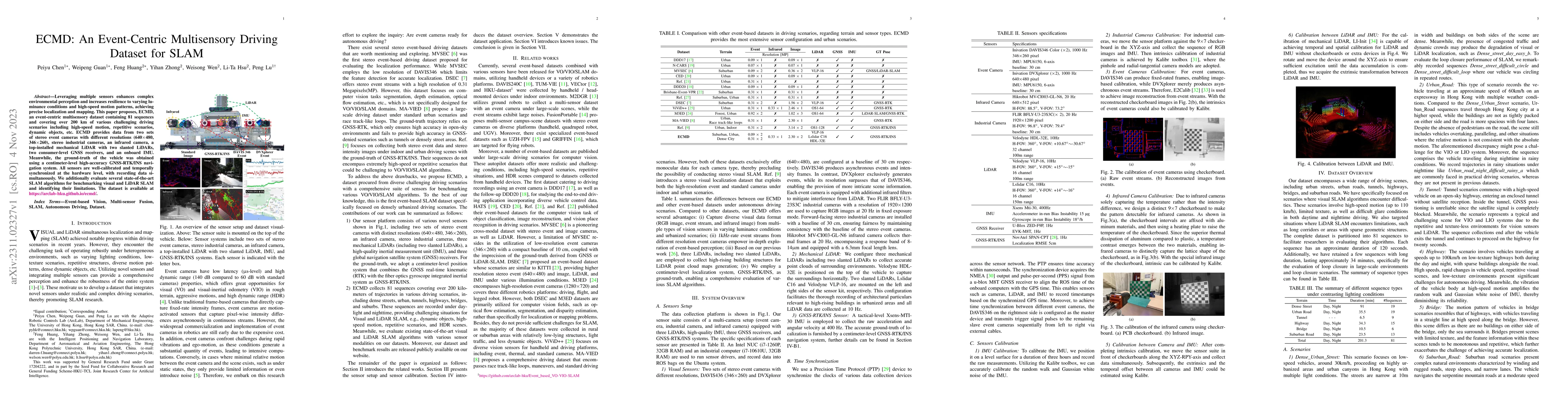
Leveraging multiple sensors enhances complex environmental perception and increases resilience to varying luminance conditions and high-speed motion patterns, achieving precise localization and mapp...
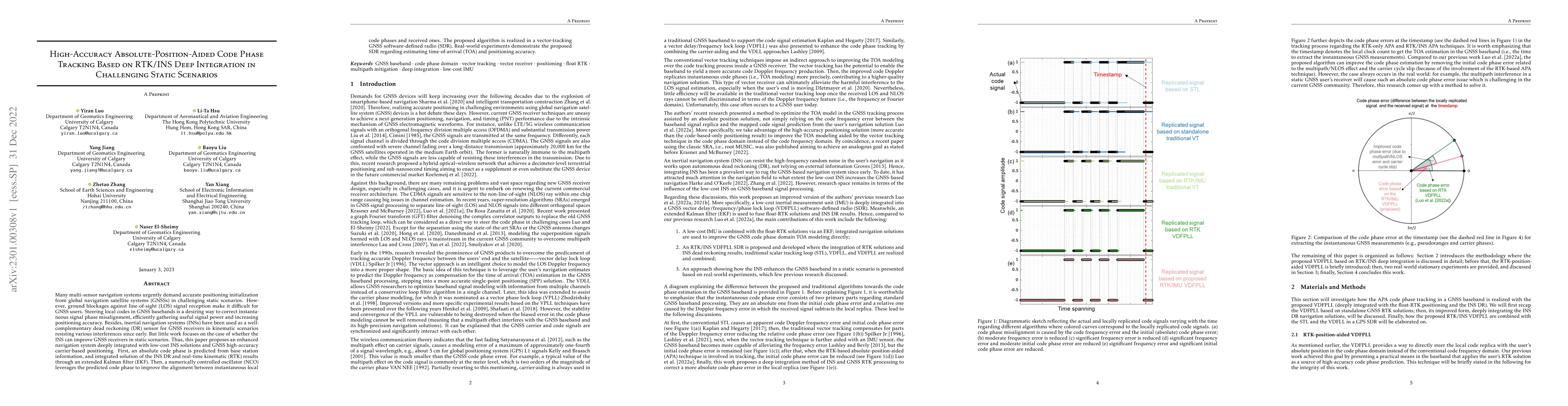
Many multi-sensor navigation systems urgently demand accurate positioning initialization from global navigation satellite systems (GNSSs) in challenging static scenarios. However, ground blockages a...
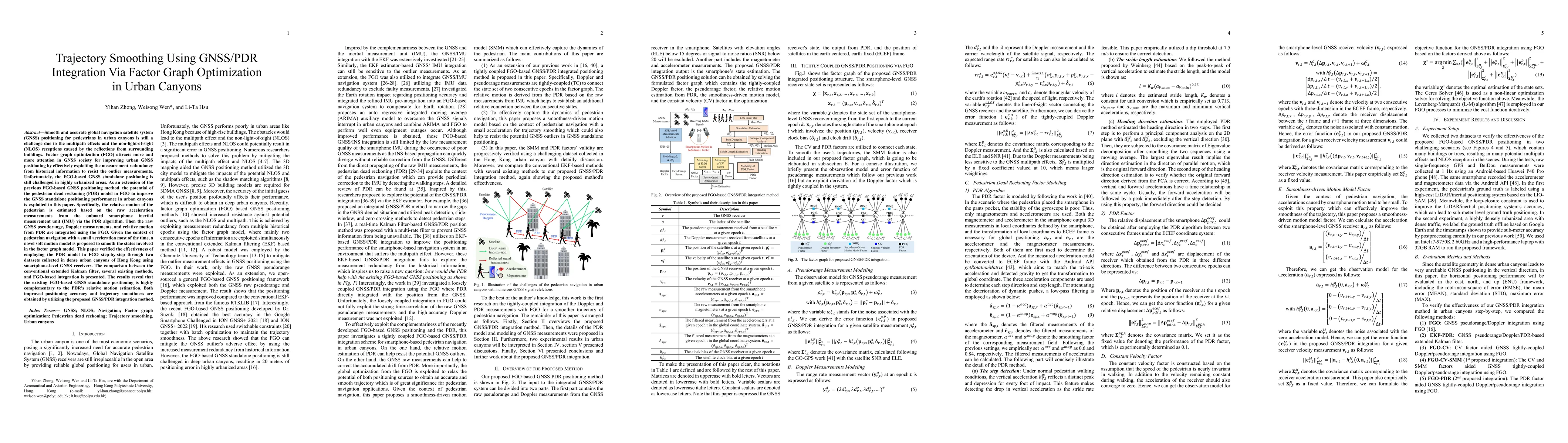
Accurate and smooth global navigation satellite system (GNSS) positioning for pedestrians in urban canyons is still a challenge due to the multipath effects and the non-light-of-sight (NLOS) recepti...
GNSS and LiDAR odometry are complementary as they provide absolute and relative positioning, respectively. Their integration in a loosely-coupled manner is straightforward but is challenged in urban...
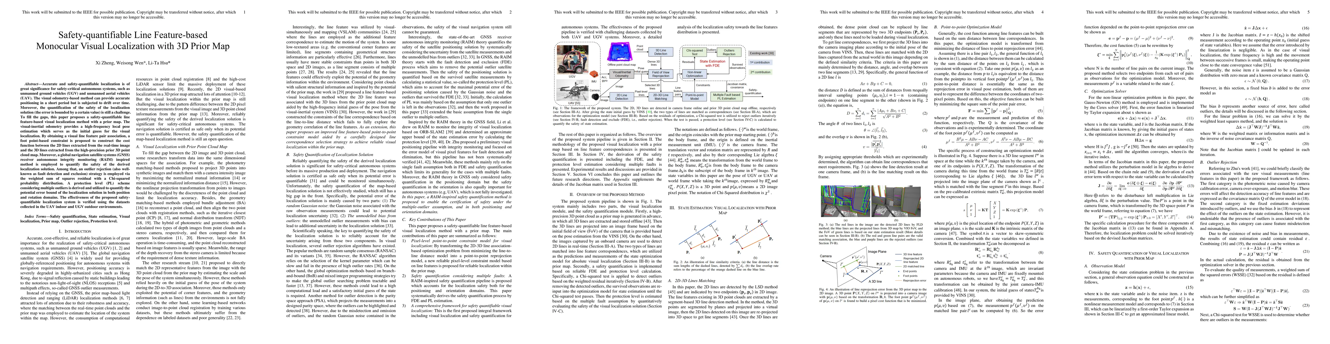
Accurate and safety-quantifiable localization is of great significance for safety-critical autonomous systems, such as unmanned ground vehicles (UGV) and unmanned aerial vehicles (UAV). The visual o...
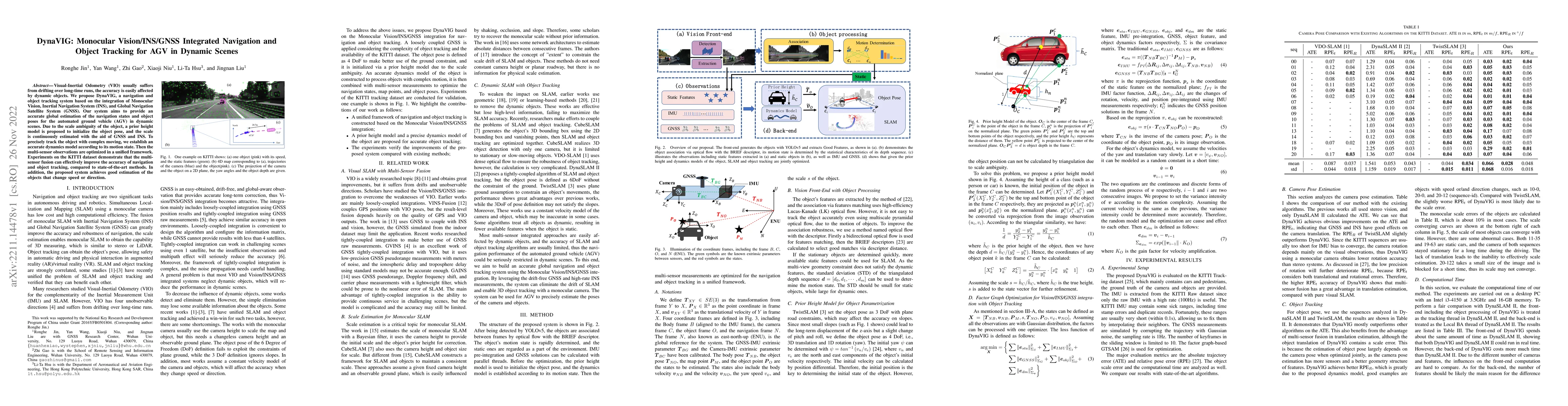
Visual-Inertial Odometry (VIO) usually suffers from drifting over long-time runs, the accuracy is easily affected by dynamic objects. We propose DynaVIG, a navigation and object tracking system base...
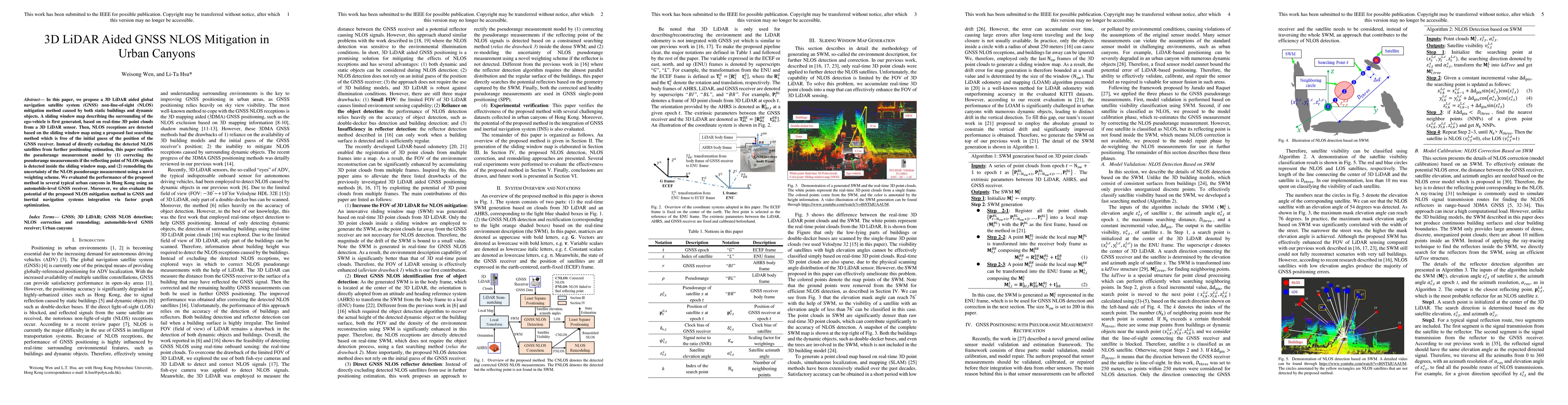
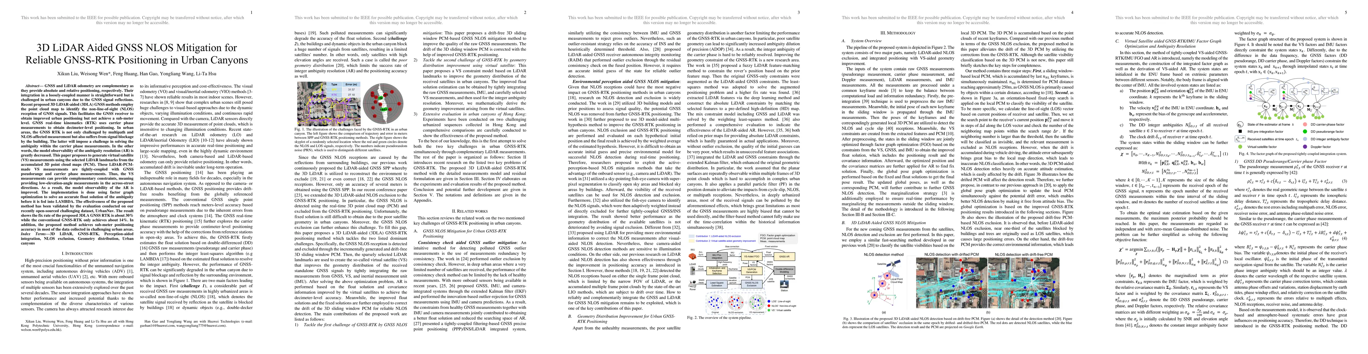
In this paper, we propose a 3D LiDAR aided global navigation satellite system (GNSS) non-line-of-sight (NLOS) mitigation method caused by both static buildings and dynamic objects. A sliding window ...
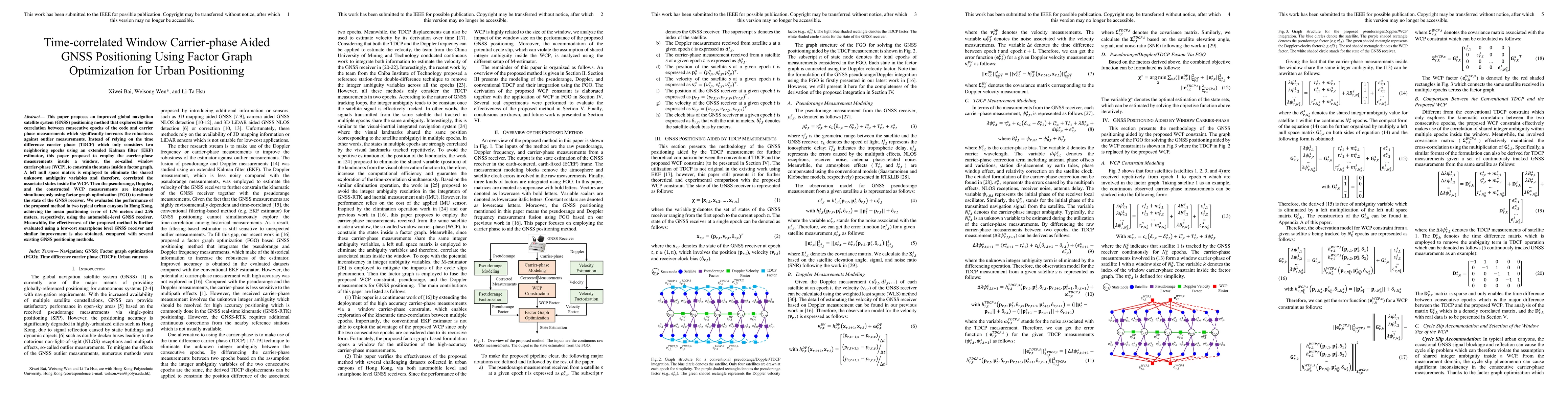
This paper proposes an improved global navigation satellite system (GNSS) positioning method that explores the time correlation between consecutive epochs of the code and carrier phase measurements ...
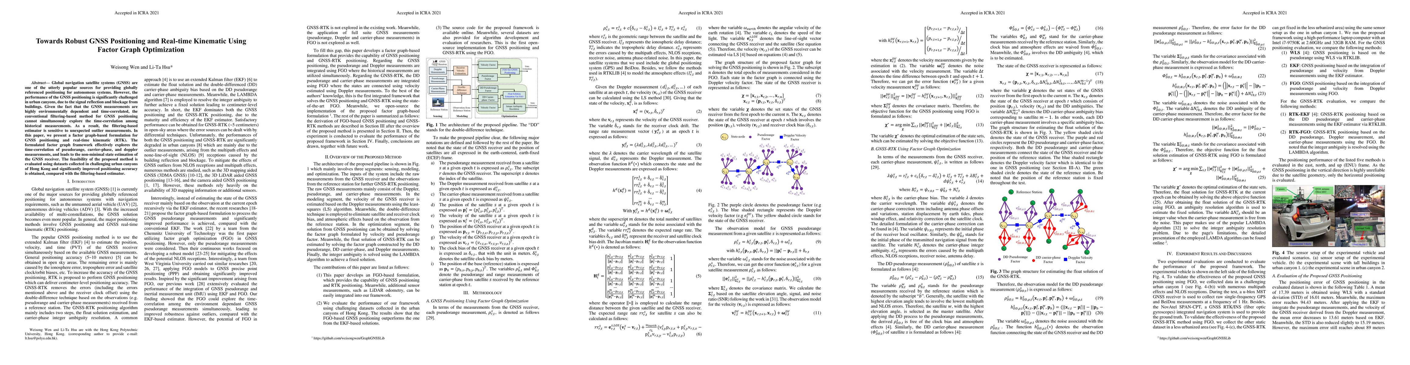
Accurate and globally referenced global navigation satellite system (GNSS) based vehicular positioning can be achieved in outlier-free open areas. However, the performance of GNSS can be significant...
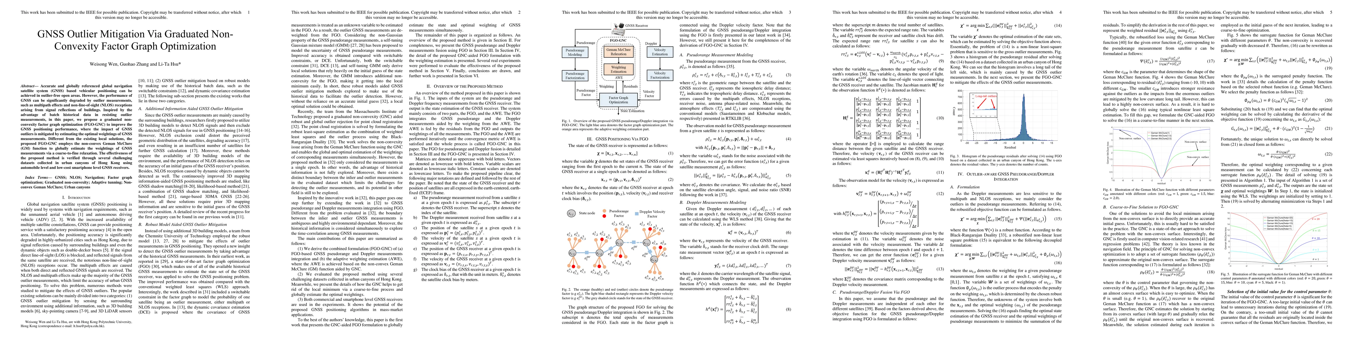
Global navigation satellite systems (GNSS) are one of the utterly popular sources for providing globally referenced positioning for autonomous systems. However, the performance of the GNSS positioni...
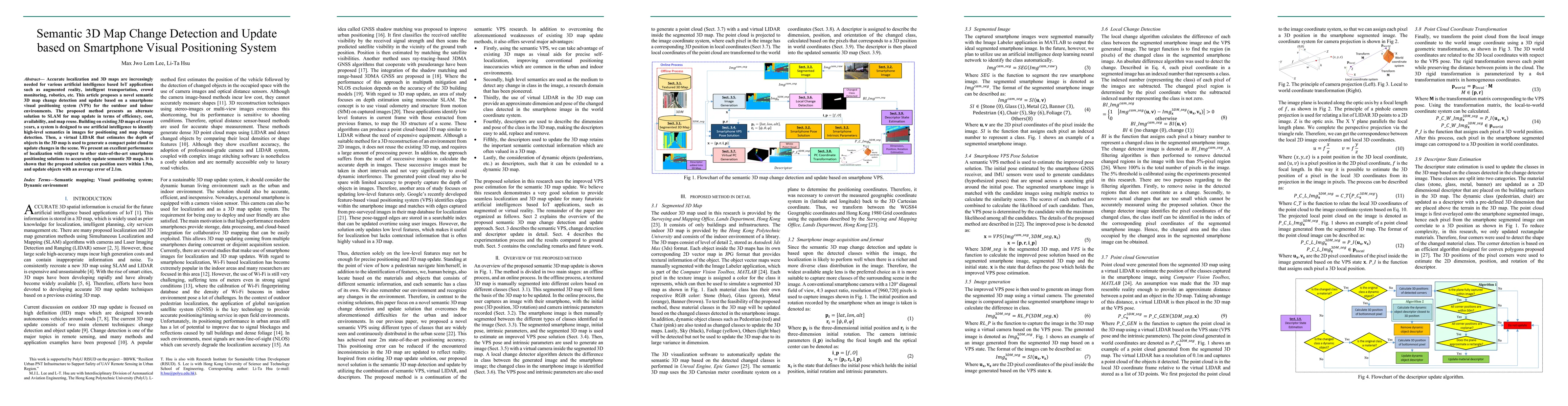
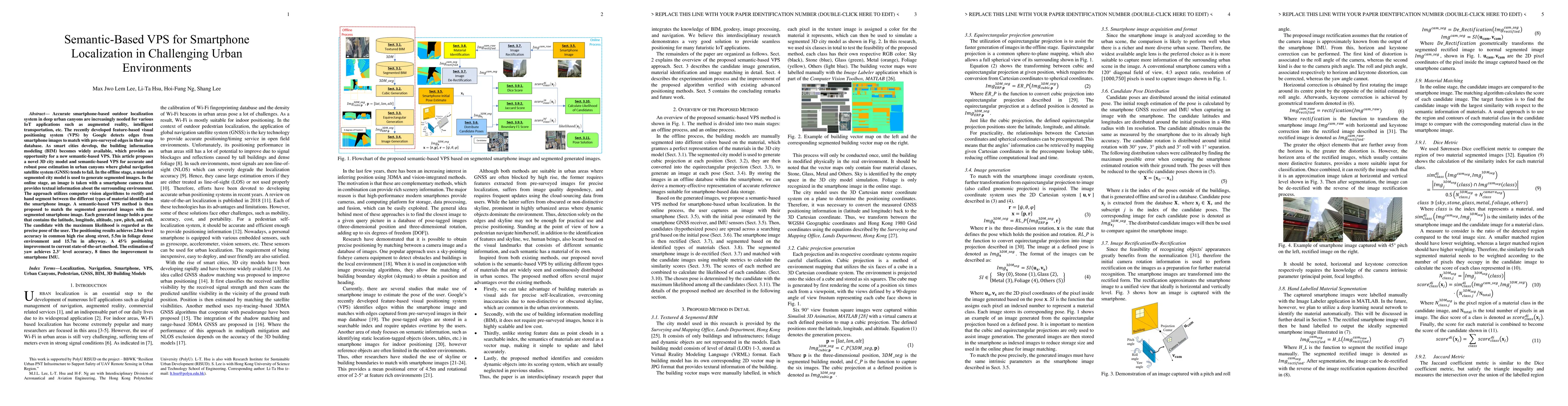
Accurate localization and 3D maps are increasingly needed for various artificial intelligence based IoT applications such as augmented reality, intelligent transportation, crowd monitoring, robotics...
Accurate smartphone-based outdoor localization system in deep urban canyons are increasingly needed for various IoT applications such as augmented reality, intelligent transportation, etc. The recen...
LiDAR-based SLAM algorithms are extensively studied to providing robust and accurate positioning for autonomous driving vehicles (ADV) in the past decades. Satisfactory performance can be obtained u...
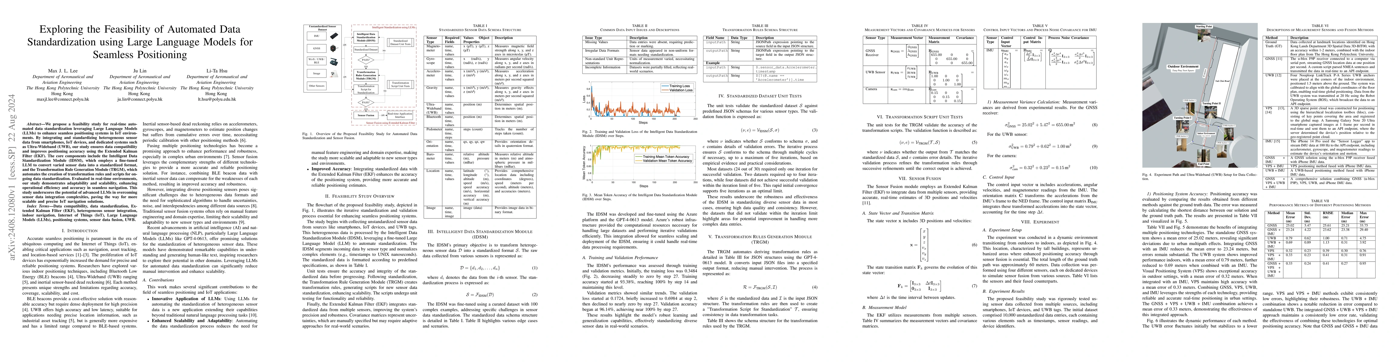
We propose a feasibility study for real-time automated data standardization leveraging Large Language Models (LLMs) to enhance seamless positioning systems in IoT environments. By integrating and stan...
Global navigation satellite systems (GNSS) are essential for aviation, requiring strict integrity monitoring to alert users to hazardously misleading information. Conventional receiver autonomous inte...
Fault detection is crucial to ensure the reliability of navigation systems. However, mainstream fault detection methods are developed based on Gaussian assumptions on nominal errors, while current att...
State estimators often provide self-assessed uncertainty metrics, such as covariance matrices, whose reliability is critical for downstream tasks. However, these self-assessments can be misleading due...
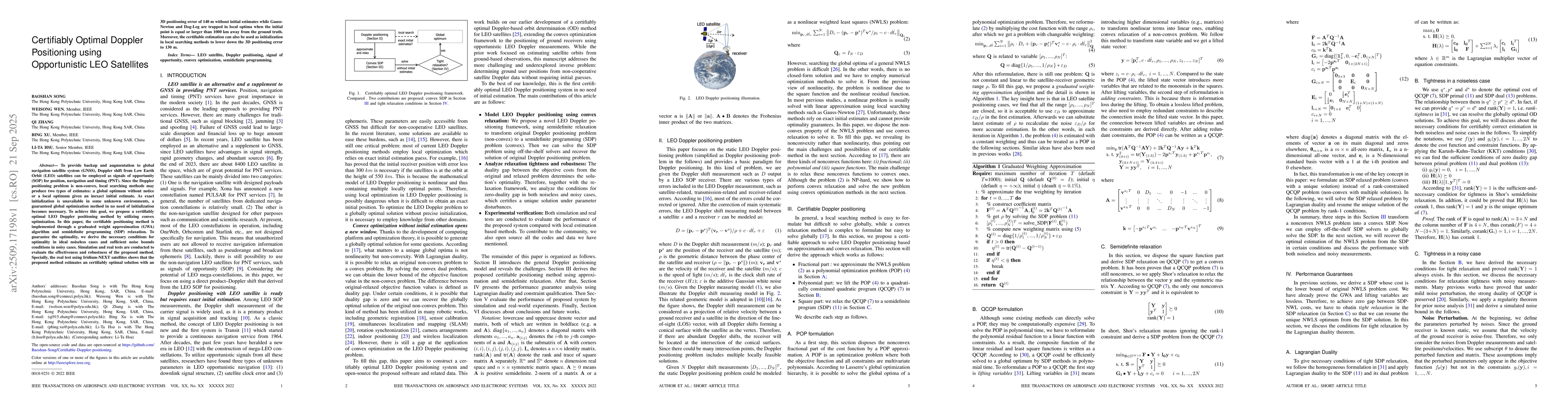
To provide backup and augmentation to global navigation satellite system (GNSS), Doppler shift from Low Earth Orbit (LEO) satellites can be employed as signals of opportunity (SOP) for position, navig...
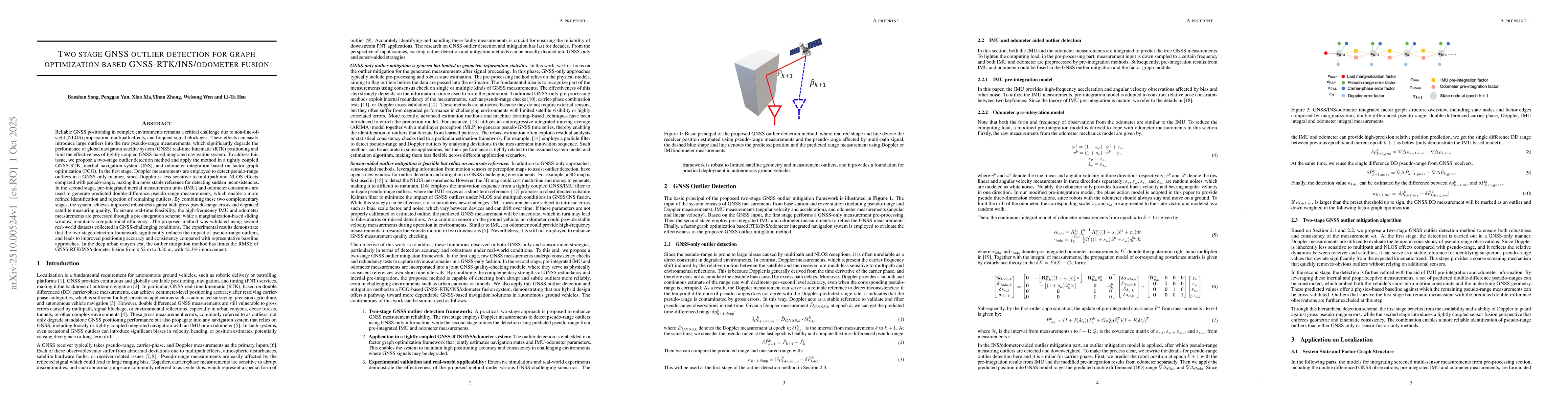
Reliable GNSS positioning in complex environments remains a critical challenge due to non-line-of-sight (NLOS) propagation, multipath effects, and frequent signal blockages. These effects can easily i...
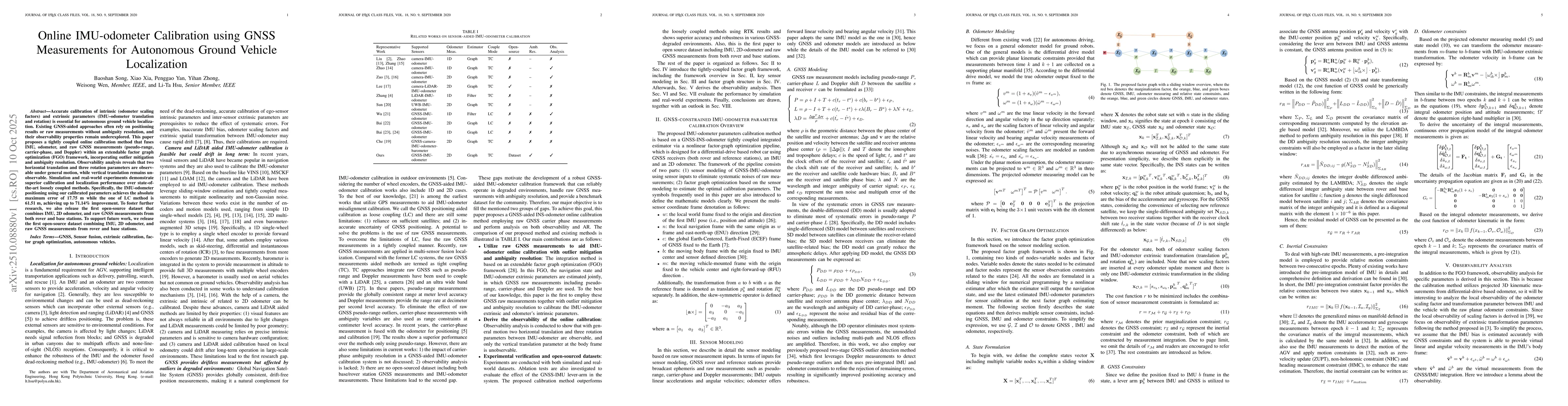
Accurate calibration of intrinsic (odometer scaling factors) and extrinsic parameters (IMU-odometer translation and rotation) is essential for autonomous ground vehicle localization. Existing GNSS-aid...
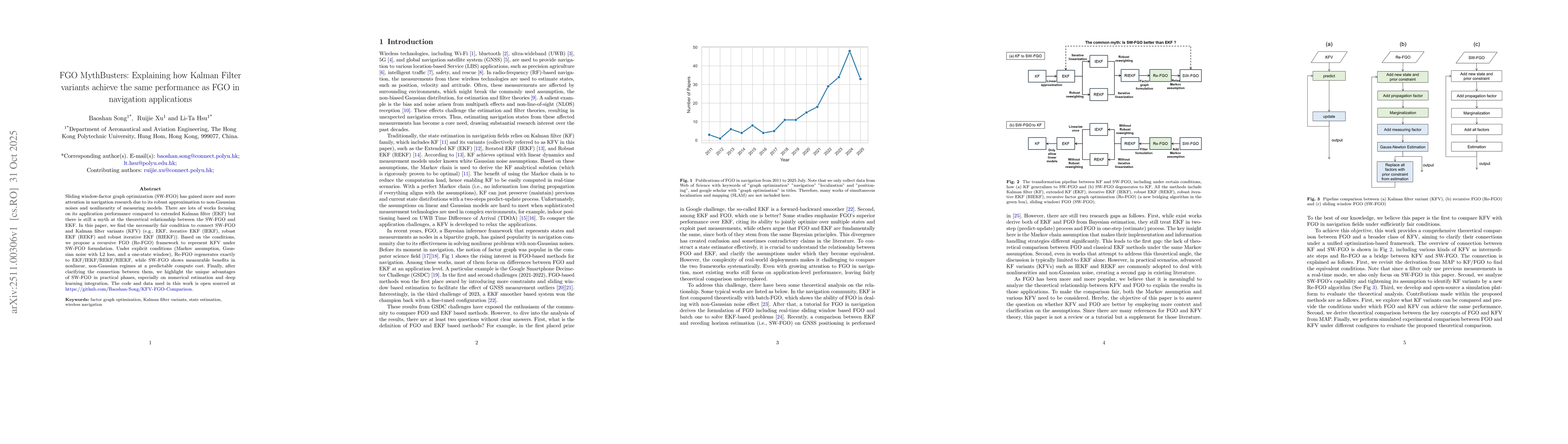
Sliding window-factor graph optimization (SW-FGO) has gained more and more attention in navigation research due to its robust approximation to non-Gaussian noises and nonlinearity of measuring models....
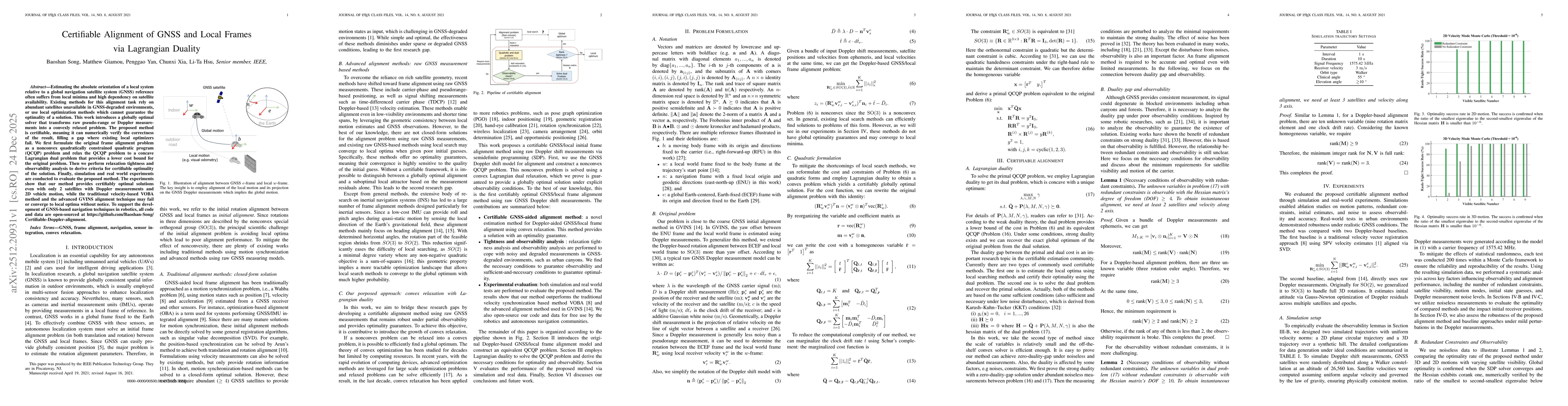
Estimating the absolute orientation of a local system relative to a global navigation satellite system (GNSS) reference often suffers from local minima and high dependency on satellite availability. E...
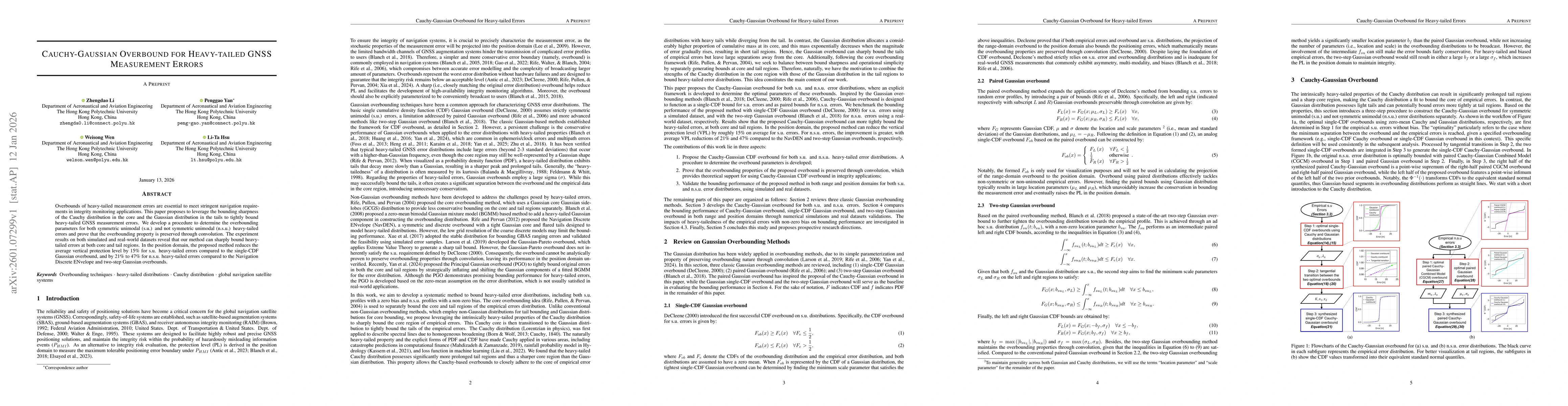
Overbounds of heavy-tailed measurement errors are essential to meet stringent navigation requirements in integrity monitoring applications. This paper proposes to leverage the bounding sharpness of th...
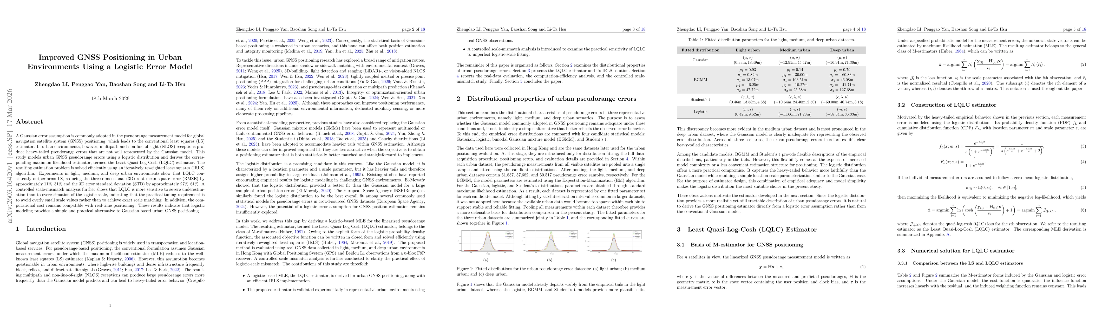
A Gaussian error assumption is commonly adopted in the pseudorange measurement model for global navigation satellite system (GNSS) positioning, which leads to the conventional least squares (LS) estim...
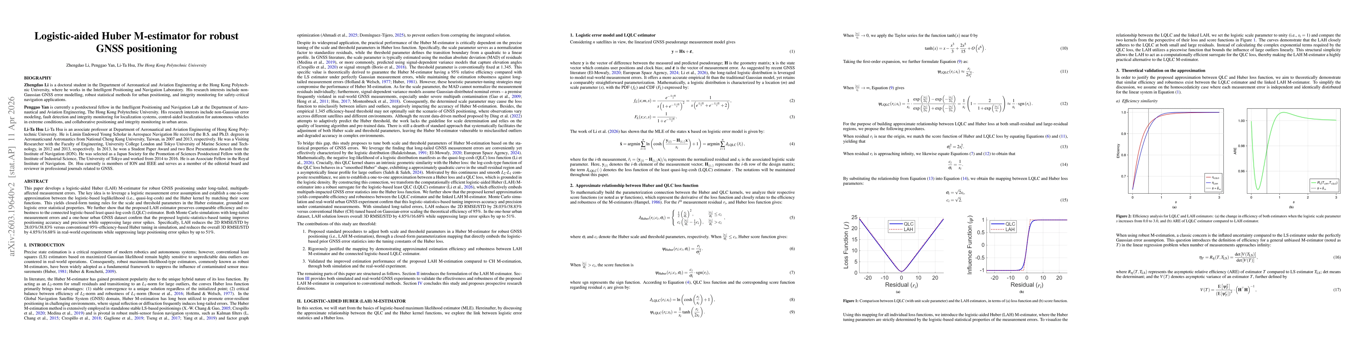
This paper develops a logistic-aided Huber (LAH) M-estimator for robust GNSS positioning under long-tailed, multipath-affected measurement errors. The key idea is to leverage a logistic measurement er...
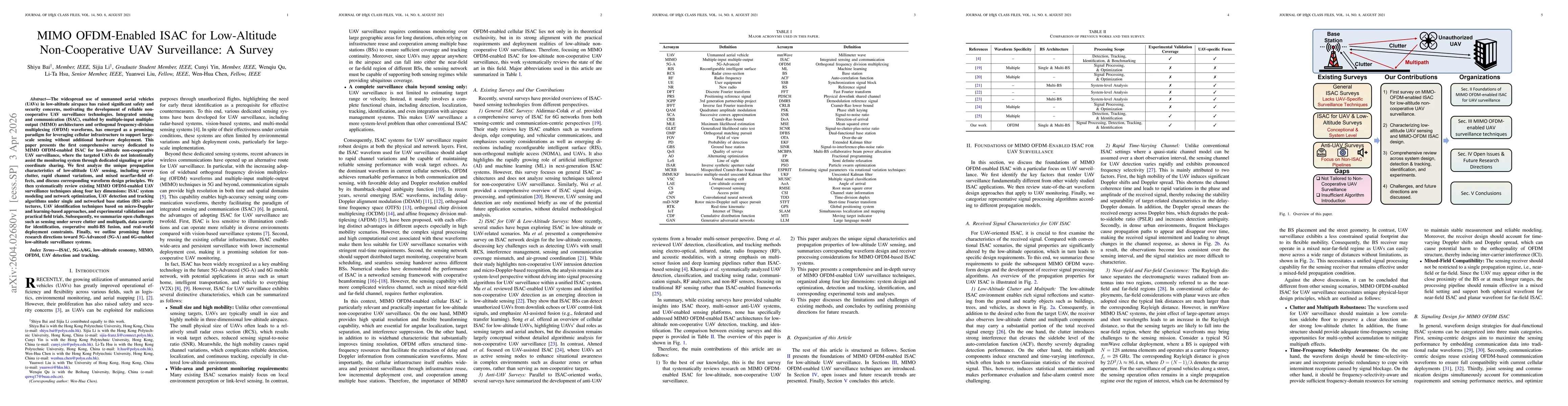
The widespread use of unmanned aerial vehicles (UAVs) in low-altitude airspace has raised significant safety and security concerns, motivating the development of reliable non-cooperative UAV surveilla...
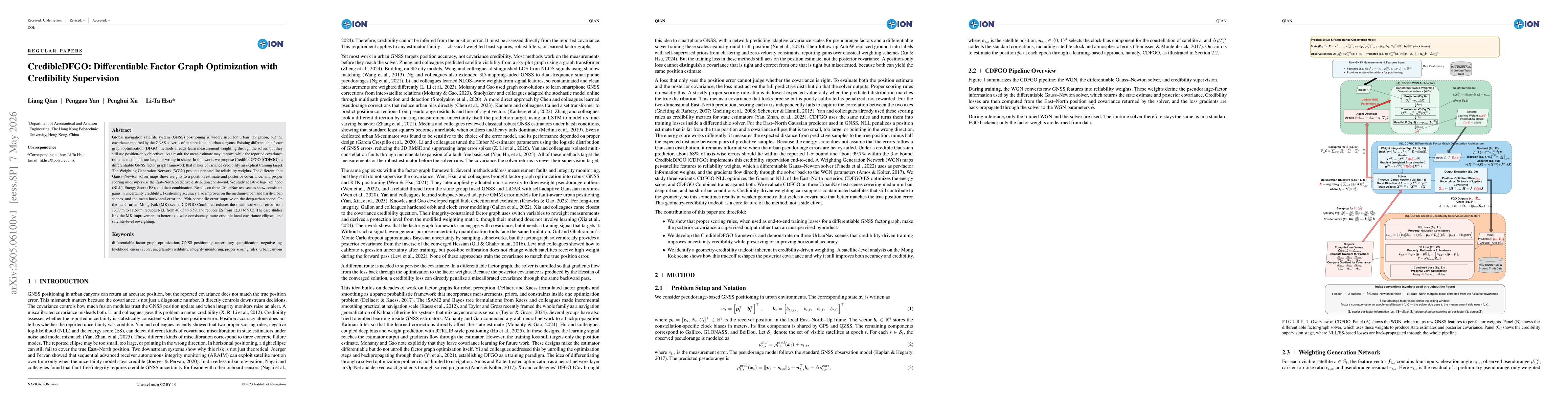
Global navigation satellite system (GNSS) positioning is widely used for urban navigation, but the covariance reported by the GNSS solver is often unreliable in urban canyons. Existing differentiable ...
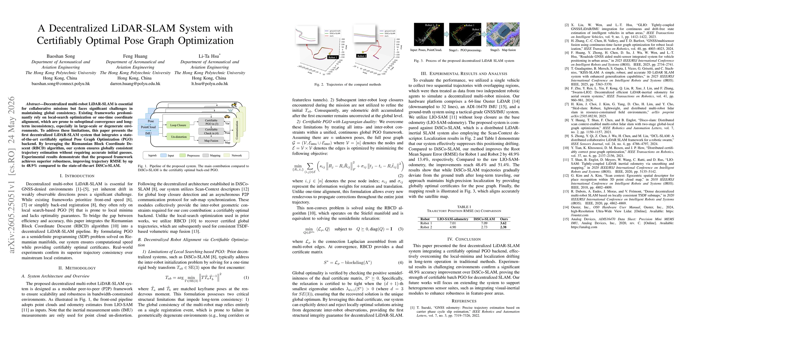
Decentralized multi-robot LiDAR-SLAM is essential for collaborative missions but faces significant challenges in maintaining global consistency. Existing frameworks predominantly rely on local-search ...
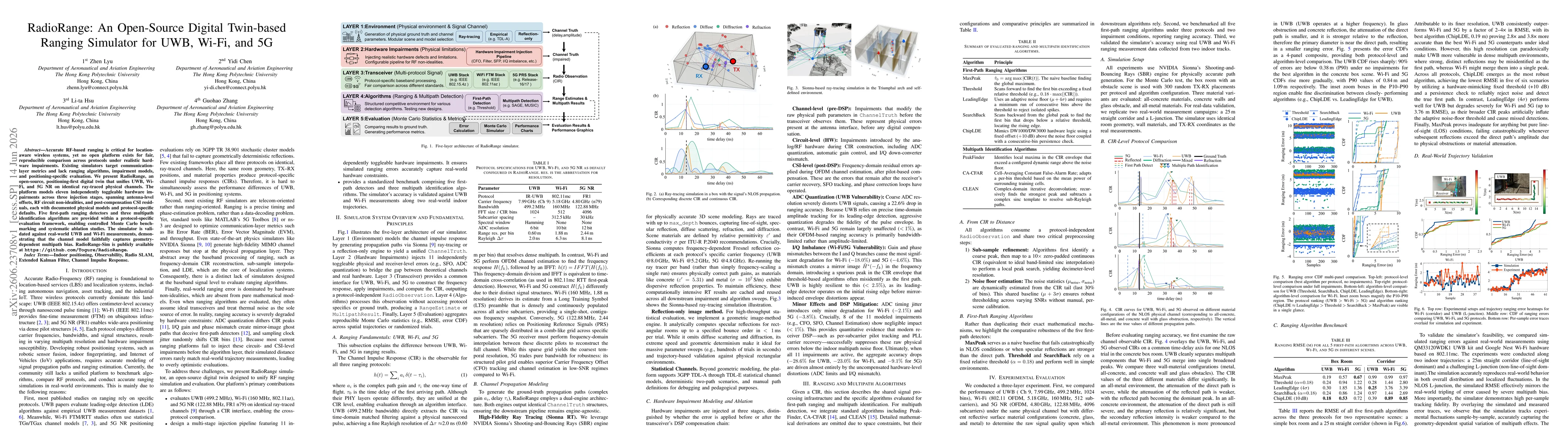
Accurate RF-based ranging is critical for location-aware wireless systems, yet no open platform exists for fair, reproducible comparison across protocols under realistic hardware impairments. Existing...