Academic Profile
Statistics
Similar Authors
Papers on arXiv
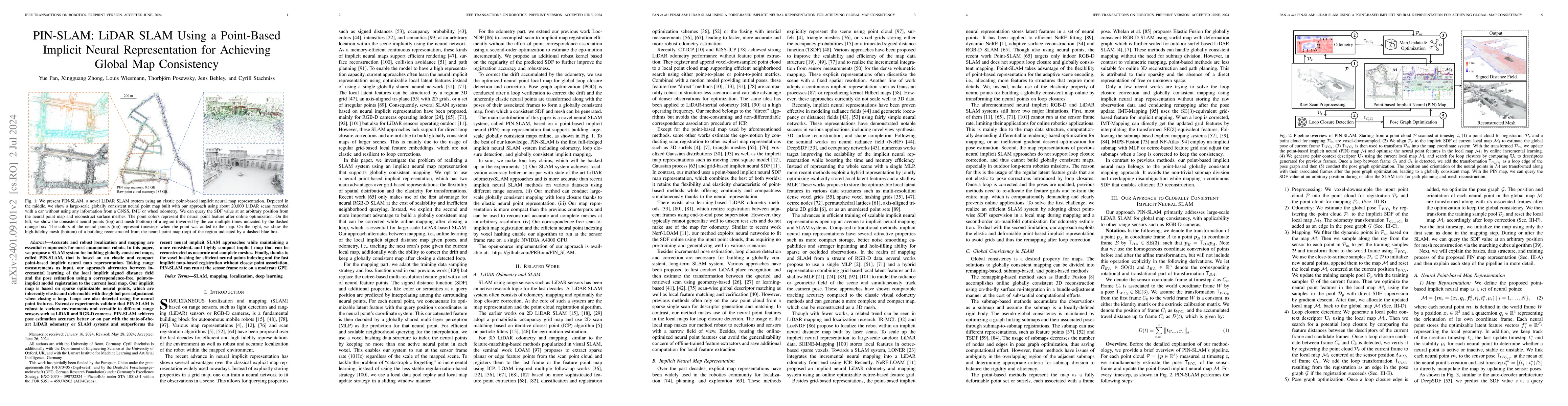
Accurate and robust localization and mapping are essential components for most autonomous robots. In this paper, we propose a SLAM system for building globally consistent maps, called PIN-SLAM, that i...
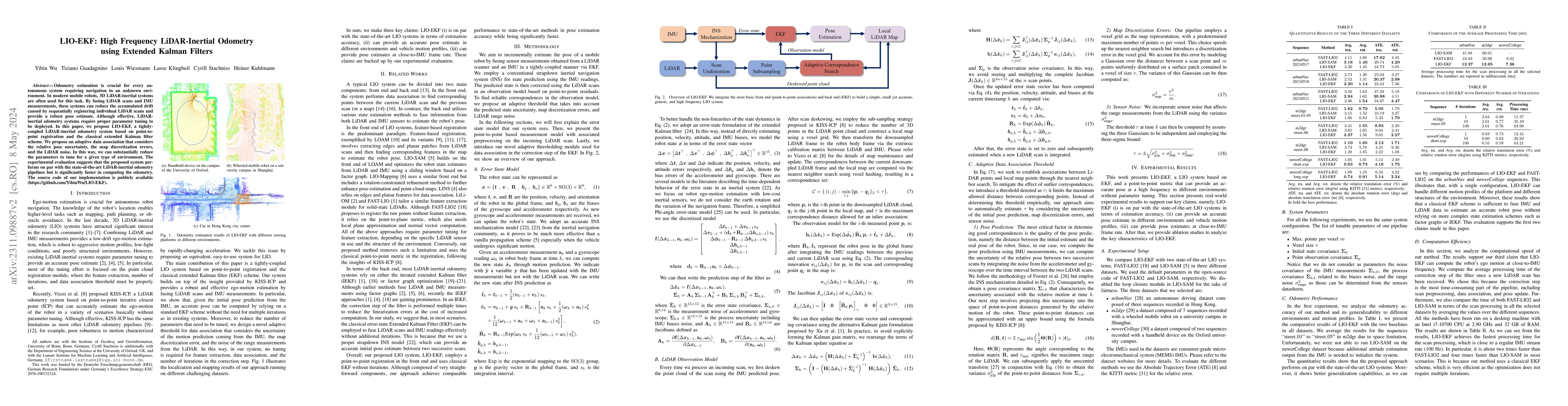
Odometry estimation is crucial for every autonomous system requiring navigation in an unknown environment. In modern mobile robots, 3D LiDAR-inertial systems are often used for this task. By fusing ...
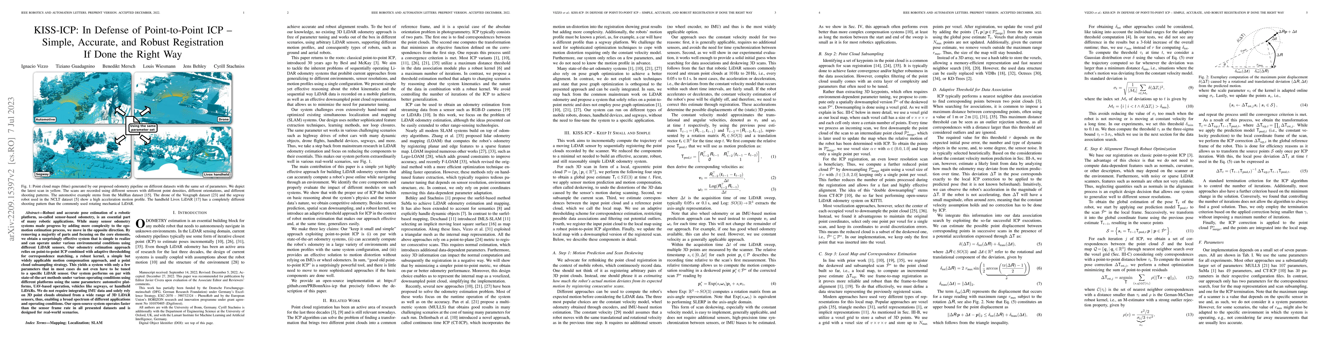
Robust and accurate pose estimation of a robotic platform, so-called sensor-based odometry, is an essential part of many robotic applications. While many sensor odometry systems made progress by add...
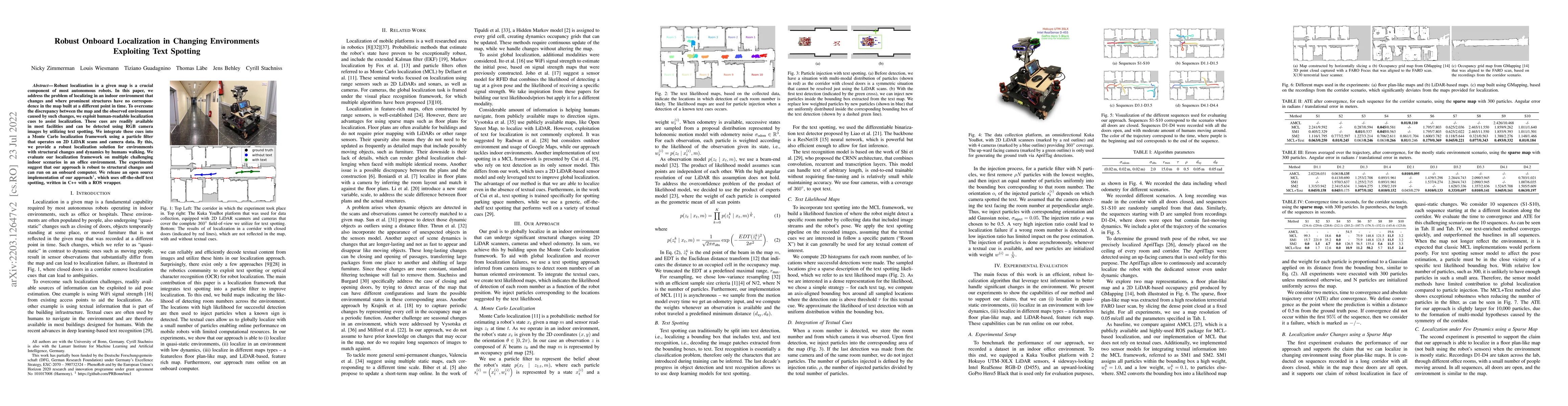
Robust localization in a given map is a crucial component of most autonomous robots. In this paper, we address the problem of localizing in an indoor environment that changes and where prominent str...
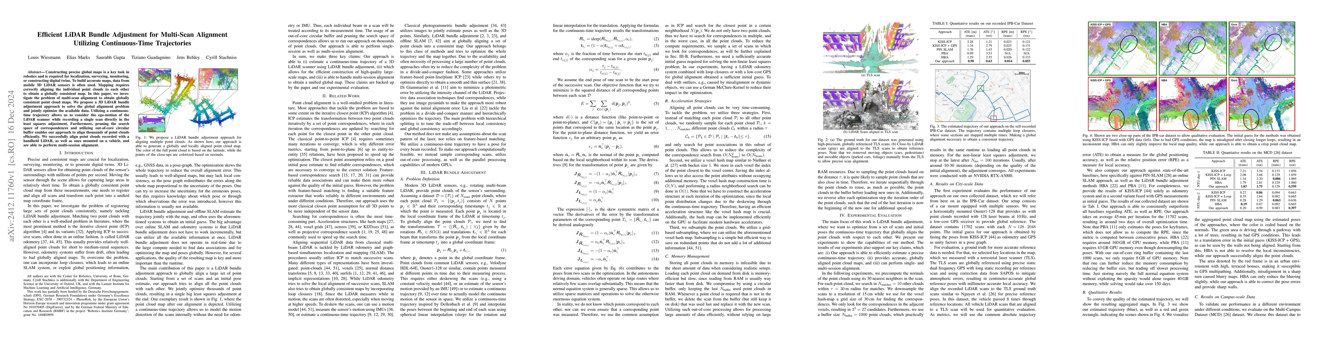
Constructing precise global maps is a key task in robotics and is required for localization, surveying, monitoring, or constructing digital twins. To build accurate maps, data from mobile 3D LiDAR sen...
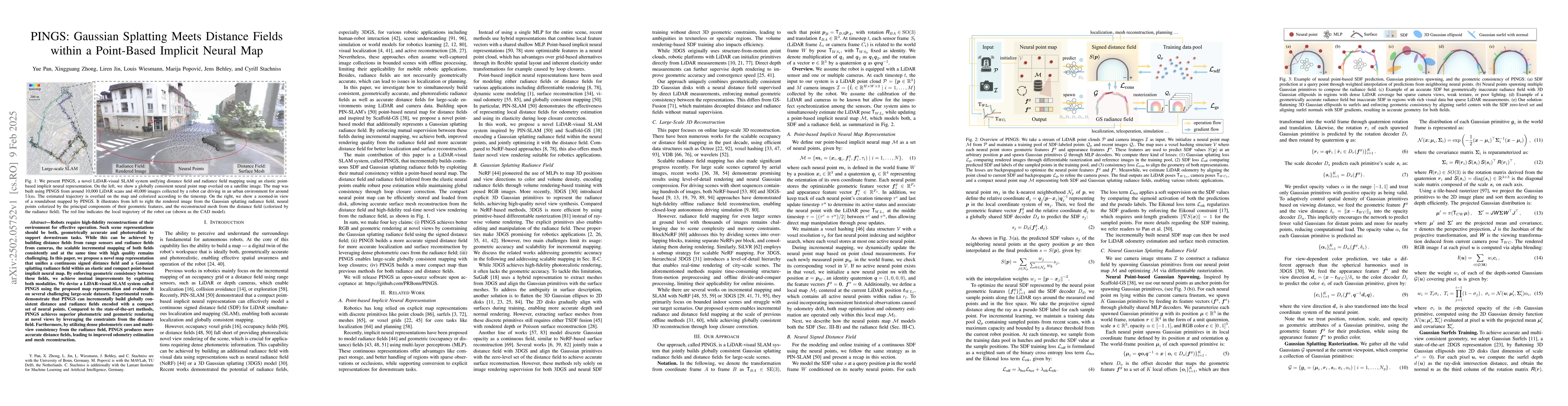
Robots require high-fidelity reconstructions of their environment for effective operation. Such scene representations should be both, geometrically accurate and photorealistic to support downstream ta...
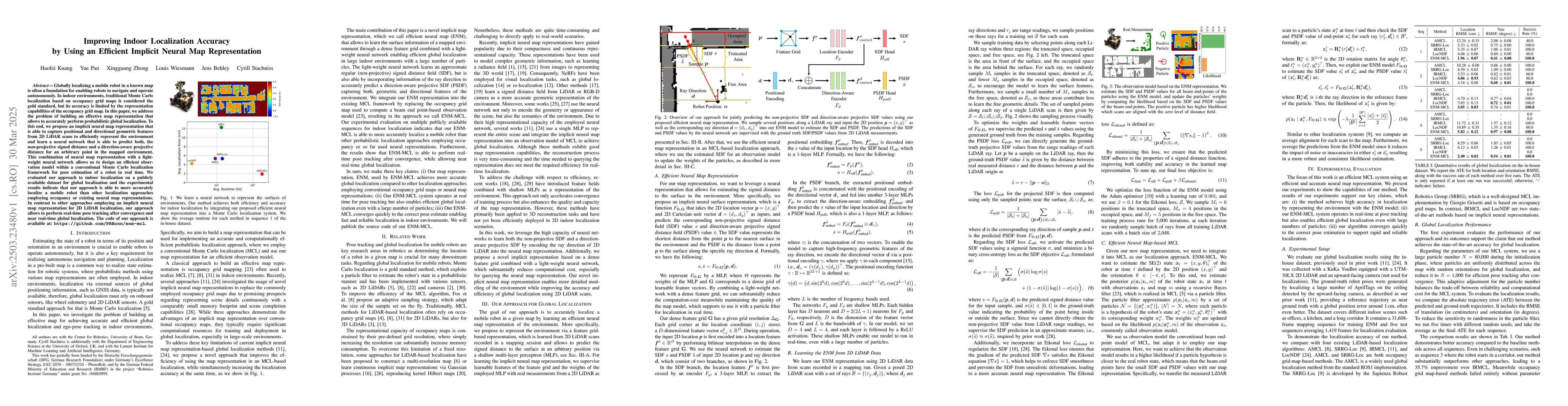
Globally localizing a mobile robot in a known map is often a foundation for enabling robots to navigate and operate autonomously. In indoor environments, traditional Monte Carlo localization based on ...
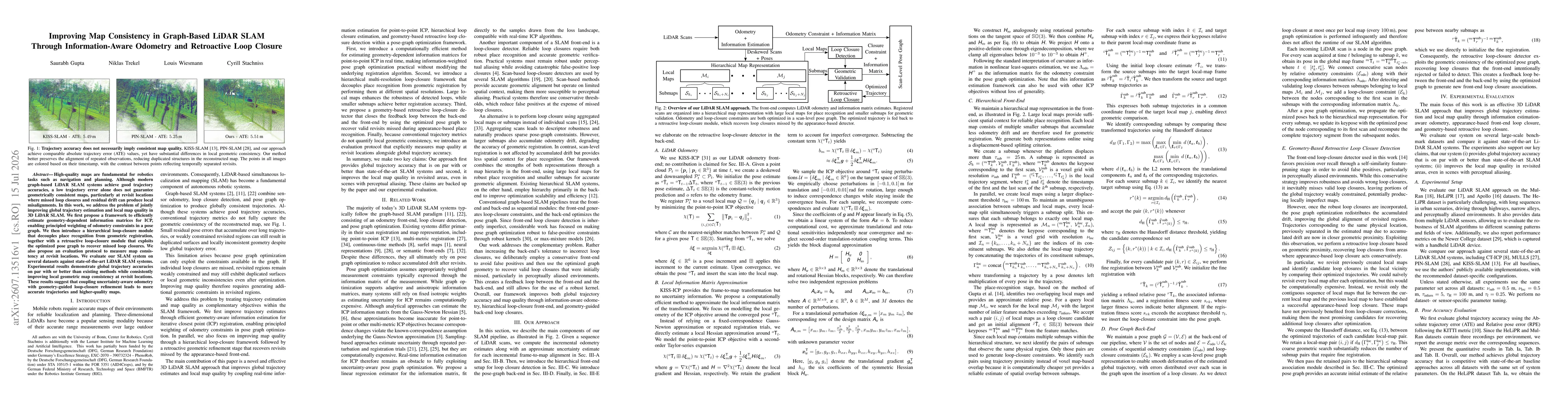
High-quality maps are fundamental for robotics tasks such as navigation and planning. Although modern graph-based LiDAR SLAM systems achieve good trajectory accuracies, a low trajectory error alone do...