Academic Profile
Statistics
Similar Authors
Papers on arXiv
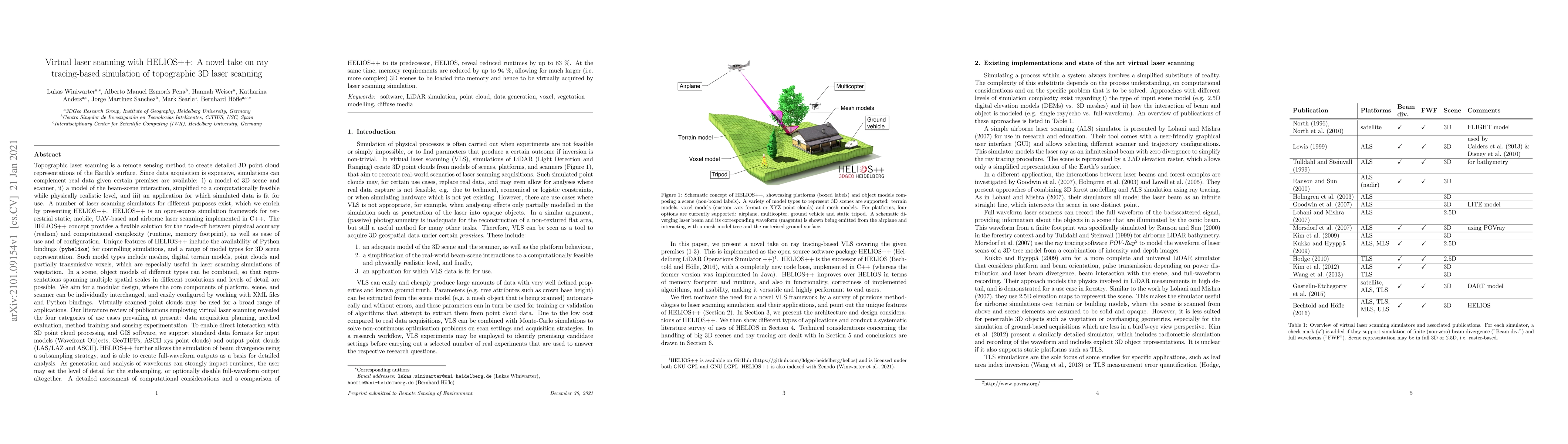
Topographic laser scanning is a remote sensing method to create detailed 3D point cloud representations of the Earth's surface. Since data acquisition is expensive, simulations can complement real d...
Proximally-sensed laser scanning offers significant potential for automated forest data capture, but challenges remain in automatically identifying tree species without additional ground data. Deep le...
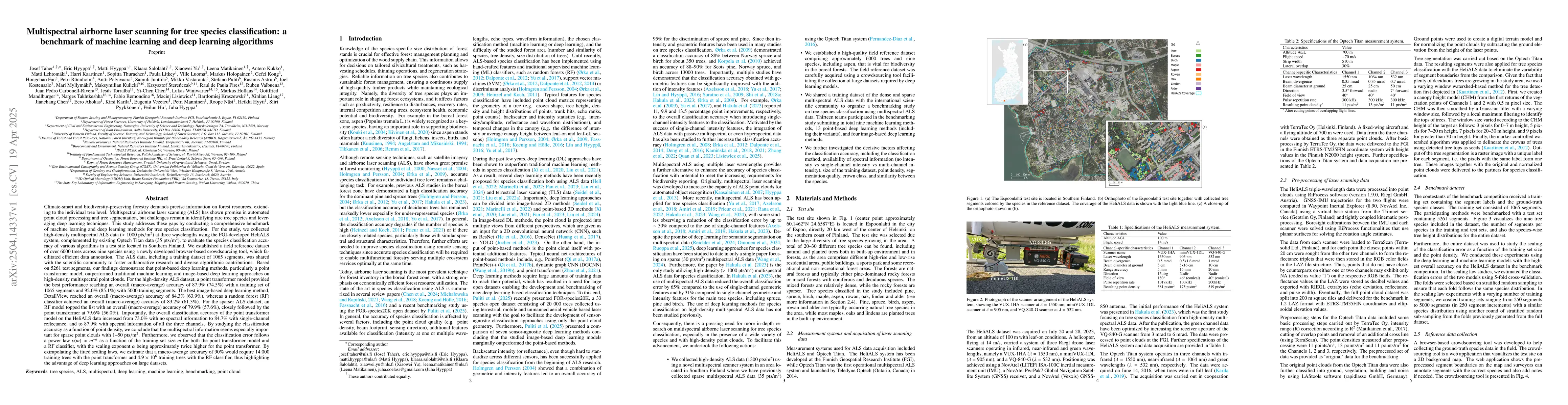
Climate-smart and biodiversity-preserving forestry demands precise information on forest resources, extending to the individual tree level. Multispectral airborne laser scanning (ALS) has shown promis...
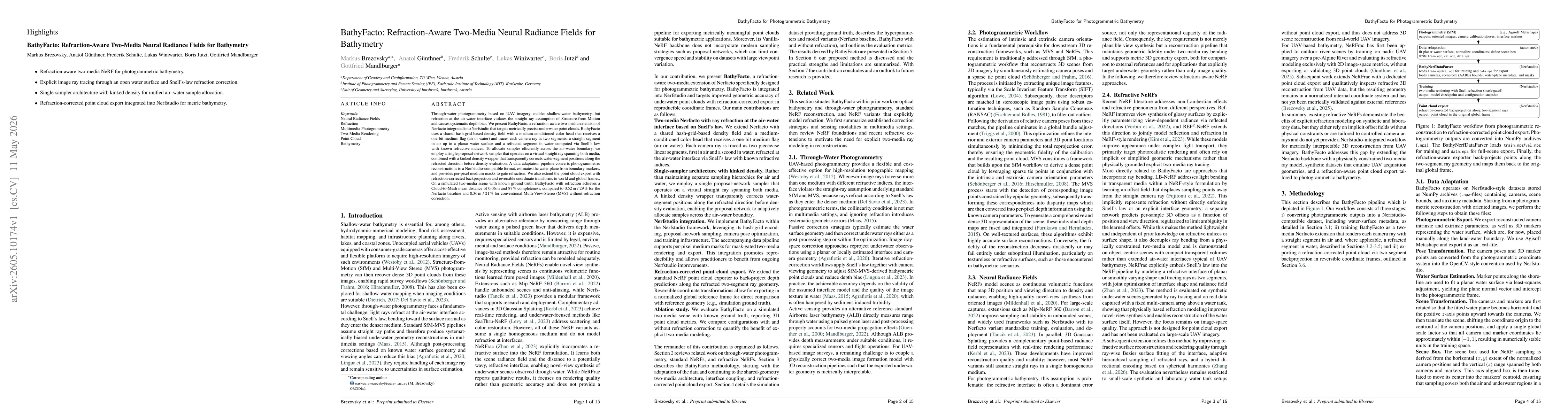
Through-water photogrammetry based on UAV imagery enables shallow-water bathymetry, but refraction at the air-water interface violates the straight-ray assumption of Structure-from-Motion and causes s...