Academic Profile
Statistics
Similar Authors
Papers on arXiv
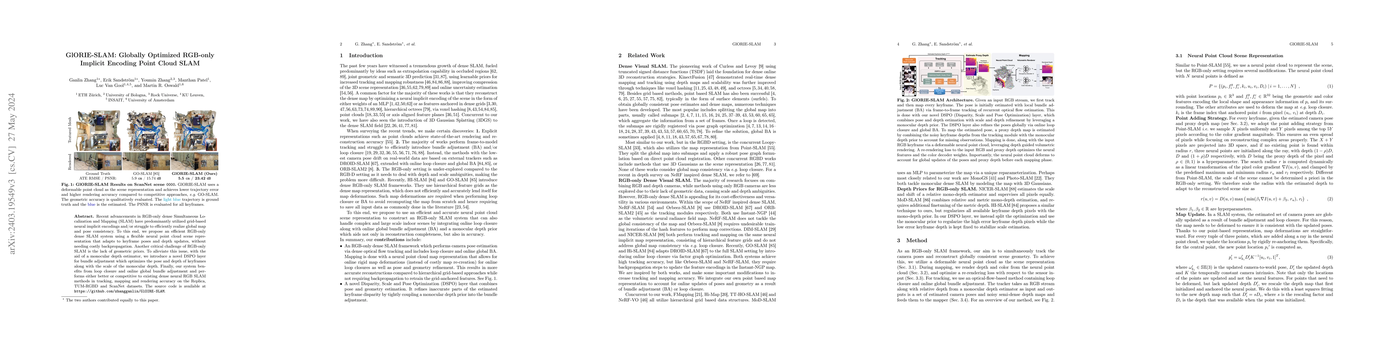
Recent advancements in RGB-only dense Simultaneous Localization and Mapping (SLAM) have predominantly utilized grid-based neural implicit encodings and/or struggle to efficiently realize global map ...
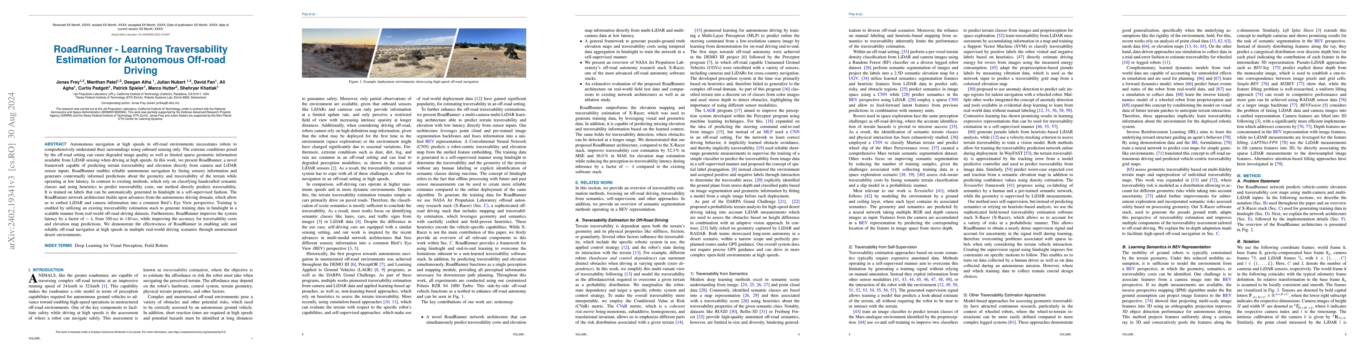
Autonomous navigation at high speeds in off-road environments necessitates robots to comprehensively understand their surroundings using onboard sensing only. The extreme conditions posed by the off...
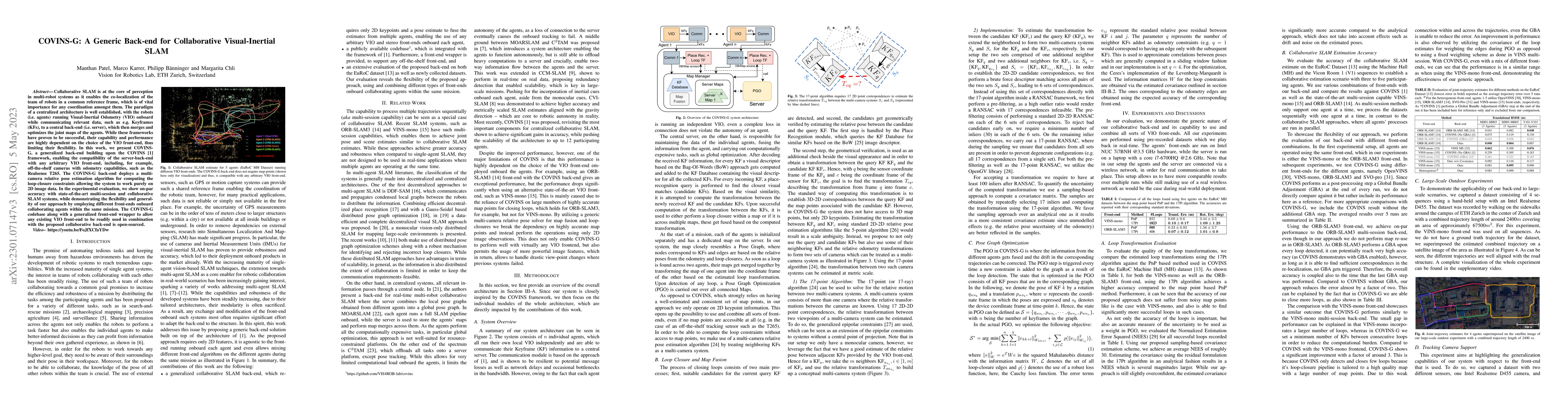
Collaborative SLAM is at the core of perception in multi-robot systems as it enables the co-localization of the team of robots in a common reference frame, which is of vital importance for any coord...
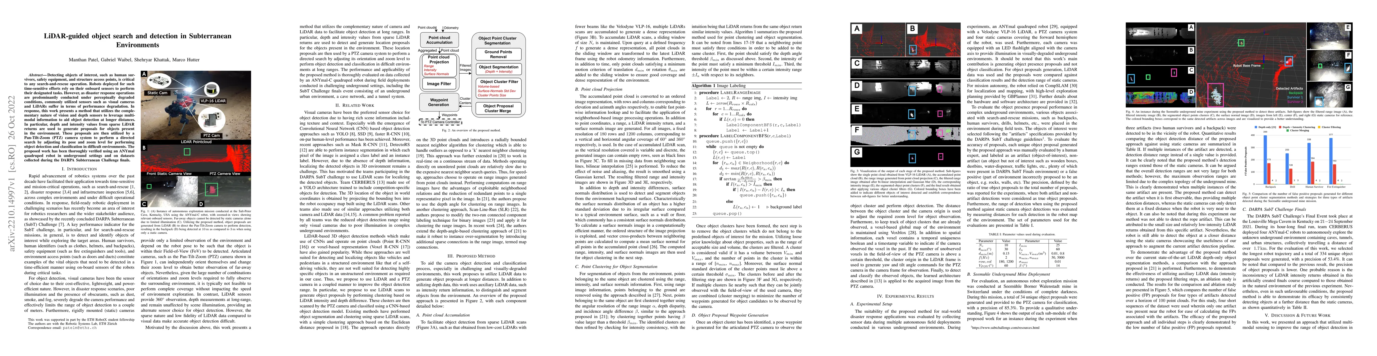
Detecting objects of interest, such as human survivors, safety equipment, and structure access points, is critical to any search-and-rescue operation. Robots deployed for such time-sensitive efforts...
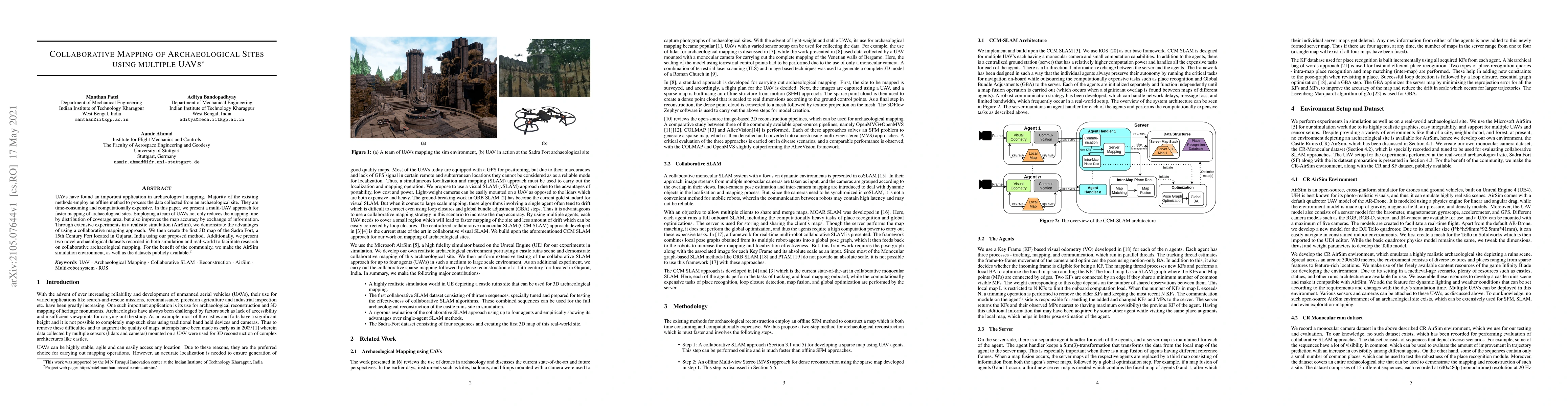
UAVs have found an important application in archaeological mapping. Majority of the existing methods employ an offline method to process the data collected from an archaeological site. They are time...
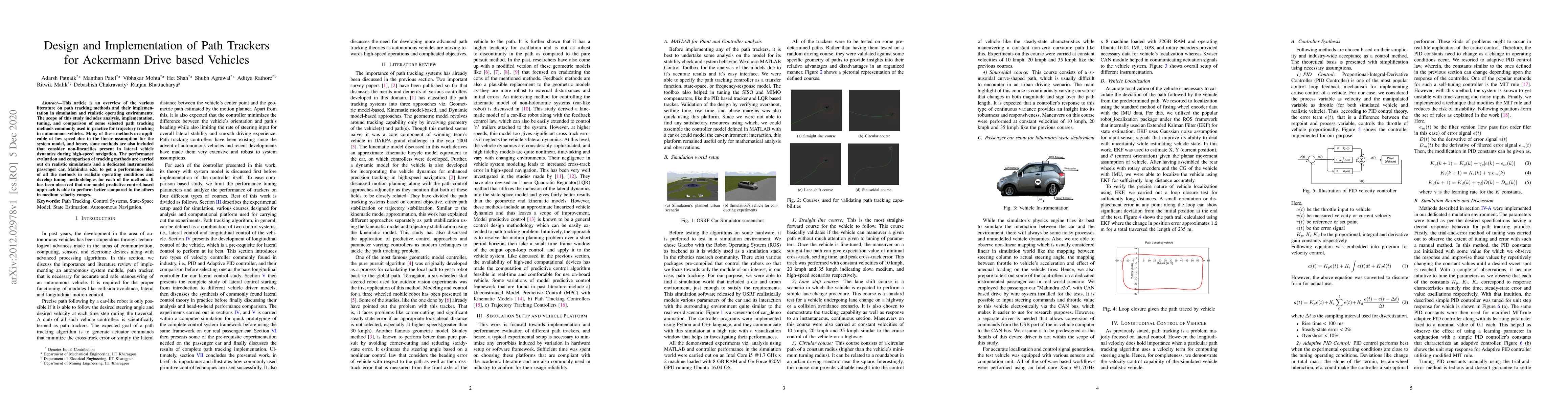
This article is an overview of the various literature on path tracking methods and their implementation in simulation and realistic operating environments.The scope of this study includes analysis, ...
The efficiency of the stock market has a significant impact on the potential return on investment. An efficient market eliminates the possibility of arbitrage and unexploited profit opportunities. T...
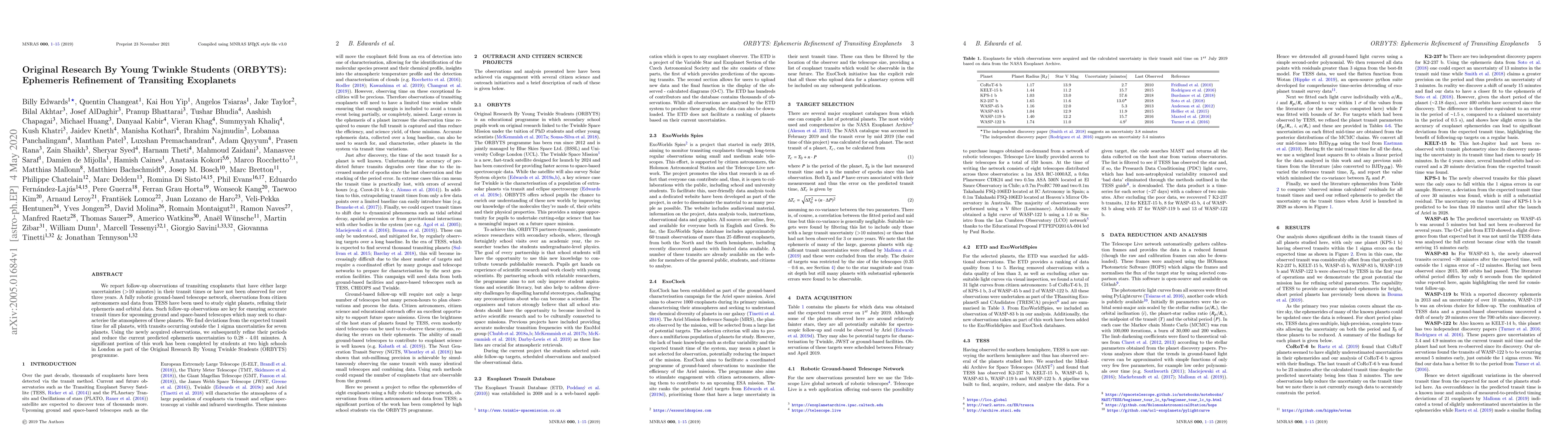
We report follow-up observations of transiting exoplanets that have either large uncertainties (>10 minutes) in their transit times or have not been observed for over three years. A fully robotic gr...
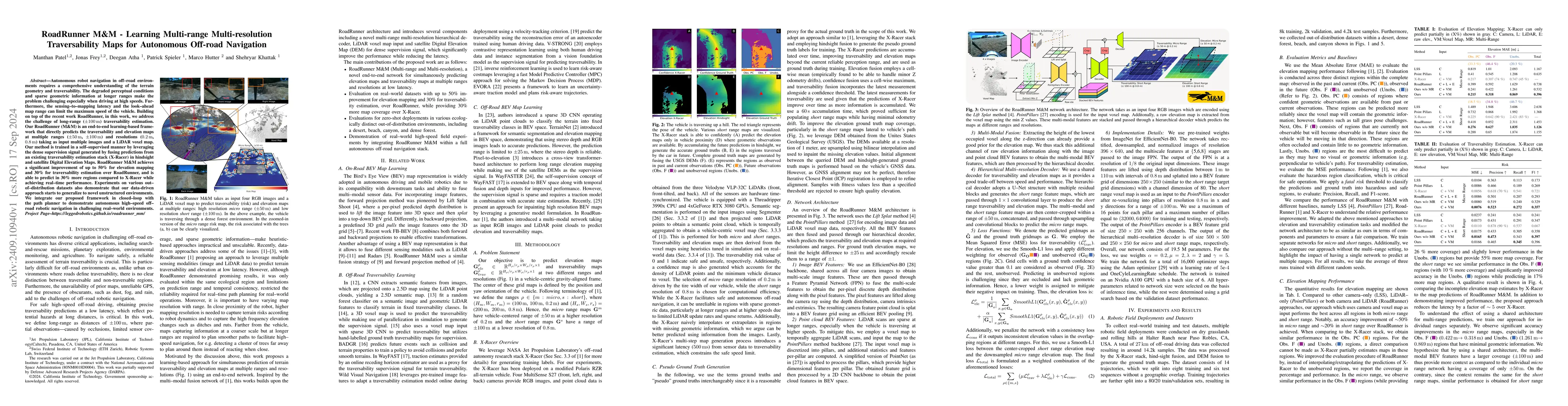
Autonomous robot navigation in off-road environments requires a comprehensive understanding of the terrain geometry and traversability. The degraded perceptual conditions and sparse geometric informat...
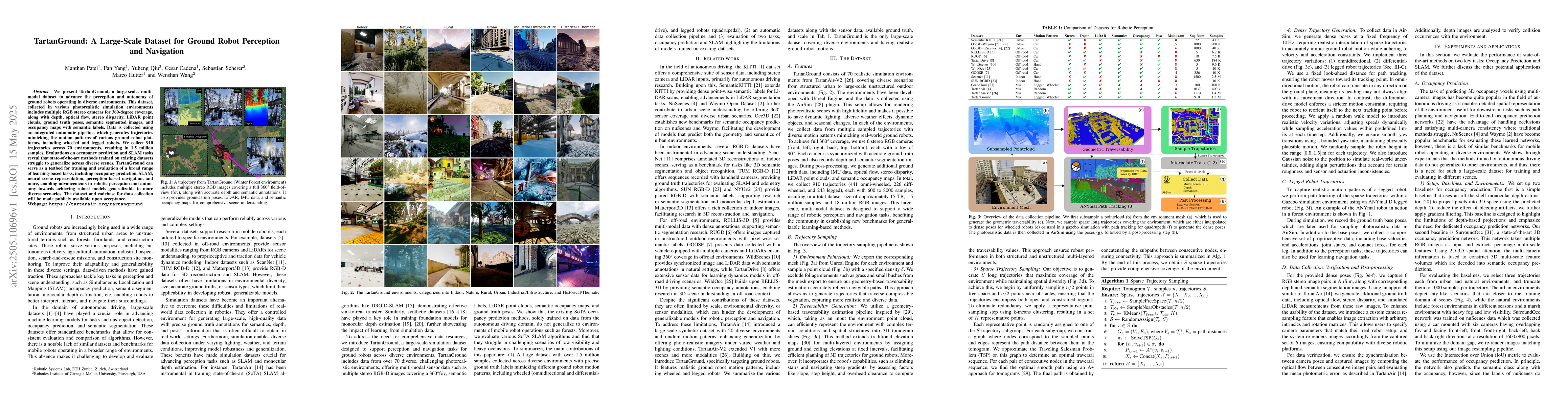
We present TartanGround, a large-scale, multi-modal dataset to advance the perception and autonomy of ground robots operating in diverse environments. This dataset, collected in various photorealistic...
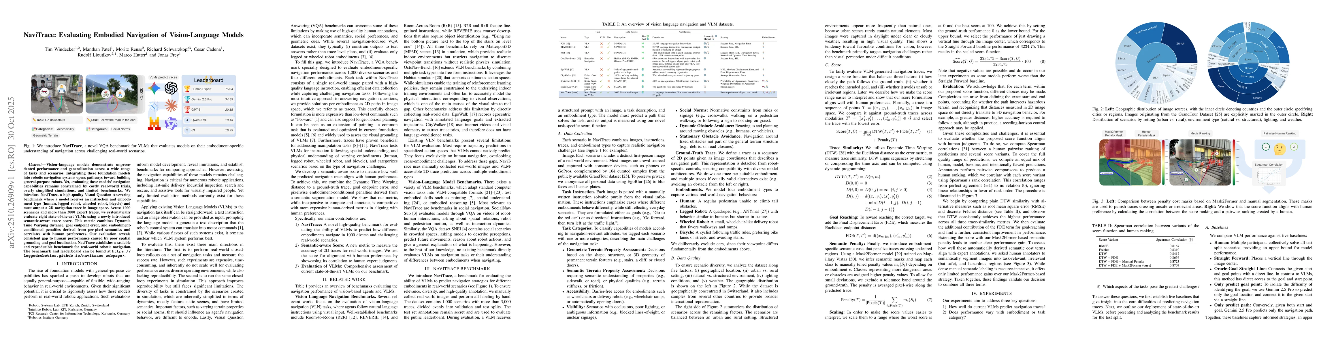
Vision-language models demonstrate unprecedented performance and generalization across a wide range of tasks and scenarios. Integrating these foundation models into robotic navigation systems opens pa...
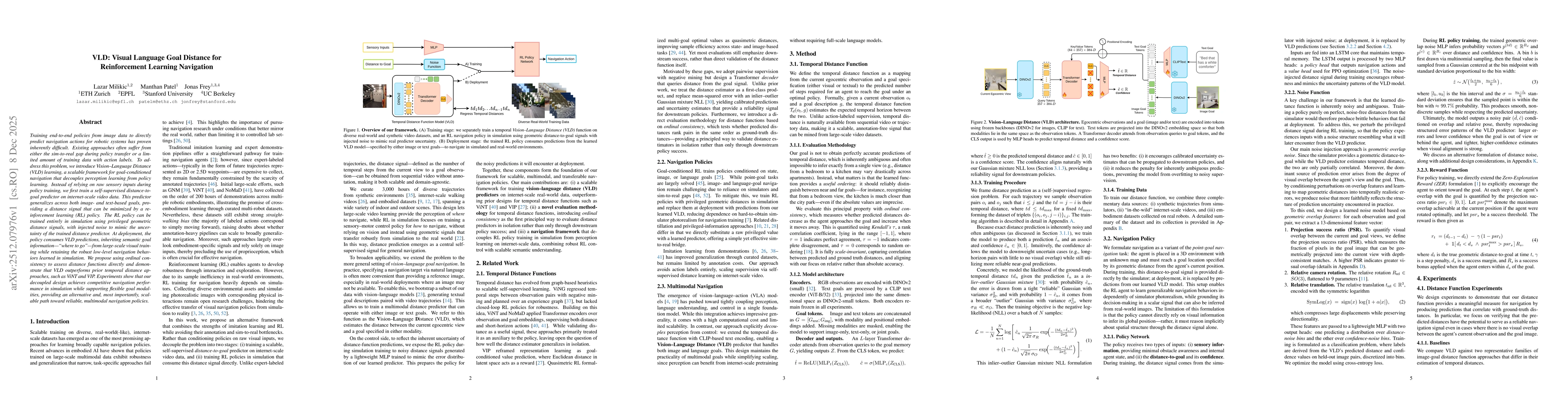
Training end-to-end policies from image data to directly predict navigation actions for robotic systems has proven inherently difficult. Existing approaches often suffer from either the sim-to-real ga...
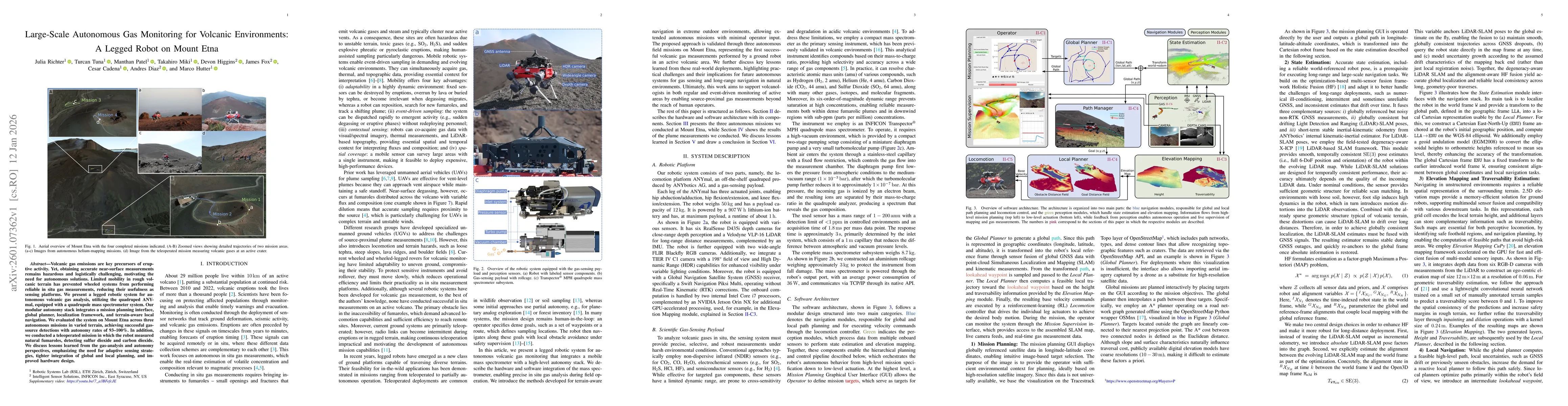
Volcanic gas emissions are key precursors of eruptive activity. Yet, obtaining accurate near-surface measurements remains hazardous and logistically challenging, motivating the need for autonomous sol...
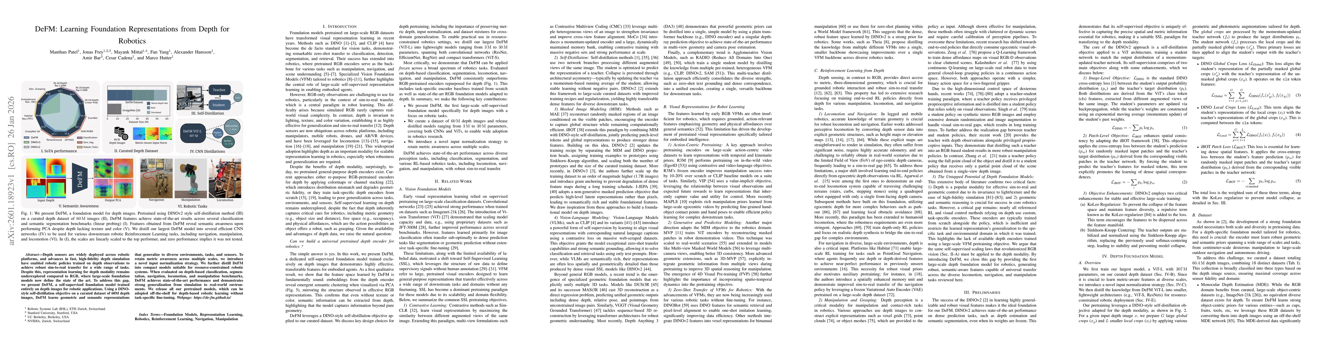
Depth sensors are widely deployed across robotic platforms, and advances in fast, high-fidelity depth simulation have enabled robotic policies trained on depth observations to achieve robust sim-to-re...
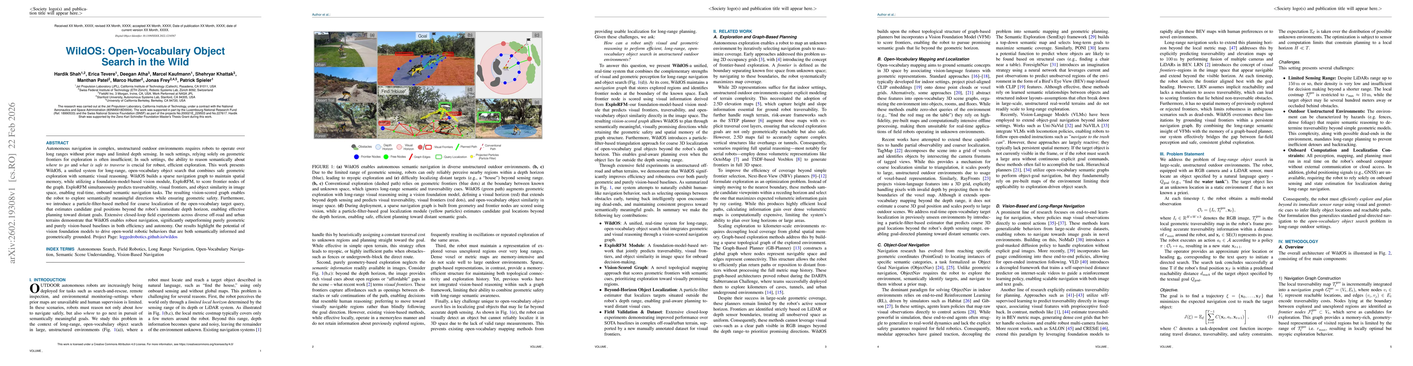
Autonomous navigation in complex, unstructured outdoor environments requires robots to operate over long ranges without prior maps and limited depth sensing. In such settings, relying solely on geomet...