Marc Rußwurm
Wageningen University, École Polytechnique Fédérale de Lausanne, Technical University of Munich
Academic Profile
Statistics
Similar Authors
Papers on arXiv
In the face of significant biodiversity decline, species distribution models (SDMs) are essential for understanding the impact of climate change on species habitats by connecting environmental condi...
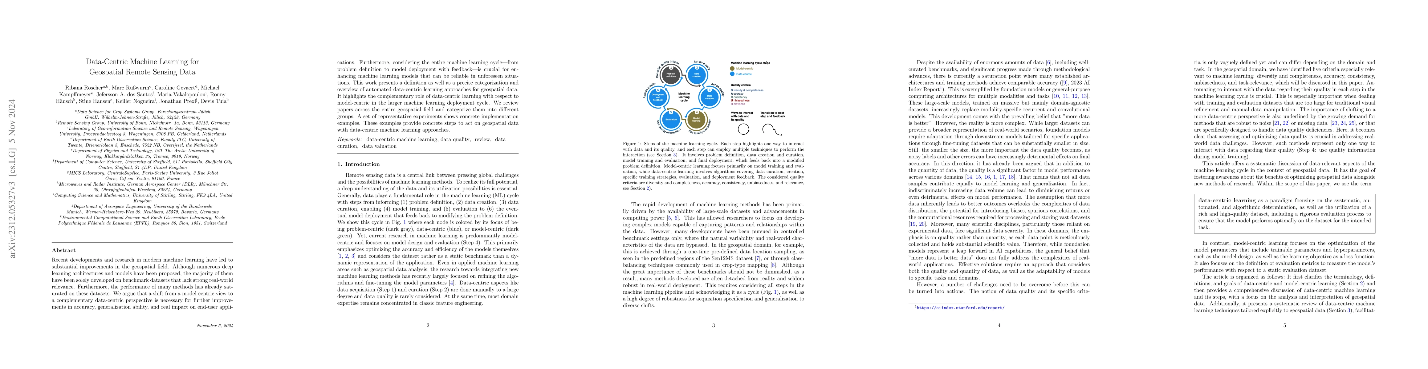
Recent developments and research in modern machine learning have led to substantial improvements in the geospatial field. Although numerous deep learning architectures and models have been proposed,...
Geographic information is essential for modeling tasks in fields ranging from ecology to epidemiology. However, extracting relevant location characteristics for a given task can be challenging, ofte...
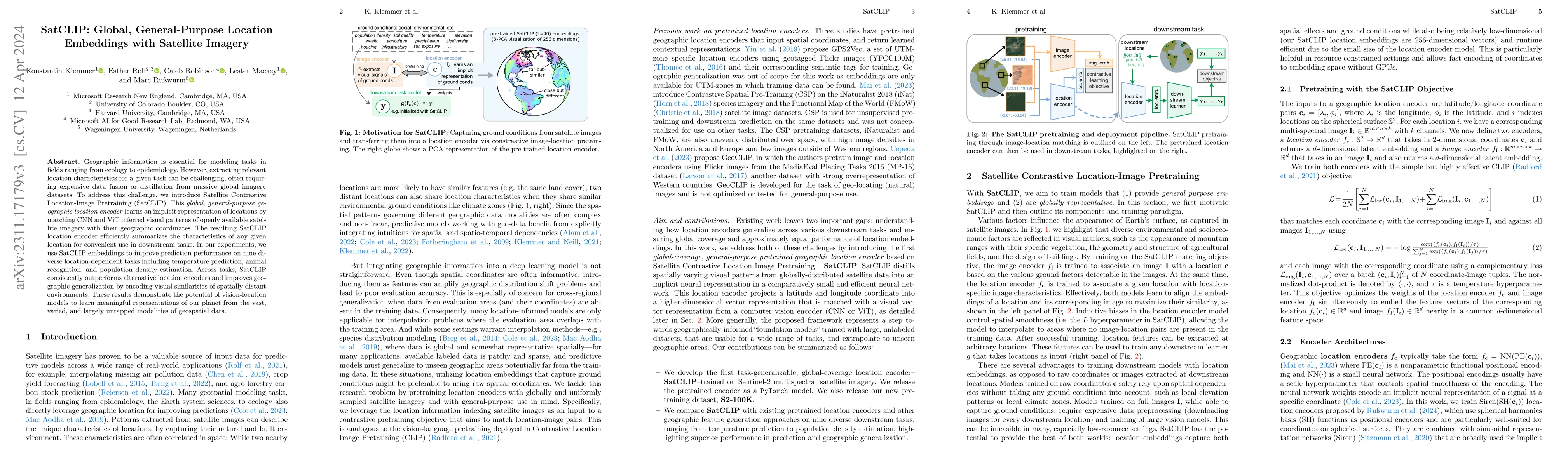
Learning representations of geographical space is vital for any machine learning model that integrates geolocated data, spanning application domains such as remote sensing, ecology, or epidemiology....
Detecting and quantifying marine pollution and macro-plastics is an increasingly pressing ecological issue that directly impacts ecology and human health. Efforts to quantify marine pollution are of...
The representations of the Earth's surface vary from one geographic region to another. For instance, the appearance of urban areas differs between continents, and seasonality influences the appearan...
The amount of available Earth observation data has increased dramatically in the recent years. Efficiently making use of the entire body information is a current challenge in remote sensing and dema...
In this work, we introduce a recently developed early classification mechanism to satellite-based agricultural monitoring. It augments existing classification models by an additional stopping probab...
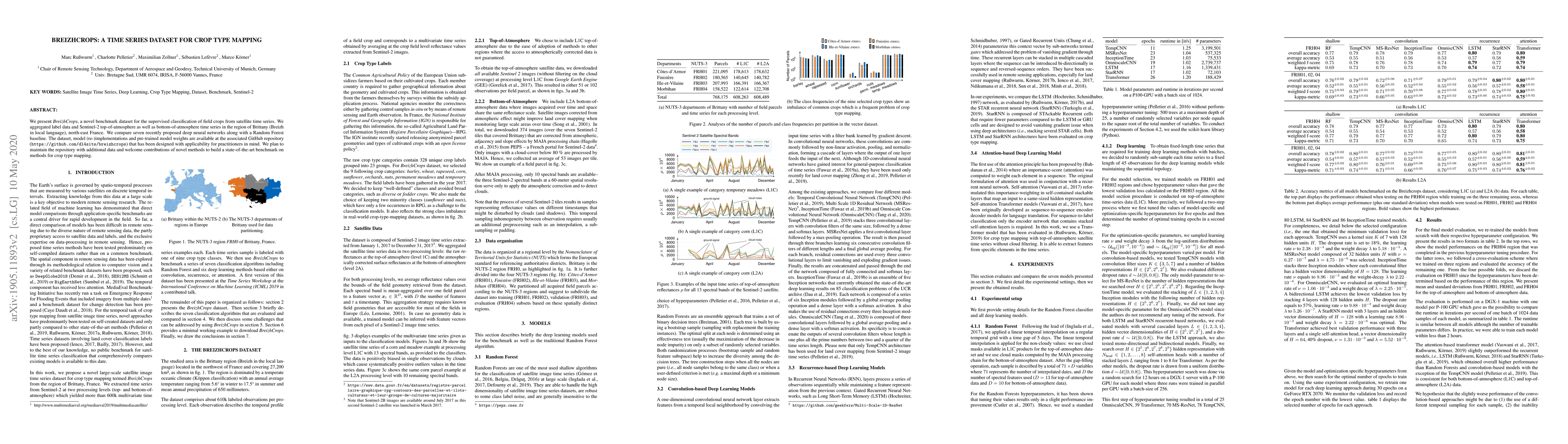
We present Breizhcrops, a novel benchmark dataset for the supervised classification of field crops from satellite time series. We aggregated label data and Sentinel-2 top-of-atmosphere as well as bo...
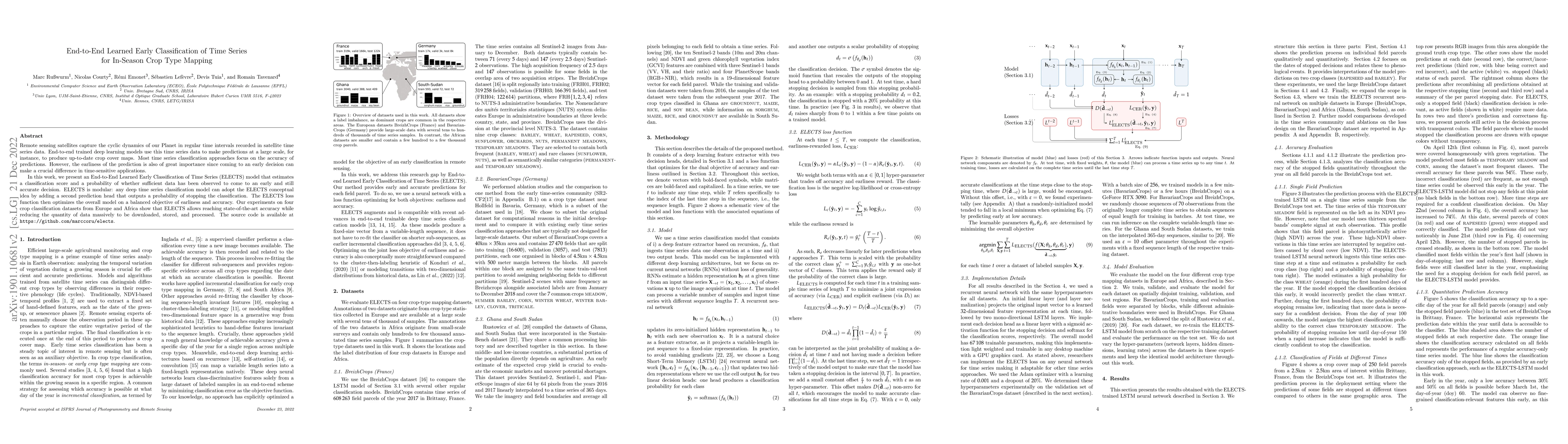
Remote sensing satellites capture the cyclic dynamics of our Planet in regular time intervals recorded in satellite time series data. End-to-end trained deep learning models use this time series dat...
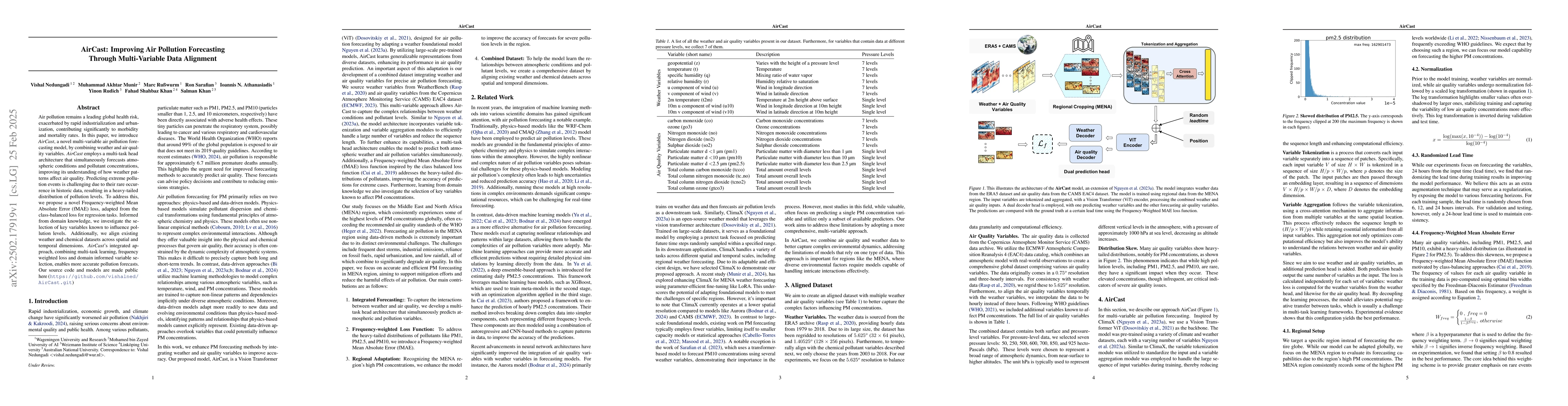
Air pollution remains a leading global health risk, exacerbated by rapid industrialization and urbanization, contributing significantly to morbidity and mortality rates. In this paper, we introduce Ai...
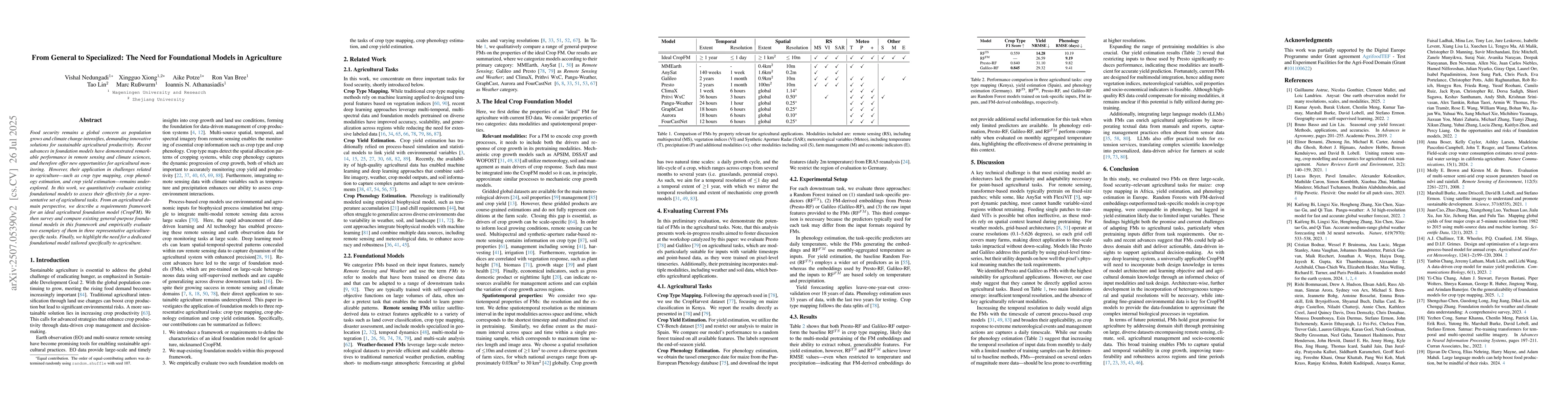
Food security remains a global concern as population grows and climate change intensifies, demanding innovative solutions for sustainable agricultural productivity. Recent advances in foundation model...
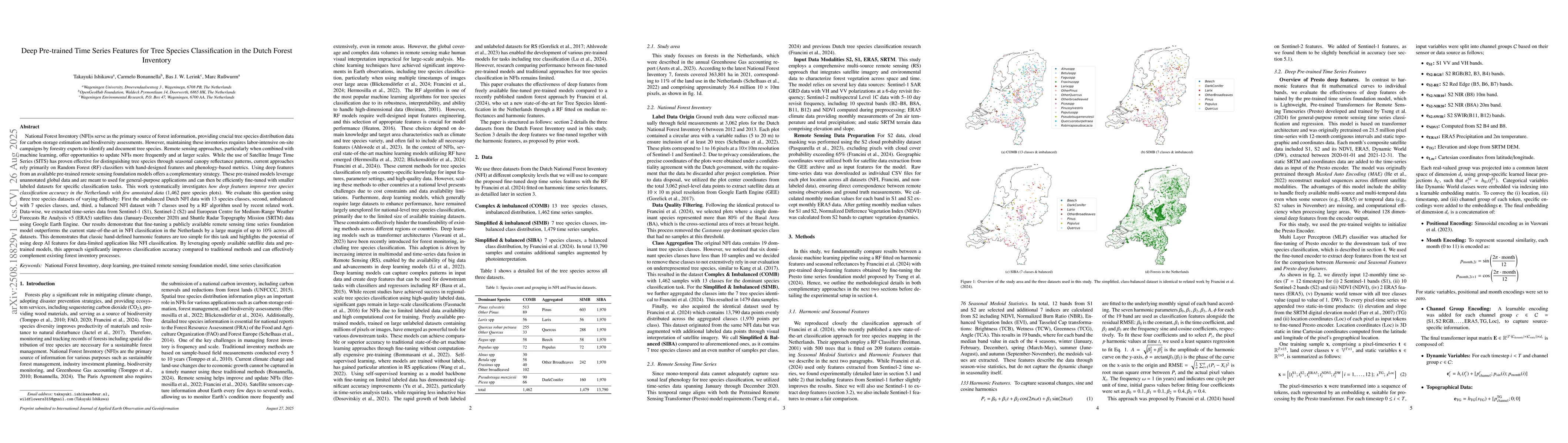
National Forest Inventory (NFI)s serve as the primary source of forest information, providing crucial tree species distribution data. However, maintaining these inventories requires labor-intensive on...
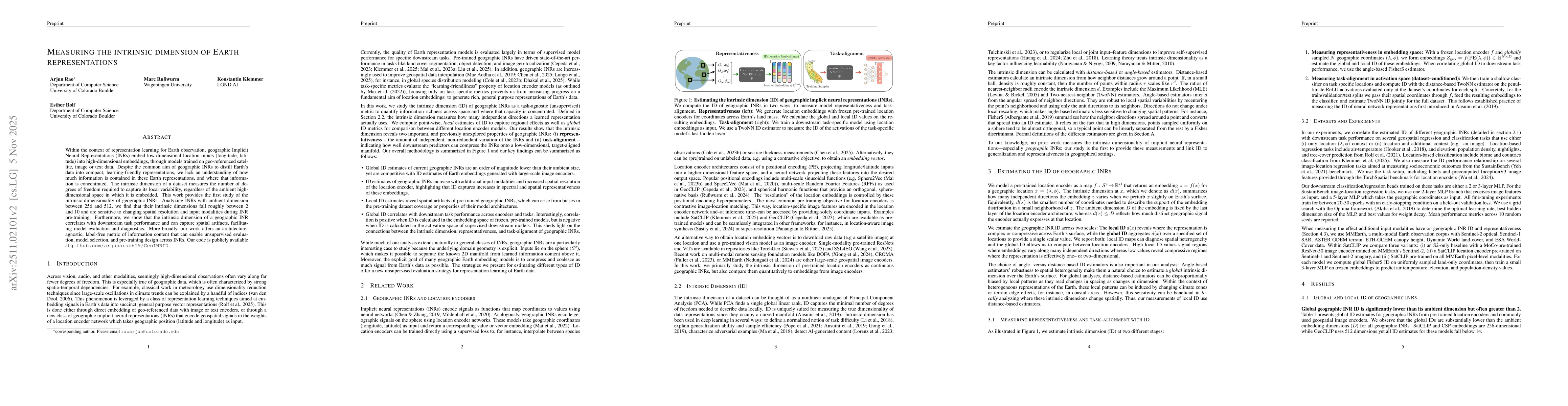
Within the context of representation learning for Earth observation, geographic Implicit Neural Representations (INRs) embed low-dimensional location inputs (longitude, latitude) into high-dimensional...
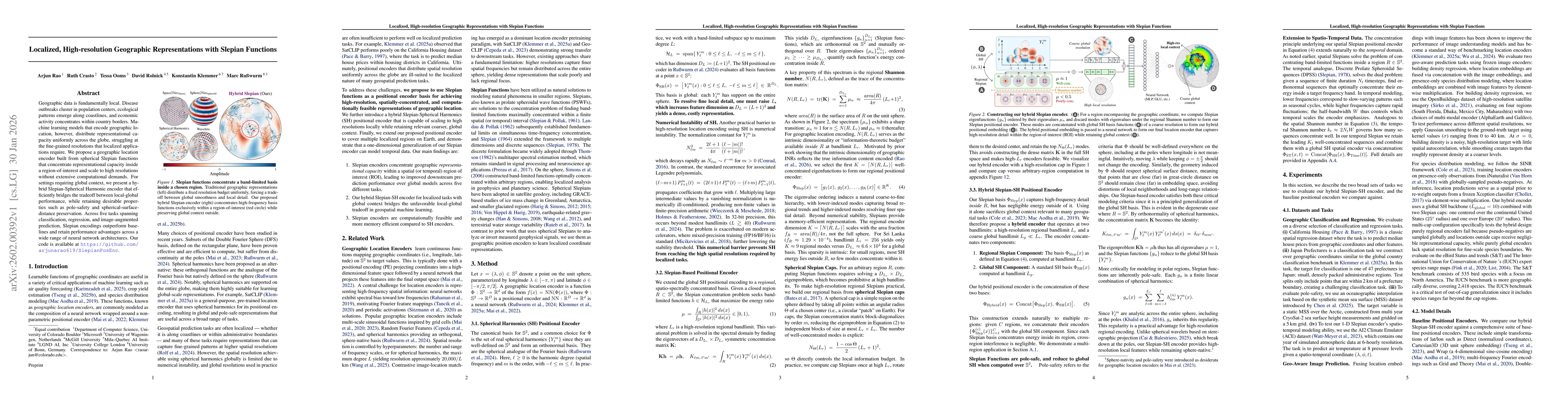
Geographic data is fundamentally local. Disease outbreaks cluster in population centers, ecological patterns emerge along coastlines, and economic activity concentrates within country borders. Machine...
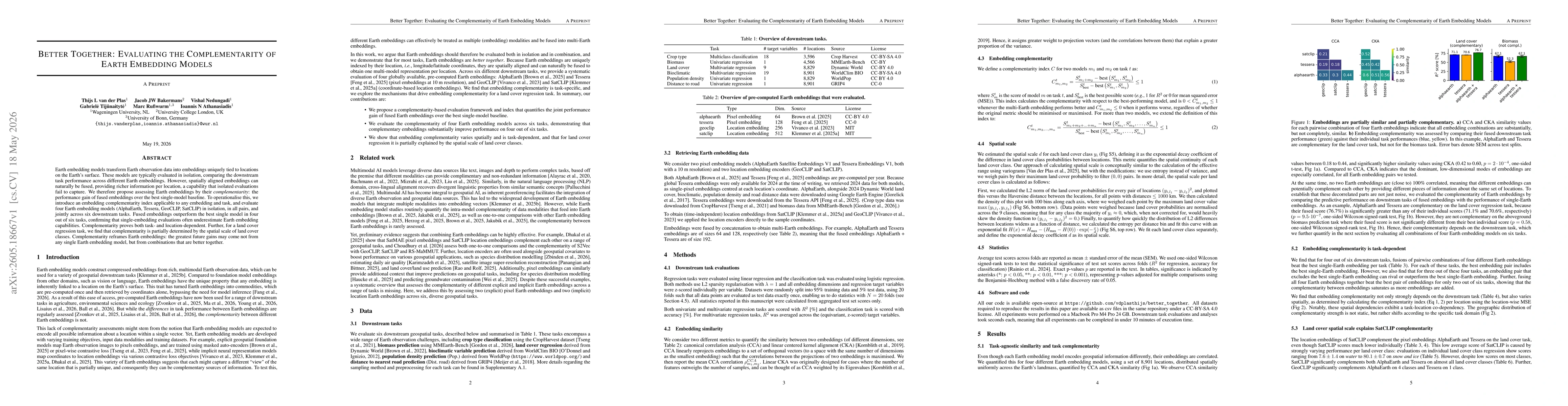
Earth embedding models transform Earth observation data into embeddings uniquely tied to locations on the Earth's surface. These models are typically evaluated in isolation, comparing the downstream t...