2
arXiv Papers
173
Total Publications
Profile
Academic Profile
Metrics
Statistics
2
arXiv Papers
173
Total Publications
Network
Similar Authors
Publications
Papers on arXiv
arXiv
On the potential of mapping sea level anomalies from satellite altimetry
with Random Forest Regression
The sea level observations from satellite altimetry are characterised by a sparse spatial and temporal coverage. For this reason, along-track data are routinely interpolated into daily grids. The la...
arXiv
WHALES: an optimized retracker for satellite radar altimeter waveforms
in sea state applications
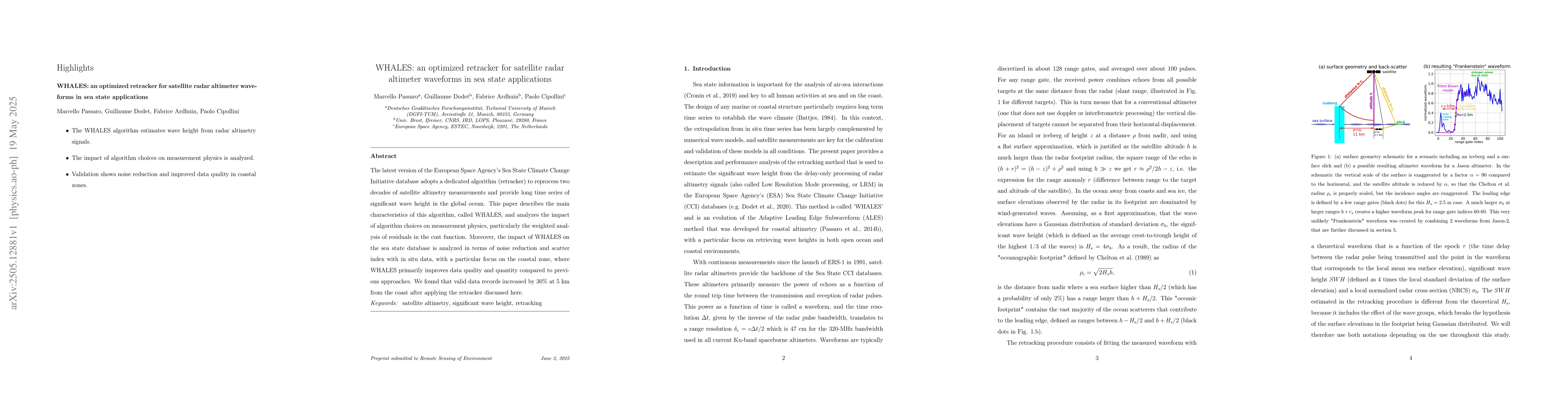
The latest version of the European Space Agency's Sea State Climate Change Initiative database adopts a dedicated algorithm (retracker) to reprocess two decades of satellite altimetry measurements and...