ArxivLens
M
Researcher

Maria Pia Del Rosso

6 papers on arXiv

6 arXiv Papers
16 Total Publications
Profile

Academic Profile

Name M. P. D. Rosso
Total Papers 16
Scholar Profile View on Semantic Scholar
Metrics

Statistics

6 arXiv Papers
16 Total Publications
Publications

Papers on arXiv

Thumbnail for QSpeckleFilter: a Quantum Machine Learning approach for SAR speckle
  filtering
arXiv
QSpeckleFilter: a Quantum Machine Learning approach for SAR speckle filtering

The use of Synthetic Aperture Radar (SAR) has greatly advanced our capacity for comprehensive Earth monitoring, providing detailed insights into terrestrial surface use and cover regardless of weath...

Thumbnail for Spatio-Temporal SAR-Optical Data Fusion for Cloud Removal via a Deep
  Hierarchical Model
arXiv
Spatio-Temporal SAR-Optical Data Fusion for Cloud Removal via a Deep Hierarchical Model

Cloud removal is a relevant topic in Remote Sensing as it fosters the usability of high-resolution optical images for Earth monitoring and study. Related techniques have been analyzed for years with...

Thumbnail for Paradigm selection for Data Fusion of SAR and Multispectral Sentinel
  data applied to Land-Cover Classification
arXiv
Paradigm selection for Data Fusion of SAR and Multispectral Sentinel data applied to Land-Cover Classification

Data fusion is a well-known technique, becoming more and more popular in the Artificial Intelligence for Earth Observation (AI4EO) domain mainly due to its ability of reinforcing AI4EO applications ...

Thumbnail for A speckle filter for Sentinel-1 SAR Ground Range Detected data based on
  Residual Convolutional Neural Networks
arXiv
A speckle filter for Sentinel-1 SAR Ground Range Detected data based on Residual Convolutional Neural Networks

In recent years, machine learning (ML) algorithms have become widespread in all the fields of remote sensing (RS) and earth observation (EO). This has allowed the rapid development of new procedures...

Thumbnail for Automatic Dataset Builder for Machine Learning Applications to Satellite
  Imagery
arXiv
Automatic Dataset Builder for Machine Learning Applications to Satellite Imagery

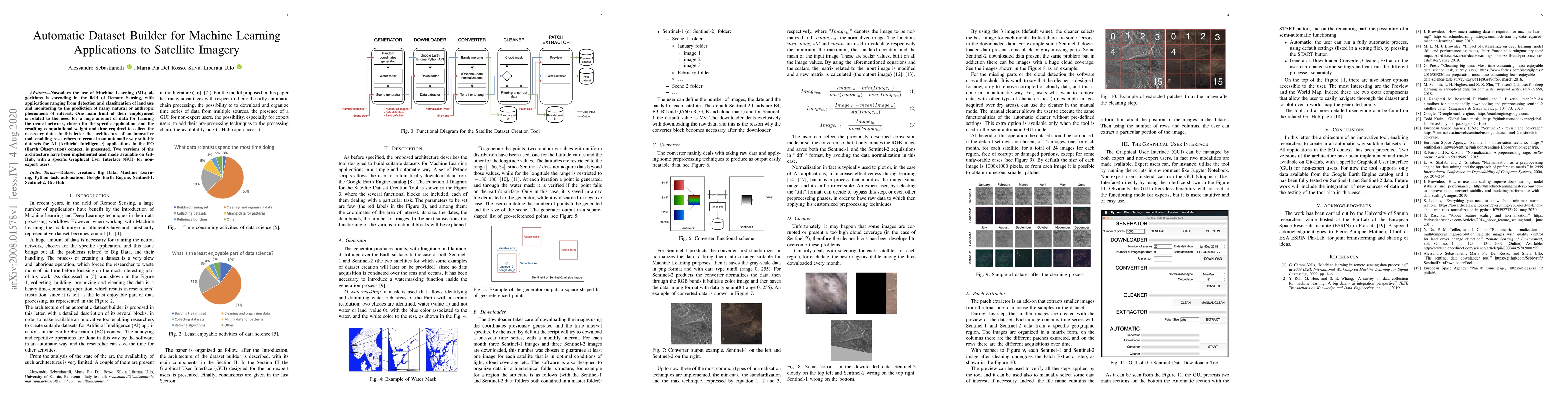
Nowadays the use of Machine Learning (ML) algorithms is spreading in the field of Remote Sensing, with applications ranging from detection and classification of land use and monitoring to the predic...

Thumbnail for Application of DInSAR Technique to High Coherence Satellite Images for
  Strategic Infrastructure Monitoring
arXiv
Application of DInSAR Technique to High Coherence Satellite Images for Strategic Infrastructure Monitoring

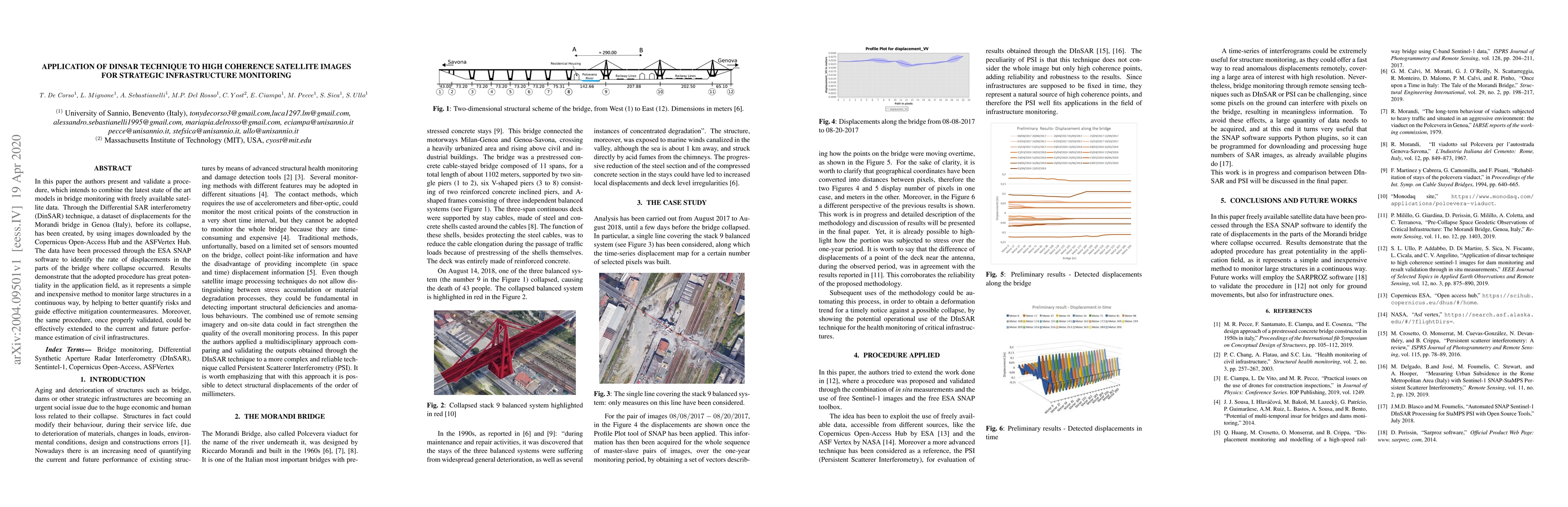
In this paper the authors present and validate a procedure, which intends to combine the latest state of the art models in bridge monitoring with freely available satellite data. Through the Differe...

This website uses cookies to ensure you get the best experience. Learn more