Academic Profile
Statistics
Similar Authors
Papers on arXiv
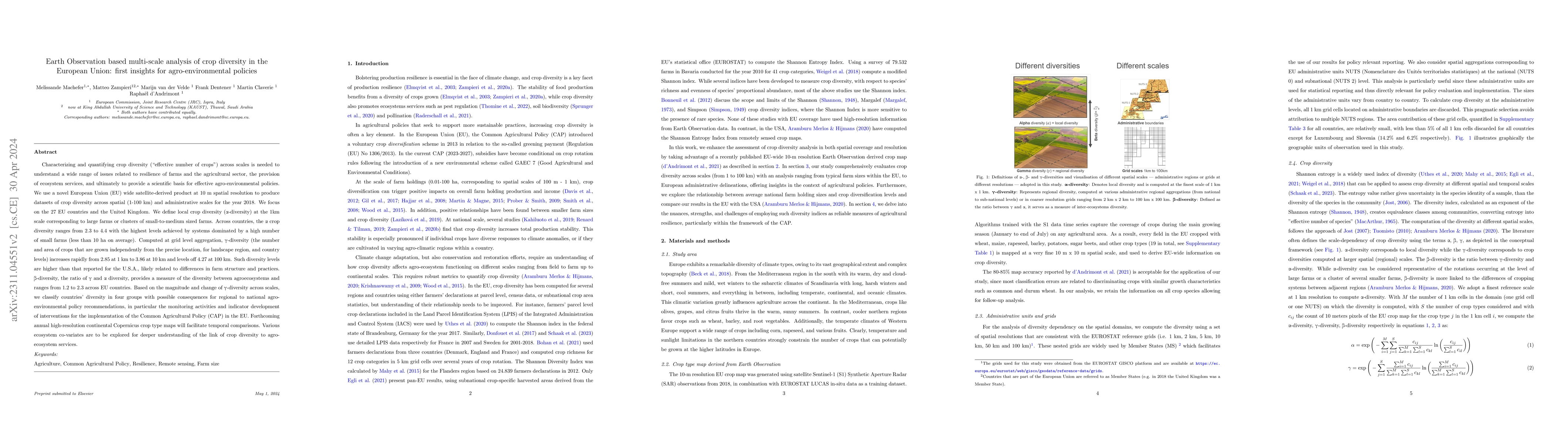
To understand the resilience of farms and the agricultural sector, as well as the provision of ecosystem services, we need to characterize and quantify crop diversity. Using a 10m resolution satelli...
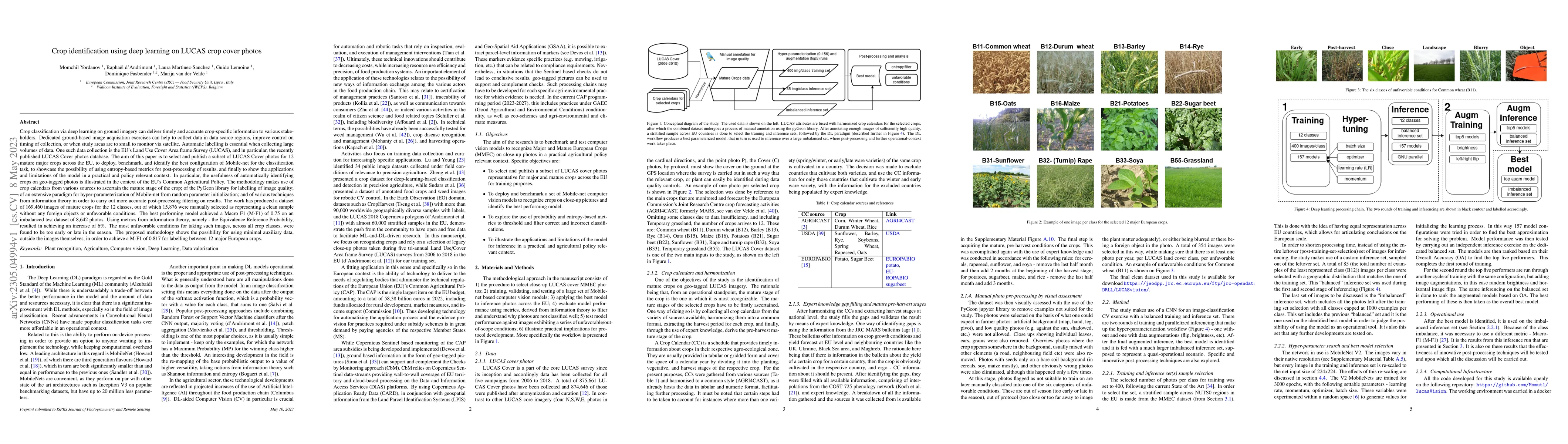
Crop classification via deep learning on ground imagery can deliver timely and accurate crop-specific information to various stakeholders. Dedicated ground-based image acquisition exercises can help...
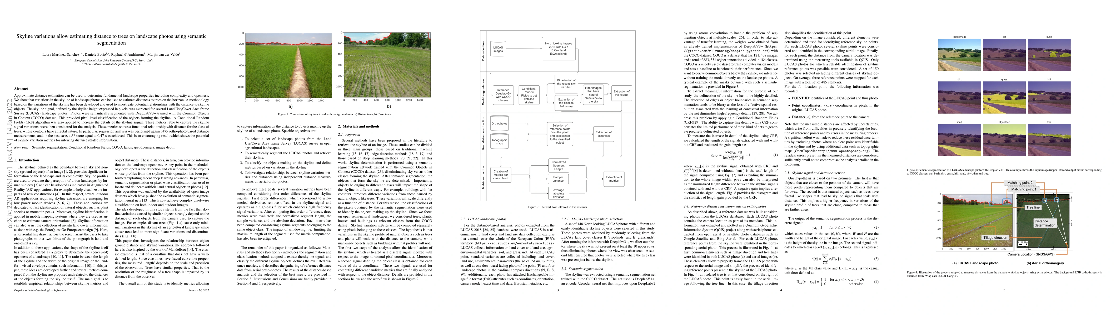
Approximate distance estimation can be used to determine fundamental landscape properties including complexity and openness. We show that variations in the skyline of landscape photos can be used to...
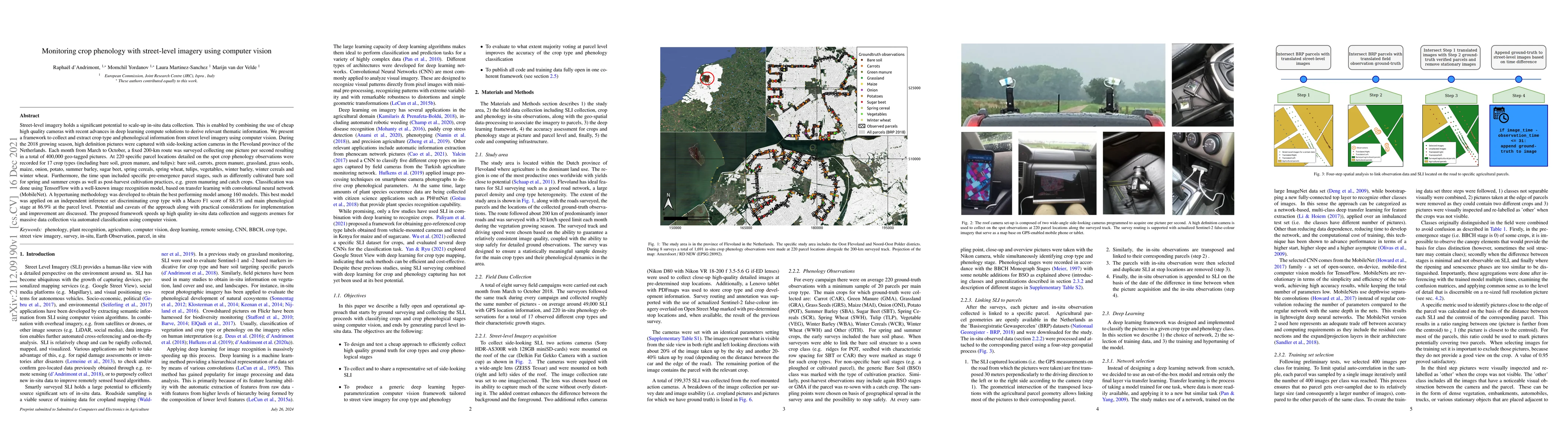
Street-level imagery holds a significant potential to scale-up in-situ data collection. This is enabled by combining the use of cheap high quality cameras with recent advances in deep learning compu...
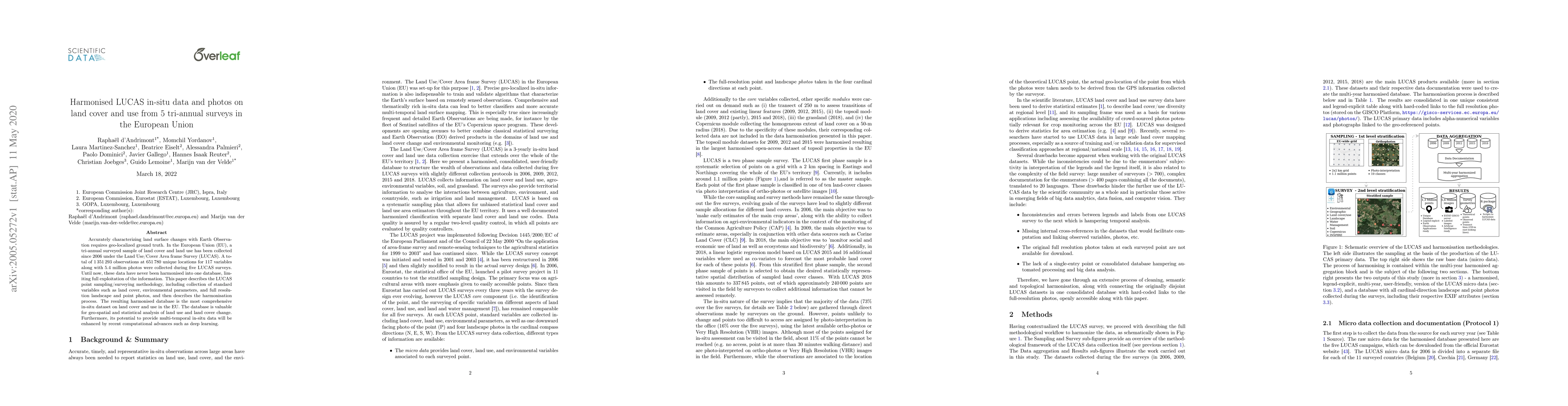
Accurately characterizing land surface changes with Earth Observation requires geo-localized ground truth. In the European Union (EU), a tri-annual surveyed sample of land cover and land use has bee...
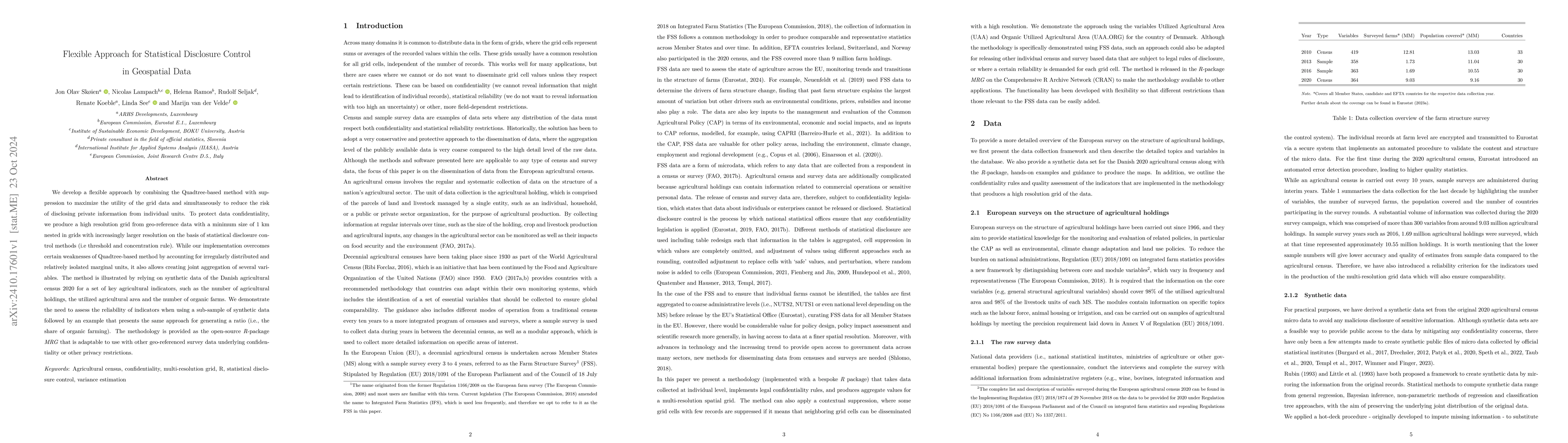
We develop a flexible approach by combining the Quadtree-based method with suppression to maximize the utility of the grid data and simultaneously to reduce the risk of disclosing private information ...