Academic Profile
Statistics
Similar Authors
Papers on arXiv
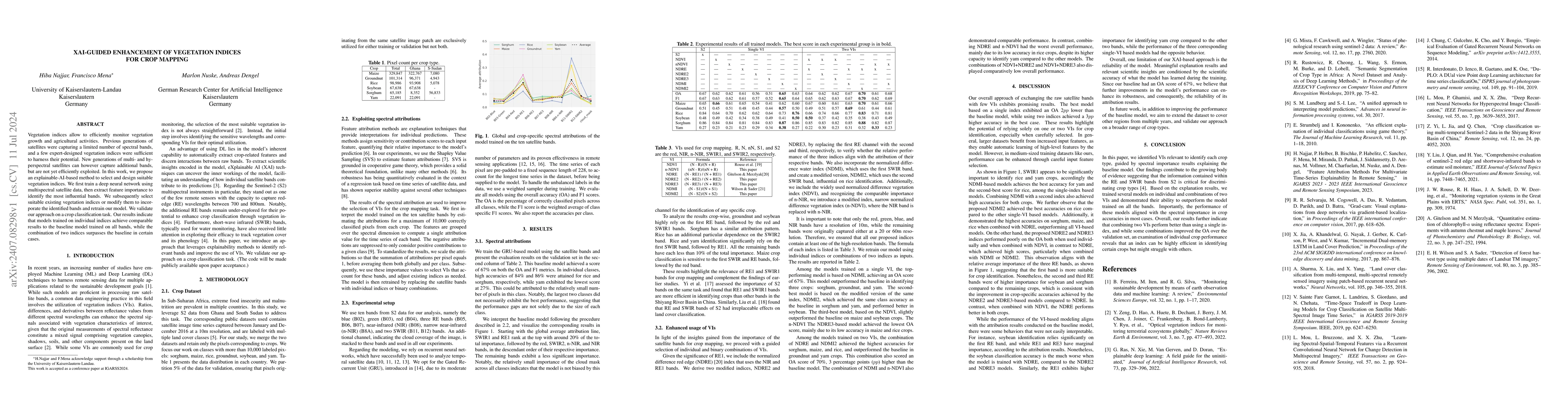
Vegetation indices allow to efficiently monitor vegetation growth and agricultural activities. Previous generations of satellites were capturing a limited number of spectral bands, and a few expert-de...
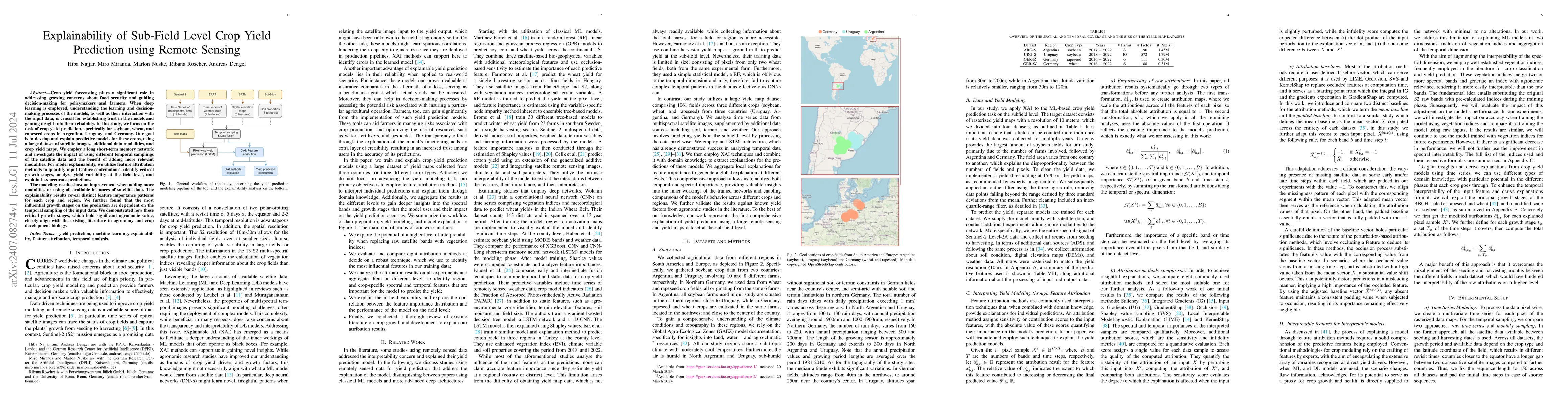
Crop yield forecasting plays a significant role in addressing growing concerns about food security and guiding decision-making for policymakers and farmers. When deep learning is employed, understandi...
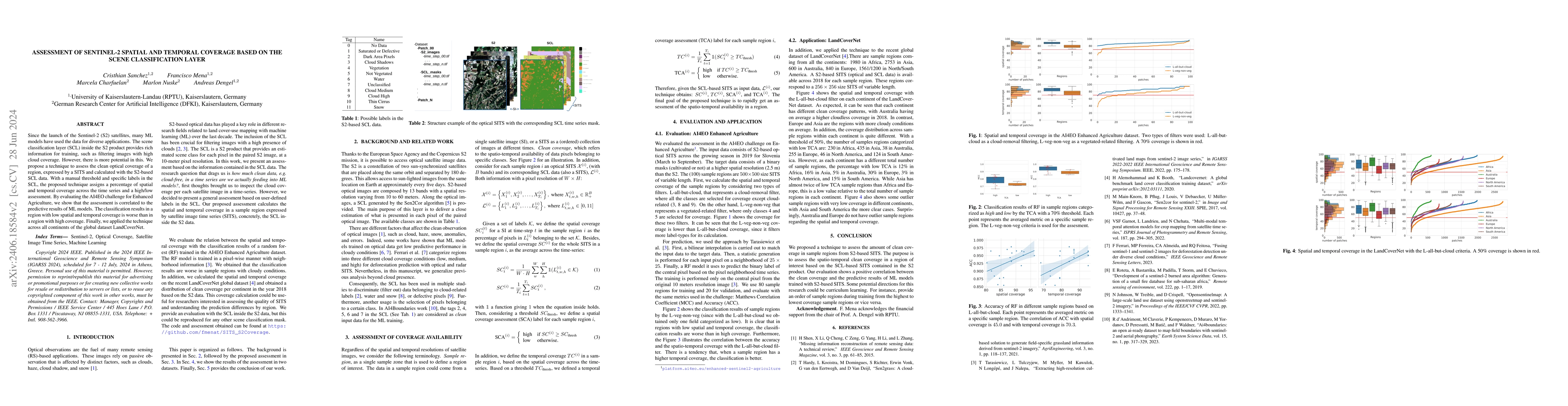
Since the launch of the Sentinel-2 (S2) satellites, many ML models have used the data for diverse applications. The scene classification layer (SCL) inside the S2 product provides rich information for...
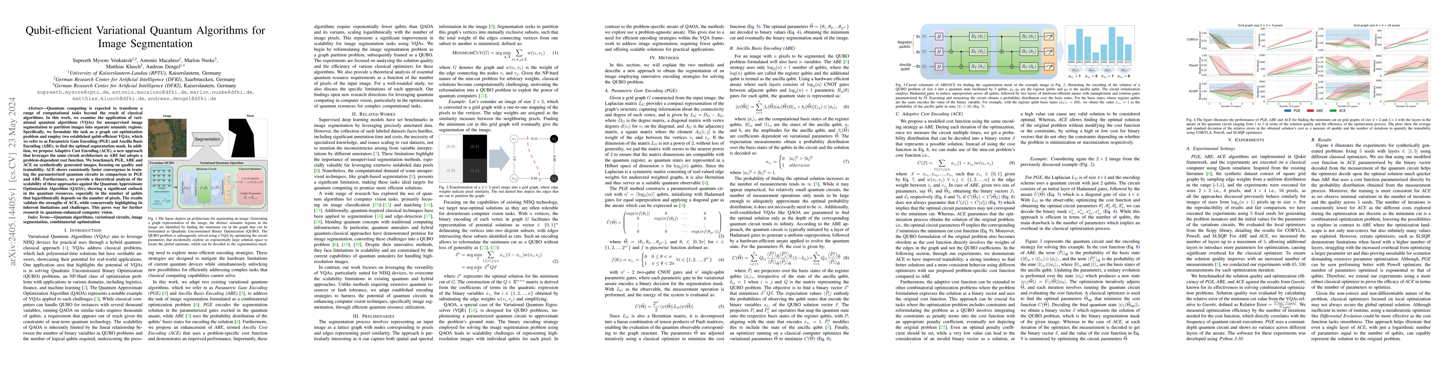
Quantum computing is expected to transform a range of computational tasks beyond the reach of classical algorithms. In this work, we examine the application of variational quantum algorithms (VQAs) ...
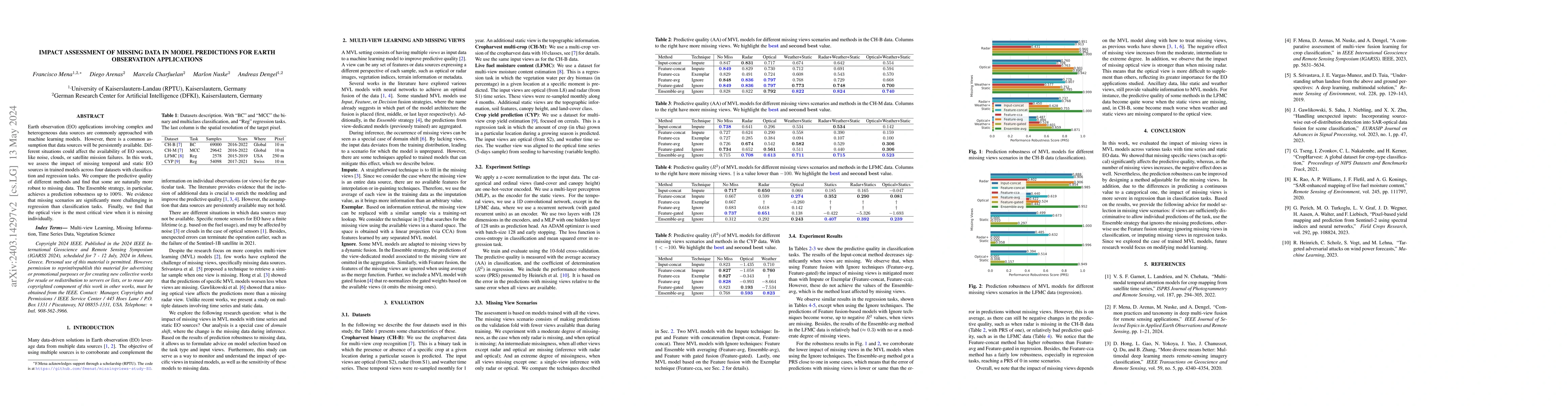
Earth observation (EO) applications involving complex and heterogeneous data sources are commonly approached with machine learning models. However, there is a common assumption that data sources wil...
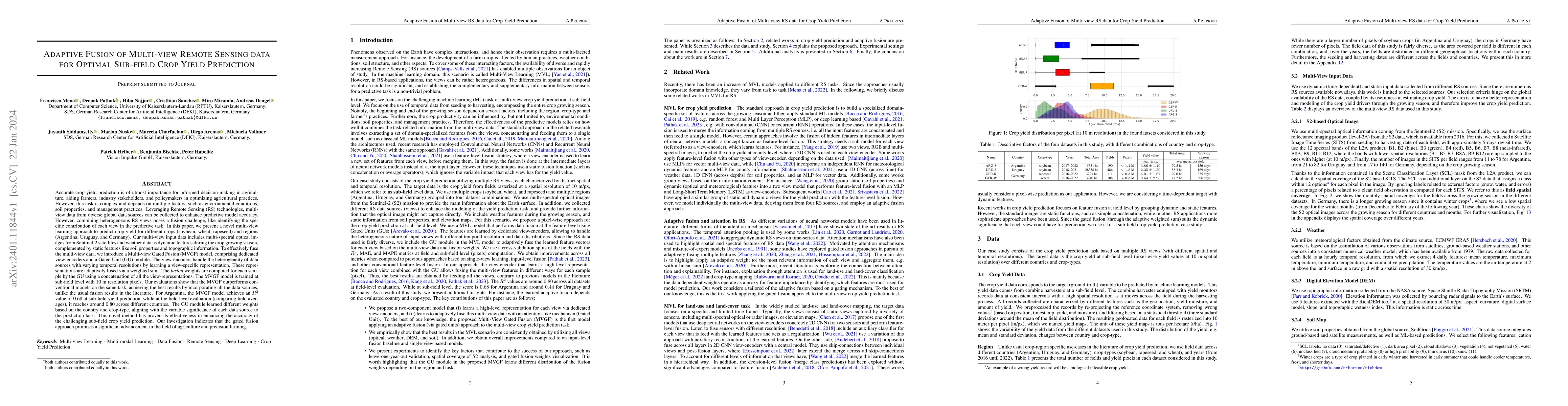
Accurate crop yield prediction is of utmost importance for informed decision-making in agriculture, aiding farmers, and industry stakeholders. However, this task is complex and depends on multiple f...
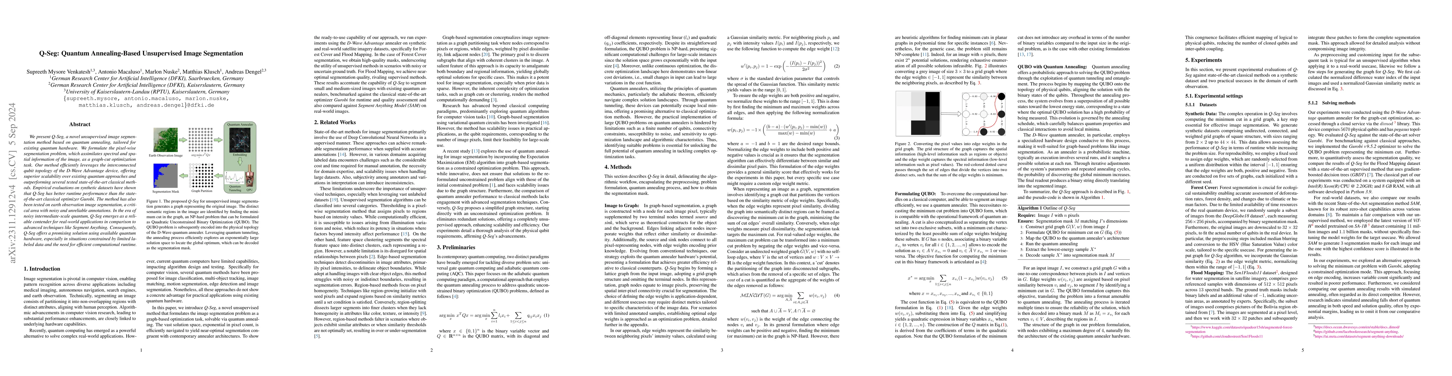
In this study, we present Q-Seg, a novel unsupervised image segmentation method based on quantum annealing, tailored for existing quantum hardware. We formulate the pixel-wise segmentation problem, ...
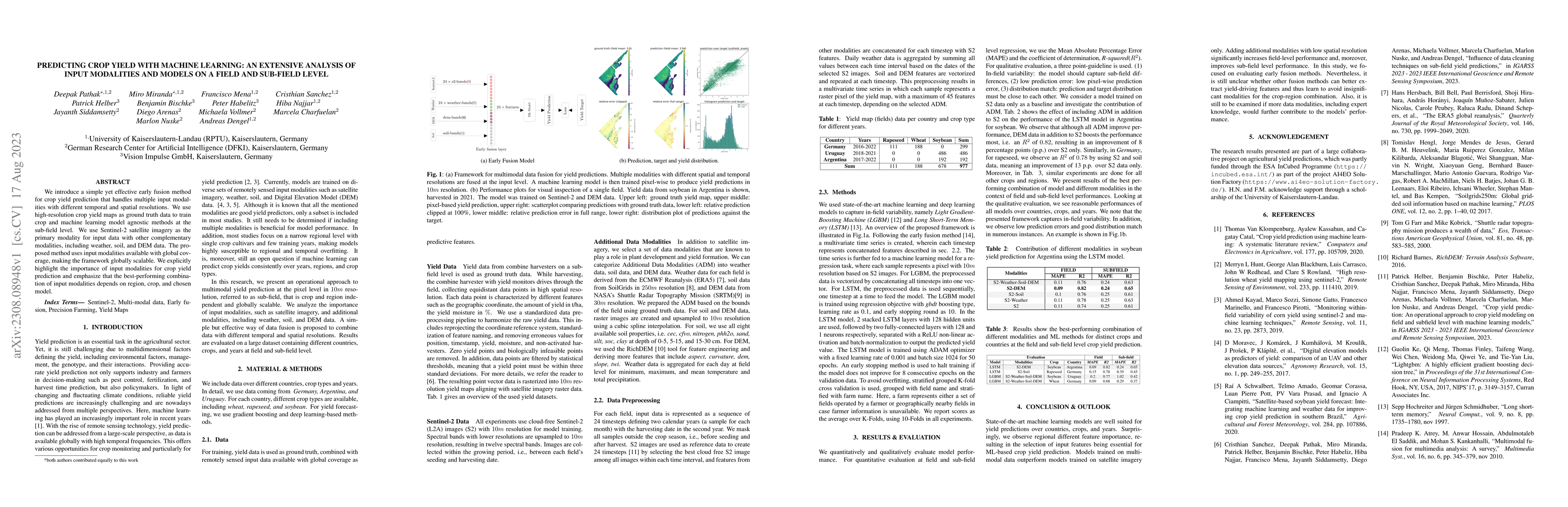
We introduce a simple yet effective early fusion method for crop yield prediction that handles multiple input modalities with different temporal and spatial resolutions. We use high-resolution crop ...
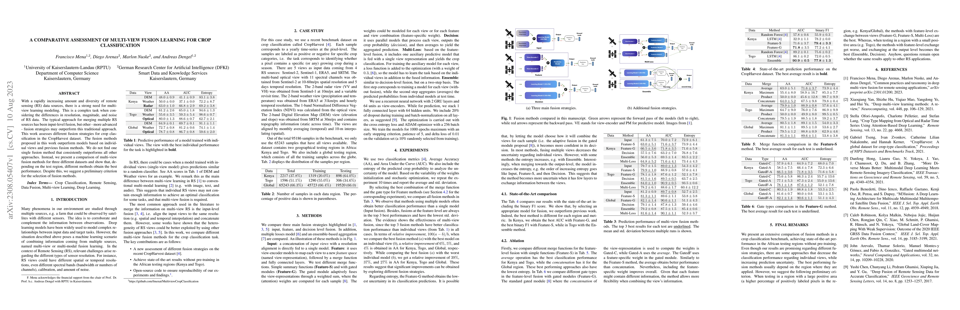
With a rapidly increasing amount and diversity of remote sensing (RS) data sources, there is a strong need for multi-view learning modeling. This is a complex task when considering the differences i...
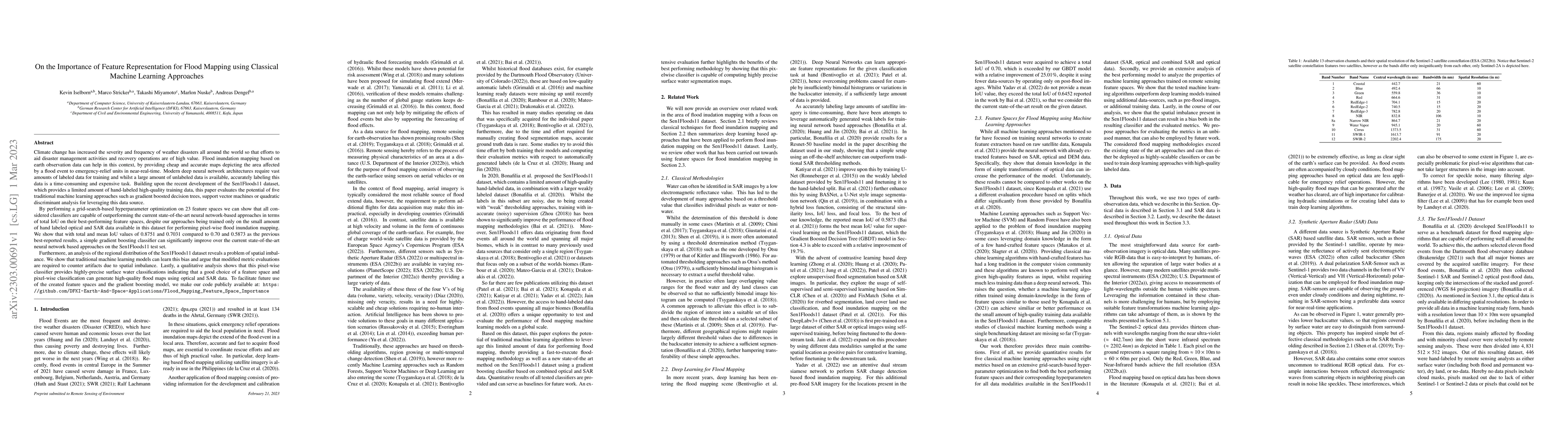
Climate change has increased the severity and frequency of weather disasters all around the world. Flood inundation mapping based on earth observation data can help in this context, by providing che...
The advances in remote sensing technologies have boosted applications for Earth observation. These technologies provide multiple observations or views with different levels of information. They migh...
The availability of temporal geospatial data in multiple modalities has been extensively leveraged to enhance the performance of machine learning models. While efforts on the design of adequate model ...
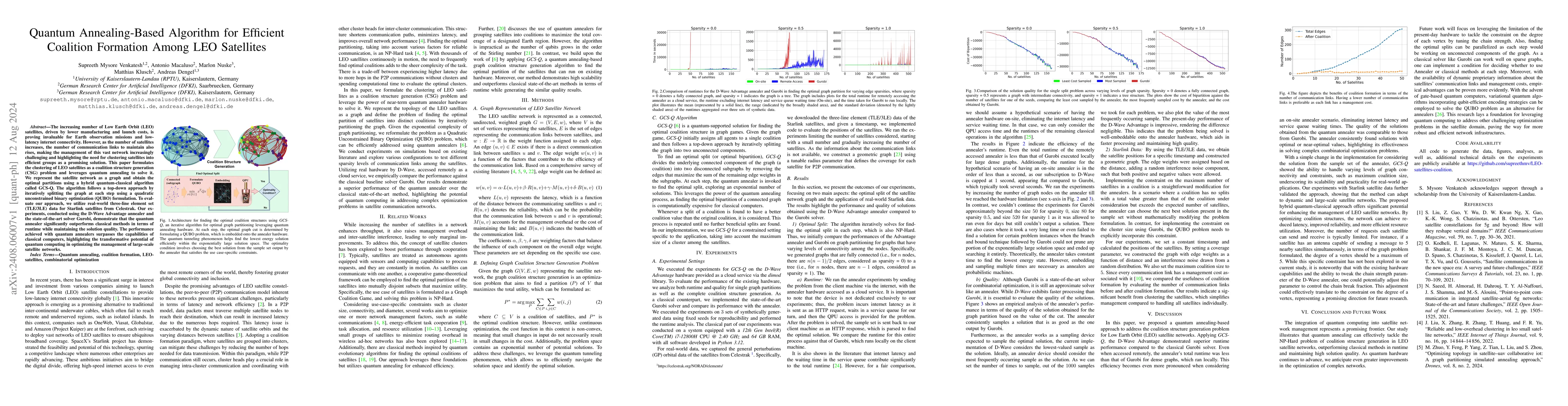
The increasing number of Low Earth Orbit (LEO) satellites, driven by lower manufacturing and launch costs, is proving invaluable for Earth observation missions and low-latency internet connectivity. H...
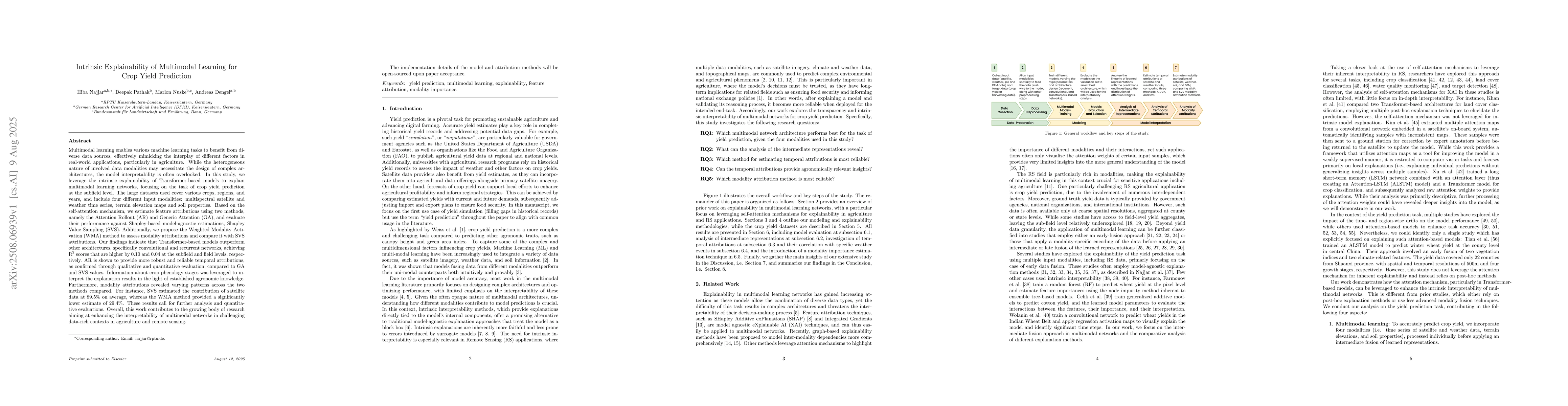
Multimodal learning enables various machine learning tasks to benefit from diverse data sources, effectively mimicking the interplay of different factors in real-world applications, particularly in ag...
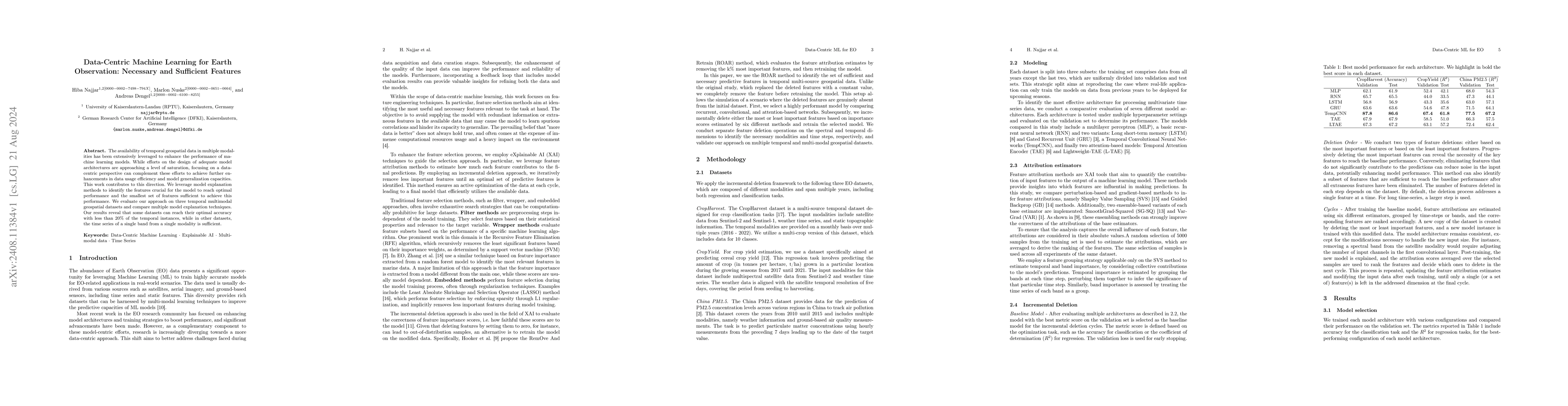
Crop yield prediction requires substantial data to train scalable models. However, creating yield prediction datasets is constrained by high acquisition costs, heterogeneous data quality, and data pri...