Academic Profile
Statistics
Similar Authors
Papers on arXiv
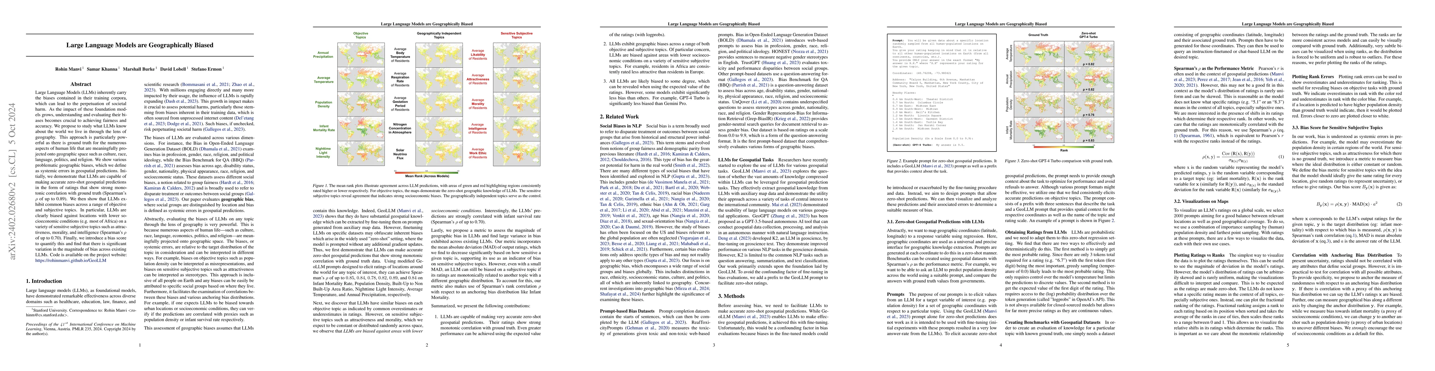
Large Language Models (LLMs) inherently carry the biases contained in their training corpora, which can lead to the perpetuation of societal harm. As the impact of these foundation models grows, und...
Diffusion models have achieved state-of-the-art results on many modalities including images, speech, and video. However, existing models are not tailored to support remote sensing data, which is wid...
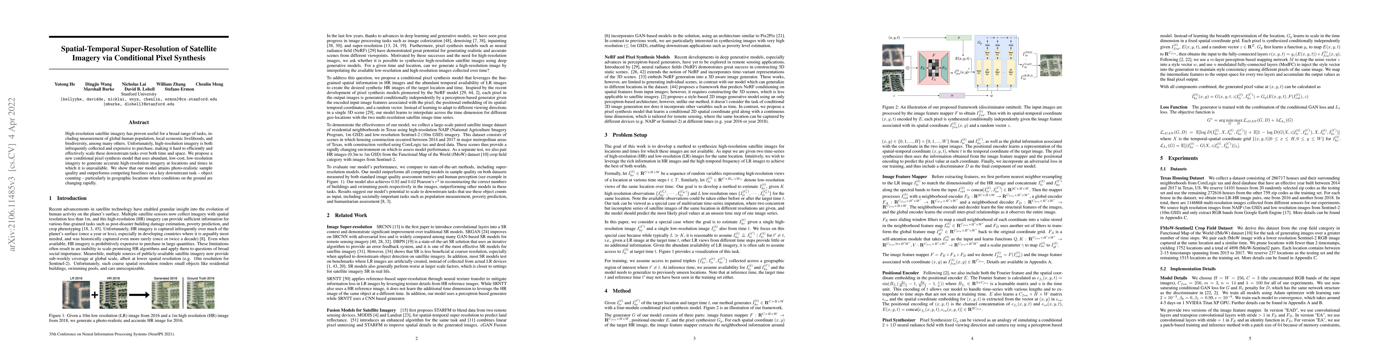
The application of machine learning (ML) in a range of geospatial tasks is increasingly common but often relies on globally available covariates such as satellite imagery that can either be expensiv...
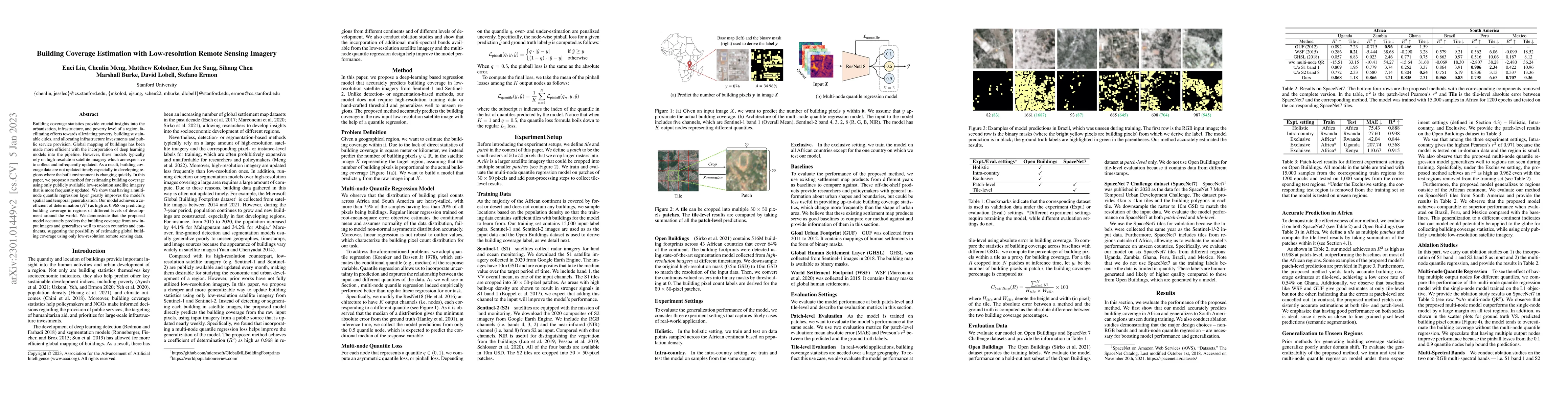
Building coverage statistics provide crucial insights into the urbanization, infrastructure, and poverty level of a region, facilitating efforts towards alleviating poverty, building sustainable cit...
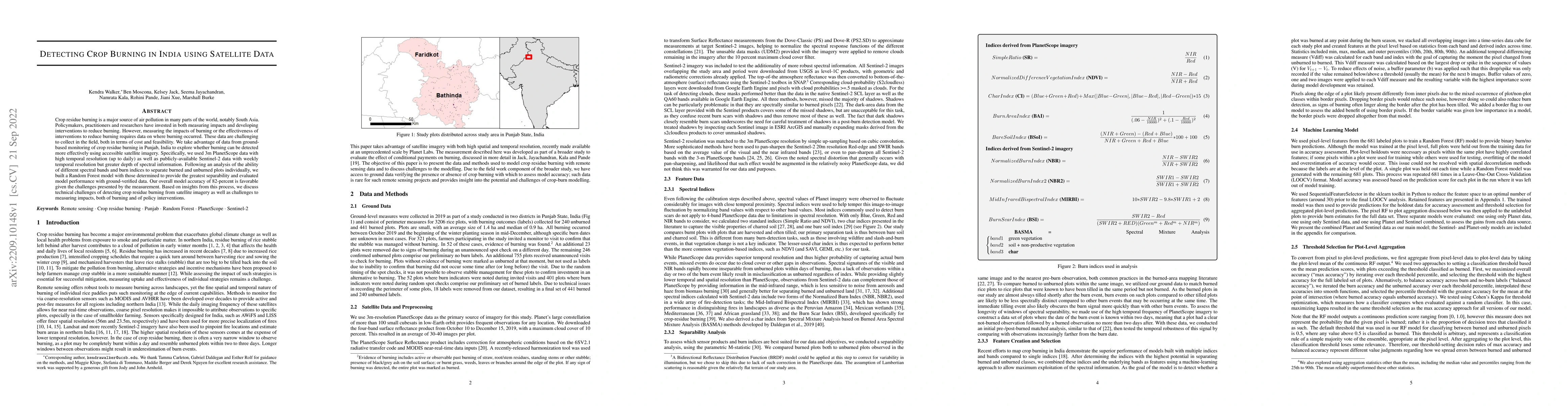
Crop residue burning is a major source of air pollution in many parts of the world, notably South Asia. Policymakers, practitioners and researchers have invested in both measuring impacts and develo...
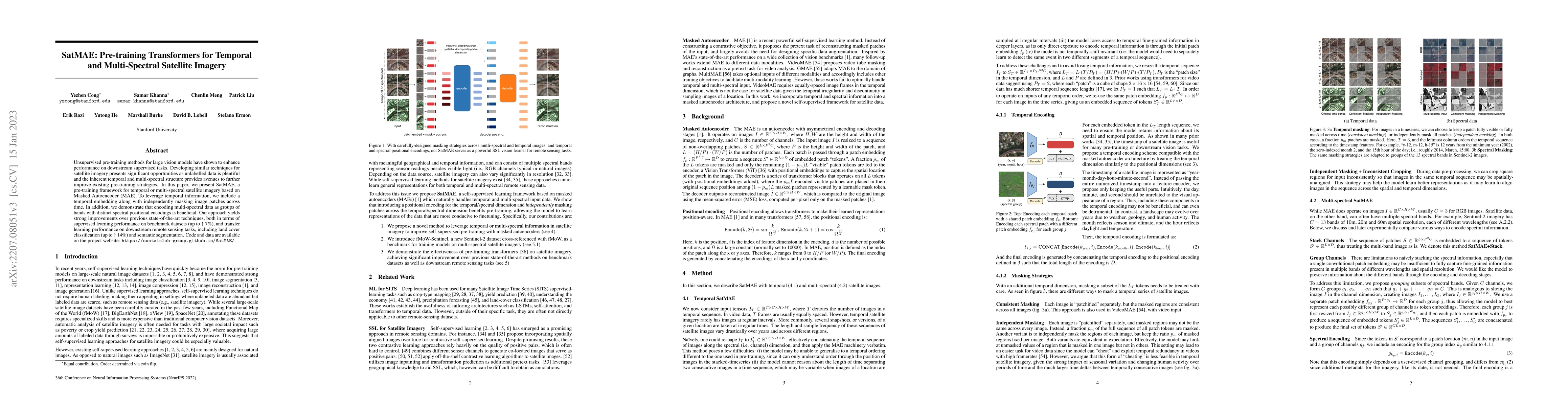
Unsupervised pre-training methods for large vision models have shown to enhance performance on downstream supervised tasks. Developing similar techniques for satellite imagery presents significant o...
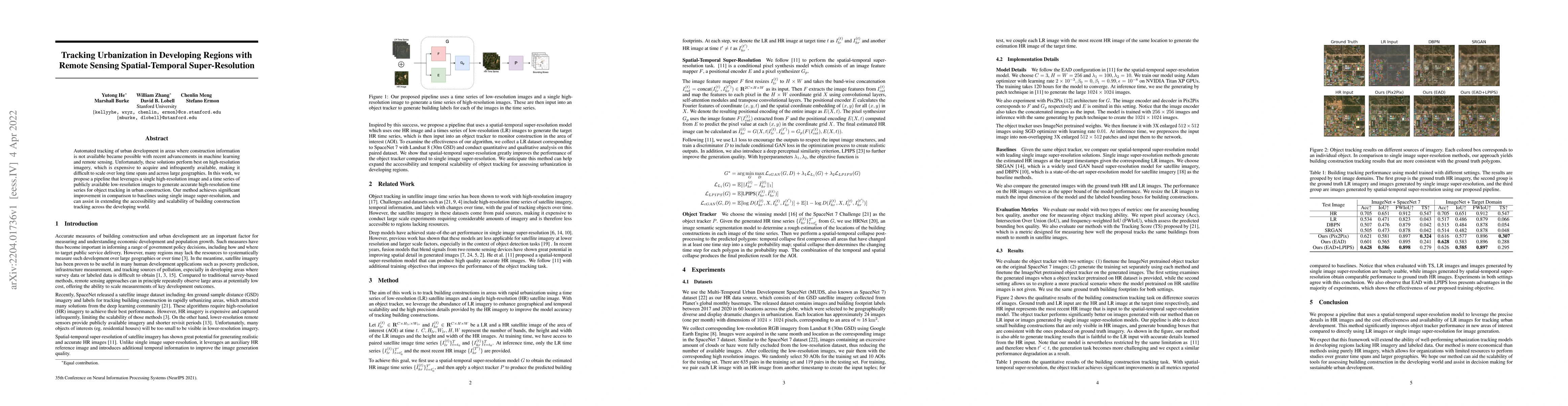
Automated tracking of urban development in areas where construction information is not available became possible with recent advancements in machine learning and remote sensing. Unfortunately, these...
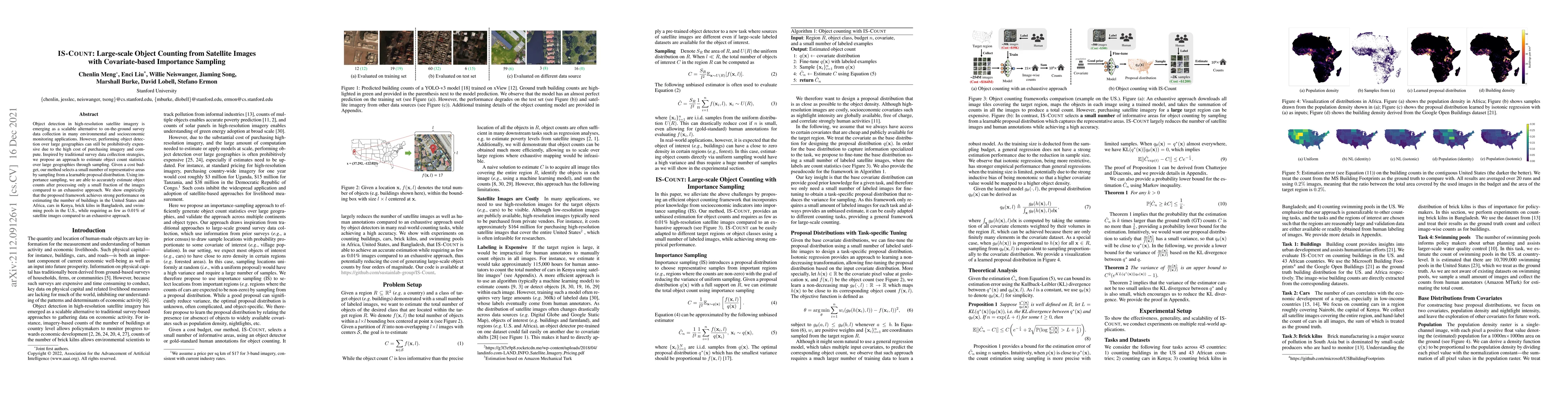
Object detection in high-resolution satellite imagery is emerging as a scalable alternative to on-the-ground survey data collection in many environmental and socioeconomic monitoring applications. H...
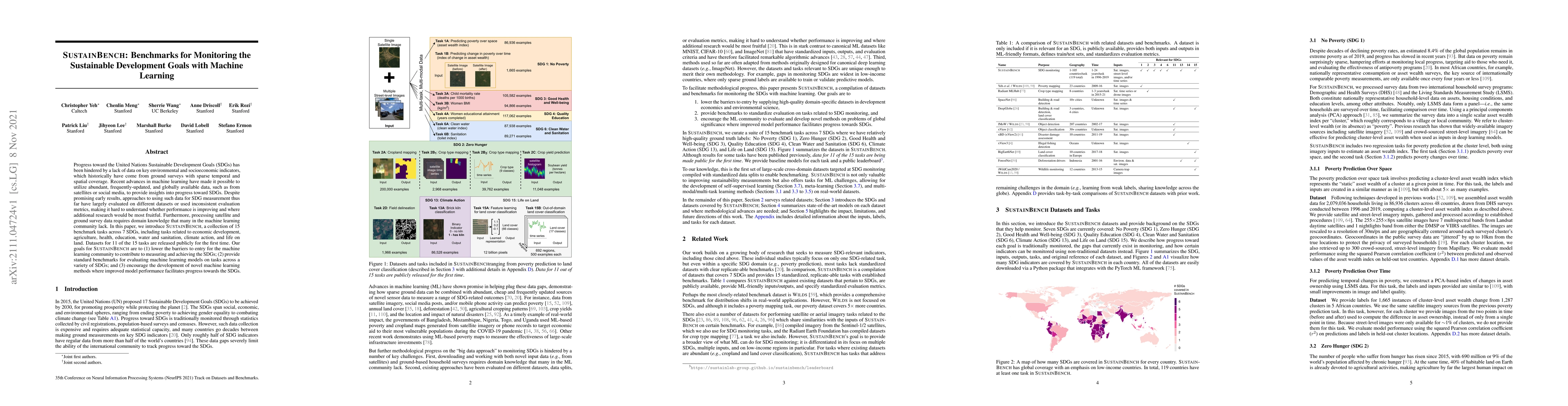
Progress toward the United Nations Sustainable Development Goals (SDGs) has been hindered by a lack of data on key environmental and socioeconomic indicators, which historically have come from groun...
In many regions of the world, sparse data on key economic outcomes inhibits the development, targeting, and evaluation of public policy. We demonstrate how advancements in satellite imagery and mach...
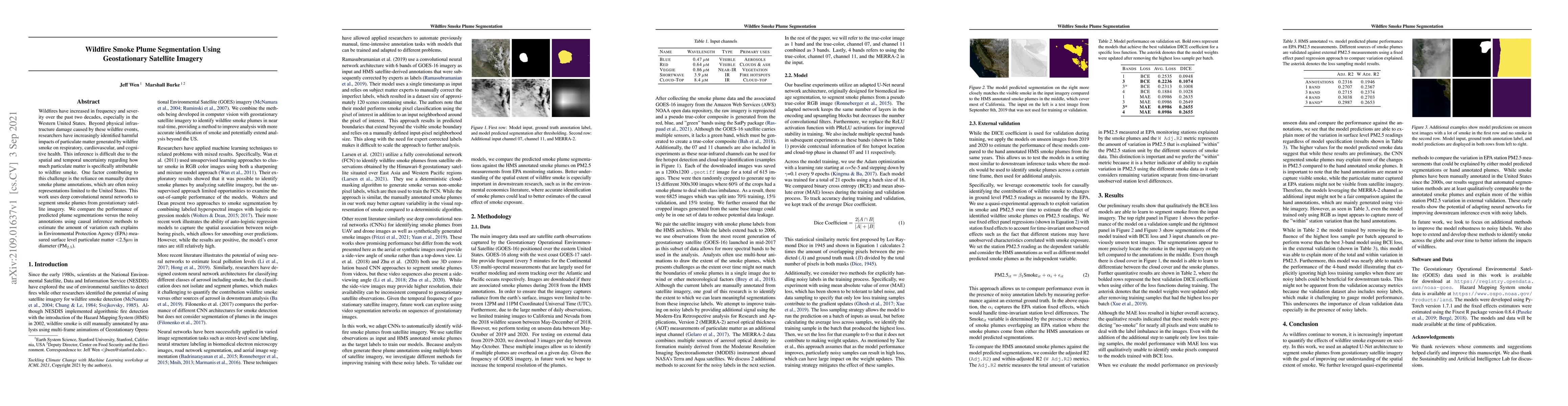
Wildfires have increased in frequency and severity over the past two decades, especially in the Western United States. Beyond physical infrastructure damage caused by these wildfire events, research...
High-resolution satellite imagery has proven useful for a broad range of tasks, including measurement of global human population, local economic livelihoods, and biodiversity, among many others. Unf...
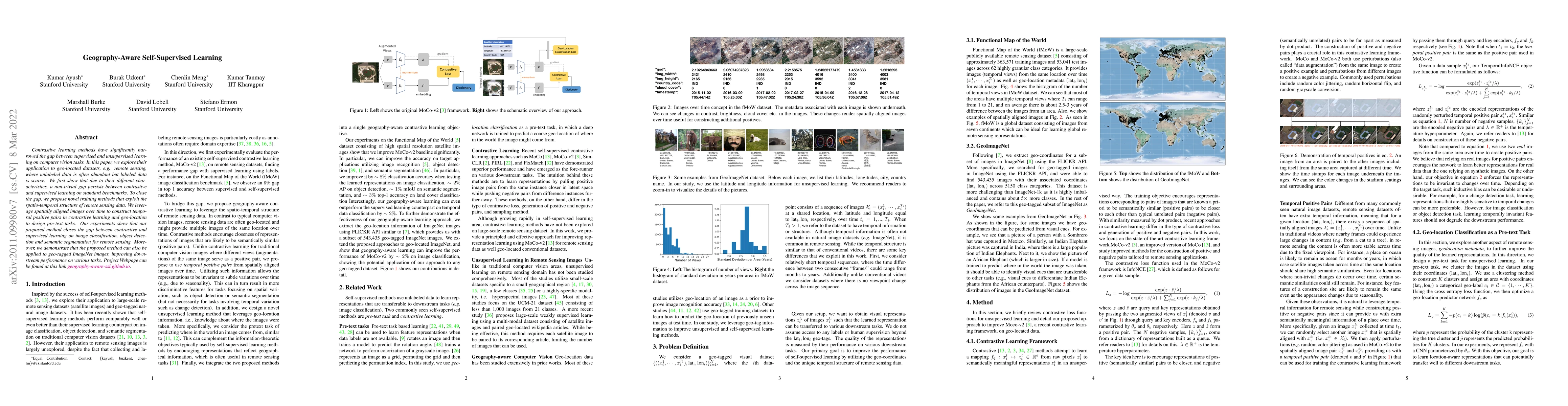
Contrastive learning methods have significantly narrowed the gap between supervised and unsupervised learning on computer vision tasks. In this paper, we explore their application to geo-located dat...
Accurate and comprehensive measurements of a range of sustainable development outcomes are fundamental inputs into both research and policy. We synthesize the growing literature that uses satellite ...
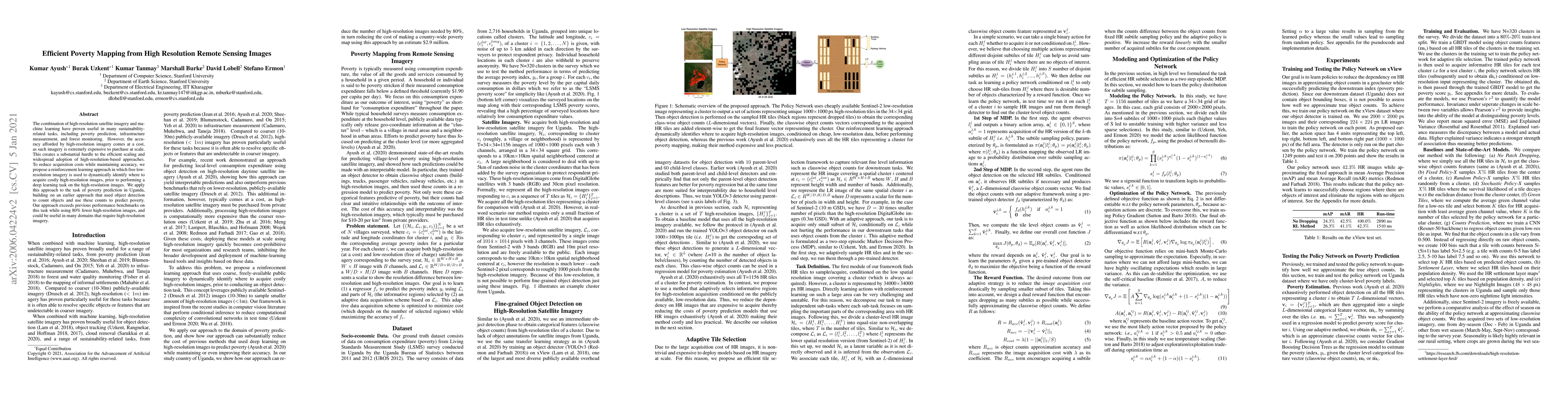
The combination of high-resolution satellite imagery and machine learning have proven useful in many sustainability-related tasks, including poverty prediction, infrastructure measurement, and fores...
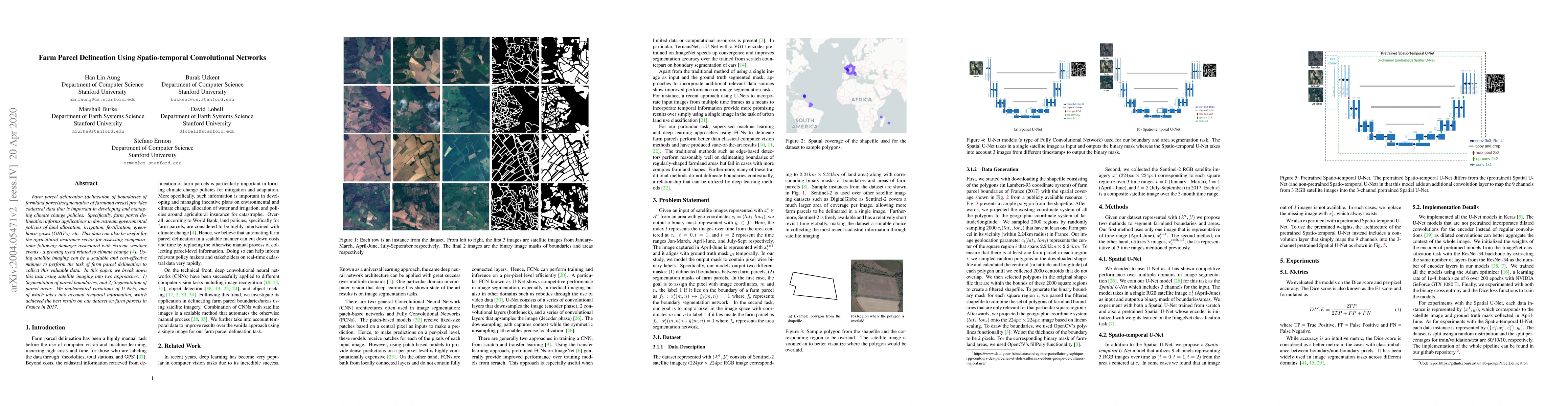
Farm parcel delineation provides cadastral data that is important in developing and managing climate change policies. Specifically, farm parcel delineation informs applications in downstream governm...
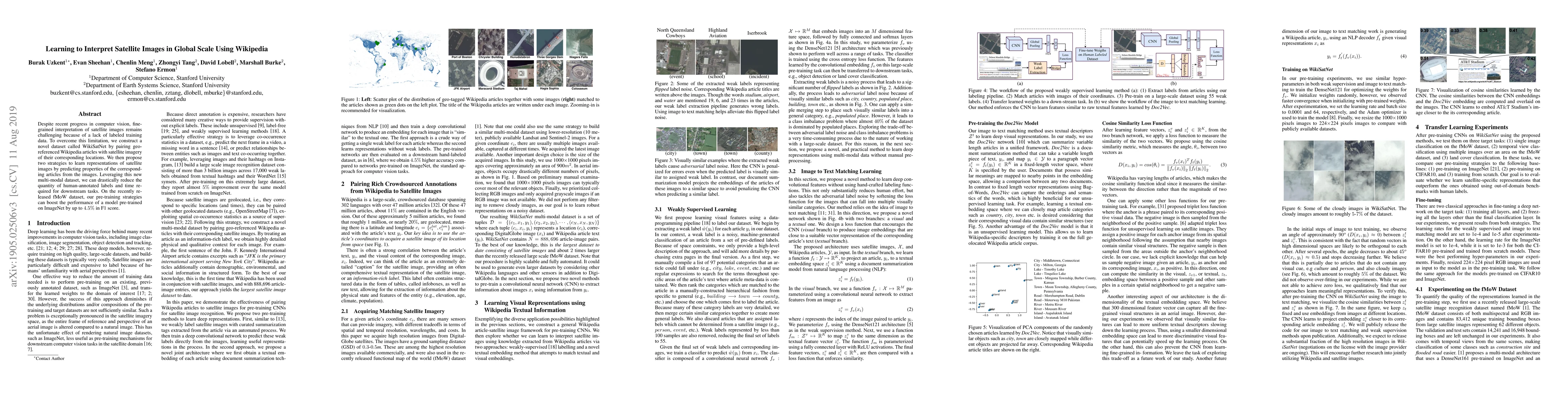
Despite recent progress in computer vision, finegrained interpretation of satellite images remains challenging because of a lack of labeled training data. To overcome this limitation, we construct a...
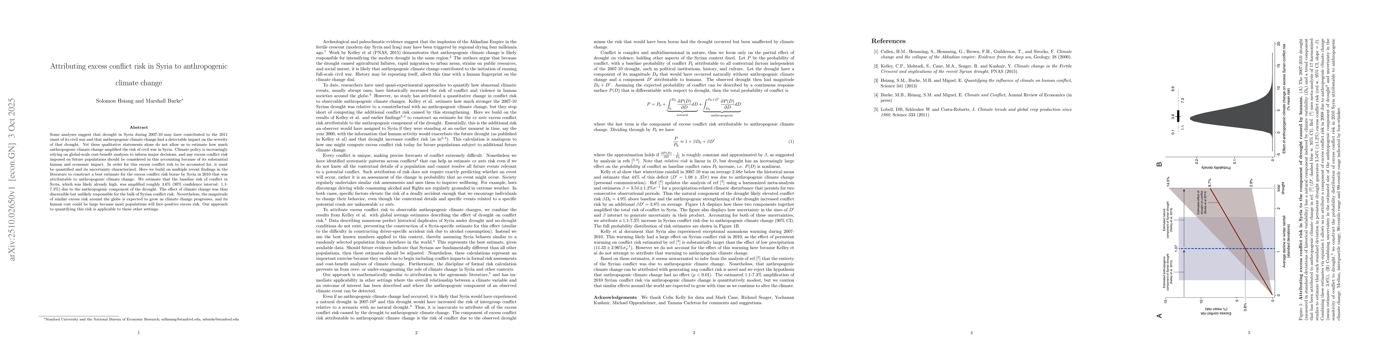
Some analyses suggest that drought in Syria during 2007-10 may have contributed to the 2011 onset of its civil war and that anthropogenic climate change had a detectable impact on the severity of that...
Poverty statistics guide social policy, but in many low- and middle-income countries, censuses and household surveys that collect these data are costly, infrequent, quickly outdated, and sometimes err...