Academic Profile
Statistics
Similar Authors
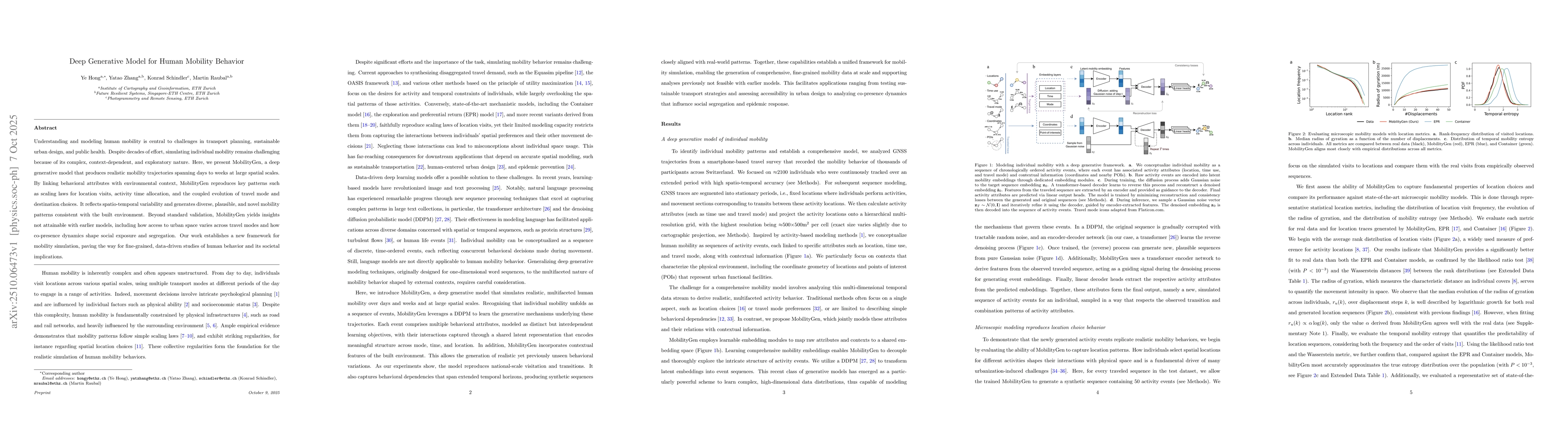
Papers on arXiv
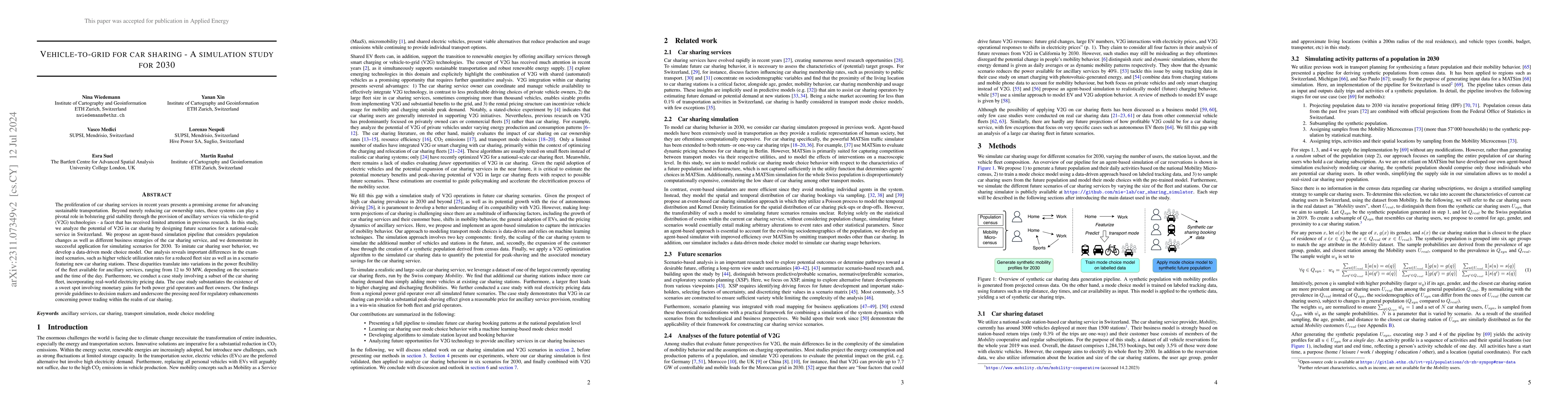
The proliferation of car sharing services in recent years presents a promising avenue for advancing sustainable transportation. Beyond merely reducing car ownership rates, these systems can play a piv...
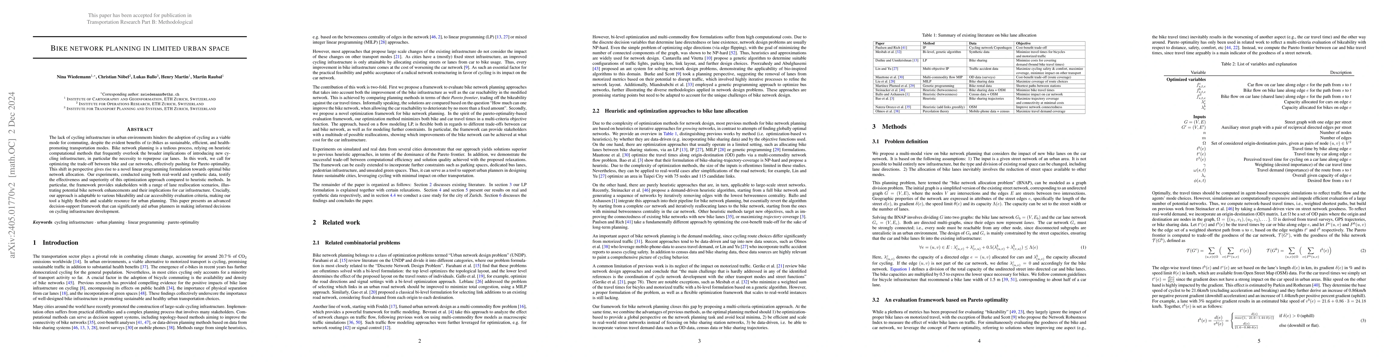
The lack of cycling infrastructure in urban environments hinders the adoption of cycling as a viable mode for commuting, despite the evident benefits of (e-)bikes as sustainable, efficient, and heal...
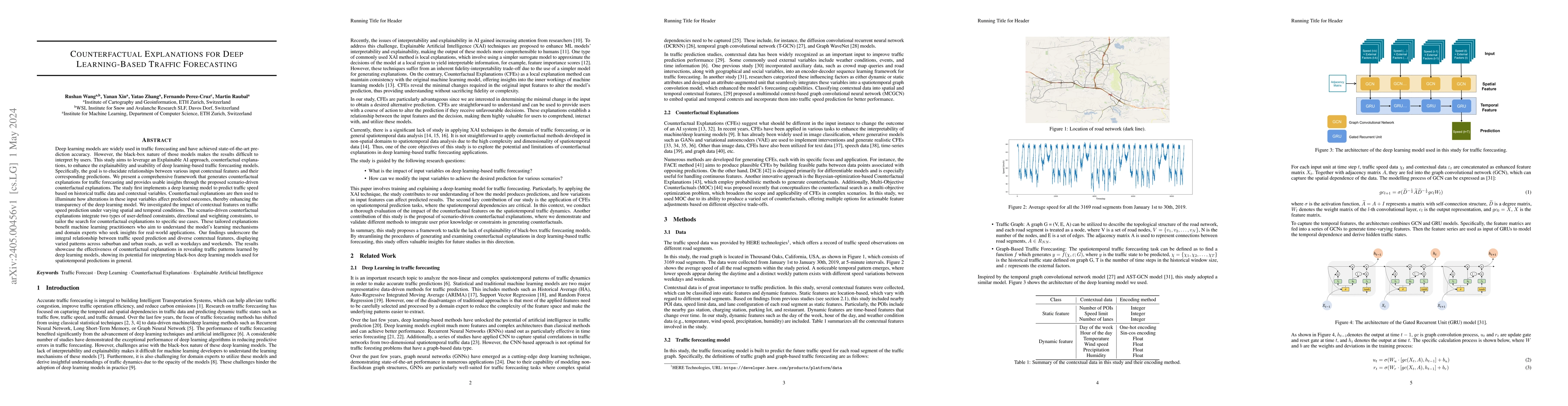
Deep learning models are widely used in traffic forecasting and have achieved state-of-the-art prediction accuracy. However, the black-box nature of those models makes the results difficult to inter...
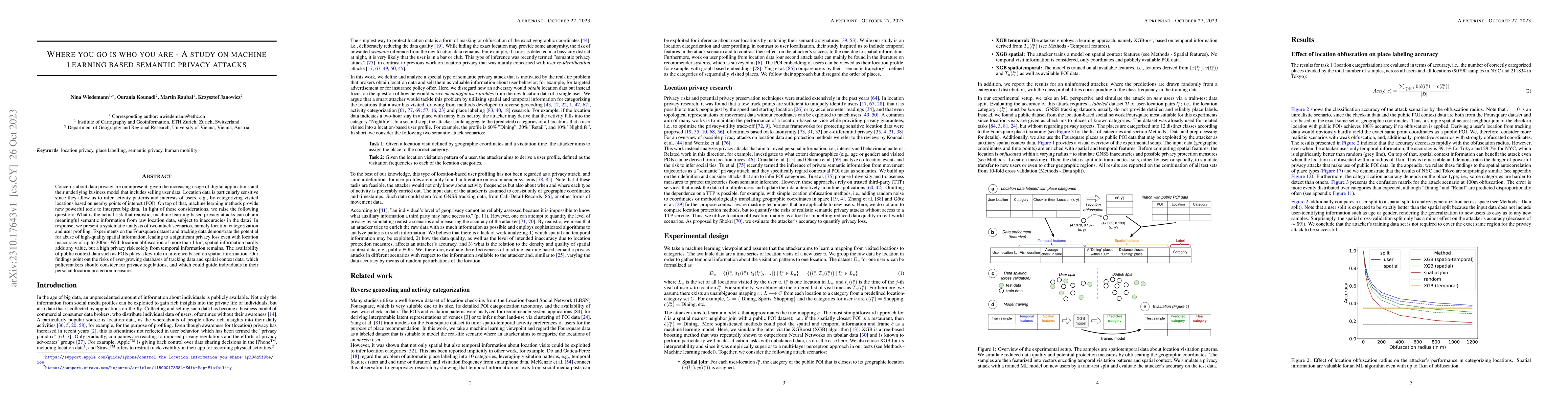
Concerns about data privacy are omnipresent, given the increasing usage of digital applications and their underlying business model that includes selling user data. Location data is particularly sen...
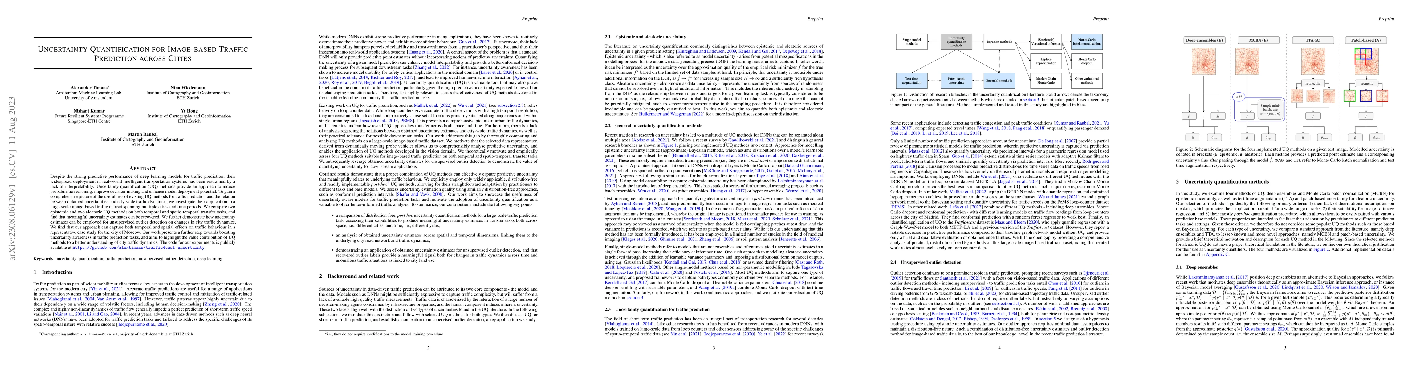
Despite the strong predictive performance of deep learning models for traffic prediction, their widespread deployment in real-world intelligent transportation systems has been restrained by a lack o...
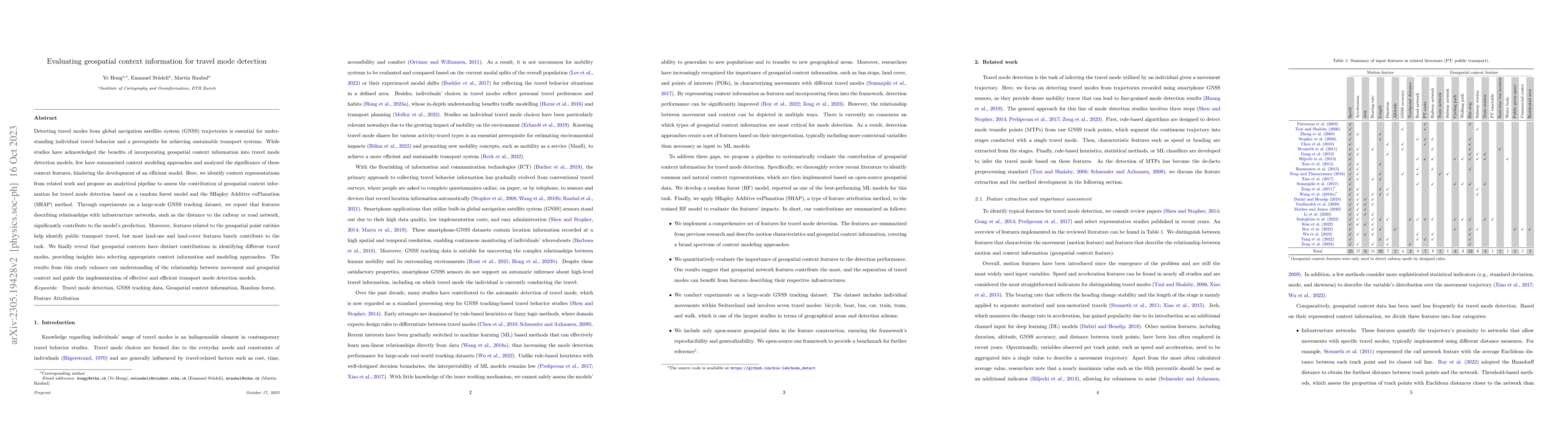
Detecting travel modes from global navigation satellite system (GNSS) trajectories is essential for understanding individual travel behavior and a prerequisite for achieving sustainable transport sy...
In recent years, car-sharing services have emerged as viable alternatives to private individual mobility, promising more sustainable and resource-efficient, but still comfortable transportation. Res...
Accurate activity location prediction is a crucial component of many mobility applications and is particularly required to develop personalized, sustainable transportation systems. Despite the wides...
Artificial intelligence (AI) is revolutionizing many areas of our lives, leading a new era of technological advancement. Particularly, the transportation sector would benefit from the progress in AI...
Deploying real-time control on large-scale fleets of electric vehicles (EVs) is becoming pivotal as the share of EVs over internal combustion engine vehicles increases. In this paper, we present a V...
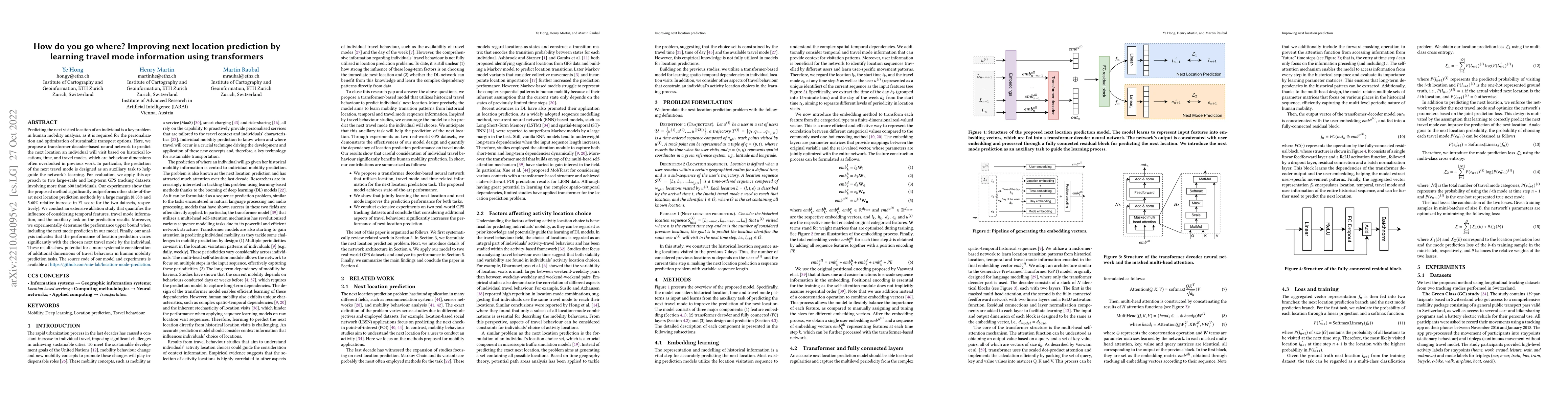
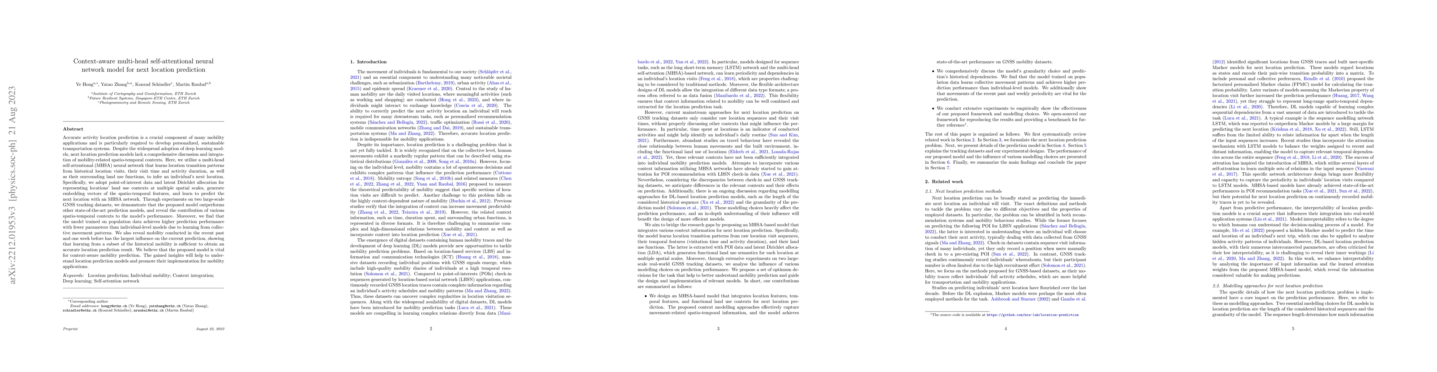
Predicting the next visited location of an individual is a key problem in human mobility analysis, as it is required for the personalization and optimization of sustainable transport options. Here, ...
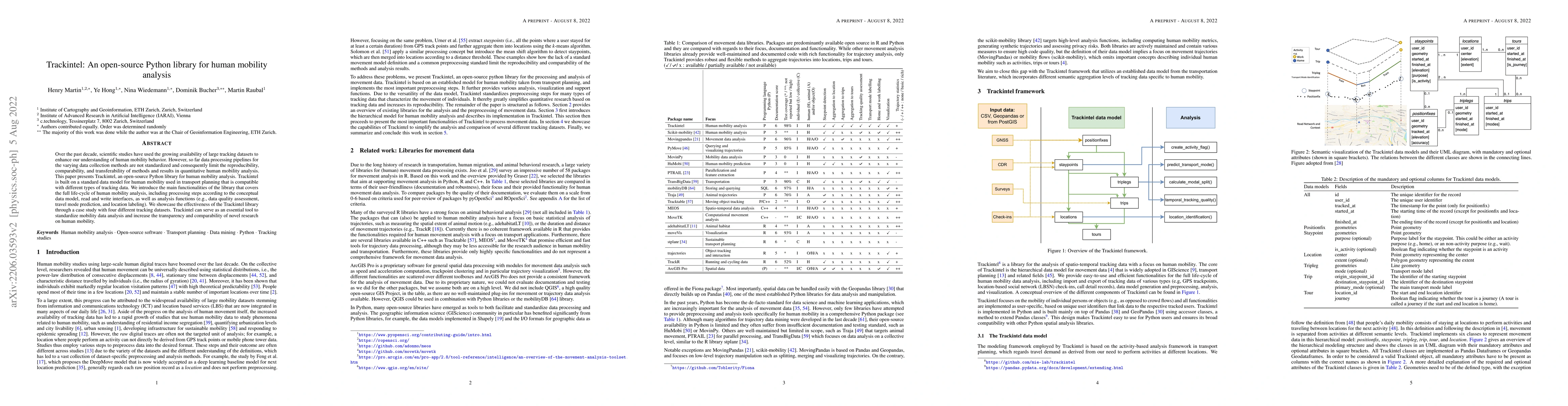
Over the past decade, scientific studies have used the growing availability of large tracking datasets to enhance our understanding of human mobility behavior. However, so far data processing pipeli...
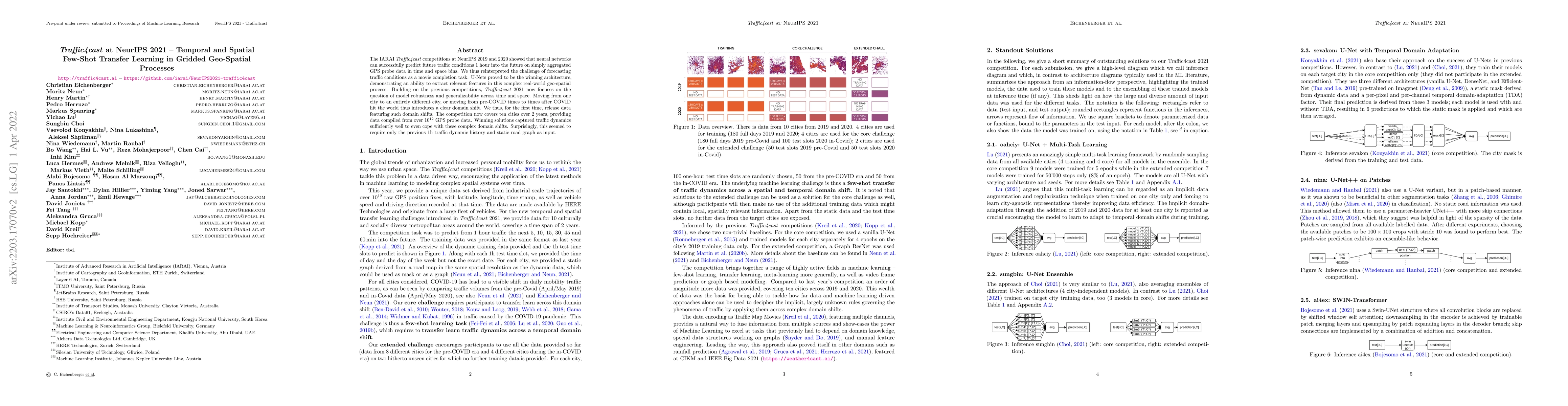
The IARAI Traffic4cast competitions at NeurIPS 2019 and 2020 showed that neural networks can successfully predict future traffic conditions 1 hour into the future on simply aggregated GPS probe data...
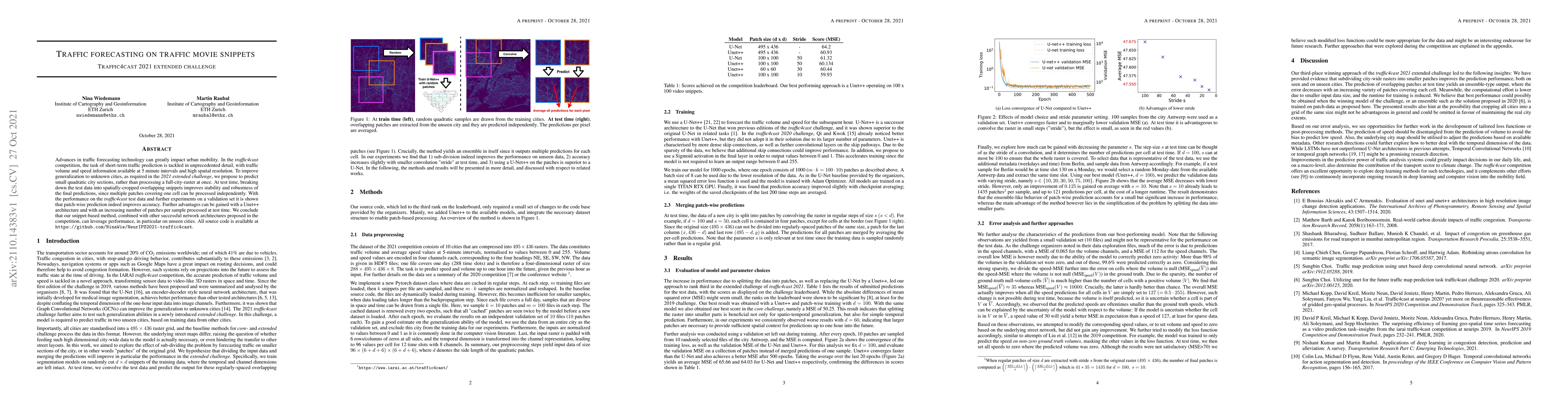
Advances in traffic forecasting technology can greatly impact urban mobility. In the traffic4cast competition, the task of short-term traffic prediction is tackled in unprecedented detail, with traf...
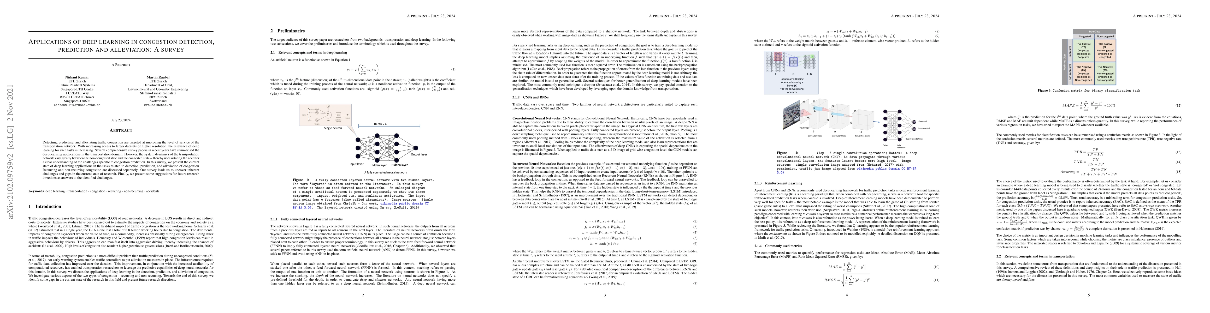
Detecting, predicting, and alleviating traffic congestion are targeted at improving the level of service of the transportation network. With increasing access to larger datasets of higher resolution...
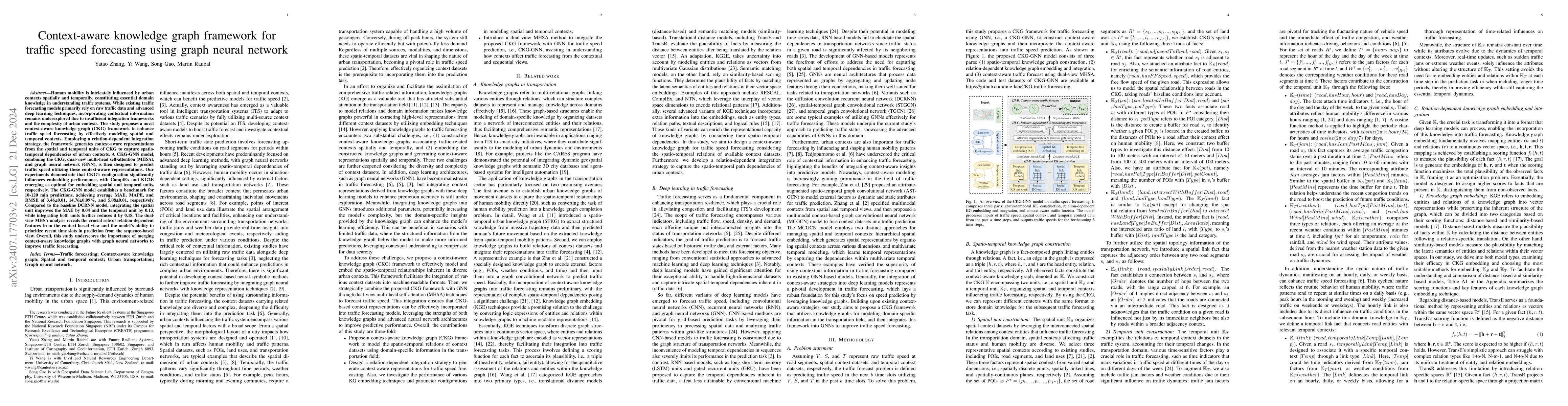
Human mobility is intricately influenced by urban contexts spatially and temporally, constituting essential domain knowledge in understanding traffic systems. While existing traffic forecasting models...
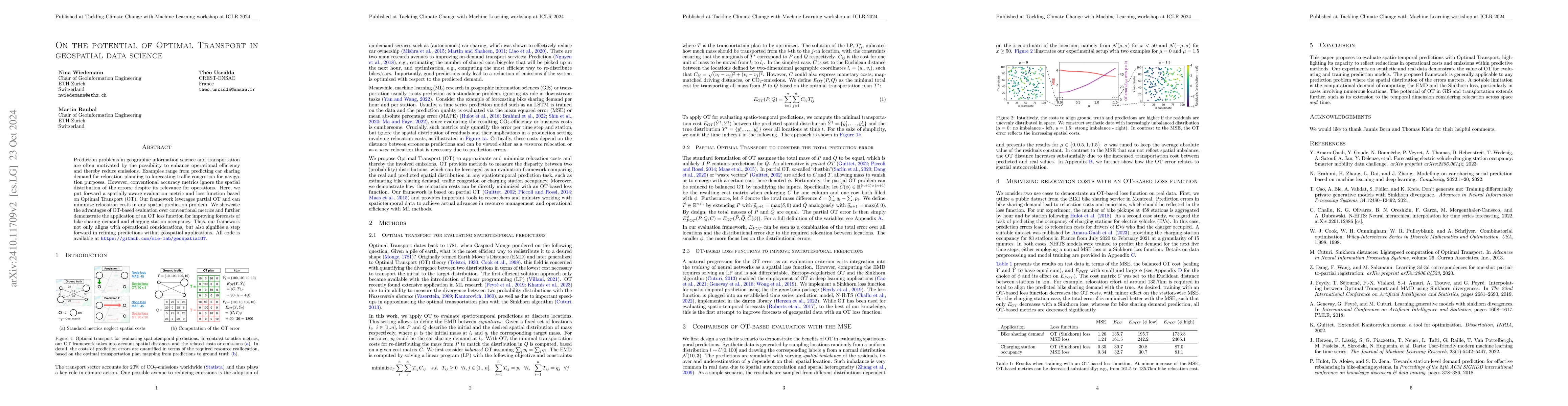
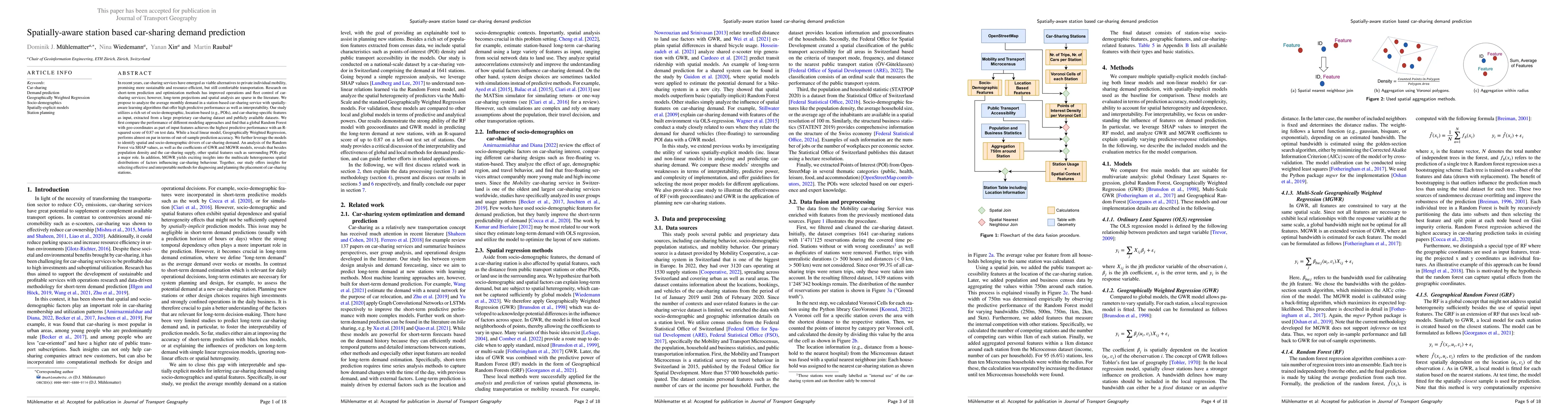
Prediction problems in geographic information science and transportation are frequently motivated by the possibility to enhance operational efficiency. Examples range from predicting car sharing deman...
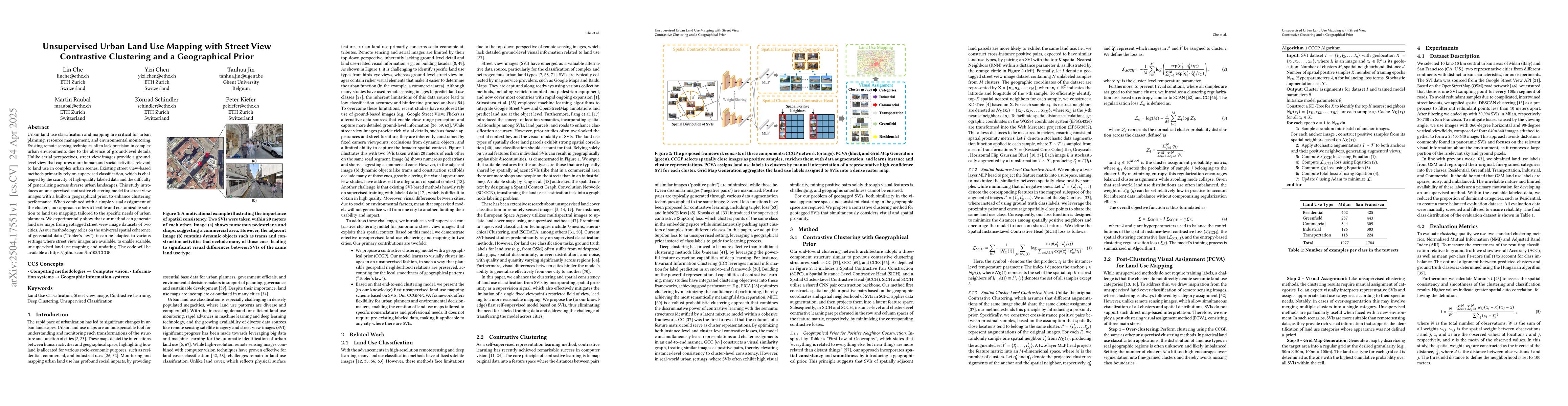
Urban land use classification and mapping are critical for urban planning, resource management, and environmental monitoring. Existing remote sensing techniques often lack precision in complex urban e...
Understanding and modeling human mobility is central to challenges in transport planning, sustainable urban design, and public health. Despite decades of effort, simulating individual mobility remains...
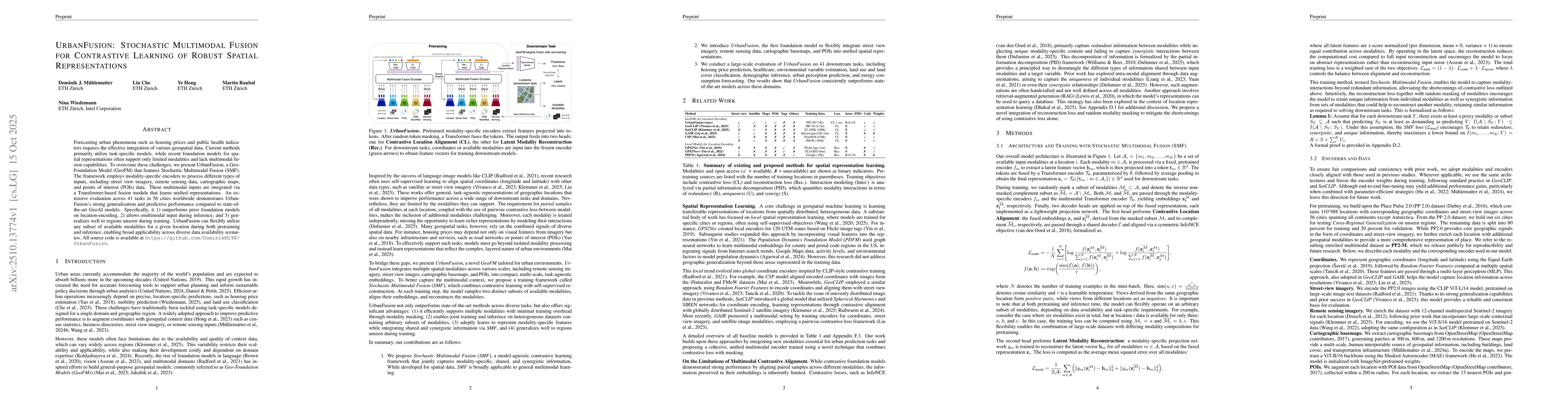
Forecasting urban phenomena such as housing prices and public health indicators requires the effective integration of various geospatial data. Current methods primarily utilize task-specific models, w...
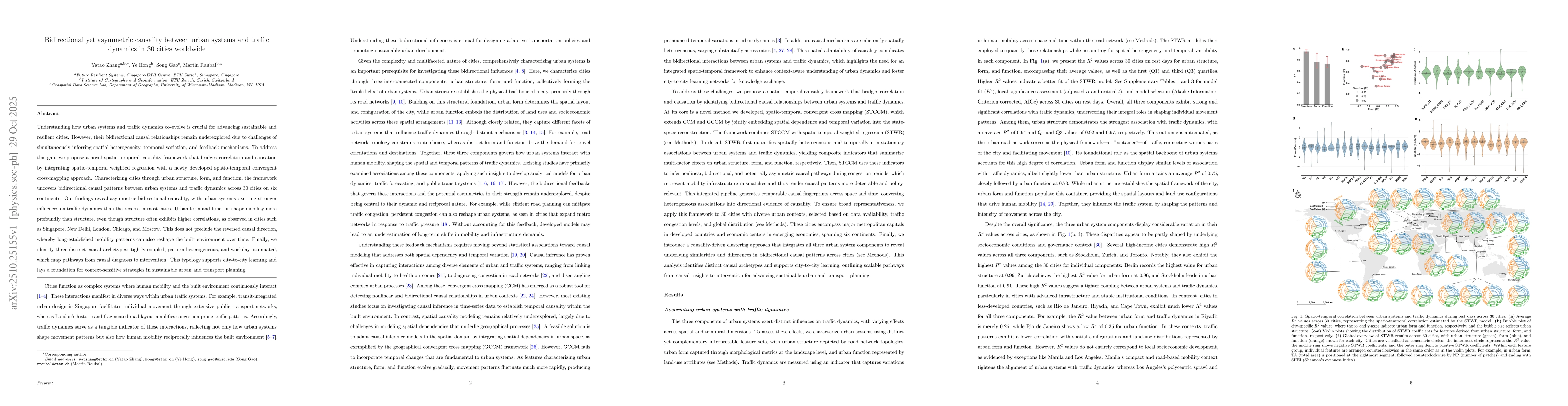
Understanding how urban systems and traffic dynamics co-evolve is crucial for advancing sustainable and resilient cities. However, their bidirectional causal relationships remain underexplored due to ...
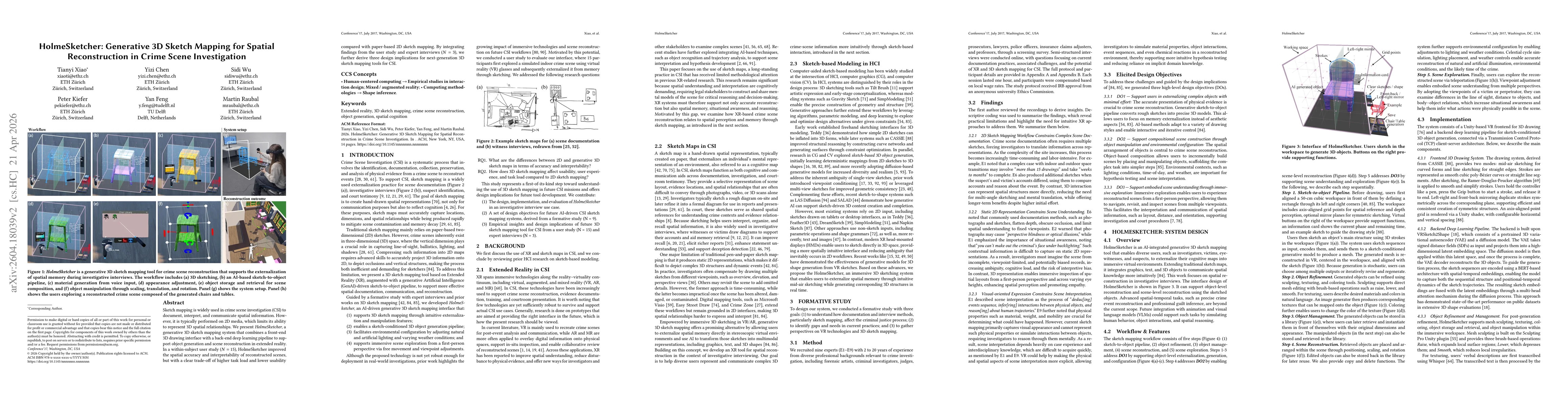
Sketch mapping is widely used in crime scene investigation (CSI) to document, interpret, and communicate spatial information. However, it is typically performed on 2D media, which limits its ability t...
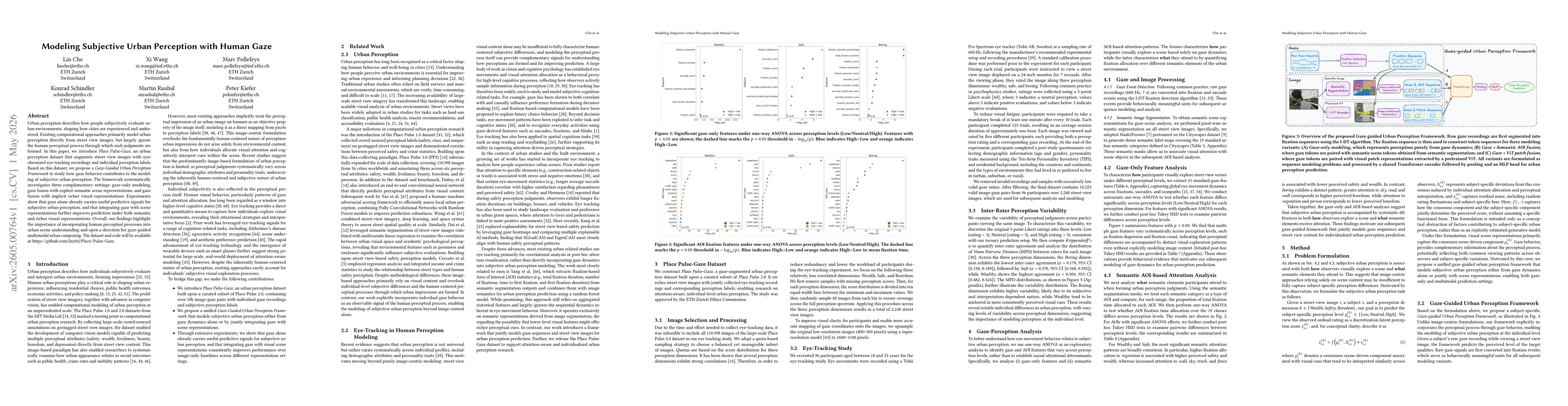
Urban perception describes how people subjectively evaluate urban environments, shaping how cities are experienced and understood. Existing computational approaches primarily model urban perception di...