Academic Profile
Statistics
Similar Authors
Papers on arXiv
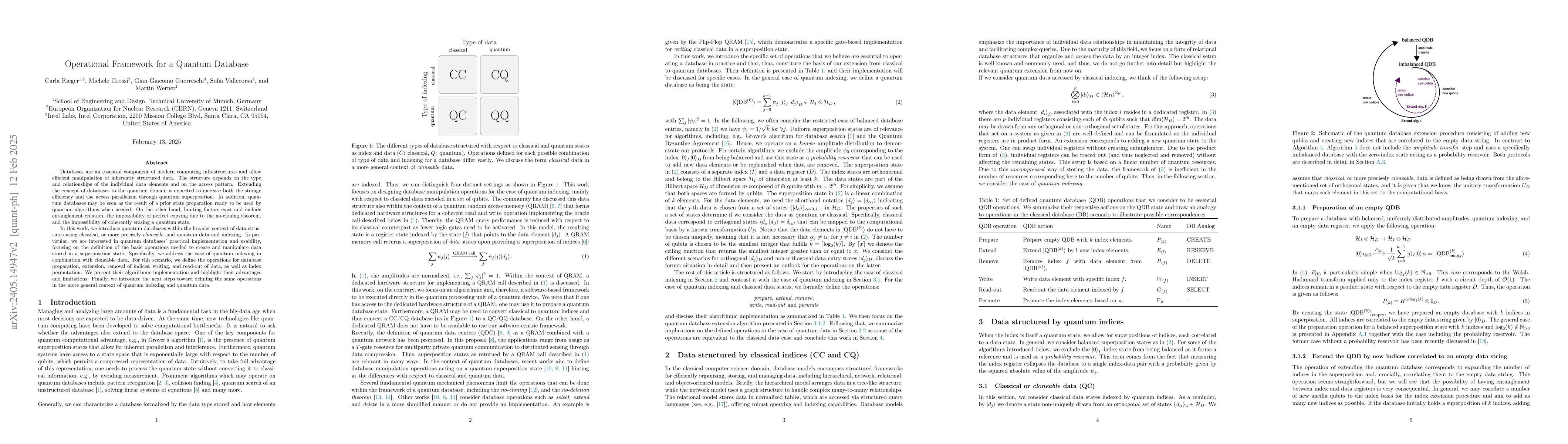
Databases are an essential component of modern computing infrastructures and allow efficient access to data stored persistently. Their structure depends on the type and relationships of the stored d...
Artificial intelligence (AI) approaches nowadays have gained remarkable success in single-modality-dominated remote sensing (RS) applications, especially with an emphasis on individual urban environ...
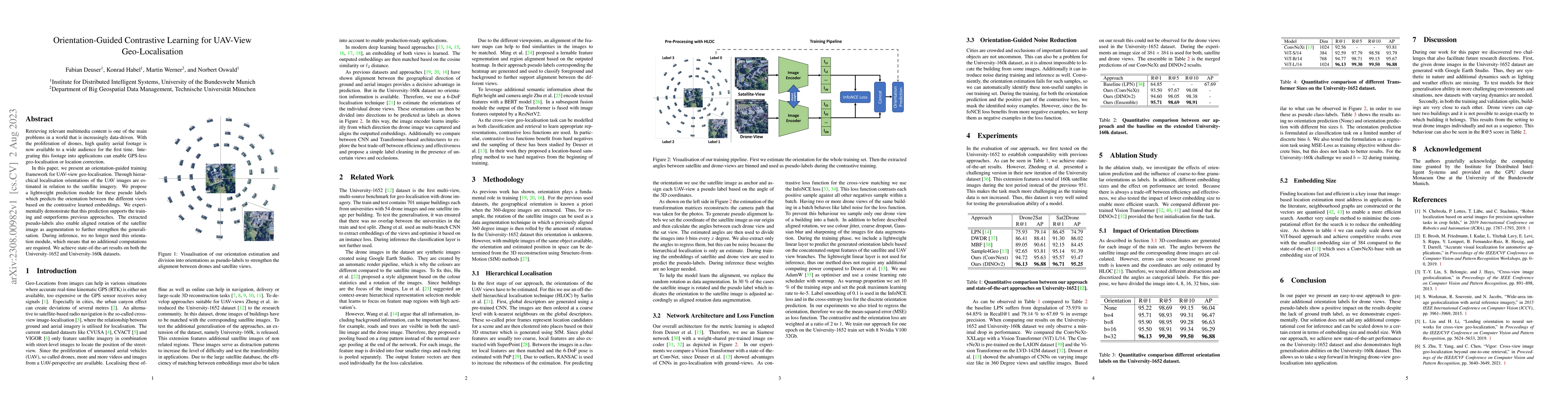
Retrieving relevant multimedia content is one of the main problems in a world that is increasingly data-driven. With the proliferation of drones, high quality aerial footage is now available to a wi...
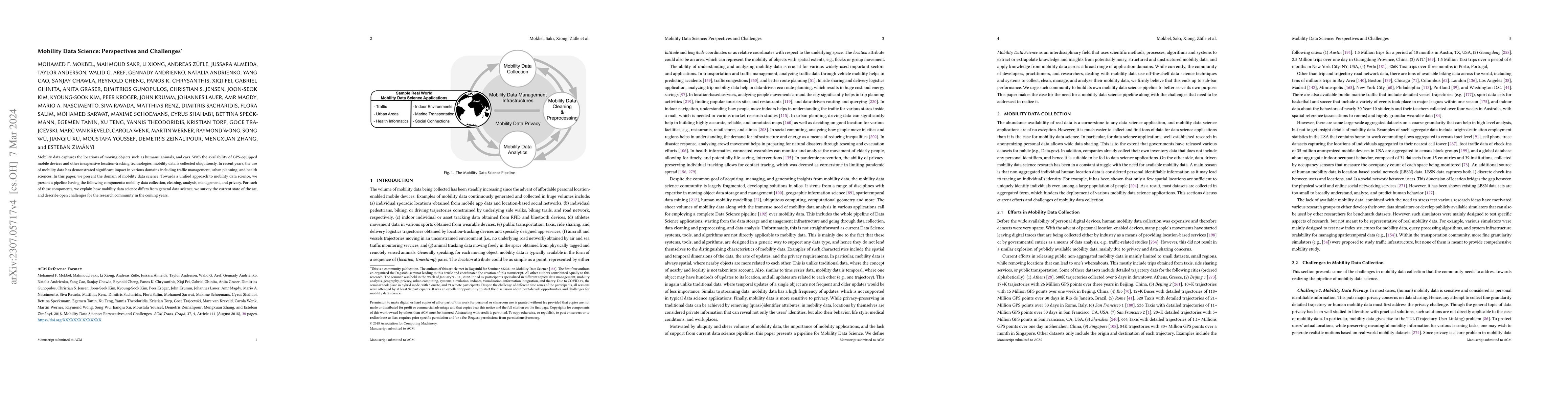
Mobility data captures the locations of moving objects such as humans, animals, and cars. With the availability of GPS-equipped mobile devices and other inexpensive location-tracking technologies, m...
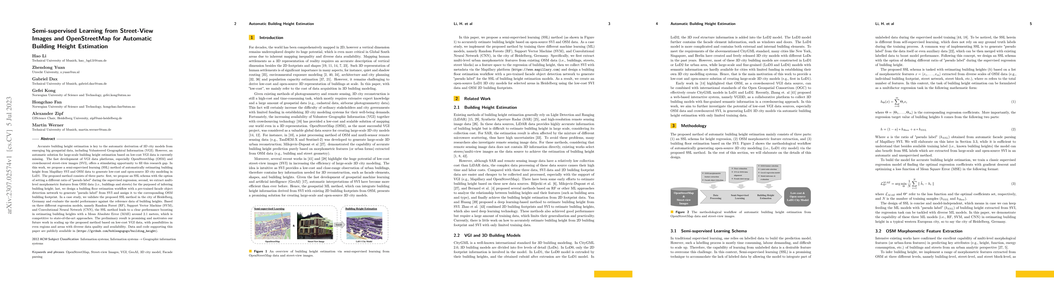
Accurate building height estimation is key to the automatic derivation of 3D city models from emerging big geospatial data, including Volunteered Geographical Information (VGI). However, an automati...
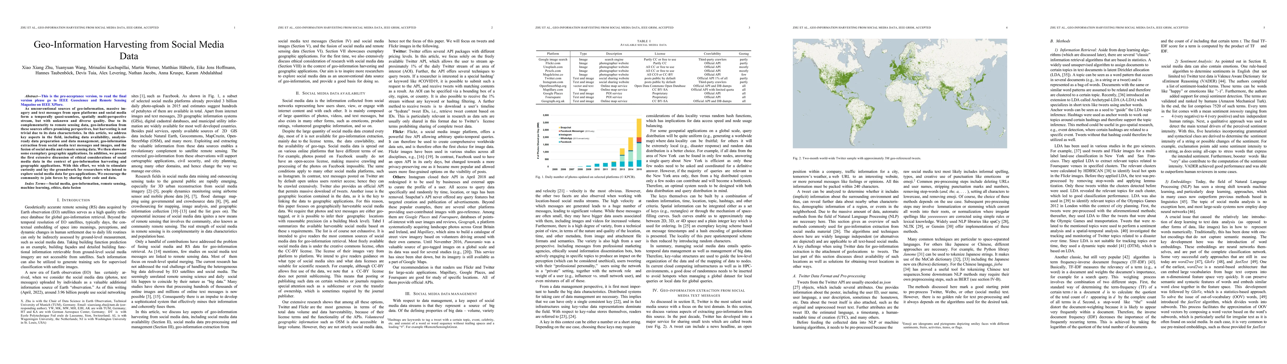
As unconventional sources of geo-information, massive imagery and text messages from open platforms and social media form a temporally quasi-seamless, spatially multi-perspective stream, but with un...
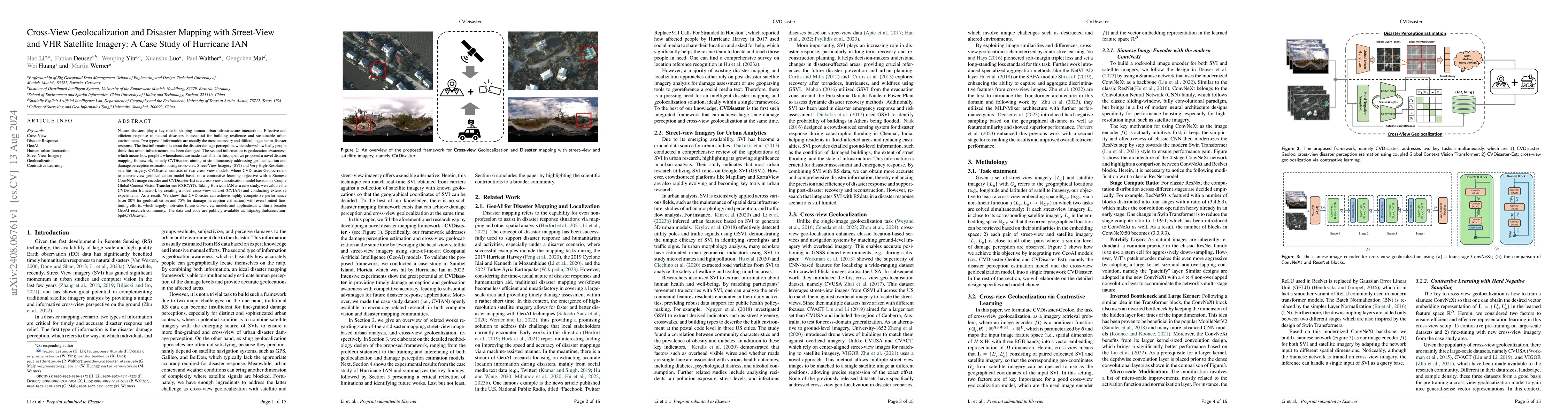
Nature disasters play a key role in shaping human-urban infrastructure interactions. Effective and efficient response to natural disasters is essential for building resilience and a sustainable urban ...
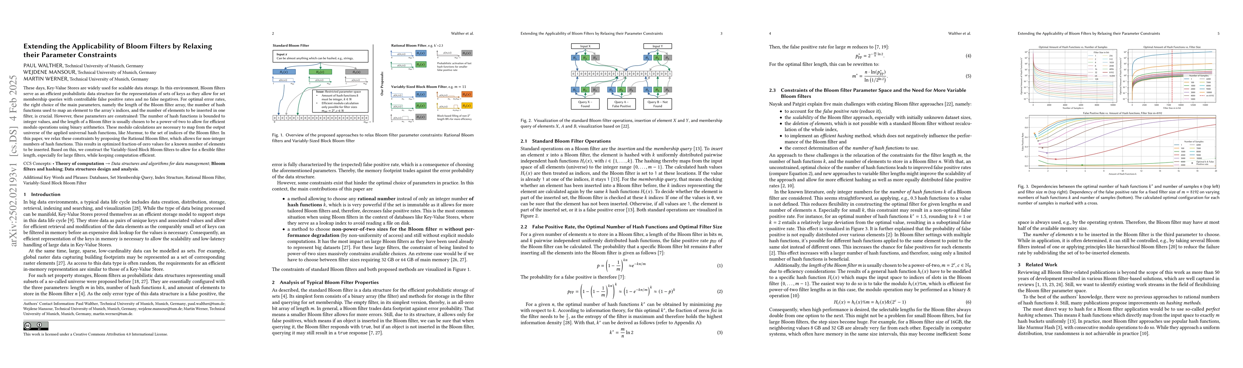
These days, Key-Value Stores are widely used for scalable data storage. In this environment, Bloom filters serve as an efficient probabilistic data structure for the representation of sets of keys as ...
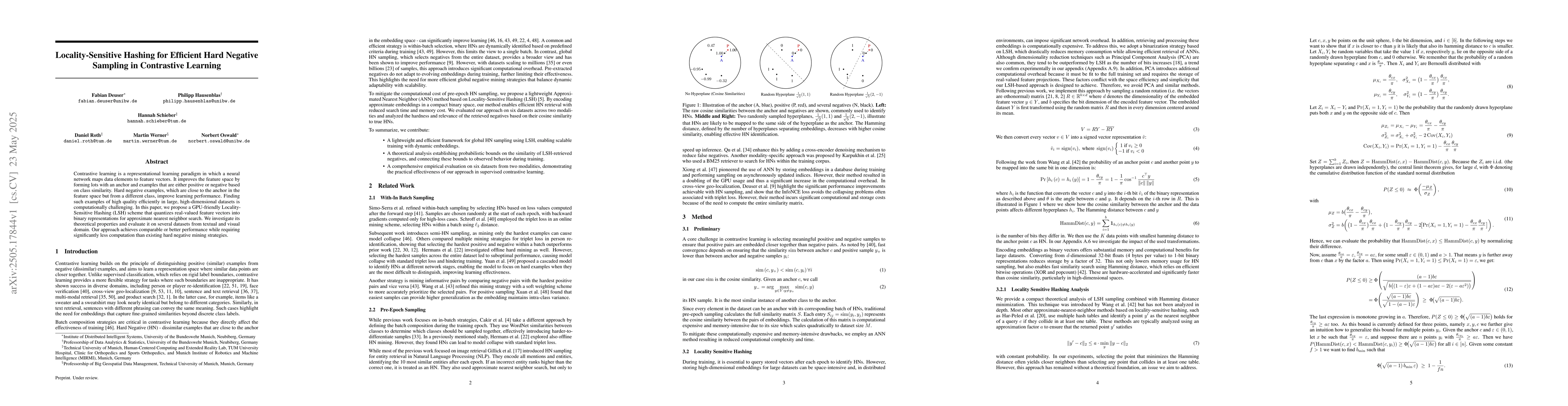
Contrastive learning is a representational learning paradigm in which a neural network maps data elements to feature vectors. It improves the feature space by forming lots with an anchor and examples ...
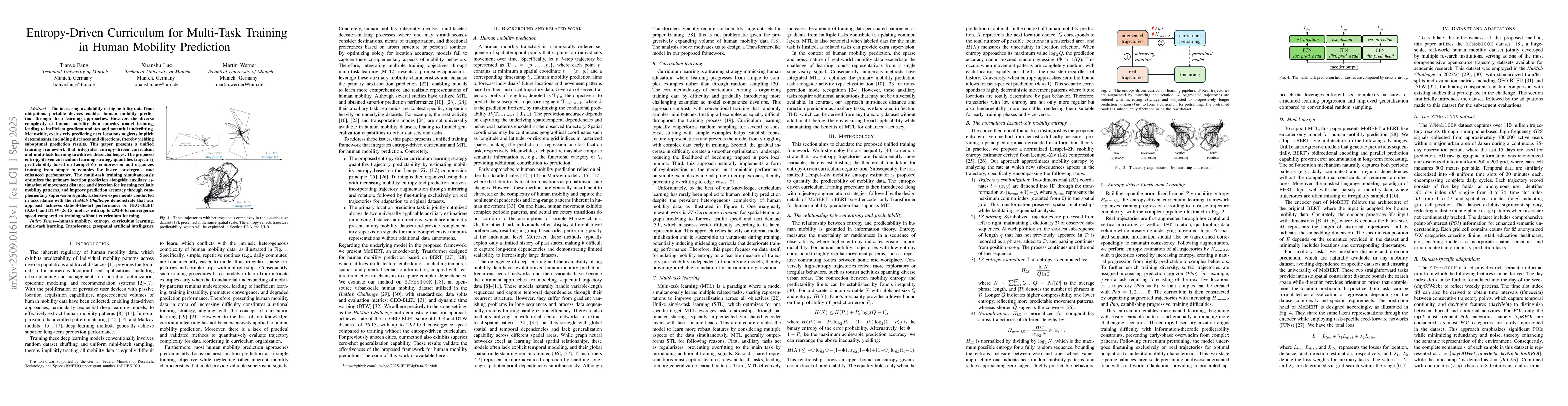
The increasing availability of big mobility data from ubiquitous portable devices enables human mobility prediction through deep learning approaches. However, the diverse complexity of human mobility ...
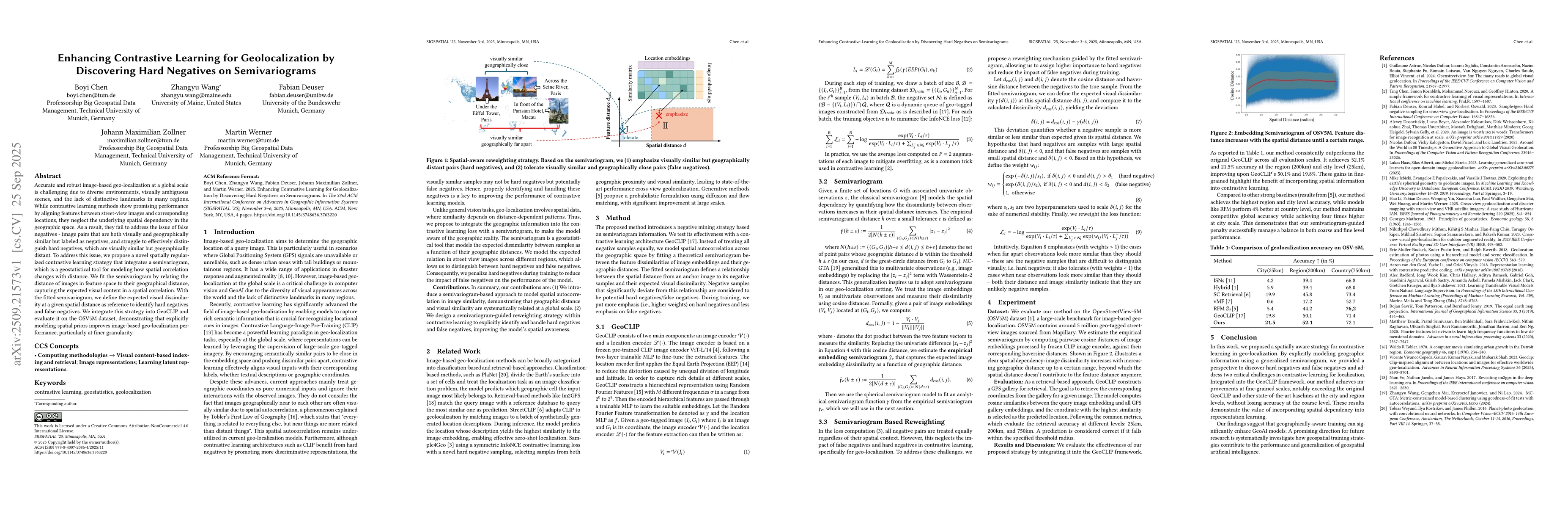
Accurate and robust image-based geo-localization at a global scale is challenging due to diverse environments, visually ambiguous scenes, and the lack of distinctive landmarks in many regions. While c...
Streaming process mining deals with the real-time analysis of streaming data. Event streams require algorithms capable of processing data incrementally. To systematically address the complexities of t...
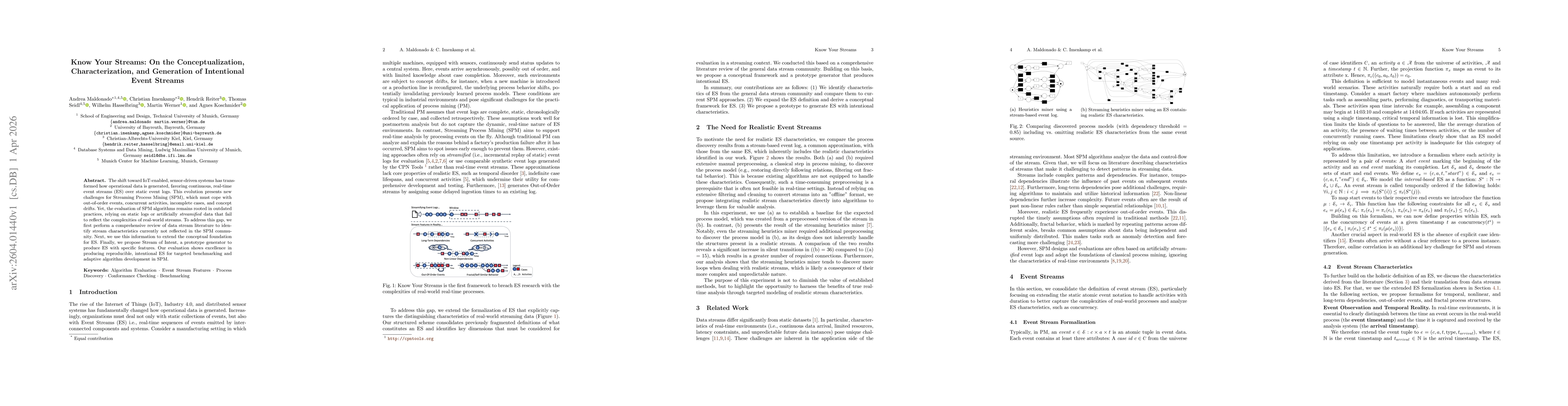
The shift toward IoT-enabled, sensor-driven systems has transformed how operational data is generated, favoring continuous, real-time event streams (ES) over static event logs. This evolution presents...