Academic Profile
Statistics
Similar Authors
Papers on arXiv
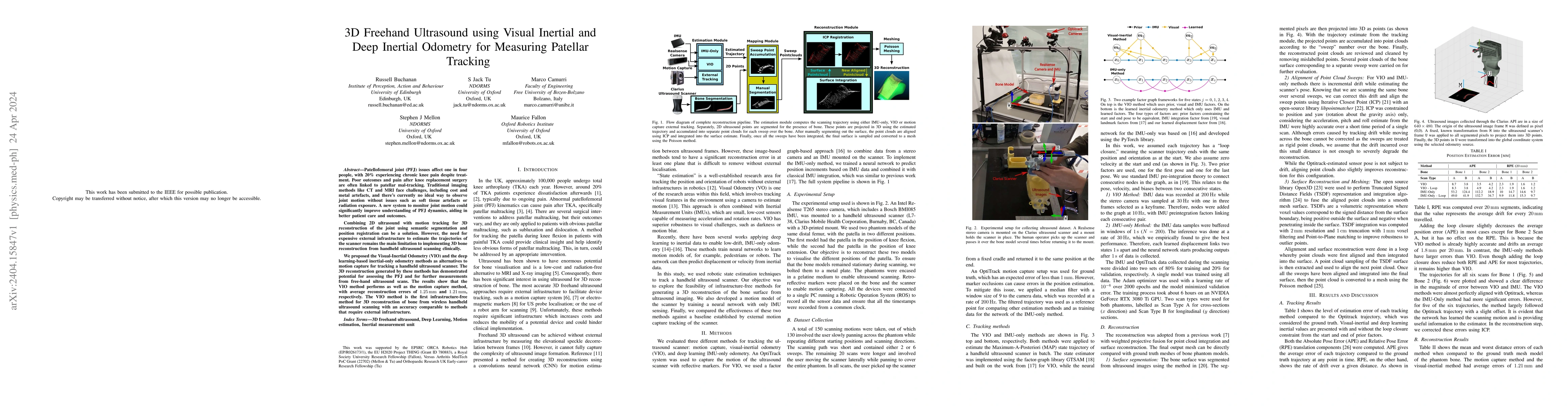
Patellofemoral joint (PFJ) issues affect one in four people, with 20% experiencing chronic knee pain despite treatment. Poor outcomes and pain after knee replacement surgery are often linked to pate...
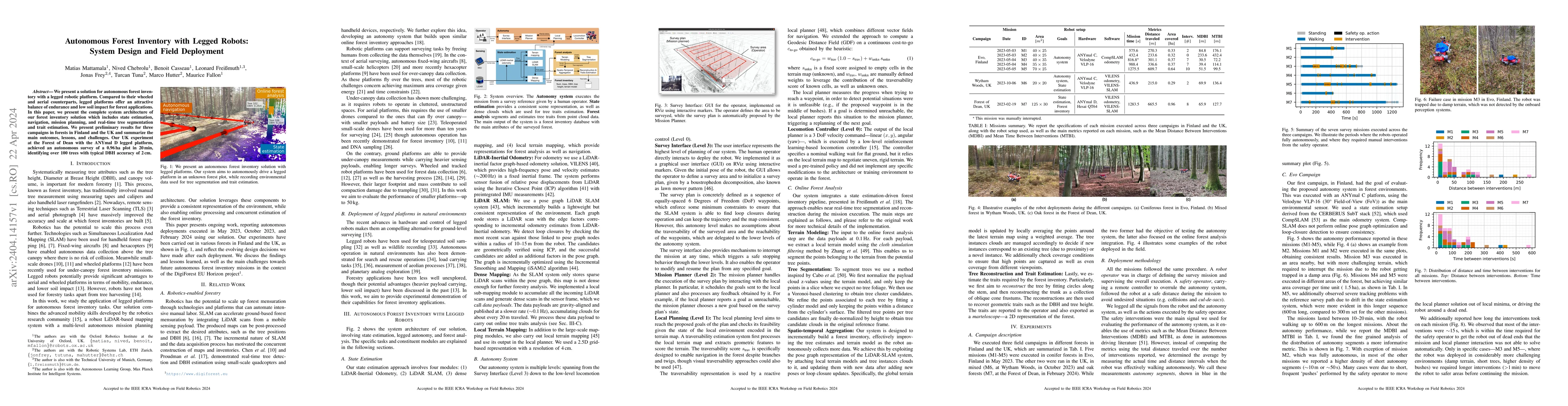
We present a solution for autonomous forest inventory with a legged robotic platform. Compared to their wheeled and aerial counterparts, legged platforms offer an attractive balance of endurance and...
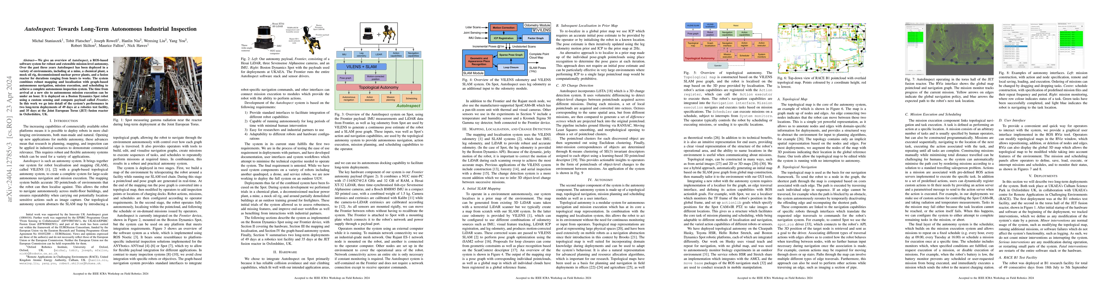
We give an overview of AutoInspect, a ROS-based software system for robust and extensible mission-level autonomy. Over the past three years AutoInspect has been deployed in a variety of environments...
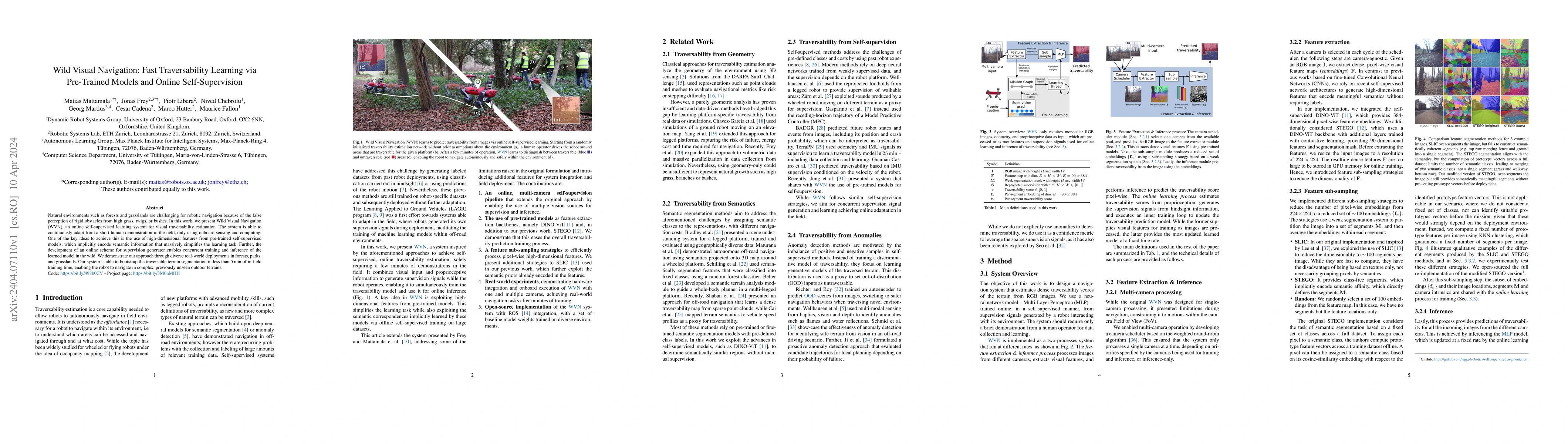
Natural environments such as forests and grasslands are challenging for robotic navigation because of the false perception of rigid obstacles from high grass, twigs, or bushes. In this work, we pres...
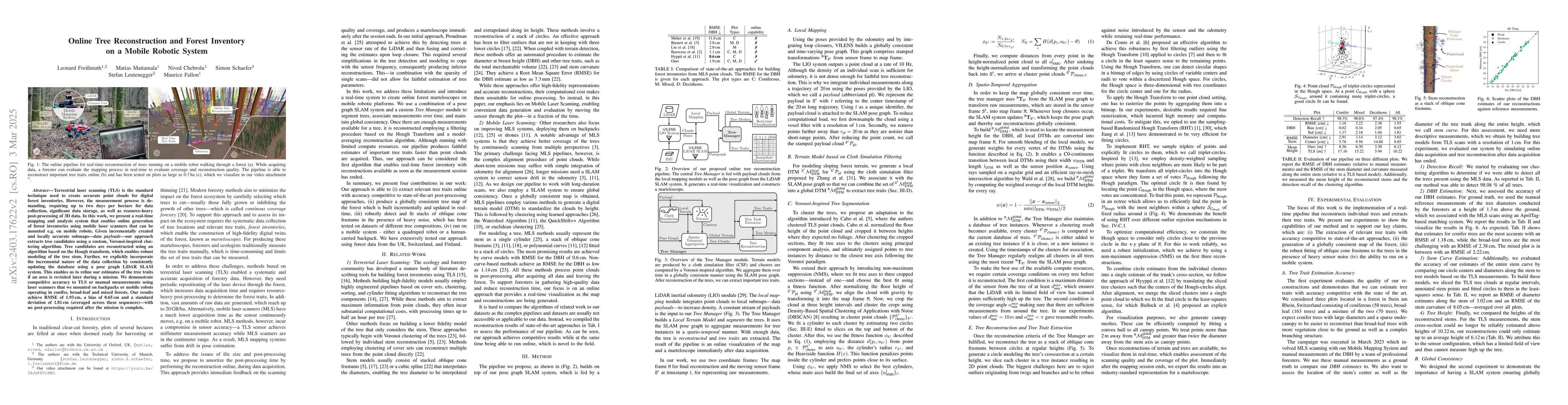
Terrestrial laser scanning (TLS) is the standard technique used to create accurate point clouds for digital forest inventories. However, the measurement process is demanding, requiring up to two day...
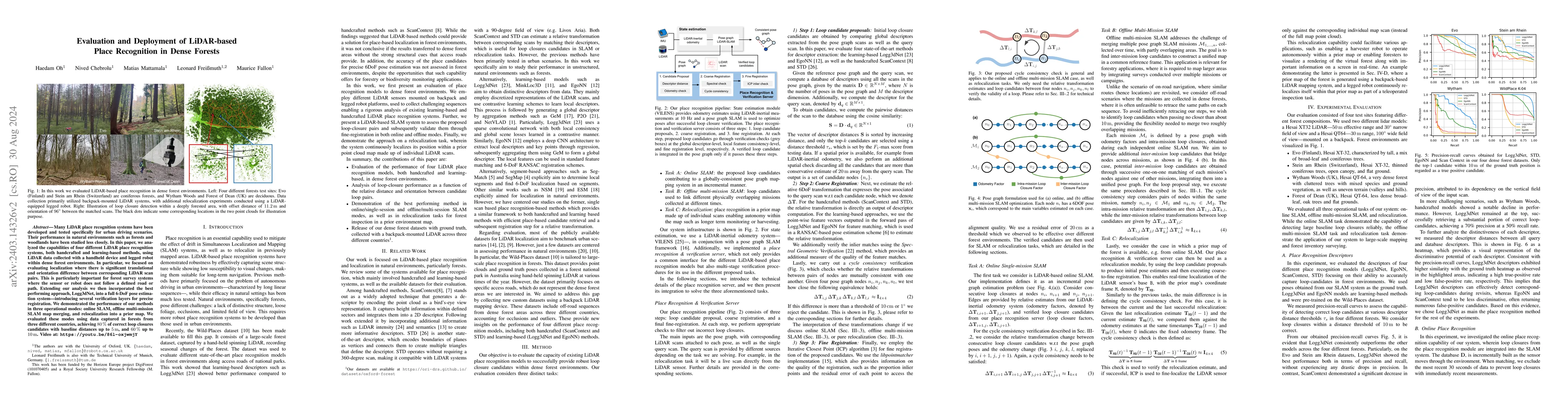
Many LiDAR place recognition systems have been developed and tested specifically for urban driving scenarios. Their performance in natural environments such as forests and woodlands have been studie...
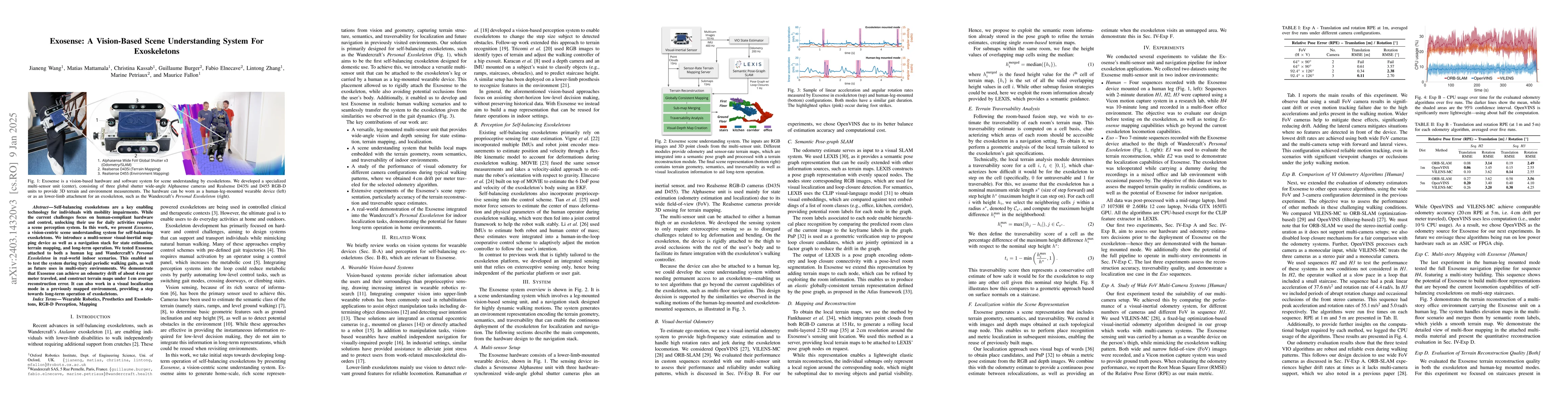
Exoskeletons for daily use by those with mobility impairments are being developed. They will require accurate and robust scene understanding systems. Current research has used vision to identify imm...
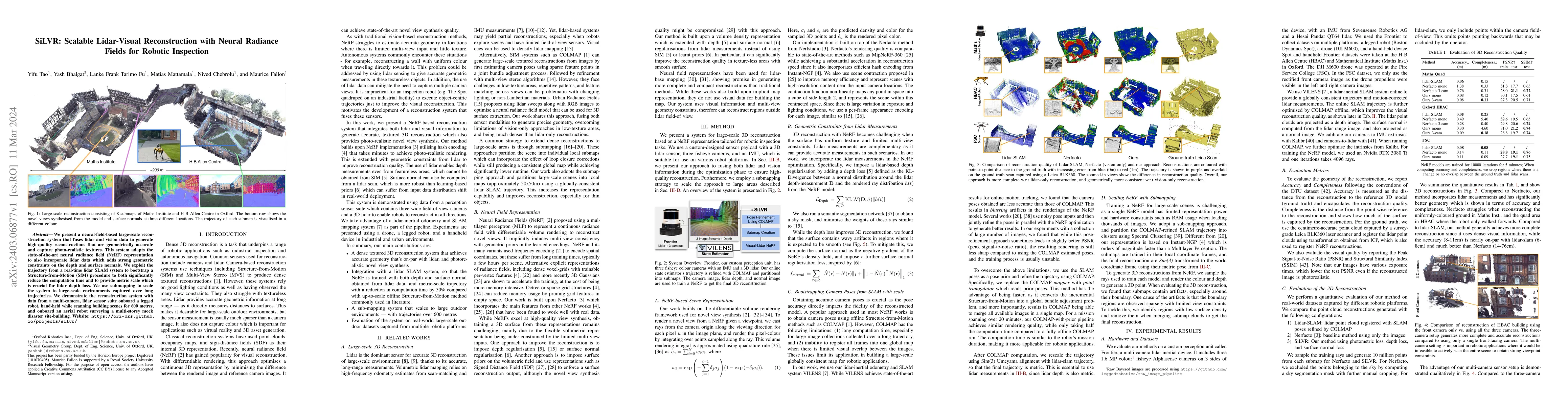
We present a neural-field-based large-scale reconstruction system that fuses lidar and vision data to generate high-quality reconstructions that are geometrically accurate and capture photo-realisti...
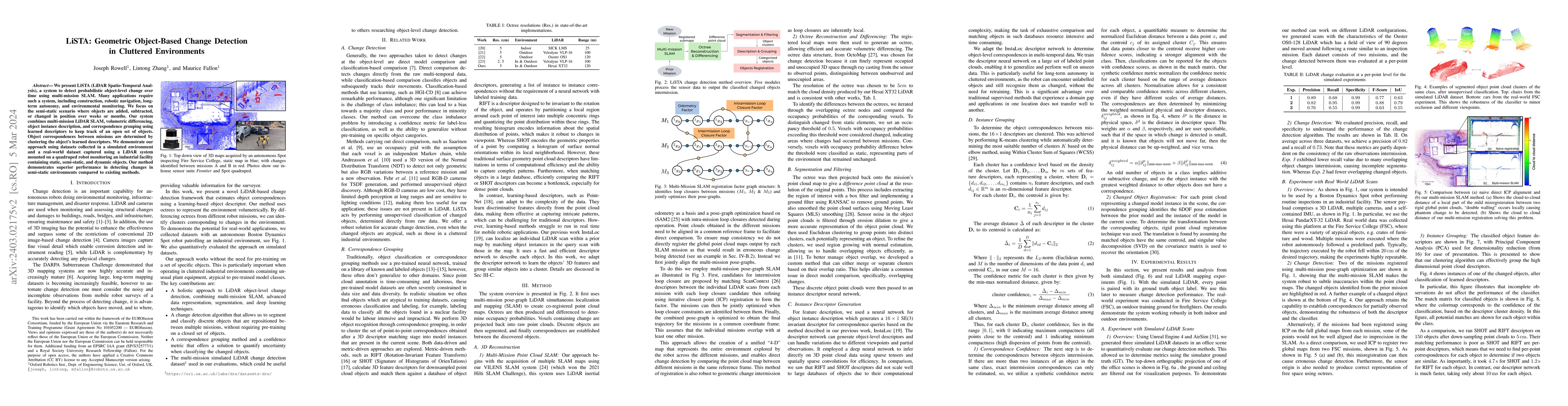
We present LiSTA (LiDAR Spatio-Temporal Analysis), a system to detect probabilistic object-level change over time using multi-mission SLAM. Many applications require such a system, including constru...
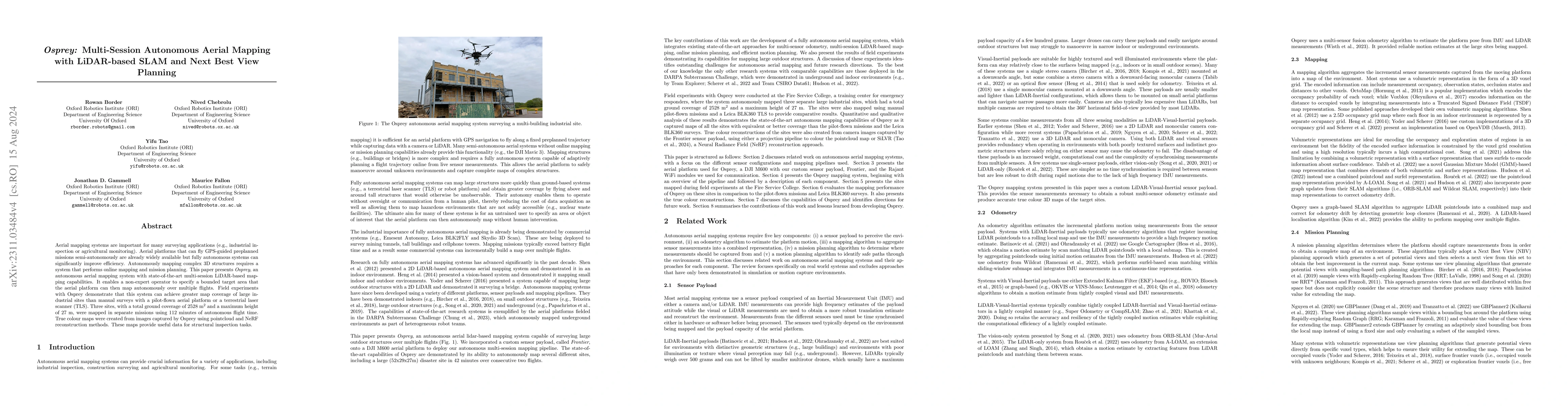
Aerial mapping systems are important for many surveying applications (e.g., industrial inspection or agricultural monitoring). Aerial platforms that can fly GPS-guided preplanned missions semi-auton...
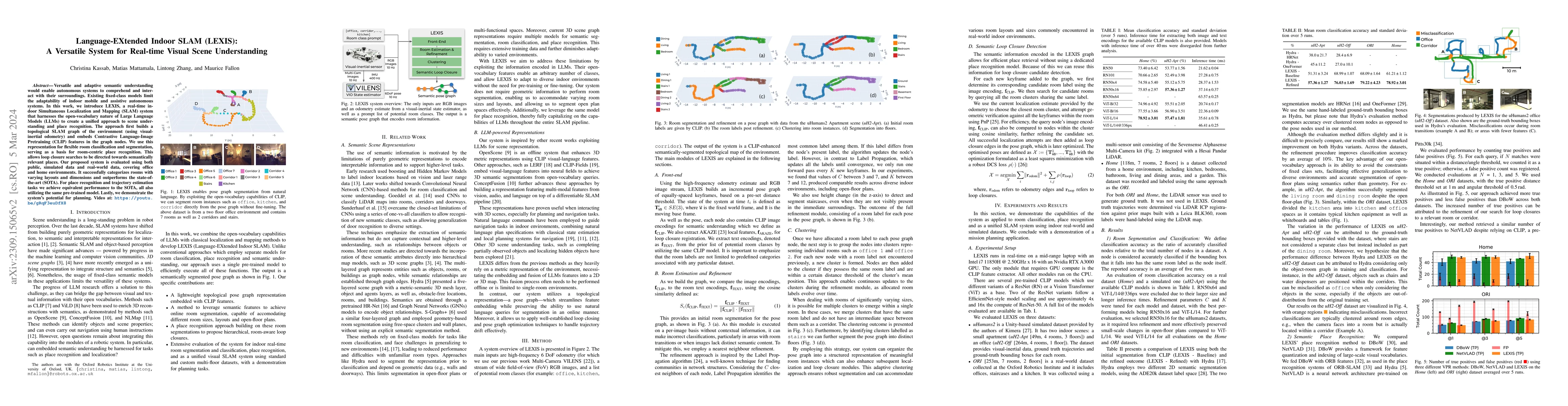
Versatile and adaptive semantic understanding would enable autonomous systems to comprehend and interact with their surroundings. Existing fixed-class models limit the adaptability of indoor mobile ...
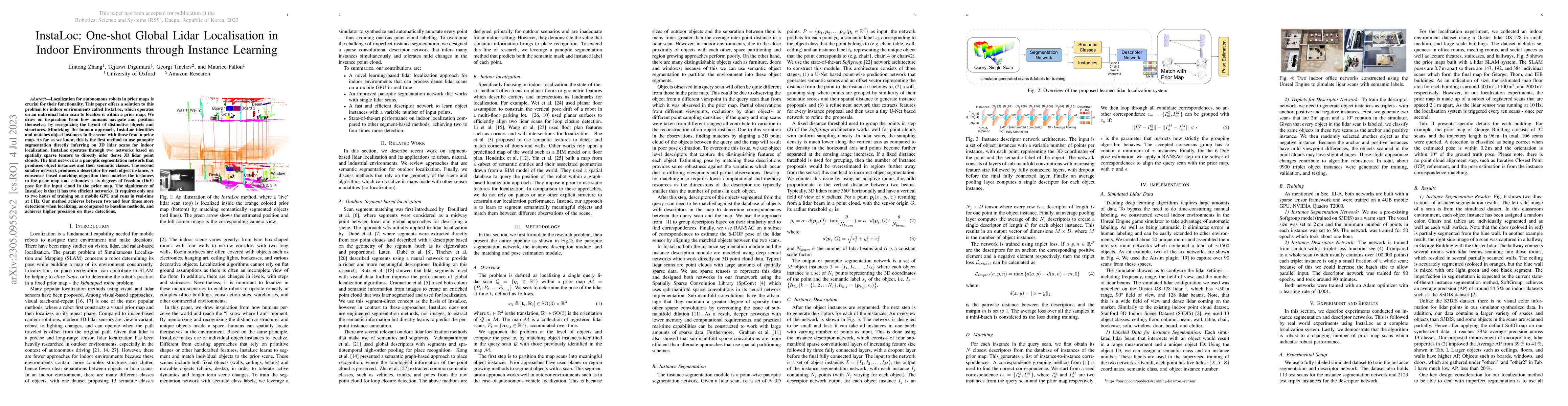
Localization for autonomous robots in prior maps is crucial for their functionality. This paper offers a solution to this problem for indoor environments called InstaLoc, which operates on an indivi...
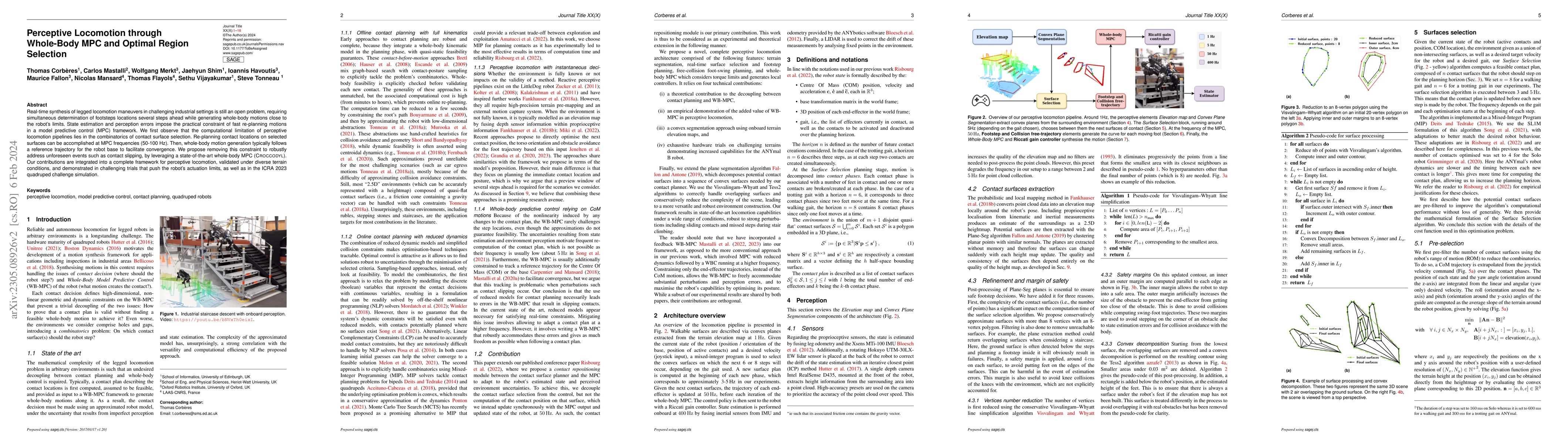
Real-time synthesis of legged locomotion maneuvers in challenging industrial settings is still an open problem, requiring simultaneous determination of footsteps locations several steps ahead while ...
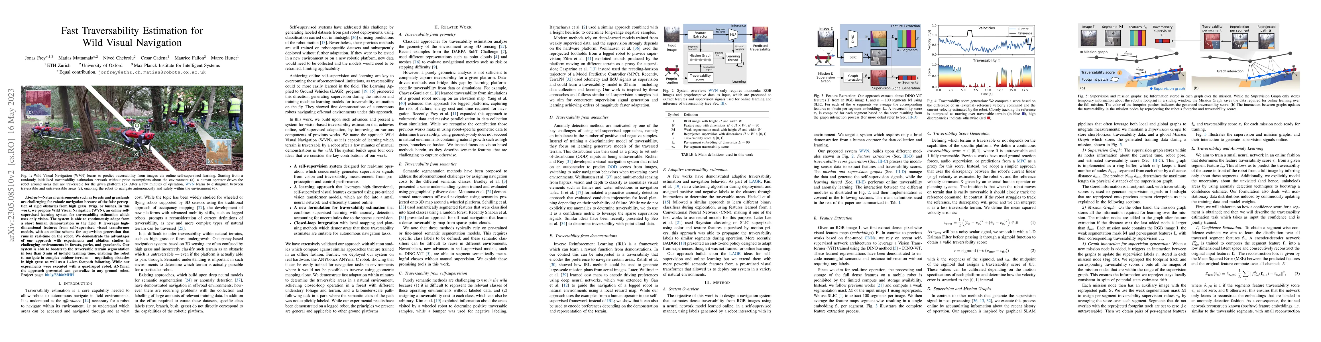
Natural environments such as forests and grasslands are challenging for robotic navigation because of the false perception of rigid obstacles from high grass, twigs, or bushes. In this work, we prop...
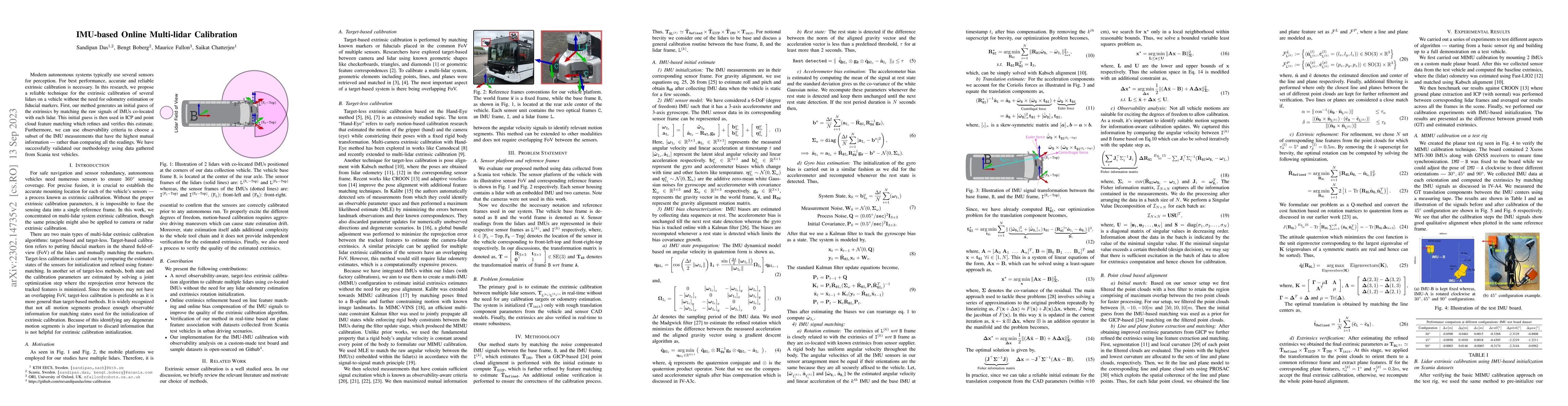
Modern autonomous systems typically use several sensors for perception. For best performance, accurate and reliable extrinsic calibration is necessary. In this research, we propose a reliable techni...
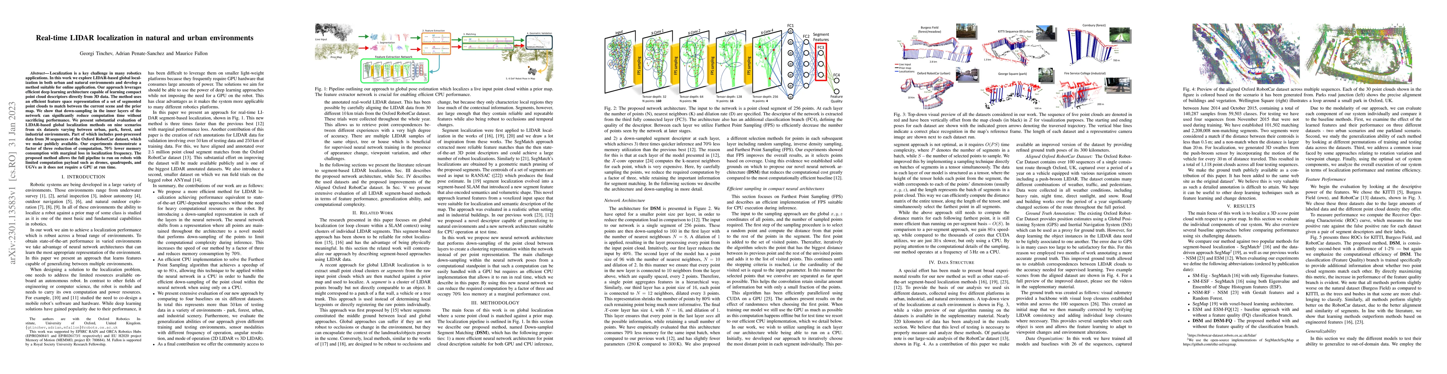
Localization is a key challenge in many robotics applications. In this work we explore LIDAR-based global localization in both urban and natural environments and develop a method suitable for online...
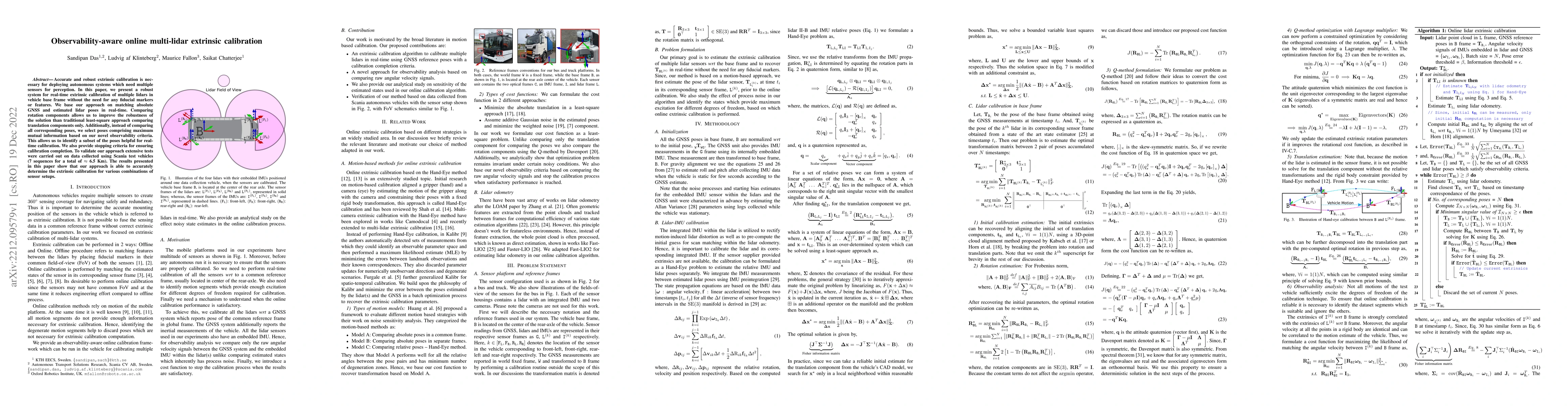
Accurate and robust extrinsic calibration is necessary for deploying autonomous systems which need multiple sensors for perception. In this paper, we present a robust system for real-time extrinsic ...
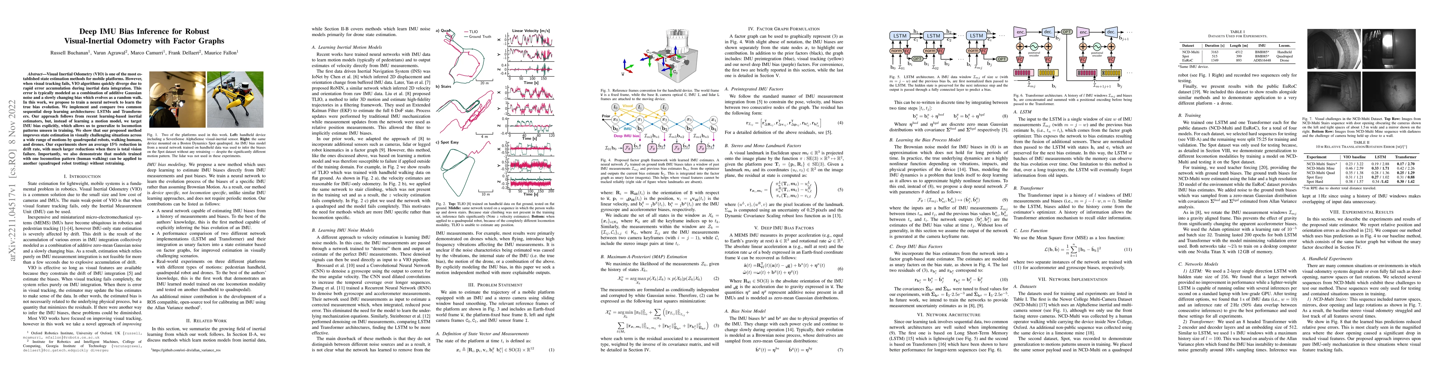
Visual Inertial Odometry (VIO) is one of the most established state estimation methods for mobile platforms. However, when visual tracking fails, VIO algorithms quickly diverge due to rapid error ac...
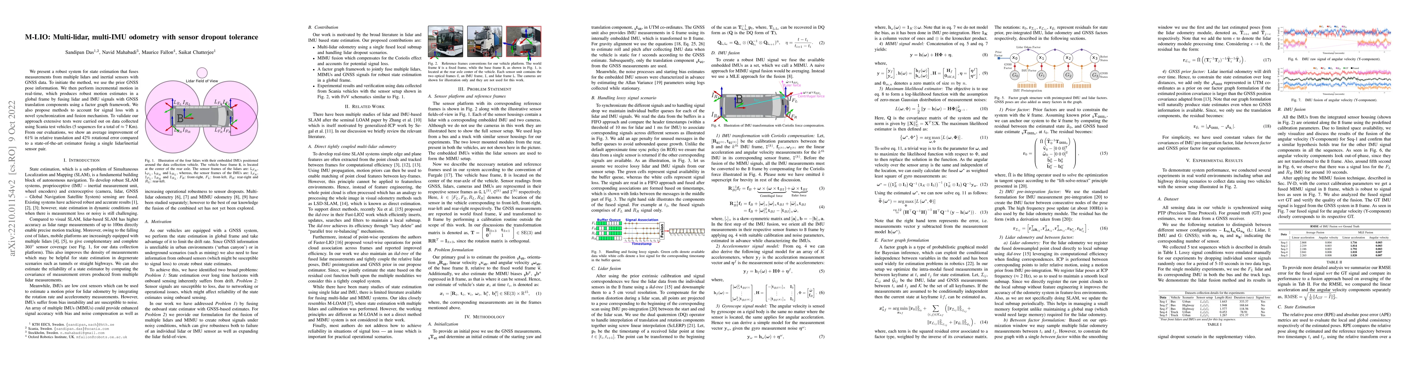
We present a robust system for state estimation that fuses measurements from multiple lidars and inertial sensors with GNSS data. To initiate the method, we use the prior GNSS pose information. We t...
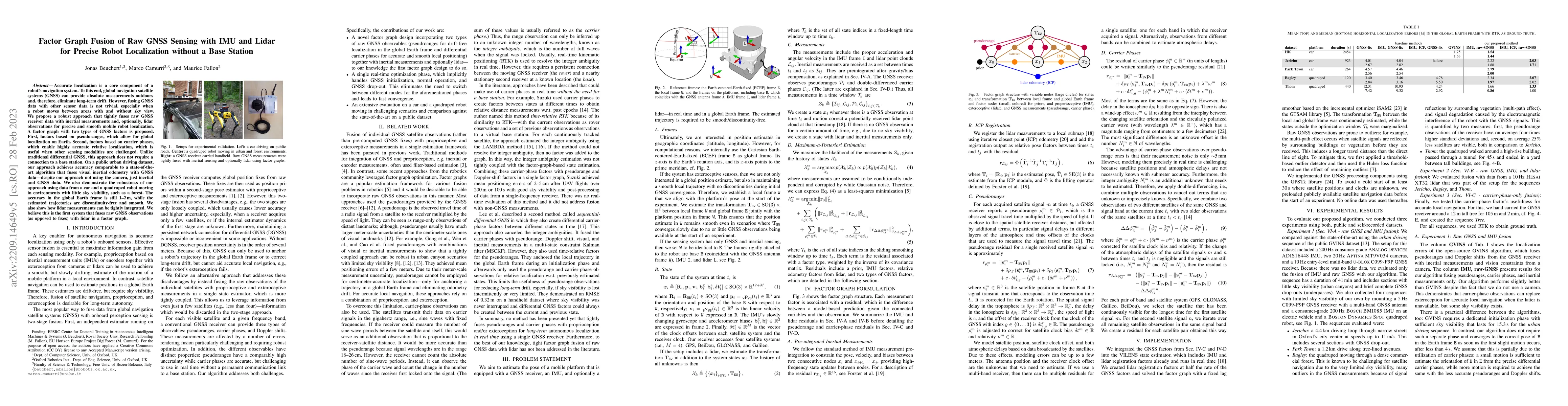
Accurate localization is a core component of a robot's navigation system. To this end, global navigation satellite systems (GNSS) can provide absolute measurements outdoors and, therefore, eliminate...
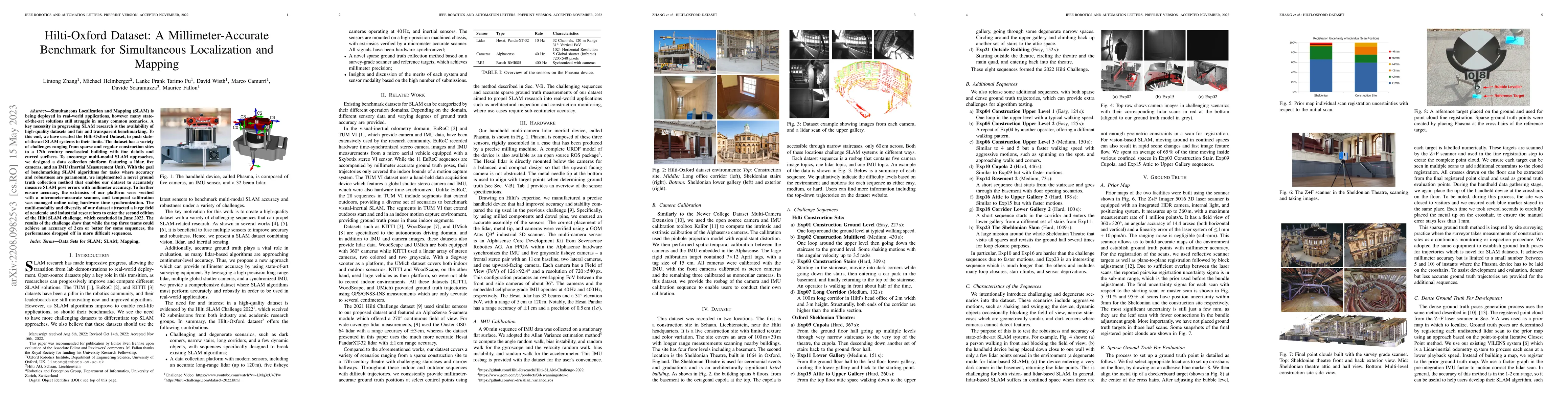
Simultaneous Localization and Mapping (SLAM) is being deployed in real-world applications, however many state-of-the-art solutions still struggle in many common scenarios. A key necessity in progres...
Safe motion planning in robotics requires planning into space which has been verified to be free of obstacles. However, obtaining such environment representations using lidars is challenging by virt...
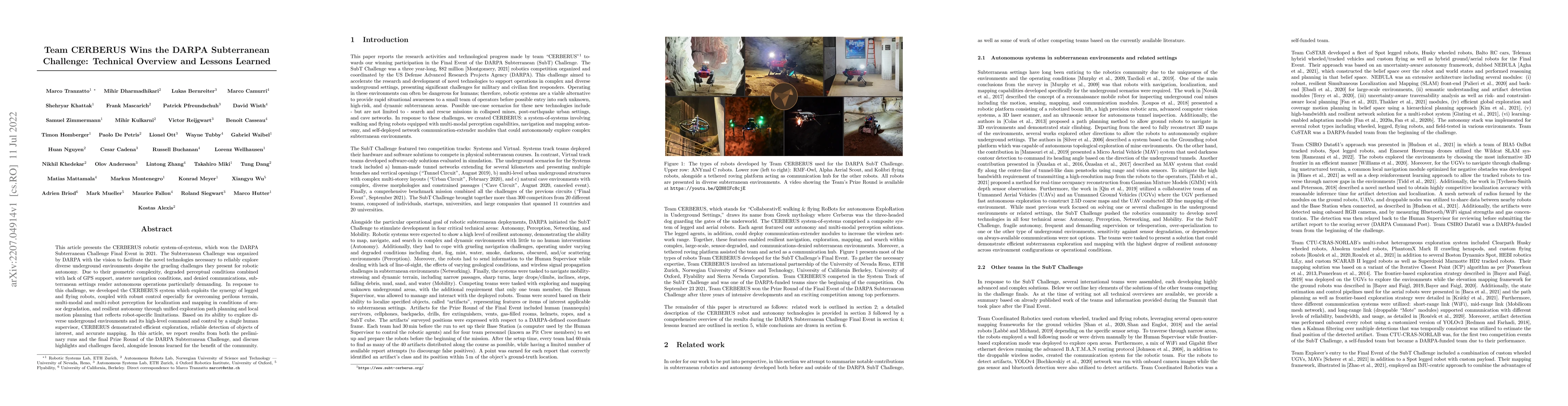
This article presents the CERBERUS robotic system-of-systems, which won the DARPA Subterranean Challenge Final Event in 2021. The Subterranean Challenge was organized by DARPA with the vision to fac...
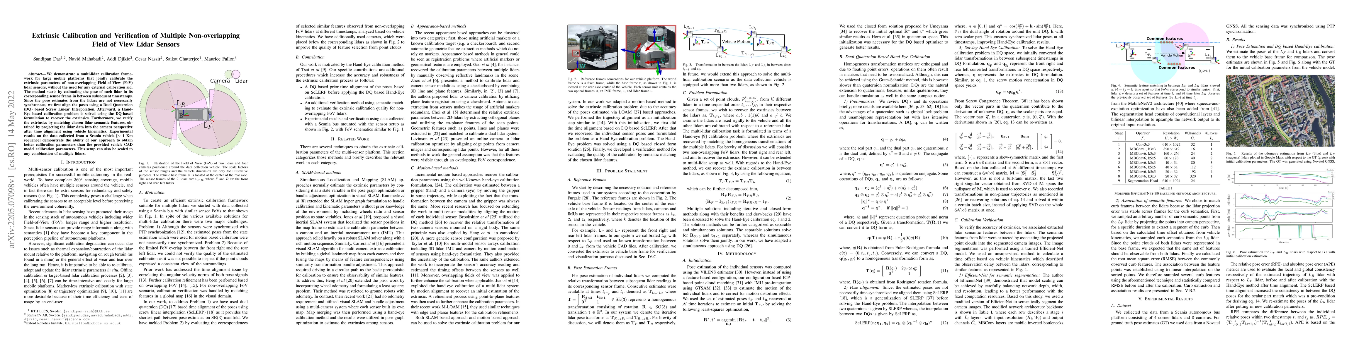
We demonstrate a multi-lidar calibration framework for large mobile platforms that jointly calibrate the extrinsic parameters of non-overlapping Field-of-View (FoV) lidar sensors, without the need f...
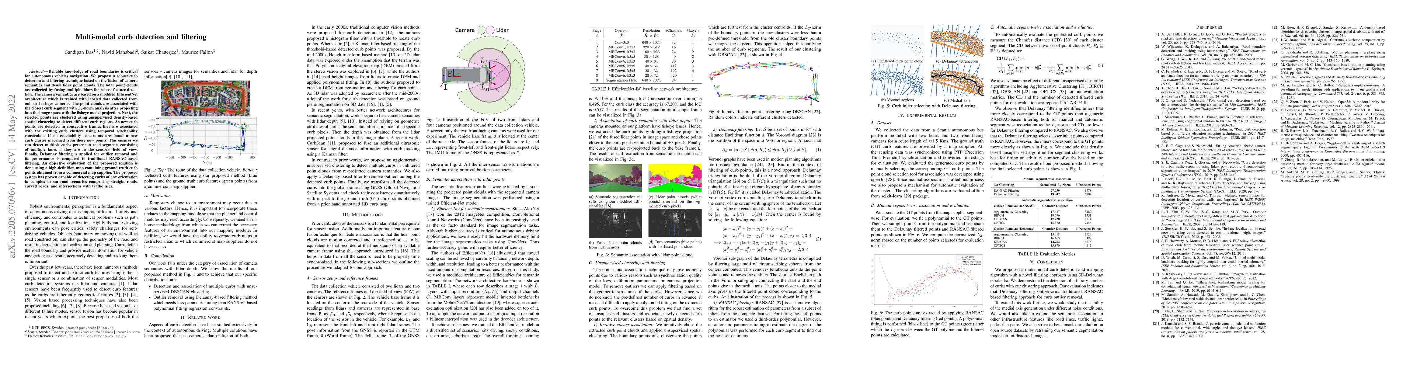
Reliable knowledge of road boundaries is critical for autonomous vehicle navigation. We propose a robust curb detection and filtering technique based on the fusion of camera semantics and dense lida...
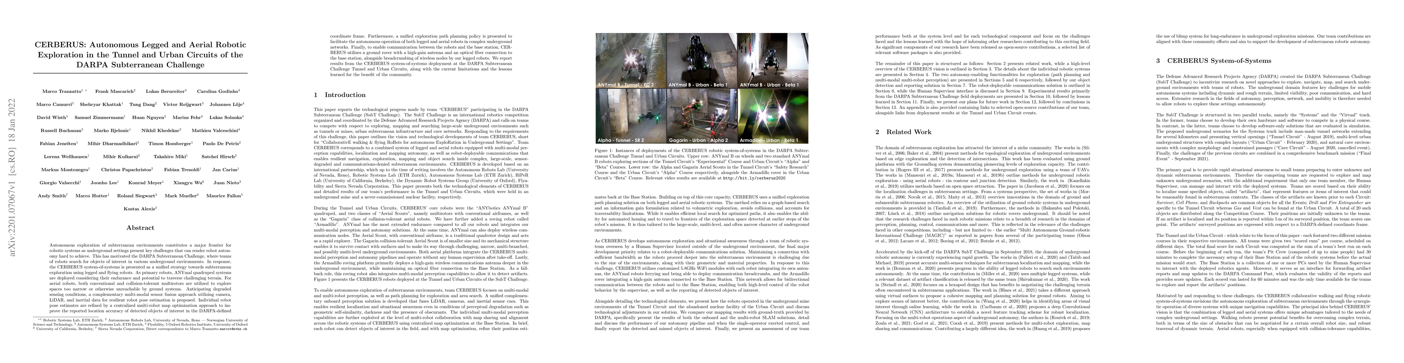
Autonomous exploration of subterranean environments constitutes a major frontier for robotic systems as underground settings present key challenges that can render robot autonomy hard to achieve. Th...
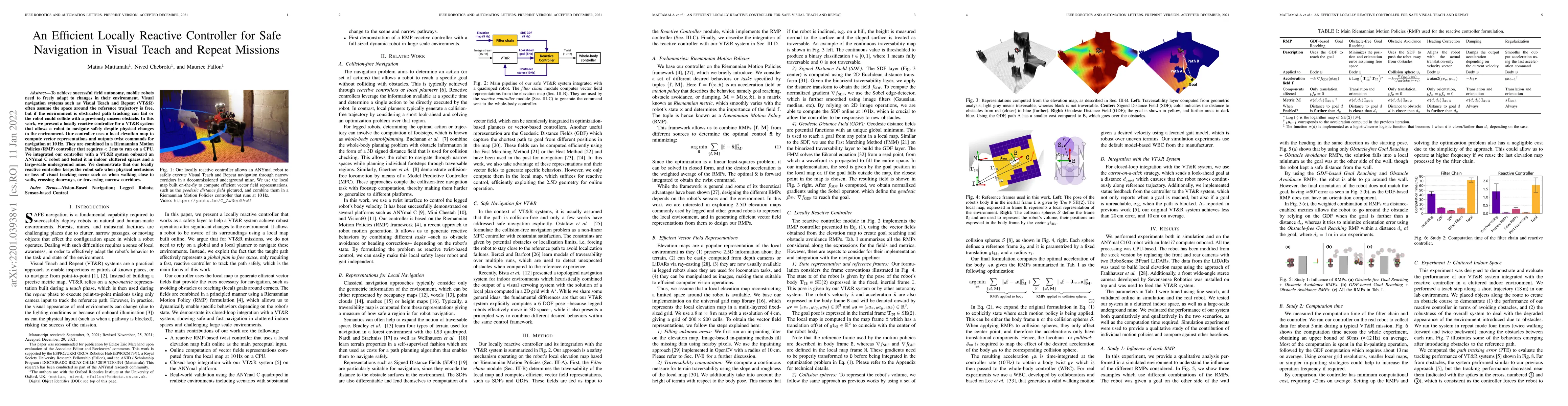
To achieve successful field autonomy, mobile robots need to freely adapt to changes in their environment. Visual navigation systems such as Visual Teach and Repeat (VT&R) often assume the space arou...
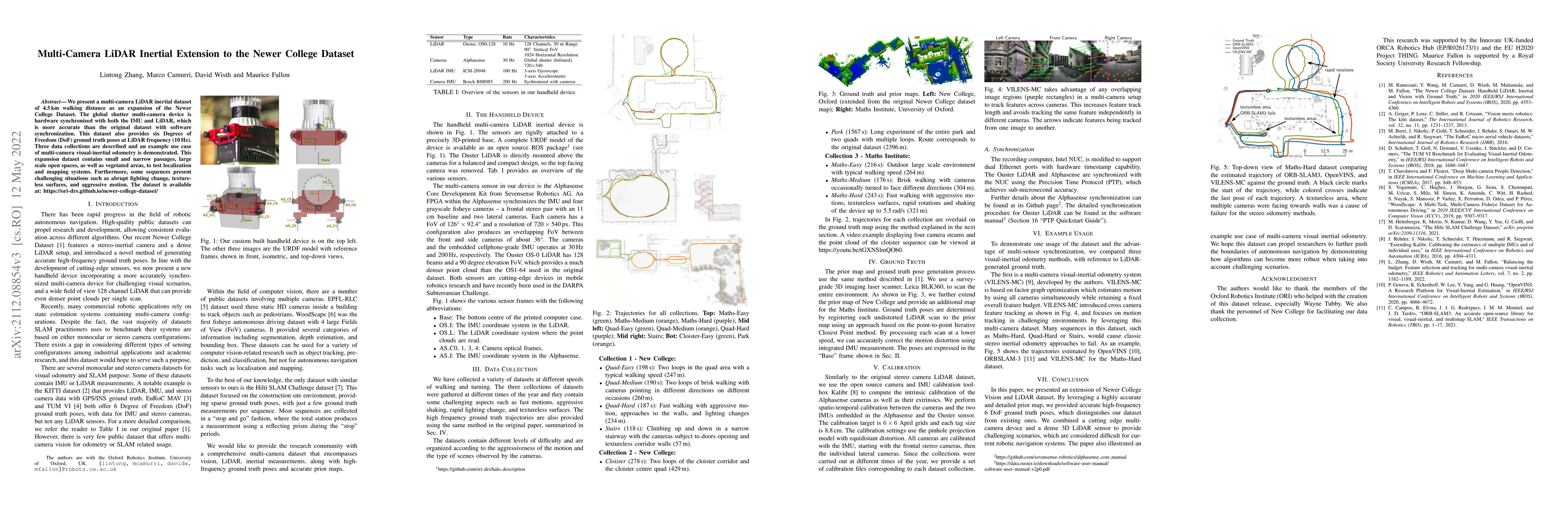
We present a multi-camera LiDAR inertial dataset of 4.5 km walking distance as an expansion of the Newer College Dataset. The global shutter multi-camera device is hardware synchronized with both th...
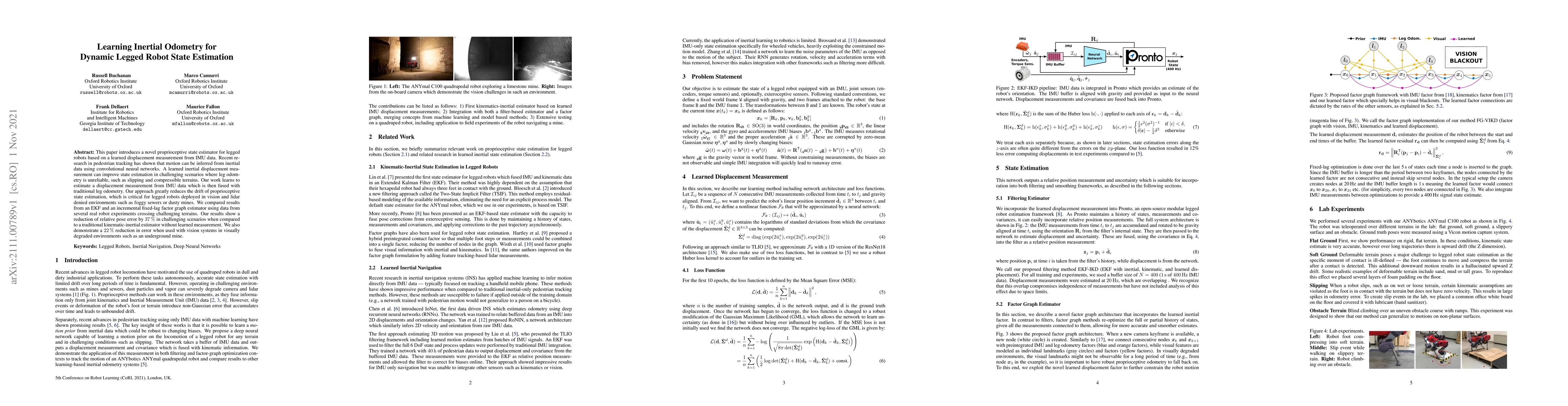
This paper introduces a novel proprioceptive state estimator for legged robots based on a learned displacement measurement from IMU data. Recent research in pedestrian tracking has shown that motion...
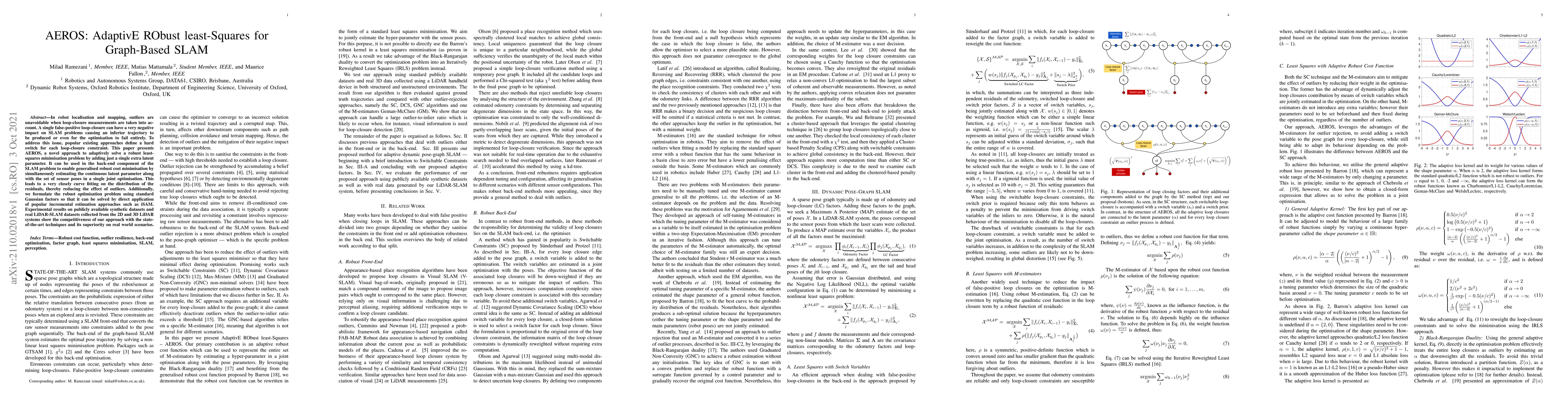
In robot localisation and mapping, outliers are unavoidable when loop-closure measurements are taken into account. A single false-positive loop-closure can have a very negative impact on SLAM proble...
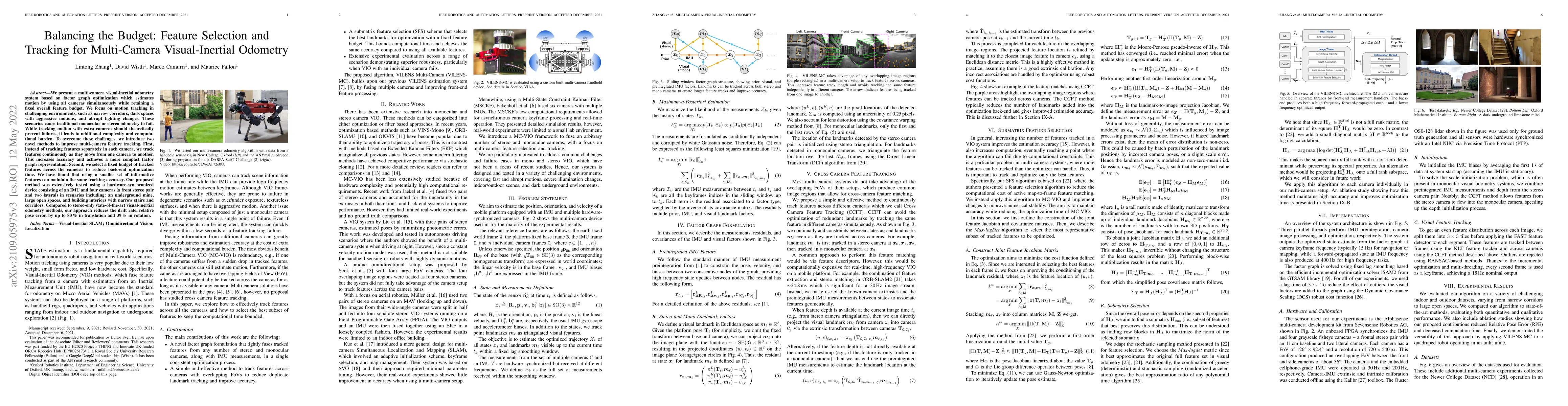
We present a multi-camera visual-inertial odometry system based on factor graph optimization which estimates motion by using all cameras simultaneously while retaining a fixed overall feature budget...
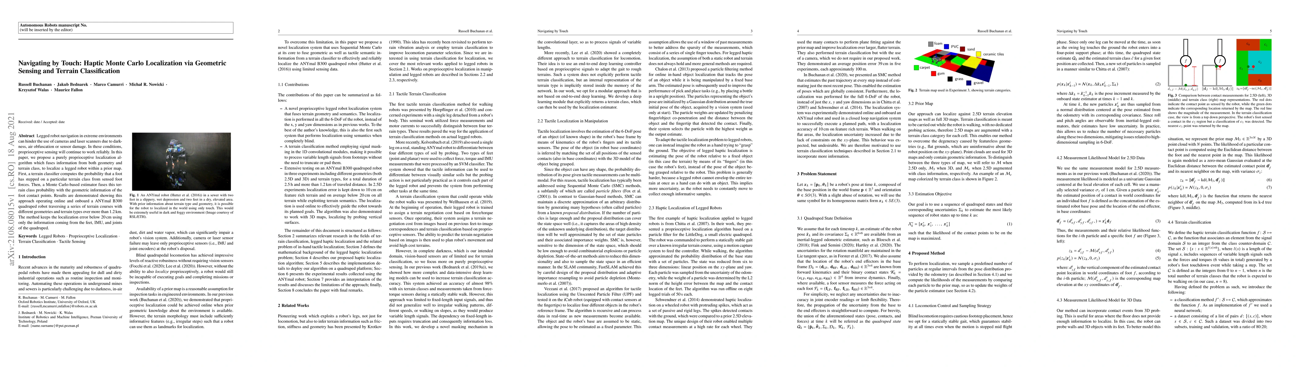
Legged robot navigation in extreme environments can hinder the use of cameras and laser scanners due to darkness, air obfuscation or sensor damage. In these conditions, proprioceptive sensing will c...
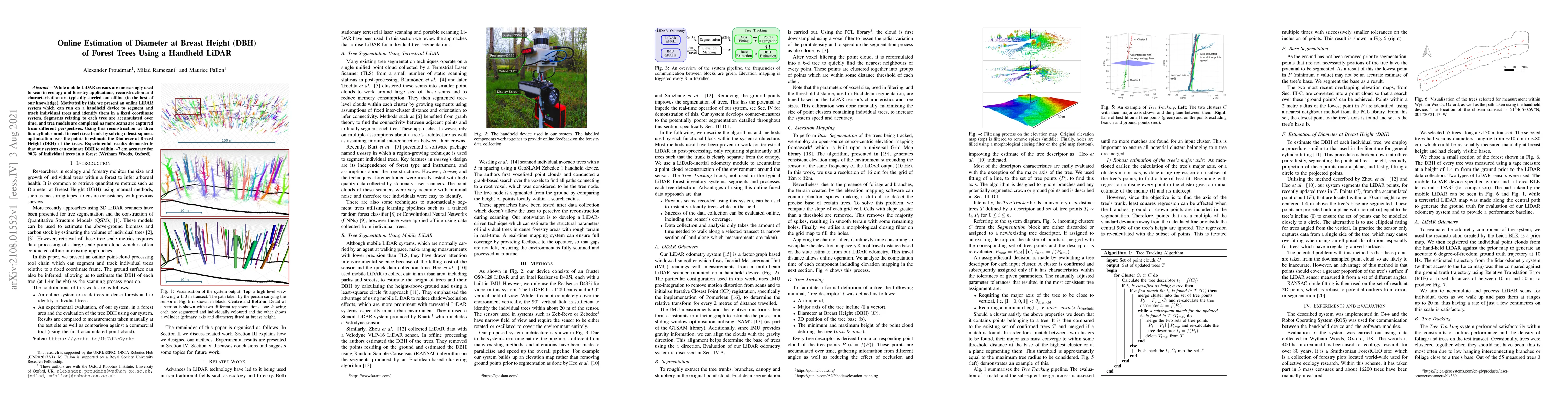
While mobile LiDAR sensors are increasingly used to scan in ecology and forestry applications, reconstruction and characterisation are typically carried out offline (to the best of our knowledge). M...
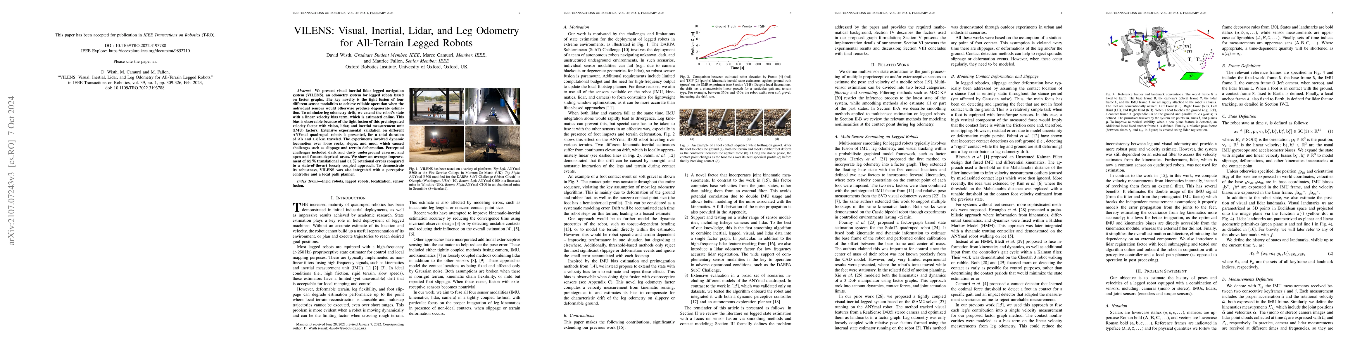
We present VILENS (Visual Inertial Lidar Legged Navigation System), an odometry system for legged robots based on factor graphs. The key novelty is the tight fusion of four different sensor modaliti...
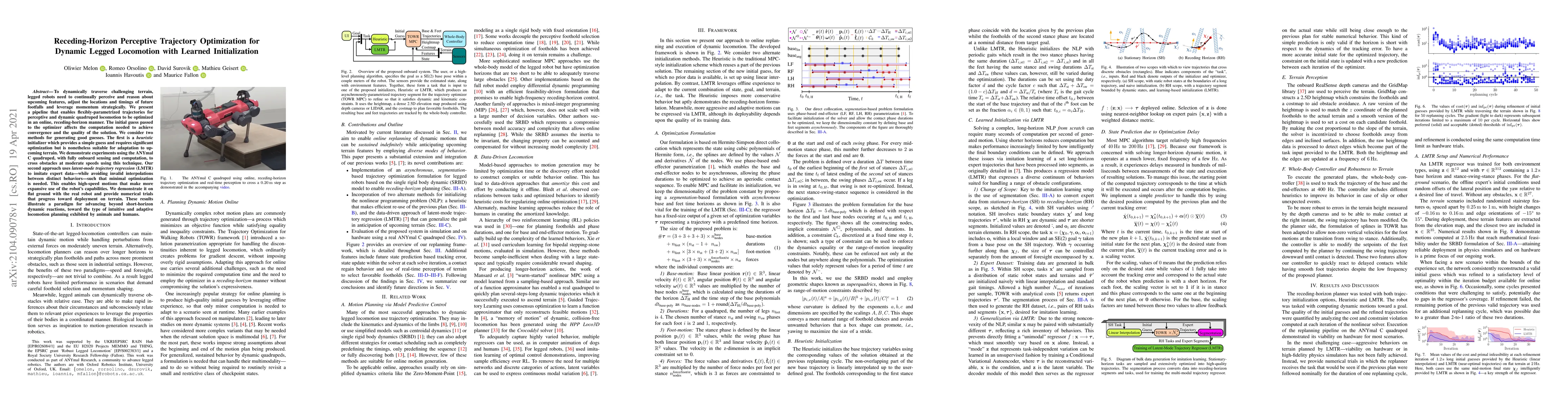
To dynamically traverse challenging terrain, legged robots need to continually perceive and reason about upcoming features, adjust the locations and timings of future footfalls and leverage momentum...
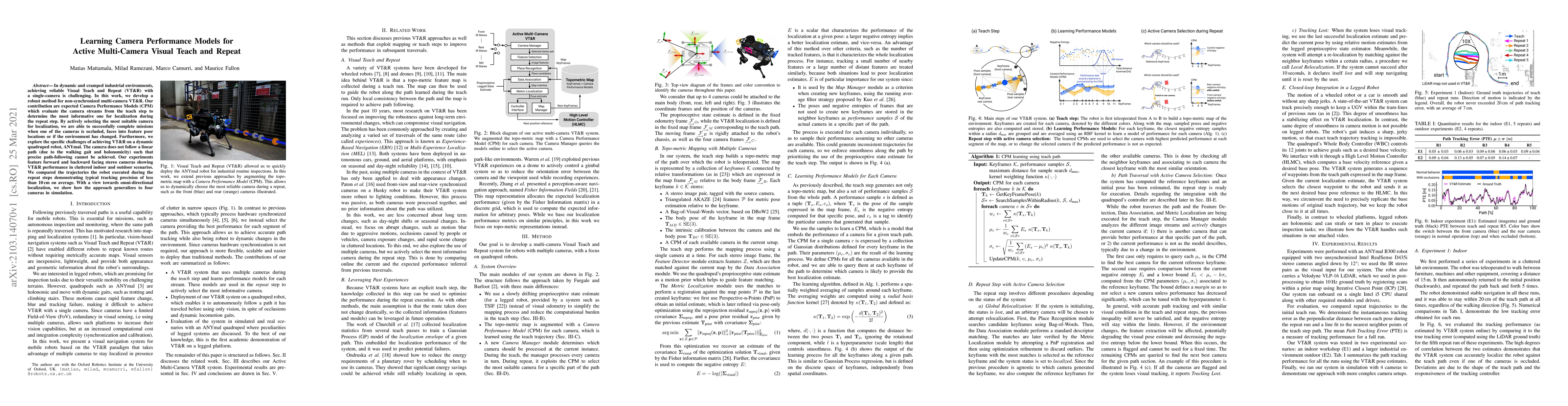
In dynamic and cramped industrial environments, achieving reliable Visual Teach and Repeat (VT&R) with a single-camera is challenging. In this work, we develop a robust method for non-synchronized m...
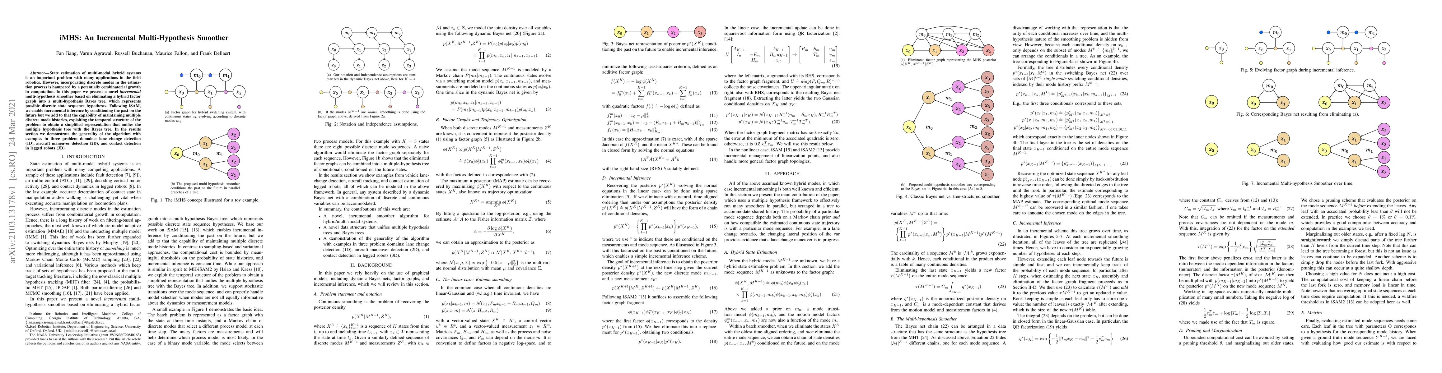
State estimation of multi-modal hybrid systems is an important problem with many applications in the field robotics. However, incorporating discrete modes in the estimation process is hampered by a ...
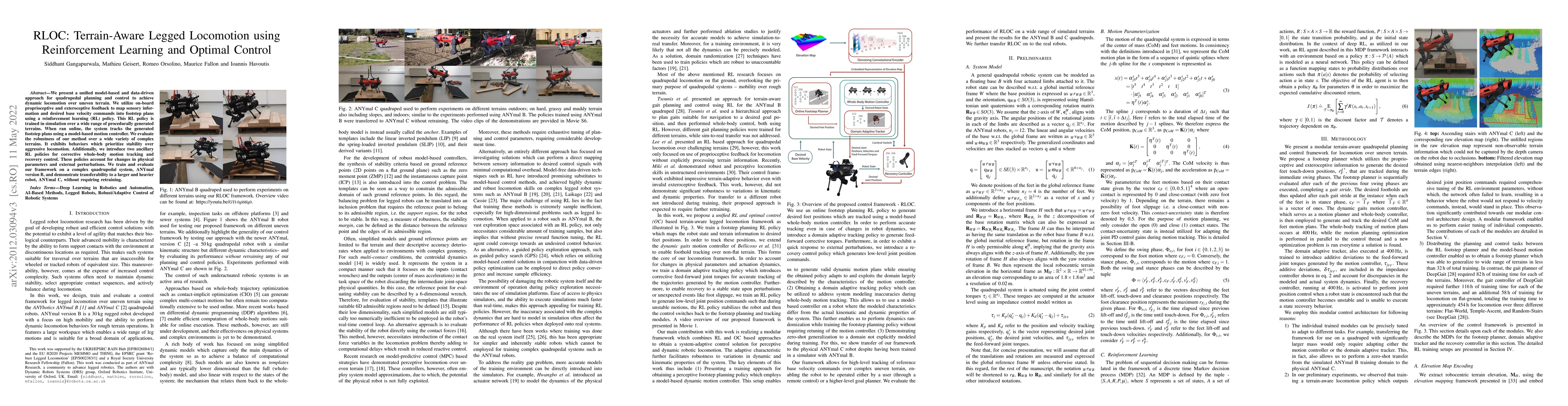
We present a unified model-based and data-driven approach for quadrupedal planning and control to achieve dynamic locomotion over uneven terrain. We utilize on-board proprioceptive and exteroceptive...
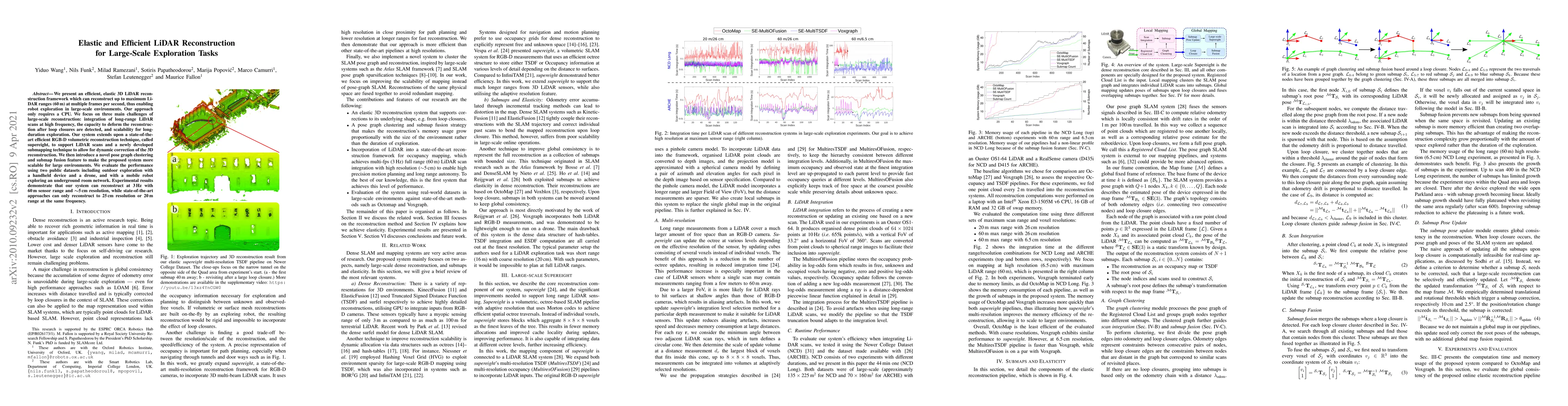
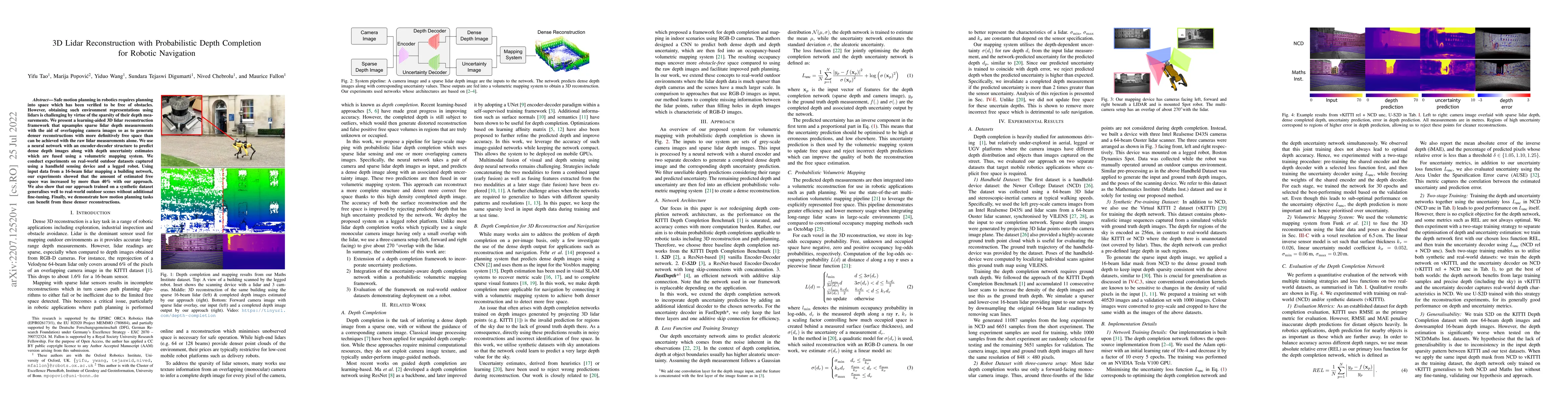
We present an efficient, elastic 3D LiDAR reconstruction framework which can reconstruct up to maximum LiDAR ranges (60 m) at multiple frames per second, thus enabling robot exploration in large-sca...
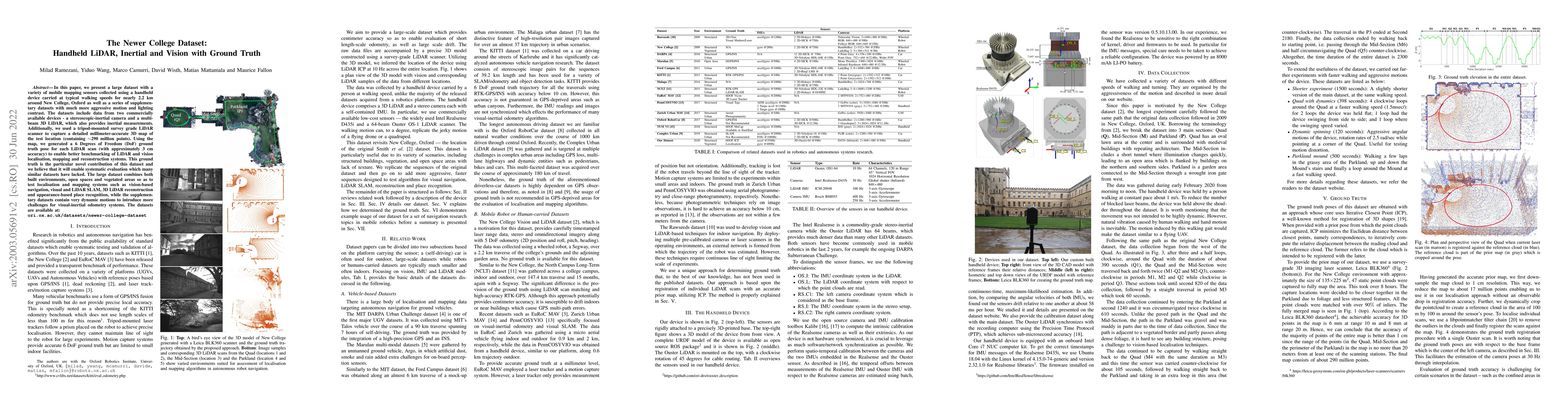
In this paper we present a large dataset with a variety of mobile mapping sensors collected using a handheld device carried at typical walking speeds for nearly 2.2 km through New College, Oxford. T...
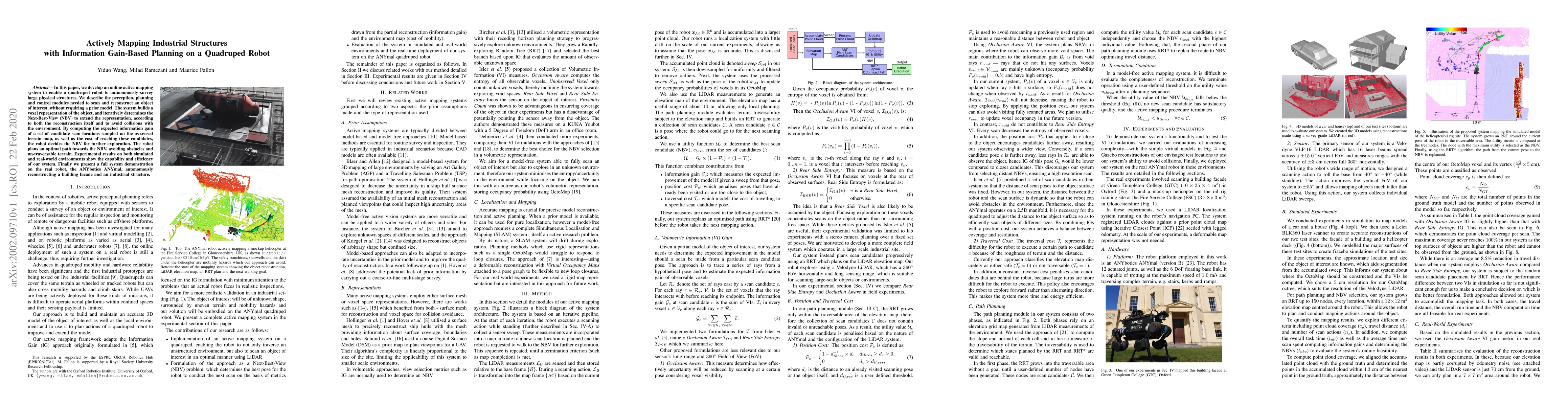
In this paper, we develop an online active mapping system to enable a quadruped robot to autonomously survey large physical structures. We describe the perception, planning and control modules neede...
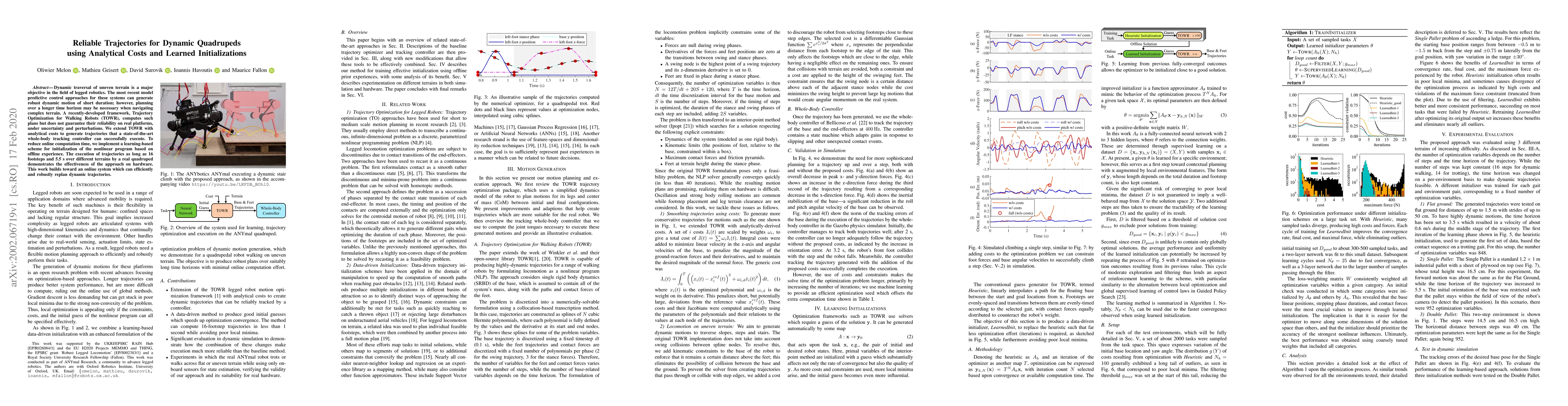
Dynamic traversal of uneven terrain is a major objective in the field of legged robotics. The most recent model predictive control approaches for these systems can generate robust dynamic motion of ...
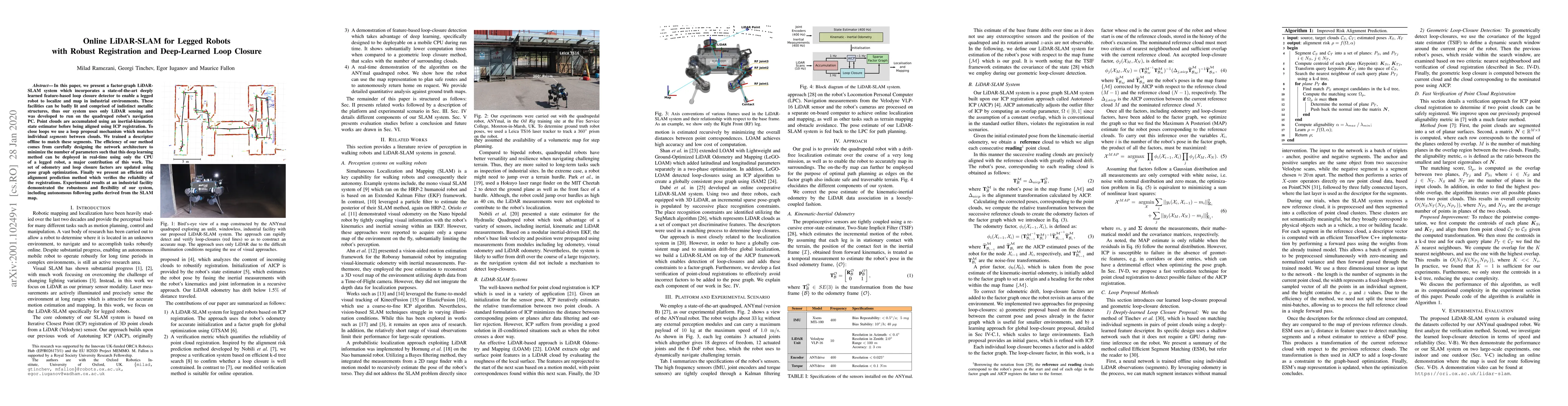
In this paper, we present a factor-graph LiDAR-SLAM system which incorporates a state-of-the-art deeply learned feature-based loop closure detector to enable a legged robot to localize and map in in...
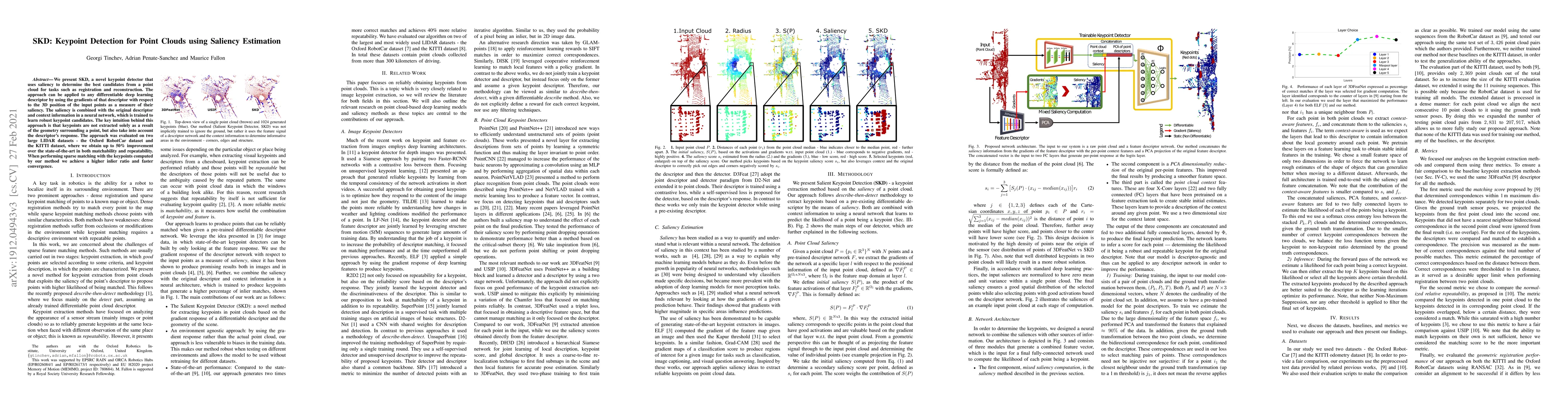
We present SKD, a novel keypoint detector that uses saliency to determine the best candidates from a point cloud for tasks such as registration and reconstruction. The approach can be applied to any...
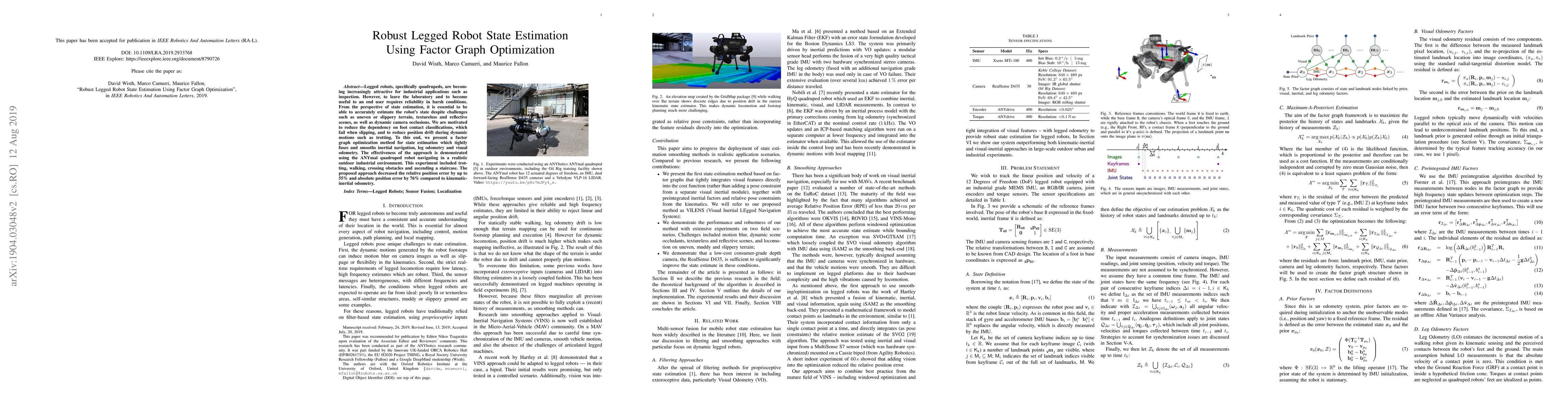
Legged robots, specifically quadrupeds, are becoming increasingly attractive for industrial applications such as inspection. However, to leave the laboratory and to become useful to an end user requ...
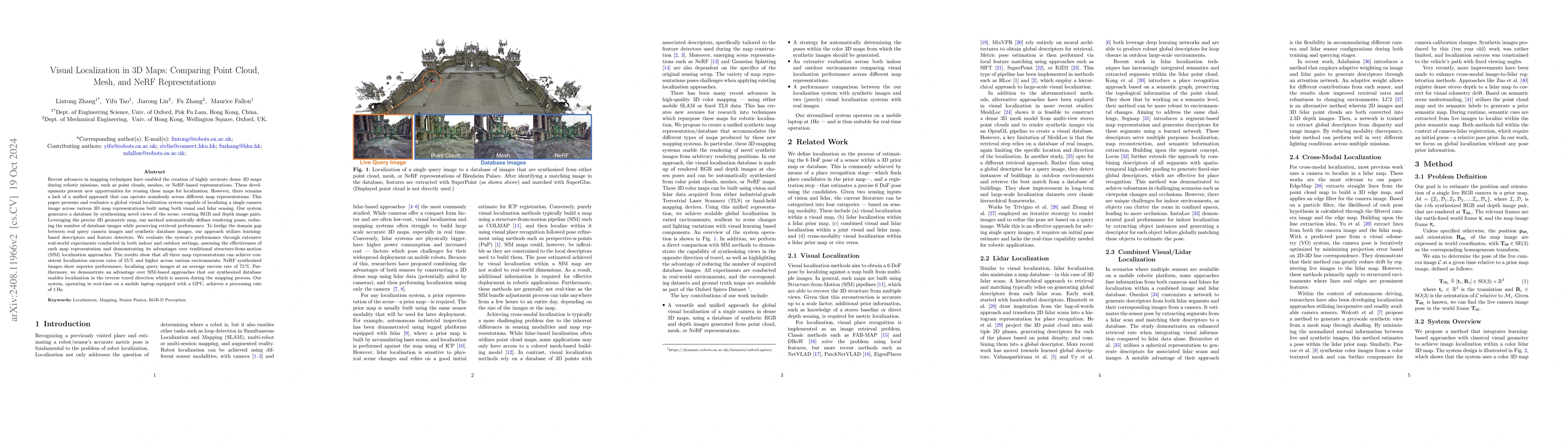
This paper introduces and assesses a cross-modal global visual localization system that can localize camera images within a color 3D map representation built using both visual and lidar sensing. We pr...
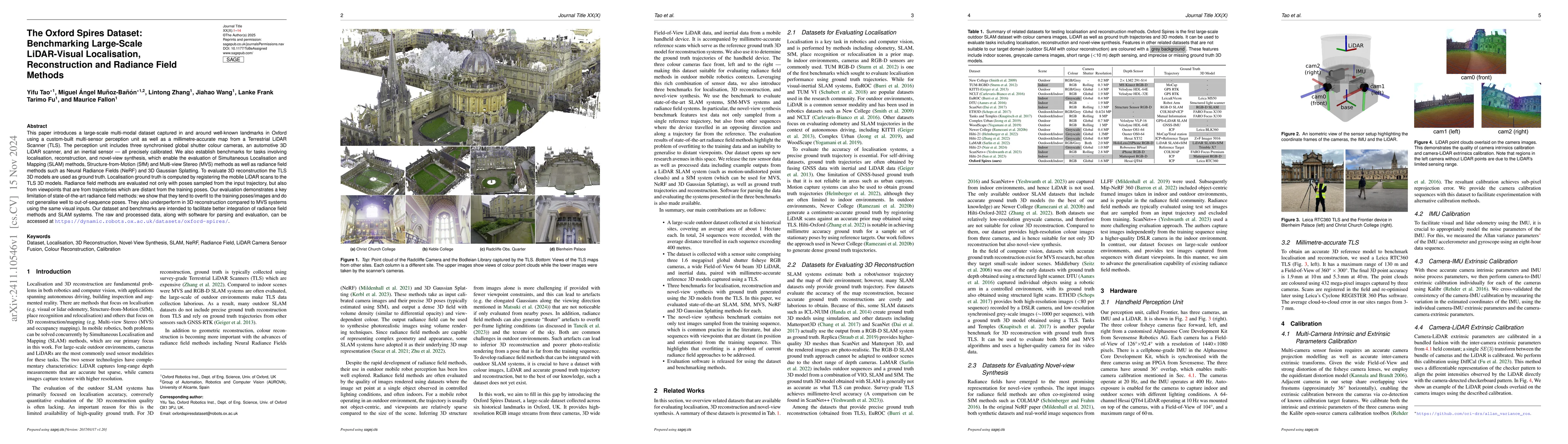
This paper introduces a large-scale multi-modal dataset captured in and around well-known landmarks in Oxford using a custom-built multi-sensor perception unit as well as a millimetre-accurate map fro...
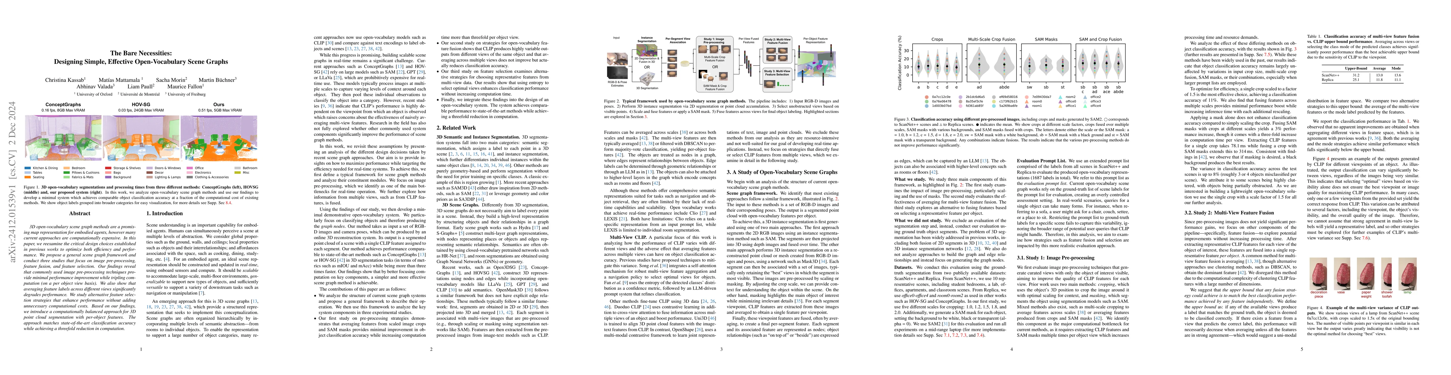
3D open-vocabulary scene graph methods are a promising map representation for embodied agents, however many current approaches are computationally expensive. In this paper, we reexamine the critical d...
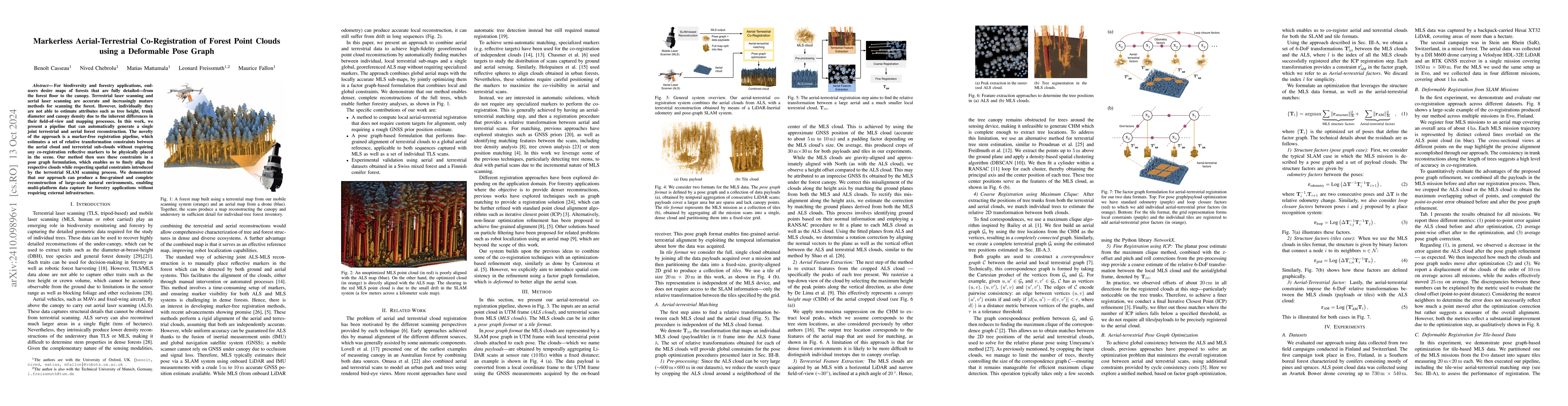
For biodiversity and forestry applications, end-users desire maps of forests that are fully detailed, from the forest floor to the canopy. Terrestrial laser scanning and aerial laser scanning are accu...
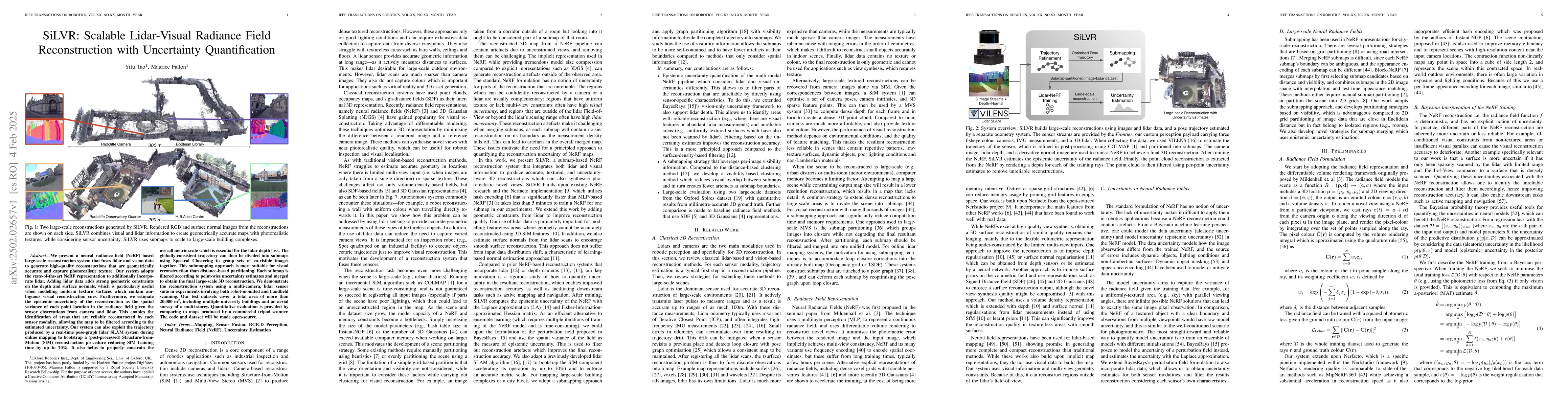
We present a neural radiance field (NeRF) based large-scale reconstruction system that fuses lidar and vision data to generate high-quality reconstructions that are geometrically accurate and capture ...
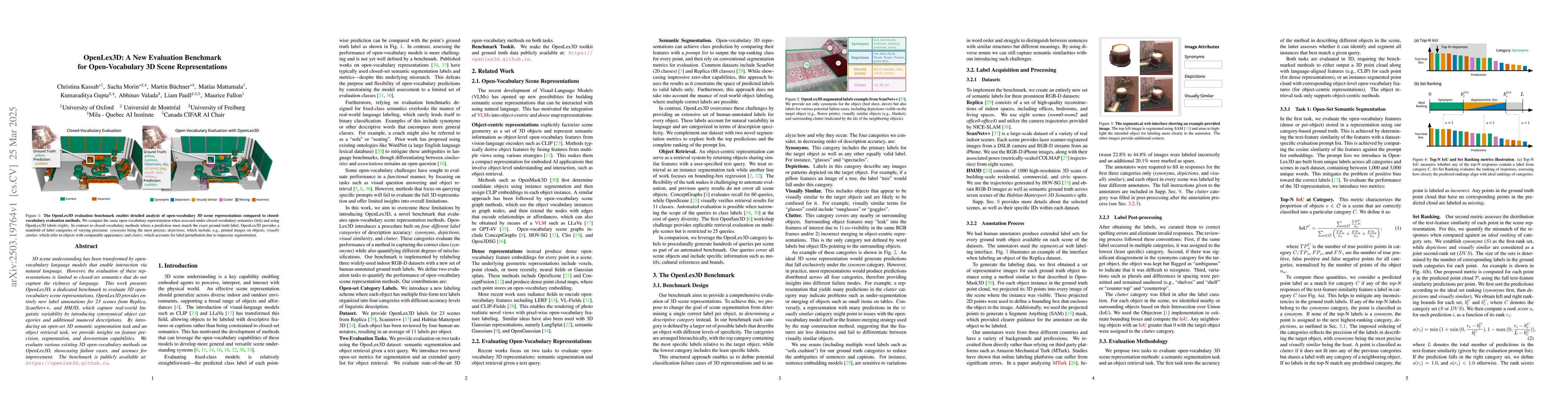
3D scene understanding has been transformed by open-vocabulary language models that enable interaction via natural language. However, the evaluation of these representations is limited to closed-set s...
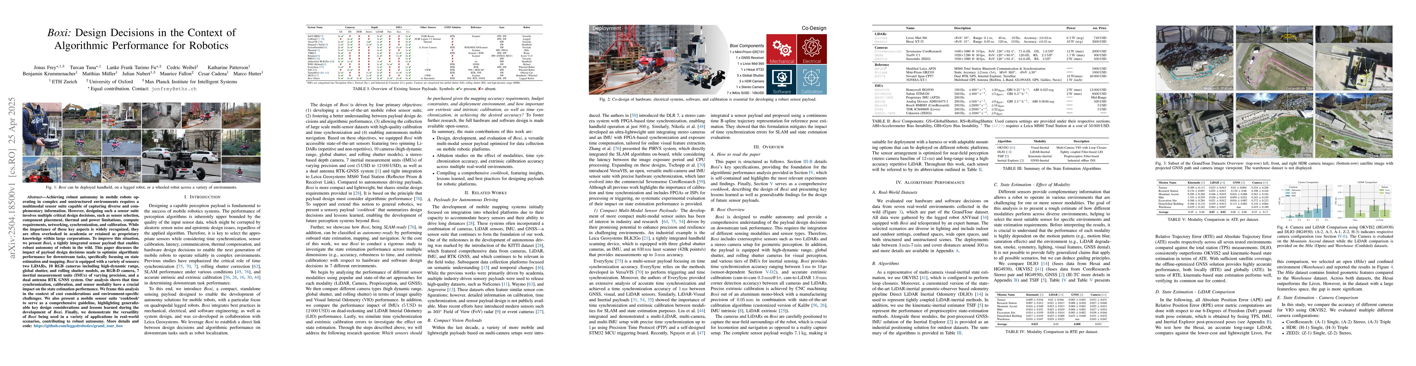
Achieving robust autonomy in mobile robots operating in complex and unstructured environments requires a multimodal sensor suite capable of capturing diverse and complementary information. However, de...
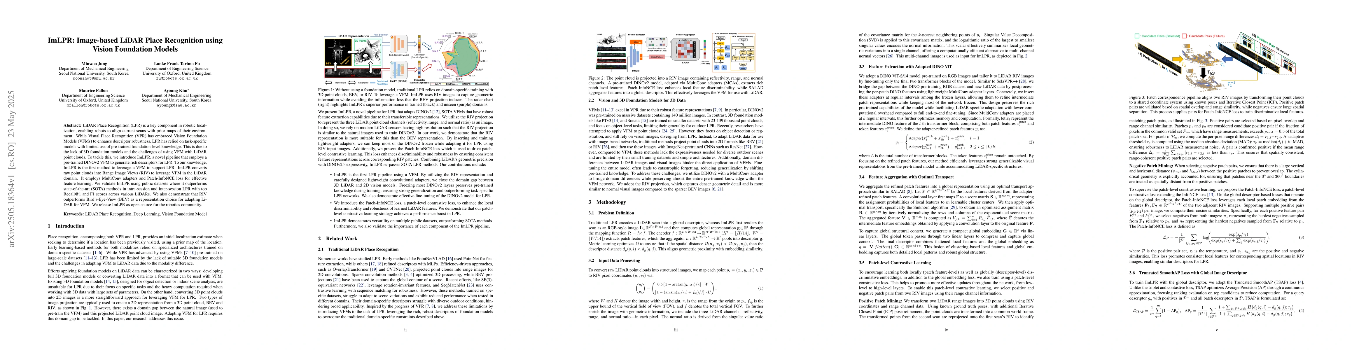
LiDAR Place Recognition (LPR) is a key component in robotic localization, enabling robots to align current scans with prior maps of their environment. While Visual Place Recognition (VPR) has embraced...
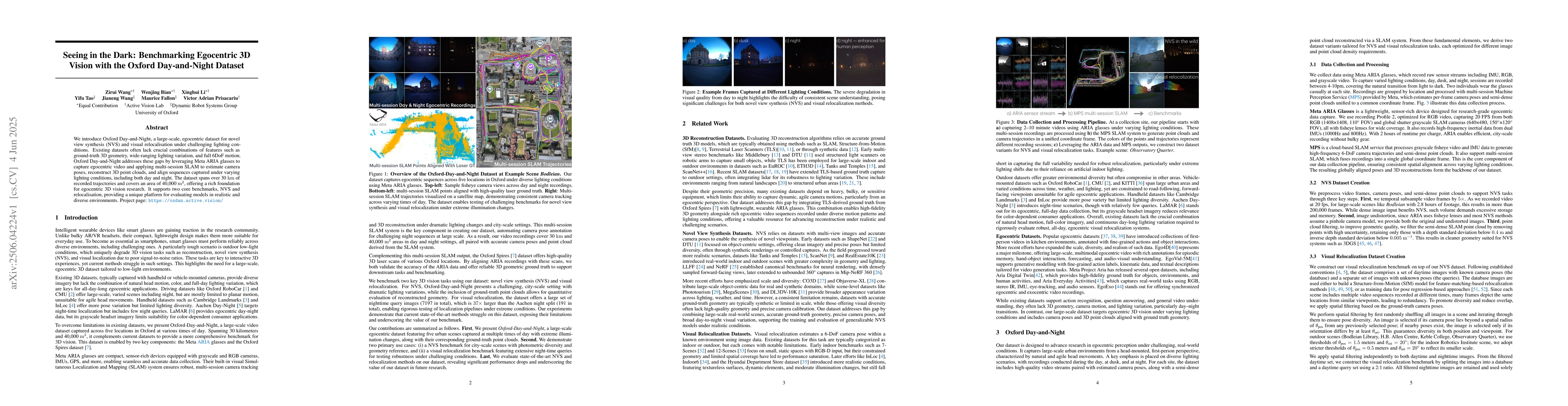
We introduce Oxford Day-and-Night, a large-scale, egocentric dataset for novel view synthesis (NVS) and visual relocalisation under challenging lighting conditions. Existing datasets often lack crucia...
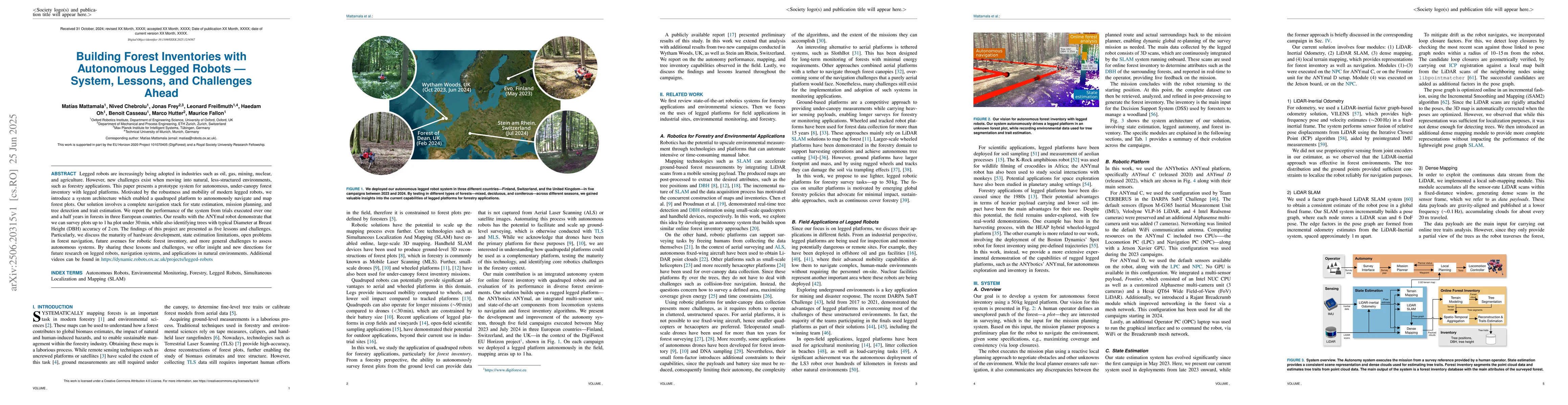
Legged robots are increasingly being adopted in industries such as oil, gas, mining, nuclear, and agriculture. However, new challenges exist when moving into natural, less-structured environments, suc...
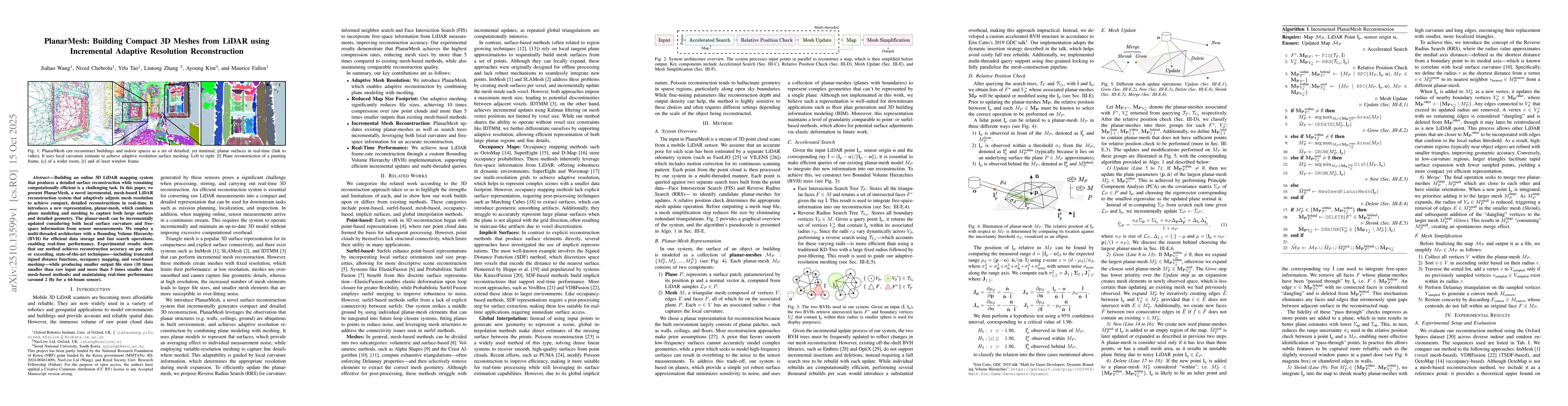
Building an online 3D LiDAR mapping system that produces a detailed surface reconstruction while remaining computationally efficient is a challenging task. In this paper, we present PlanarMesh, a nove...
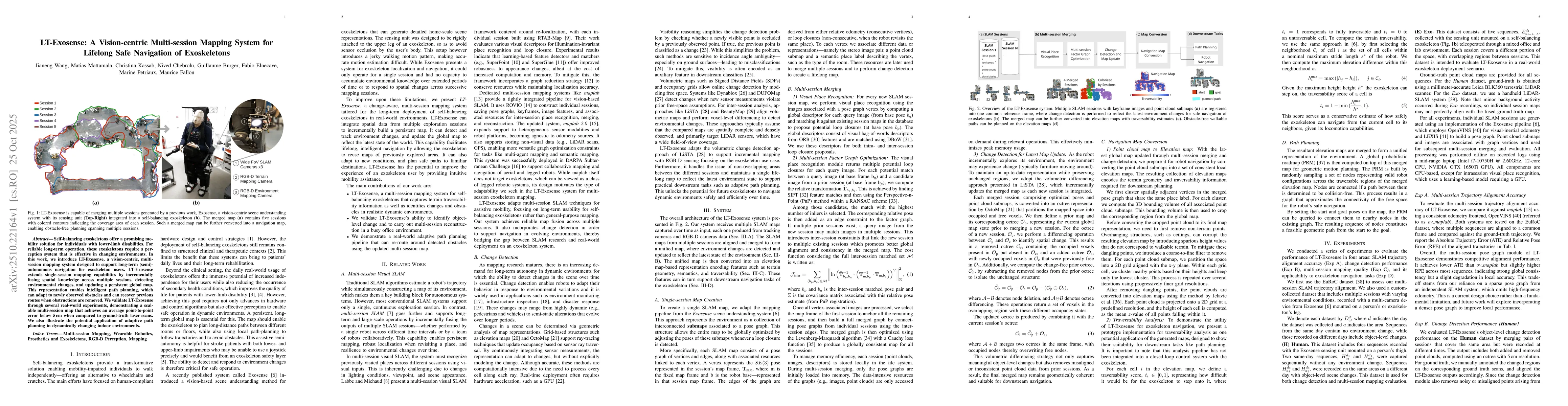
Self-balancing exoskeletons offer a promising mobility solution for individuals with lower-limb disabilities. For reliable long-term operation, these exoskeletons require a perception system that is e...
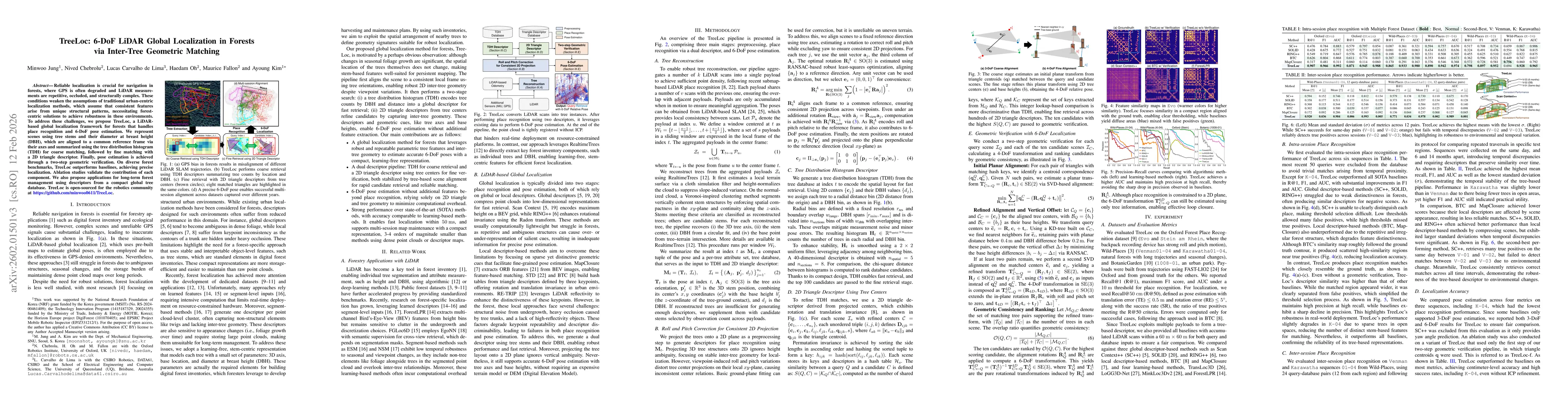
Reliable localization is crucial for navigation in forests, where GPS is often degraded and LiDAR measurements are repetitive, occluded, and structurally complex. These conditions weaken the assumptio...
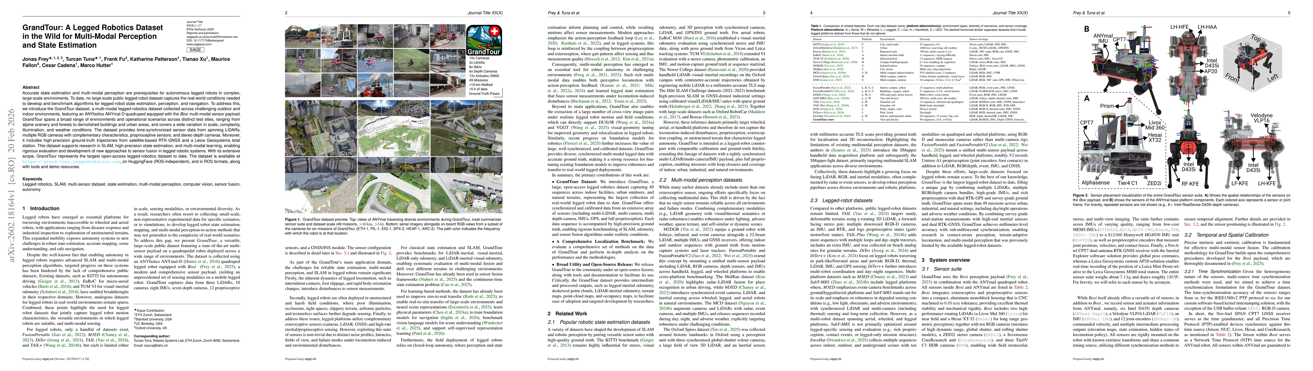
Accurate state estimation and multi-modal perception are prerequisites for autonomous legged robots in complex, large-scale environments. To date, no large-scale public legged-robot dataset captures t...
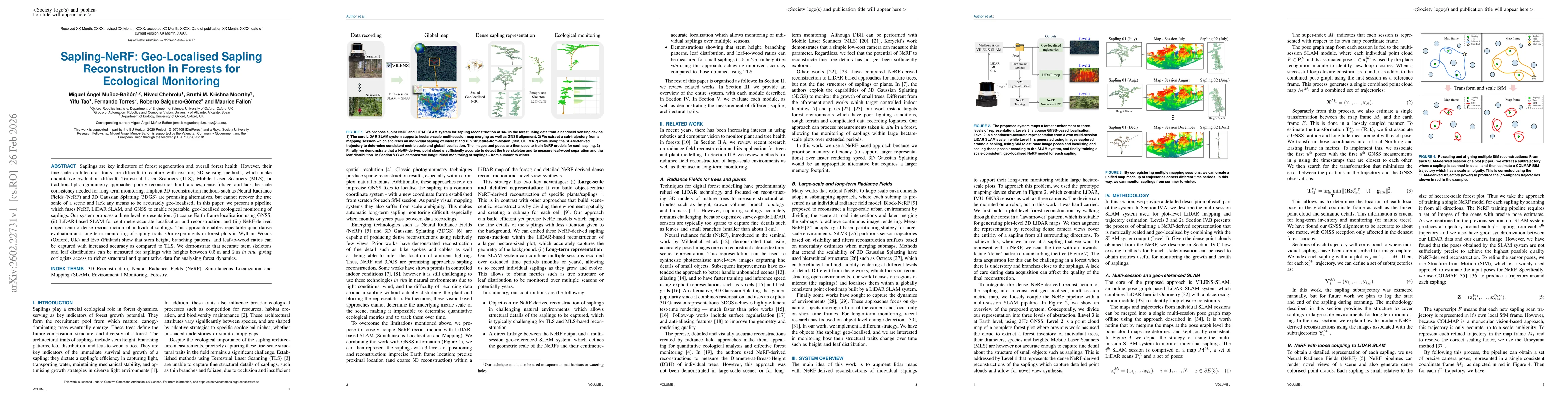
Saplings are key indicators of forest regeneration and overall forest health. However, their fine-scale architectural traits are difficult to capture with existing 3D sensing methods, which make quant...
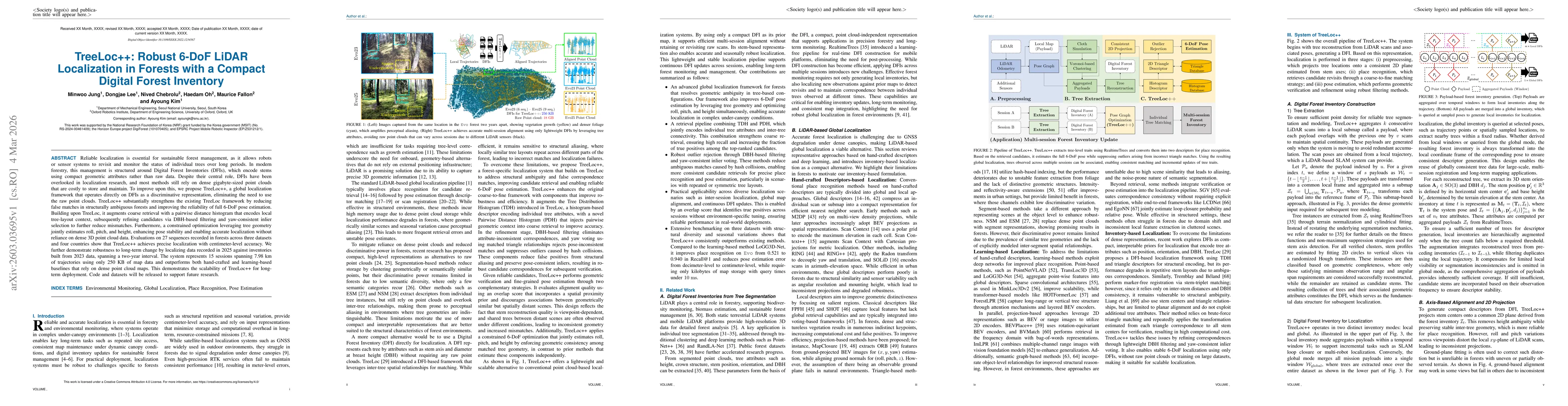
Reliable localization is essential for sustainable forest management, as it allows robots or sensor systems to revisit and monitor the status of individual trees over long periods. In modern forestry,...
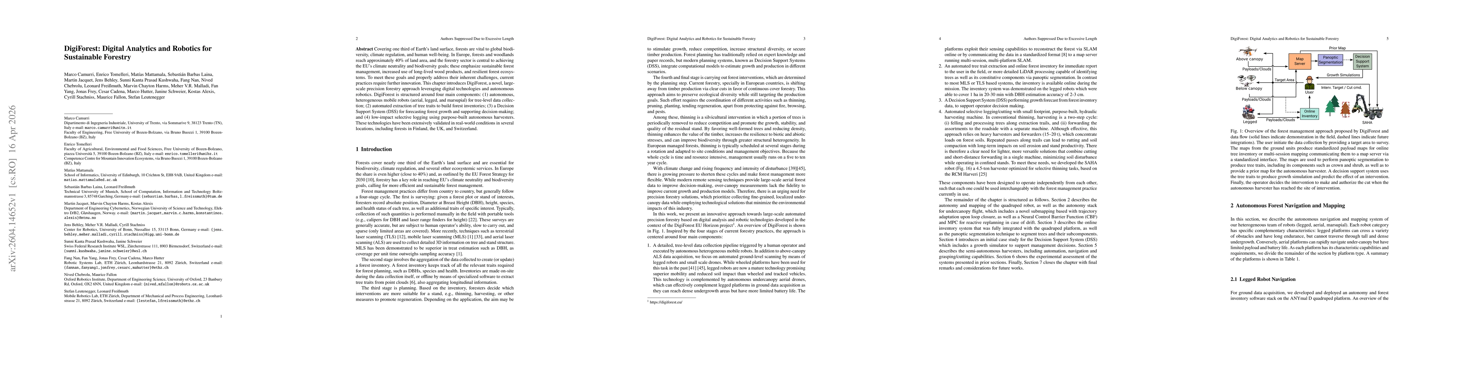
Covering one third of Earth's land surface, forests are vital to global biodiversity, climate regulation, and human well-being. In Europe, forests and woodlands reach approximately 40% of land area, a...
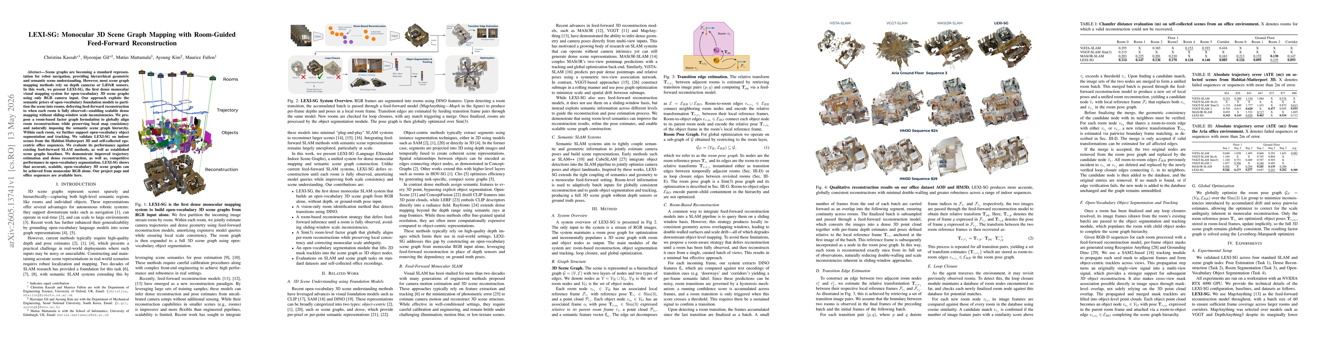
Scene graphs are becoming a standard representation for robot navigation, providing hierarchical geometric and semantic scene understanding. However, most scene graph mapping methods rely on depth cam...
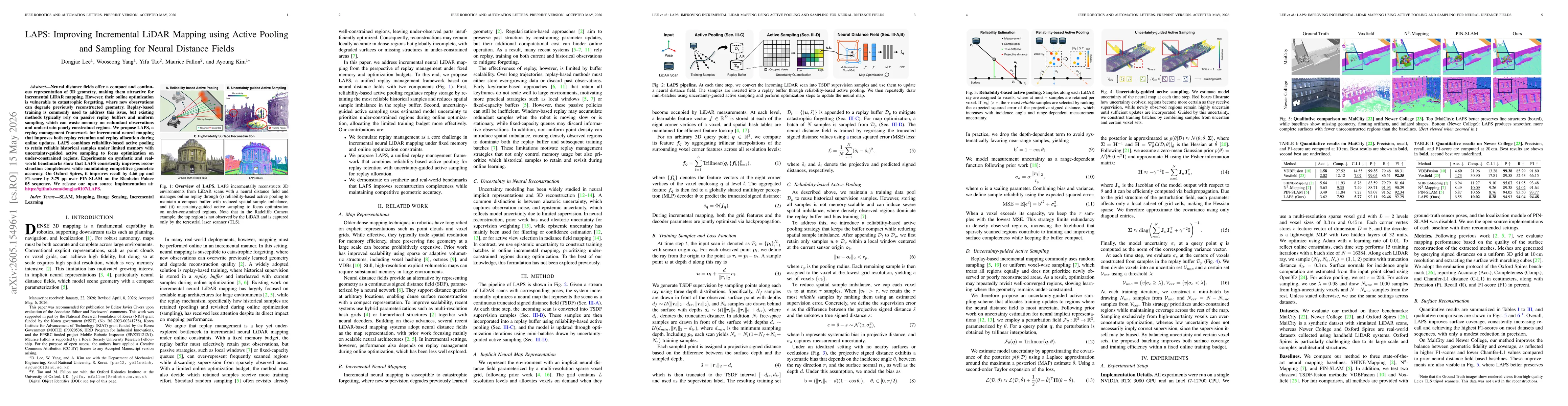
Neural distance fields offer a compact and continuous representation of 3D geometry, making them attractive for incremental LiDAR mapping. However, their online optimization is vulnerable to catastrop...
Recent works have explored unifying SLAM with geometric foundation models (GFMs). However, directly using GFM predictions for tracking is highly sensitive to model capability and uncertainty, as geome...