Osprey: Multi-Session Autonomous Aerial Mapping with LiDAR-based SLAM and Next Best View Planning
Publication
Metrics
AI Quick Summary
Osprey is an autonomous aerial mapping system using LiDAR-based SLAM and next best view planning for multi-session mapping of complex 3D structures. Field experiments show it can achieve greater coverage on large industrial sites compared to manual or traditional methods.
Paper Preview
Abstract
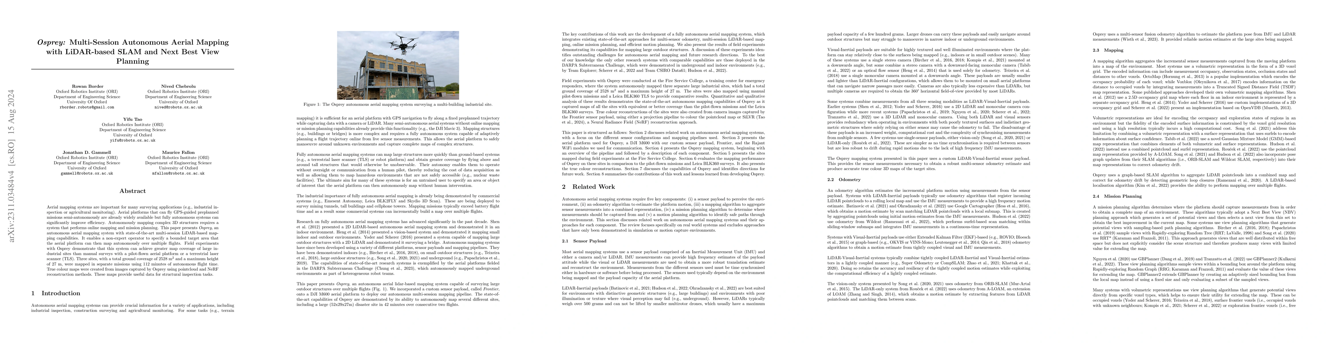
Aerial mapping systems are important for many surveying applications (e.g., industrial inspection or agricultural monitoring). Aerial platforms that can fly GPS-guided preplanned missions semi-autonomously are already widely available but fully autonomous systems can significantly improve efficiency. Autonomously mapping complex 3D structures requires a system that performs online mapping and mission planning. This paper presents Osprey, an autonomous aerial mapping system with state-of-the-art multi-session LiDAR-based mapping capabilities. It enables a non-expert operator to specify a bounded target area that the aerial platform can then map autonomously over multiple flights. Field experiments with Osprey demonstrate that this system can achieve greater map coverage of large industrial sites than manual surveys with a pilot-flown aerial platform or a terrestrial laser scanner (TLS). Three sites, with a total ground coverage of $2528$ m$^2$ and a maximum height of $27$ m, were mapped in separate missions using $112$ minutes of autonomous flight time. True colour maps were created from images captured by Osprey using pointcloud and NeRF reconstruction methods. These maps provide useful data for structural inspection tasks.
AI Key Findings
Get AI-generated insights about this paper's methodology, results, significance, and more — seven facets brought into focus.
Impact
Paper Details
Authors
PDF Preview
Key Terms
Citation Network
Current paper (gray), citations (green), references (blue)
Display is limited for performance on very large graphs.
Discussion 0