Academic Profile
Statistics
Similar Authors
Papers on arXiv
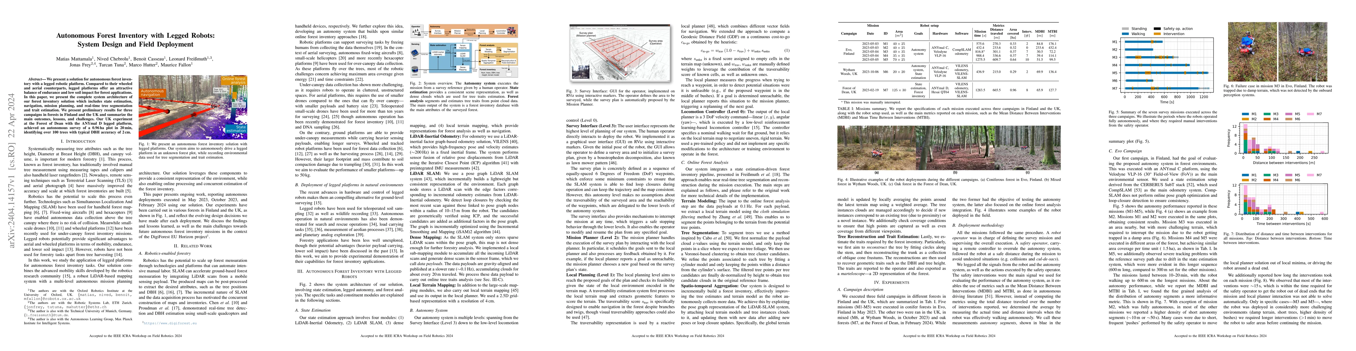
We present a solution for autonomous forest inventory with a legged robotic platform. Compared to their wheeled and aerial counterparts, legged platforms offer an attractive balance of endurance and...
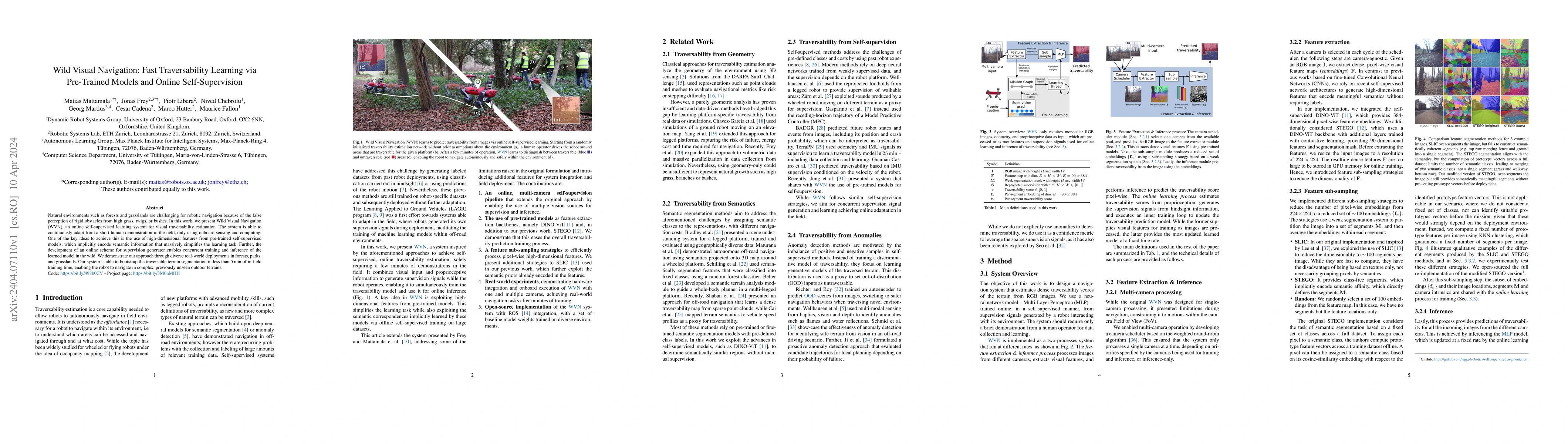
Natural environments such as forests and grasslands are challenging for robotic navigation because of the false perception of rigid obstacles from high grass, twigs, or bushes. In this work, we pres...
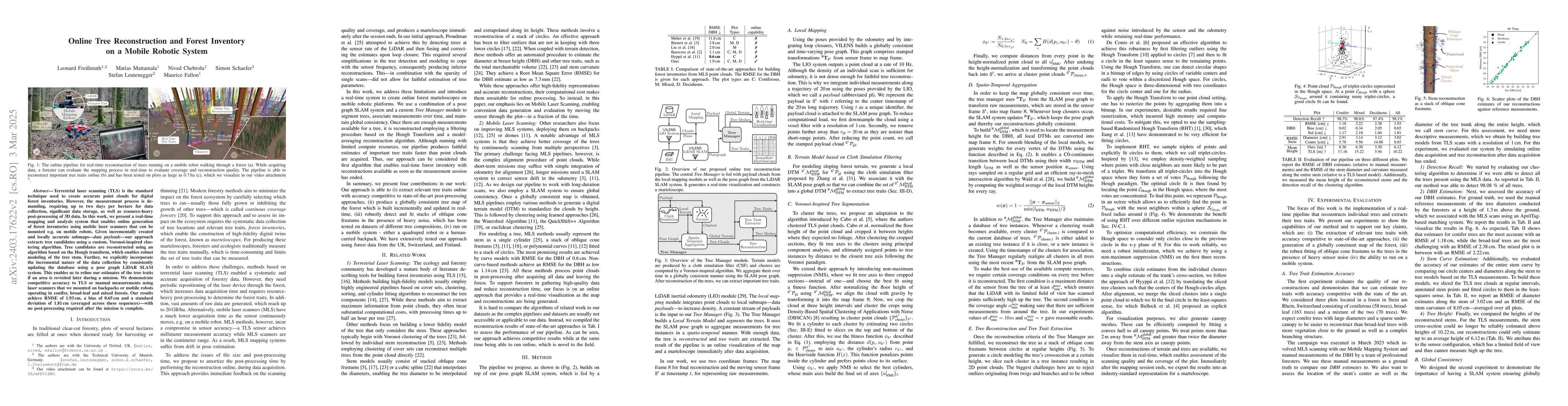
Terrestrial laser scanning (TLS) is the standard technique used to create accurate point clouds for digital forest inventories. However, the measurement process is demanding, requiring up to two day...
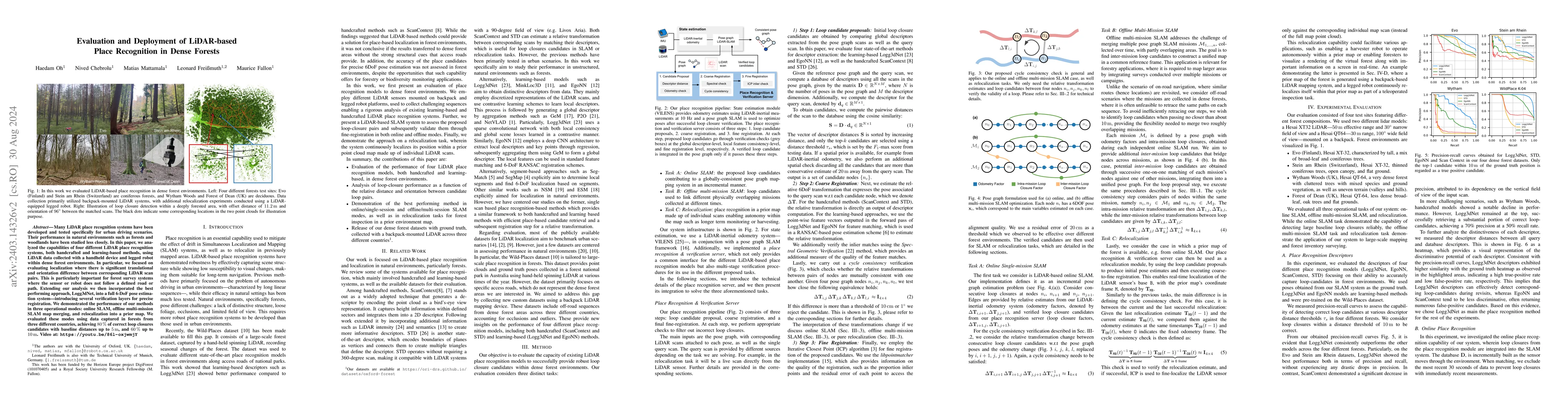
Many LiDAR place recognition systems have been developed and tested specifically for urban driving scenarios. Their performance in natural environments such as forests and woodlands have been studie...
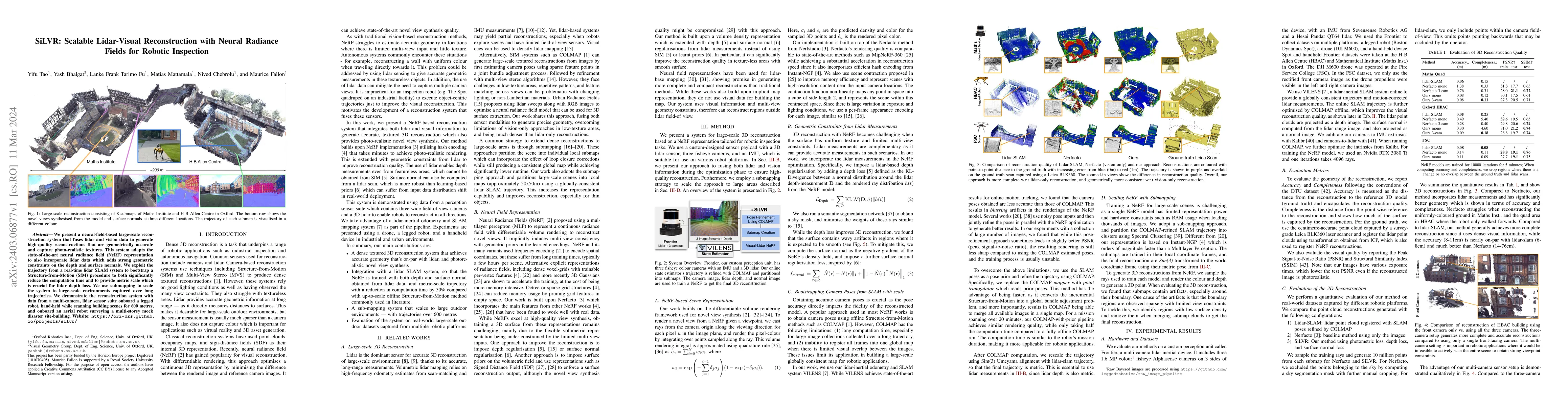
We present a neural-field-based large-scale reconstruction system that fuses lidar and vision data to generate high-quality reconstructions that are geometrically accurate and capture photo-realisti...
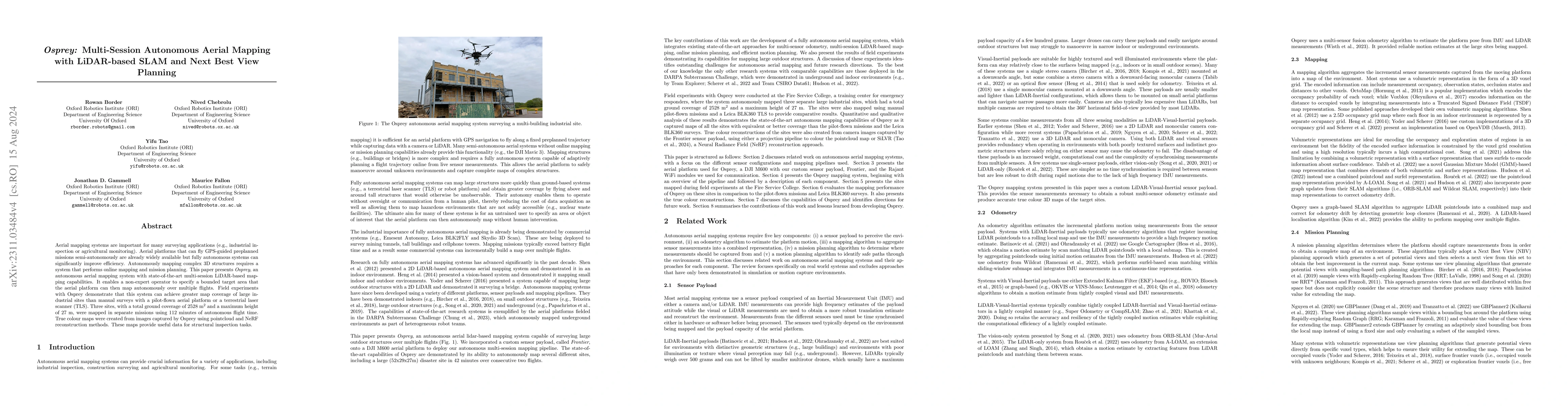
Aerial mapping systems are important for many surveying applications (e.g., industrial inspection or agricultural monitoring). Aerial platforms that can fly GPS-guided preplanned missions semi-auton...
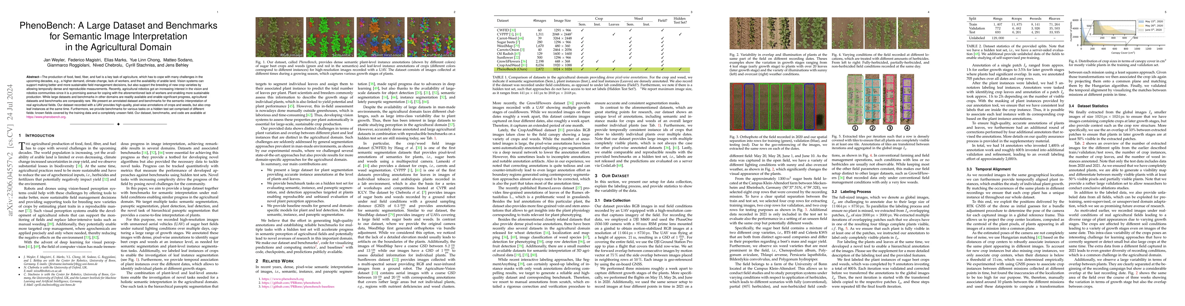
The production of food, feed, fiber, and fuel is a key task of agriculture. Especially crop production has to cope with a multitude of challenges in the upcoming decades caused by a growing world po...
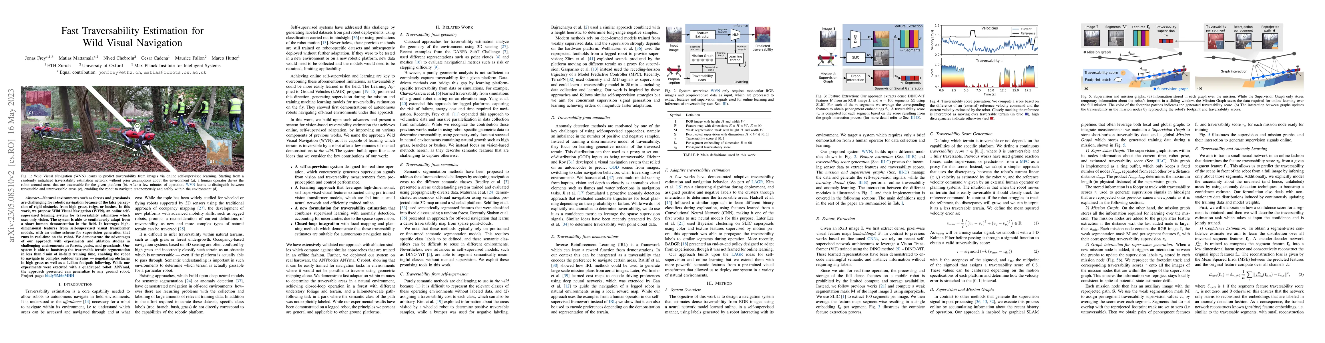
Natural environments such as forests and grasslands are challenging for robotic navigation because of the false perception of rigid obstacles from high grass, twigs, or bushes. In this work, we prop...
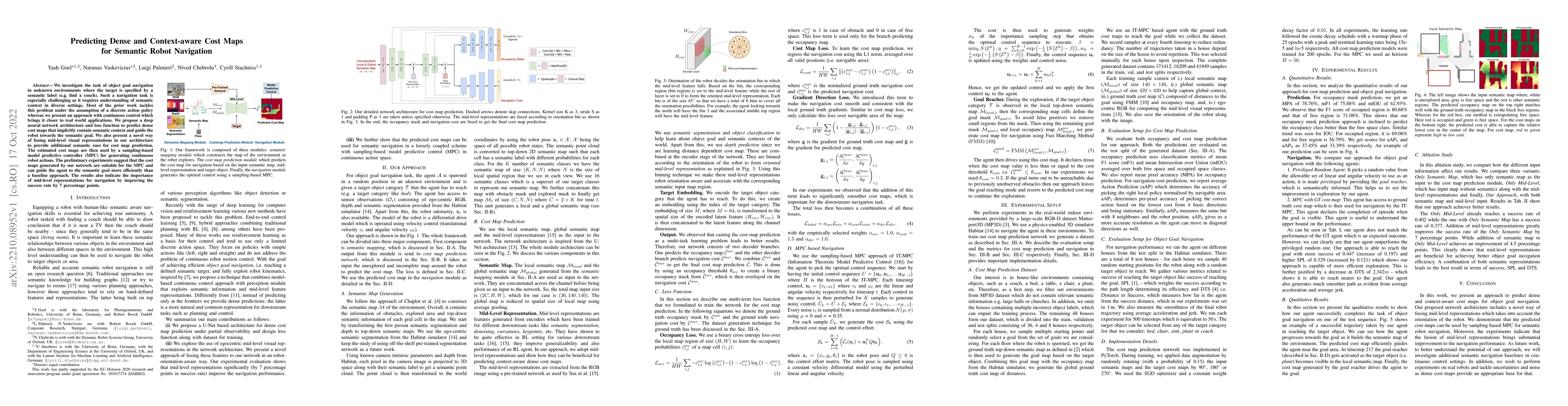
We investigate the task of object goal navigation in unknown environments where the target is specified by a semantic label (e.g. find a couch). Such a navigation task is especially challenging as i...
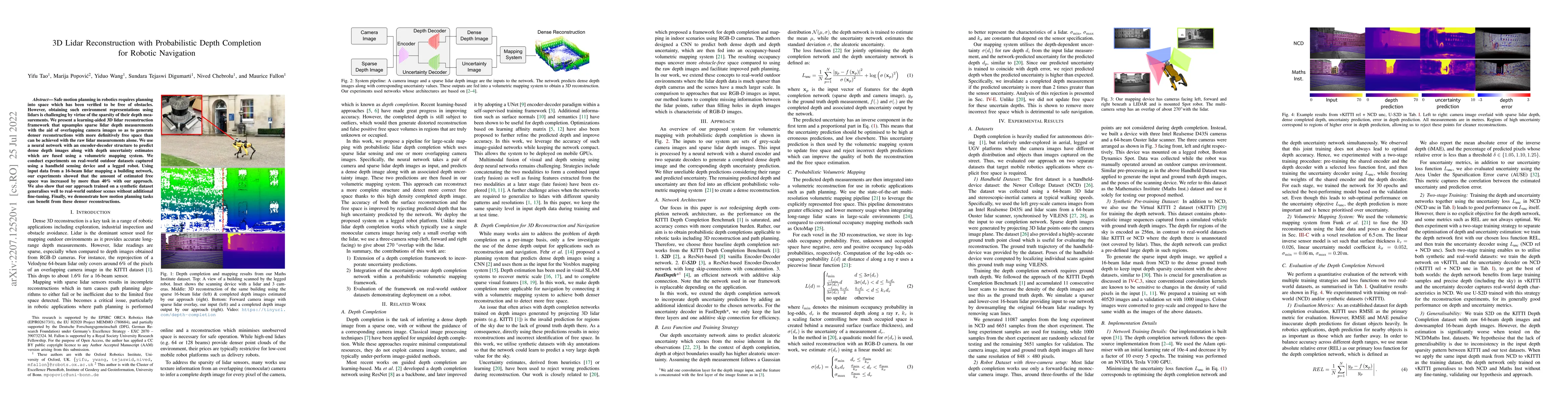
Safe motion planning in robotics requires planning into space which has been verified to be free of obstacles. However, obtaining such environment representations using lidars is challenging by virt...
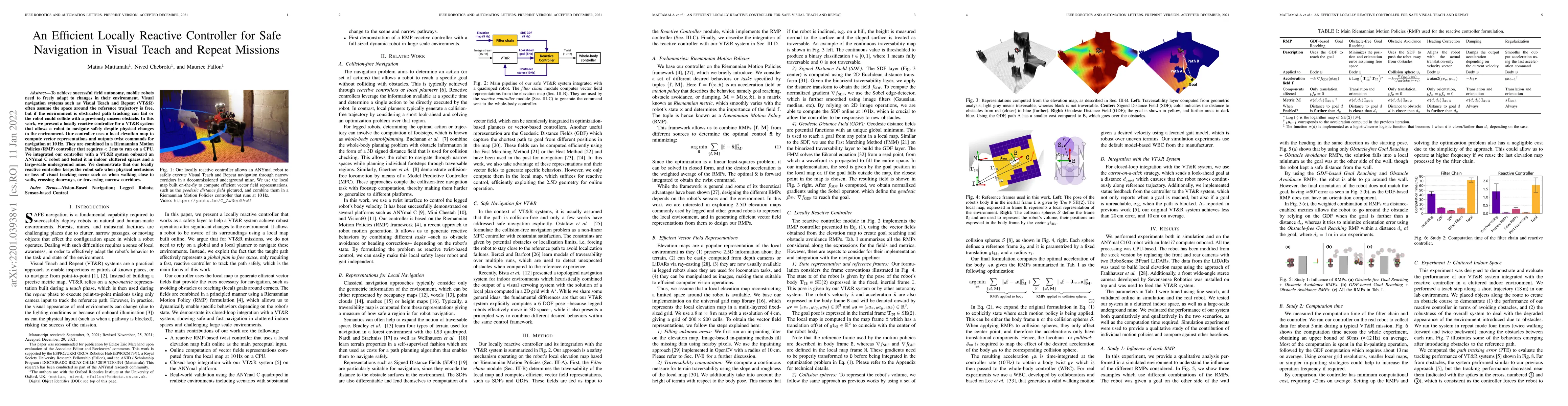
To achieve successful field autonomy, mobile robots need to freely adapt to changes in their environment. Visual navigation systems such as Visual Teach and Repeat (VT&R) often assume the space arou...
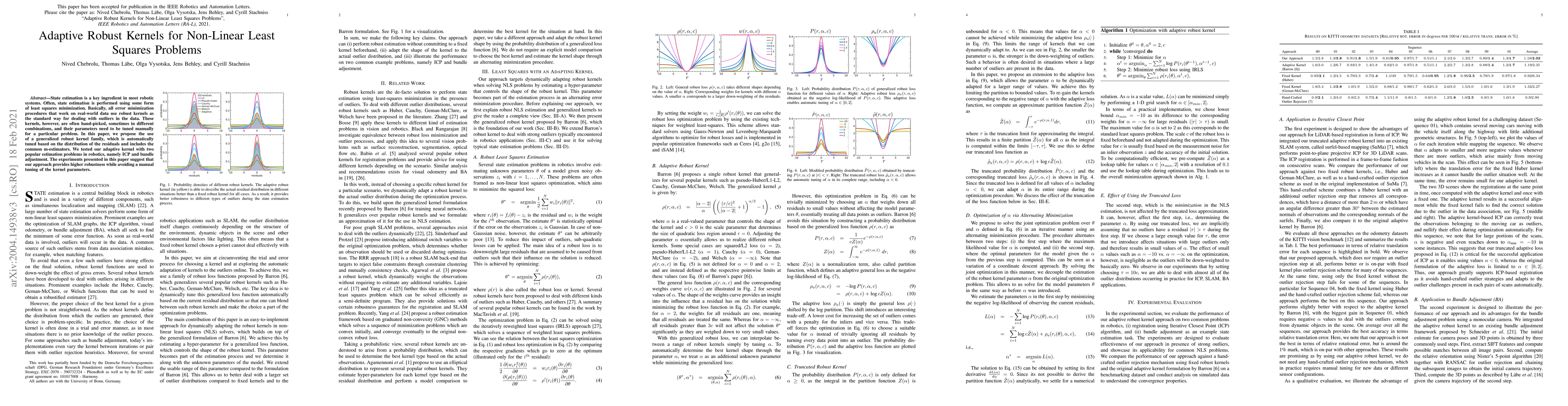
State estimation is a key ingredient in most robotic systems. Often, state estimation is performed using some form of least squares minimization. Basically, all error minimization procedures that wo...
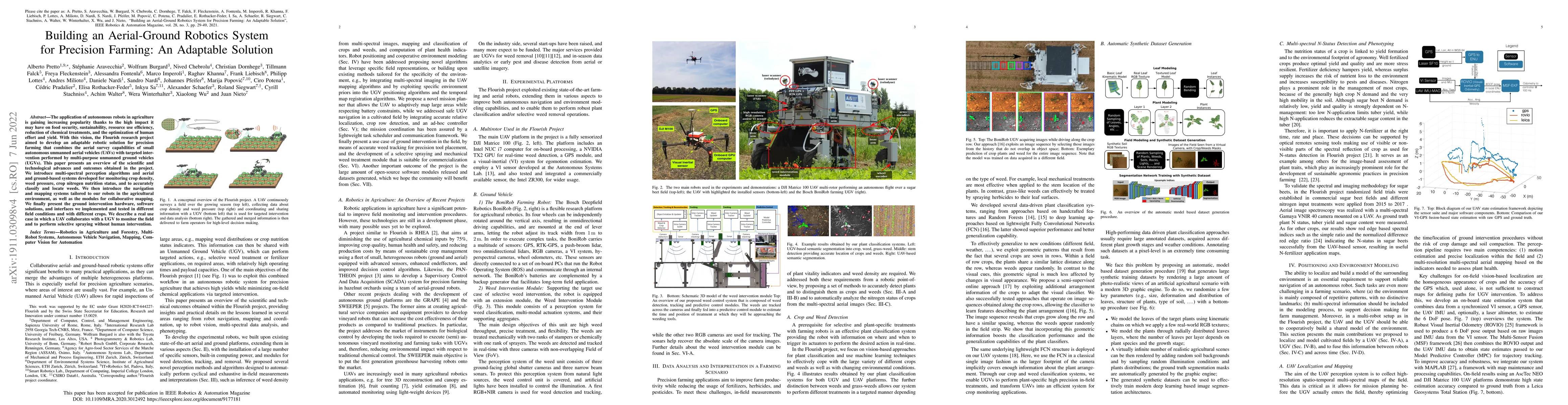
The application of autonomous robots in agriculture is gaining increasing popularity thanks to the high impact it may have on food security, sustainability, resource use efficiency, reduction of che...
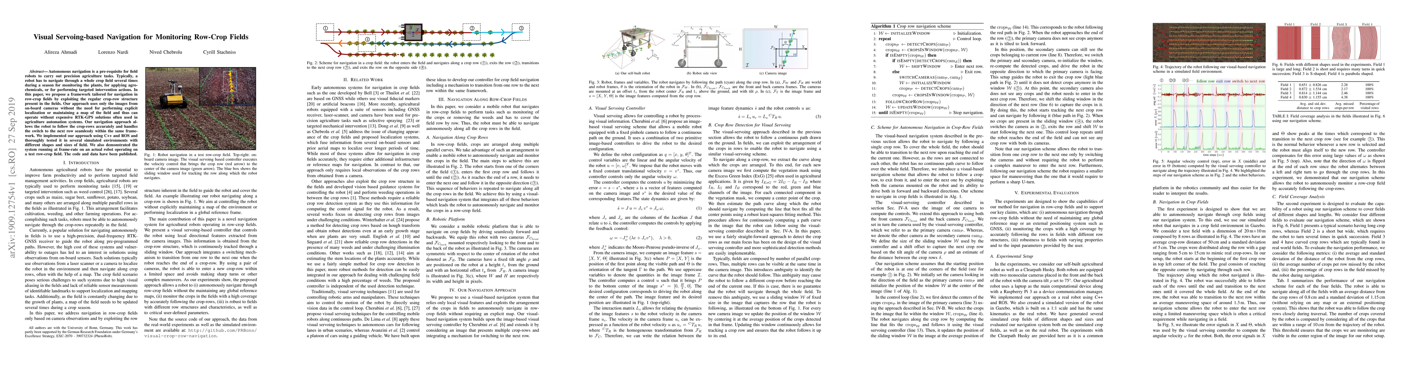
Autonomous navigation is a pre-requisite for field robots to carry out precision agriculture tasks. Typically, a robot has to navigate through a whole crop field several times during a season for mo...
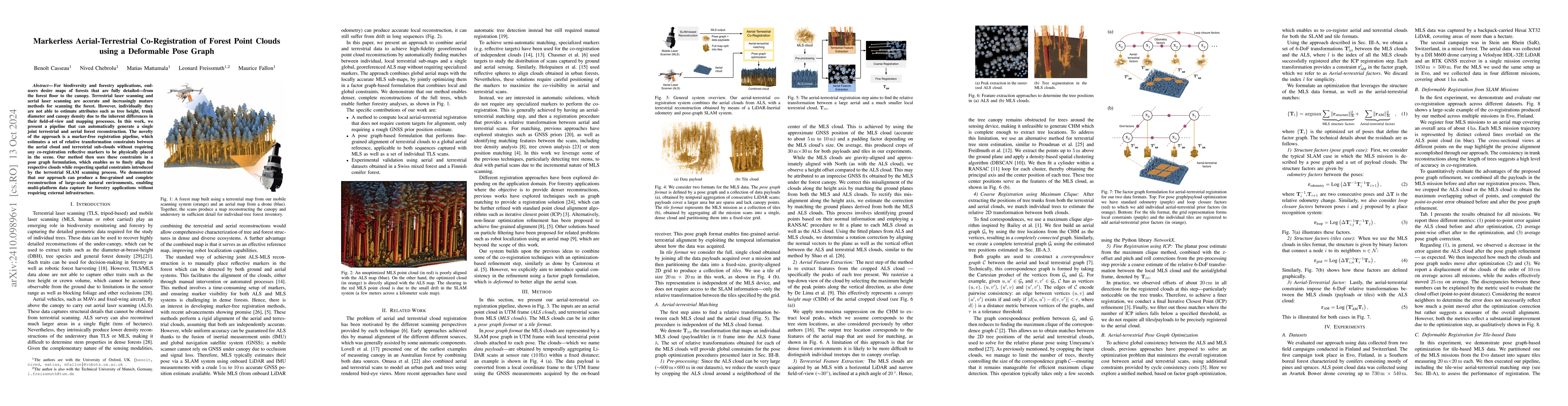
For biodiversity and forestry applications, end-users desire maps of forests that are fully detailed, from the forest floor to the canopy. Terrestrial laser scanning and aerial laser scanning are accu...
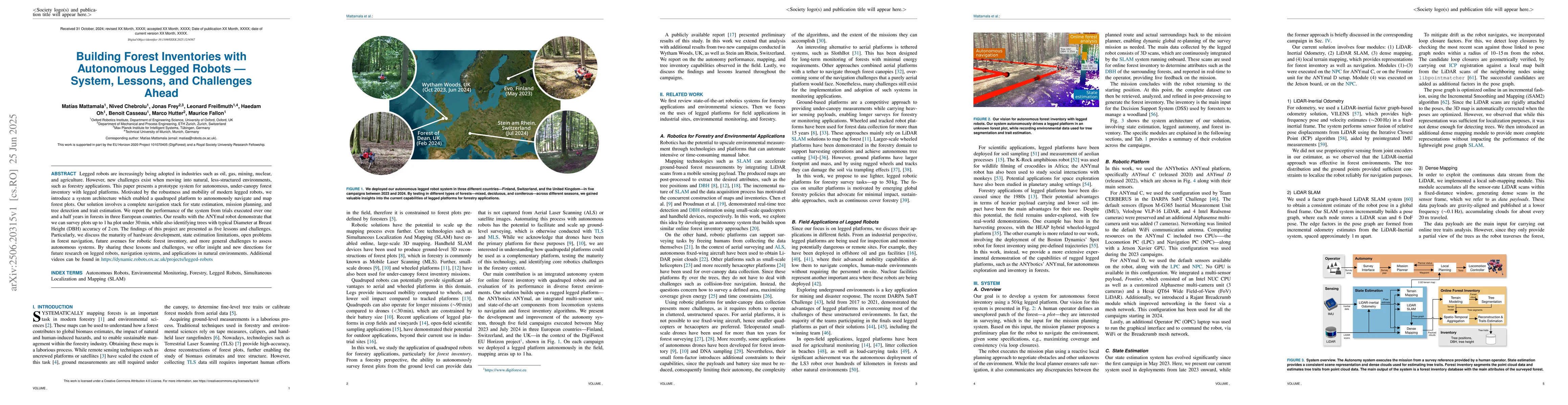
Legged robots are increasingly being adopted in industries such as oil, gas, mining, nuclear, and agriculture. However, new challenges exist when moving into natural, less-structured environments, suc...
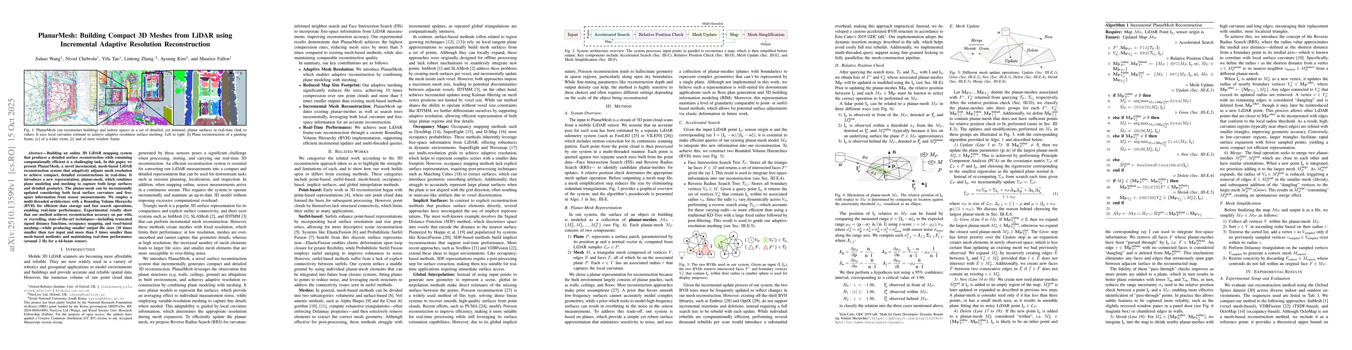
Building an online 3D LiDAR mapping system that produces a detailed surface reconstruction while remaining computationally efficient is a challenging task. In this paper, we present PlanarMesh, a nove...
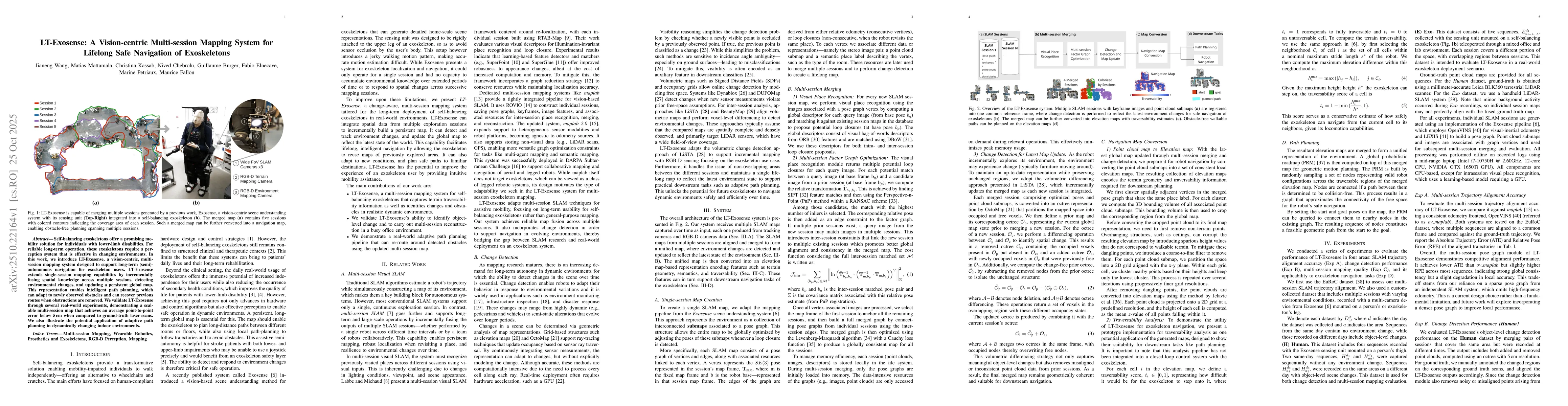
Self-balancing exoskeletons offer a promising mobility solution for individuals with lower-limb disabilities. For reliable long-term operation, these exoskeletons require a perception system that is e...
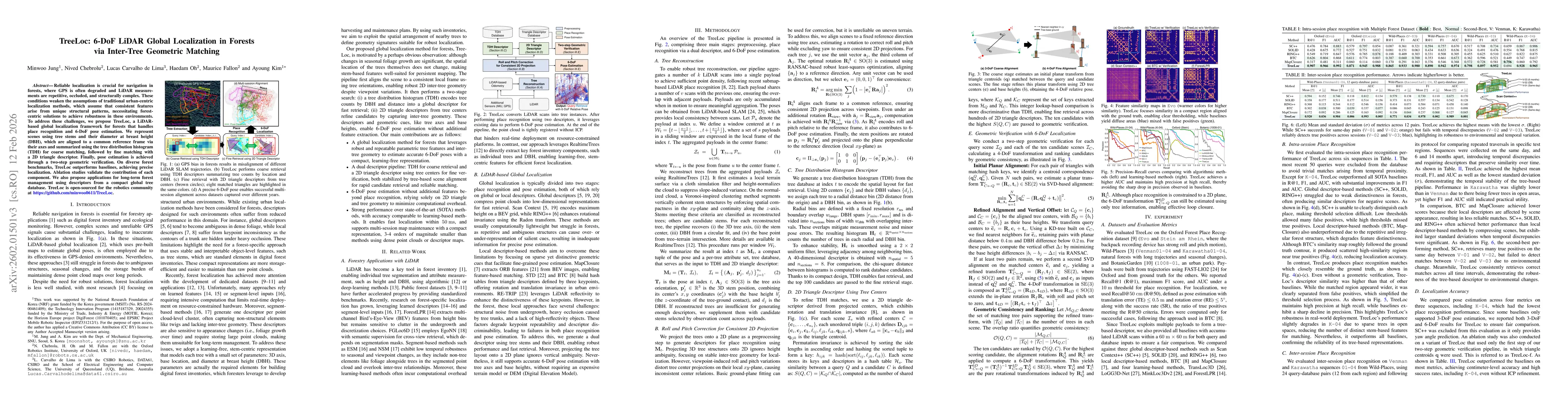
Reliable localization is crucial for navigation in forests, where GPS is often degraded and LiDAR measurements are repetitive, occluded, and structurally complex. These conditions weaken the assumptio...
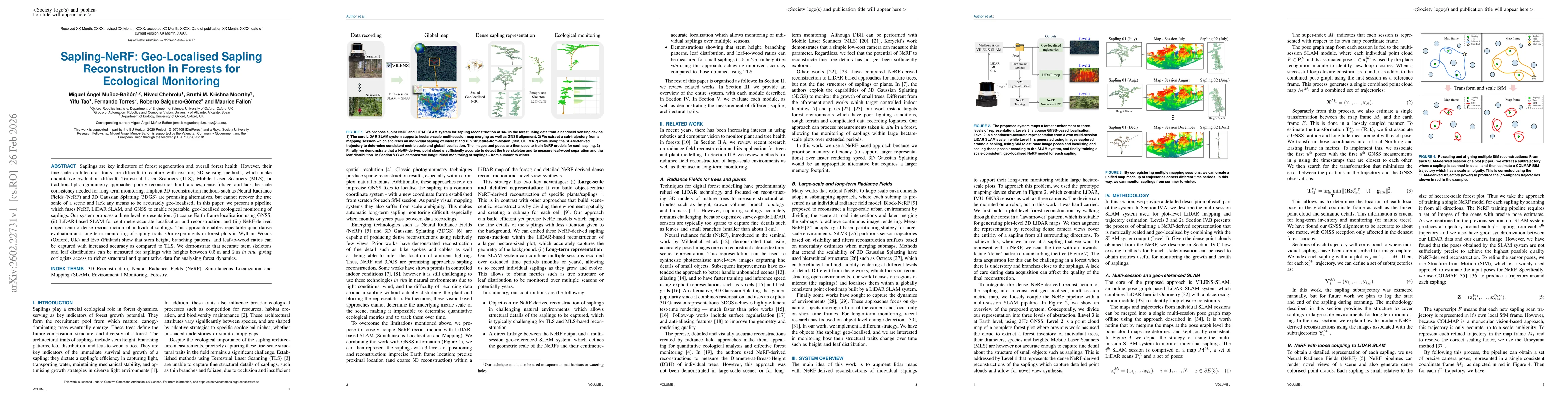
Saplings are key indicators of forest regeneration and overall forest health. However, their fine-scale architectural traits are difficult to capture with existing 3D sensing methods, which make quant...
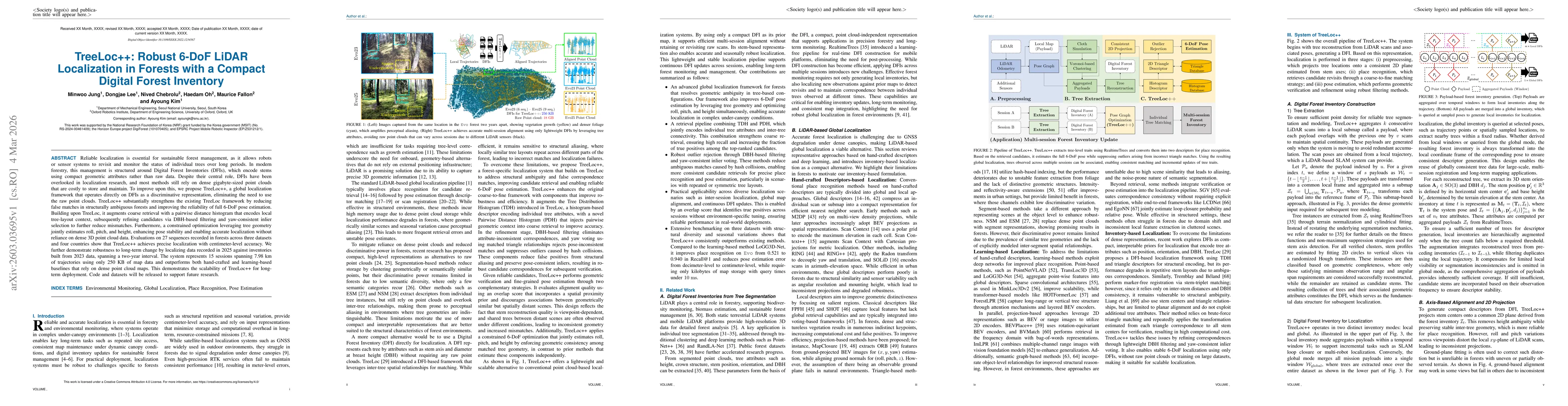
Reliable localization is essential for sustainable forest management, as it allows robots or sensor systems to revisit and monitor the status of individual trees over long periods. In modern forestry,...
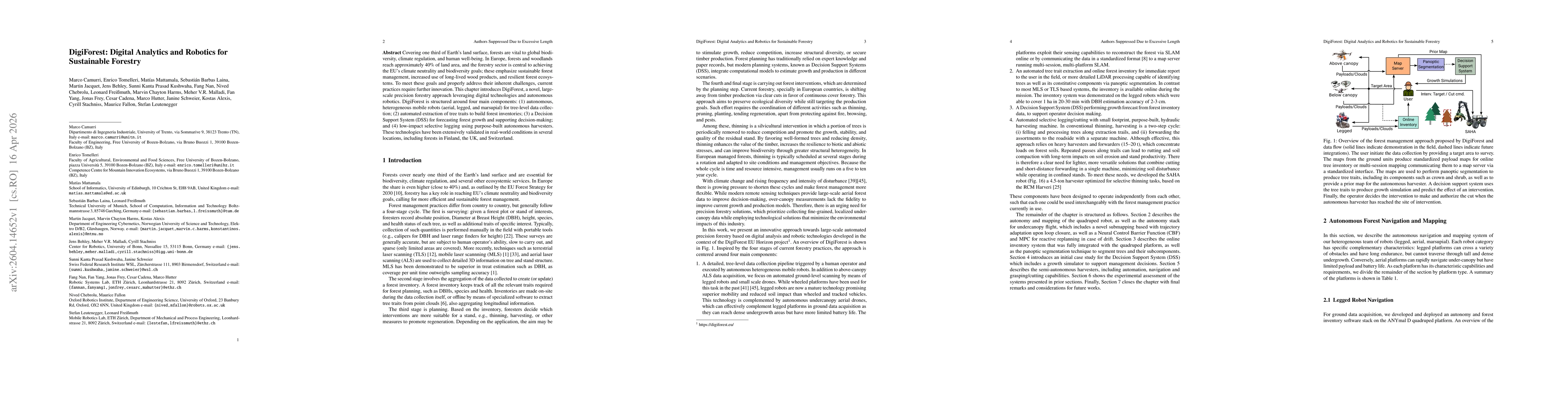
Covering one third of Earth's land surface, forests are vital to global biodiversity, climate regulation, and human well-being. In Europe, forests and woodlands reach approximately 40% of land area, a...
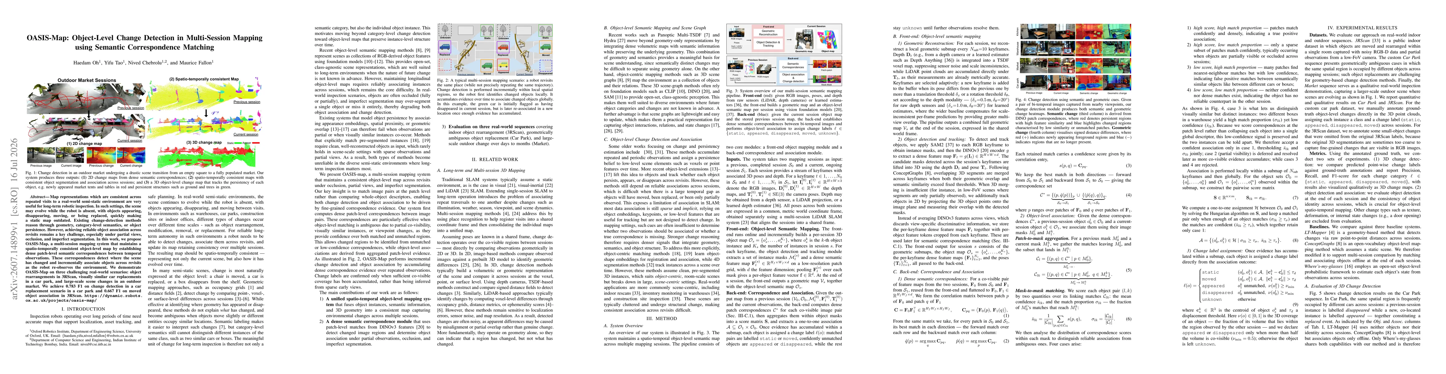
Map representations which are consistent across repeated visits to a real-world semi-static environment are very useful for long-term robotic inspection. In such settings, the scene may evolve while t...