Academic Profile
Statistics
Similar Authors
Papers on arXiv
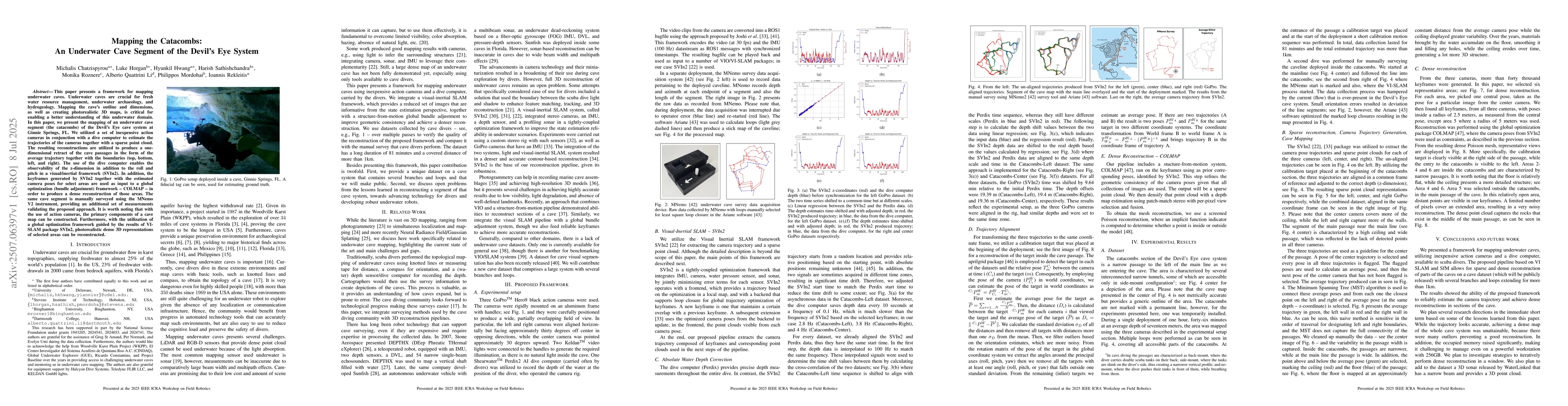
This paper presents a framework for mapping underwater caves. Underwater caves are crucial for fresh water resource management, underwater archaeology, and hydrogeology. Mapping the cave's outline and...
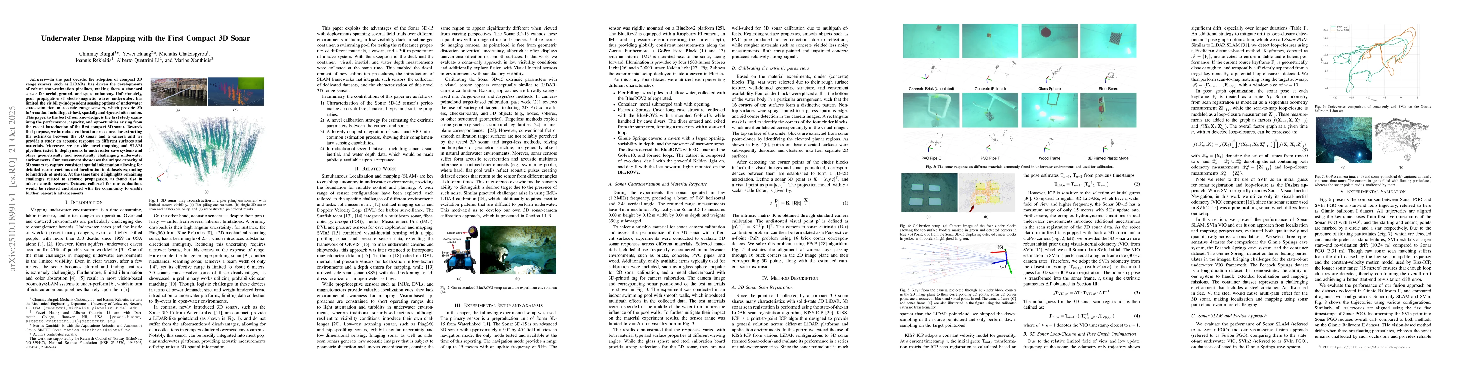
In the past decade, the adoption of compact 3D range sensors, such as LiDARs, has driven the developments of robust state-estimation pipelines, making them a standard sensor for aerial, ground, and sp...
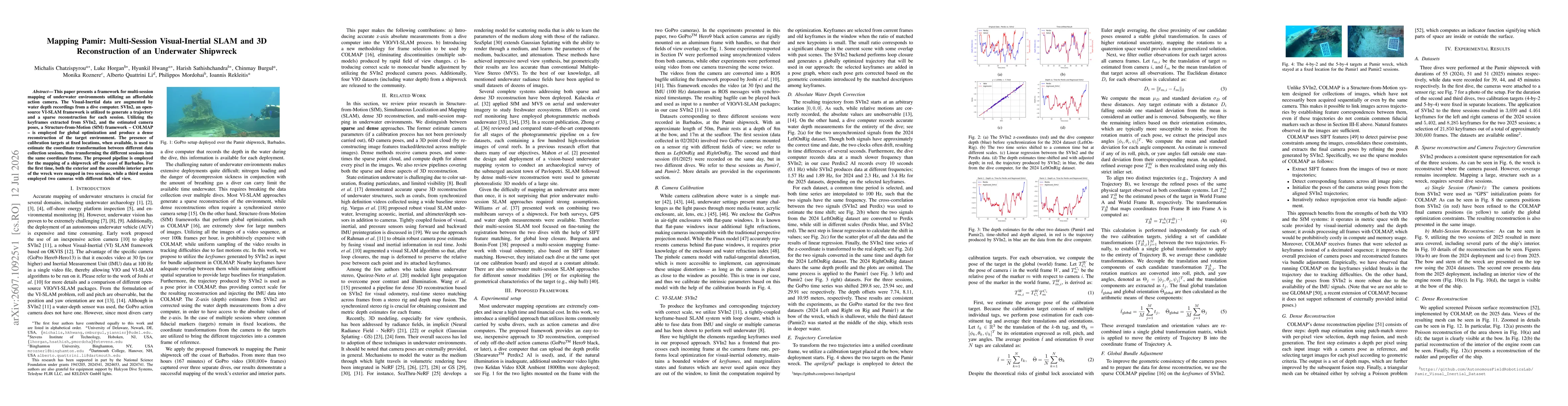
This paper presents a framework for multi-session mapping of underwater environments utilizing an affordable action camera. The Visual-Inertial data are augmented by water depth recordings from a dive...