Academic Profile
Statistics
Similar Authors
Papers on arXiv
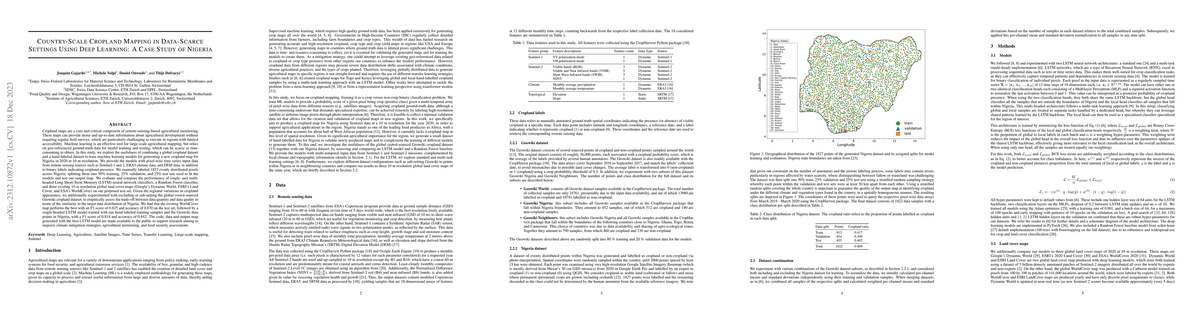
Cropland maps are a core and critical component of remote-sensing-based agricultural monitoring, providing dense and up-to-date information about agricultural development. Machine learning is an eff...
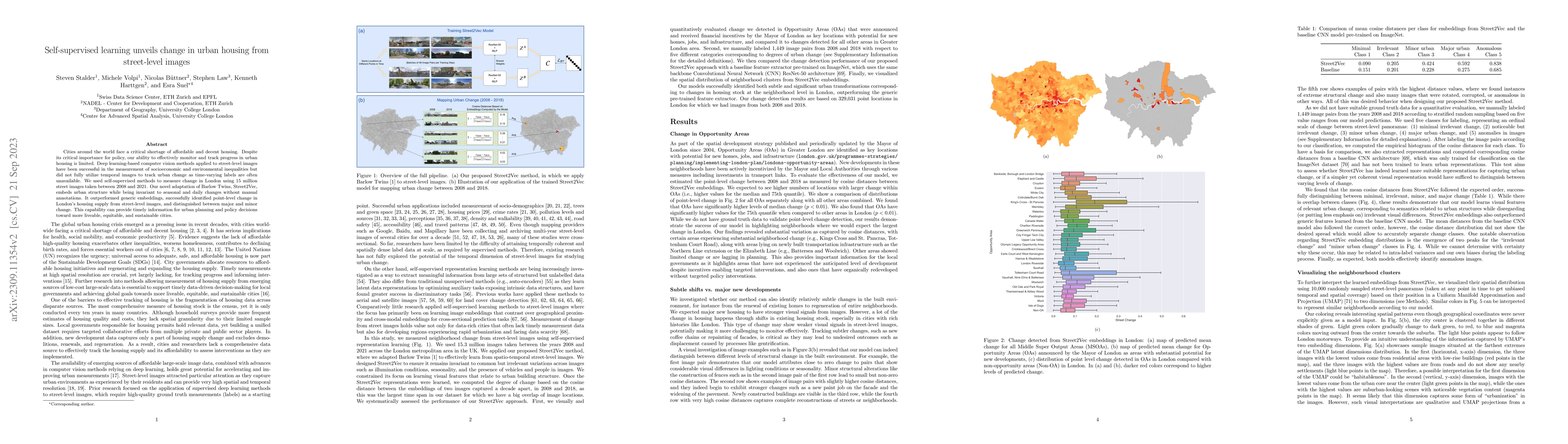
Cities around the world face a critical shortage of affordable and decent housing. Despite its critical importance for policy, our ability to effectively monitor and track progress in urban housing ...
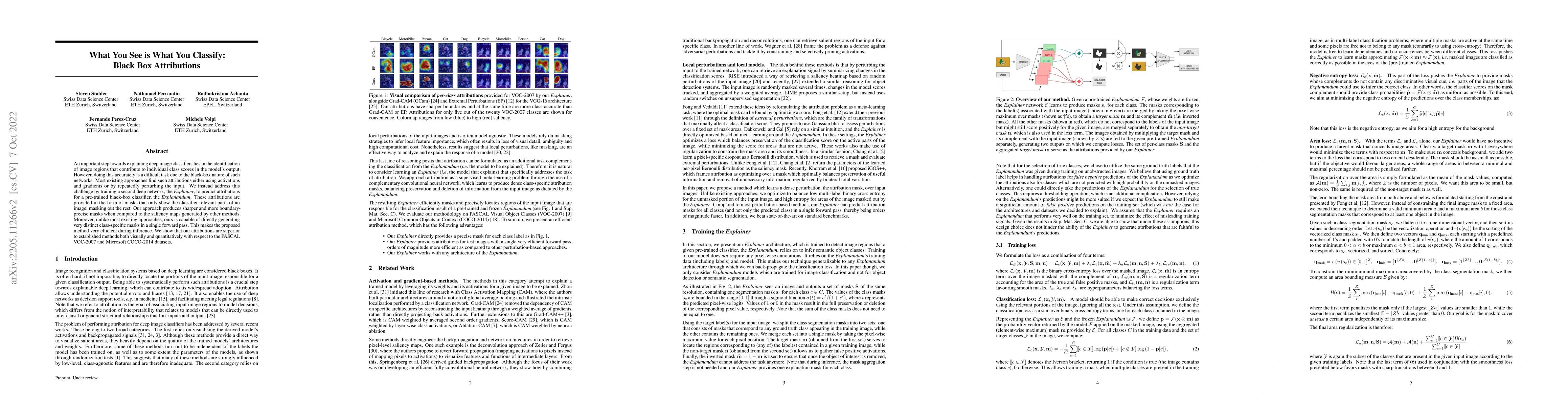
An important step towards explaining deep image classifiers lies in the identification of image regions that contribute to individual class scores in the model's output. However, doing this accurate...
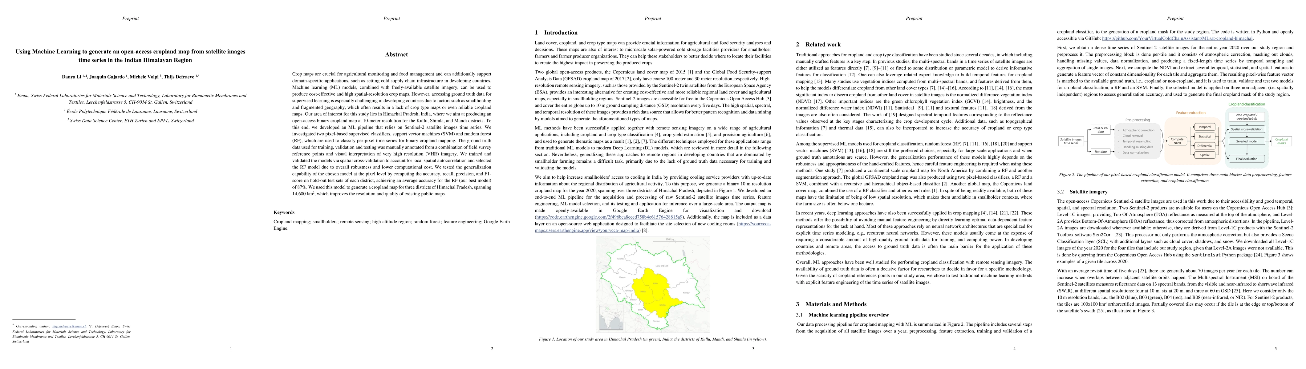
Crop maps are crucial for agricultural monitoring and food management and can additionally support domain-specific applications, such as setting cold supply chain infrastructure in developing countr...
We introduce a method for manifold alignment of different modalities (or domains) of remote sensing images. The problem is recurrent when a set of multitemporal, multisource, multisensor and multian...
Defining an efficient training set is one of the most delicate phases for the success of remote sensing image classification routines. The complexity of the problem, the limited temporal and financi...
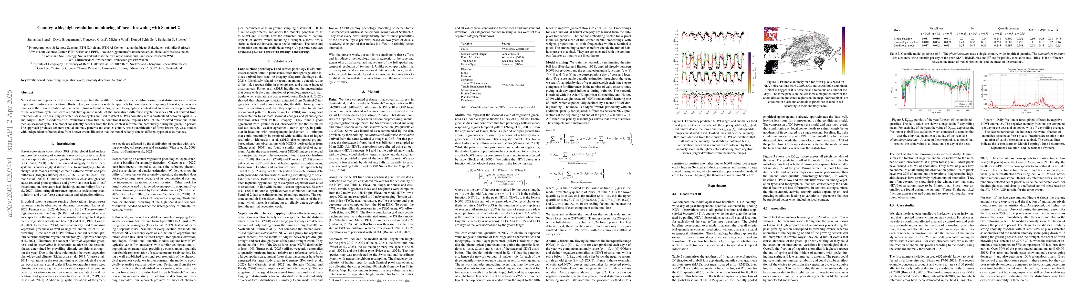
Natural and anthropogenic disturbances are impacting the health of forests worldwide. Monitoring forest disturbances at scale is important to inform conservation efforts. Here, we present a scalable a...
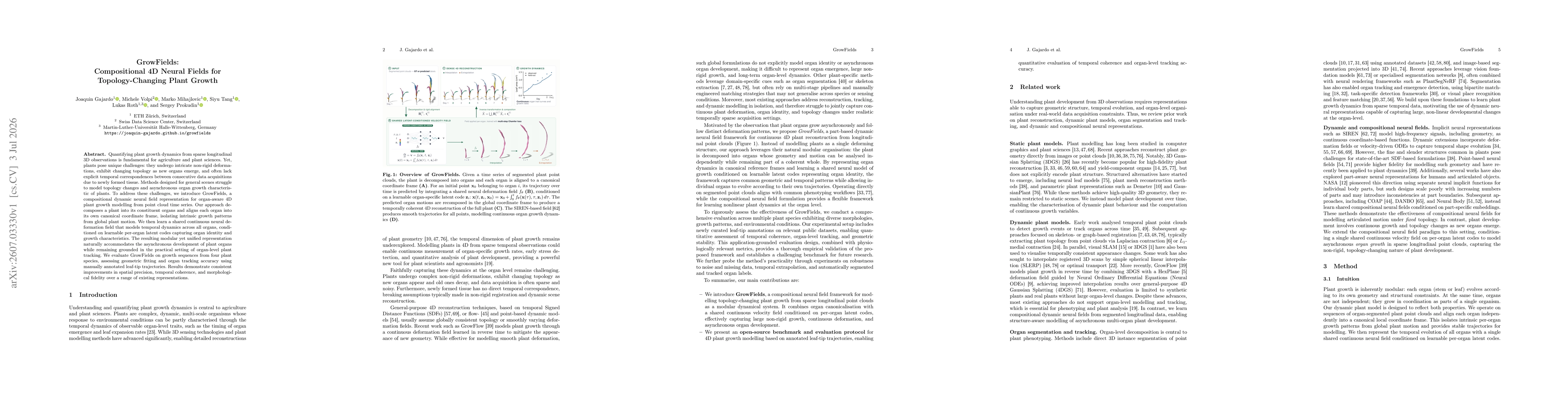
Quantifying plant growth dynamics from sparse longitudinal 3D observations is fundamental for agriculture and plant sciences. Yet, plants pose unique challenges: they undergo intricate non-rigid defor...