Country-Scale Cropland Mapping in Data-Scarce Settings Using Deep Learning: A Case Study of Nigeria
Publication
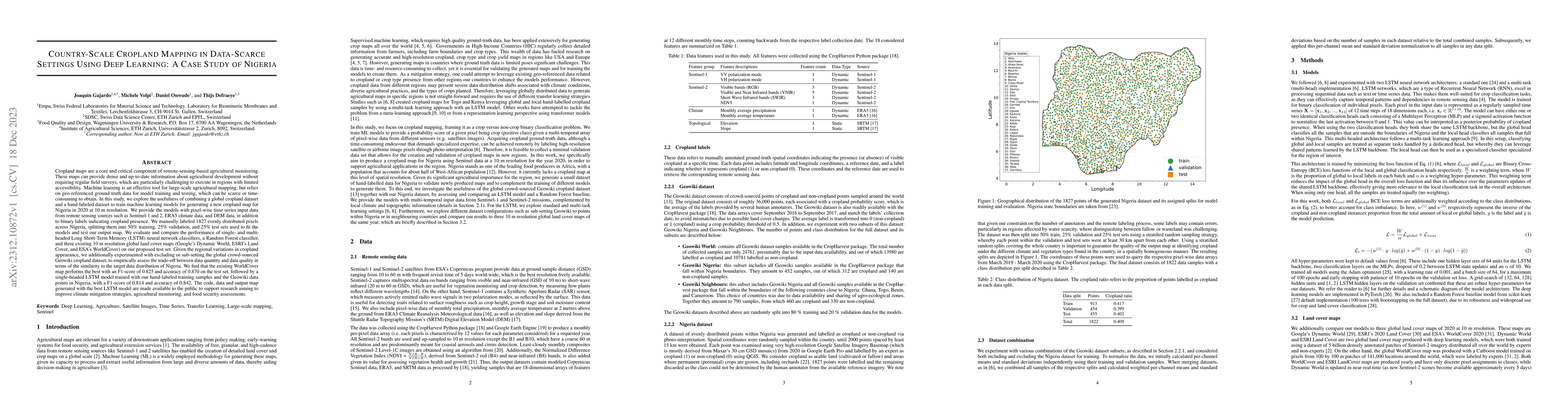
Metrics
AI Quick Summary
This study develops a cropland map for Nigeria using deep learning and remote sensing data, combining a global dataset with a small, manually labeled dataset. The best performing model, ESA's WorldCover, achieved an F1-score of 0.825 and accuracy of 0.870, while a single-headed LSTM model trained on local data and global crowd-sourced data performed closely behind.
Paper Preview
Abstract
Cropland maps are a core and critical component of remote-sensing-based agricultural monitoring, providing dense and up-to-date information about agricultural development. Machine learning is an effective tool for large-scale agricultural mapping, but relies on geo-referenced ground-truth data for model training and testing, which can be scarce or time-consuming to obtain. In this study, we explore the usefulness of combining a global cropland dataset and a hand-labeled dataset to train machine learning models for generating a new cropland map for Nigeria in 2020 at 10 m resolution. We provide the models with pixel-wise time series input data from remote sensing sources such as Sentinel-1 and 2, ERA5 climate data, and DEM data, in addition to binary labels indicating cropland presence. We manually labeled 1827 evenly distributed pixels across Nigeria, splitting them into 50\% training, 25\% validation, and 25\% test sets used to fit the models and test our output map. We evaluate and compare the performance of single- and multi-headed Long Short-Term Memory (LSTM) neural network classifiers, a Random Forest classifier, and three existing 10 m resolution global land cover maps (Google's Dynamic World, ESRI's Land Cover, and ESA's WorldCover) on our proposed test set. Given the regional variations in cropland appearance, we additionally experimented with excluding or sub-setting the global crowd-sourced Geowiki cropland dataset, to empirically assess the trade-off between data quantity and data quality in terms of the similarity to the target data distribution of Nigeria. We find that the existing WorldCover map performs the best with an F1-score of 0.825 and accuracy of 0.870 on the test set, followed by a single-headed LSTM model trained with our hand-labeled training samples and the Geowiki data points in Nigeria, with a F1-score of 0.814 and accuracy of 0.842.
AI Key Findings
Get AI-generated insights about this paper's methodology, results, significance, and more — seven facets brought into focus.
Impact
Paper Details
Authors
PDF Preview
Key Terms
Citation Network
Current paper (gray), citations (green), references (blue)
Display is limited for performance on very large graphs.
Discussion 0