Mingtao Xiong
4 papers on arXiv
Academic Profile
Statistics
Similar Authors
Papers on arXiv
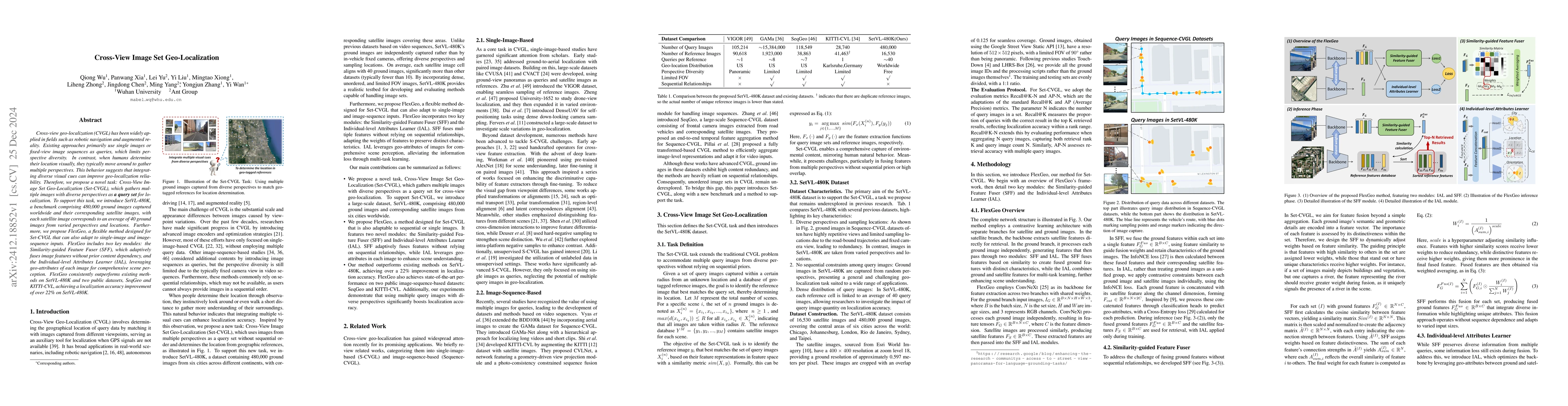
Cross-View Image Set Geo-Localization
Cross-view geo-localization (CVGL) has been widely applied in fields such as robotic navigation and augmented reality. Existing approaches primarily use single images or fixed-view image sequences as ...
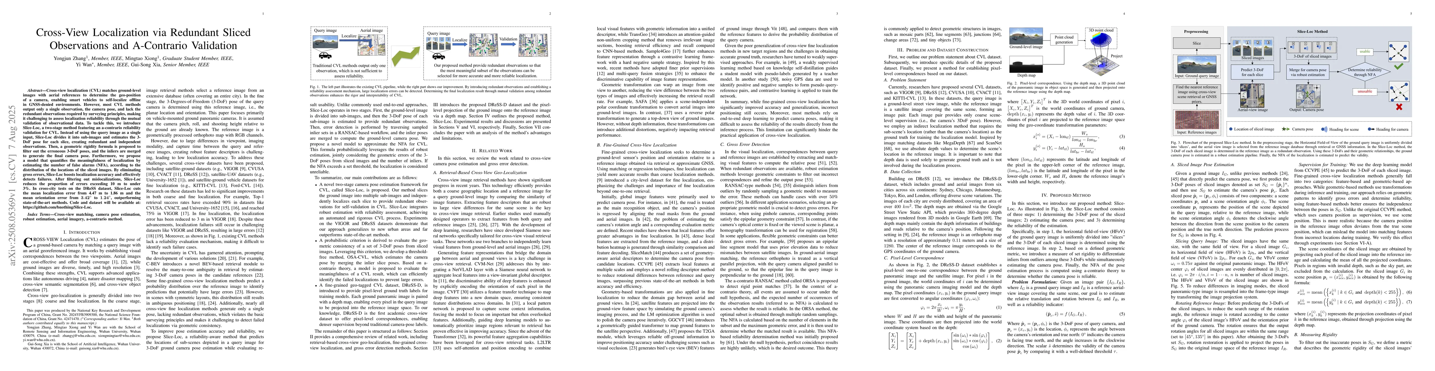
Cross-View Localization via Redundant Sliced Observations and A-Contrario Validation
Cross-view localization (CVL) matches ground-level images with aerial references to determine the geo-position of a camera, enabling smart vehicles to self-localize offline in GNSS-denied environments...
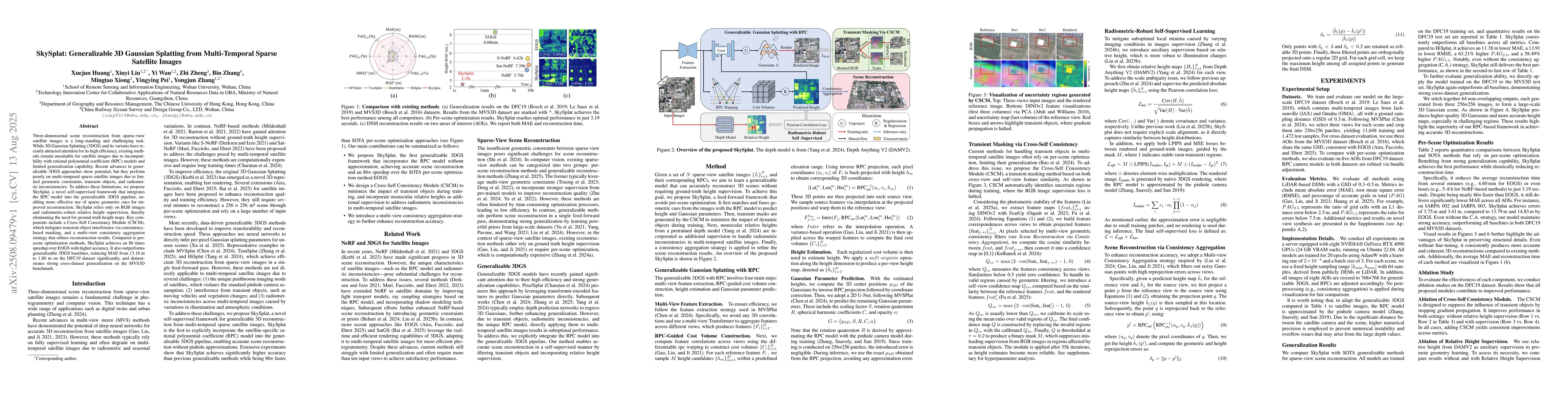
SkySplat: Generalizable 3D Gaussian Splatting from Multi-Temporal Sparse Satellite Images
Three-dimensional scene reconstruction from sparse-view satellite images is a long-standing and challenging task. While 3D Gaussian Splatting (3DGS) and its variants have recently attracted attention ...
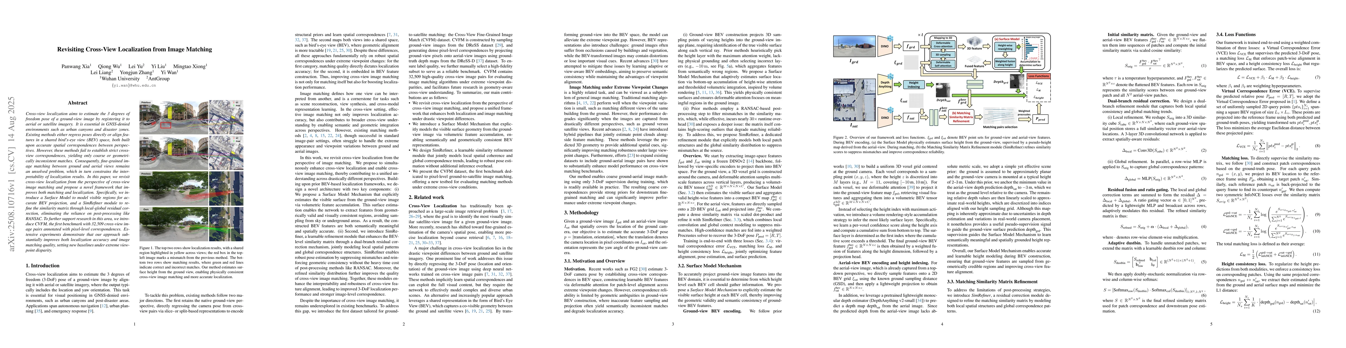
Revisiting Cross-View Localization from Image Matching
Cross-view localization aims to estimate the 3 degrees of freedom pose of a ground-view image by registering it to aerial or satellite imagery. It is essential in GNSS-denied environments such as urba...