Academic Profile
Statistics
Similar Authors
Papers on arXiv
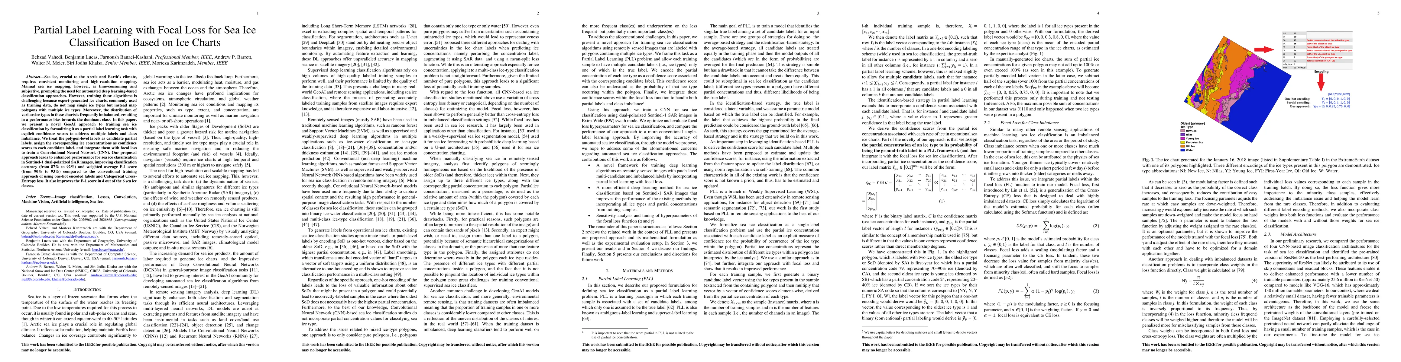
Sea ice, crucial to the Arctic and Earth's climate, requires consistent monitoring and high-resolution mapping. Manual sea ice mapping, however, is time-consuming and subjective, prompting the need ...
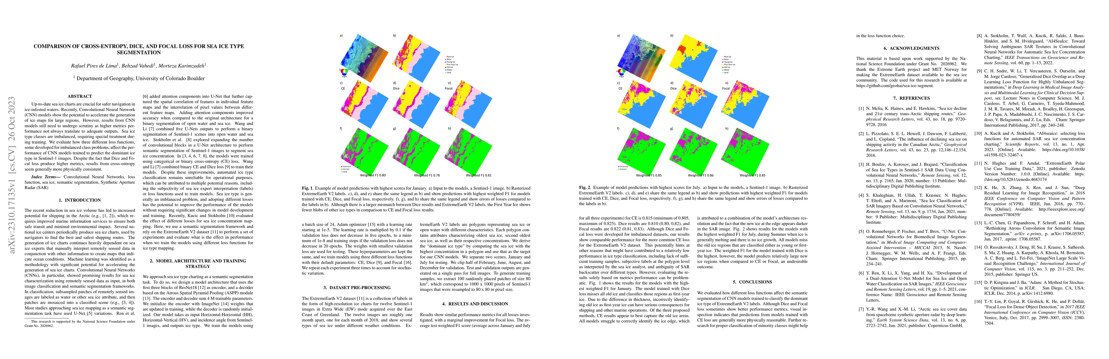
Up-to-date sea ice charts are crucial for safer navigation in ice-infested waters. Recently, Convolutional Neural Network (CNN) models show the potential to accelerate the generation of ice maps for...
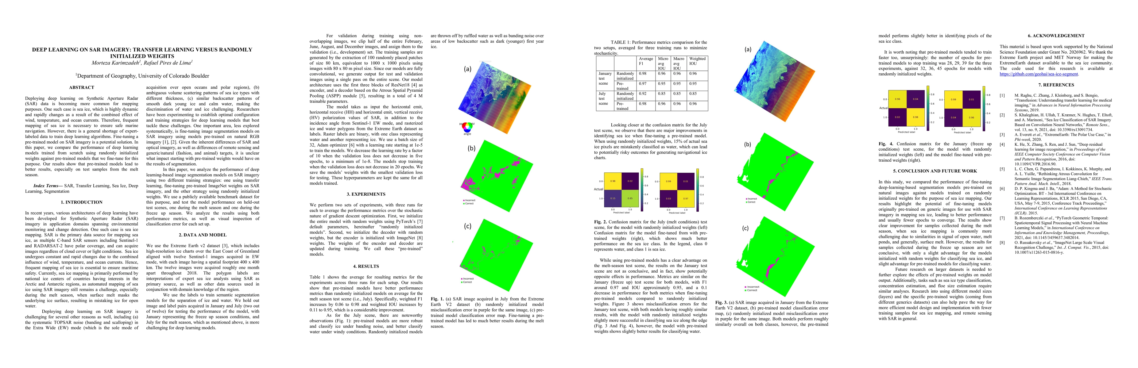
Deploying deep learning on Synthetic Aperture Radar (SAR) data is becoming more common for mapping purposes. One such case is sea ice, which is highly dynamic and rapidly changes as a result of the ...
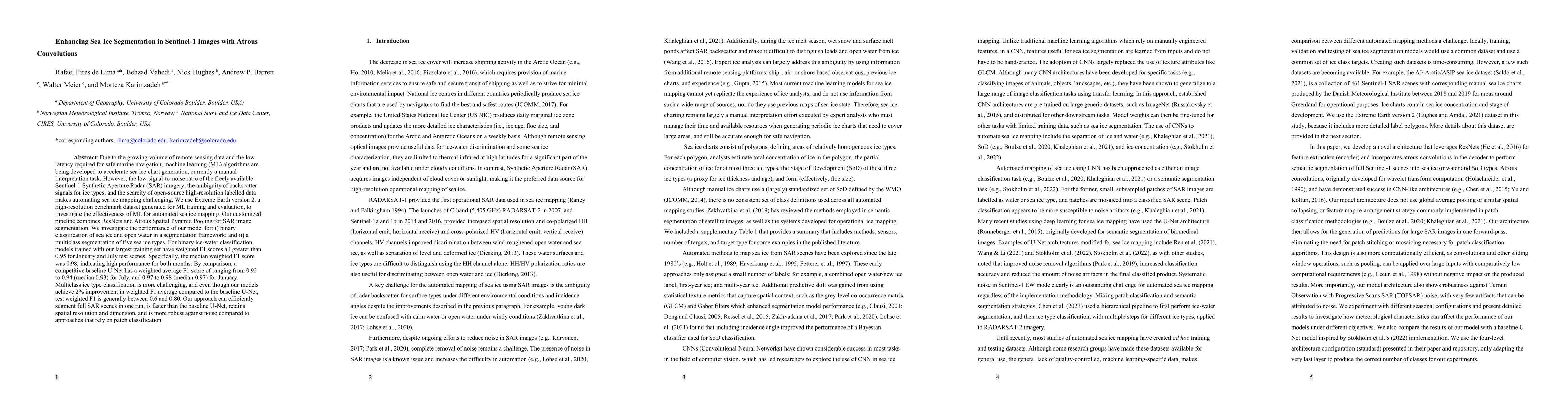
Due to the growing volume of remote sensing data and the low latency required for safe marine navigation, machine learning (ML) algorithms are being developed to accelerate sea ice chart generation,...
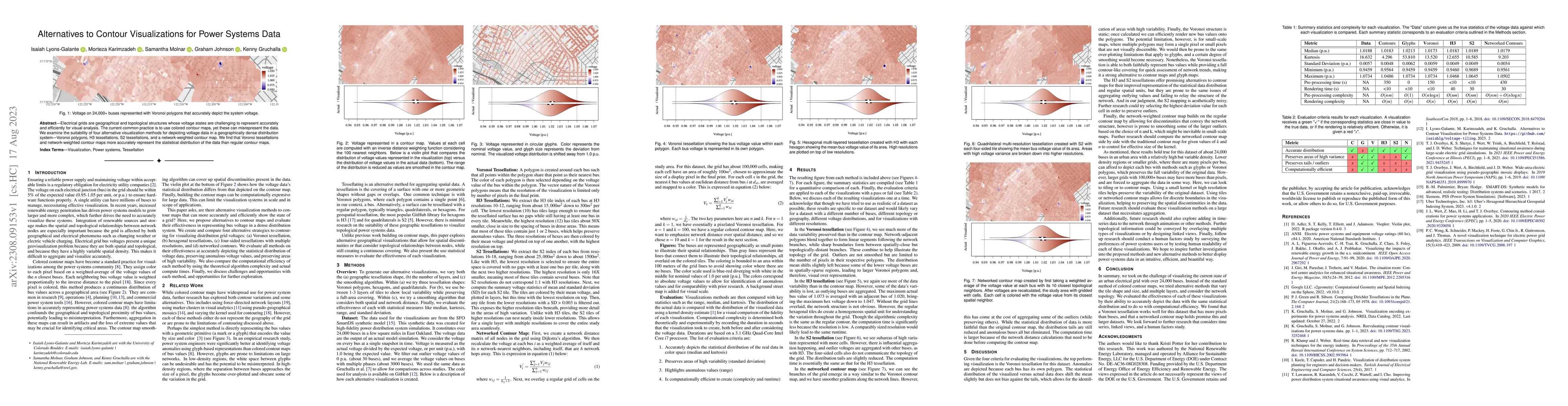
Electrical grids are geographical and topological structures whose voltage states are challenging to represent accurately and efficiently for visual analysis. The current common practice is to use c...
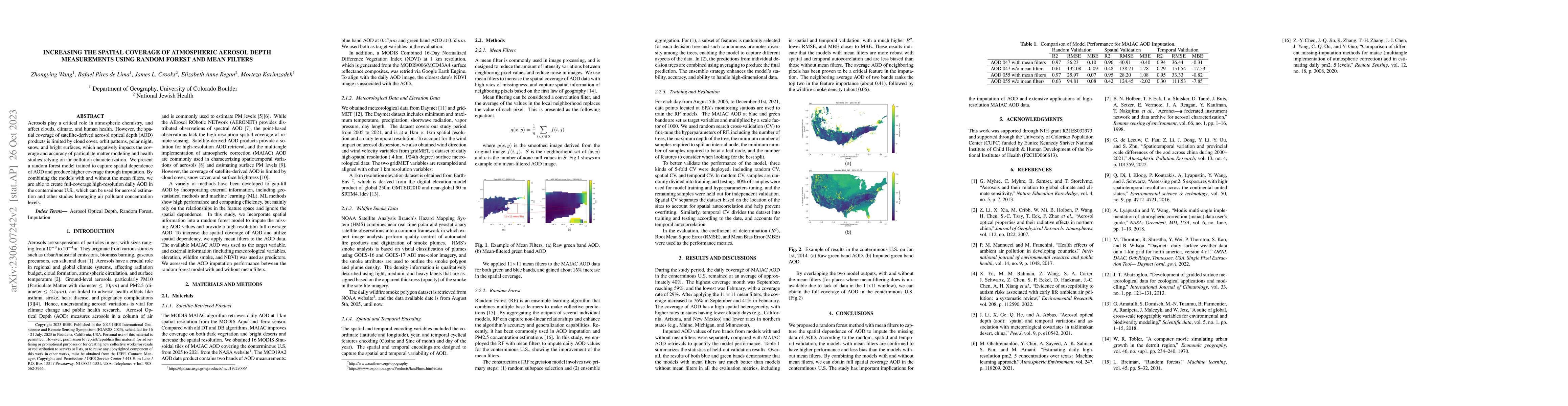
Aerosols play a critical role in atmospheric chemistry, and affect clouds, climate, and human health. However, the spatial coverage of satellite-derived aerosol optical depth (AOD) products is limit...
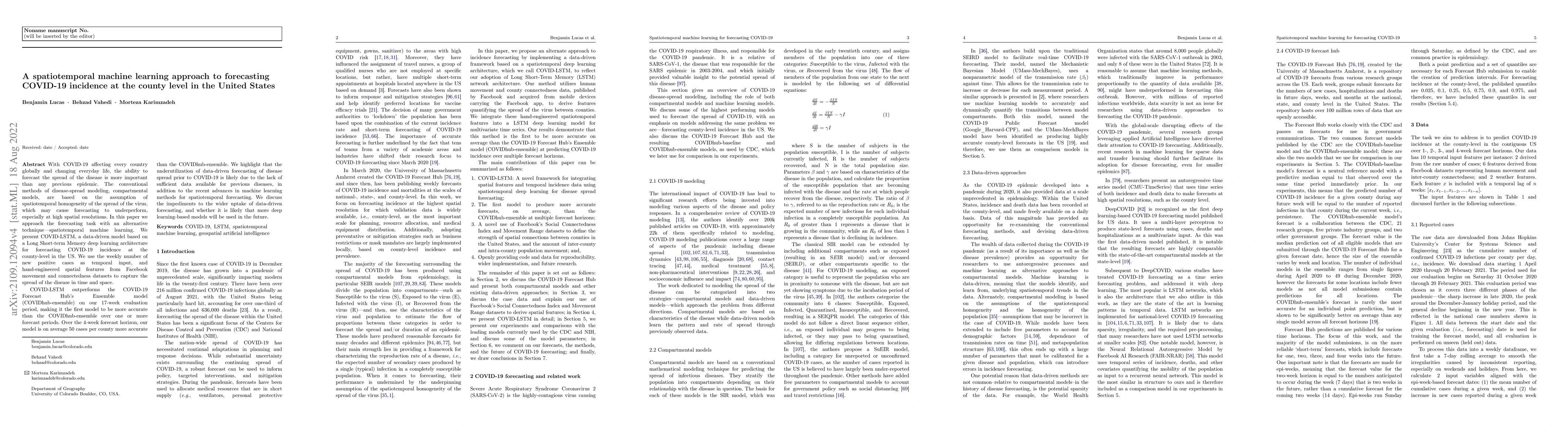
With COVID-19 affecting every country globally and changing everyday life, the ability to forecast the spread of the disease is more important than any previous epidemic. The conventional methods of...
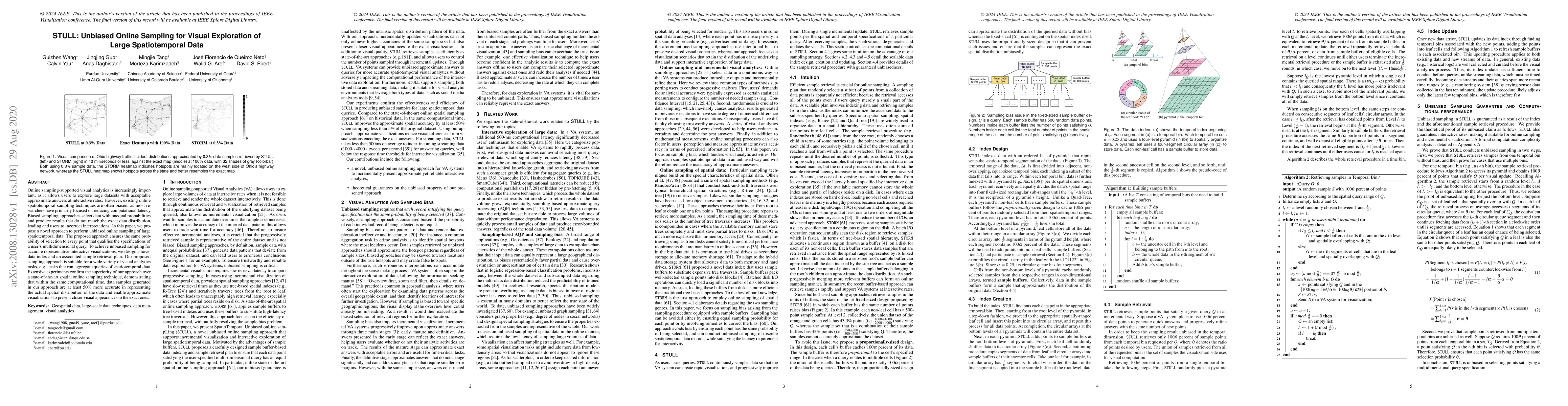
Online sampling-supported visual analytics is increasingly important, as it allows users to explore large datasets with acceptable approximate answers at interactive rates. However, existing online ...
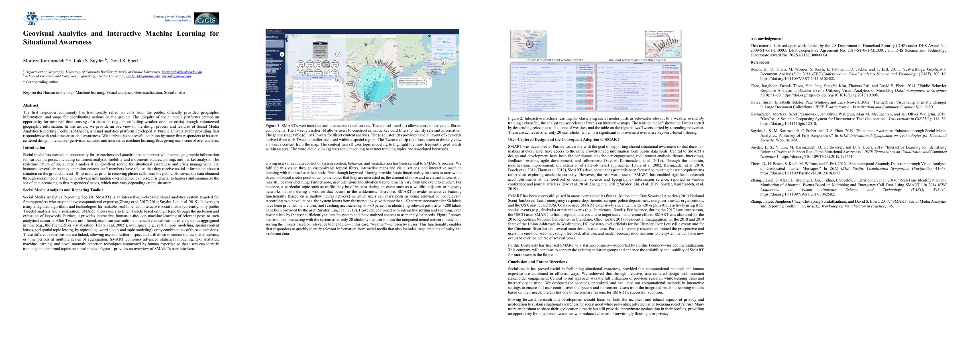
The first responder community has traditionally relied on calls from the public, officially-provided geographic information and maps for coordinating actions on the ground. The ubiquity of social me...
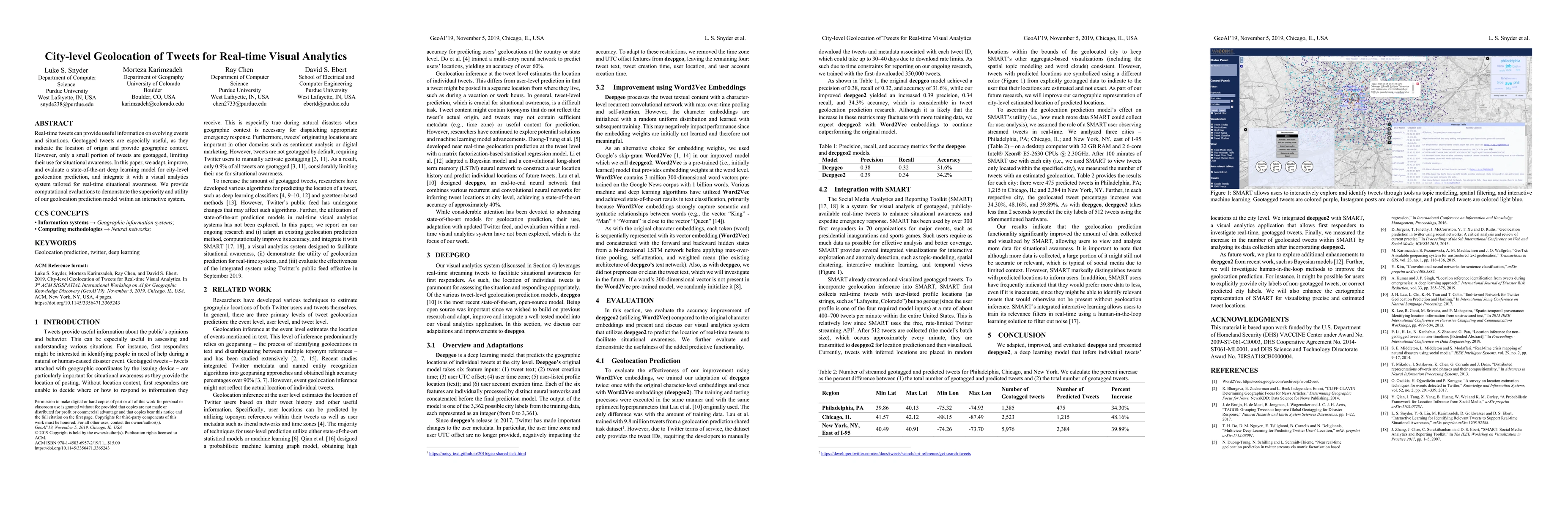
Real-time tweets can provide useful information on evolving events and situations. Geotagged tweets are especially useful, as they indicate the location of origin and provide geographic context. How...
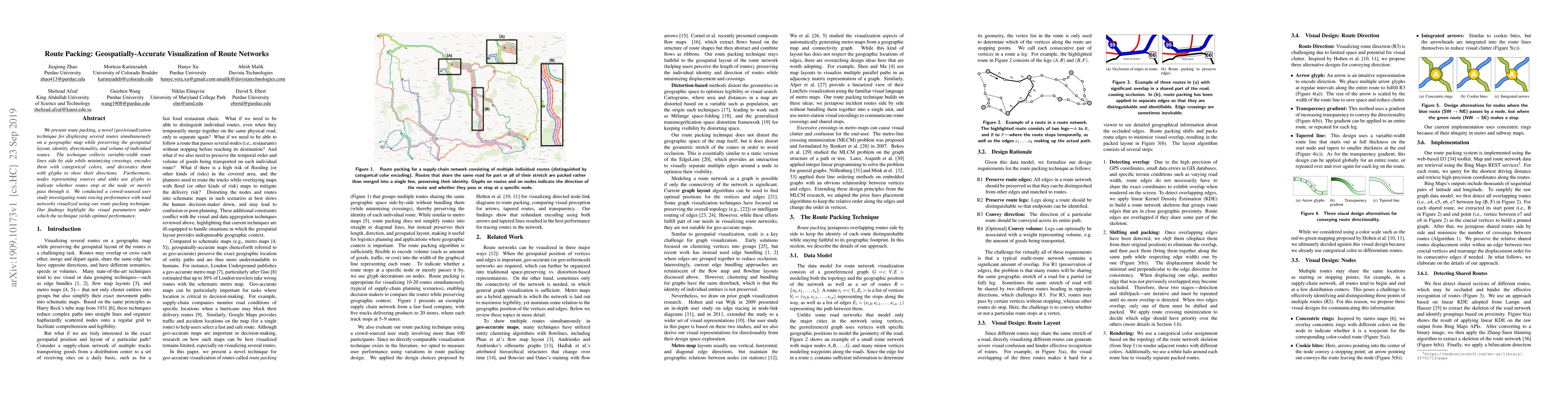
We present route packing, a novel (geo)visualization technique for displaying several routes simultaneously on a geographic map while preserving the geospatial layout, identity, directionality, and ...
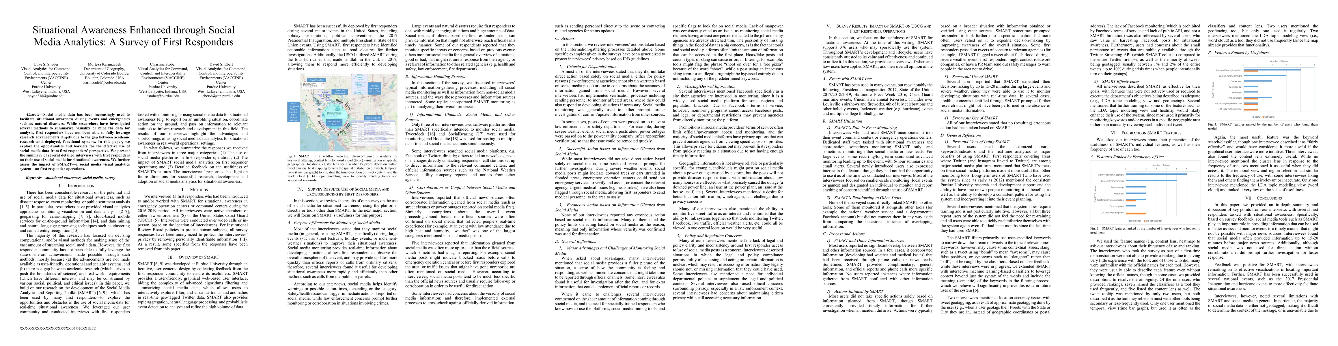
Social media data has been increasingly used to facilitate situational awareness during events and emergencies such as natural disasters. While researchers have investigated several methods to summa...
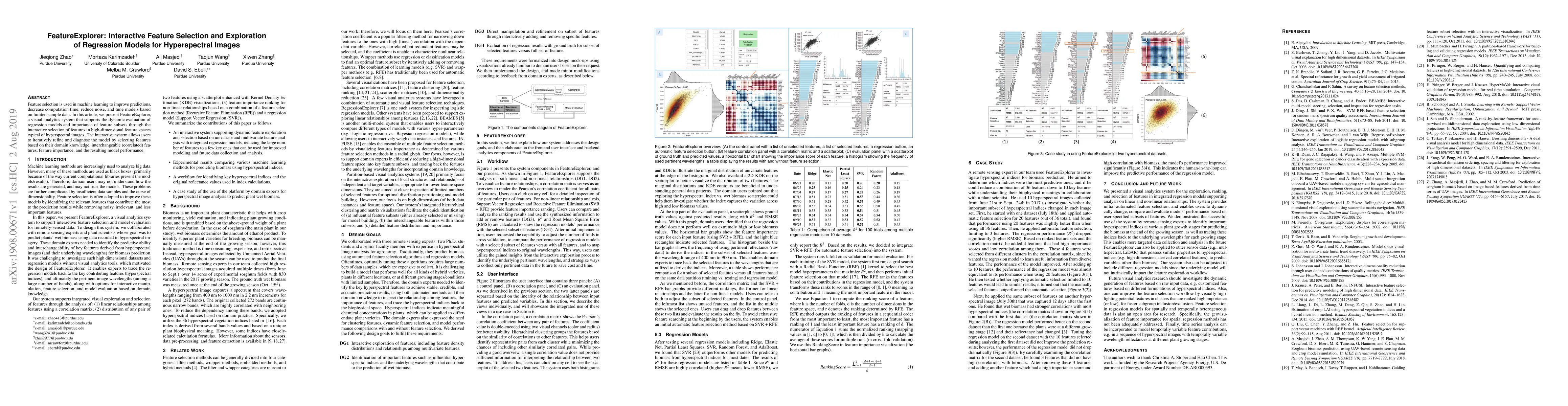
Feature selection is used in machine learning to improve predictions, decrease computation time, reduce noise, and tune models based on limited sample data. In this article, we present FeatureExplor...
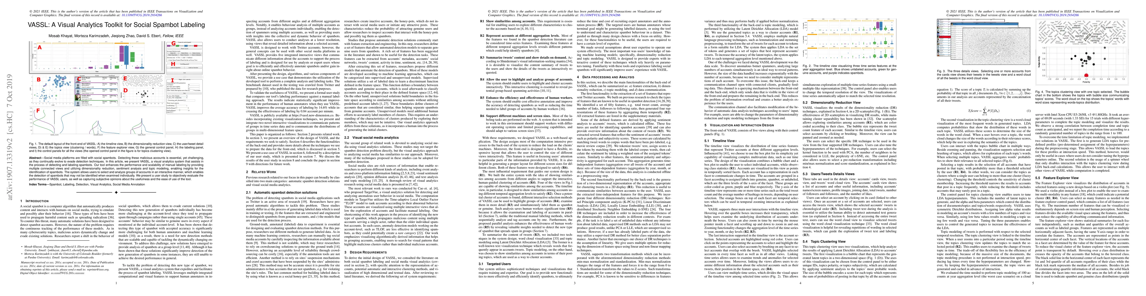
Social media platforms such as Twitter are filled with social spambots. Detecting these malicious accounts is essential, yet challenging, as they continually evolve and evade traditional detection t...
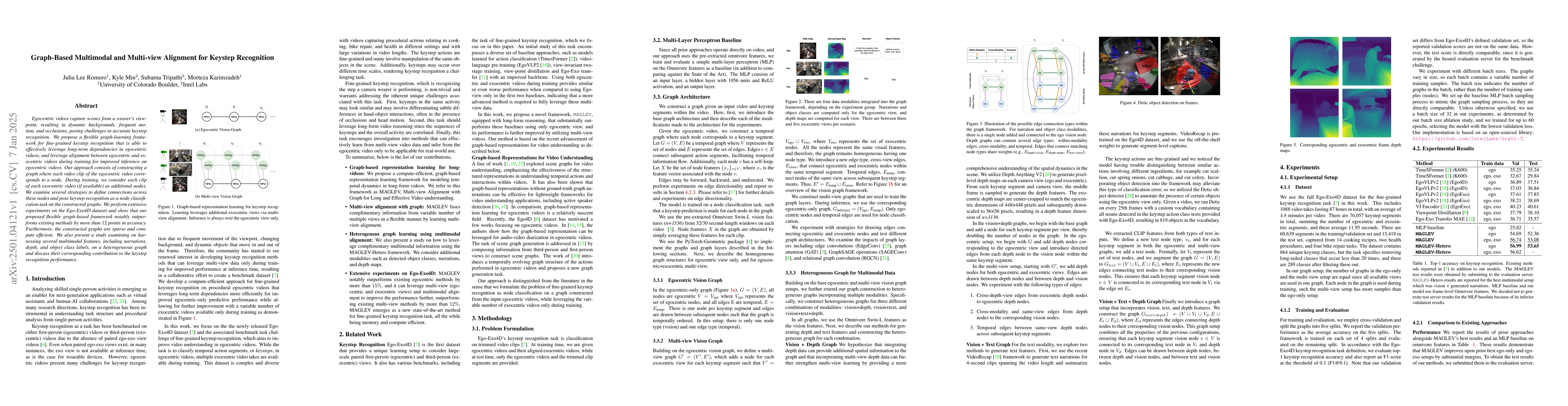
Egocentric videos capture scenes from a wearer's viewpoint, resulting in dynamic backgrounds, frequent motion, and occlusions, posing challenges to accurate keystep recognition. We propose a flexible ...
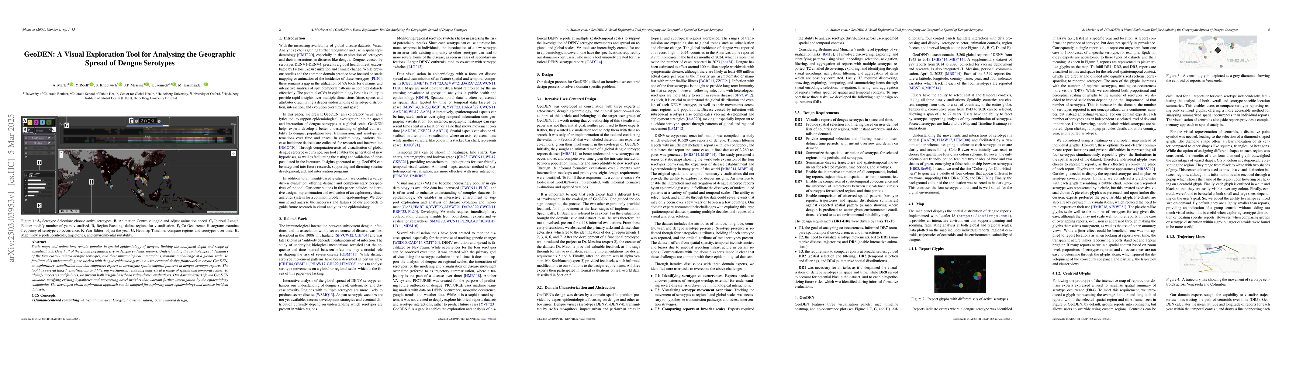
Static maps and animations remain popular in spatial epidemiology of dengue, limiting the analytical depth and scope of visualisations. Over half of the global population live in dengue endemic region...
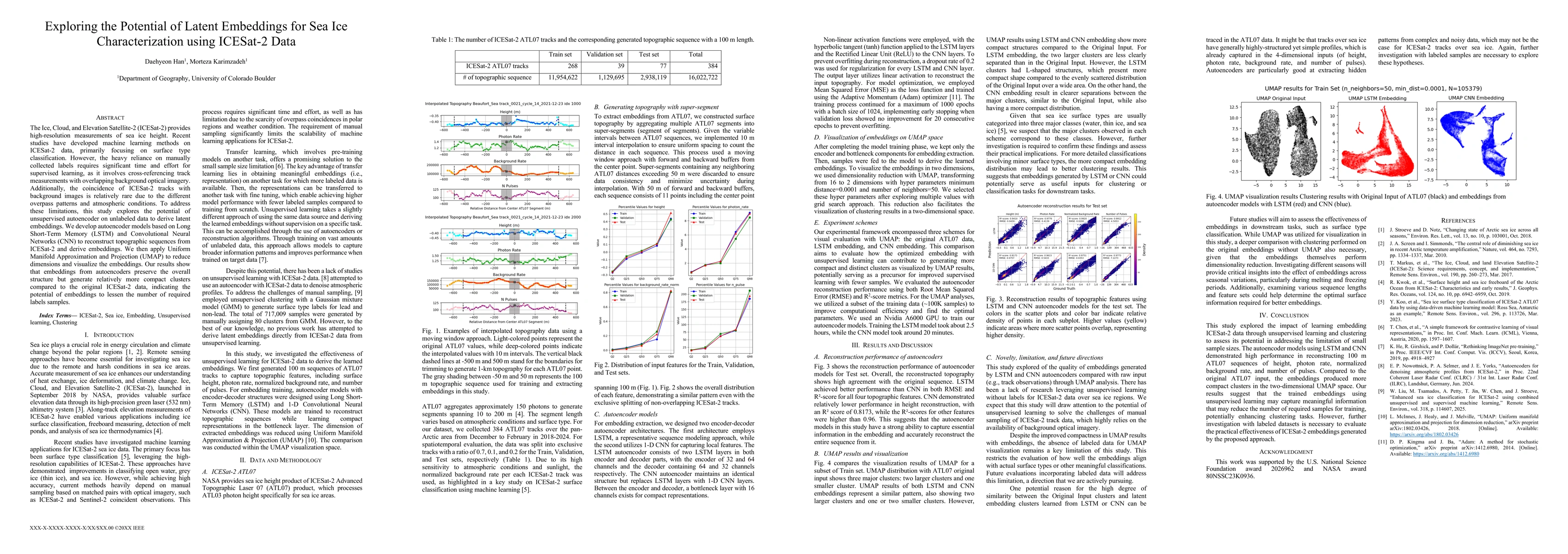
The Ice, Cloud, and Elevation Satellite-2 (ICESat-2) provides high-resolution measurements of sea ice height. Recent studies have developed machine learning methods on ICESat-2 data, primarily focusin...
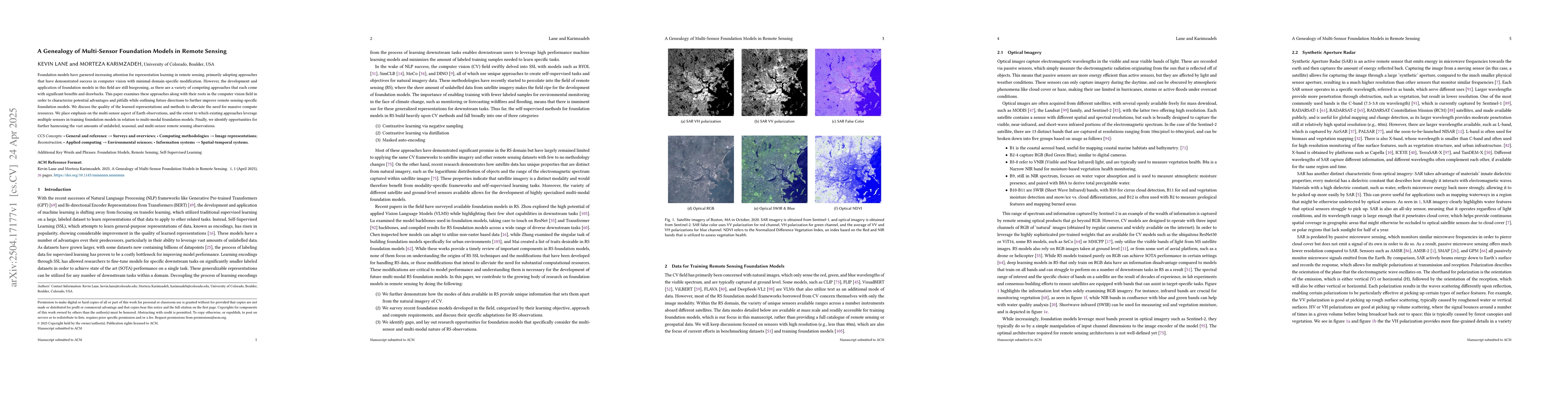
Foundation models have garnered increasing attention for representation learning in remote sensing, primarily adopting approaches that have demonstrated success in computer vision with minimal domain-...
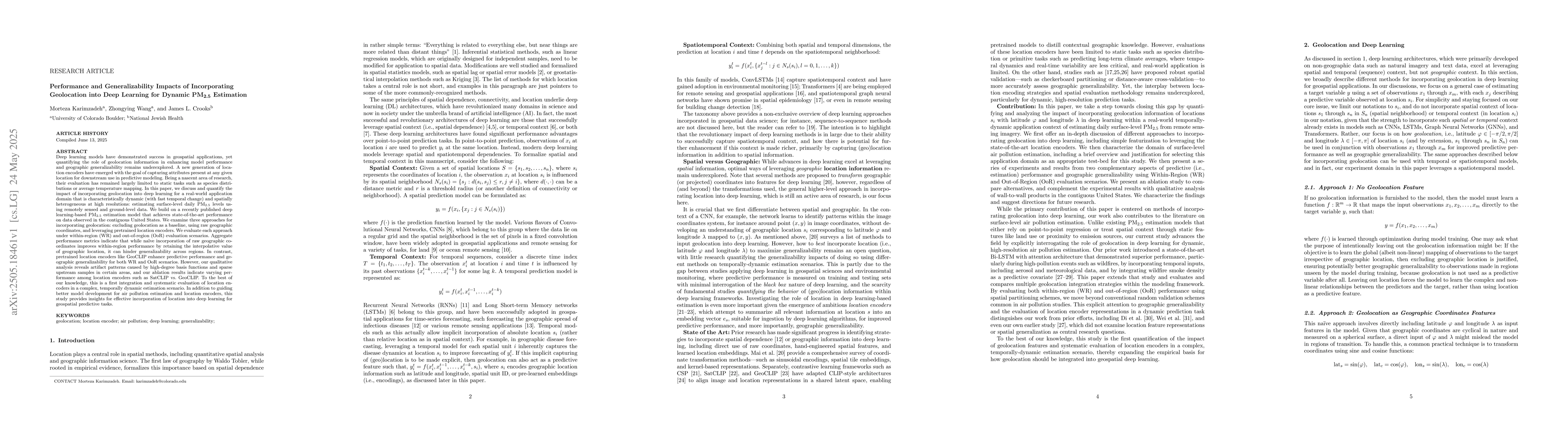
Deep learning models have demonstrated success in geospatial applications, yet quantifying the role of geolocation information in enhancing model performance and geographic generalizability remains un...
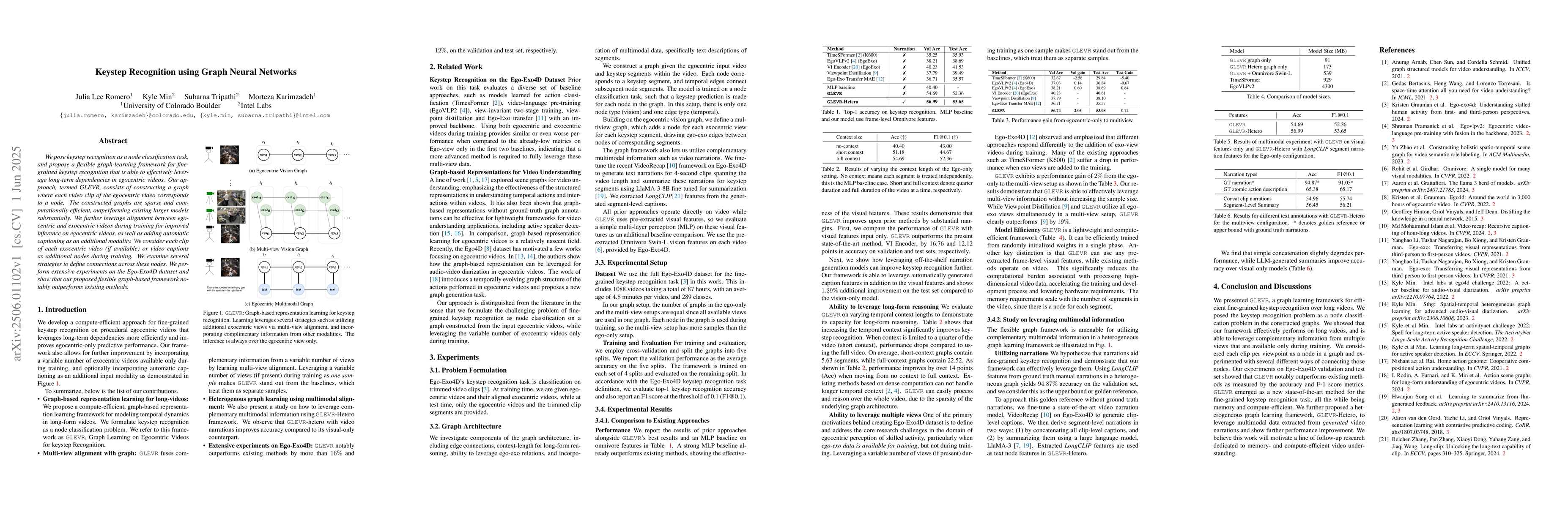
We pose keystep recognition as a node classification task, and propose a flexible graph-learning framework for fine-grained keystep recognition that is able to effectively leverage long-term dependenc...
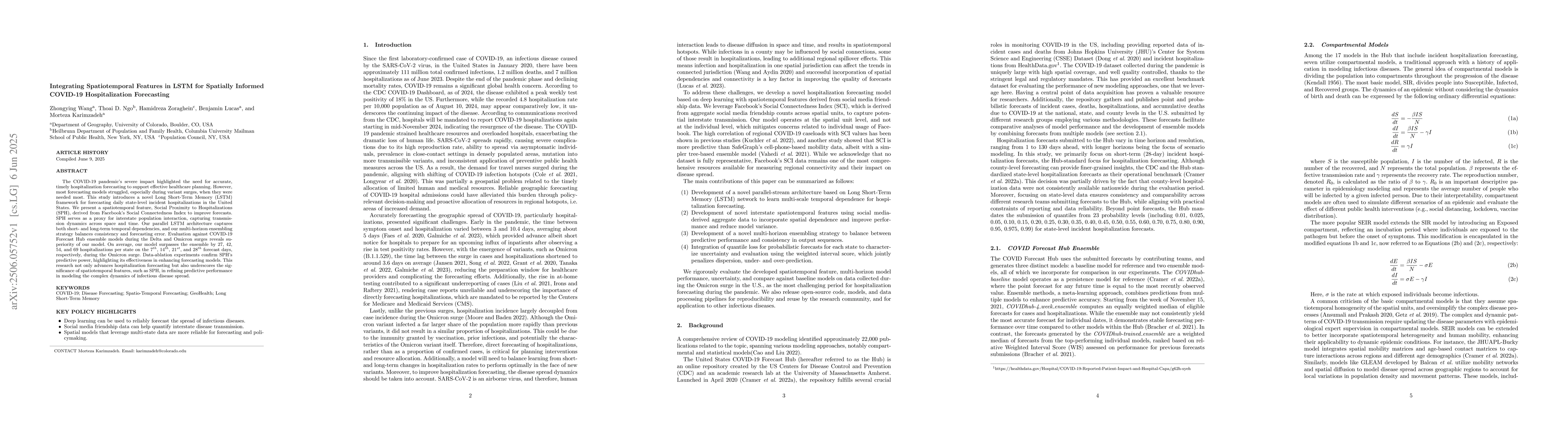
The COVID-19 pandemic's severe impact highlighted the need for accurate, timely hospitalization forecasting to support effective healthcare planning. However, most forecasting models struggled, especi...
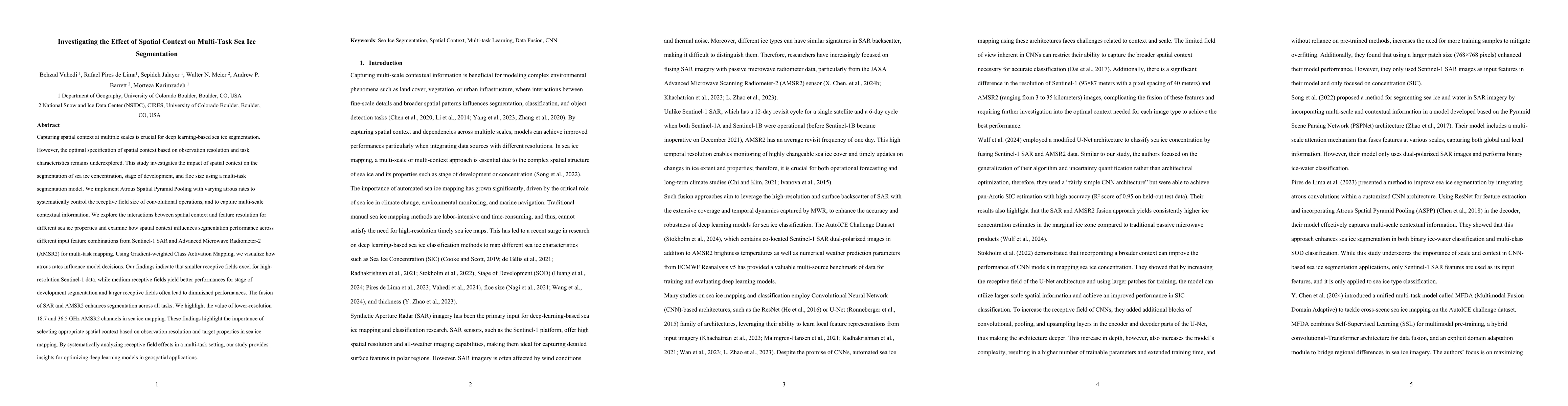
Capturing spatial context at multiple scales is crucial for deep learning-based sea ice segmentation. However, the optimal specification of spatial context based on observation resolution and task cha...
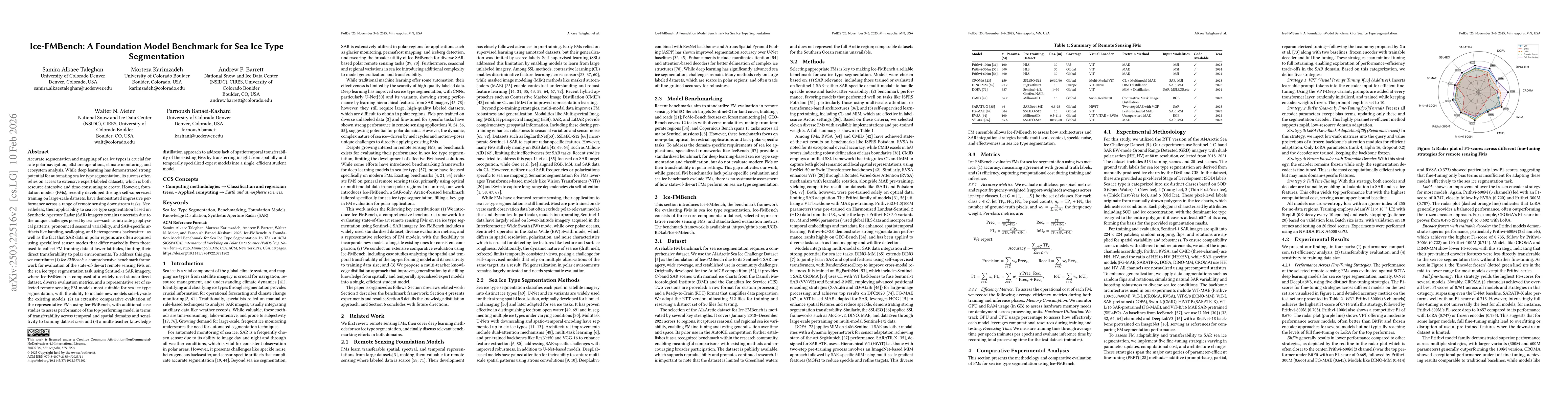
Accurate segmentation and mapping of sea ice types is crucial for safe polar navigation, offshore operations, and climate monitoring. While deep learning has demonstrated strong potential for automati...
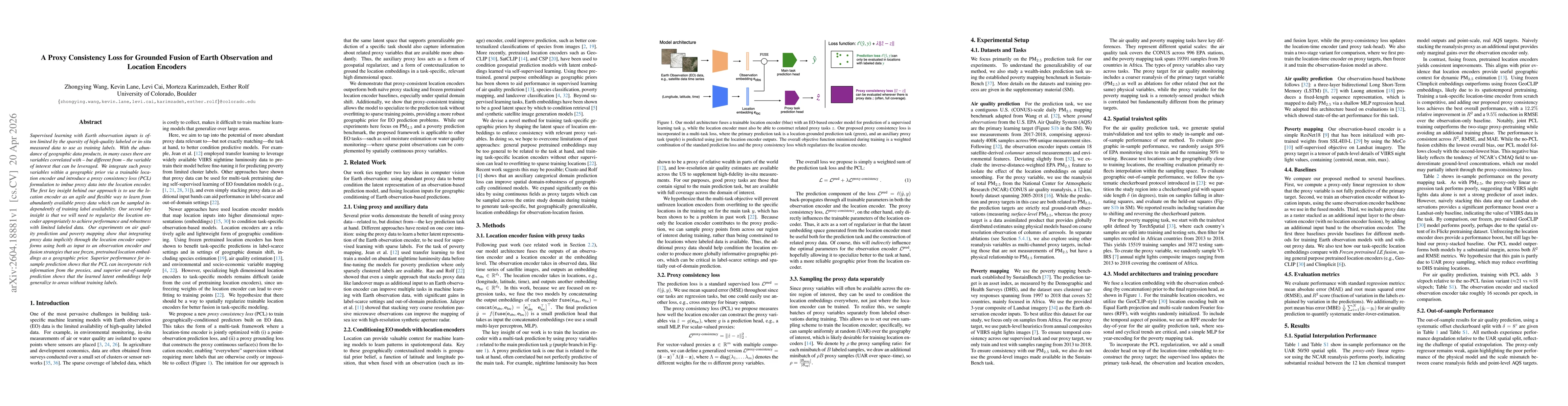
Supervised learning with Earth observation inputs is often limited by the sparsity of high-quality labeled or in-situ measured data to use as training labels. With the abundance of geographic data pro...
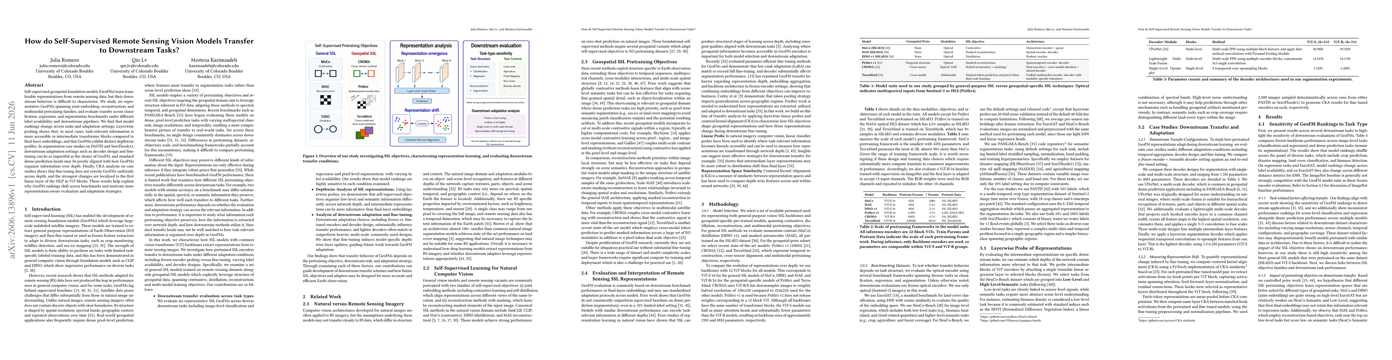
Self-supervised geospatial foundation models (GeoFMs) learn transferable representations from remote sensing data, but their downstream behavior is difficult to characterize. We study six representati...