Academic Profile
Statistics
Similar Authors
Papers on arXiv
Although geographically weighted Poisson regression (GWPR) is a popular regression for spatially indexed count data, its development is relatively limited compared to that found for linear geographi...
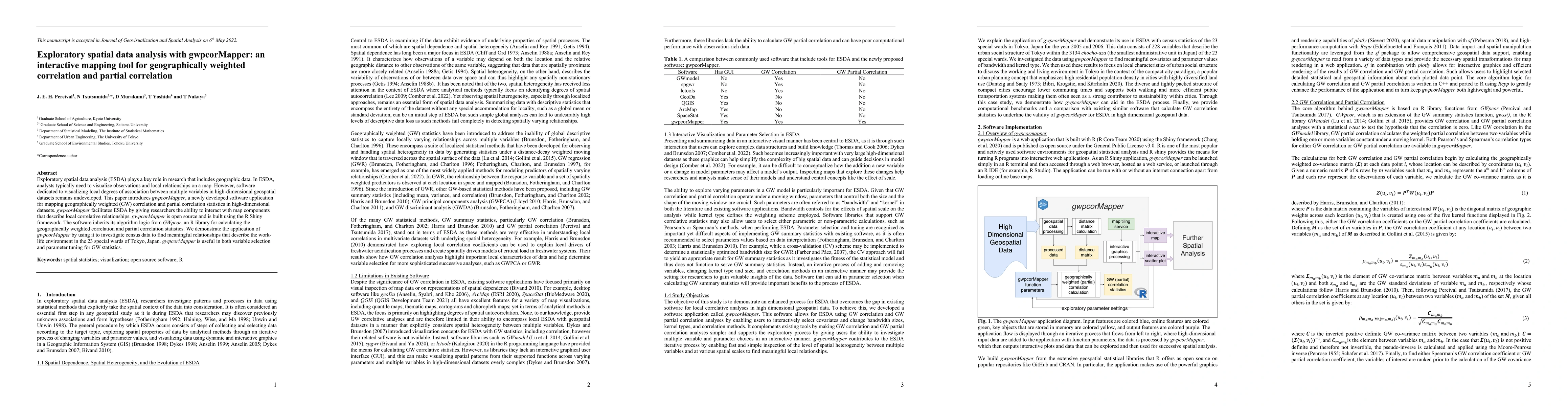
Exploratory spatial data analysis (ESDA) plays a key role in research that includes geographic data. In ESDA, analysts often want to be able to visualize observations and local relationships on a ma...
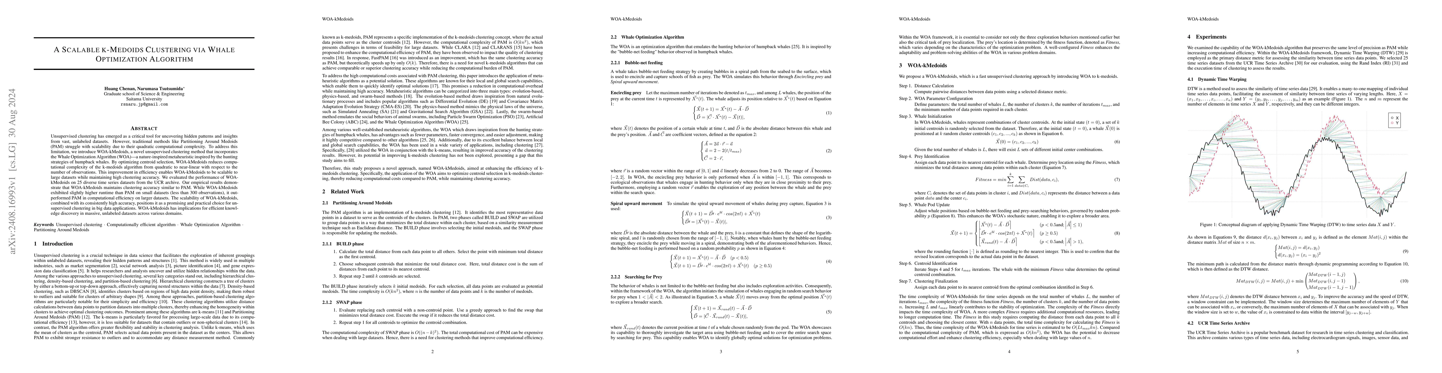
Unsupervised clustering has emerged as a critical tool for uncovering hidden patterns and insights from vast, unlabeled datasets. However, traditional methods like Partitioning Around Medoids (PAM) st...
Near real-time flood monitoring is crucial for disaster response, yet existing methods face significant limitations in training data requirements and cloud cover interference. Here we present a novel ...
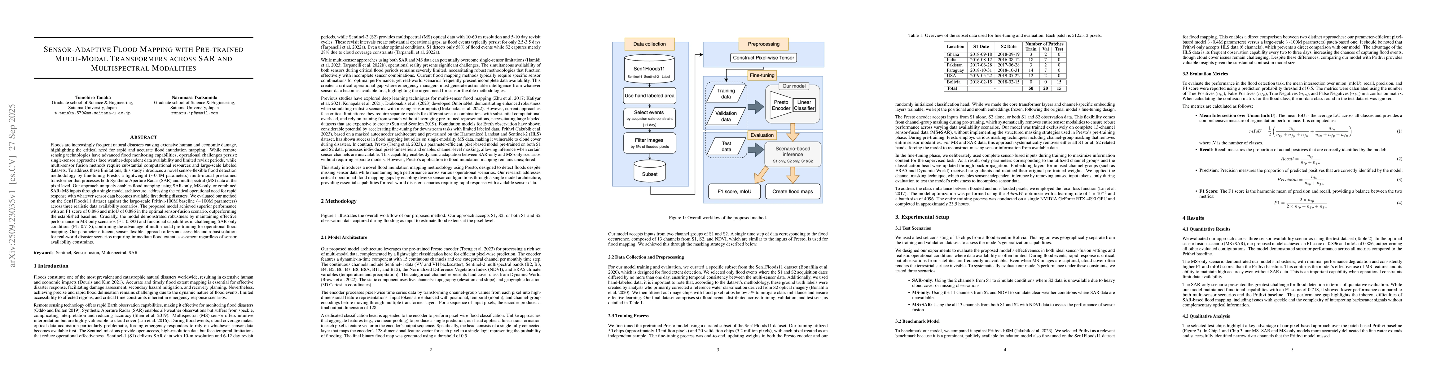
Floods are increasingly frequent natural disasters causing extensive human and economic damage, highlighting the critical need for rapid and accurate flood inundation mapping. While remote sensing tec...
This study develops the Local Aggregate Multiscale Process (LAMP), a scalable and machine-learning-compatible alternative to conventional spatial Gaussian processes (GPs, or kriging). Unlike conventio...
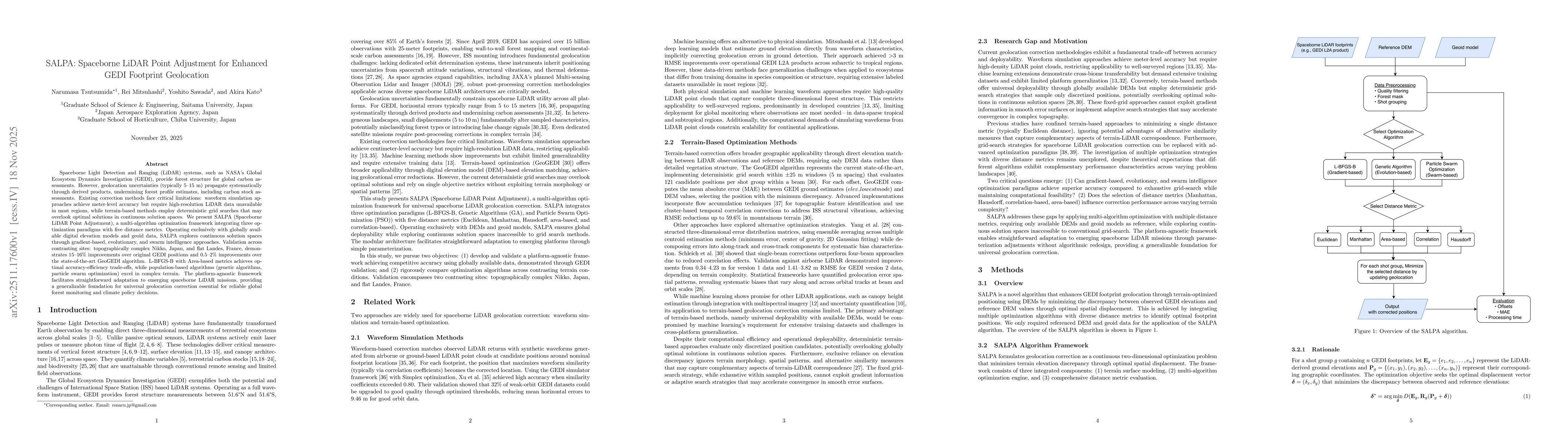
Spaceborne Light Detection and Ranging (LiDAR) systems, such as NASA's Global Ecosystem Dynamics Investigation (GEDI), provide forest structure for global carbon assessments. However, geolocation unce...
Although a recent study suggested that coarse-to-fine learning provides a fast and flexible framework for large-scale spatial process modeling, the method was originally developed for Gaussian respons...