Academic Profile
Statistics
Similar Authors
Papers on arXiv
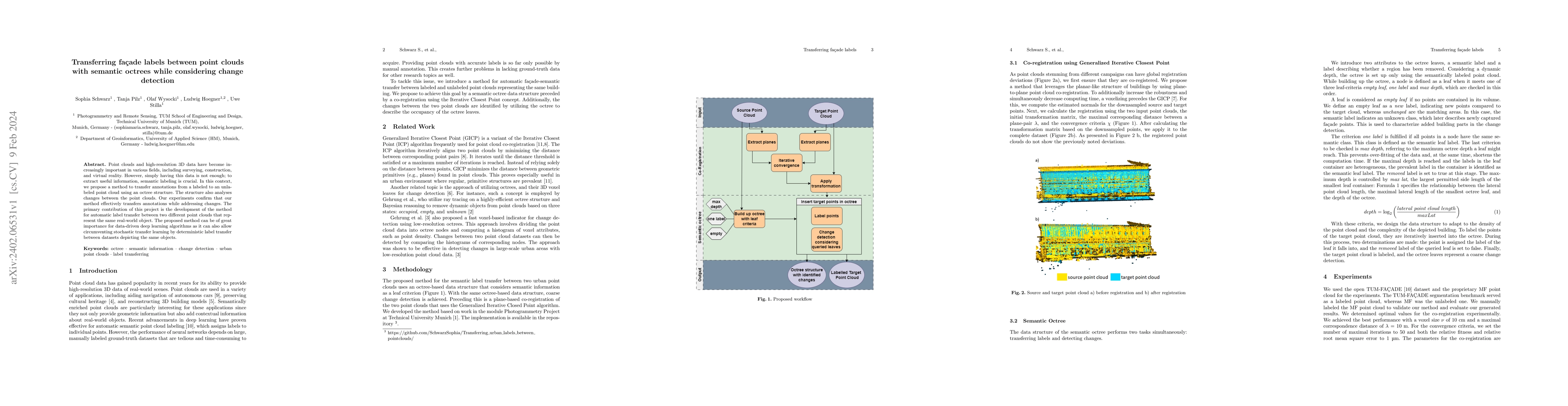
Point clouds and high-resolution 3D data have become increasingly important in various fields, including surveying, construction, and virtual reality. However, simply having this data is not enough;...
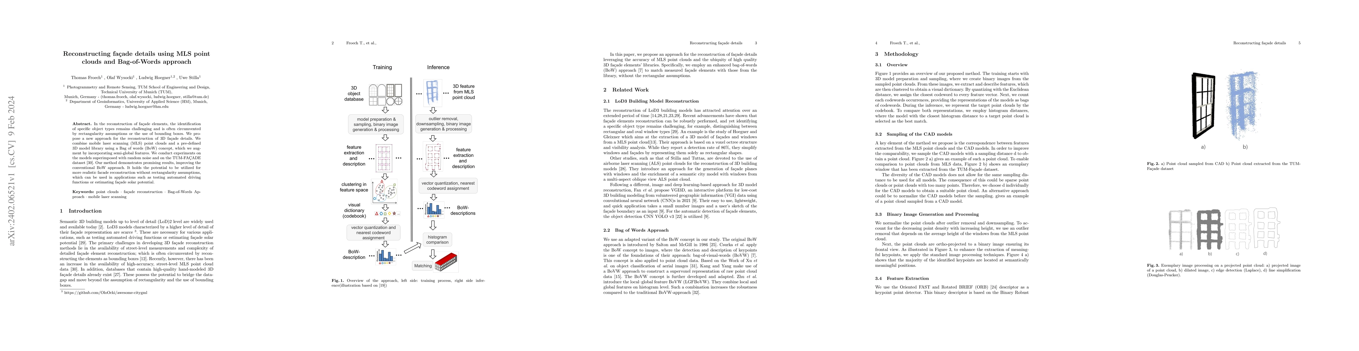
In the reconstruction of fa\c{c}ade elements, the identification of specific object types remains challenging and is often circumvented by rectangularity assumptions or the use of bounding boxes. We...
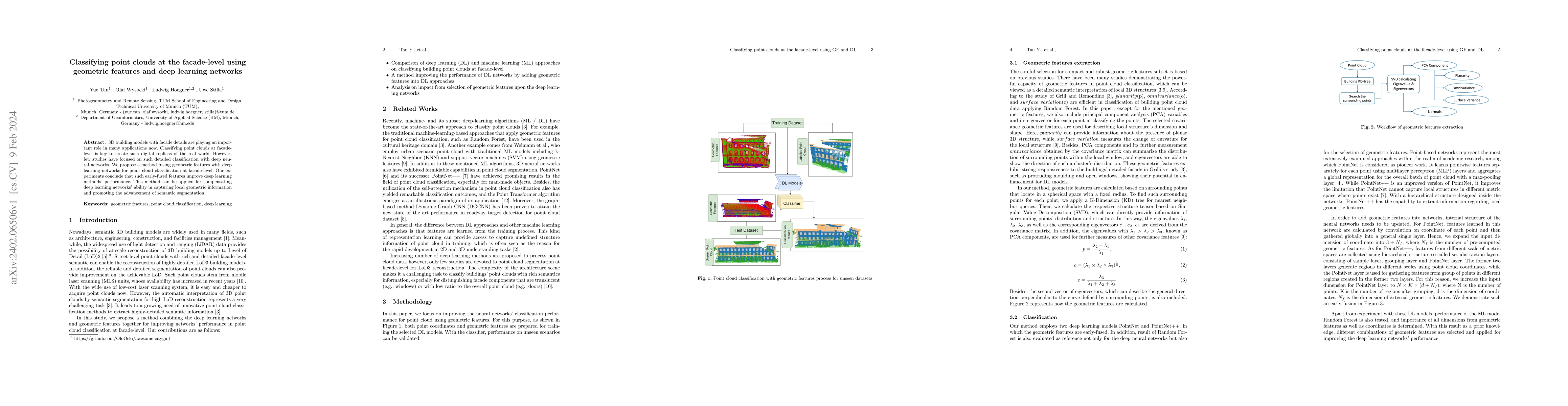
3D building models with facade details are playing an important role in many applications now. Classifying point clouds at facade-level is key to create such digital replicas of the real world. Howe...
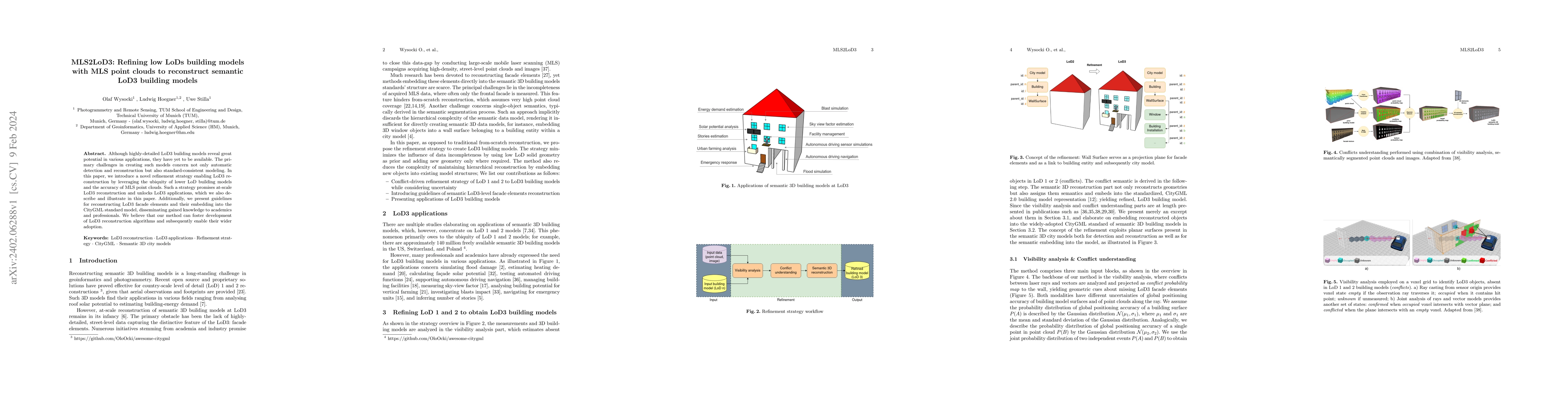
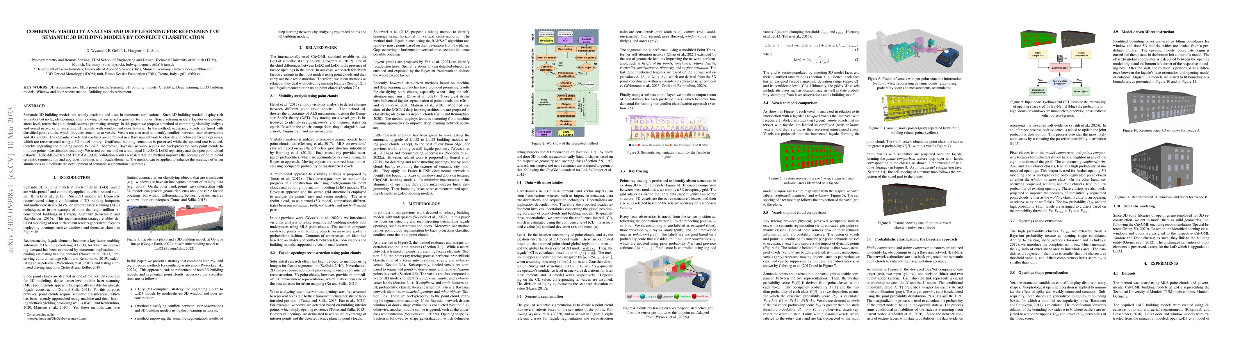
Although highly-detailed LoD3 building models reveal great potential in various applications, they have yet to be available. The primary challenges in creating such models concern not only automatic...
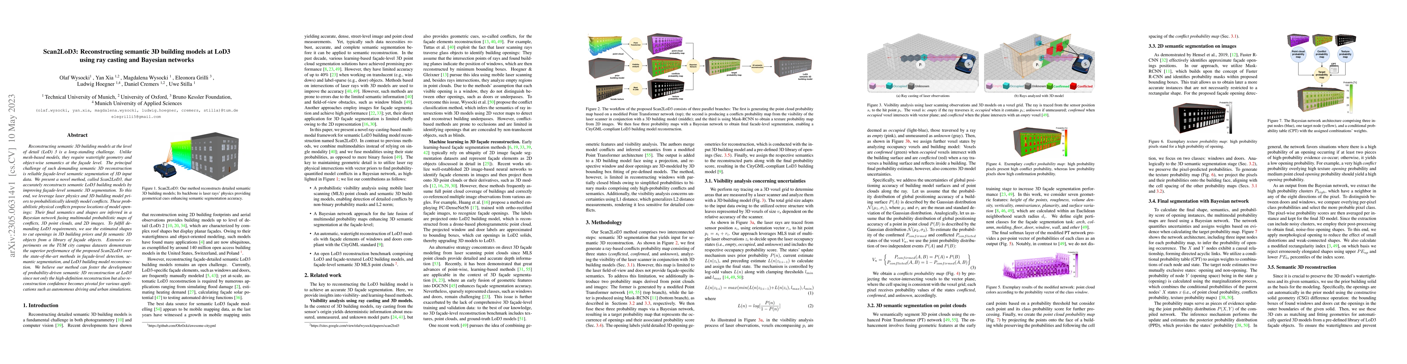
Reconstructing semantic 3D building models at the level of detail (LoD) 3 is a long-standing challenge. Unlike mesh-based models, they require watertight geometry and object-wise semantics at the fa...
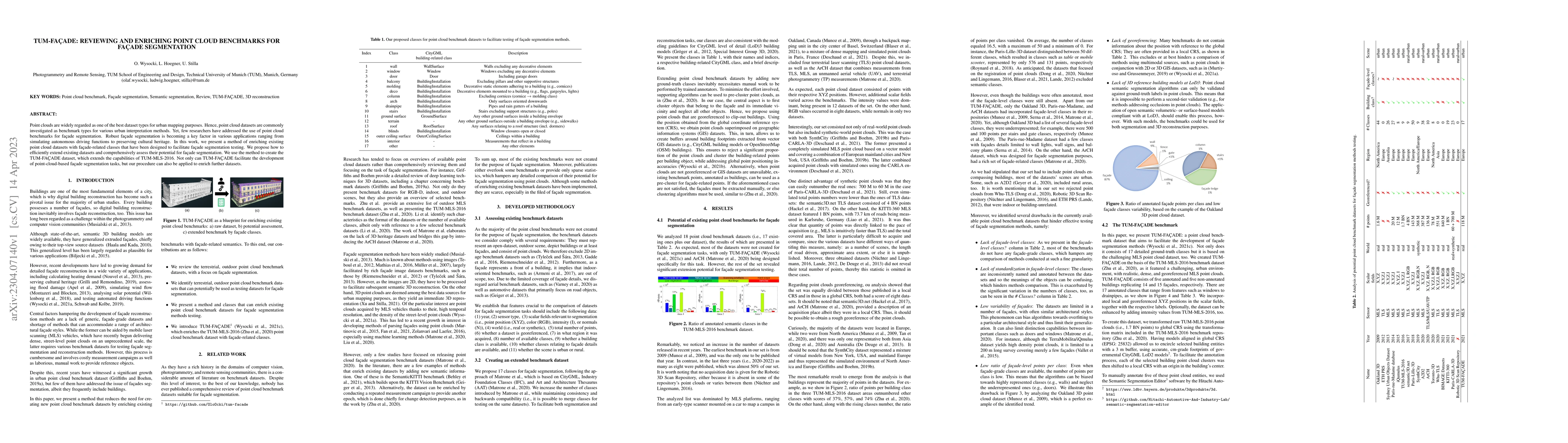
Point clouds are widely regarded as one of the best dataset types for urban mapping purposes. Hence, point cloud datasets are commonly investigated as benchmark types for various urban interpretatio...
Semantic 3D building models are widely available and used in numerous applications. Such 3D building models display rich semantics but no fa\c{c}ade openings, chiefly owing to their aerial acquisiti...
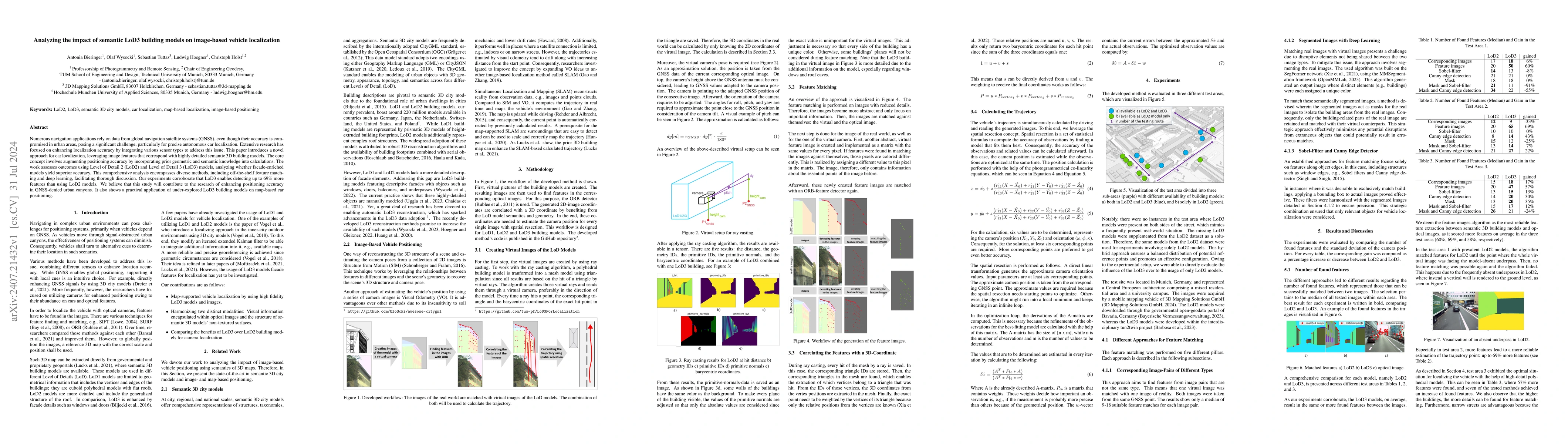
Numerous navigation applications rely on data from global navigation satellite systems (GNSS), even though their accuracy is compromised in urban areas, posing a significant challenge, particularly fo...
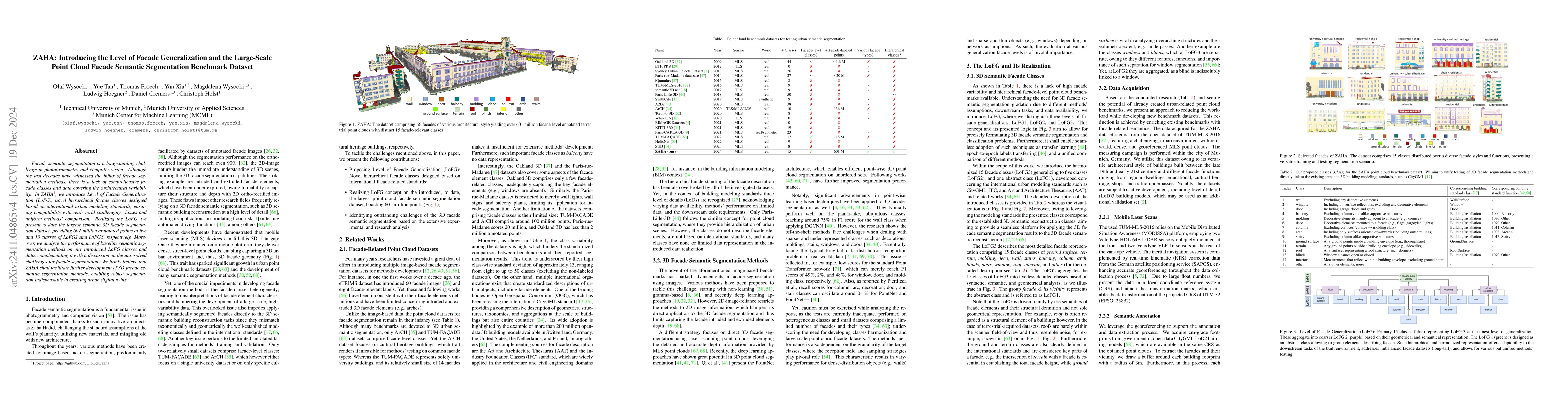
Facade semantic segmentation is a long-standing challenge in photogrammetry and computer vision. Although the last decades have witnessed the influx of facade segmentation methods, there is a lack of ...
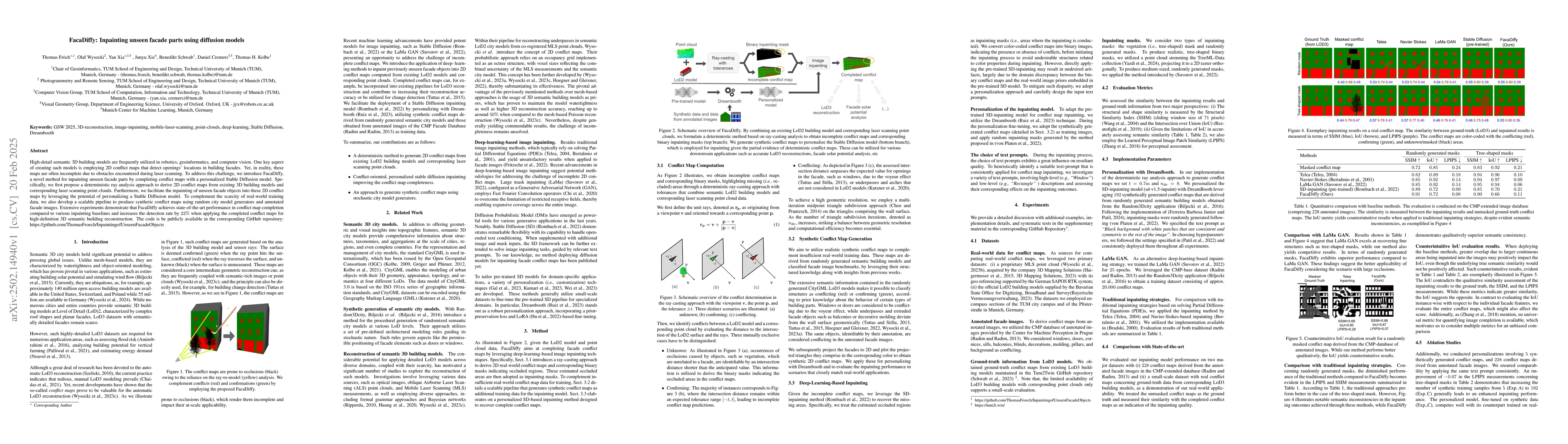
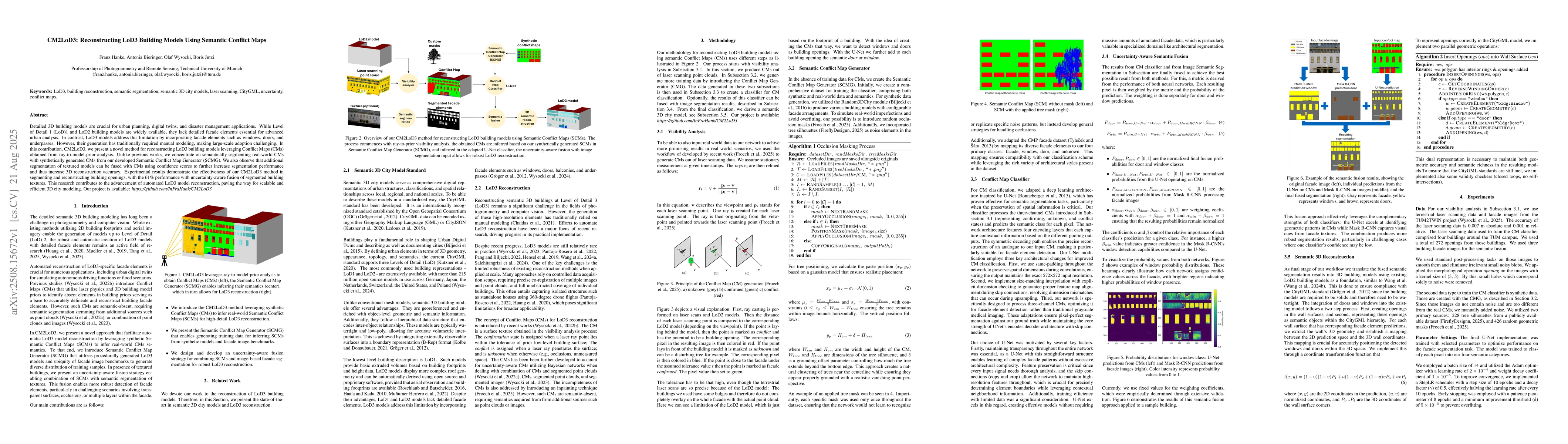
High-detail semantic 3D building models are frequently utilized in robotics, geoinformatics, and computer vision. One key aspect of creating such models is employing 2D conflict maps that detect openi...
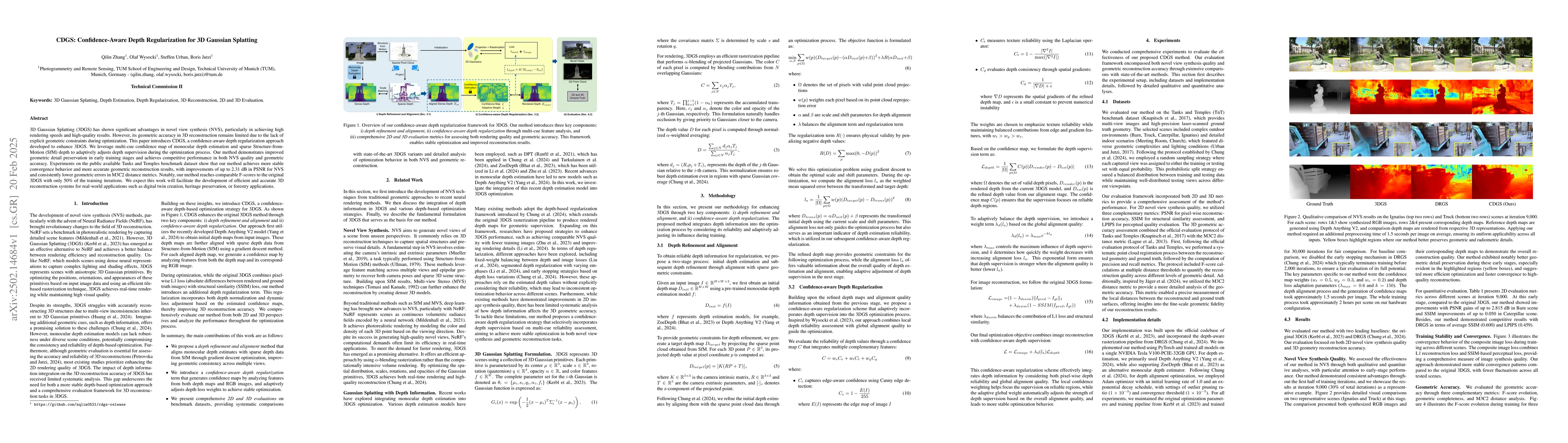
3D Gaussian Splatting (3DGS) has shown significant advantages in novel view synthesis (NVS), particularly in achieving high rendering speeds and high-quality results. However, its geometric accuracy i...
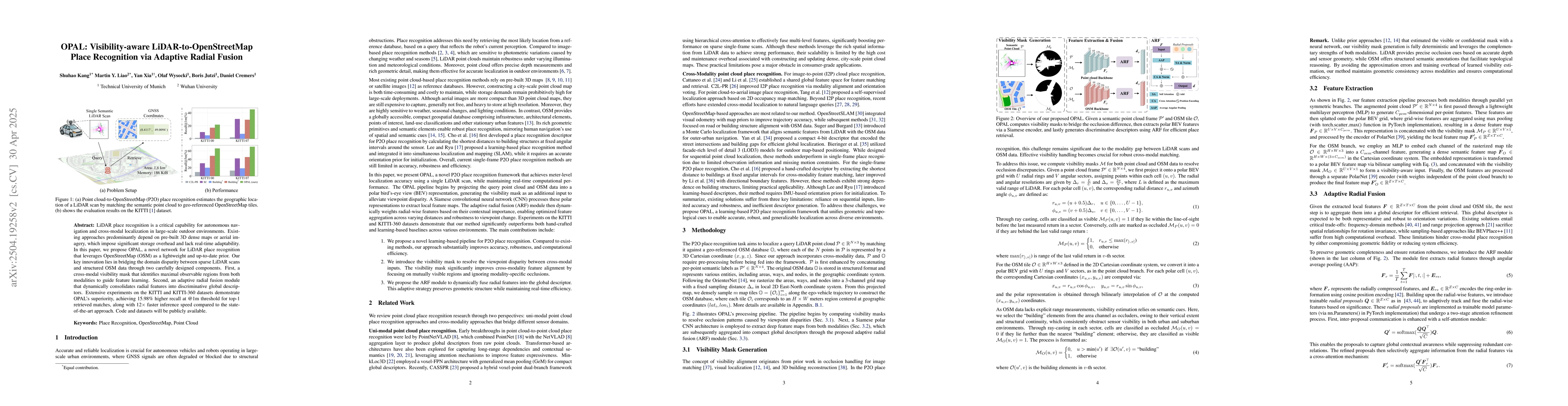
LiDAR place recognition is a critical capability for autonomous navigation and cross-modal localization in large-scale outdoor environments. Existing approaches predominantly depend on pre-built 3D de...
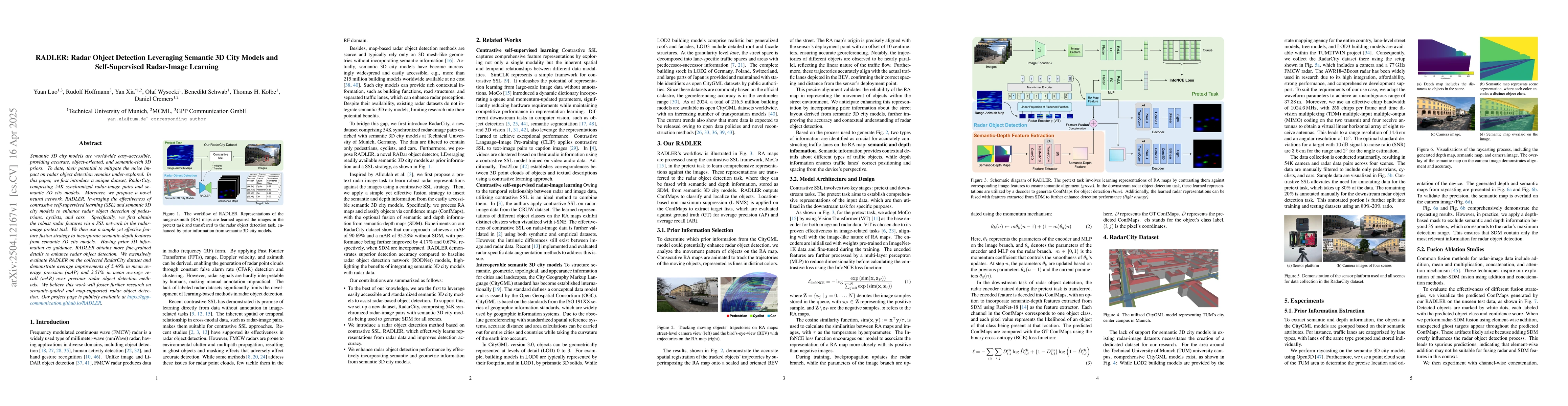
Semantic 3D city models are worldwide easy-accessible, providing accurate, object-oriented, and semantic-rich 3D priors. To date, their potential to mitigate the noise impact on radar object detection...
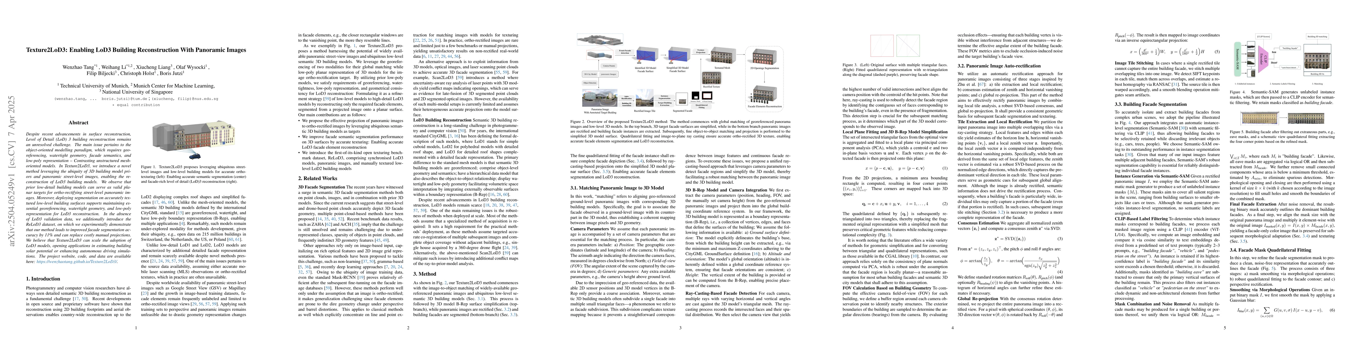
Despite recent advancements in surface reconstruction, Level of Detail (LoD) 3 building reconstruction remains an unresolved challenge. The main issue pertains to the object-oriented modelling paradig...
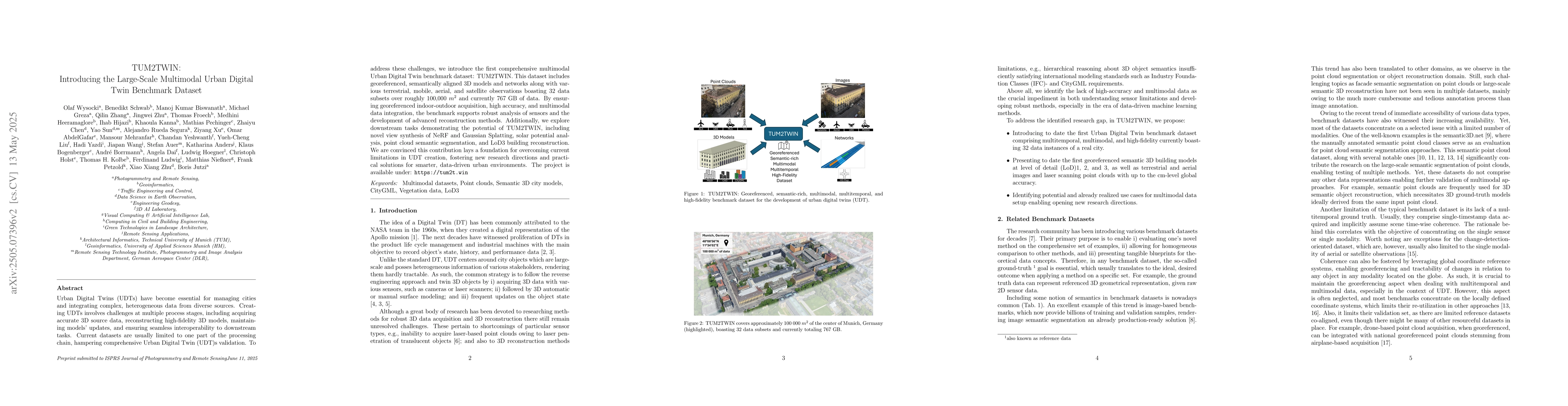
Urban Digital Twins (UDTs) have become essential for managing cities and integrating complex, heterogeneous data from diverse sources. Creating UDTs involves challenges at multiple process stages, inc...
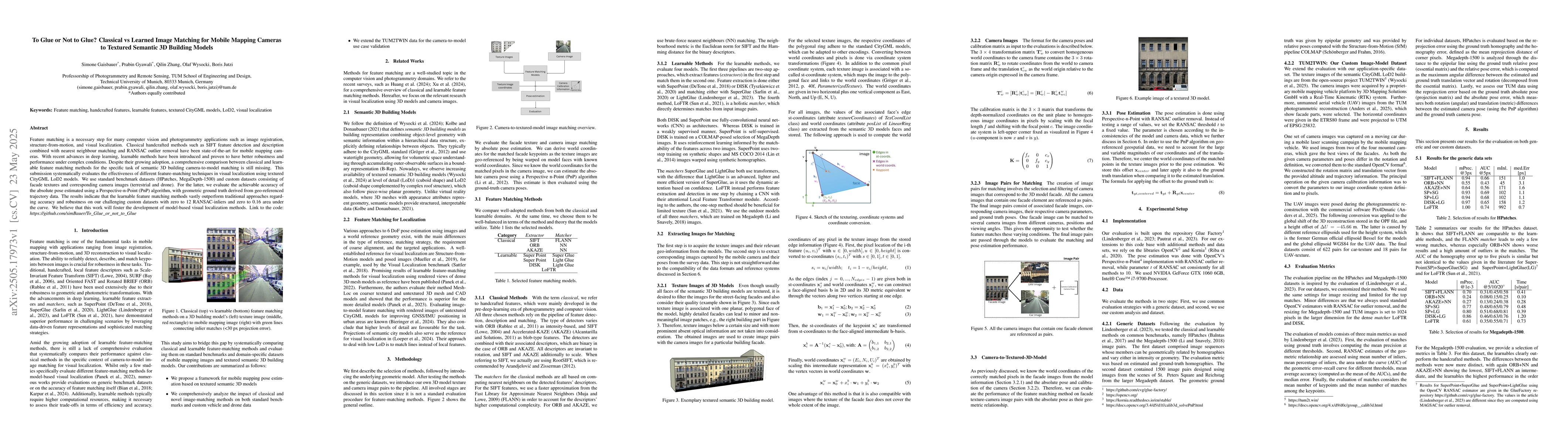
Feature matching is a necessary step for many computer vision and photogrammetry applications such as image registration, structure-from-motion, and visual localization. Classical handcrafted methods ...
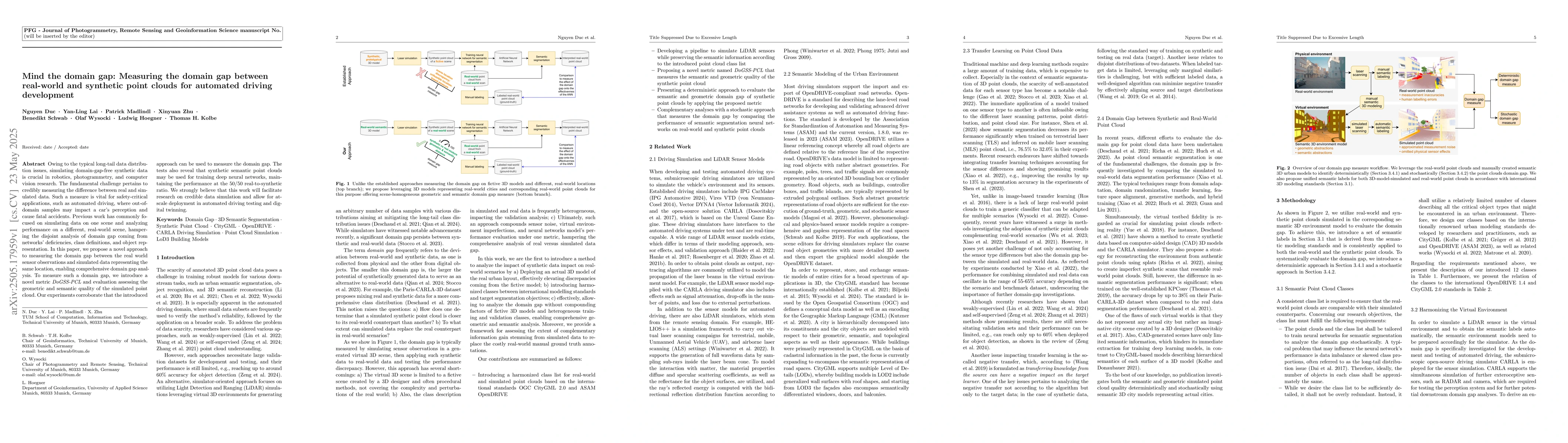
Owing to the typical long-tail data distribution issues, simulating domain-gap-free synthetic data is crucial in robotics, photogrammetry, and computer vision research. The fundamental challenge perta...
Recent advances in Gaussian Splatting (GS) have demonstrated its effectiveness in photo-realistic rendering and 3D reconstruction. Among these, 2D Gaussian Splatting (2DGS) is particularly suitable fo...
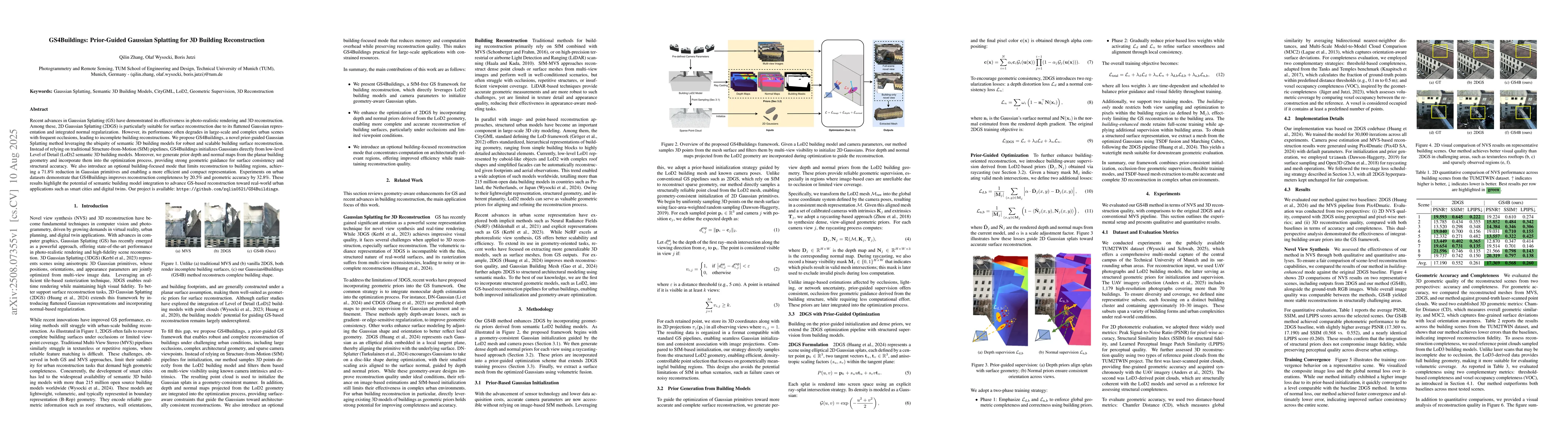
Detailed 3D building models are crucial for urban planning, digital twins, and disaster management applications. While Level of Detail 1 (LoD)1 and LoD2 building models are widely available, they lack...
Point clouds are widely used for infrastructure monitoring by providing geometric information, where segmentation is required for downstream tasks such as defect detection. Existing research has autom...
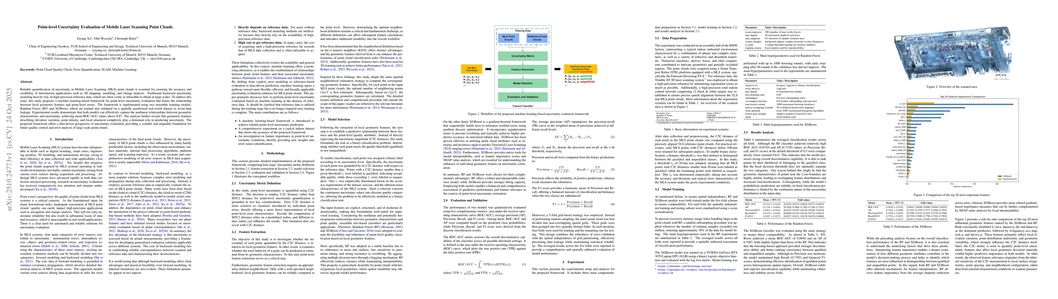
Reliable quantification of uncertainty in Mobile Laser Scanning (MLS) point clouds is essential for ensuring the accuracy and credibility of downstream applications such as 3D mapping, modeling, and c...
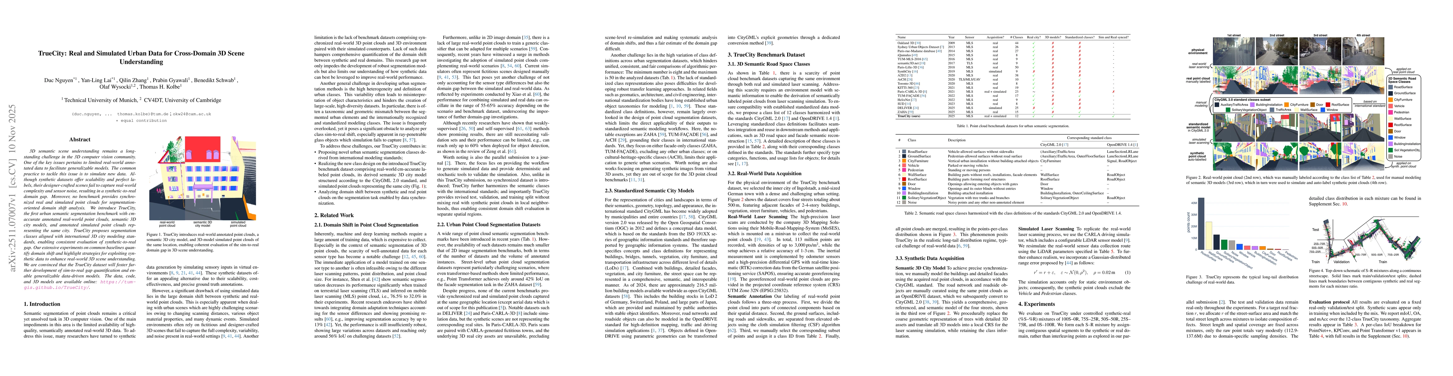
3D semantic scene understanding remains a long-standing challenge in the 3D computer vision community. One of the key issues pertains to limited real-world annotated data to facilitate generalizable m...
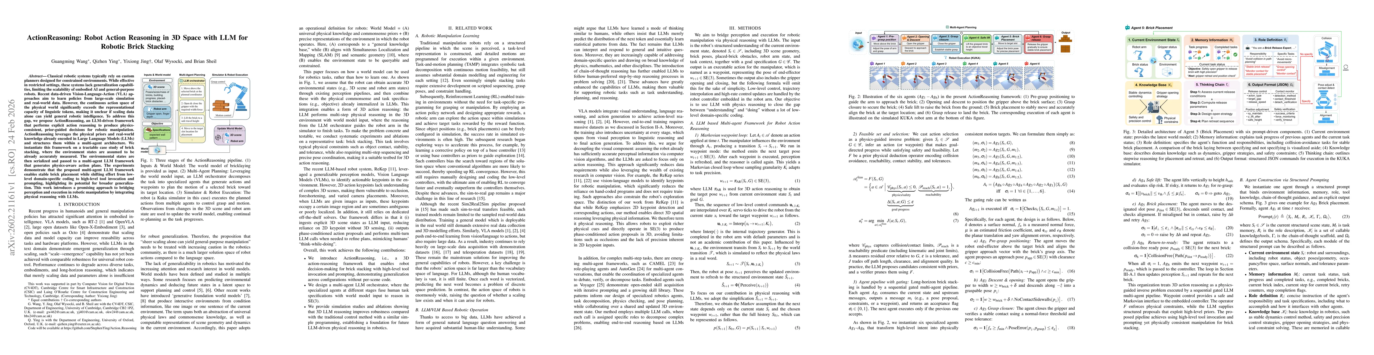
Classical robotic systems typically rely on custom planners designed for constrained environments. While effective in restricted settings, these systems lack generalization capabilities, limiting the ...
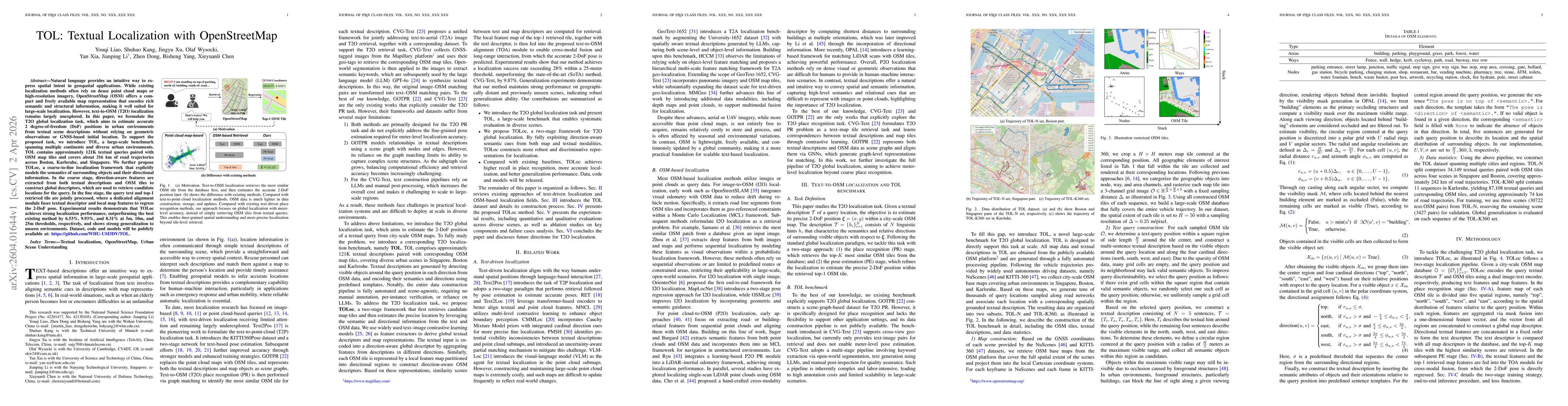
Natural language provides an intuitive way to express spatial intent in geospatial applications. While existing localization methods often rely on dense point cloud maps or high-resolution imagery, Op...
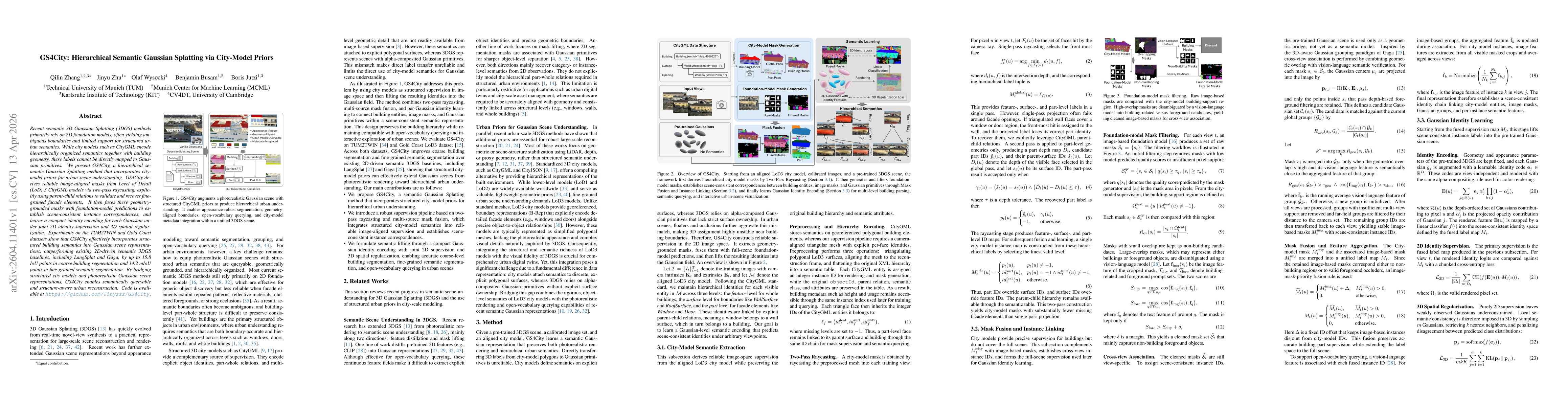
Recent semantic 3D Gaussian Splatting (3DGS) methods primarily rely on 2D foundation models, often yielding ambiguous boundaries and limited support for structured urban semantics. While city models s...
3D Gaussian Splatting (3DGS) has been widely adopted for scene reconstruction, where training inherently constitutes a highly coupled and non-convex optimization problem. Recent works commonly incorpo...
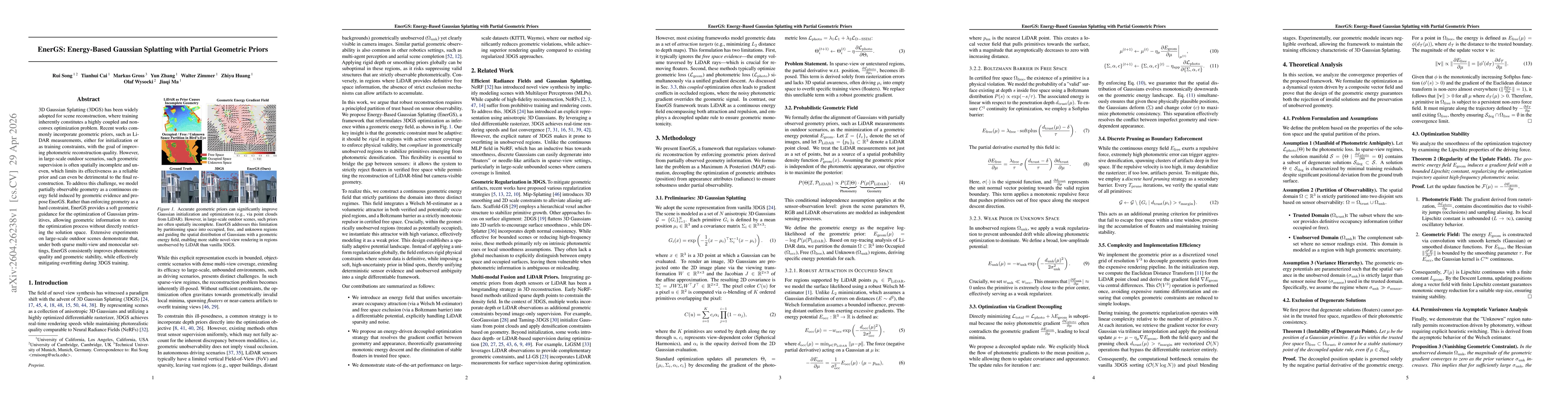
Feedforward 3D Gaussian Splatting (3DGS) often struggles in trajectory-based sparse-view driving scenes. Existing Gaussian repair methods mainly target optimization-based 3DGS, while diffusion-based r...
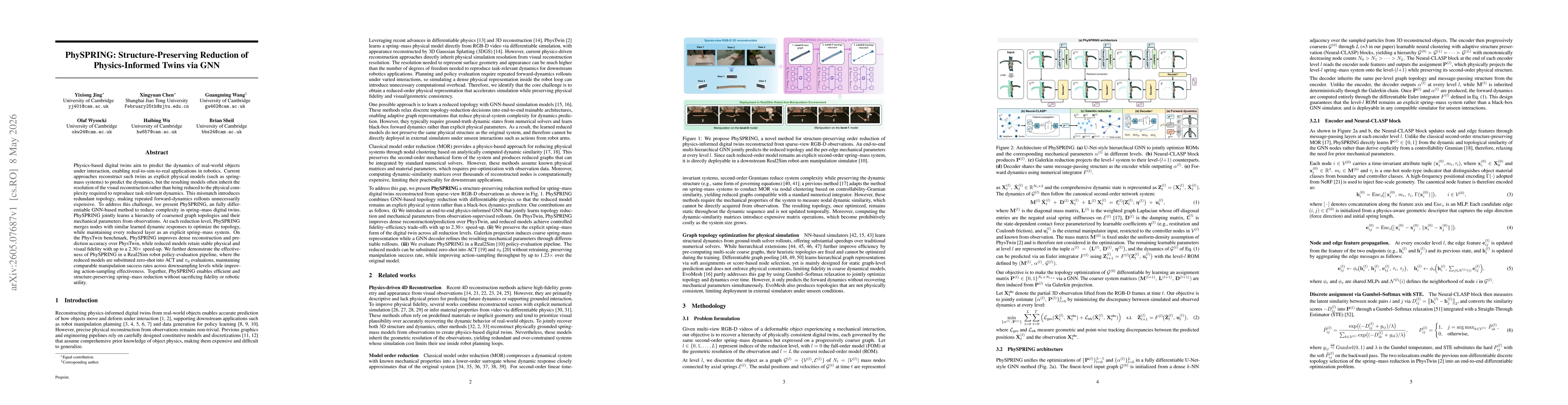
Physics-based digital twins aim to predict the dynamics of real-world objects under interaction, enabling real-to-sim-to-real applications in robotics. Current approaches reconstruct such twins as exp...
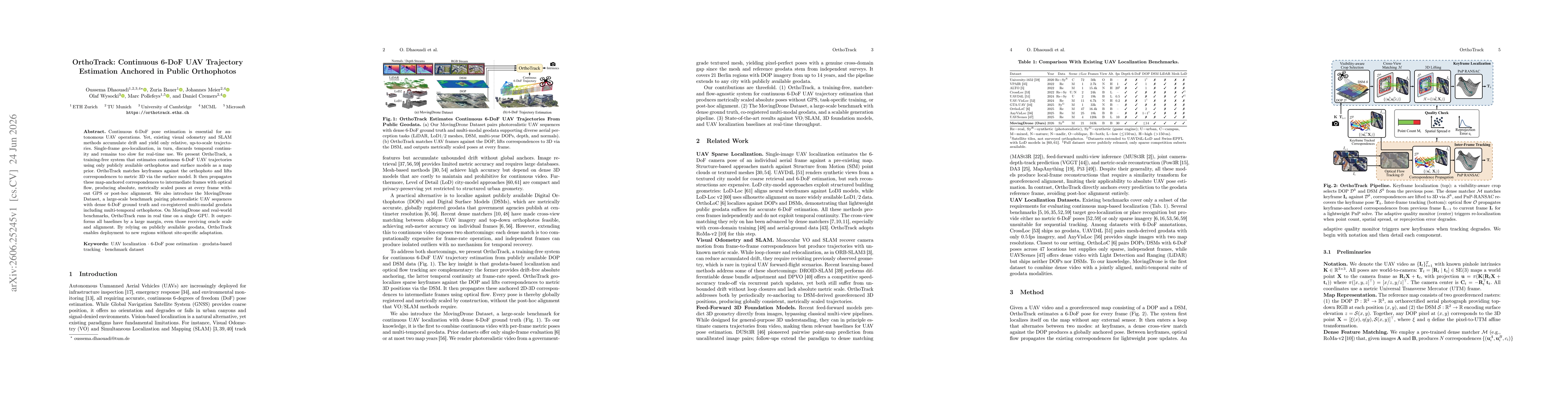
Continuous 6-DoF pose estimation is essential for autonomous UAV operations. Yet, existing visual odometry and SLAM methods accumulate drift and yield only relative, up-to-scale trajectories. Single-f...
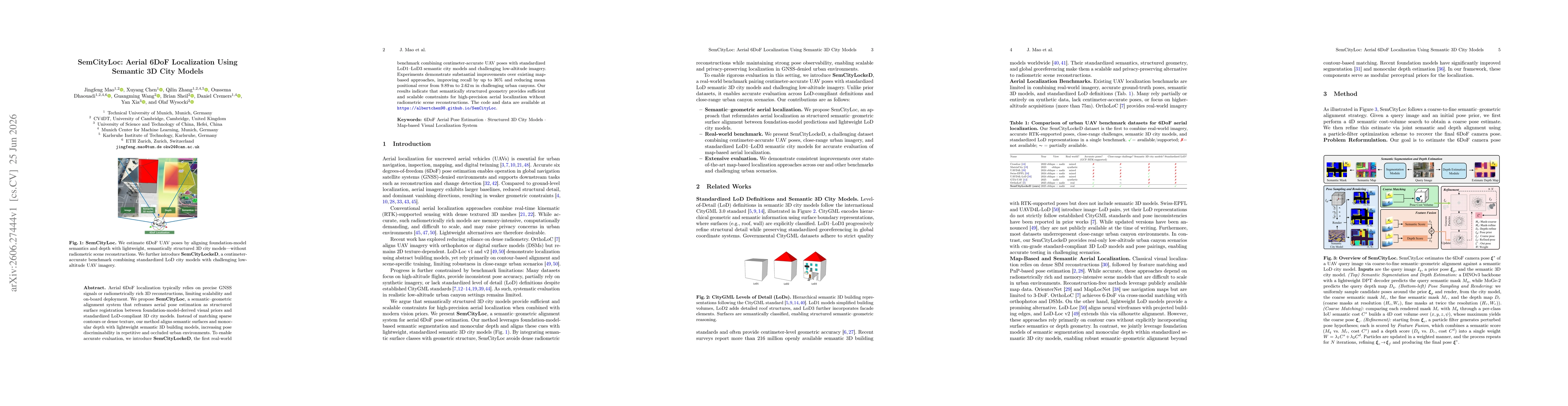
Aerial 6DoF localization typically relies on precise GNSS signals or radiometrically rich 3D reconstructions, limiting scalability and on-board deployment. We propose SemCityLoc, a semantic-geometric ...
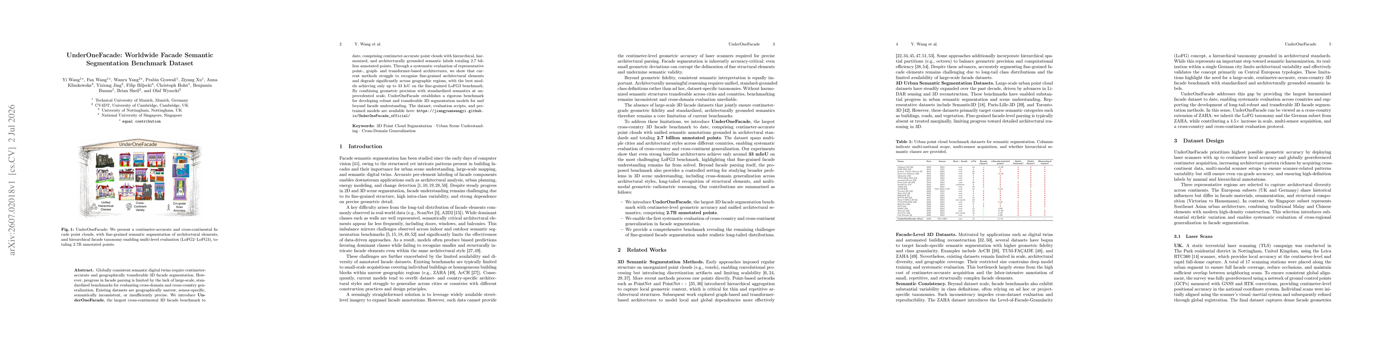
Globally consistent semantic digital twins require centimeter-accurate and geographically transferable 3D facade segmentation. However, progress in facade parsing is limited by the lack of large-scale...