Academic Profile
Statistics
Similar Authors
Papers on arXiv
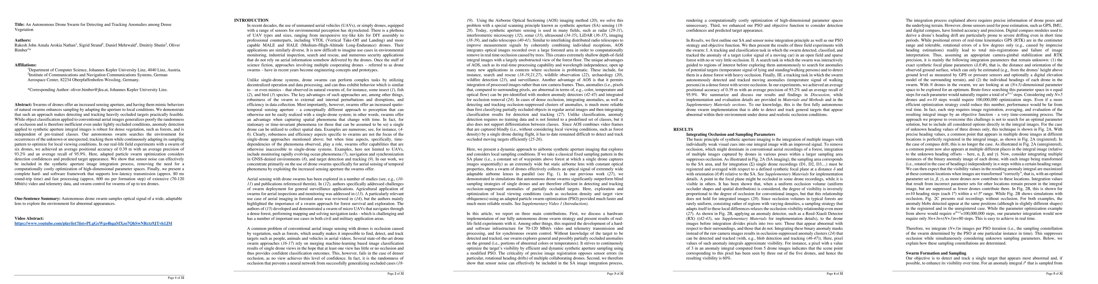
Swarms of drones offer an increased sensing aperture, and having them mimic behaviors of natural swarms enhances sampling by adapting the aperture to local conditions. We demonstrate that such an appr...
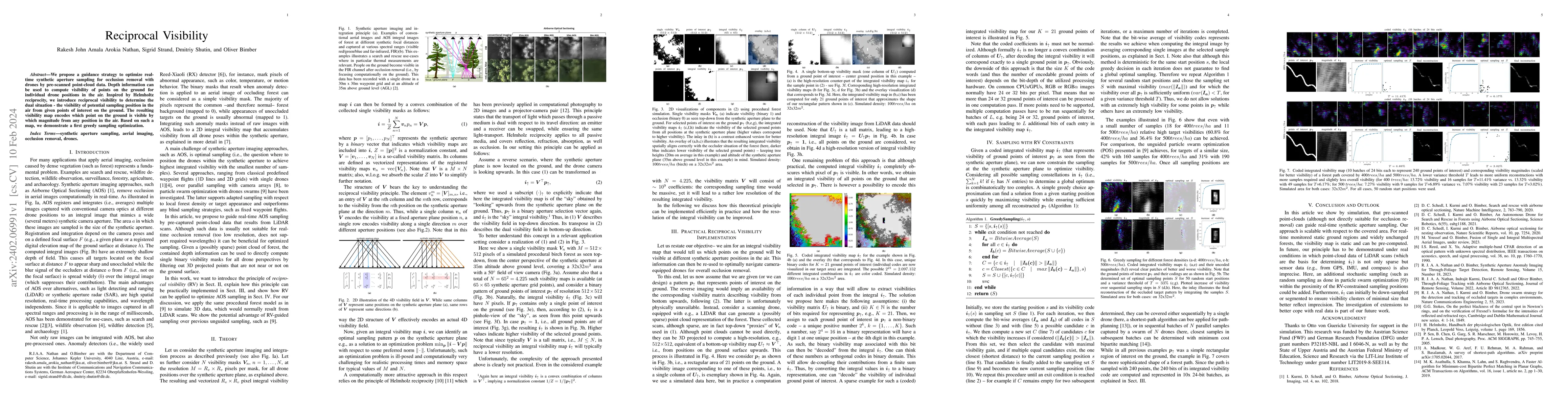
We propose a guidance strategy to optimize real-time synthetic aperture sampling for occlusion removal with drones by pre-scanned point-cloud data. Depth information can be used to compute visibilit...
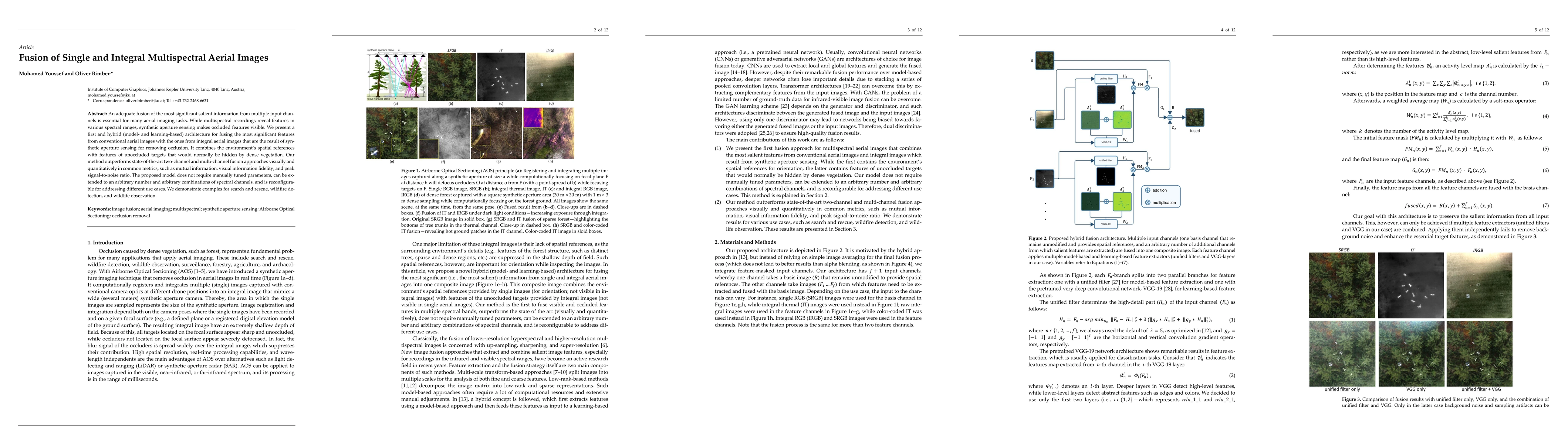
An adequate fusion of the most significant salient information from multiple input channels is essential for many aerial imaging tasks. While multispectral recordings reveal features in various spec...
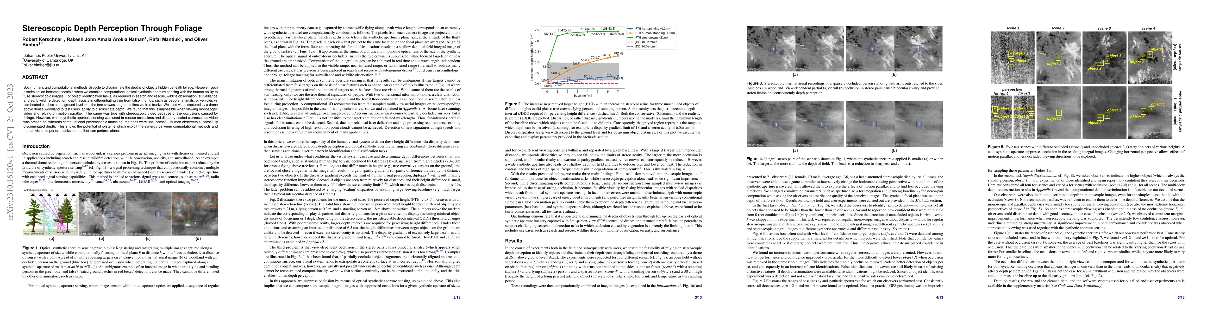
Both humans and computational methods struggle to discriminate the depths of objects hidden beneath foliage. However, such discrimination becomes feasible when we combine computational optical synth...
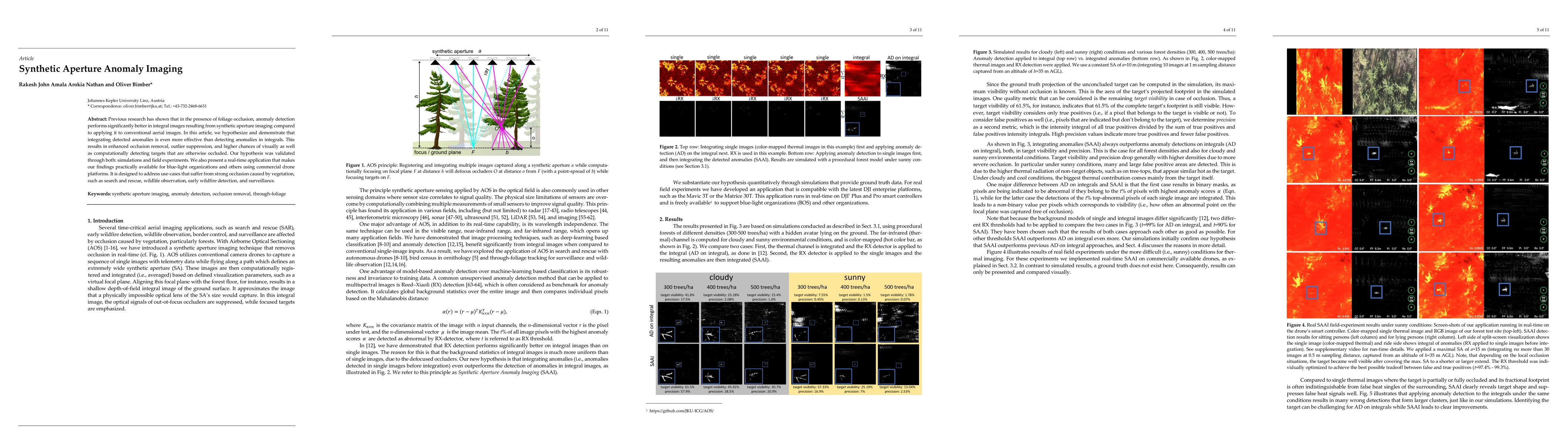
Previous research has shown that in the presence of foliage occlusion, anomaly detection performs significantly better in integral images resulting from synthetic aperture imaging compared to applyi...
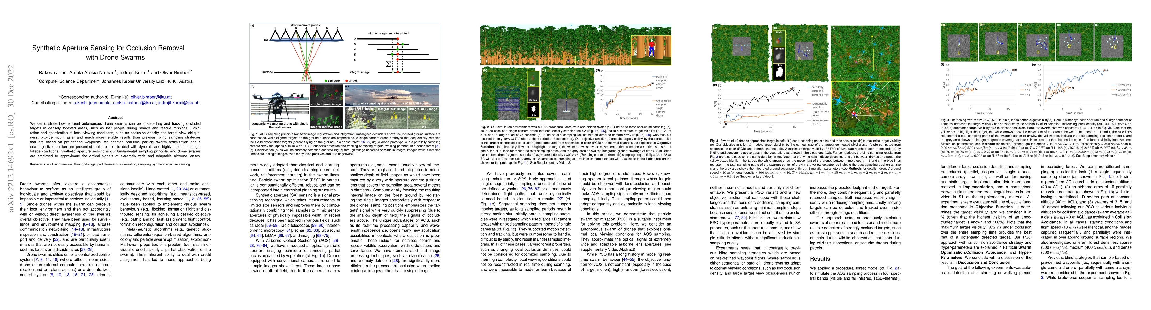
We demonstrate how efficient autonomous drone swarms can be in detecting and tracking occluded targets in densely forested areas, such as lost people during search and rescue missions. Exploration a...
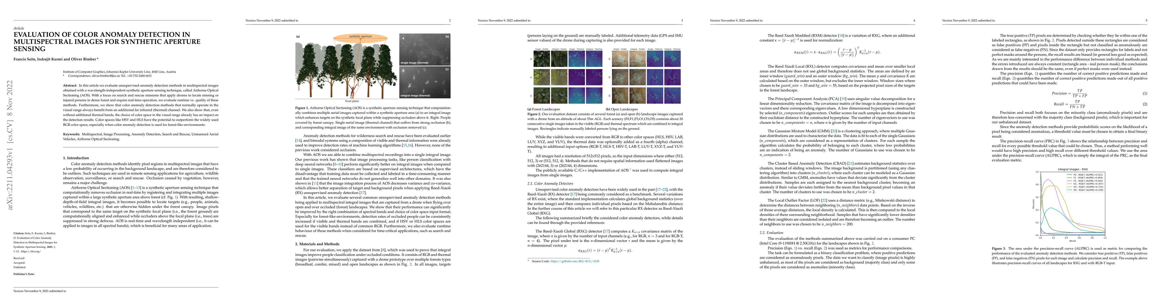
In this article, we evaluate unsupervised anomaly detection methods in multispectral images obtained with a wavelength-independent synthetic aperture sensing technique, called Airborne Optical Secti...
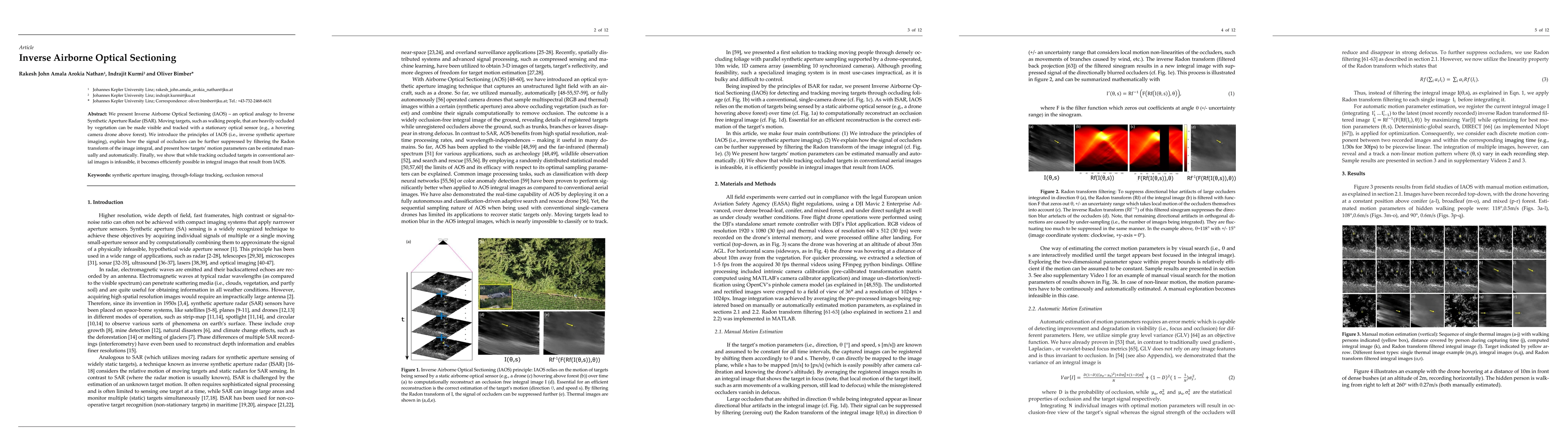
We present Inverse Airborne Optical Sectioning (IAOS) an optical analogy to Inverse Synthetic Aperture Radar (ISAR). Moving targets, such as walking people, that are heavily occluded by vegetation c...
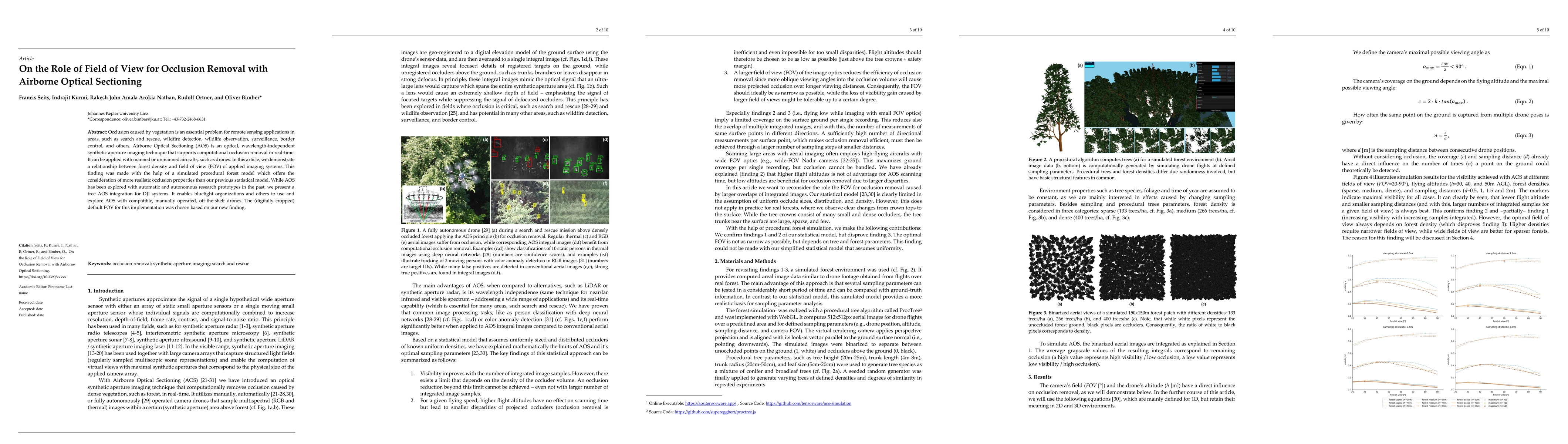
Occlusion caused by vegetation is an essential problem for remote sensing applications in areas, such as search and rescue, wildfire detection, wildlife observation, surveillance, border control, an...
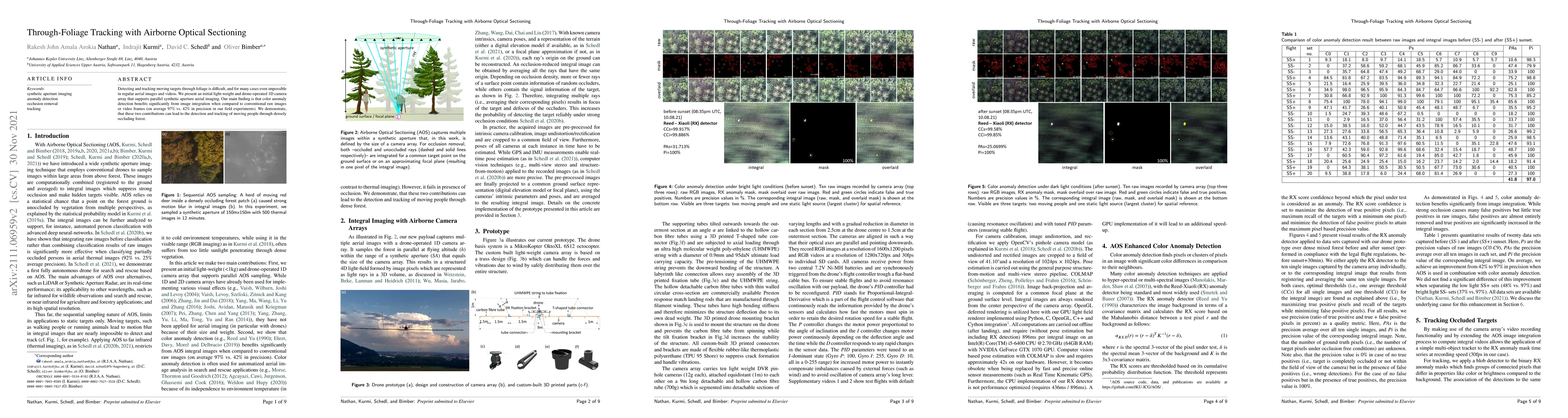
Detecting and tracking moving targets through foliage is difficult, and for many cases even impossible in regular aerial images and videos. We present an initial light-weight and drone-operated 1D c...
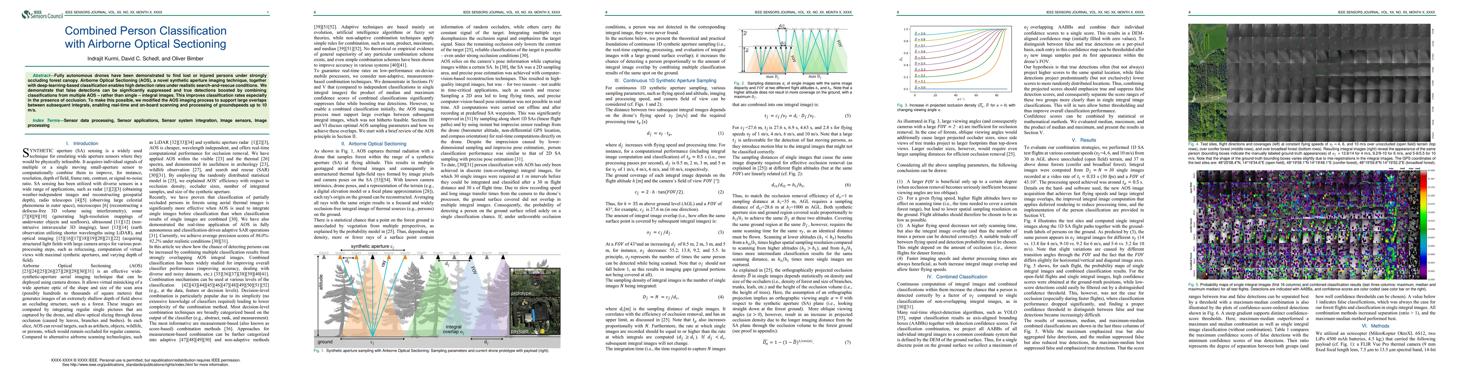
Fully autonomous drones have been demonstrated to find lost or injured persons under strongly occluding forest canopy. Airborne Optical Sectioning (AOS), a novel synthetic aperture imaging technique...
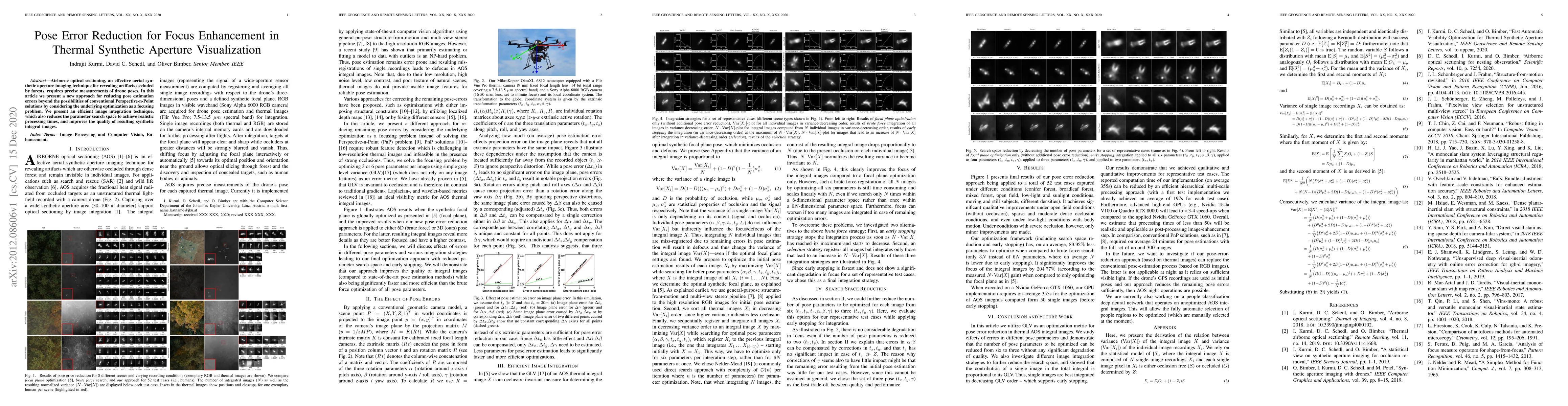
Airborne optical sectioning, an effective aerial synthetic aperture imaging technique for revealing artifacts occluded by forests, requires precise measurements of drone poses. In this article we pr...
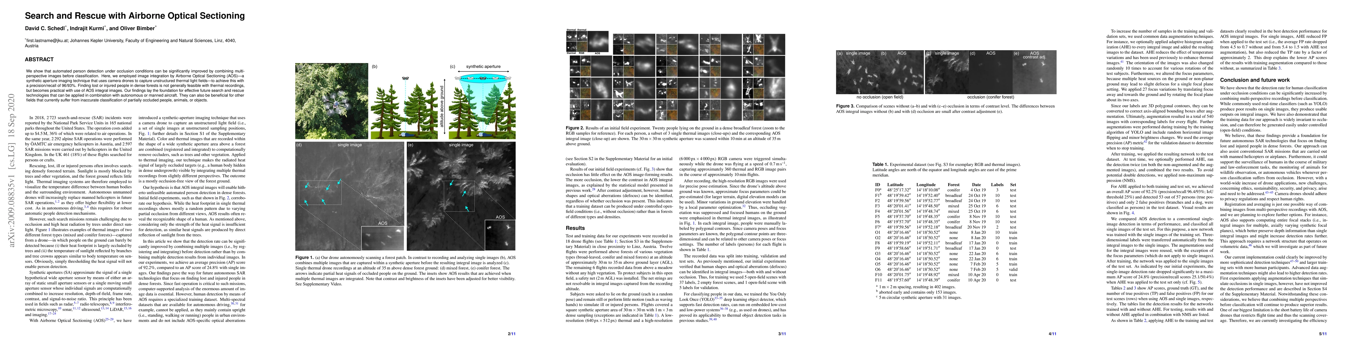
We show that automated person detection under occlusion conditions can be significantly improved by combining multi-perspective images before classification. Here, we employed image integration by A...
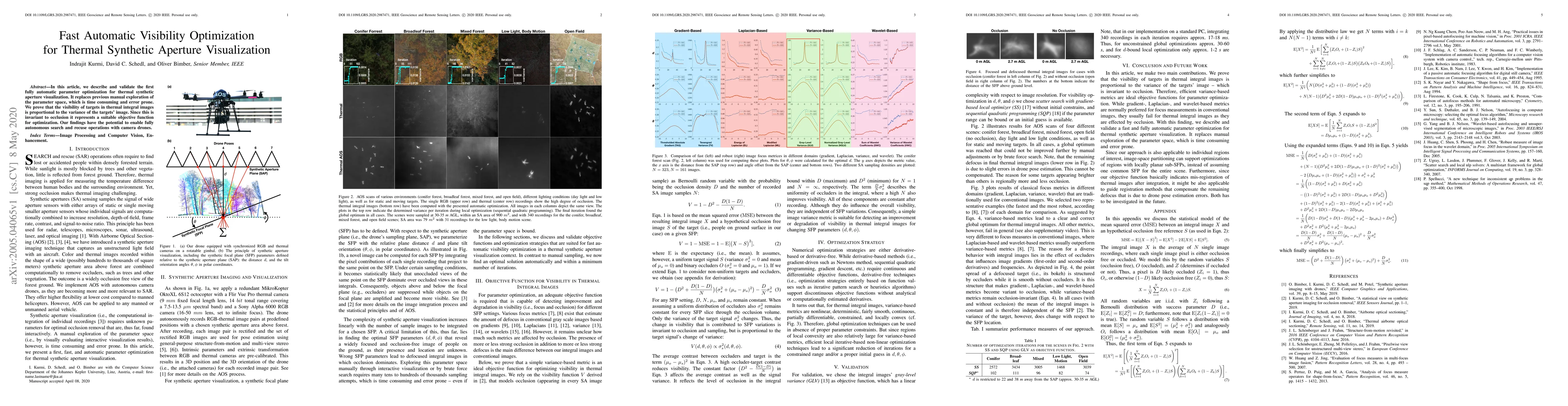
In this article, we describe and validate the first fully automatic parameter optimization for thermal synthetic aperture visualization. It replaces previous manual exploration of the parameter spac...
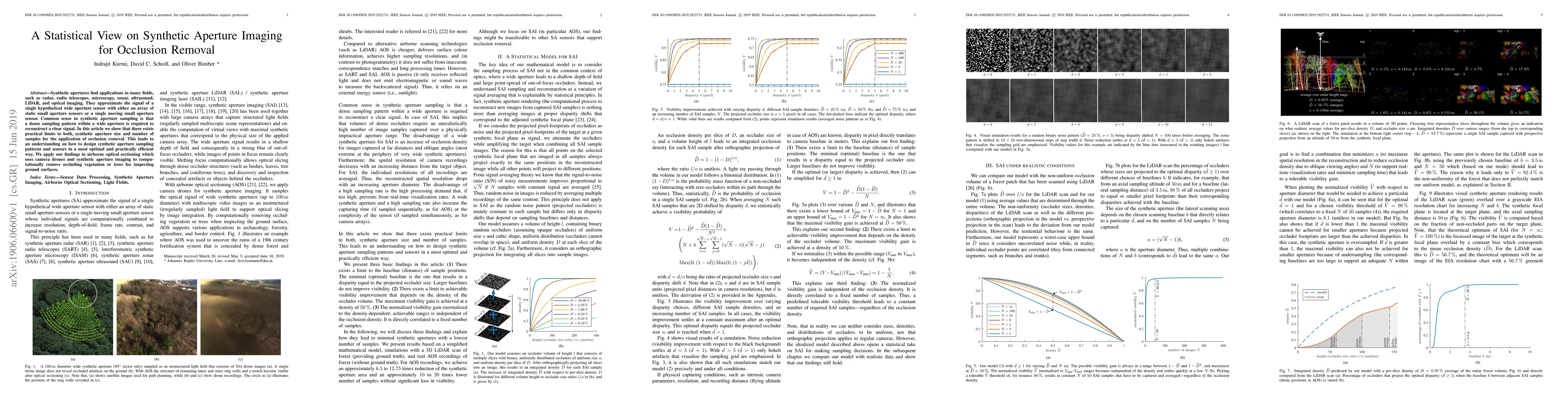
Synthetic apertures find applications in many fields, such as radar, radio telescopes, microscopy, sonar, ultrasound, LiDAR, and optical imaging. They approximate the signal of a single hypothetical...
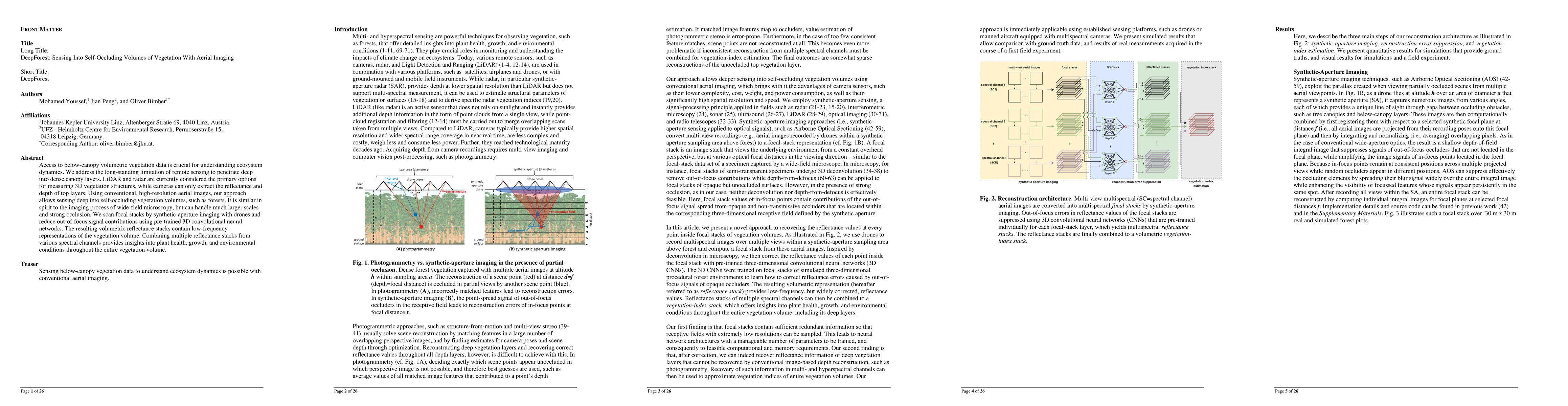
Access to below-canopy volumetric vegetation data is crucial for understanding ecosystem dynamics. We address the long-standing limitation of remote sensing to penetrate deep into dense canopy layers....
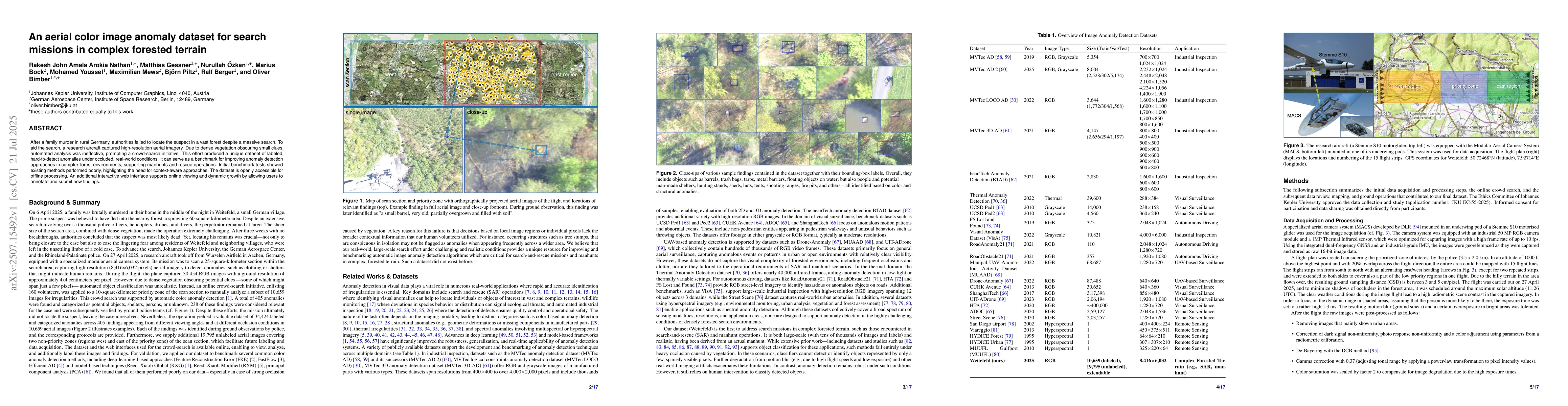
After a family murder in rural Germany, authorities failed to locate the suspect in a vast forest despite a massive search. To aid the search, a research aircraft captured high-resolution aerial image...
Peering, a side-to-side motion used by animals to estimate distance through motion parallax, offers a powerful bio-inspired strategy to overcome a fundamental limitation in robotic vision: partial occ...
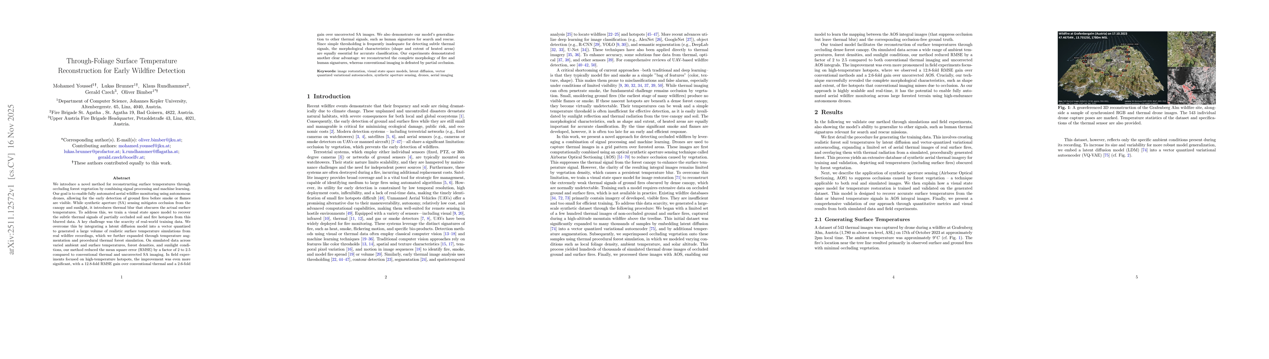
We introduce a novel method for reconstructing surface temperatures through occluding forest vegetation by combining signal processing and machine learning. Our goal is to enable fully automated aeria...
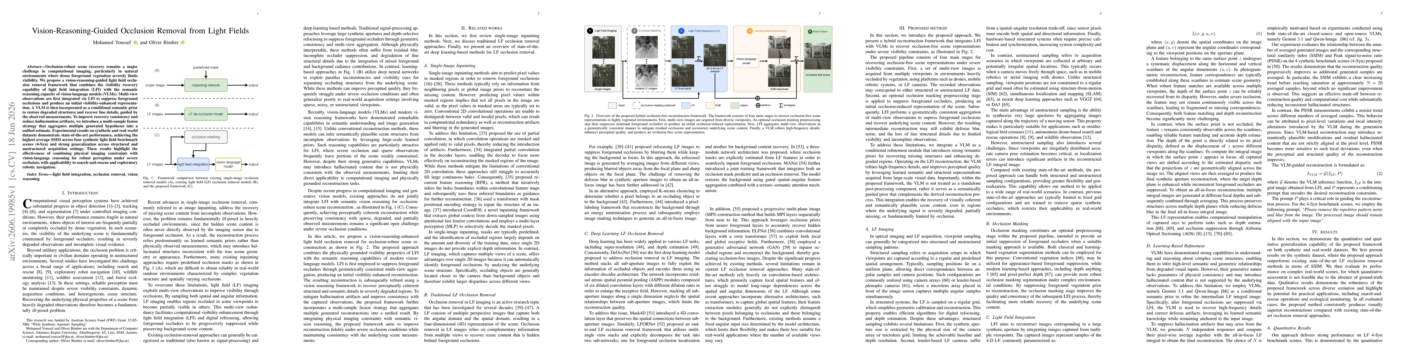
Occlusion-robust scene recovery remains a major challenge in computational imaging, particularly in natural environments where dense foreground vegetation severely limits visibility. We propose a visi...