ArxivLens
O
Researcher

Ovi Paul

5 papers on arXiv

5 arXiv Papers
6 Total Publications
Profile

Academic Profile

Name Ovi Paul
Total Papers 6
Scholar Profile View on Semantic Scholar
Metrics

Statistics

5 arXiv Papers
6 Total Publications
Publications

Papers on arXiv

Thumbnail for BD-SAT: High-resolution Land Use Land Cover Dataset & Benchmark Results
  for Developing Division: Dhaka, BD
arXiv
BD-SAT: High-resolution Land Use Land Cover Dataset & Benchmark Results for Developing Division: Dhaka, BD

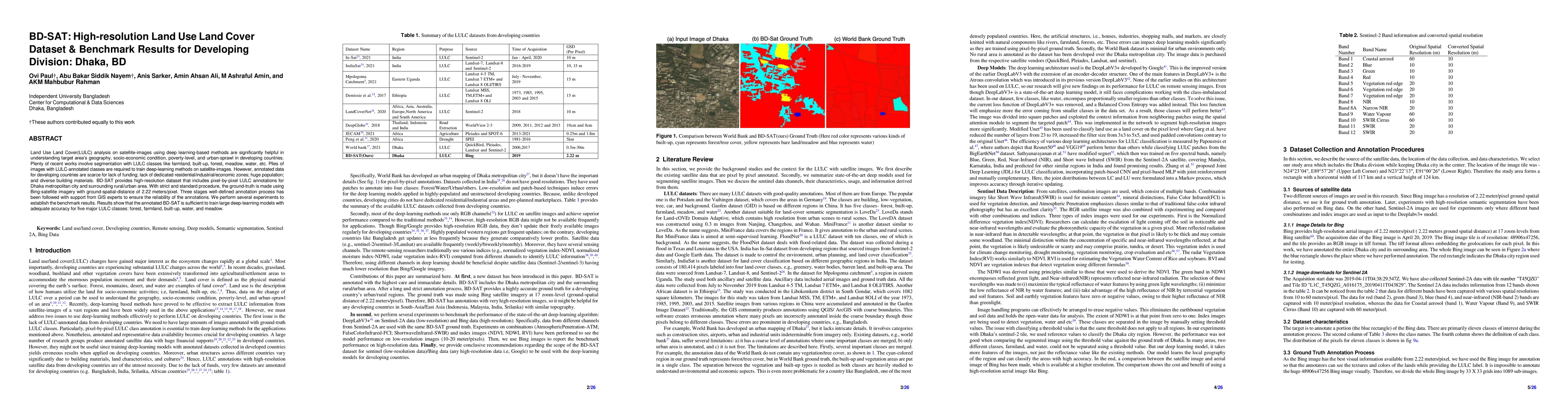
Land Use Land Cover (LULC) analysis on satellite images using deep learning-based methods is significantly helpful in understanding the geography, socio-economic conditions, poverty levels, and urba...

Thumbnail for A Novel Disaster Image Dataset and Characteristics Analysis using
  Attention Model
arXiv
A Novel Disaster Image Dataset and Characteristics Analysis using Attention Model

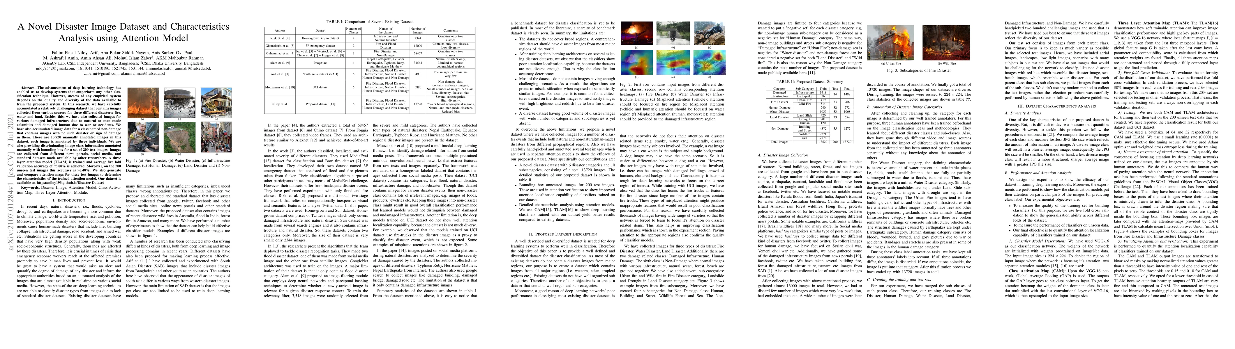
The advancement of deep learning technology has enabled us to develop systems that outperform any other classification technique. However, success of any empirical system depends on the quality and ...

Thumbnail for LULC Segmentation of RGB Satellite Image Using FCN-8
arXiv
LULC Segmentation of RGB Satellite Image Using FCN-8

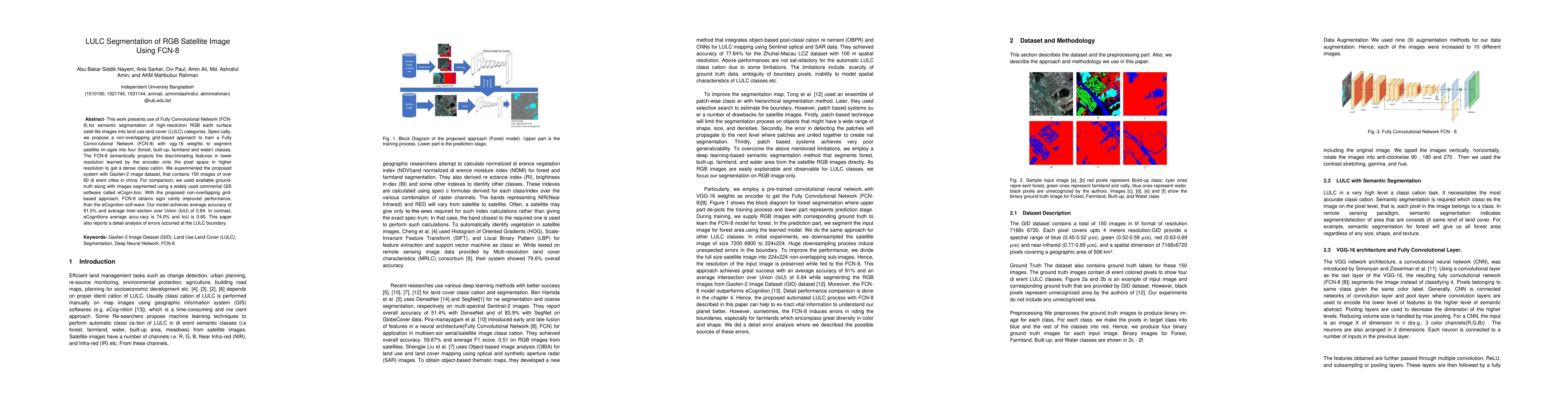
This work presents use of Fully Convolutional Network (FCN-8) for semantic segmentation of high-resolution RGB earth surface satel-lite images into land use land cover (LULC) categories. Specically,...

Thumbnail for Image Pre-processing on NumtaDB for Bengali Handwritten Digit
  Recognition
arXiv
Image Pre-processing on NumtaDB for Bengali Handwritten Digit Recognition

NumtaDB is by far the largest data-set collection for handwritten digits in Bengali. This is a diverse dataset containing more than 85000 images. But this diversity also makes this dataset very diff...

Thumbnail for BD Open LULC Map: High-resolution land use land cover mapping &
  benchmarking for urban development in Dhaka, Bangladesh
arXiv
BD Open LULC Map: High-resolution land use land cover mapping & benchmarking for urban development in Dhaka, Bangladesh

Land Use Land Cover (LULC) mapping using deep learning significantly enhances the reliability of LULC classification, aiding in understanding geography, socioeconomic conditions, poverty levels, and u...

This website uses cookies to ensure you get the best experience. Learn more