Quentin Bonassies

4 papers on arXiv

Statistics

arXiv Papers 4

Papers on arXiv

Thumbnail for Remote Sensing Data Assimilation with a Chained Hydrologic-hydraulic
  Model for Flood Forecasting

Remote Sensing Data Assimilation with a Chained Hydrologic-hydraulic Model for Flood Forecasting

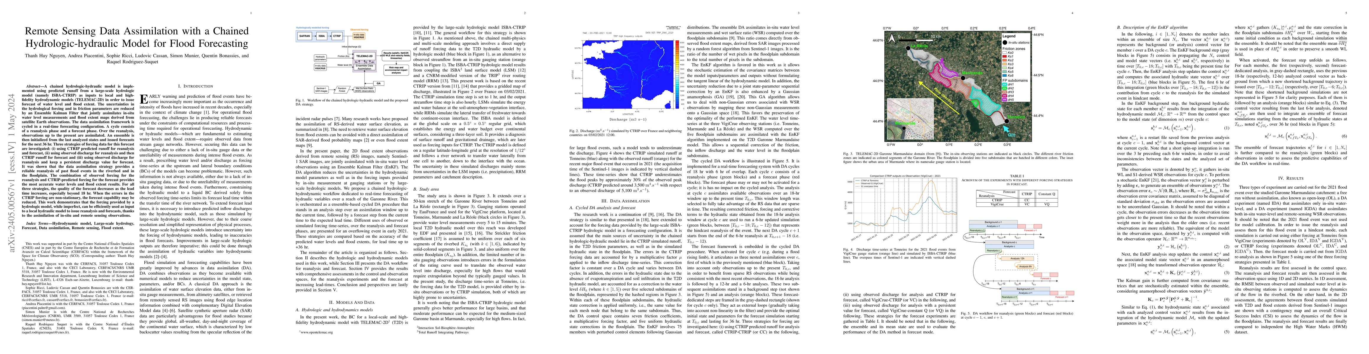
A chained hydrologic-hydraulic model is implemented using predicted runoff from a large-scale hydrologic model (namely ISBA-CTRIP) as inputs to local hydrodynamic models (TELEMAC-2D) to issue foreca...

Thumbnail for Reducing Uncertainties of a Chained Hydrologic-hydraulic Model to
  Improve Flood Forecasting Using Multi-source Earth Observation Data

Reducing Uncertainties of a Chained Hydrologic-hydraulic Model to Improve Flood Forecasting Using Multi-source Earth Observation Data

The challenges in operational flood forecasting lie in producing reliable forecasts given constrained computational resources and within processing times that are compatible with near-real-time fore...

Thumbnail for Comparative Analysis of TELEMAC-2D Models on Agricultural Flood Damage
  Estimates

Comparative Analysis of TELEMAC-2D Models on Agricultural Flood Damage Estimates

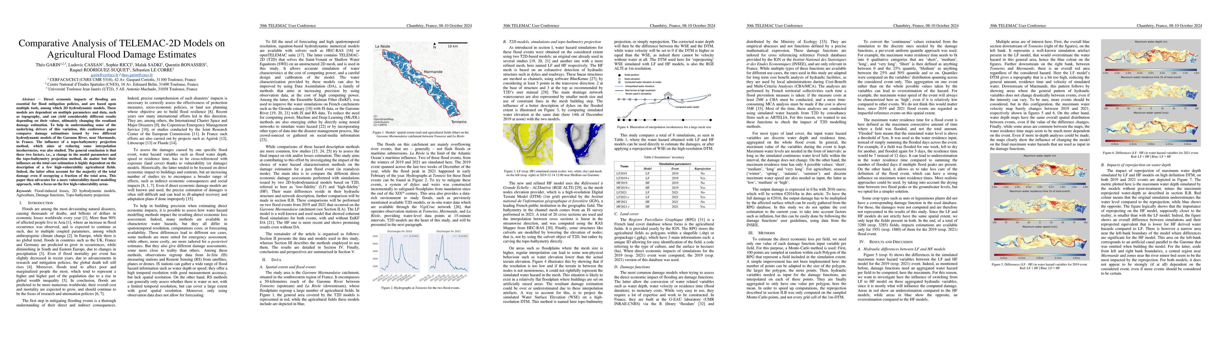
Direct economic impacts of flooding are essential for flood mitigation policies, and are based upon multiple tools, among which 2D hydrodynamic models. These models are dependent on multiple parameter...

Thumbnail for Assimilation of SWOT Altimetry Data for Riverine Flood Reanalysis: From
  Synthetic to Real Data

Assimilation of SWOT Altimetry Data for Riverine Flood Reanalysis: From Synthetic to Real Data

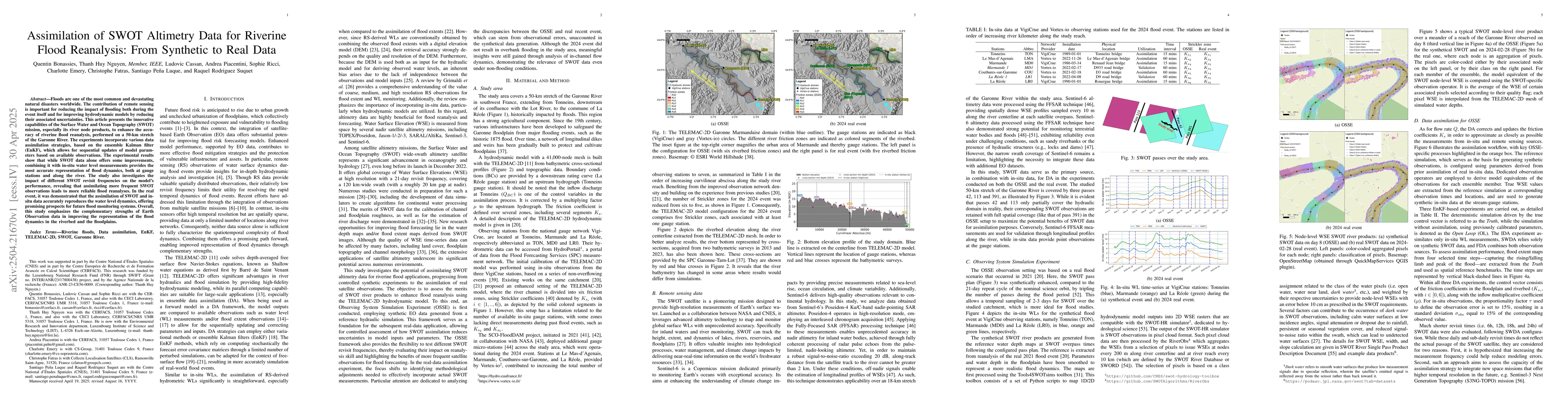
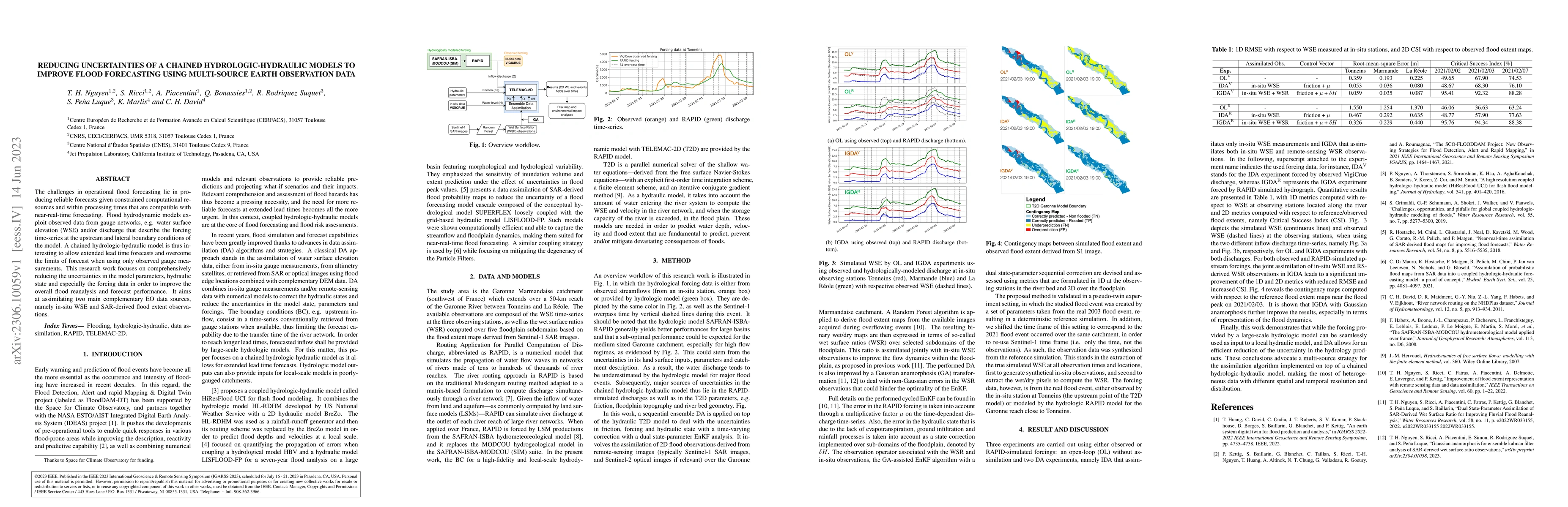
Floods are one of the most common and devastating natural disasters worldwide. The contribution of remote sensing is important for reducing the impact of flooding both during the event itself and for ...

This website uses cookies to ensure you get the best experience. Learn more