Academic Profile
Statistics
Similar Authors
Papers on arXiv
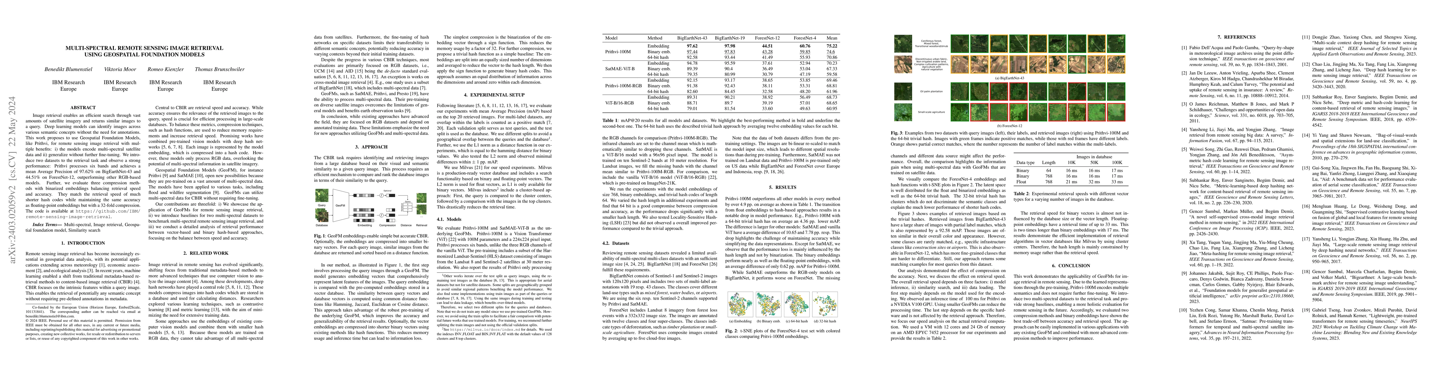
Image retrieval enables an efficient search through vast amounts of satellite imagery and returns similar images to a query. Deep learning models can identify images across various semantic concepts...
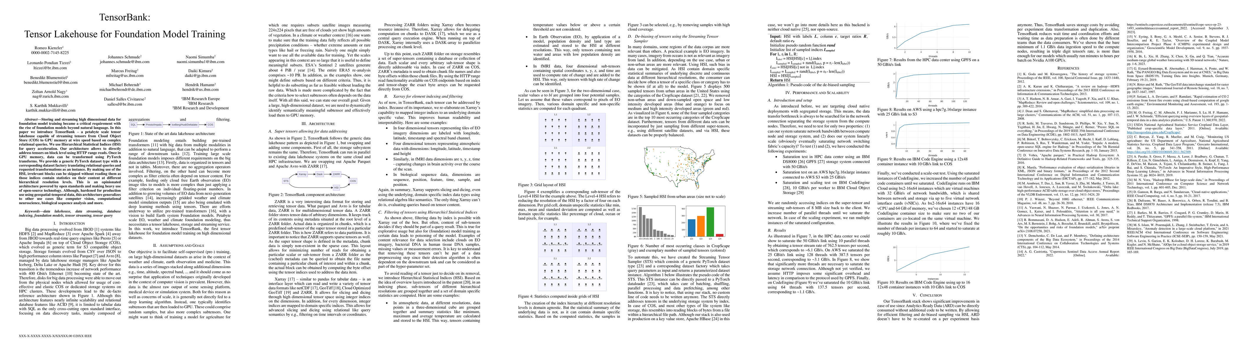
Storing and streaming high dimensional data for foundation model training became a critical requirement with the rise of foundation models beyond natural language. In this paper we introduce TensorB...
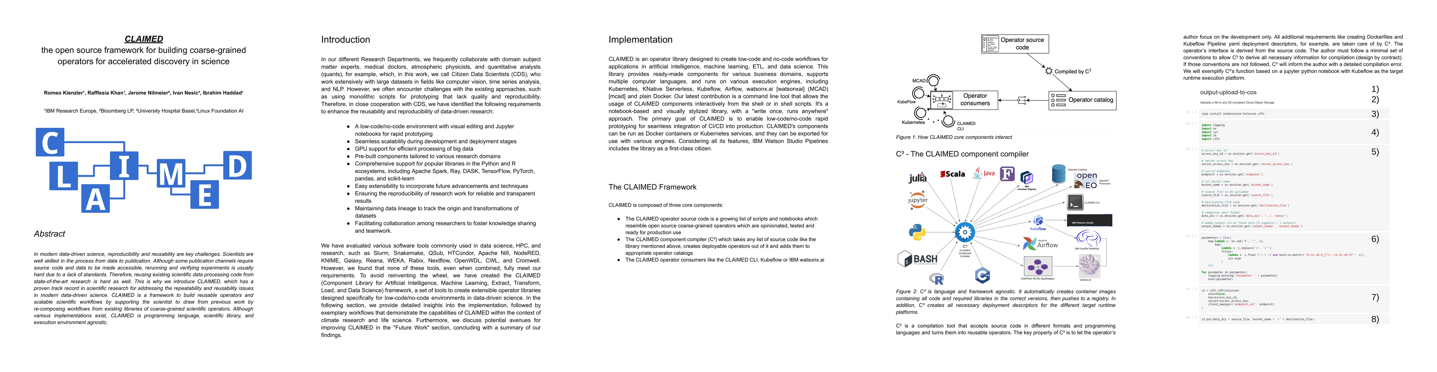
In modern data-driven science, reproducibility and reusability are key challenges. Scientists are well skilled in the process from data to publication. Although some publication channels require sou...
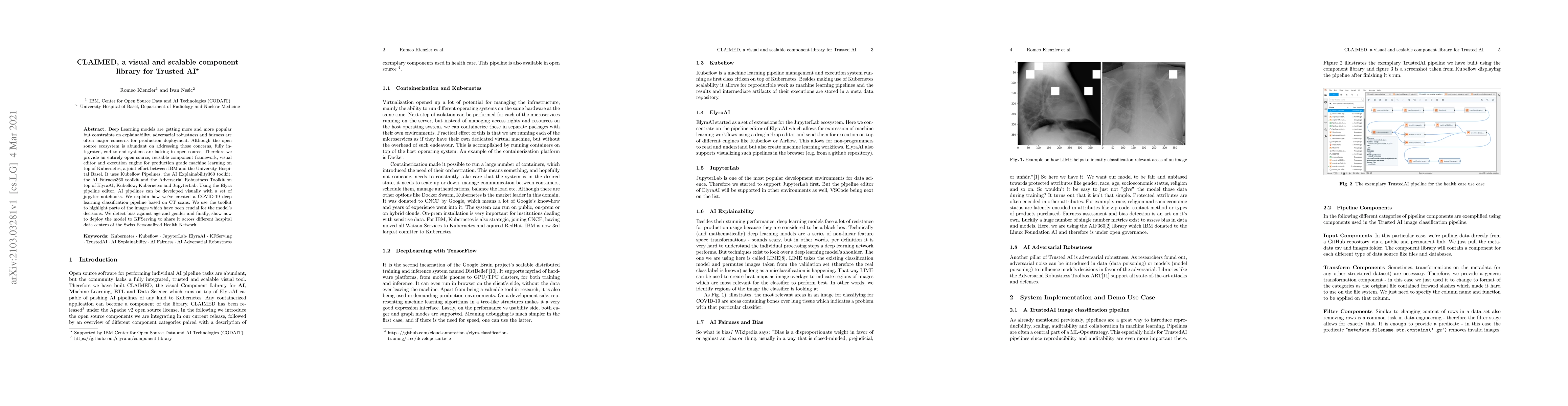
Deep Learning models are getting more and more popular but constraints on explainability, adversarial robustness and fairness are often major concerns for production deployment. Although the open so...
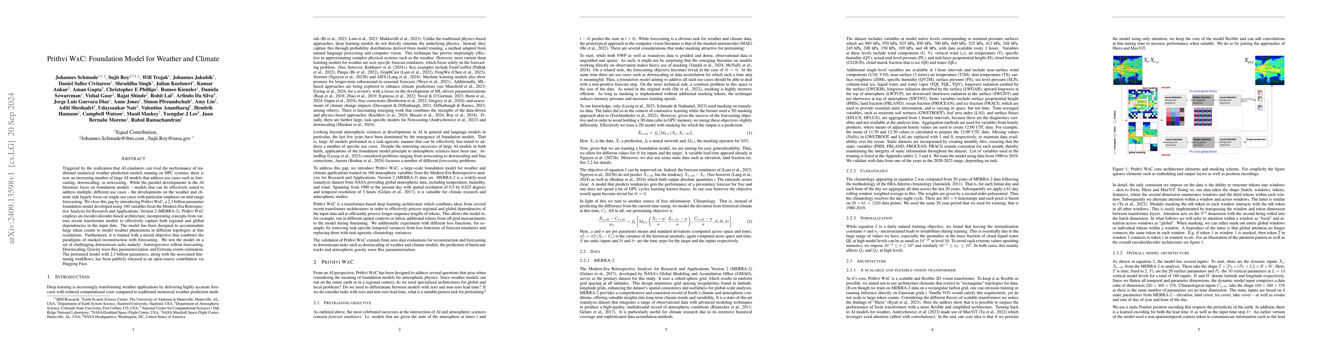
Triggered by the realization that AI emulators can rival the performance of traditional numerical weather prediction models running on HPC systems, there is now an increasing number of large AI models...
Over the past decades, there has been an explosion in the amount of available Earth Observation (EO) data. The unprecedented coverage of the Earth's surface and atmosphere by satellite imagery has res...
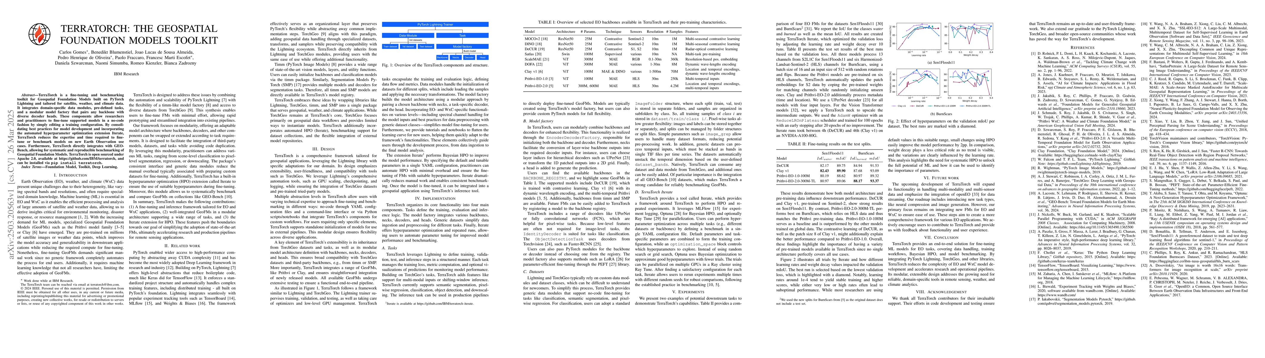
TerraTorch is a fine-tuning and benchmarking toolkit for Geospatial Foundation Models built on PyTorch Lightning and tailored for satellite, weather, and climate data. It integrates domain-specific da...