Academic Profile
Statistics
Similar Authors
Papers on arXiv
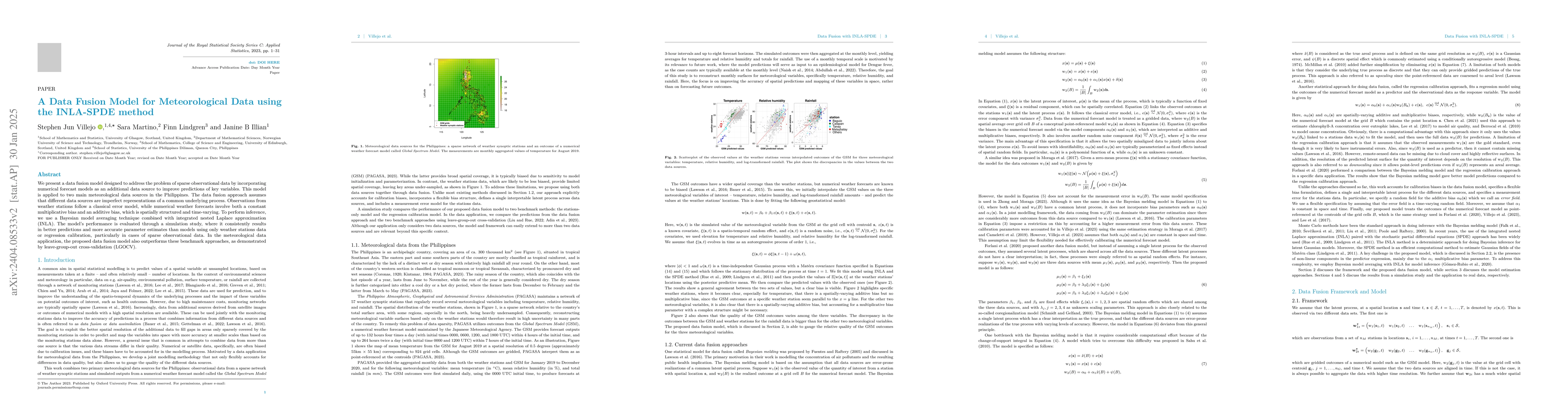
This work aims to combine two primary meteorological data sources in the Philippines: data from a sparse network of weather stations and outcomes of a numerical weather prediction model. To this end...
Modern methods for quantifying and predicting species distribution play a crucial part in biodiversity conservation. Occupancy models are a popular choice for analyzing species occurrence data as th...
Aiming to deliver improved precipitation simulations for hydrological impact assessment studies, we develop a methodology for modelling and simulating high-dimensional spatial precipitation extremes...
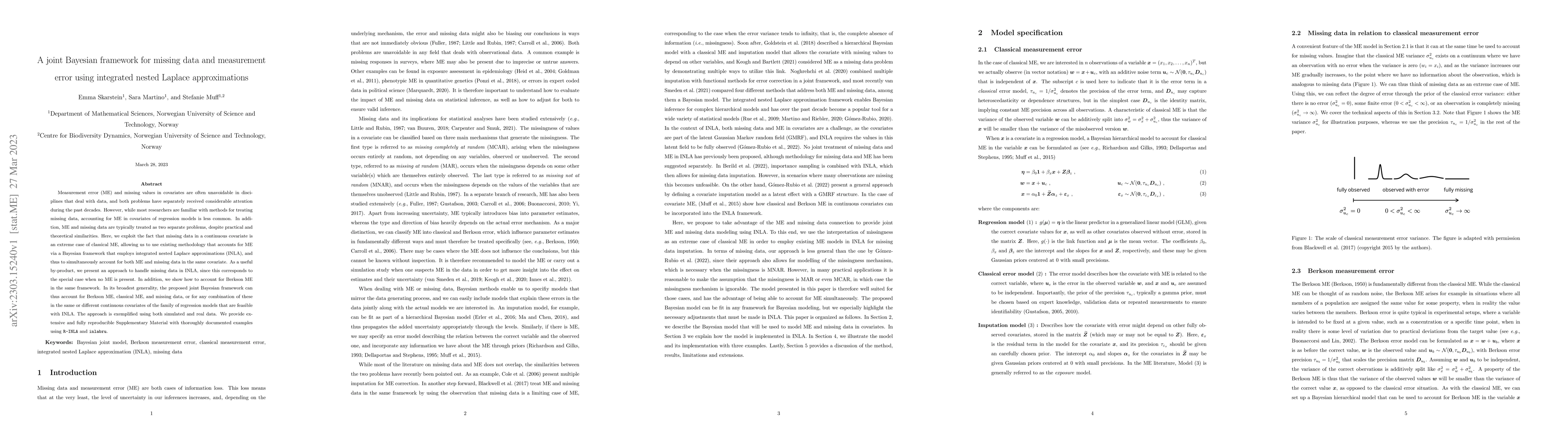
Measurement error (ME) and missing values in covariates are often unavoidable in disciplines that deal with data, and both problems have separately received considerable attention during the past de...
A successful model for high-dimensional spatial extremes should, in principle, be able to describe both weakening extremal dependence at increasing levels and changes in the type of extremal depende...
When a new environmental policy or a specific intervention is taken in order to improve air quality, it is paramount to assess and quantify - in space and time - the effectiveness of the adopted str...
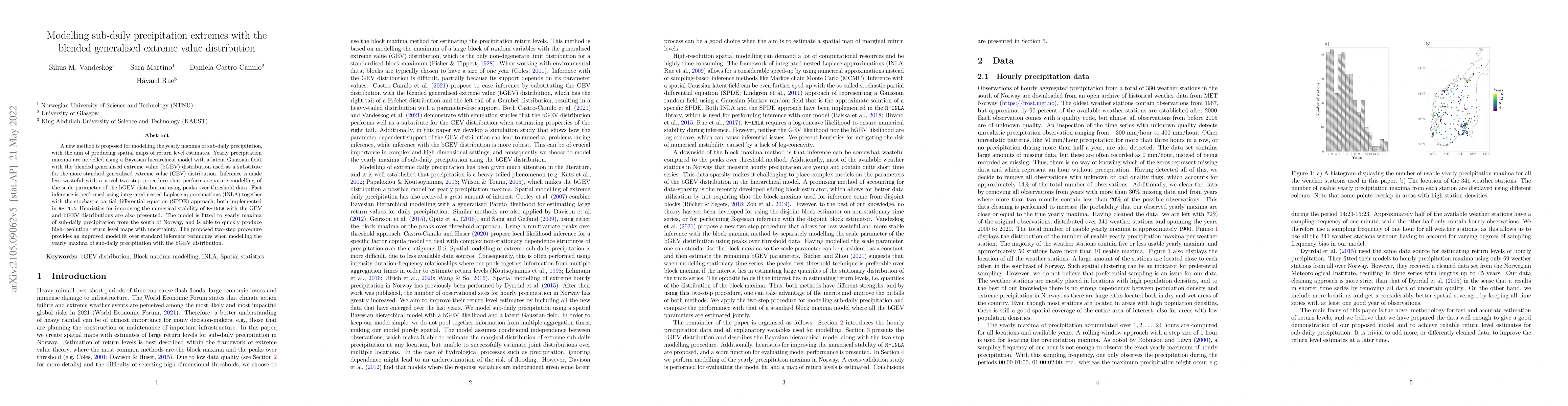
A new method is proposed for modelling the yearly maxima of sub-daily precipitation, with the aim of producing spatial maps of return level estimates. Yearly precipitation maxima are modelled using ...
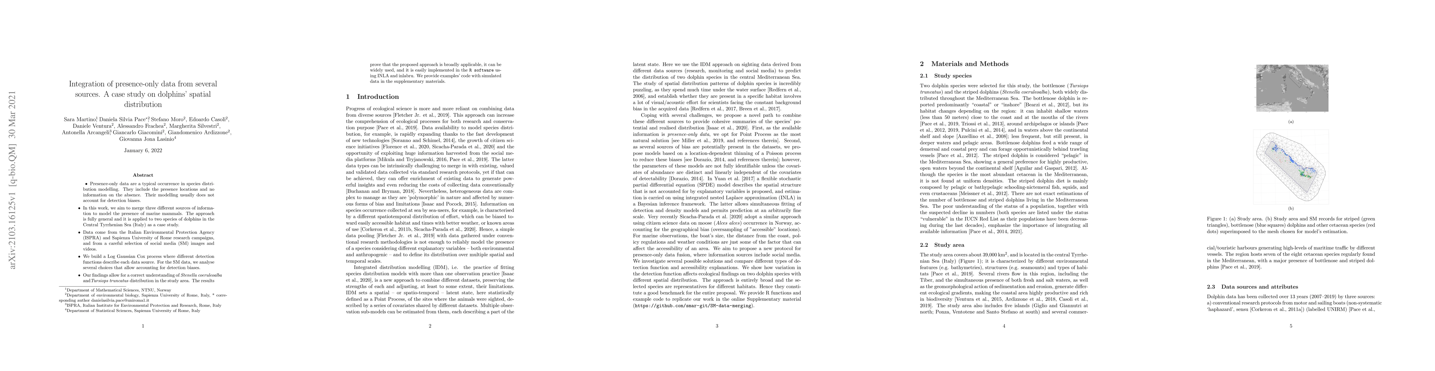
Presence-only data are a typical occurrence in species distribution modeling. They include the presence locations and no information on the absence. Their modeling usually does not account for detec...
The Integrated Nested Laplace Approximation (INLA) is a deterministic approach to Bayesian inference on latent Gaussian models (LGMs) and focuses on fast and accurate approximation of posterior marg...
This paper illustrates the main results of a spatio-temporal interpolation process of $\text{PM}_{10}$ concentrations at daily resolution using a set of 410 monitoring sites, distributed throughout ...
This is a short description and basic introduction to the Integrated nested Laplace approximations (INLA) approach. INLA is a deterministic paradigm for Bayesian inference in latent Gaussian models ...
This work tackles the problem of uncertainty propagation in two-stage Bayesian models, with a focus on spatial applications. A two-stage modeling framework has the advantage of being more computationa...
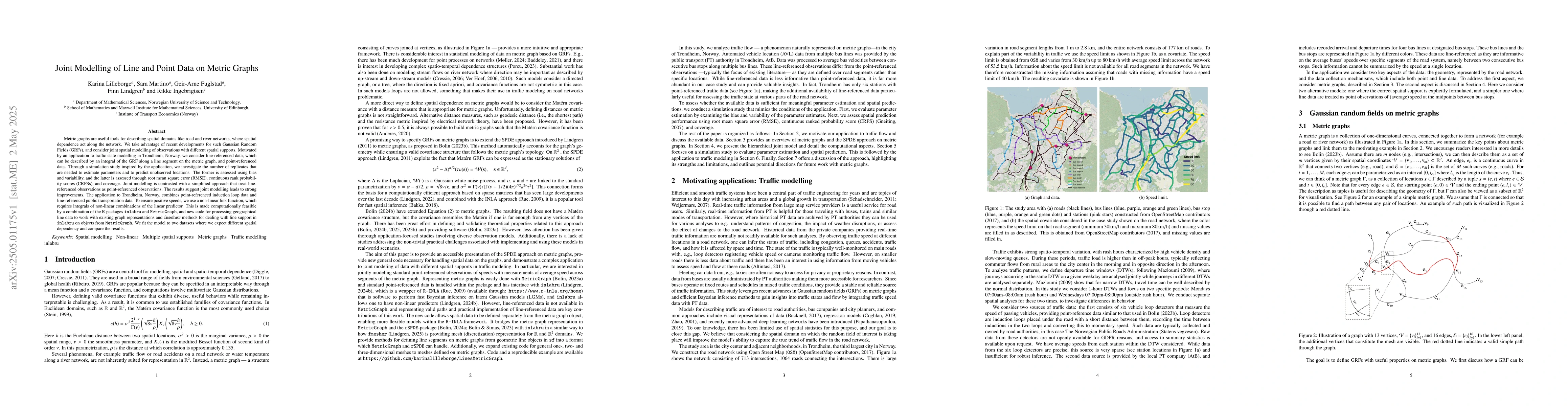
Metric graphs are useful tools for describing spatial domains like road and river networks, where spatial dependence act along the network. We take advantage of recent developments for such Gaussian R...
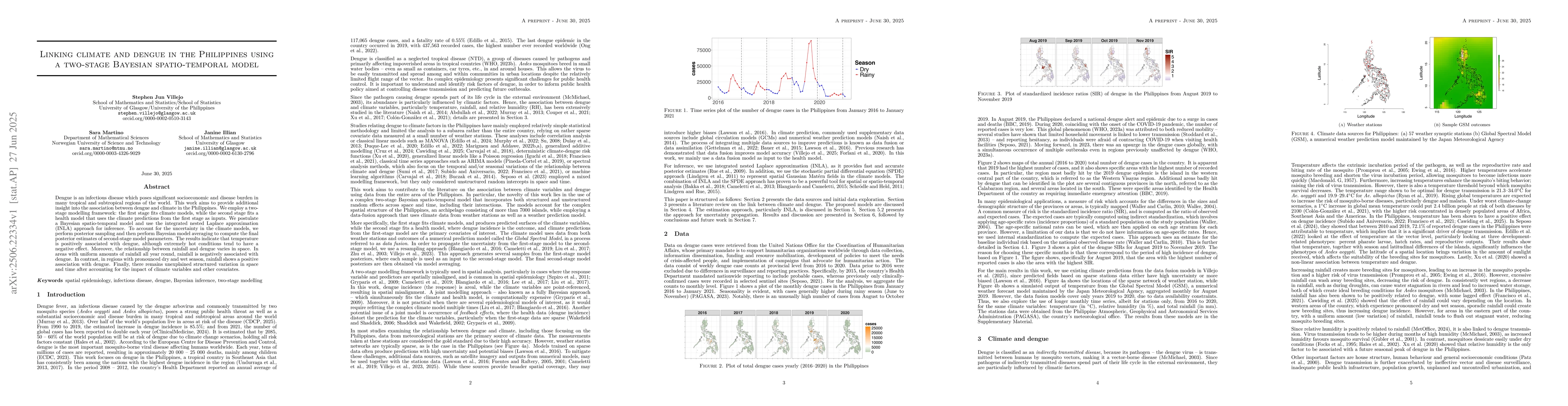
Dengue is an infectious disease which poses significant socioeconomic and disease burden in many tropical and subtropical regions of the world. This work aims to provide additional insight into the as...
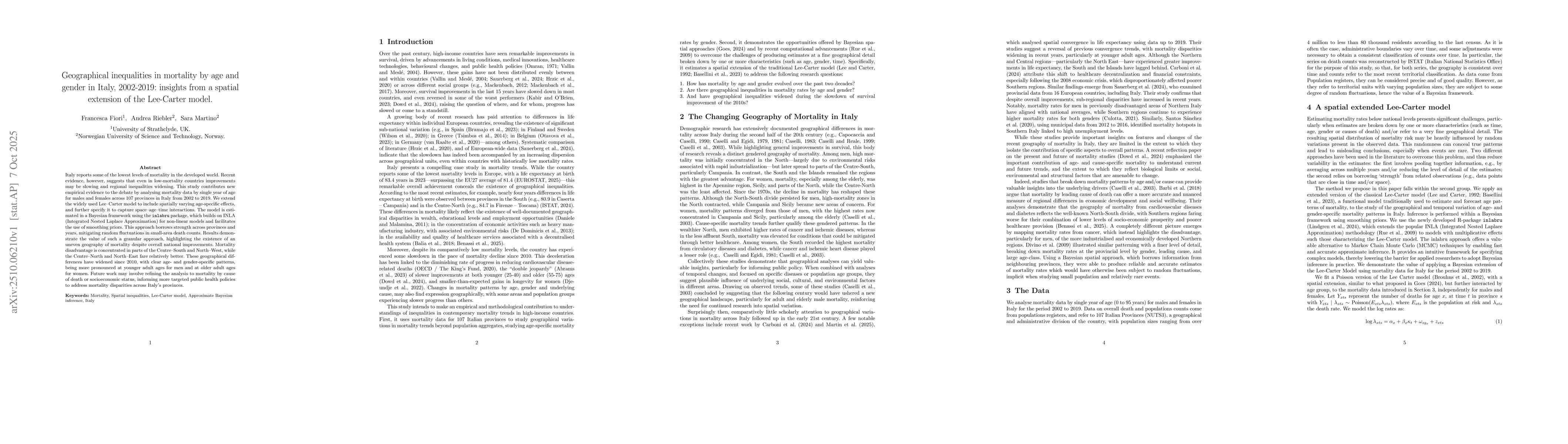
Italy reports some of the lowest levels of mortality in the developed world. Recent evidence, however, suggests that even in low mortality countries improvements may be slowing and regional inequaliti...