Academic Profile
Statistics
Similar Authors
Papers on arXiv
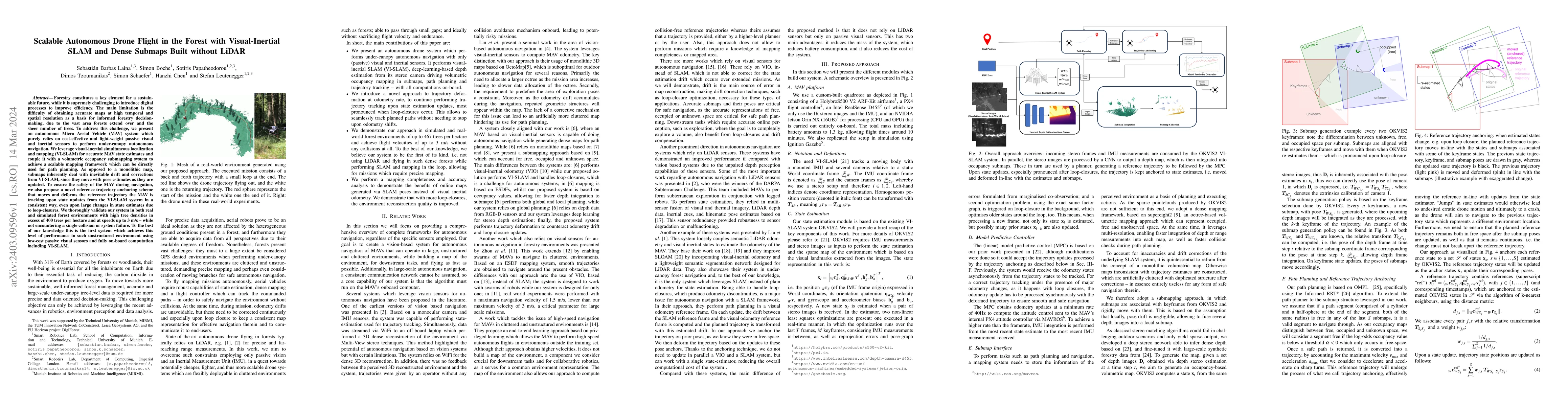
Forestry constitutes a key element for a sustainable future, while it is supremely challenging to introduce digital processes to improve efficiency. The main limitation is the difficulty of obtainin...
Autonomous navigation is one of the key requirements for every potential application of mobile robots in the real-world. Besides high-accuracy state estimation, a suitable and globally consistent re...
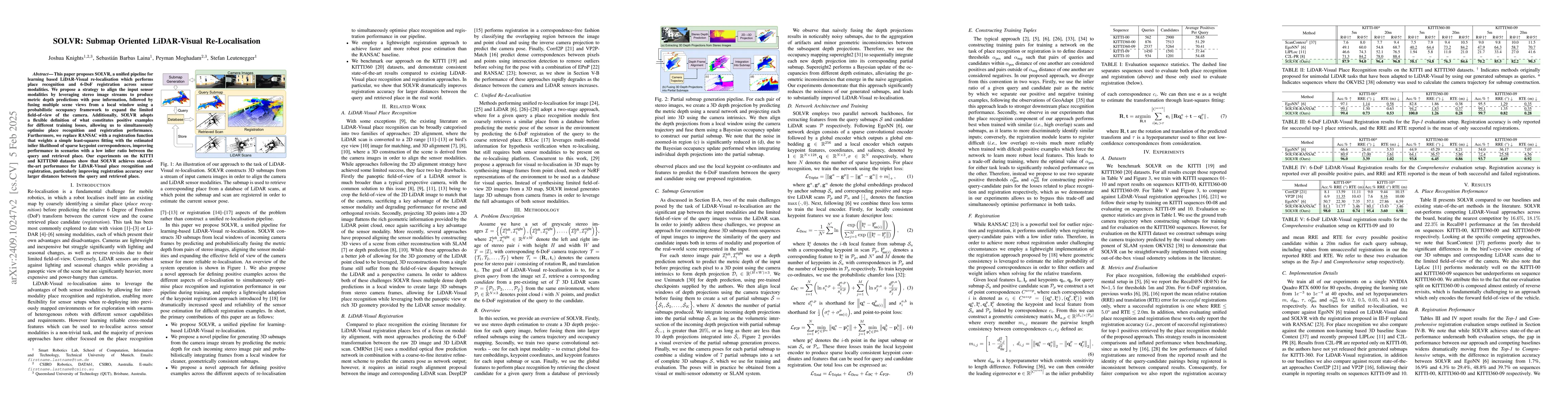
This paper proposes SOLVR, a unified pipeline for learning based LiDAR-Visual re-localisation which performs place recognition and 6-DoF registration across sensor modalities. We propose a strategy to...
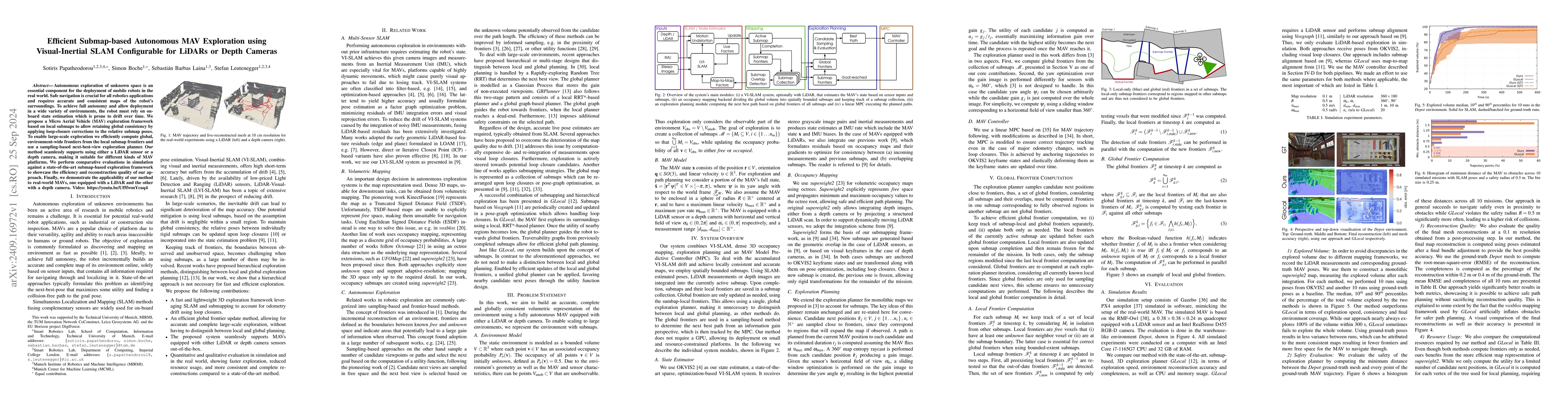
Autonomous exploration of unknown space is an essential component for the deployment of mobile robots in the real world. Safe navigation is crucial for all robotics applications and requires accurate ...
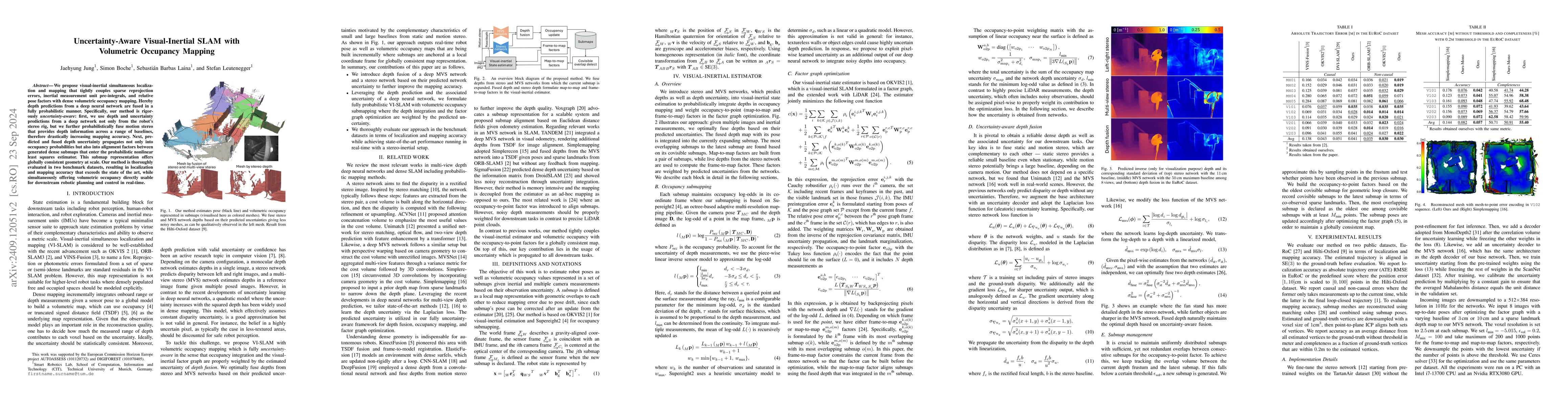
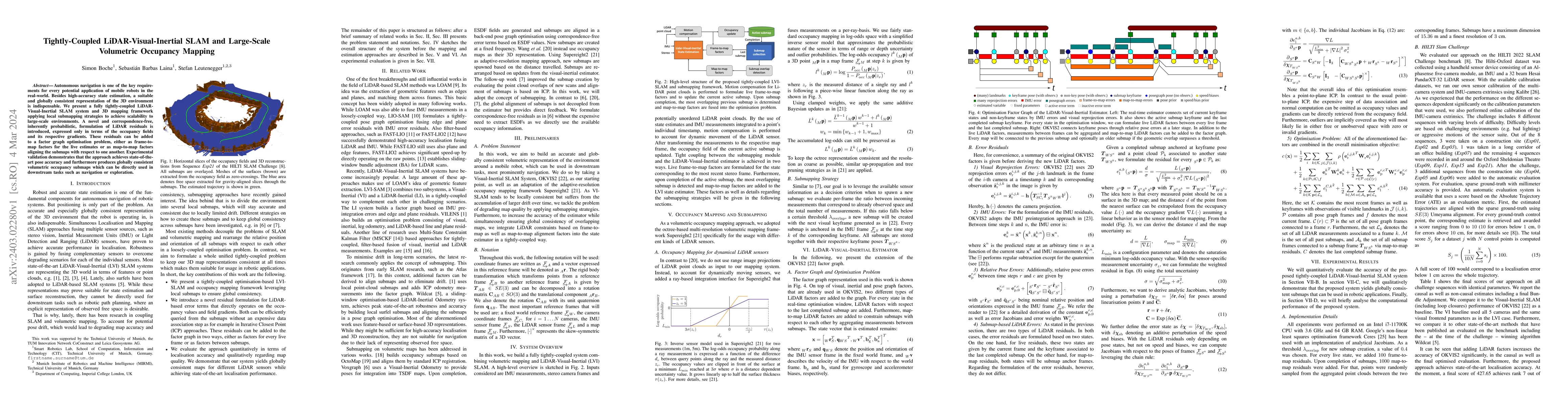
We propose visual-inertial simultaneous localization and mapping that tightly couples sparse reprojection errors, inertial measurement unit pre-integrals, and relative pose factors with dense volumetr...
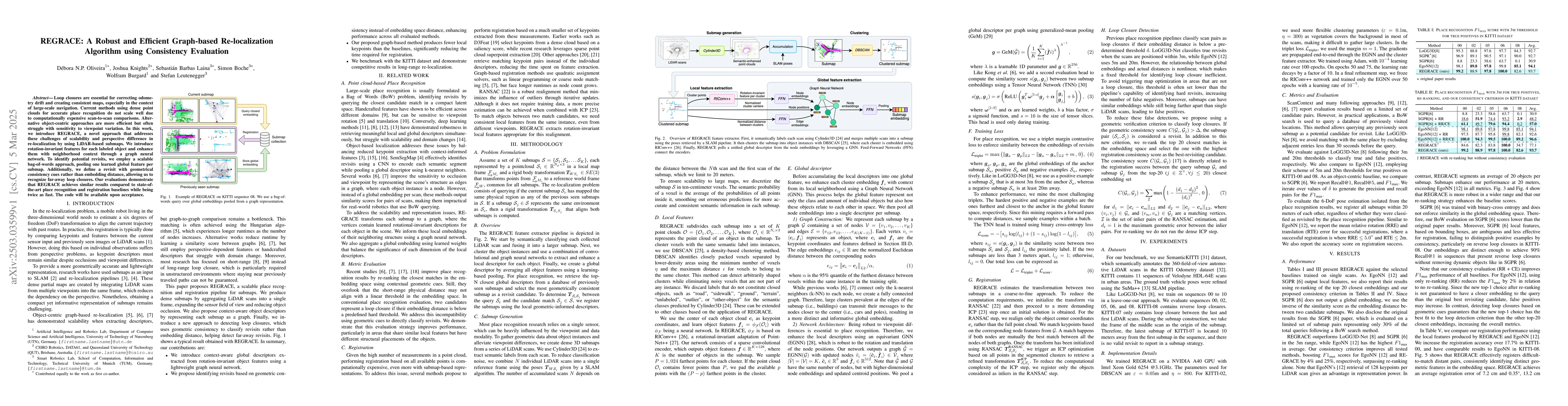
Loop closures are essential for correcting odometry drift and creating consistent maps, especially in the context of large-scale navigation. Current methods using dense point clouds for accurate place...
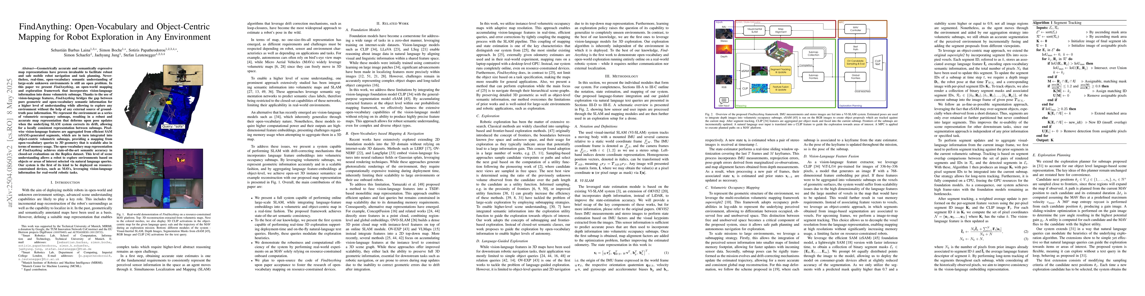
Geometrically accurate and semantically expressive map representations have proven invaluable to facilitate robust and safe mobile robot navigation and task planning. Nevertheless, real-time, open-voc...
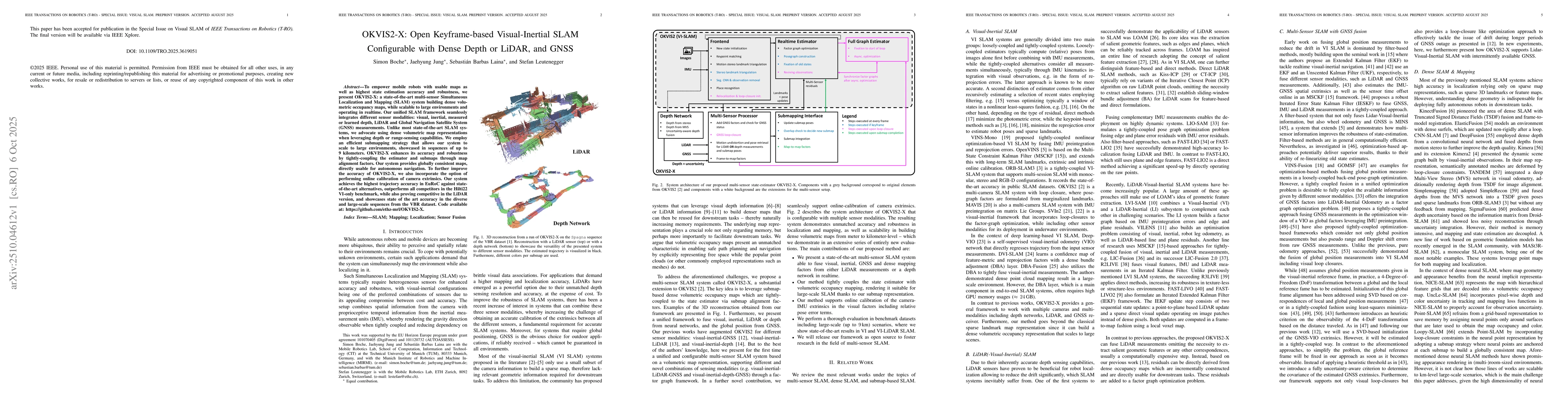
To empower mobile robots with usable maps as well as highest state estimation accuracy and robustness, we present OKVIS2-X: a state-of-the-art multi-sensor Simultaneous Localization and Mapping (SLAM)...
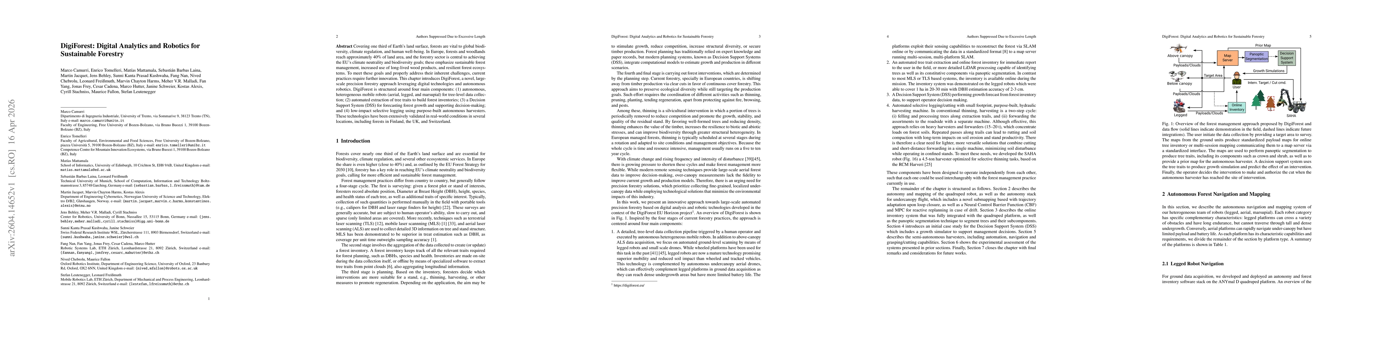
Covering one third of Earth's land surface, forests are vital to global biodiversity, climate regulation, and human well-being. In Europe, forests and woodlands reach approximately 40% of land area, a...
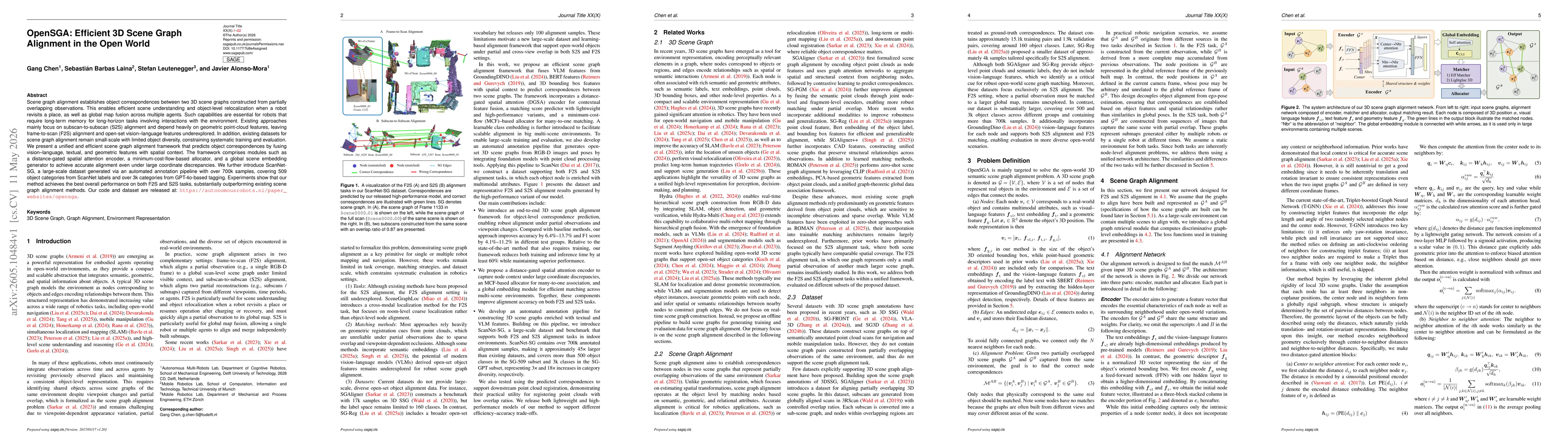
Scene graph alignment establishes object correspondences between two 3D scene graphs constructed from partially overlapping observations. This enables efficient scene understanding and object-level re...
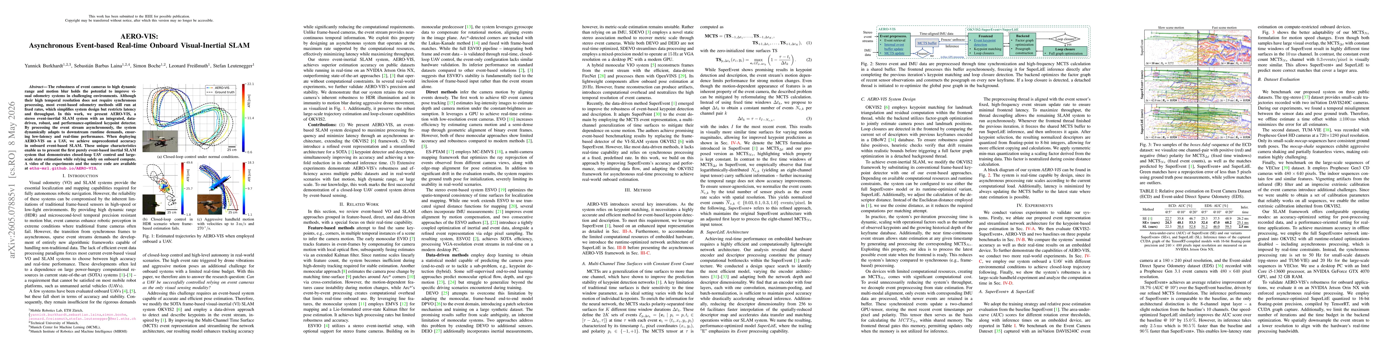
The robustness of event cameras to high dynamic range and motion blur holds the potential to improve visual odometry systems in challenging environments. Although their high temporal resolution does n...