Scalable Autonomous Drone Flight in the Forest with Visual-Inertial SLAM and Dense Submaps Built without LiDAR
Publication
Metrics
AI Quick Summary
This research develops an autonomous drone system for forest navigation using only visual and inertial sensors without LiDAR. It employs visual-inertial SLAM and dense submaps to create accurate, scalable maps for efficient forestry operations, demonstrating successful navigation in high-density forest environments without collisions.
Paper Preview
Abstract
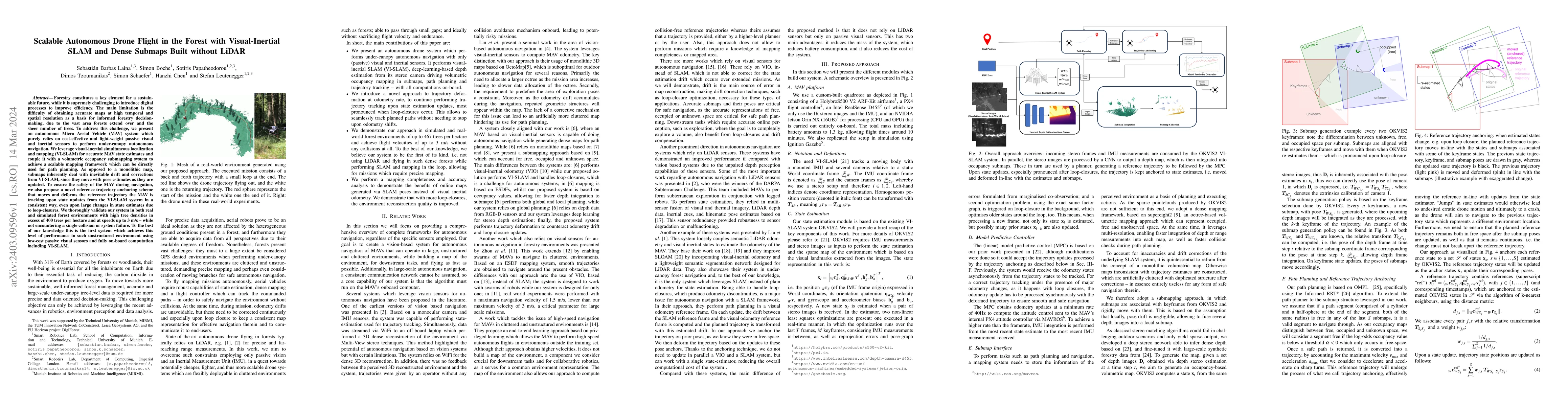
Forestry constitutes a key element for a sustainable future, while it is supremely challenging to introduce digital processes to improve efficiency. The main limitation is the difficulty of obtaining accurate maps at high temporal and spatial resolution as a basis for informed forestry decision-making, due to the vast area forests extend over and the sheer number of trees. To address this challenge, we present an autonomous Micro Aerial Vehicle (MAV) system which purely relies on cost-effective and light-weight passive visual and inertial sensors to perform under-canopy autonomous navigation. We leverage visual-inertial simultaneous localization and mapping (VI-SLAM) for accurate MAV state estimates and couple it with a volumetric occupancy submapping system to achieve a scalable mapping framework which can be directly used for path planning. As opposed to a monolithic map, submaps inherently deal with inevitable drift and corrections from VI-SLAM, since they move with pose estimates as they are updated. To ensure the safety of the MAV during navigation, we also propose a novel reference trajectory anchoring scheme that moves and deforms the reference trajectory the MAV is tracking upon state updates from the VI-SLAM system in a consistent way, even upon large changes in state estimates due to loop-closures. We thoroughly validate our system in both real and simulated forest environments with high tree densities in excess of 400 trees per hectare and at speeds up to 3 m/s - while not encountering a single collision or system failure. To the best of our knowledge this is the first system which achieves this level of performance in such unstructured environment using low-cost passive visual sensors and fully on-board computation including VI-SLAM.
AI Key Findings
Get AI-generated insights about this paper's methodology, results, significance, and more — seven facets brought into focus.
Impact
Paper Details
Authors
PDF Preview
Key Terms
Citation Network
Current paper (gray), citations (green), references (blue)
Display is limited for performance on very large graphs.
Discussion 0