Statistics
Similar Authors
Papers on arXiv

Obstacle avoidance and path planning are essential for guiding unmanned ground vehicles (UGVs) through environments that are densely populated with dynamic obstacles. This paper develops a novel appro...
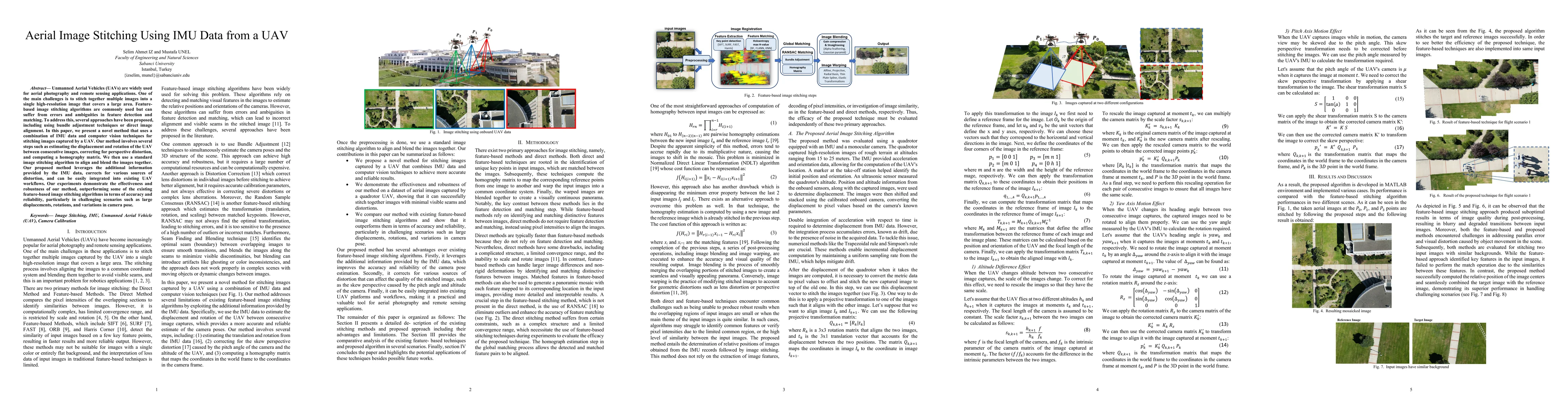
Unmanned Aerial Vehicles (UAVs) are widely used for aerial photography and remote sensing applications. One of the main challenges is to stitch together multiple images into a single high-resolution i...
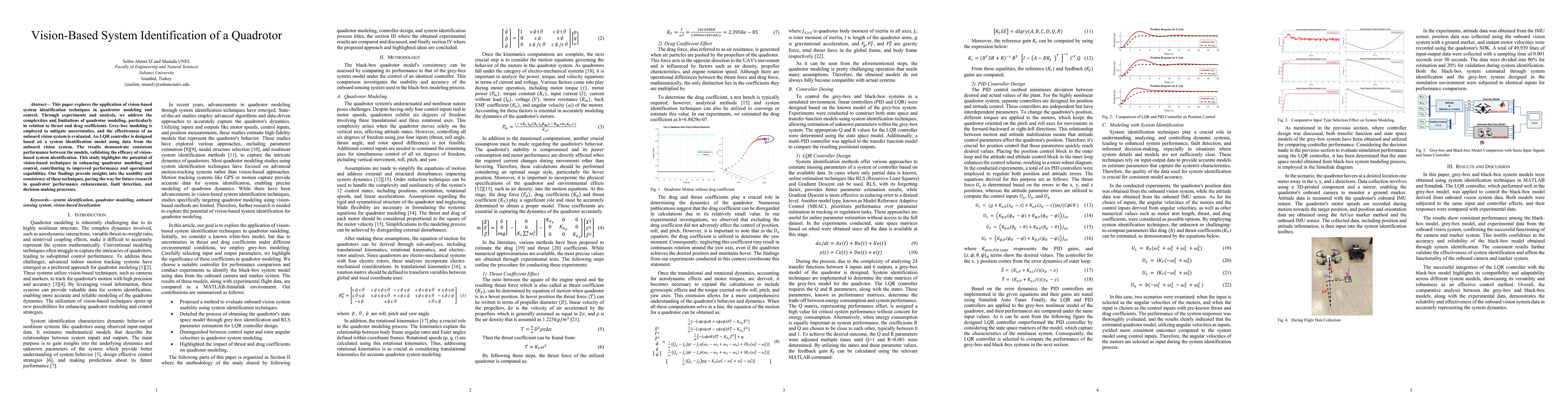
This paper explores the application of vision-based system identification techniques in quadrotor modeling and control. Through experiments and analysis, we address the complexities and limitations of...
Real-time processing of UAV imagery is crucial for applications requiring urgent geospatial information, such as disaster response, where rapid decision-making and accurate spatial data are essential....
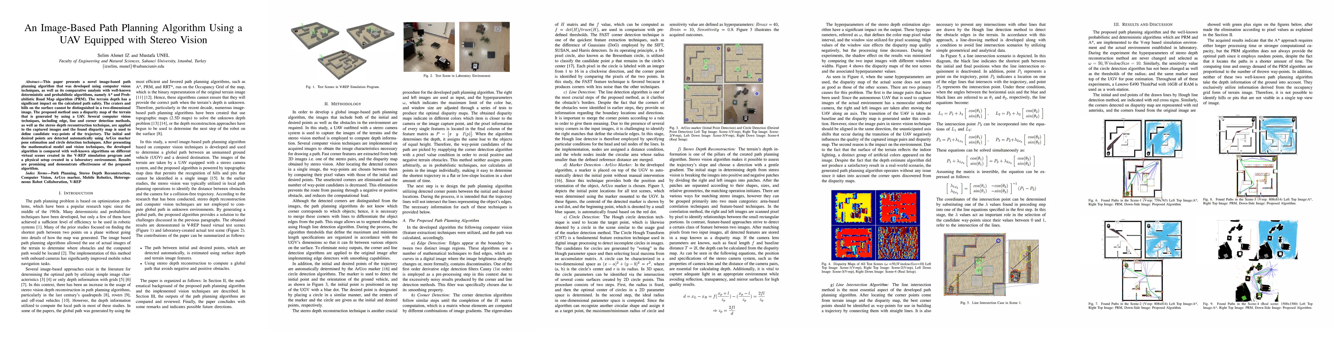
This paper presents a novel image-based path planning algorithm that was developed using computer vision techniques, as well as its comparative analysis with well-known deterministic and probabilistic...
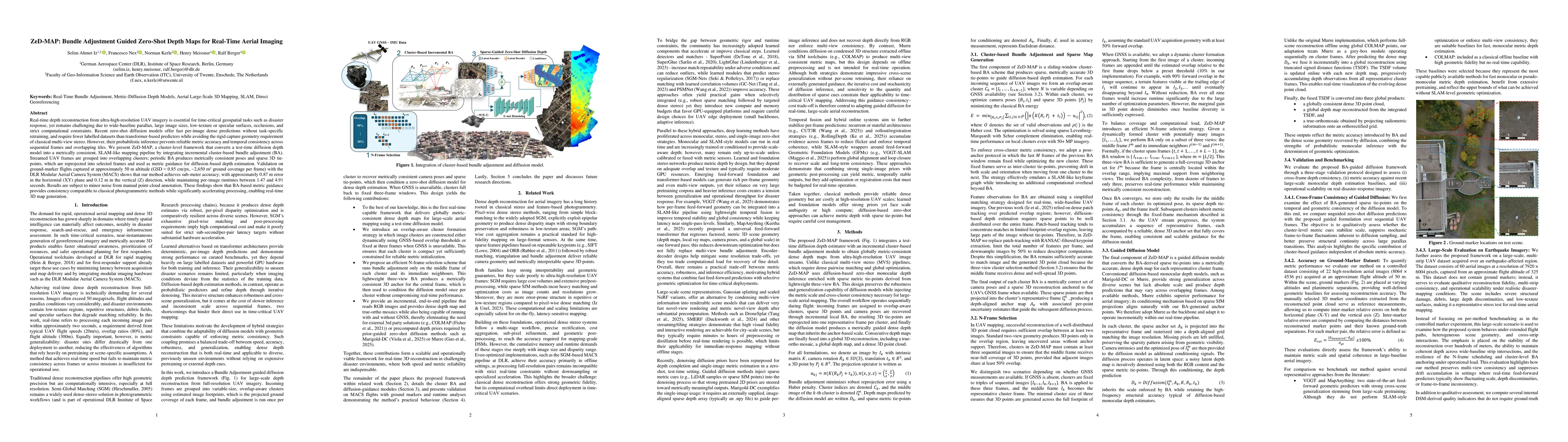
Real-time depth reconstruction from ultra-high-resolution UAV imagery is essential for time-critical geospatial tasks such as disaster response, yet remains challenging due to wide-baseline parallax, ...