Academic Profile
Statistics
Similar Authors
Papers on arXiv
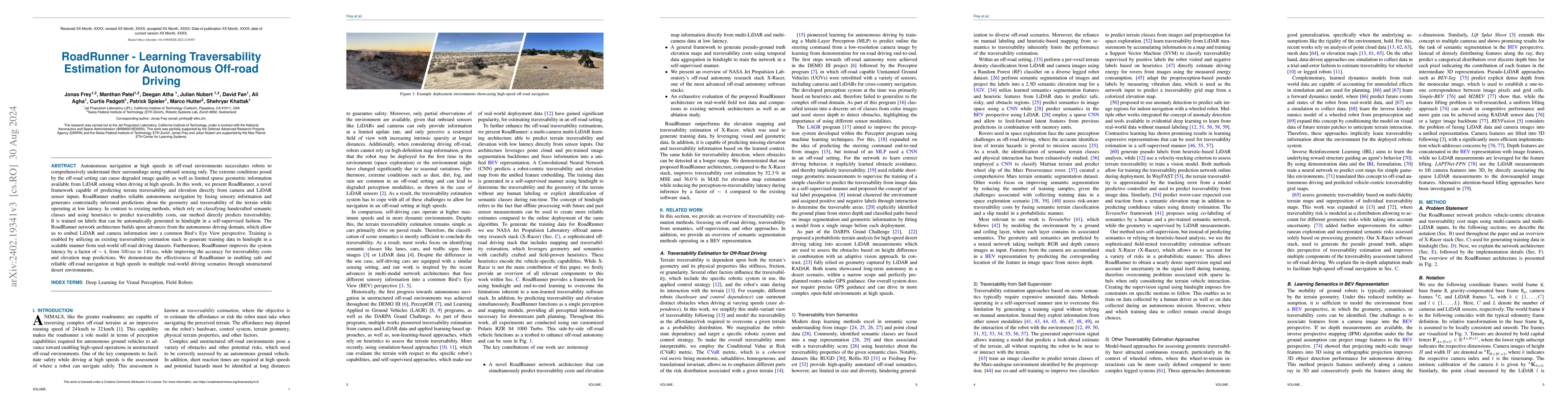
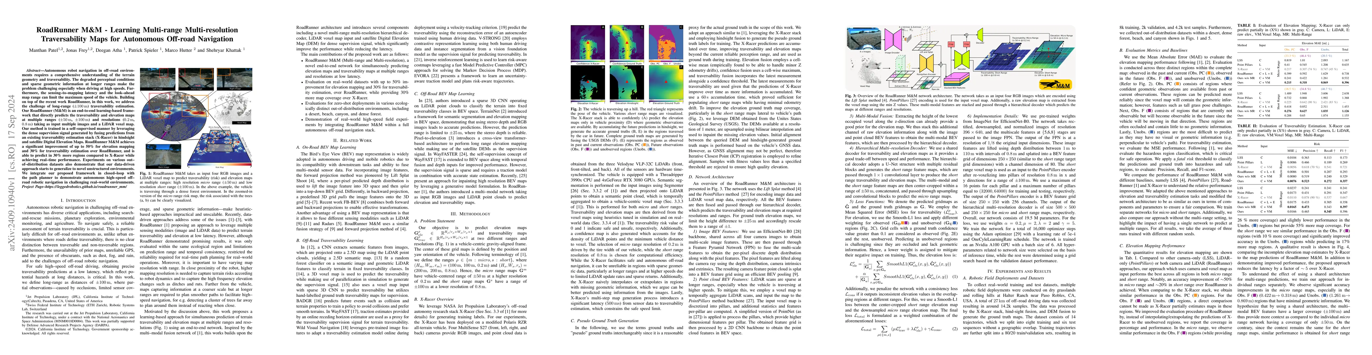
Autonomous navigation at high speeds in off-road environments necessitates robots to comprehensively understand their surroundings using onboard sensing only. The extreme conditions posed by the off...
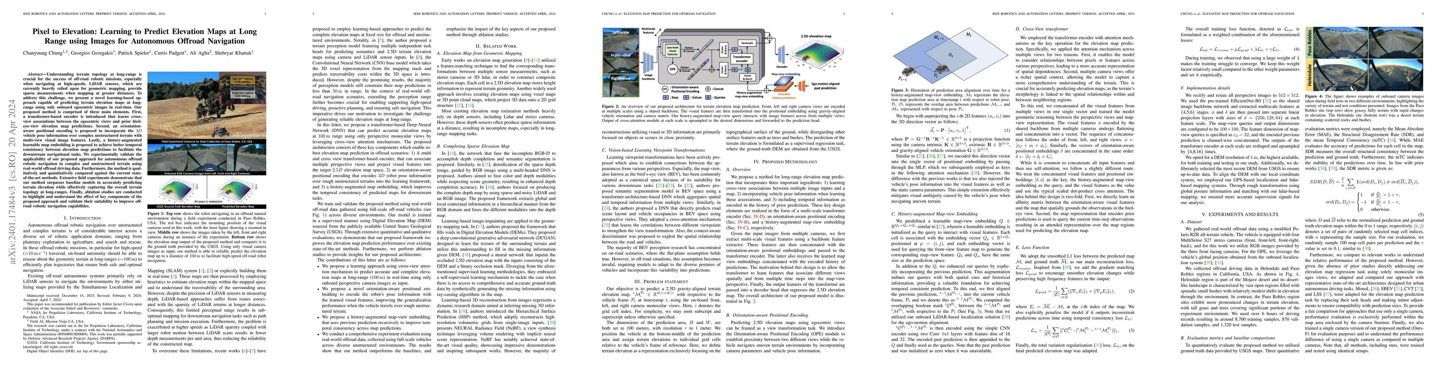
Understanding terrain topology at long-range is crucial for the success of off-road robotic missions, especially when navigating at high-speeds. LiDAR sensors, which are currently heavily relied upo...
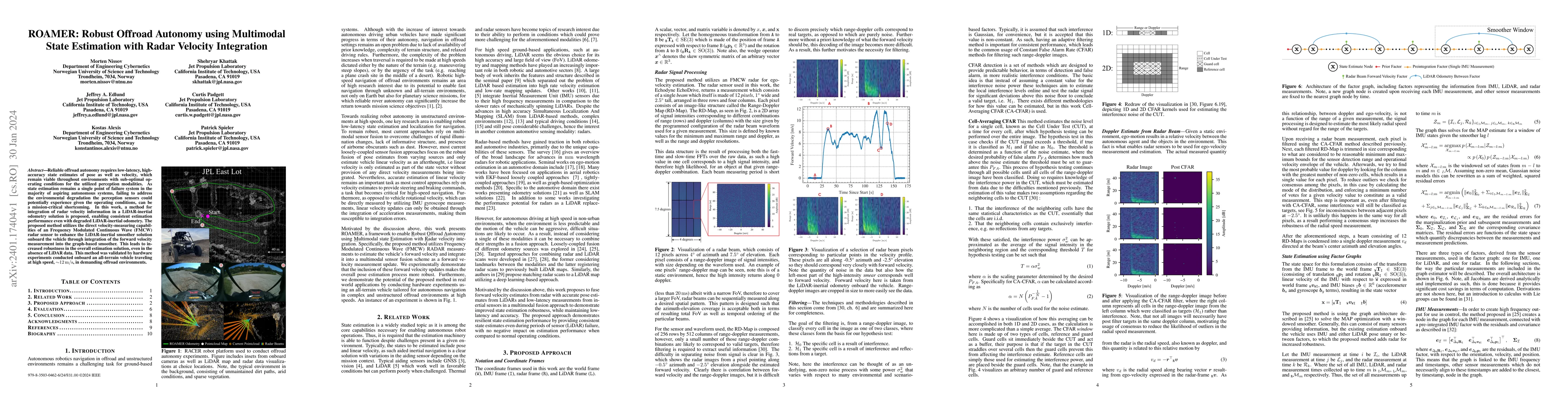
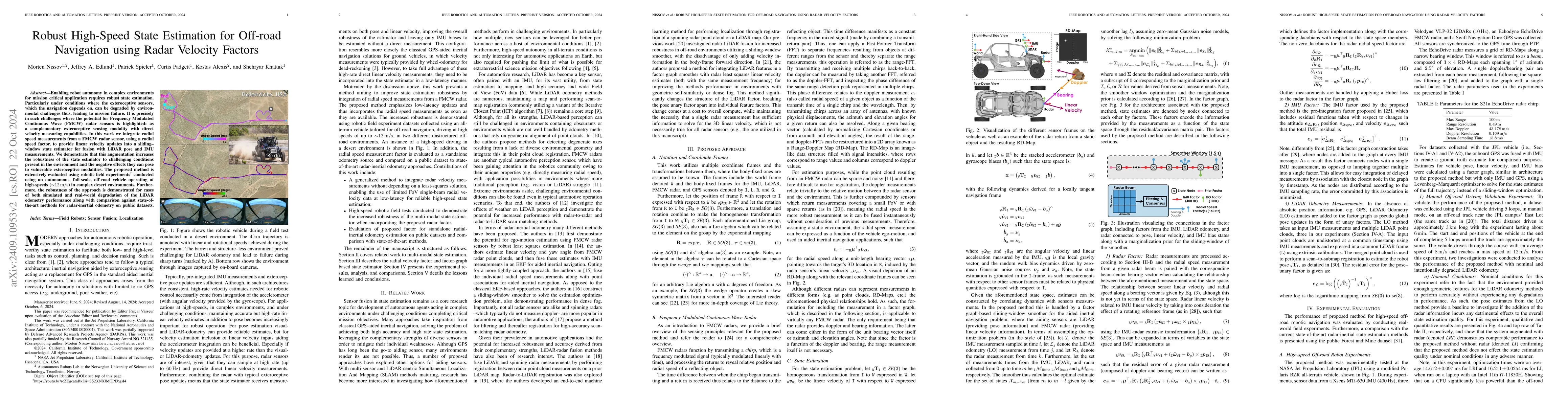
Reliable offroad autonomy requires low-latency, high-accuracy state estimates of pose as well as velocity, which remain viable throughout environments with sub-optimal operating conditions for the u...
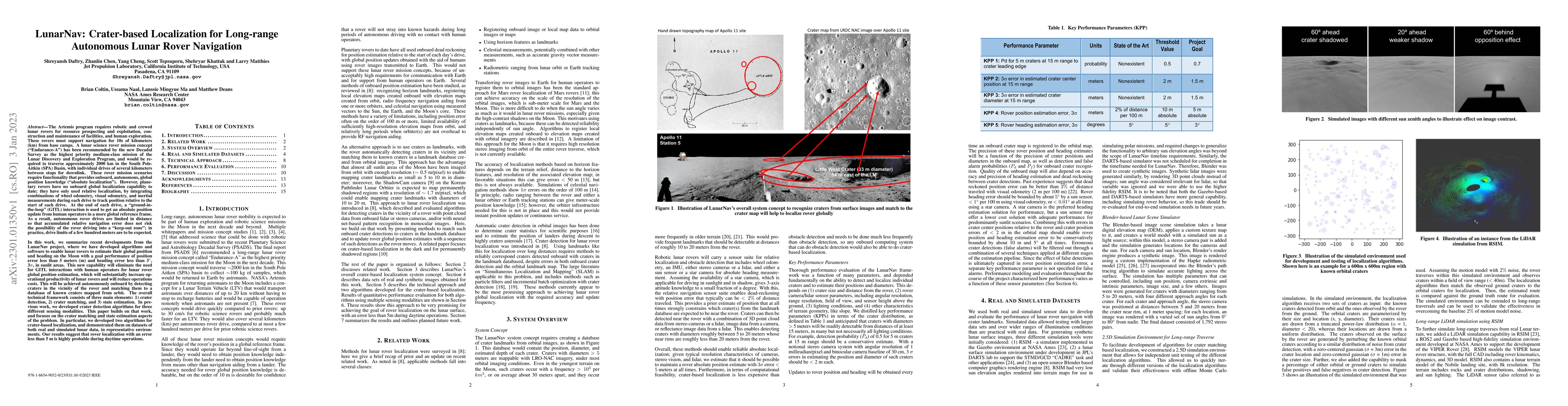
The Artemis program requires robotic and crewed lunar rovers for resource prospecting and exploitation, construction and maintenance of facilities, and human exploration. These rovers must support n...
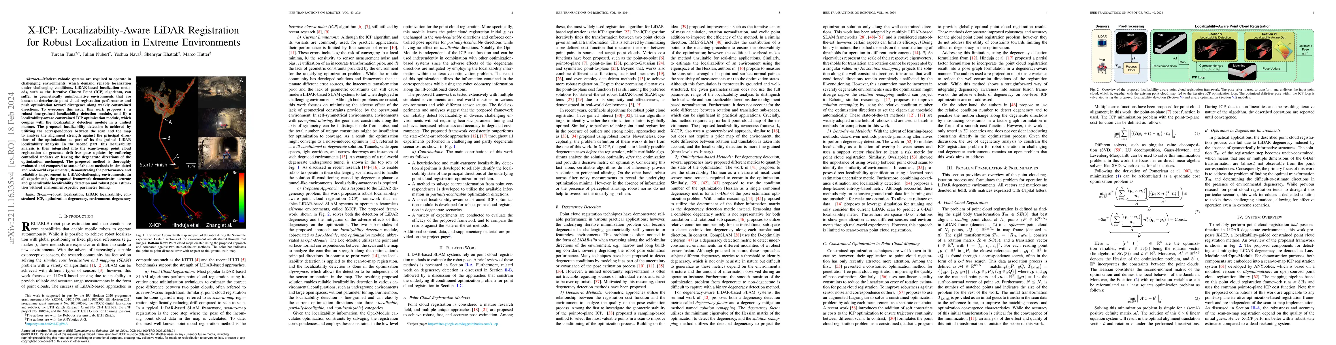
Modern robotic systems are required to operate in challenging environments, which demand reliable localization under challenging conditions. LiDAR-based localization methods, such as the Iterative C...
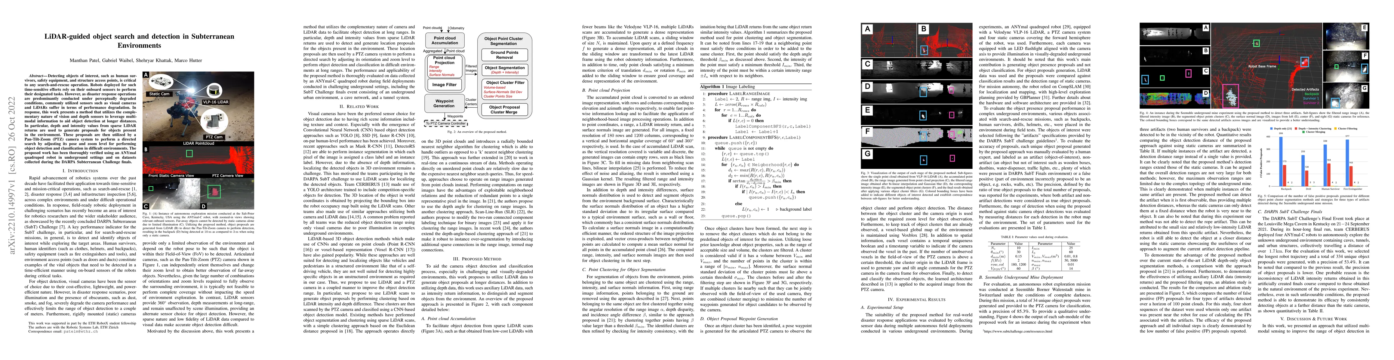
Detecting objects of interest, such as human survivors, safety equipment, and structure access points, is critical to any search-and-rescue operation. Robots deployed for such time-sensitive efforts...
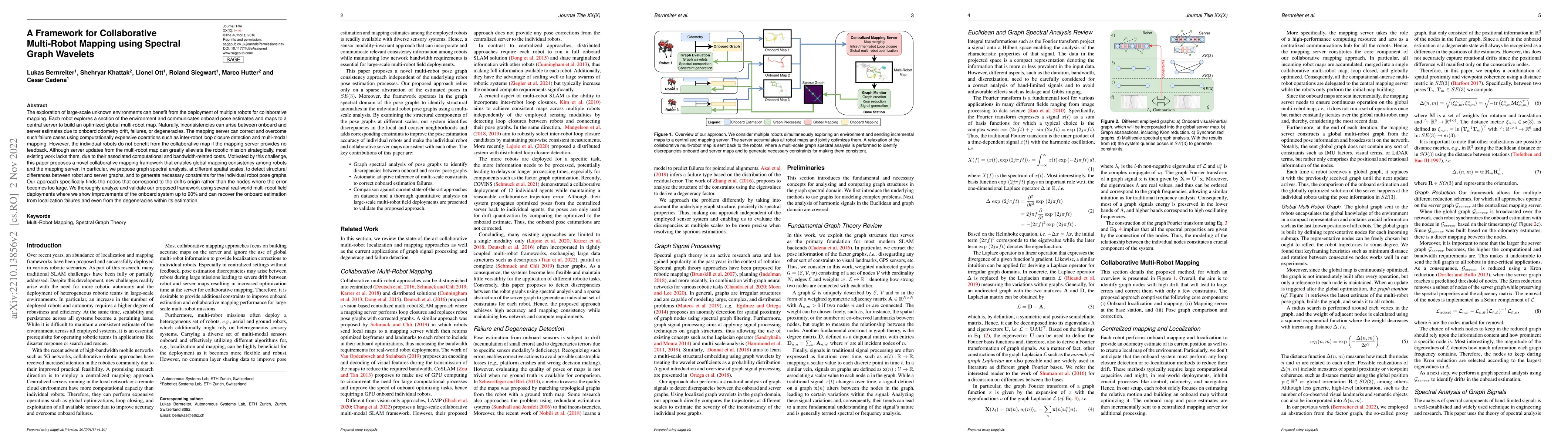
The exploration of large-scale unknown environments can benefit from the deployment of multiple robots for collaborative mapping. Each robot explores a section of the environment and communicates on...
This paper reports on the state of the art in underground SLAM by discussing different SLAM strategies and results across six teams that participated in the three-year-long SubT competition. In part...
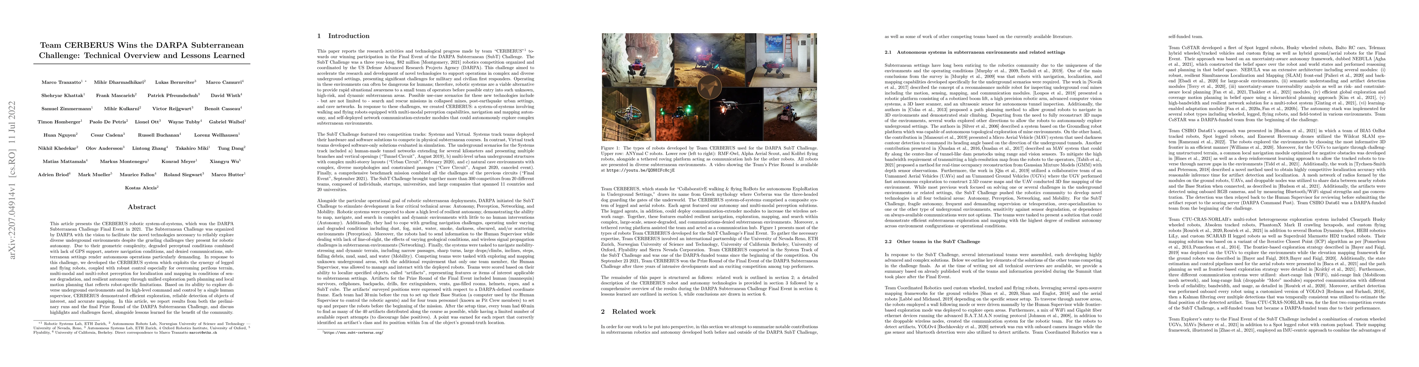
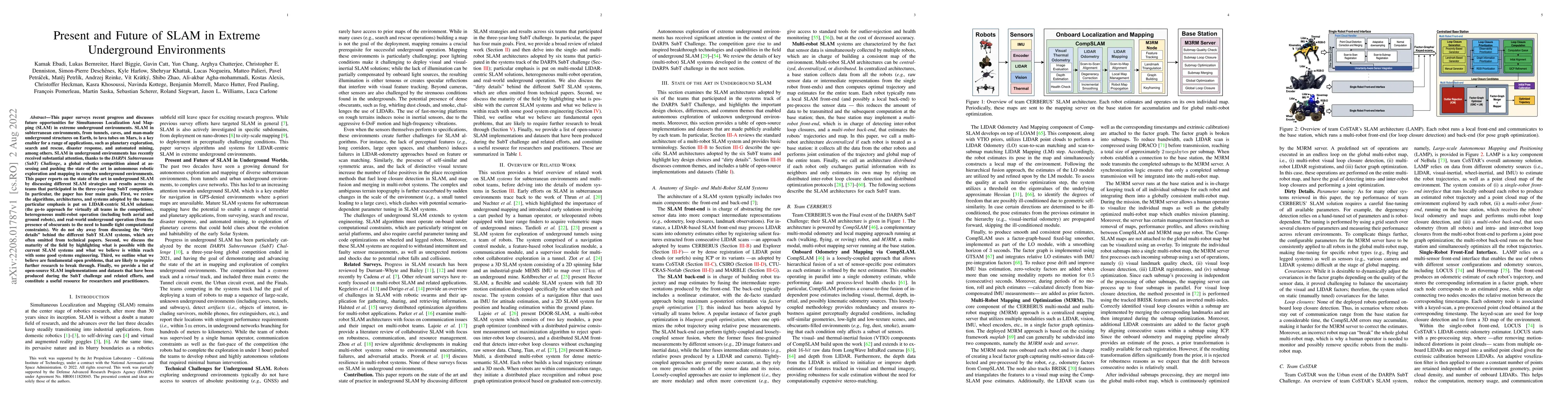
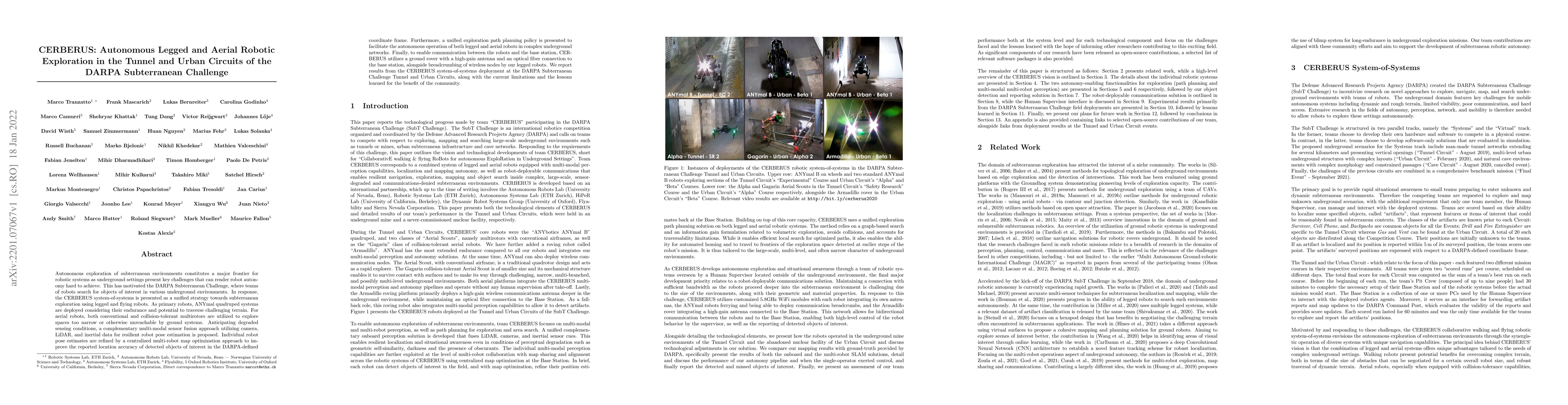
This article presents the CERBERUS robotic system-of-systems, which won the DARPA Subterranean Challenge Final Event in 2021. The Subterranean Challenge was organized by DARPA with the vision to fac...
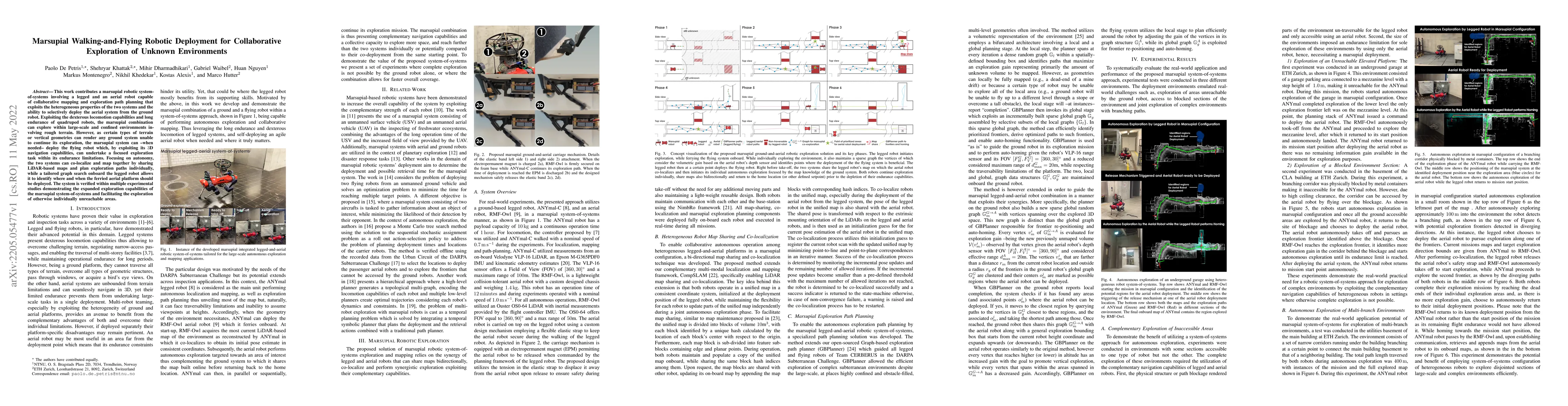
This work contributes a marsupial robotic system-of-systems involving a legged and an aerial robot capable of collaborative mapping and exploration path planning that exploits the heterogeneous prop...
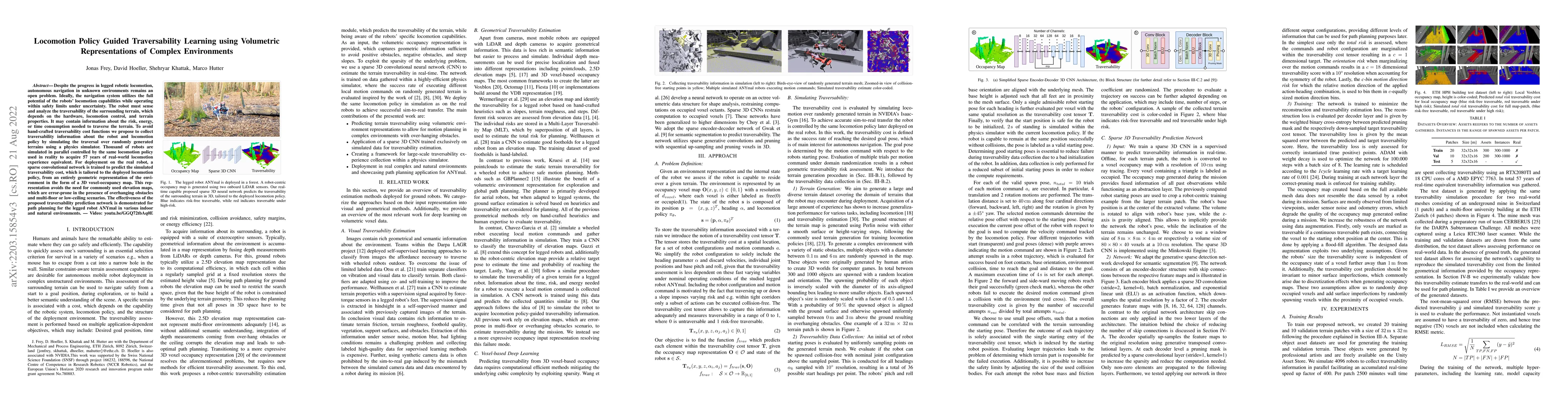
Despite the progress in legged robotic locomotion, autonomous navigation in unknown environments remains an open problem. Ideally, the navigation system utilizes the full potential of the robots' lo...
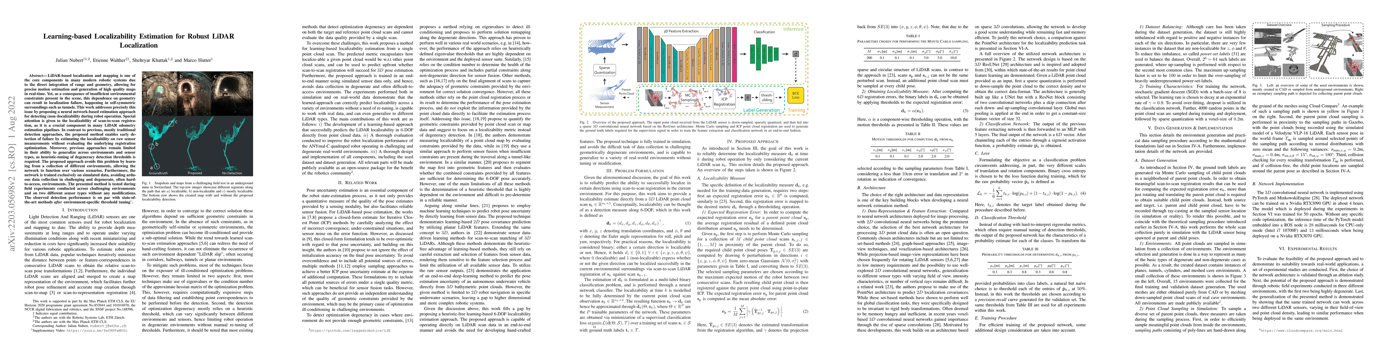
LiDAR-based localization and mapping is one of the core components in many modern robotic systems due to the direct integration of range and geometry, allowing for precise motion estimation and gene...
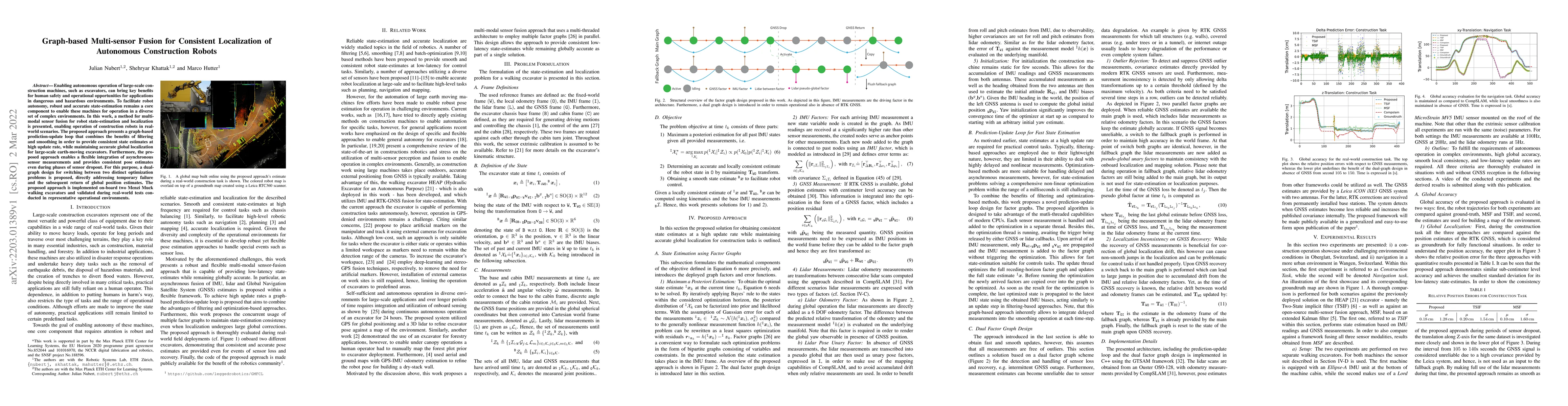
Enabling autonomous operation of large-scale construction machines, such as excavators, can bring key benefits for human safety and operational opportunities for applications in dangerous and hazard...
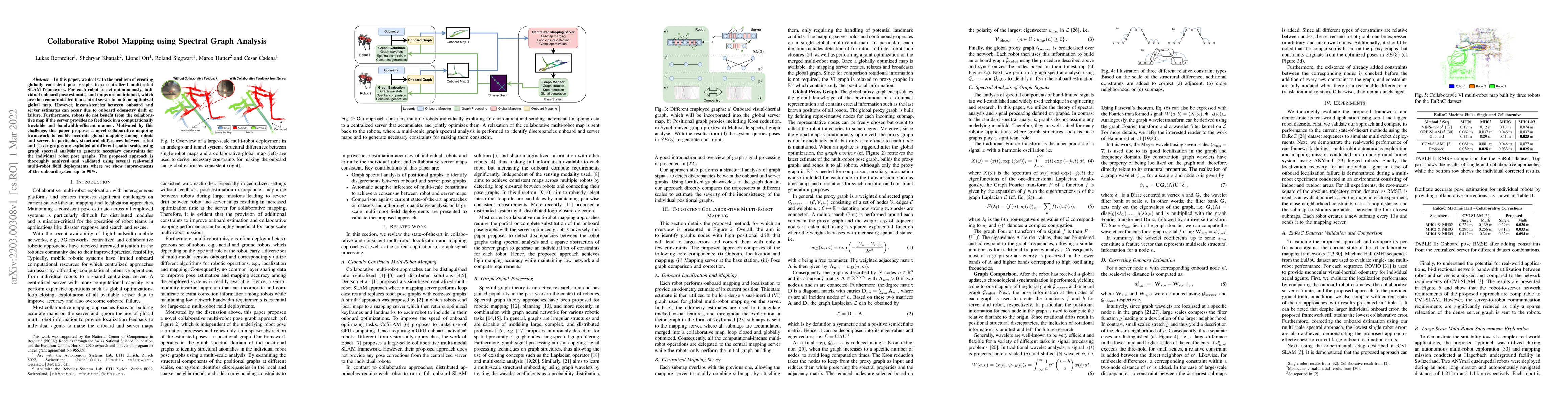
In this paper, we deal with the problem of creating globally consistent pose graphs in a centralized multi-robot SLAM framework. For each robot to act autonomously, individual onboard pose estimates...
Autonomous exploration of subterranean environments constitutes a major frontier for robotic systems as underground settings present key challenges that can render robot autonomy hard to achieve. Th...
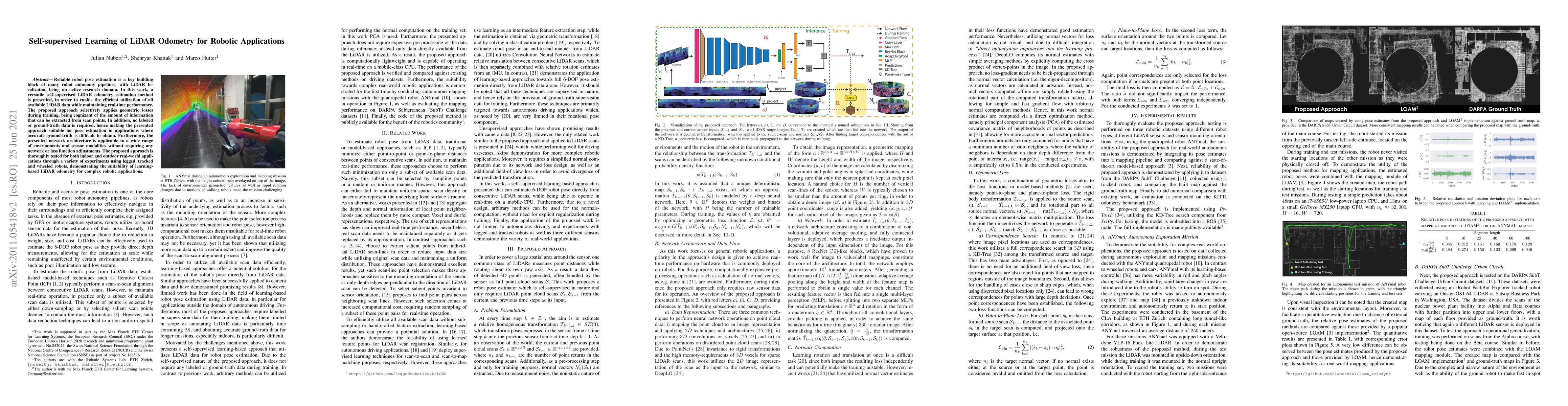
Reliable robot pose estimation is a key building block of many robot autonomy pipelines, with LiDAR localization being an active research domain. In this work, a versatile self-supervised LiDAR odom...
With an ever-widening domain of aerial robotic applications, including many mission critical tasks such as disaster response operations, search and rescue missions and infrastructure inspections tak...
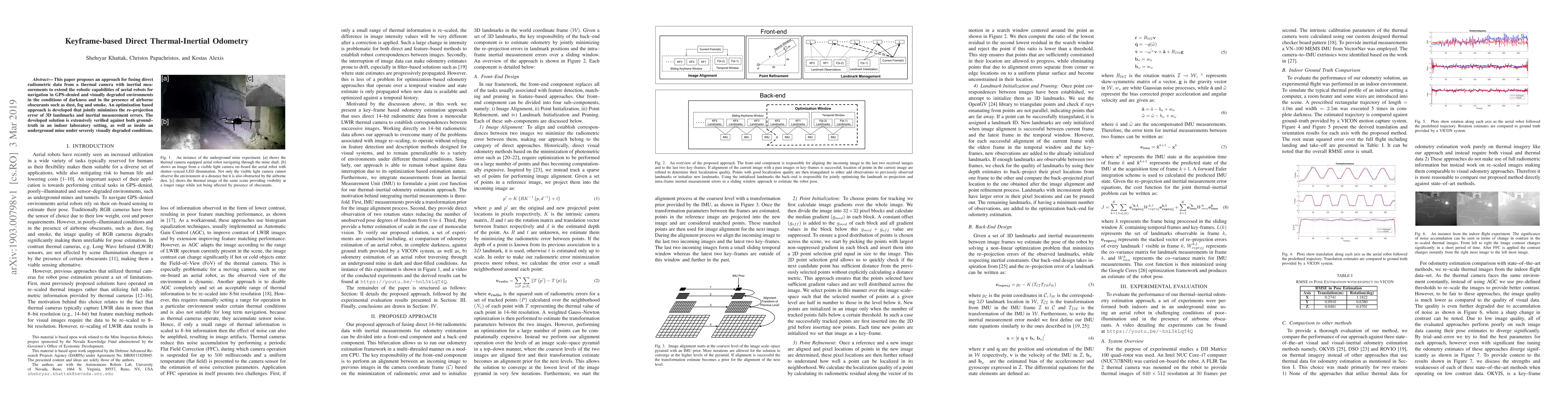
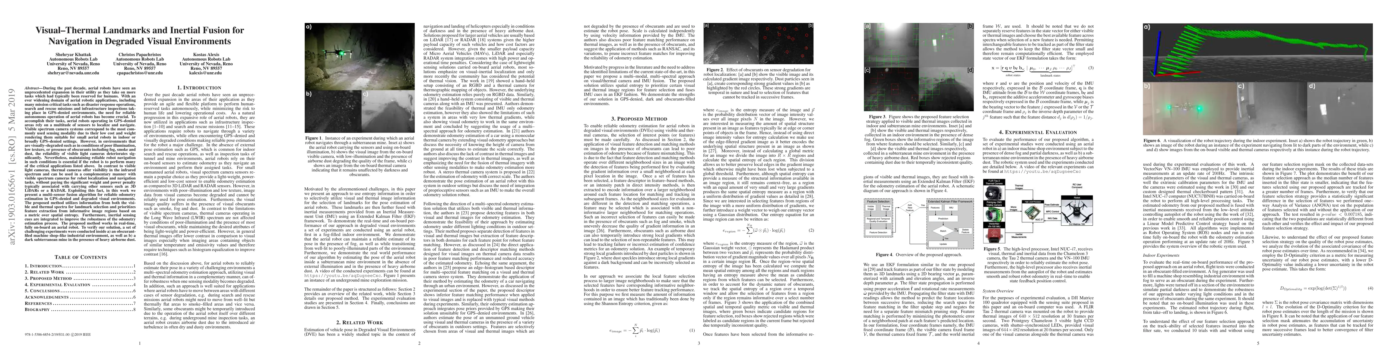
This paper proposes an approach for fusing direct radiometric data from a thermal camera with inertial measurements to extend the robotic capabilities of aerial robots for navigation in GPS-denied a...
Autonomous robot navigation in off-road environments requires a comprehensive understanding of the terrain geometry and traversability. The degraded perceptual conditions and sparse geometric informat...
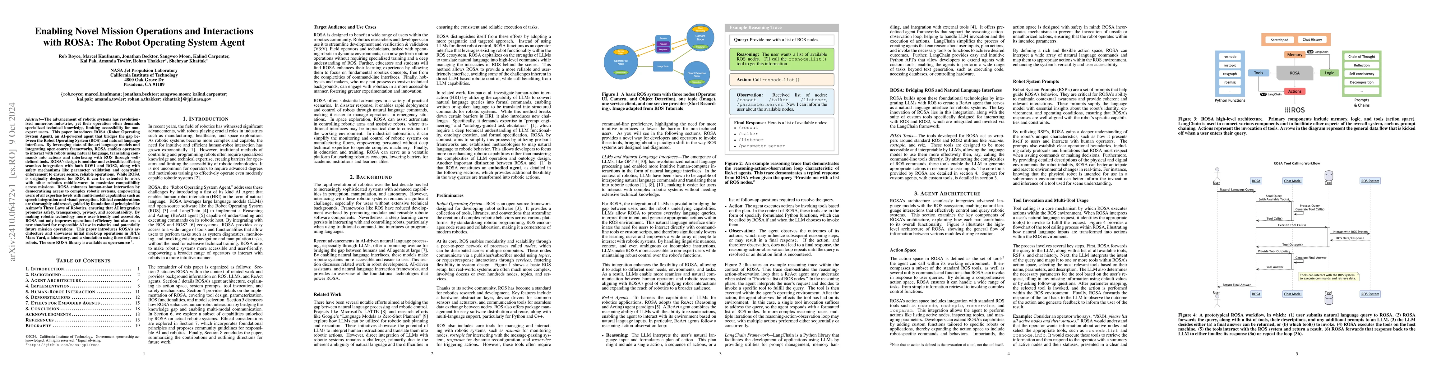
The advancement of robotic systems has revolutionized numerous industries, yet their operation often demands specialized technical knowledge, limiting accessibility for non-expert users. This paper in...
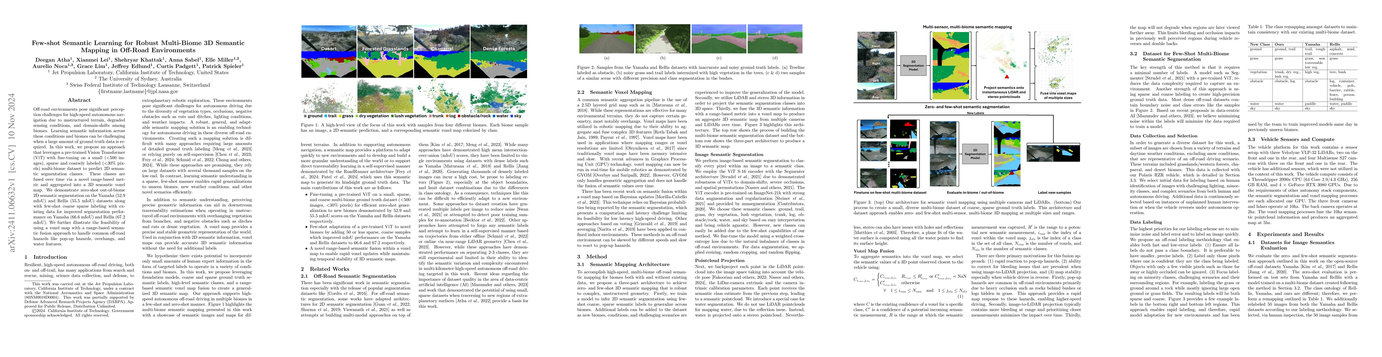
Off-road environments pose significant perception challenges for high-speed autonomous navigation due to unstructured terrain, degraded sensing conditions, and domain-shifts among biomes. Learning sem...
Enabling robot autonomy in complex environments for mission critical application requires robust state estimation. Particularly under conditions where the exteroceptive sensors, which the navigation d...
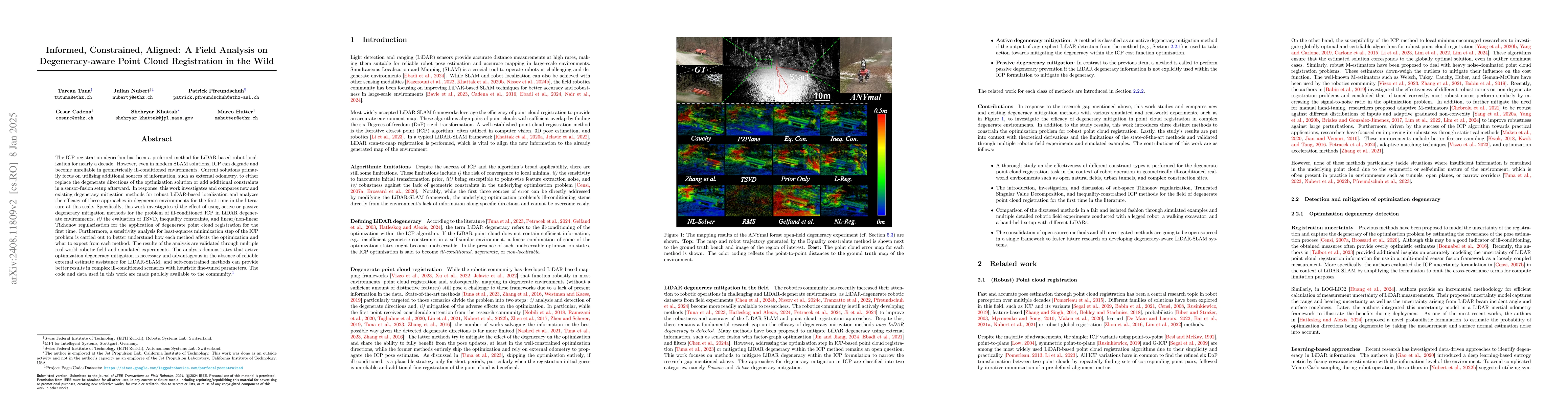
The ICP registration algorithm has been a preferred method for LiDAR-based robot localization for nearly a decade. However, even in modern SLAM solutions, ICP can degrade and become unreliable in geom...
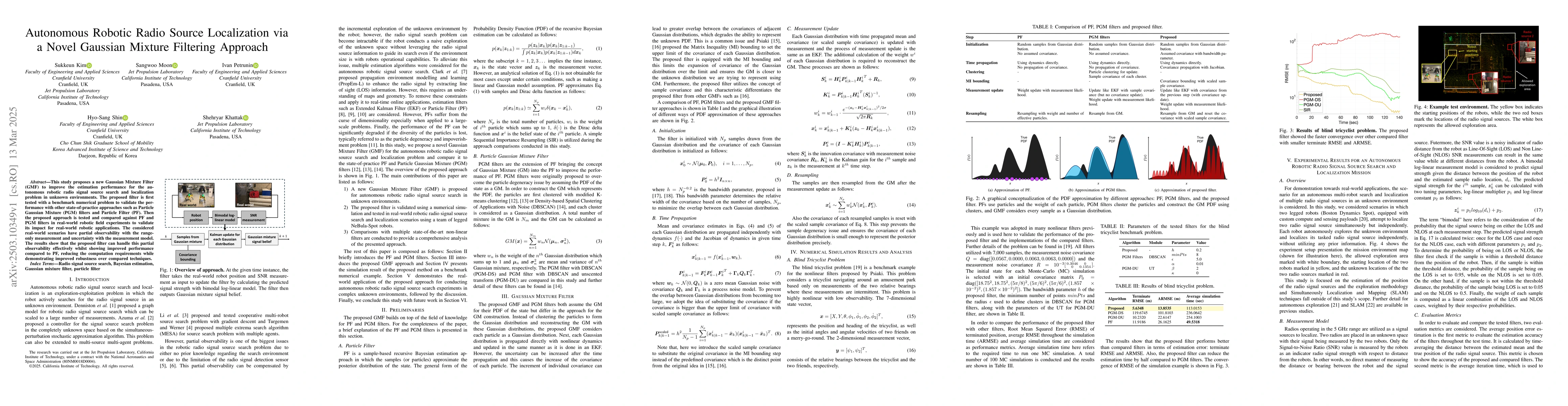
This study proposes a new Gaussian Mixture Filter (GMF) to improve the estimation performance for the autonomous robotic radio signal source search and localization problem in unknown environments. Th...
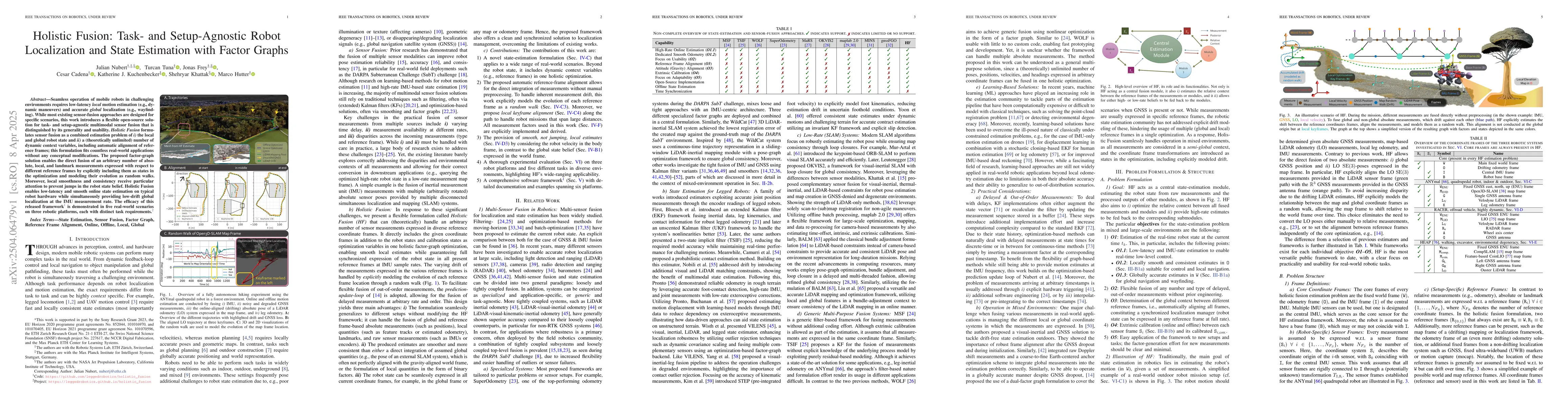
Seamless operation of mobile robots in challenging environments requires low-latency local motion estimation (e.g., dynamic maneuvers) and accurate global localization (e.g., wayfinding). While most e...
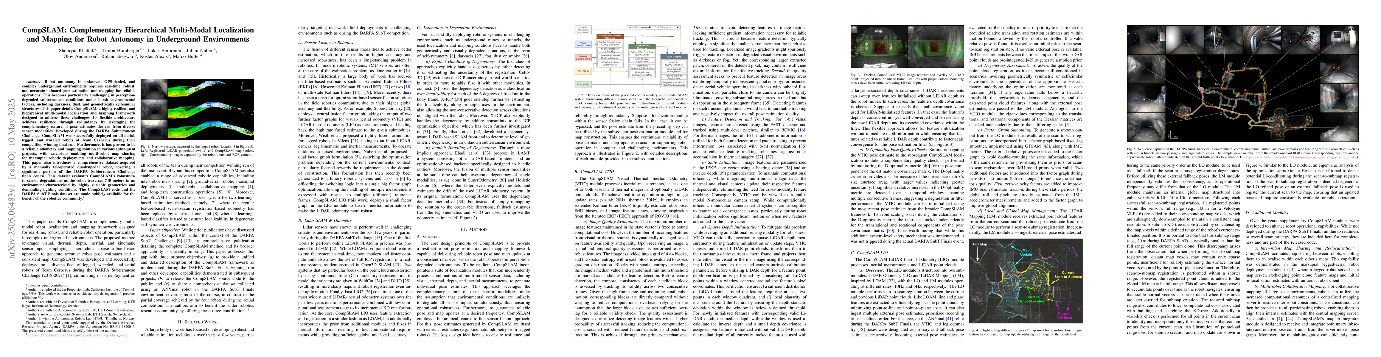
Robot autonomy in unknown, GPS-denied, and complex underground environments requires real-time, robust, and accurate onboard pose estimation and mapping for reliable operations. This becomes particula...
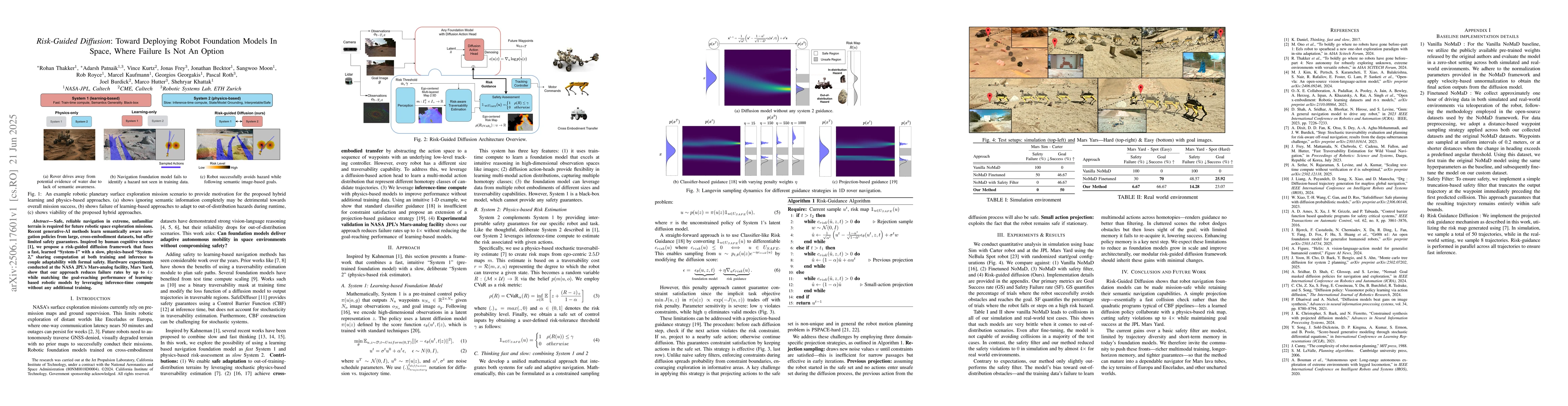
Safe, reliable navigation in extreme, unfamiliar terrain is required for future robotic space exploration missions. Recent generative-AI methods learn semantically aware navigation policies from large...
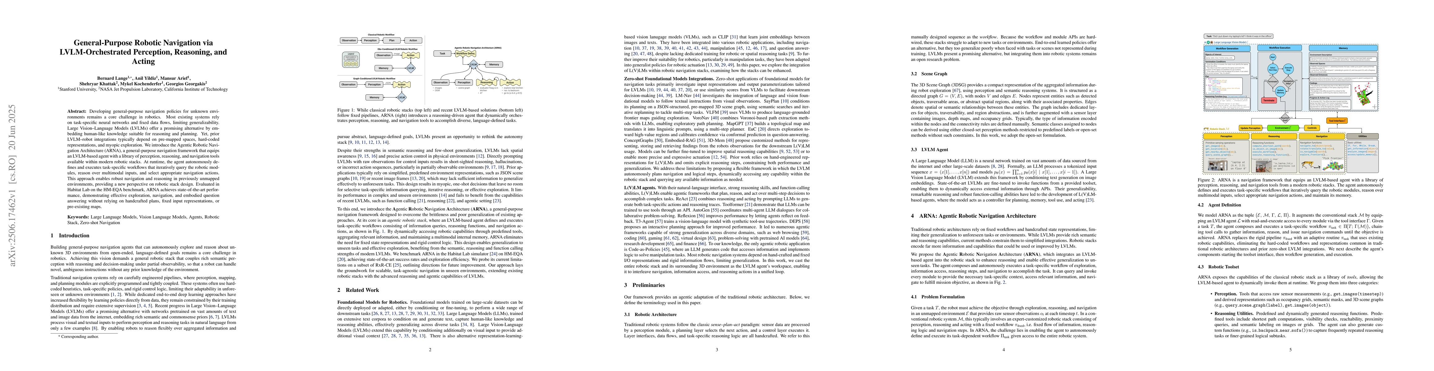
Developing general-purpose navigation policies for unknown environments remains a core challenge in robotics. Most existing systems rely on task-specific neural networks and fixed data flows, limiting...
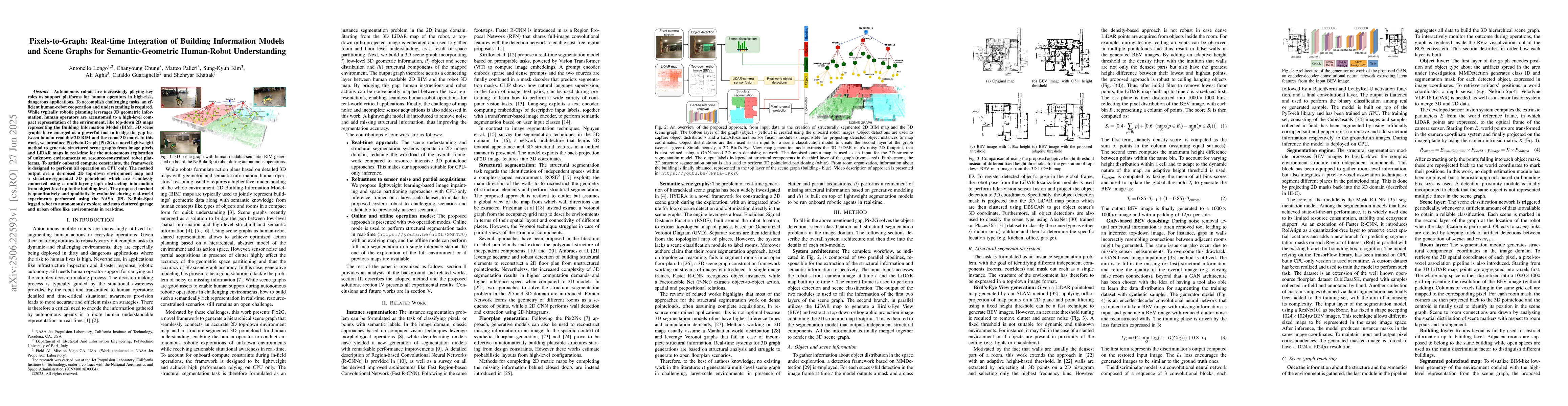
Autonomous robots are increasingly playing key roles as support platforms for human operators in high-risk, dangerous applications. To accomplish challenging tasks, an efficient human-robot cooperatio...
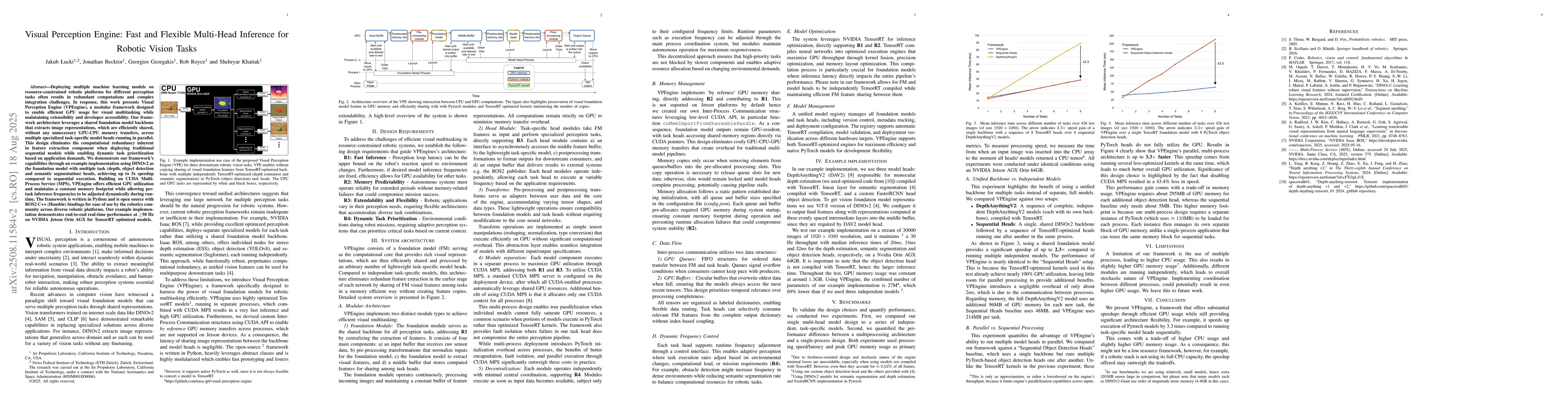
Deploying multiple machine learning models on resource-constrained robotic platforms for different perception tasks often results in redundant computations, large memory footprints, and complex integr...
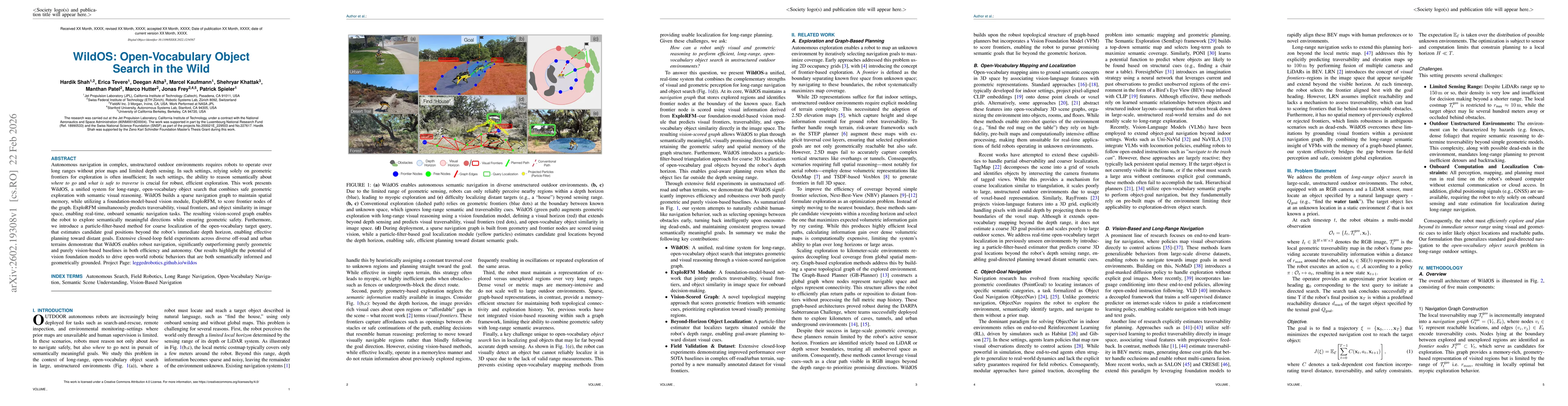
Autonomous navigation in complex, unstructured outdoor environments requires robots to operate over long ranges without prior maps and limited depth sensing. In such settings, relying solely on geomet...
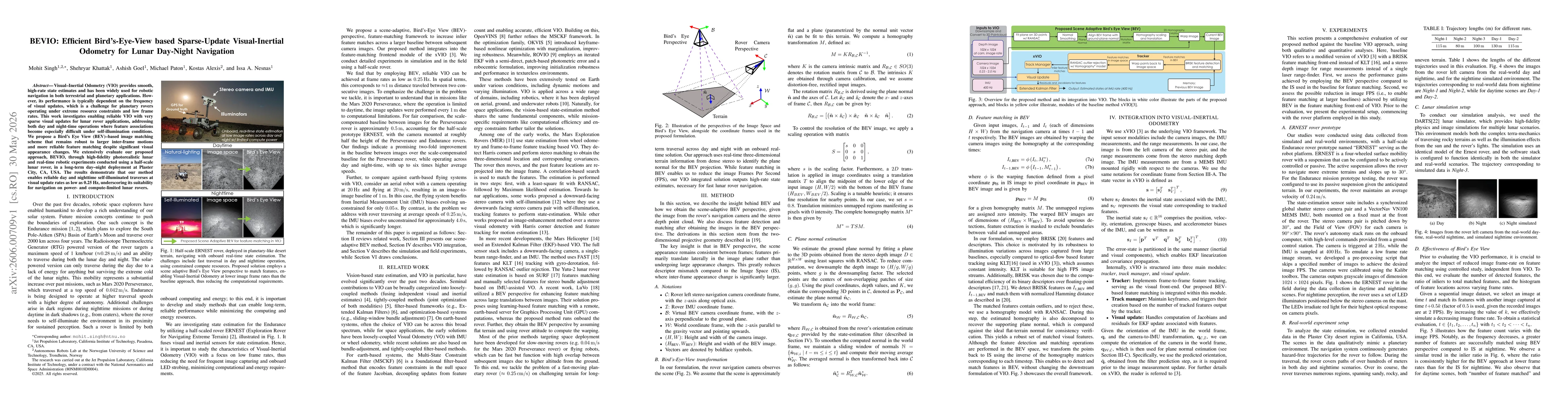
Visual-Inertial Odometry (VIO) provides smooth, high-rate state estimates and has been widely used for robotic navigation in both terrestrial and planetary applications. However, its performance is ty...