1
arXiv Papers
1
Total Publications
Profile
Academic Profile
Metrics
Statistics
1
arXiv Papers
1
Total Publications
Network
Similar Authors
Publications
Papers on arXiv
arXiv
A robot-assisted pipeline to rapidly scan 1.7 million historical aerial
photographs
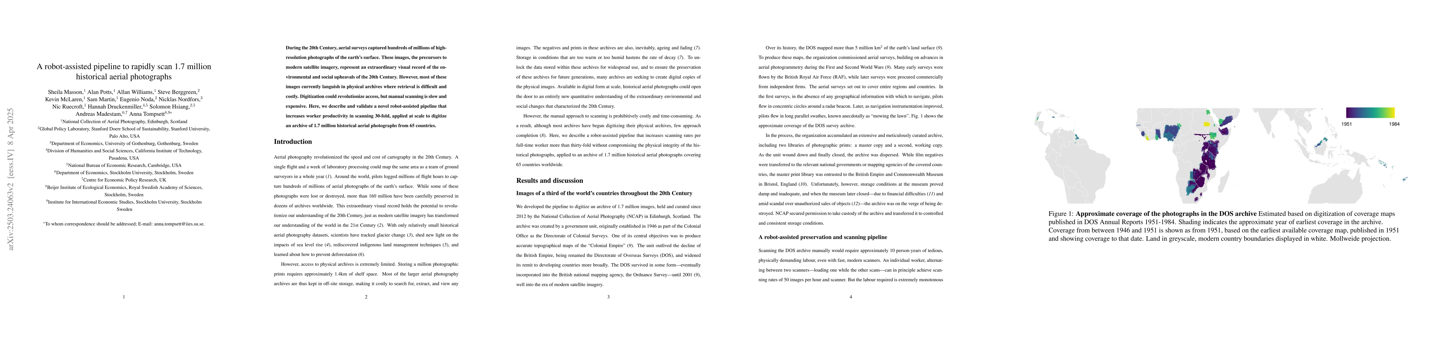
During the 20th Century, aerial surveys captured hundreds of millions of high-resolution photographs of the earth's surface. These images, the precursors to modern satellite imagery, represent an extr...