Summary
During the 20th Century, aerial surveys captured hundreds of millions of high-resolution photographs of the earth's surface. These images, the precursors to modern satellite imagery, represent an extraordinary visual record of the environmental and social upheavals of the 20th Century. However, most of these images currently languish in physical archives where retrieval is difficult and costly. Digitization could revolutionize access, but manual scanning is slow and expensive. Here, we describe and validate a novel robot-assisted pipeline that increases worker productivity in scanning 30-fold, applied at scale to digitize an archive of 1.7 million historical aerial photographs from 65 countries.
AI Key Findings
Generated Jun 10, 2025
Methodology
The paper describes a robot-assisted pipeline designed to rapidly scan historical aerial photographs, increasing worker productivity by 30-fold.
Key Results
- The pipeline successfully digitized 1.7 million historical aerial photographs from 65 countries.
- The method increased scanning productivity by 30 times compared to manual scanning.
Significance
This research is significant as it facilitates access to an extraordinary visual record of environmental and social changes in the 20th Century, currently trapped in physical archives, by making digitization faster and more cost-effective.
Technical Contribution
The main technical contribution is the development of a robot-assisted scanning pipeline that significantly increases the efficiency of historical aerial photograph digitization.
Novelty
This work stands out by applying robotics to a large-scale historical imagery digitization problem, which has traditionally relied on labor-intensive manual processes.
Limitations
- The paper does not discuss potential limitations of the robot system in handling damaged or fragile photographs.
- No information is provided on the scalability of the pipeline for even larger archives.
Future Work
- Further research could explore the application of this pipeline to additional archives or different types of historical imagery.
- Investigating improvements for handling delicate or damaged photographs would be beneficial.
Paper Details
PDF Preview
Citation Network
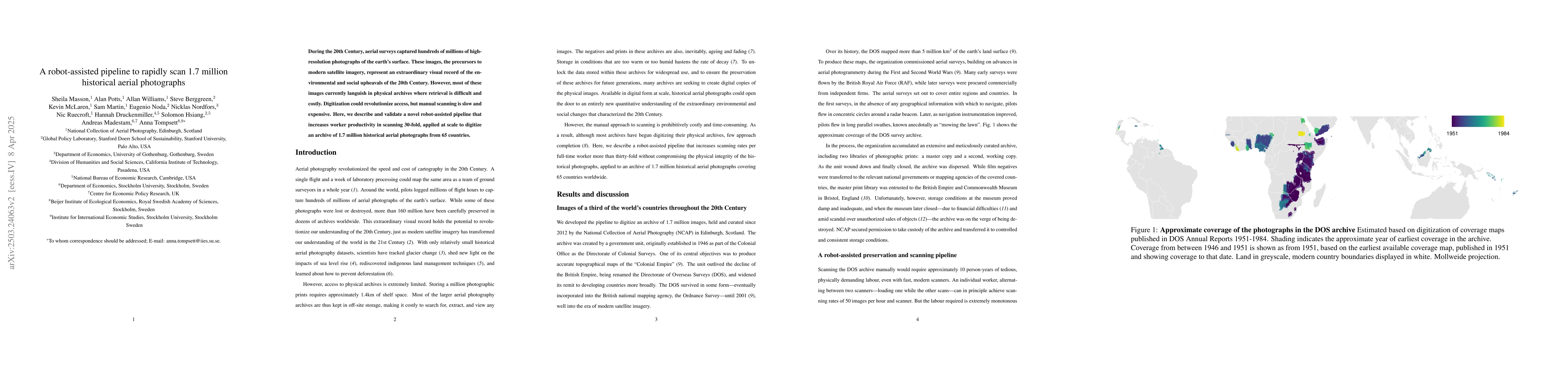
Current paper (gray), citations (green), references (blue)
Display is limited for performance on very large graphs.
Similar Papers
Found 4 papersA GAN-Enhanced Deep Learning Framework for Rooftop Detection from Historical Aerial Imagery
Pengyu Chen, Lu Huang, Sicheng Wang et al.
Blind Dates: Examining the Expression of Temporality in Historical Photographs
Nanne van Noord, Alexandra Barancová, Melvin Wevers
Prediction method of Soundscape Impressions using Environmental Sounds and Aerial Photographs
Yusuke Ono, Sunao Hara, Masanobu Abe
No citations found for this paper.
Comments (0)