Academic Profile
Statistics
Similar Authors
Papers on arXiv
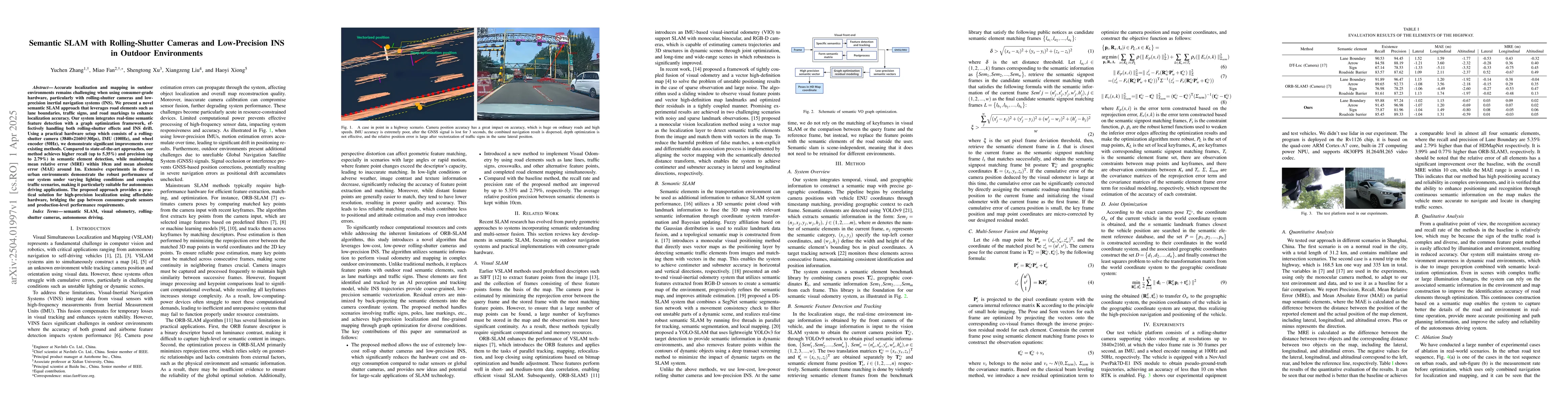
Accurate localization and mapping in outdoor environments remains challenging when using consumer-grade hardware, particularly with rolling-shutter cameras and low-precision inertial navigation system...
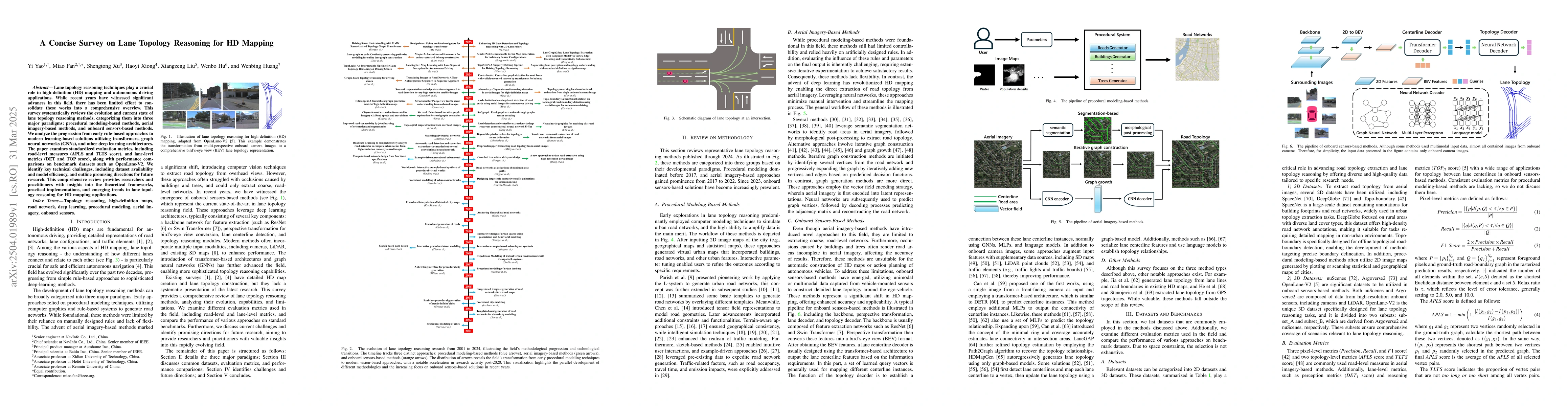
Lane topology reasoning techniques play a crucial role in high-definition (HD) mapping and autonomous driving applications. While recent years have witnessed significant advances in this field, there ...
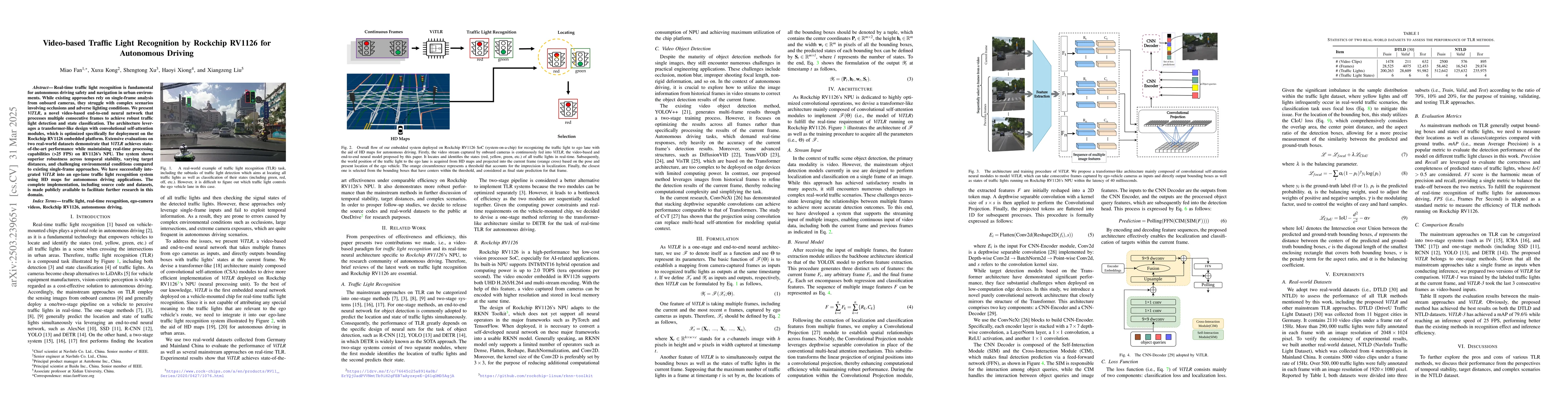
Real-time traffic light recognition is fundamental for autonomous driving safety and navigation in urban environments. While existing approaches rely on single-frame analysis from onboard cameras, the...
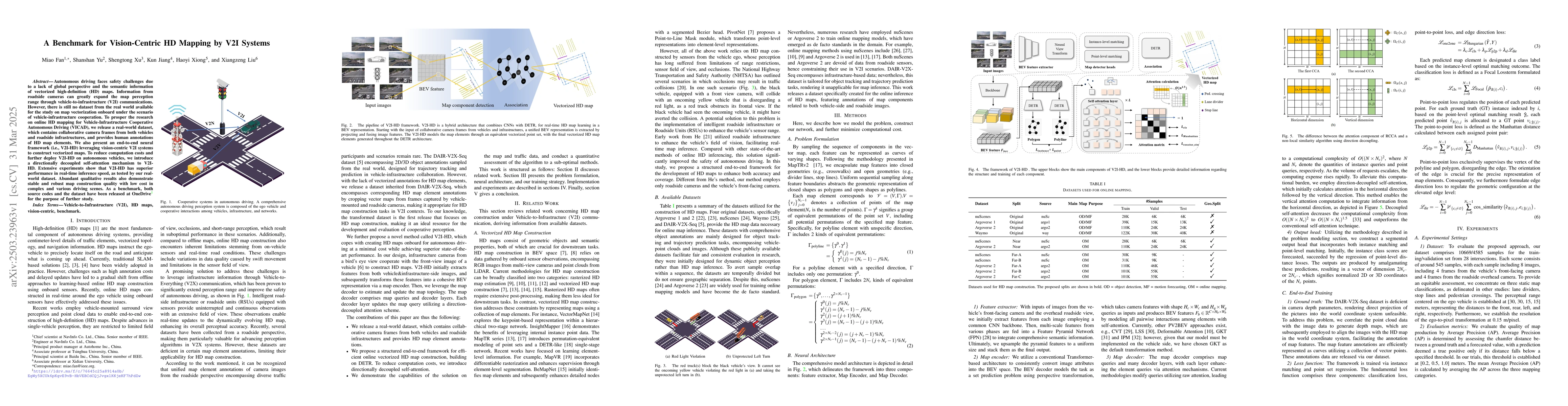
Autonomous driving faces safety challenges due to a lack of global perspective and the semantic information of vectorized high-definition (HD) maps. Information from roadside cameras can greatly expan...
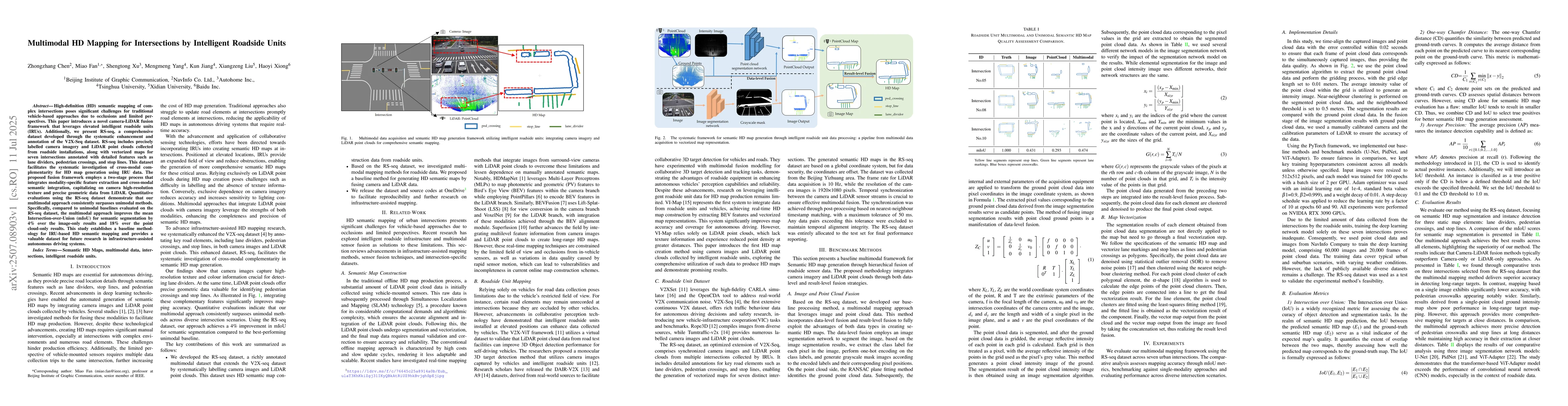
High-definition (HD) semantic mapping of complex intersections poses significant challenges for traditional vehicle-based approaches due to occlusions and limited perspectives. This paper introduces a...
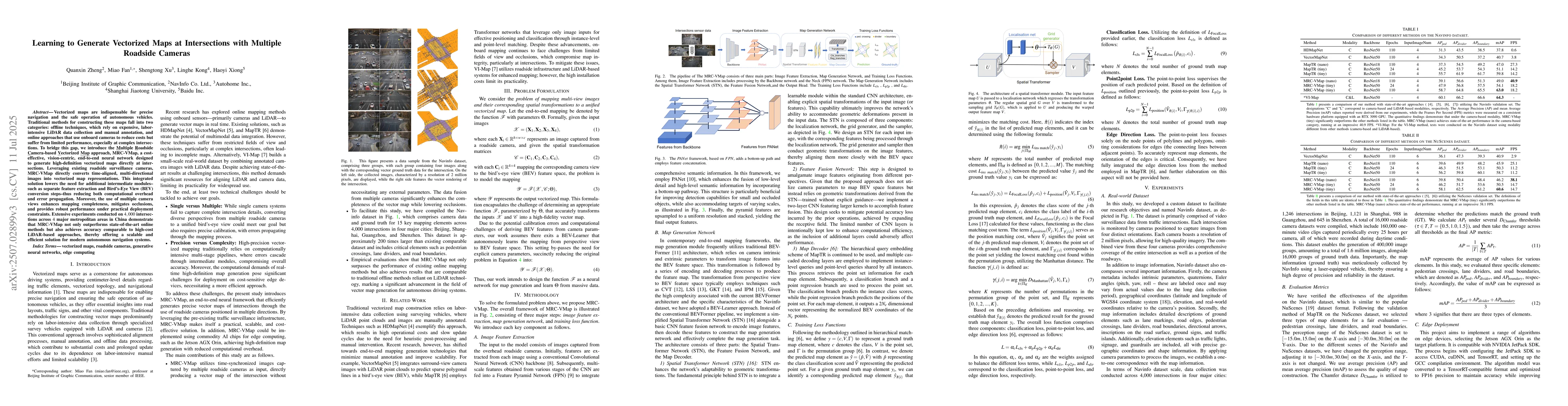
Vectorized maps are indispensable for precise navigation and the safe operation of autonomous vehicles. Traditional methods for constructing these maps fall into two categories: offline techniques, wh...
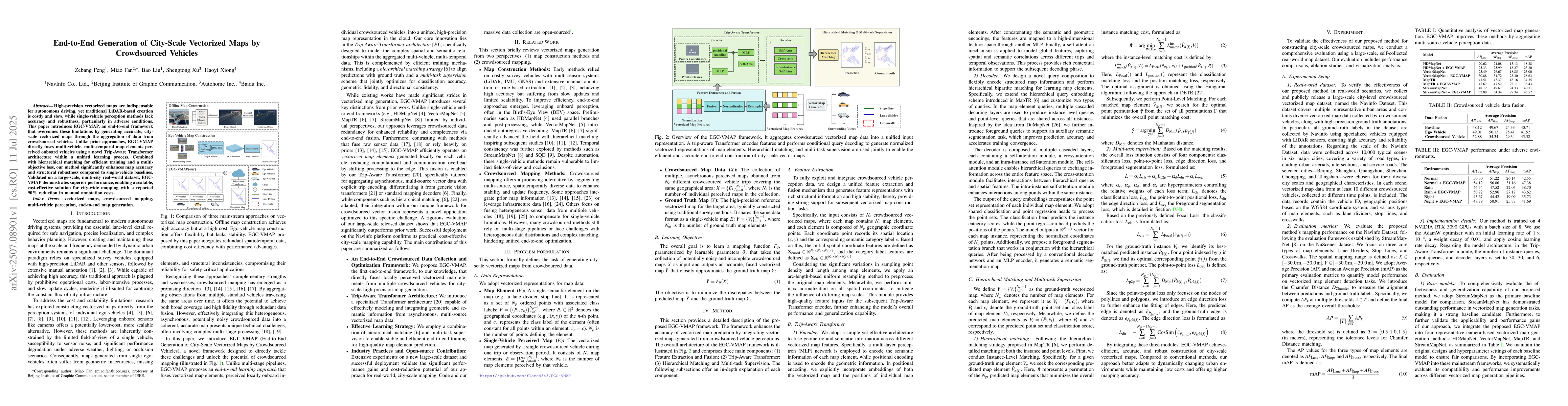
High-precision vectorized maps are indispensable for autonomous driving, yet traditional LiDAR-based creation is costly and slow, while single-vehicle perception methods lack accuracy and robustness, ...
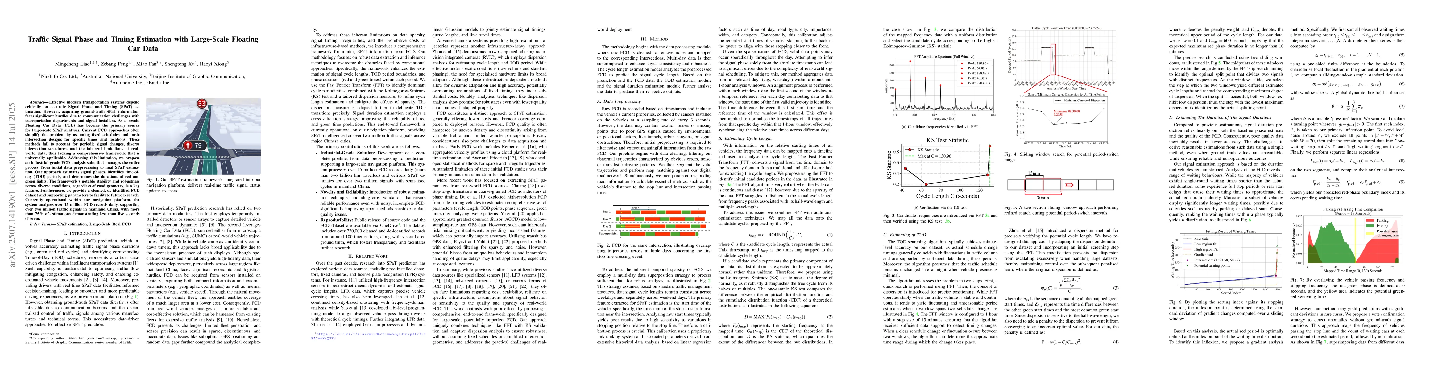
Effective modern transportation systems depend critically on accurate Signal Phase and Timing (SPaT) estimation. However, acquiring ground-truth SPaT information faces significant hurdles due to commu...