Academic Profile
Statistics
Similar Authors
Papers on arXiv
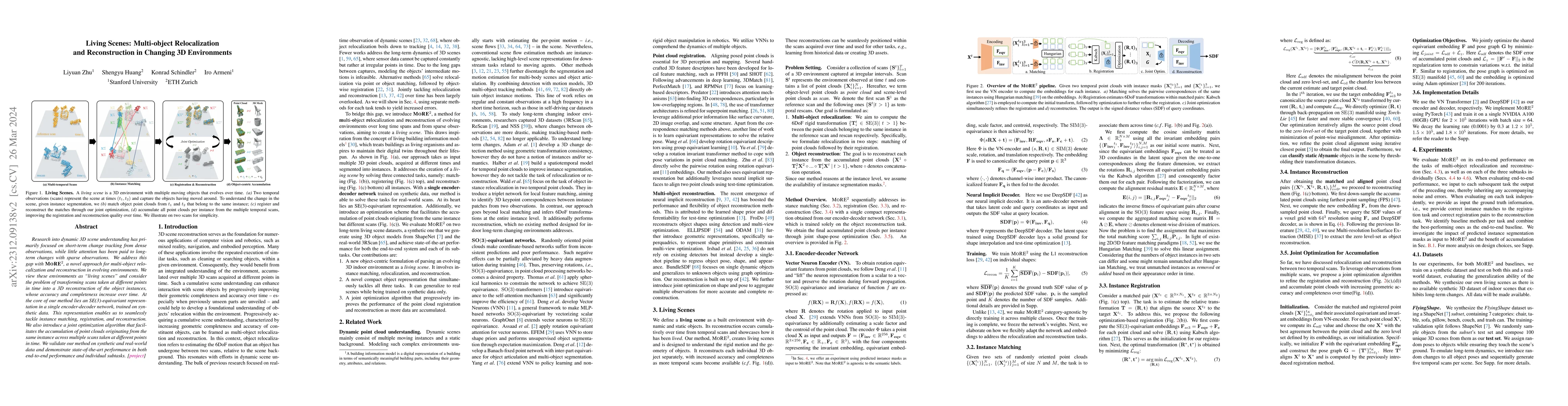
Research into dynamic 3D scene understanding has primarily focused on short-term change tracking from dense observations, while little attention has been paid to long-term changes with sparse observ...
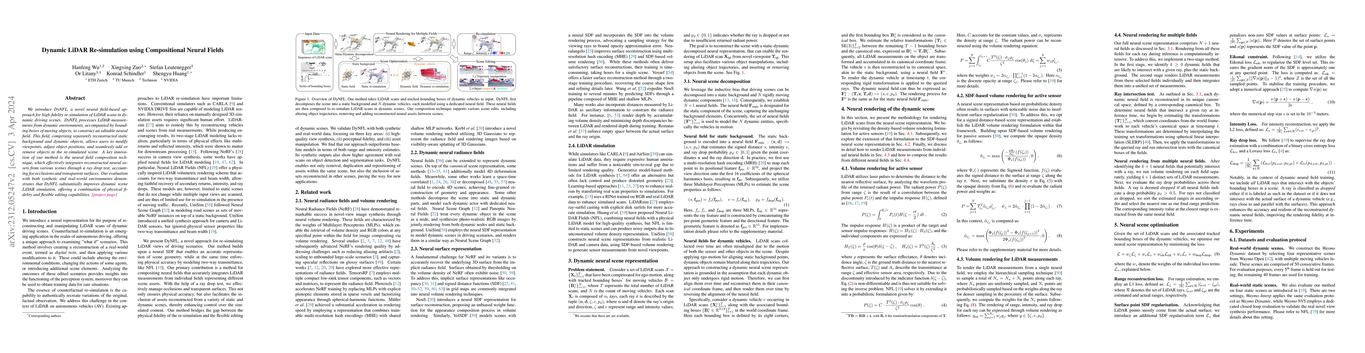
We introduce DyNFL, a novel neural field-based approach for high-fidelity re-simulation of LiDAR scans in dynamic driving scenes. DyNFL processes LiDAR measurements from dynamic environments, accomp...
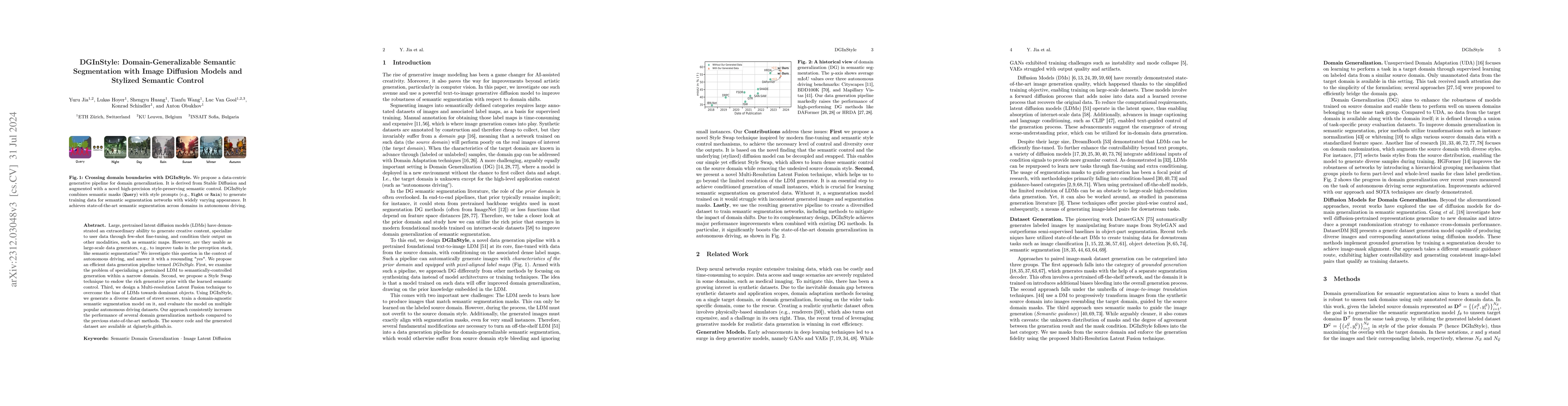
Large, pretrained latent diffusion models (LDMs) have demonstrated an extraordinary ability to generate creative content, specialize to user data through few-shot fine-tuning, and condition their ou...
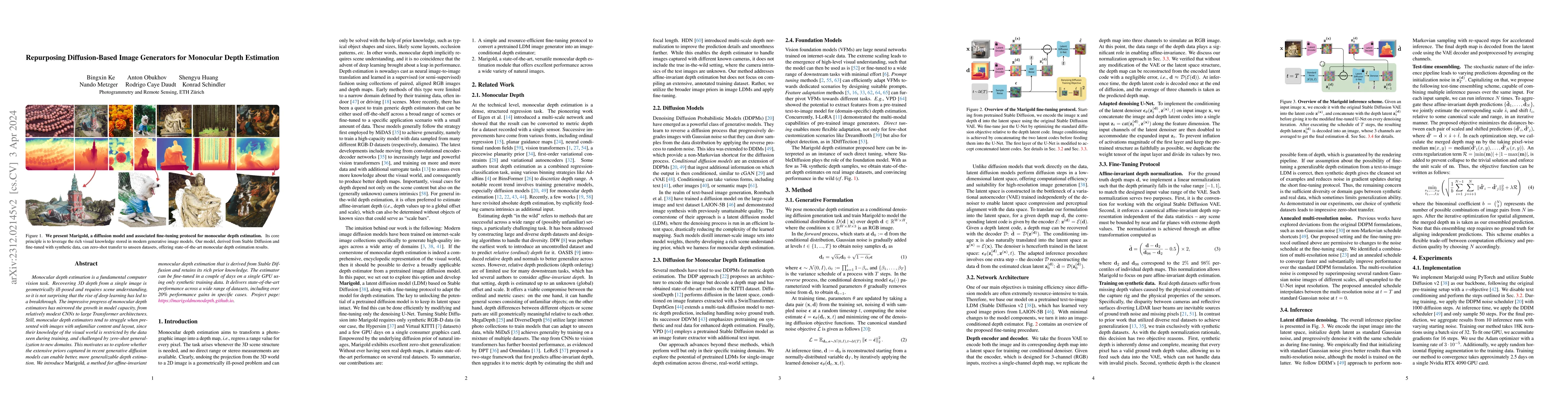
Monocular depth estimation is a fundamental computer vision task. Recovering 3D depth from a single image is geometrically ill-posed and requires scene understanding, so it is not surprising that th...
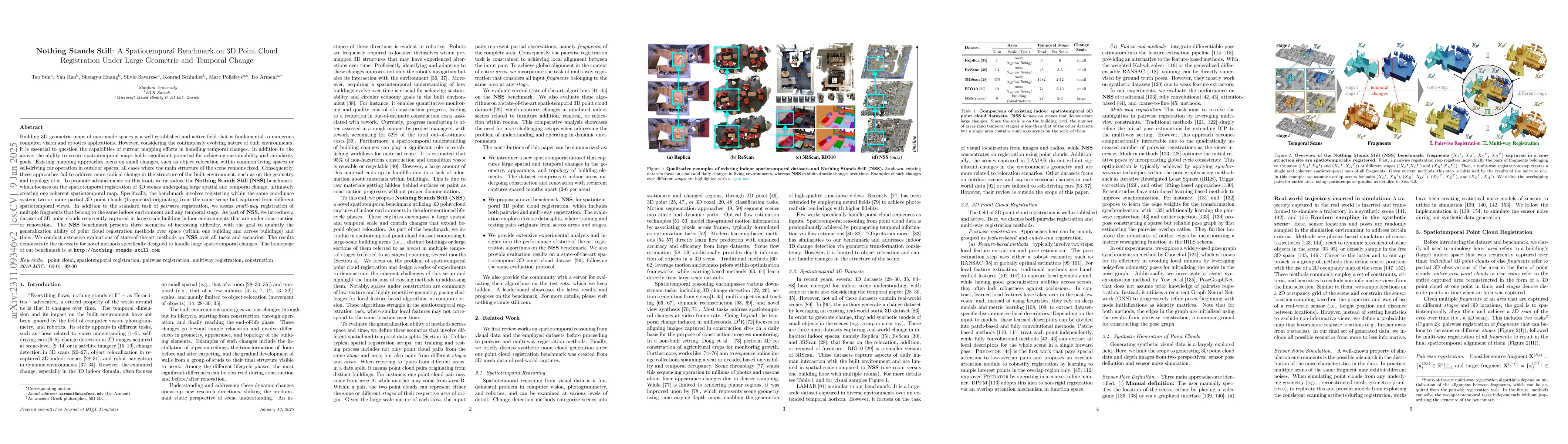
Building 3D geometric maps of man-made spaces is a well-established and active field that is fundamental to computer vision and robotics. However, considering the evolving nature of built environmen...
Dividing ads ranking system into retrieval, early, and final stages is a common practice in large scale ads recommendation to balance the efficiency and accuracy. The early stage ranking often uses ...
We present Neural Fields for LiDAR (NFL), a method to optimise a neural field scene representation from LiDAR measurements, with the goal of synthesizing realistic LiDAR scans from novel viewpoints....
Reconstruction and intrinsic decomposition of scenes from captured imagery would enable many applications such as relighting and virtual object insertion. Recent NeRF based methods achieve impressiv...
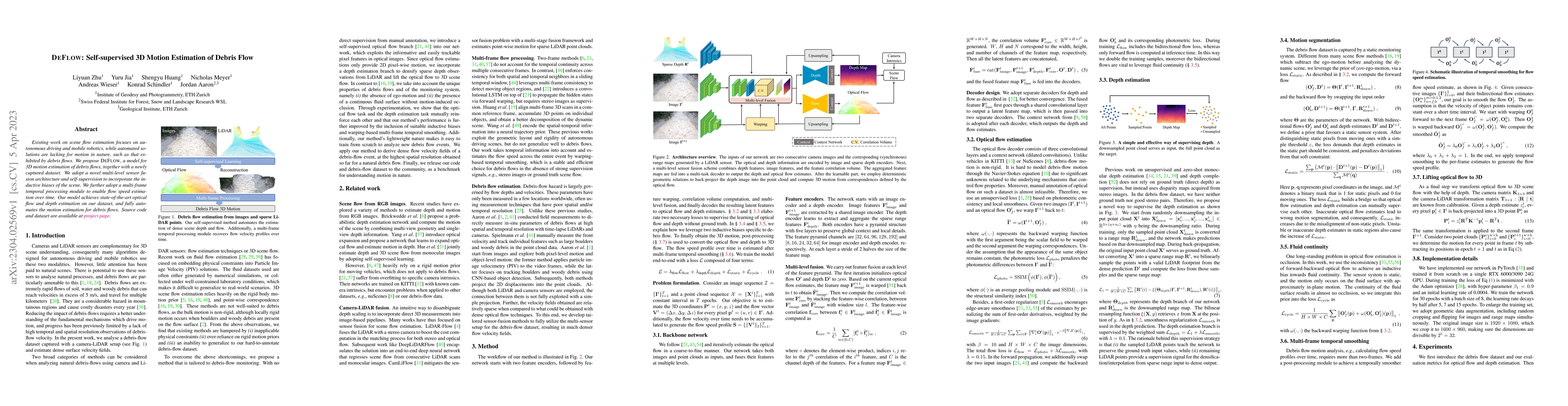
Existing work on scene flow estimation focuses on autonomous driving and mobile robotics, while automated solutions are lacking for motion in nature, such as that exhibited by debris flows. We propo...
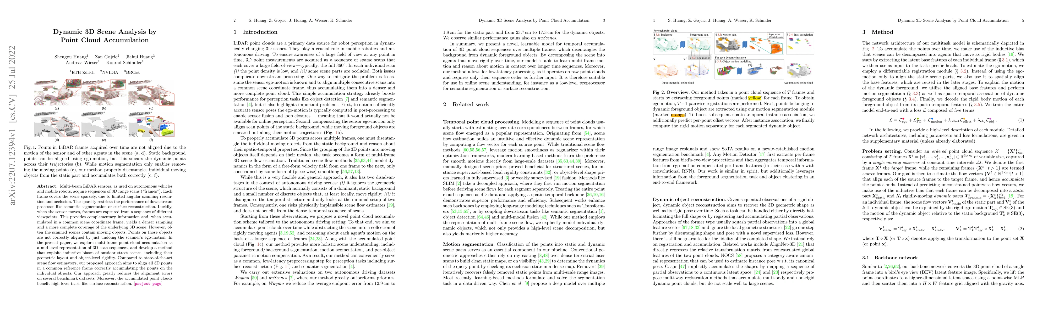
Multi-beam LiDAR sensors, as used on autonomous vehicles and mobile robots, acquire sequences of 3D range scans ("frames"). Each frame covers the scene sparsely, due to limited angular scanning reso...
Given $n$ elements, an integer $k$ and a parameter $\varepsilon$, we study to select an element with rank in $(k-n\varepsilon,k+n\varepsilon]$ using unreliable comparisons where the outcome of each ...
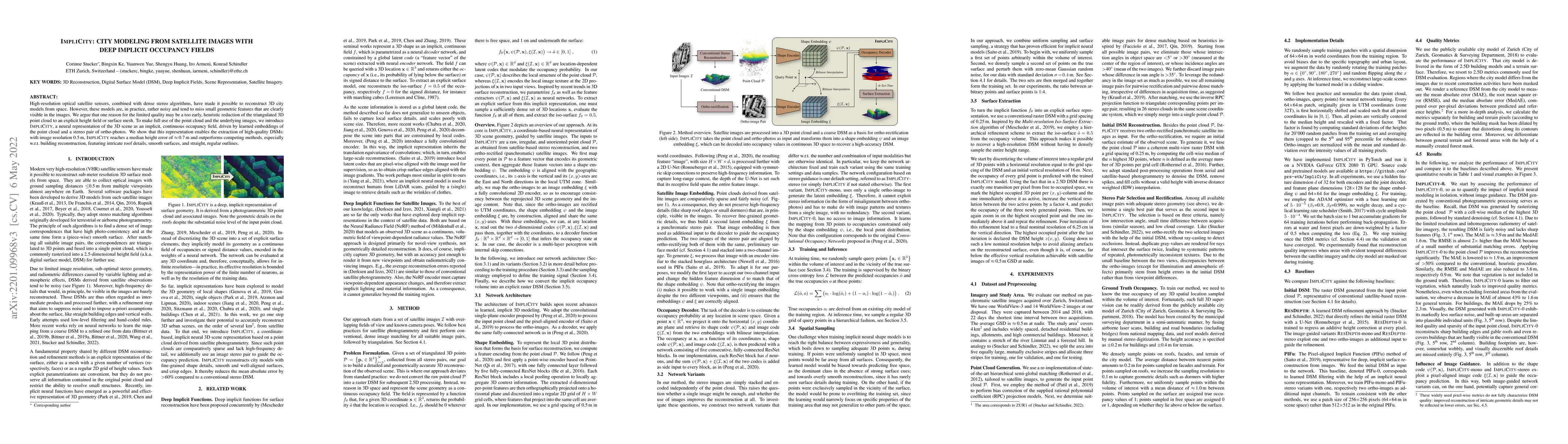
High-resolution optical satellite sensors, combined with dense stereo algorithms, have made it possible to reconstruct 3D city models from space. However, these models are, in practice, rather noisy...
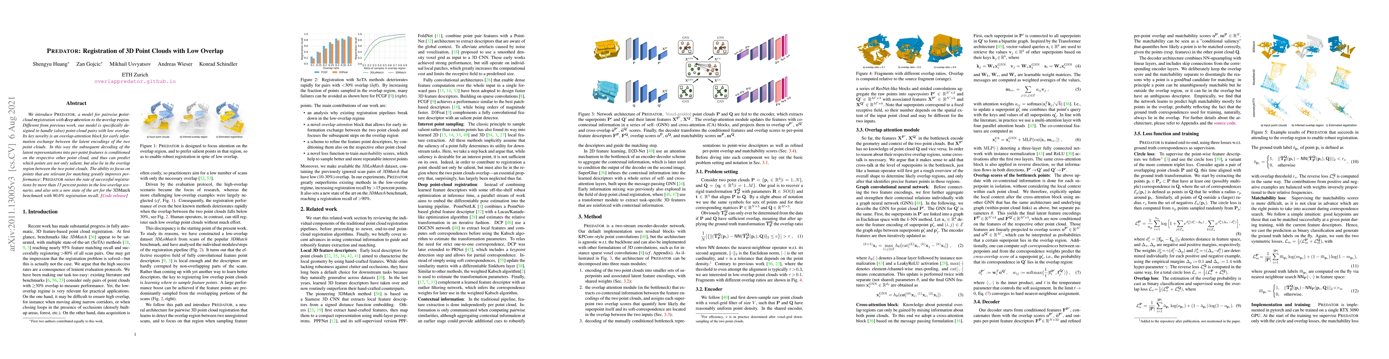
We introduce PREDATOR, a model for pairwise point-cloud registration with deep attention to the overlap region. Different from previous work, our model is specifically designed to handle (also) poin...
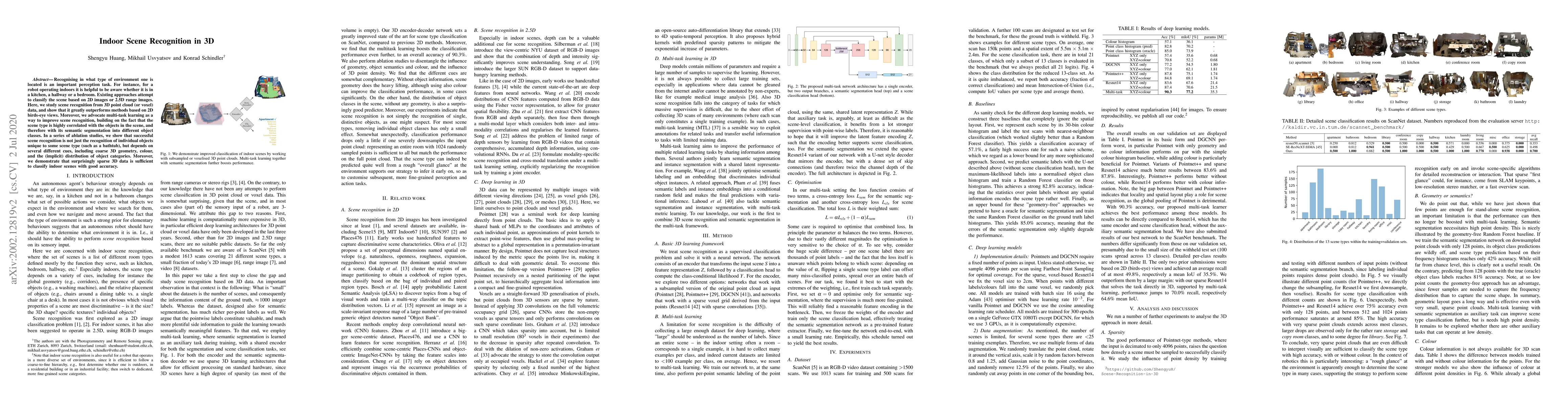
Recognising in what type of environment one is located is an important perception task. For instance, for a robot operating in indoors it is helpful to be aware whether it is in a kitchen, a hallway...
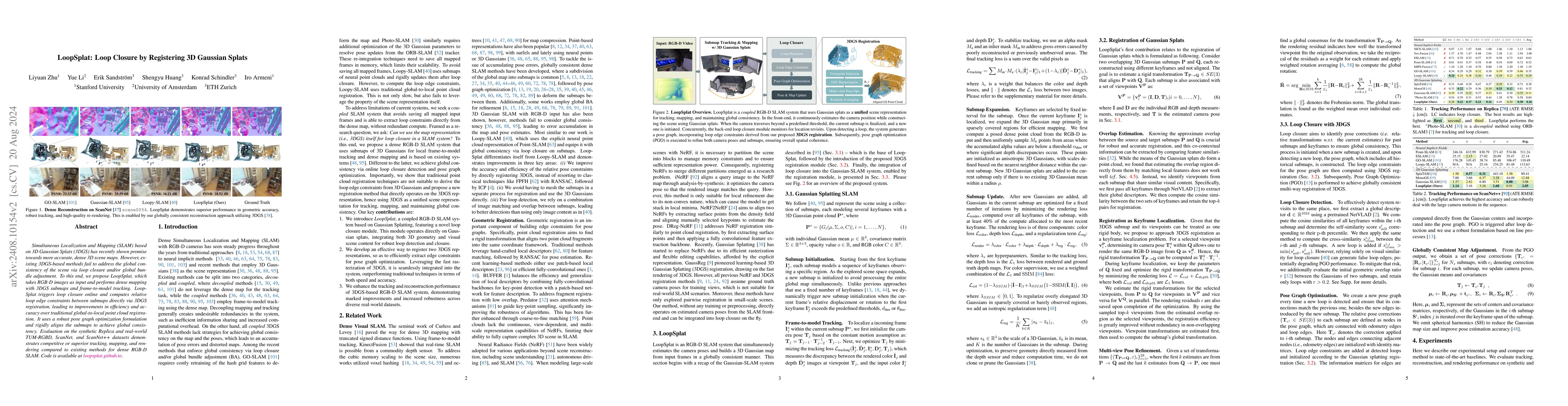
Simultaneous Localization and Mapping (SLAM) based on 3D Gaussian Splats (3DGS) has recently shown promise towards more accurate, dense 3D scene maps. However, existing 3DGS-based methods fail to addr...
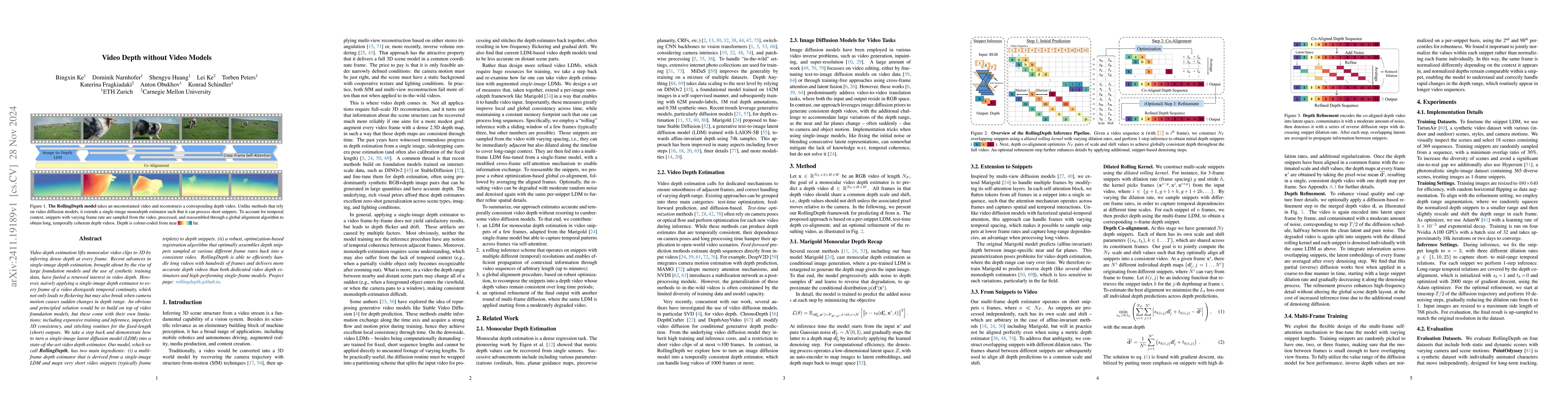
Video depth estimation lifts monocular video clips to 3D by inferring dense depth at every frame. Recent advances in single-image depth estimation, brought about by the rise of large foundation models...
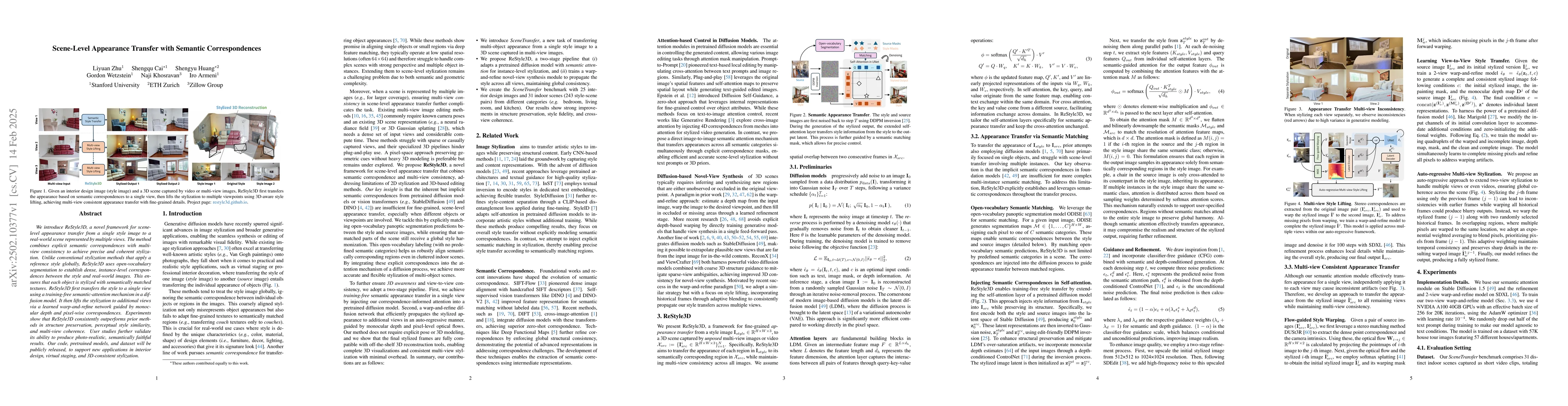
We introduce ReStyle3D, a novel framework for scene-level appearance transfer from a single style image to a real-world scene represented by multiple views. The method combines explicit semantic corre...
We consider fair allocation of $m$ indivisible items to $n$ agents of equal entitlements, with submodular valuation functions. Previously, Seddighin and Seddighin [{\em Artificial Intelligence} 2024] ...
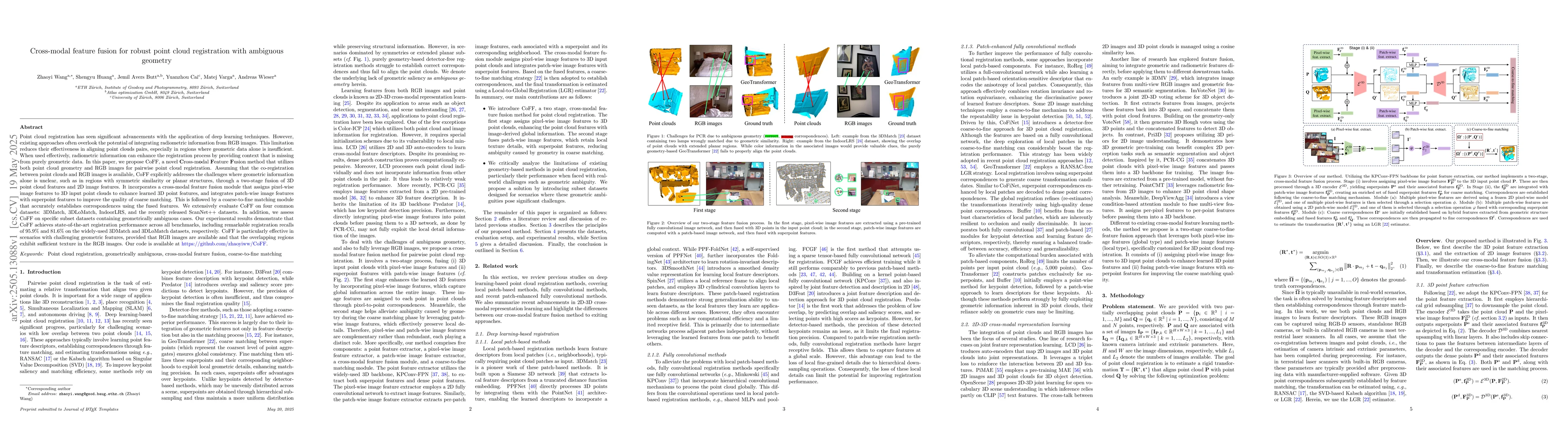
Point cloud registration has seen significant advancements with the application of deep learning techniques. However, existing approaches often overlook the potential of integrating radiometric inform...
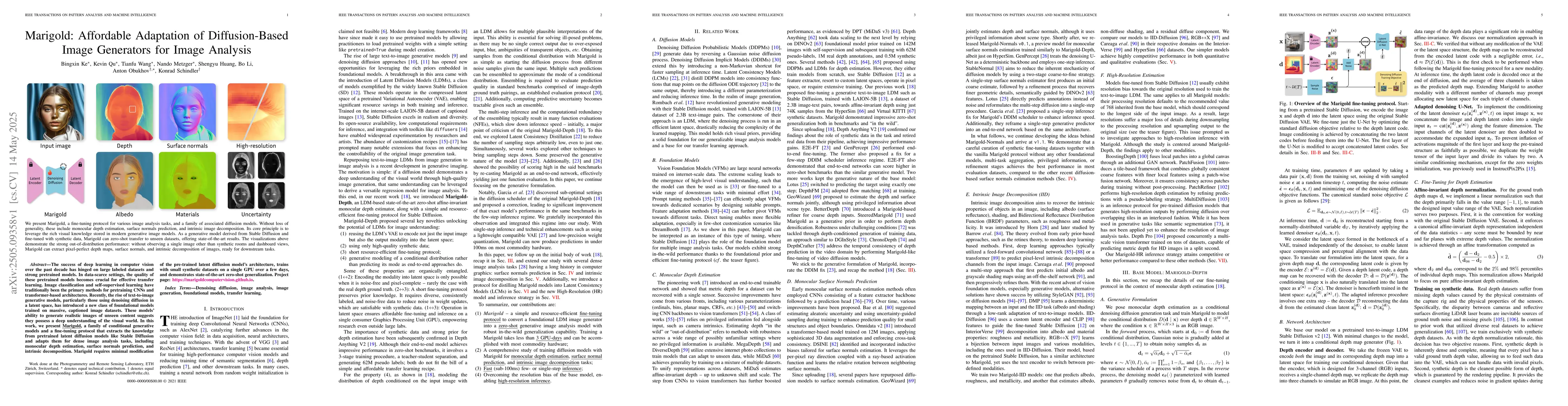
The success of deep learning in computer vision over the past decade has hinged on large labeled datasets and strong pretrained models. In data-scarce settings, the quality of these pretrained models ...
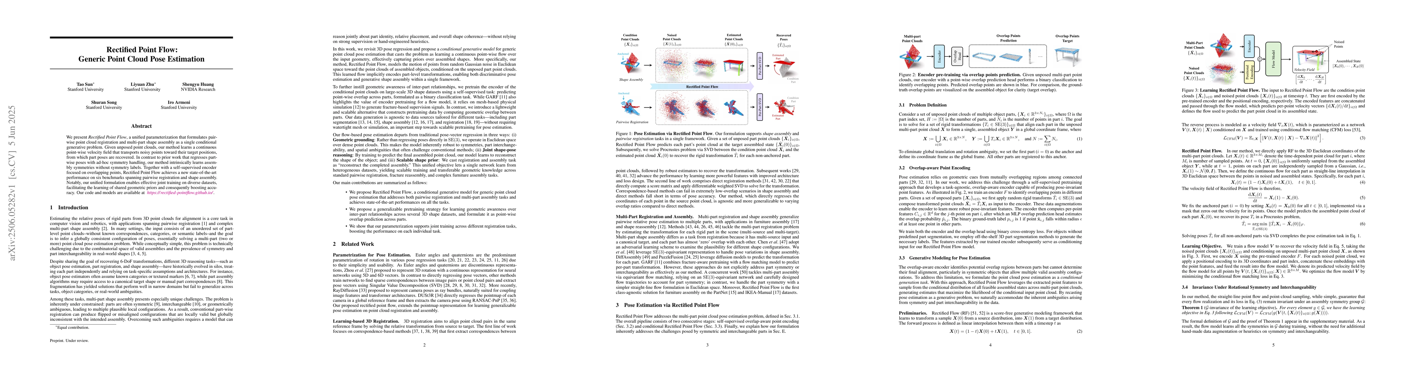
We introduce Rectified Point Flow, a unified parameterization that formulates pairwise point cloud registration and multi-part shape assembly as a single conditional generative problem. Given unposed ...
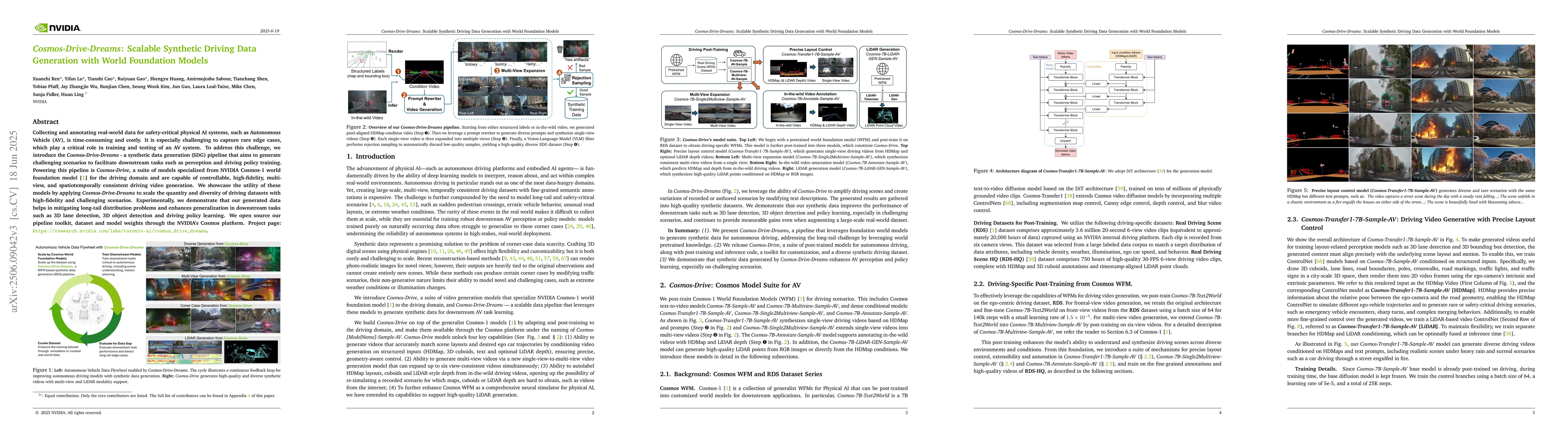
Collecting and annotating real-world data for safety-critical physical AI systems, such as Autonomous Vehicle (AV), is time-consuming and costly. It is especially challenging to capture rare edge case...
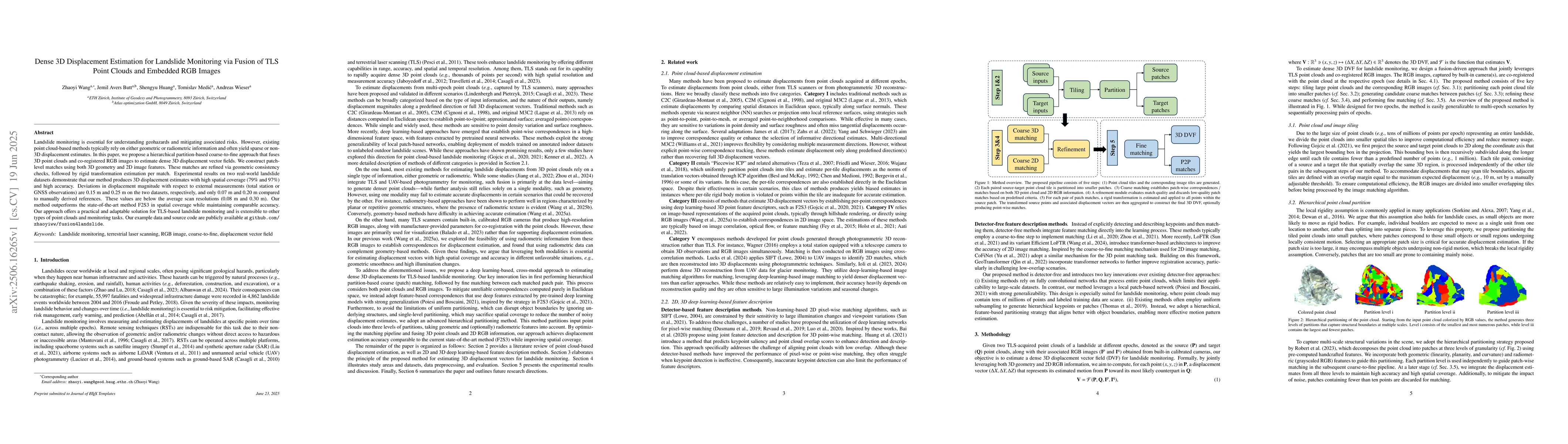
Landslide monitoring is essential for understanding geohazards and mitigating associated risks. However, existing point cloud-based methods typically rely on either geometric or radiometric informatio...
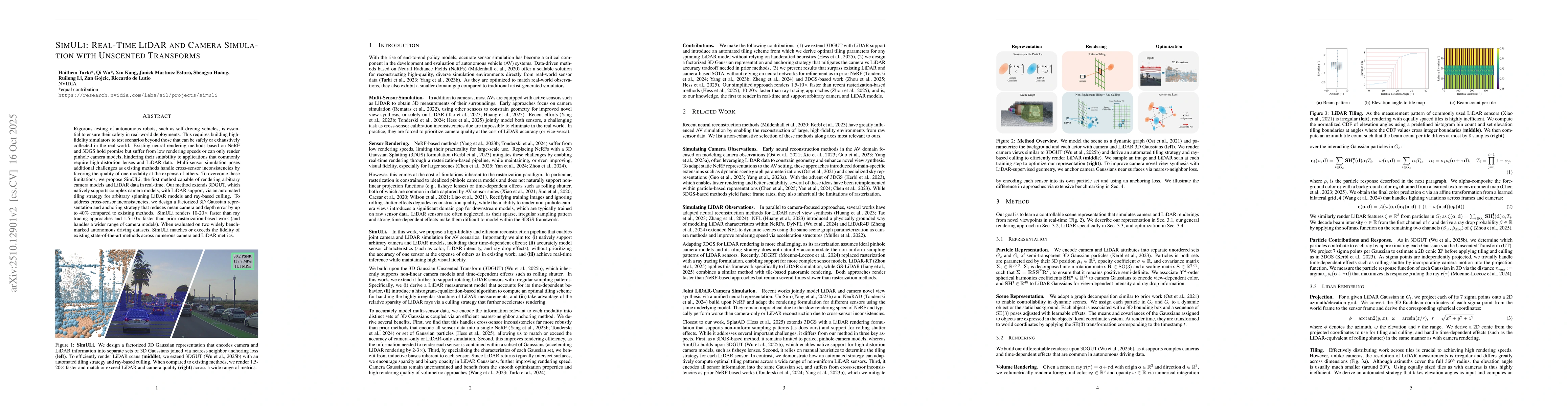
Rigorous testing of autonomous robots, such as self-driving vehicles, is essential to ensure their safety in real-world deployments. This requires building high-fidelity simulators to test scenarios b...
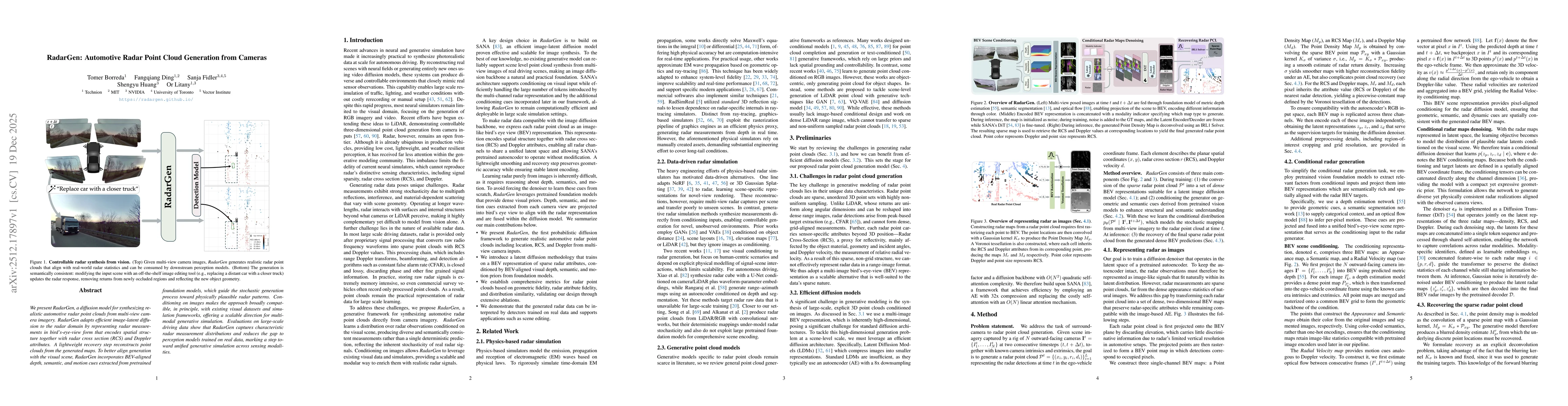
We present RadarGen, a diffusion model for synthesizing realistic automotive radar point clouds from multi-view camera imagery. RadarGen adapts efficient image-latent diffusion to the radar domain by ...
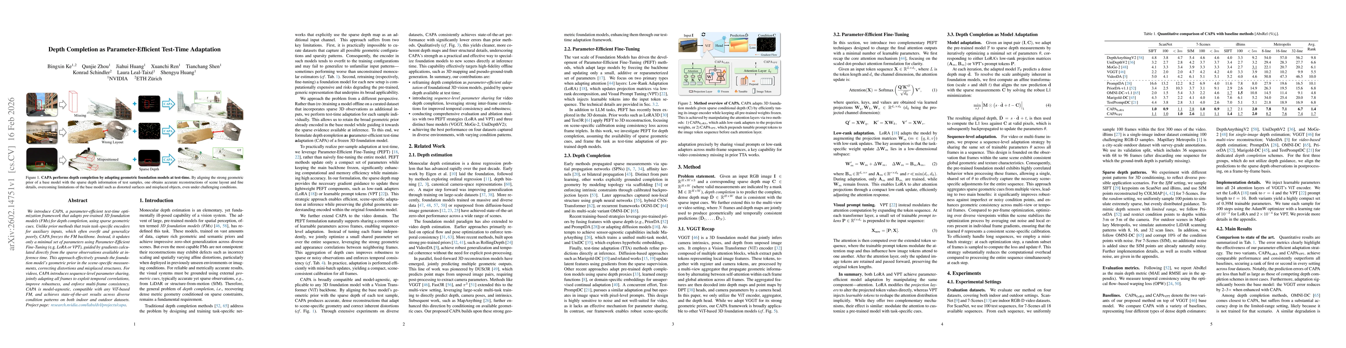
We introduce CAPA, a parameter-efficient test-time optimization framework that adapts pre-trained 3D foundation models (FMs) for depth completion, using sparse geometric cues. Unlike prior methods tha...
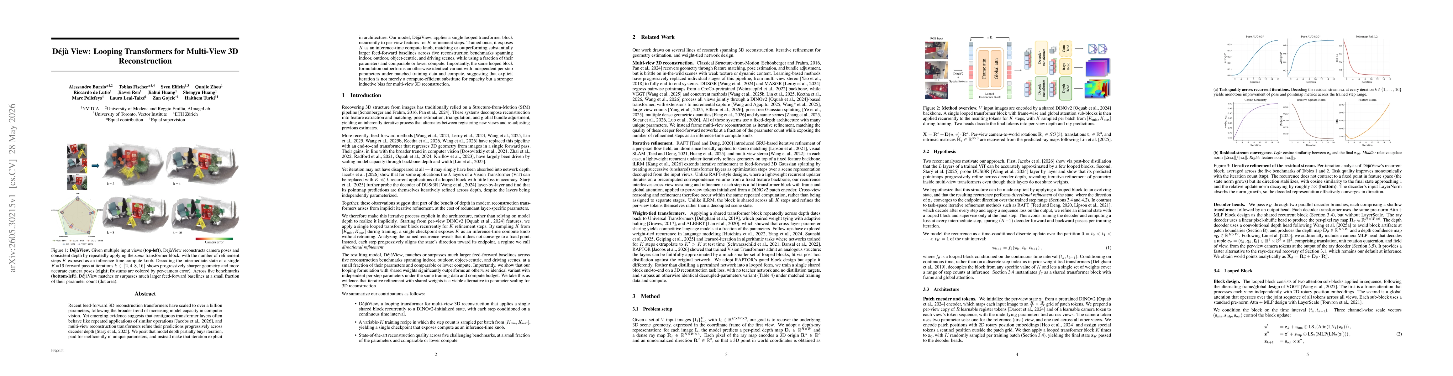
Recent feed-forward 3D reconstruction transformers have scaled to over a billion parameters, following the broader trend of increasing model capacity in computer vision. Yet emerging evidence suggests...