Academic Profile
Statistics
Similar Authors
Papers on arXiv
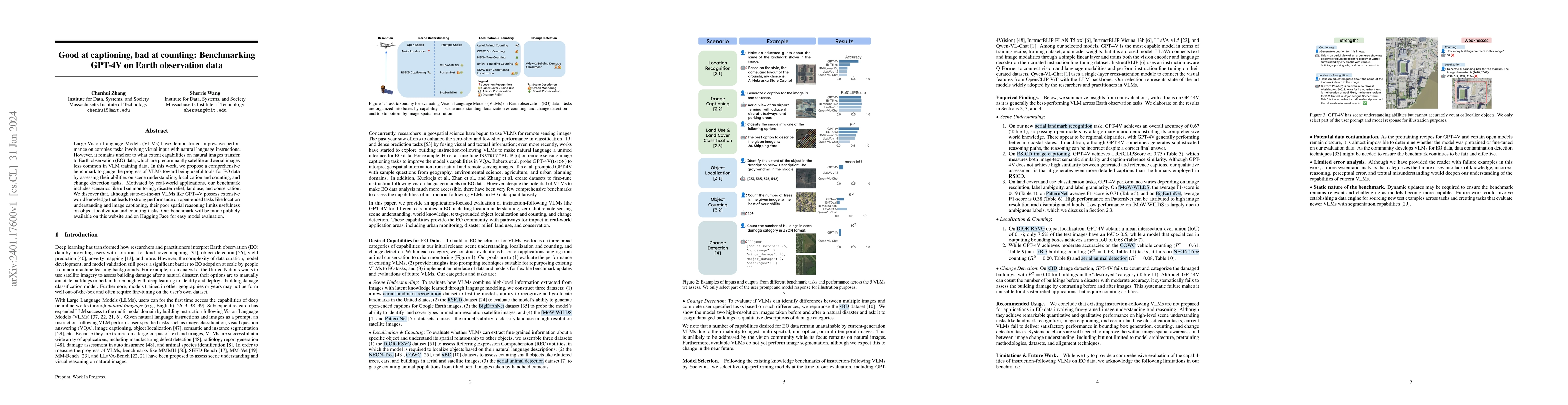
Large Vision-Language Models (VLMs) have demonstrated impressive performance on complex tasks involving visual input with natural language instructions. However, it remains unclear to what extent ca...
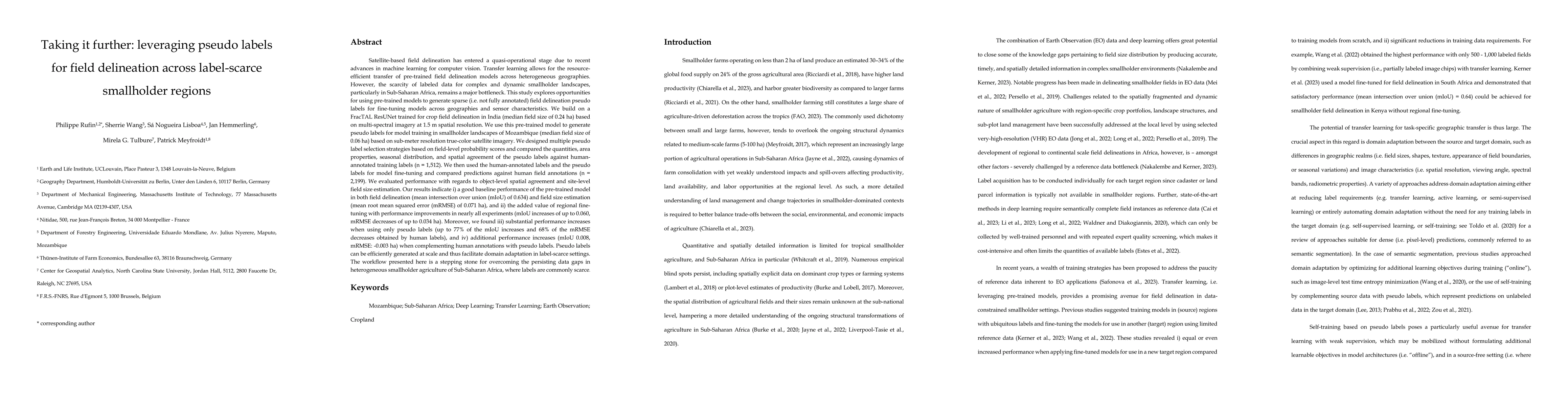
Transfer learning allows for resource-efficient geographic transfer of pre-trained field delineation models. However, the scarcity of labeled data for complex and dynamic smallholder landscapes, par...
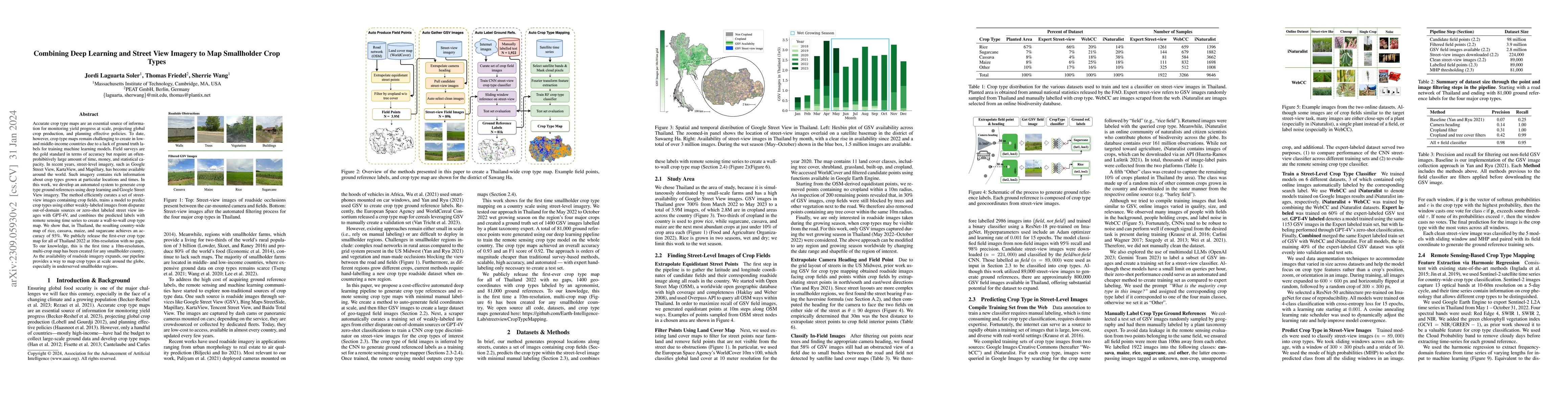
Accurate crop type maps are an essential source of information for monitoring yield progress at scale, projecting global crop production, and planning effective policies. To date, however, crop type...
Crop type maps are critical for tracking agricultural land use and estimating crop production. Remote sensing has proven an efficient and reliable tool for creating these maps in regions with abunda...
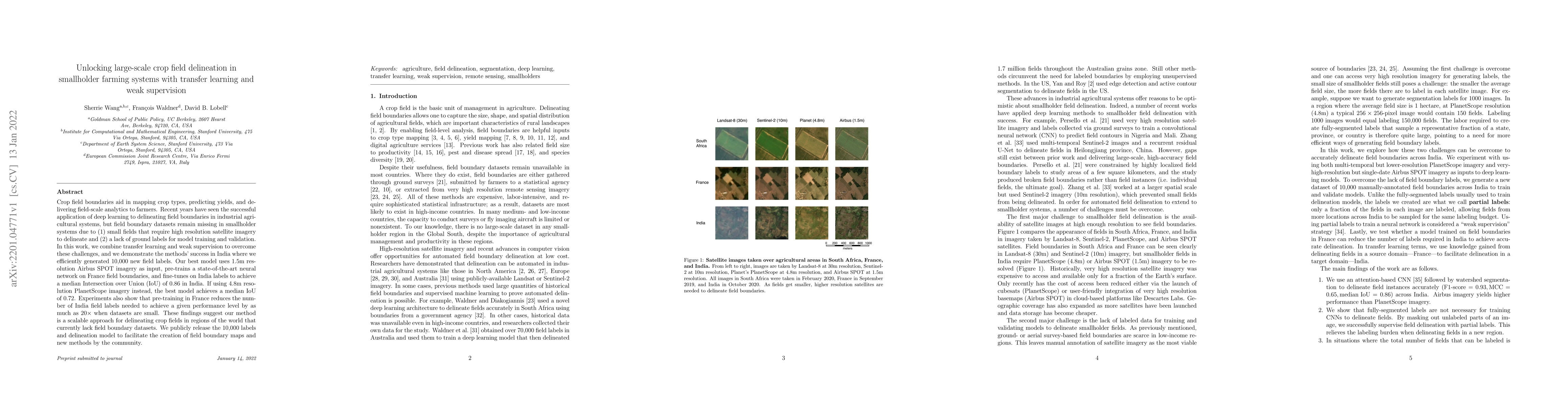
Crop field boundaries aid in mapping crop types, predicting yields, and delivering field-scale analytics to farmers. Recent years have seen the successful application of deep learning to delineating...
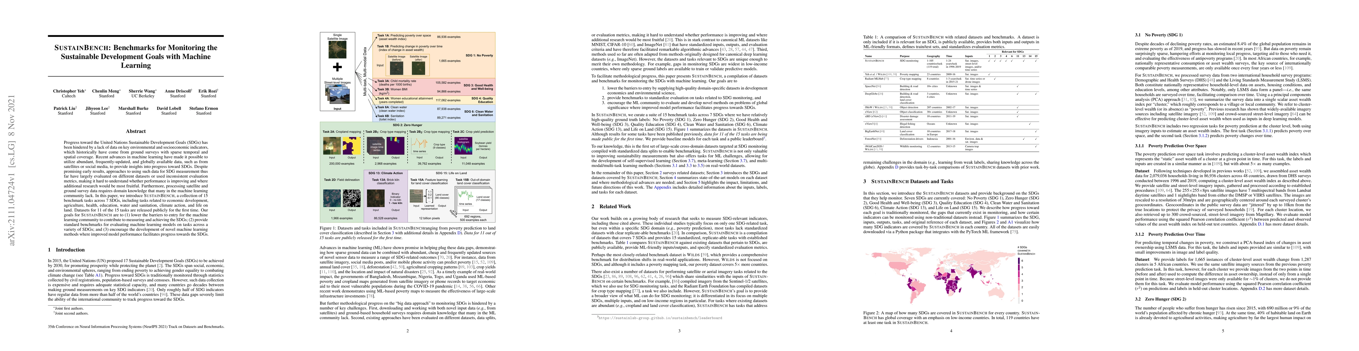
Progress toward the United Nations Sustainable Development Goals (SDGs) has been hindered by a lack of data on key environmental and socioeconomic indicators, which historically have come from groun...
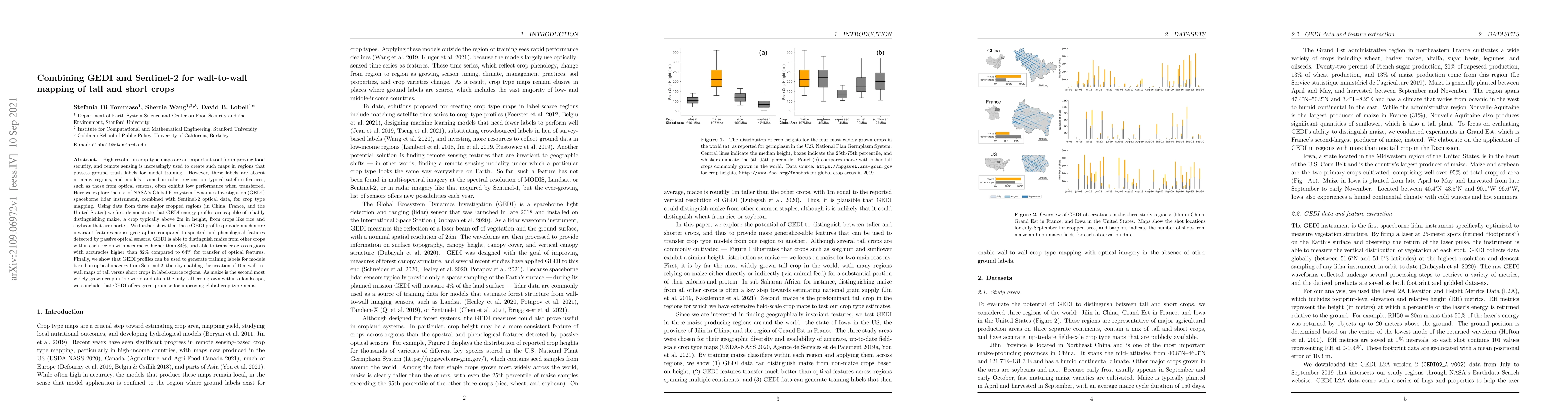
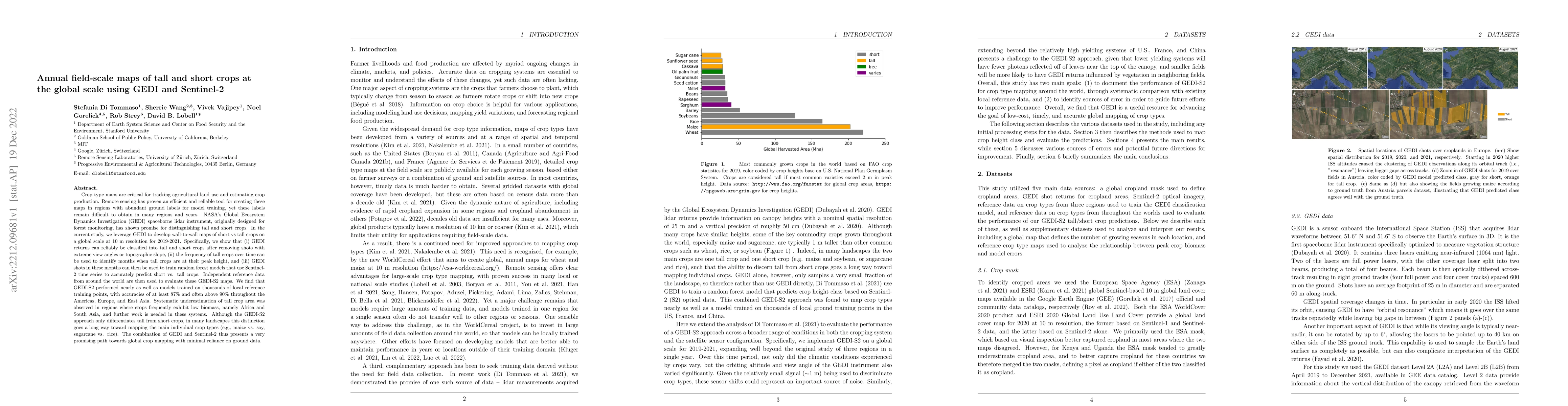
High resolution crop type maps are an important tool for improving food security, and remote sensing is increasingly used to create such maps in regions that possess ground truth labels for model tr...
Crop type mapping at the field level is critical for a variety of applications in agricultural monitoring, and satellite imagery is becoming an increasingly abundant and useful raw input from which ...
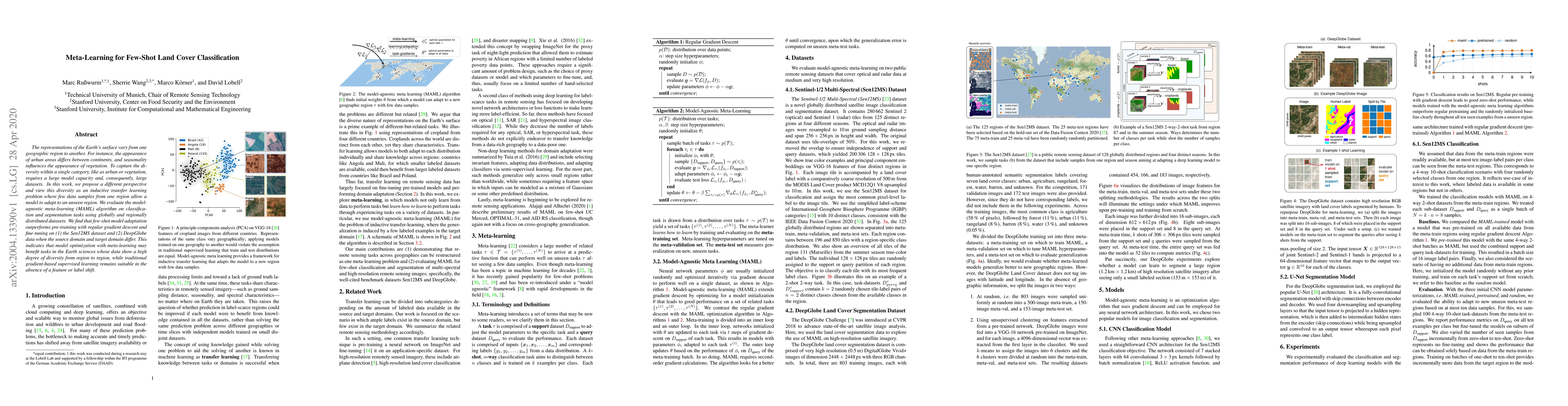
The representations of the Earth's surface vary from one geographic region to another. For instance, the appearance of urban areas differs between continents, and seasonality influences the appearan...
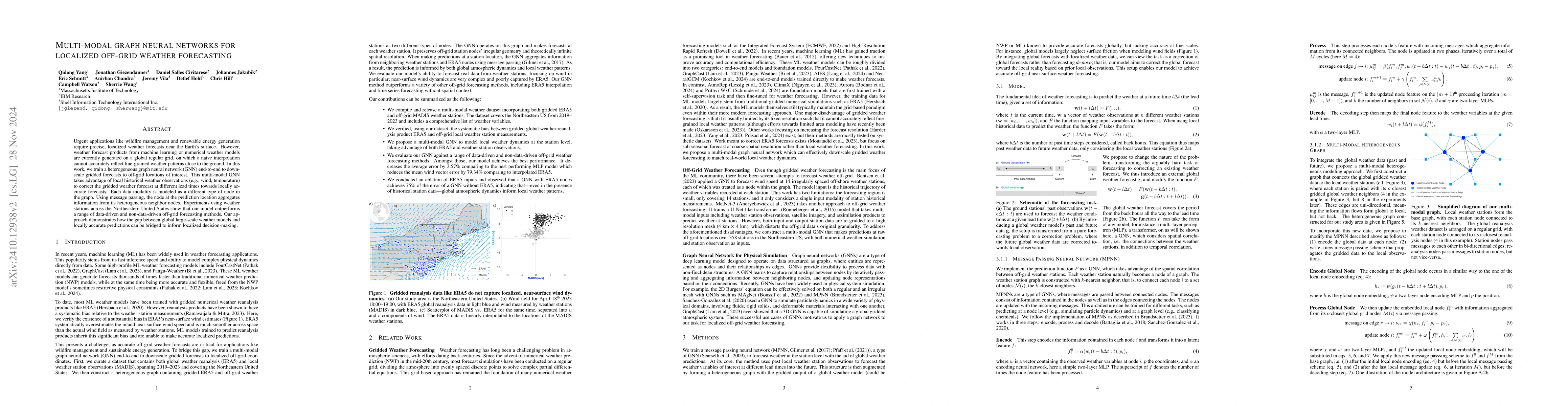
Urgent applications like wildfire management and renewable energy generation require precise, localized weather forecasts near the Earth's surface. However, weather forecast products from machine lear...
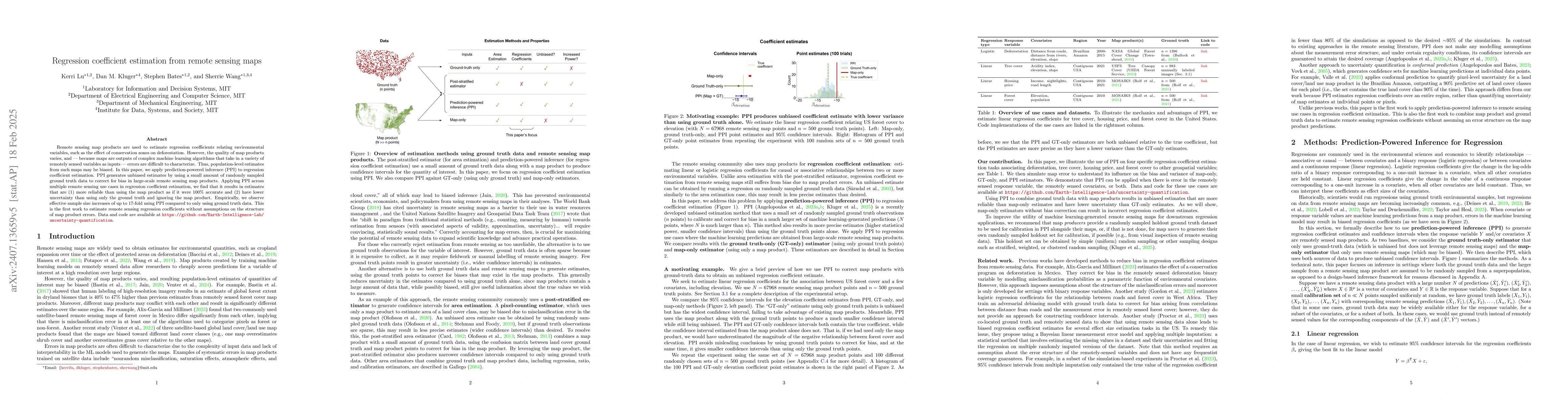
Remote sensing map products are used to obtain estimates of environmental quantities, such as deforested area or the effect of conservation zones on deforestation. However, the quality of map products...
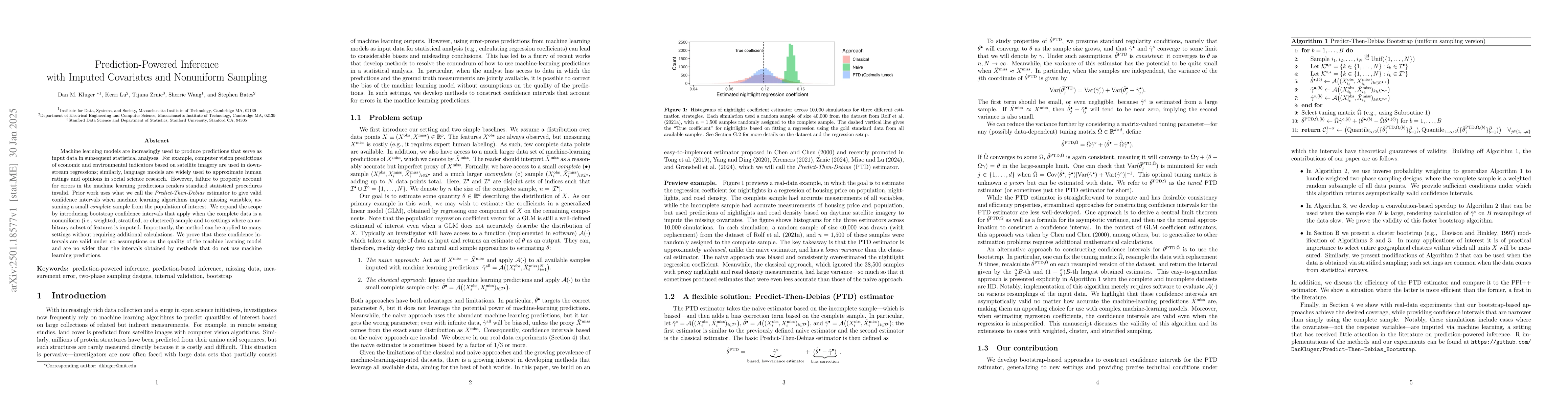
Machine learning models are increasingly used to produce predictions that serve as input data in subsequent statistical analyses. For example, computer vision predictions of economic and environmental...
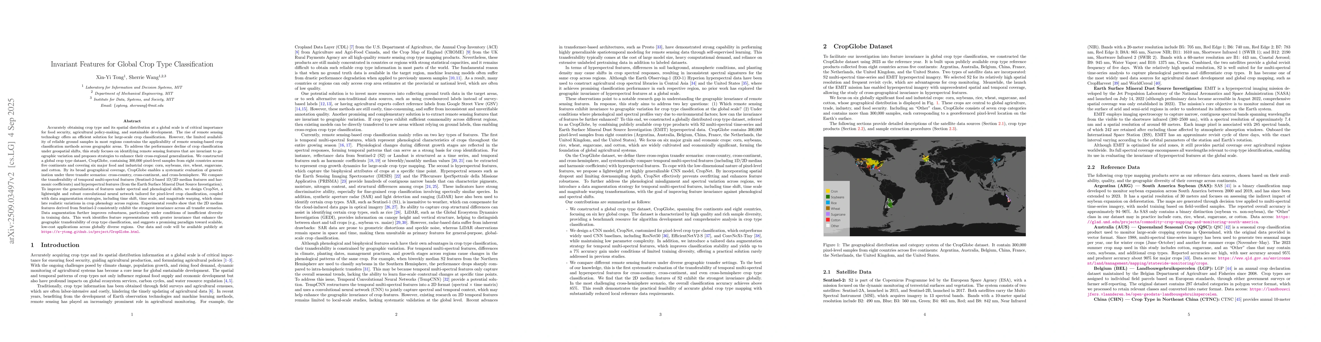
Accurately obtaining crop type and its spatial distribution at a global scale is critical for food security, agricultural policy-making, and sustainable development. Remote sensing offers an efficient...
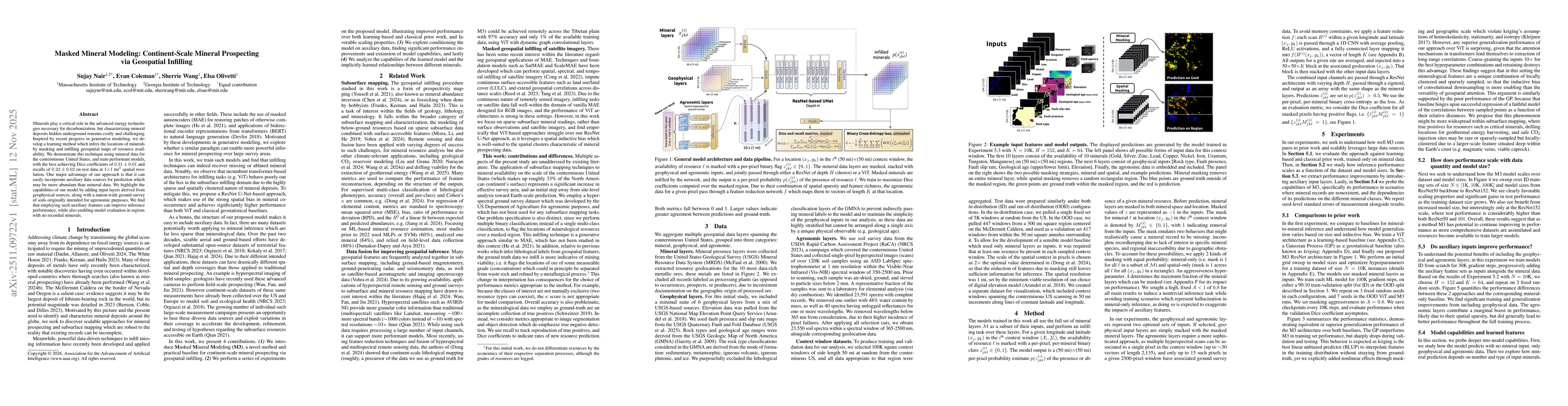
Minerals play a critical role in the advanced energy technologies necessary for decarbonization, but characterizing mineral deposits hidden underground remains costly and challenging. Inspired by rece...
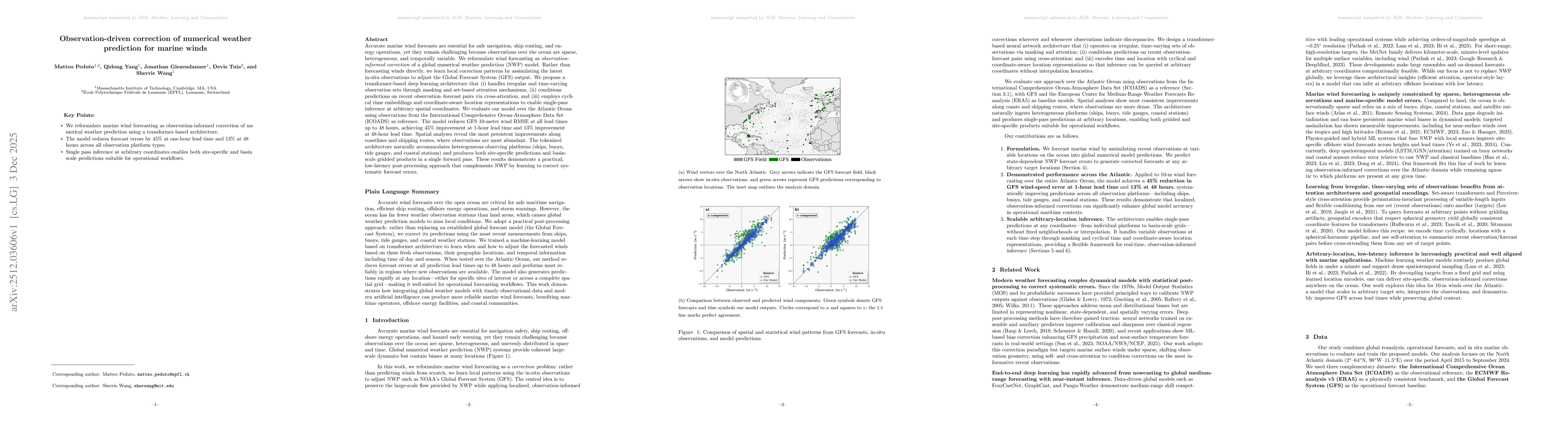
Accurate marine wind forecasts are essential for safe navigation, ship routing, and energy operations, yet they remain challenging because observations over the ocean are sparse, heterogeneous, and te...
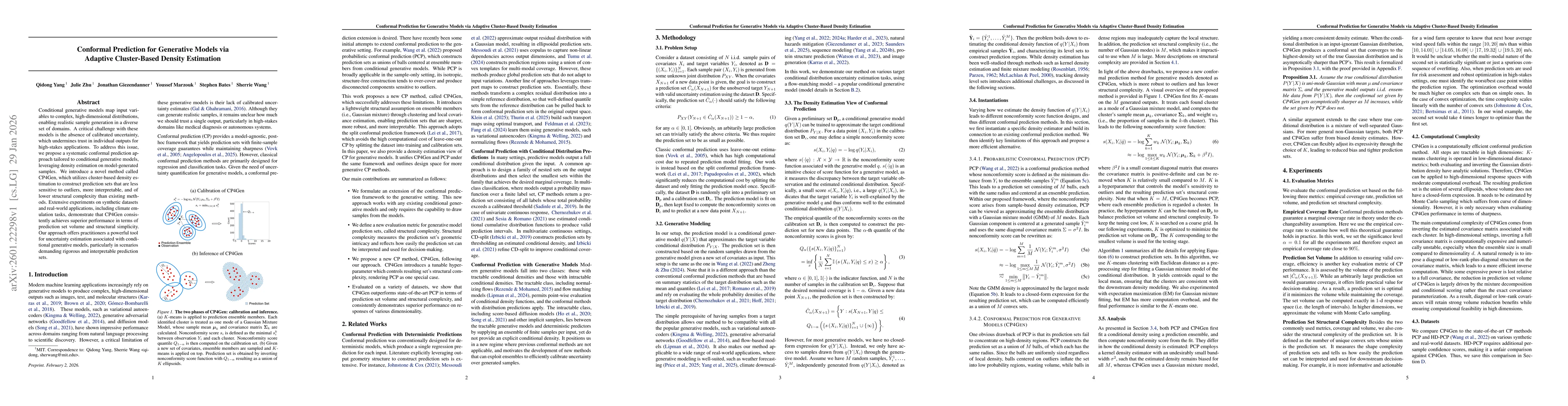
Conditional generative models map input variables to complex, high-dimensional distributions, enabling realistic sample generation in a diverse set of domains. A critical challenge with these models i...
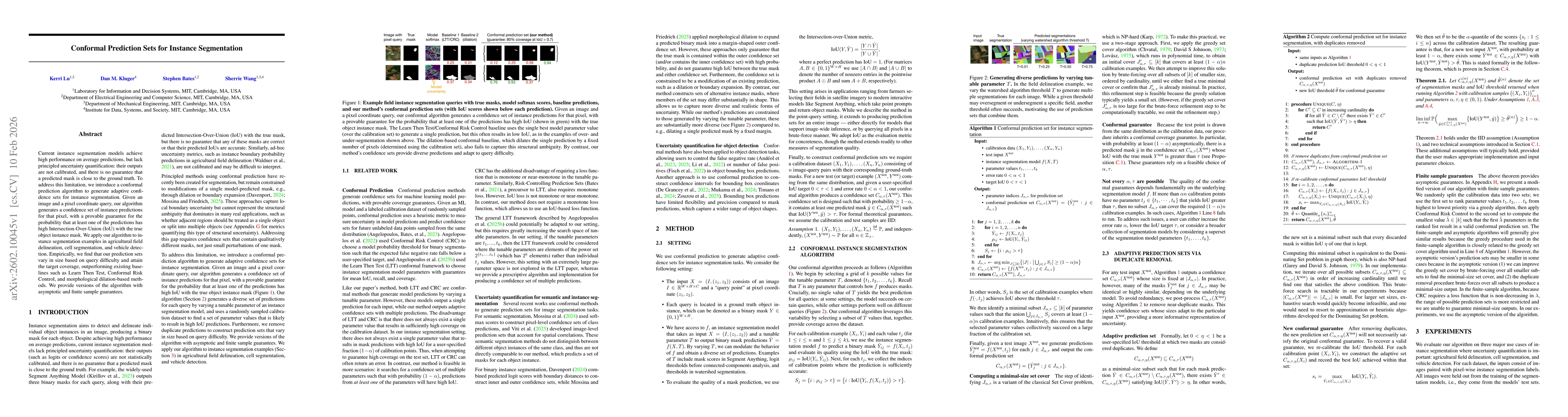
Current instance segmentation models achieve high performance on average predictions, but lack principled uncertainty quantification: their outputs are not calibrated, and there is no guarantee that a...
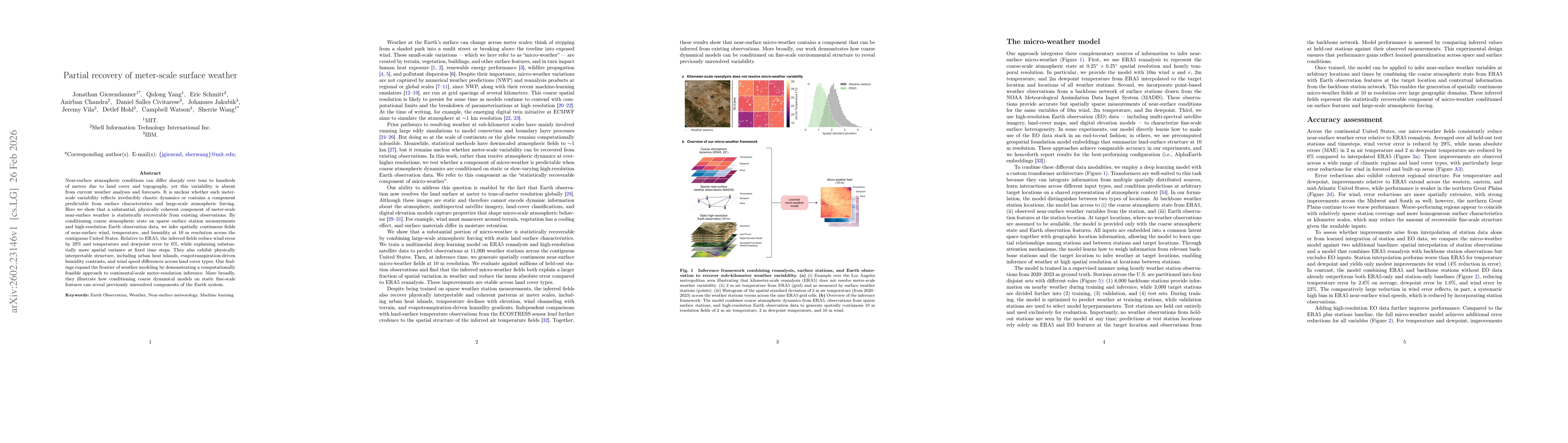
Near-surface atmospheric conditions can differ sharply over tens to hundreds of meters due to land cover and topography, yet this variability is absent from current weather analyses and forecasts. It ...