Academic Profile
Statistics
Similar Authors
Papers on arXiv
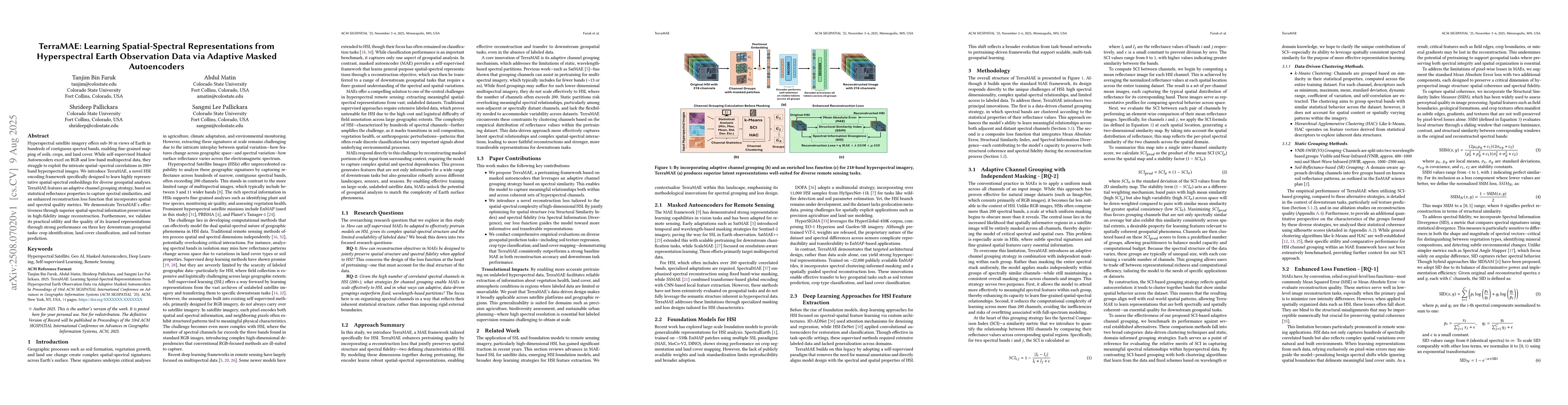
Hyperspectral satellite imagery offers sub-30 m views of Earth in hundreds of contiguous spectral bands, enabling fine-grained mapping of soils, crops, and land cover. While self-supervised Masked Aut...
The proliferation of foundation models, pretrained on large-scale unlabeled datasets, has emerged as an effective approach in creating adaptable and reusable architectures that can be leveraged for va...
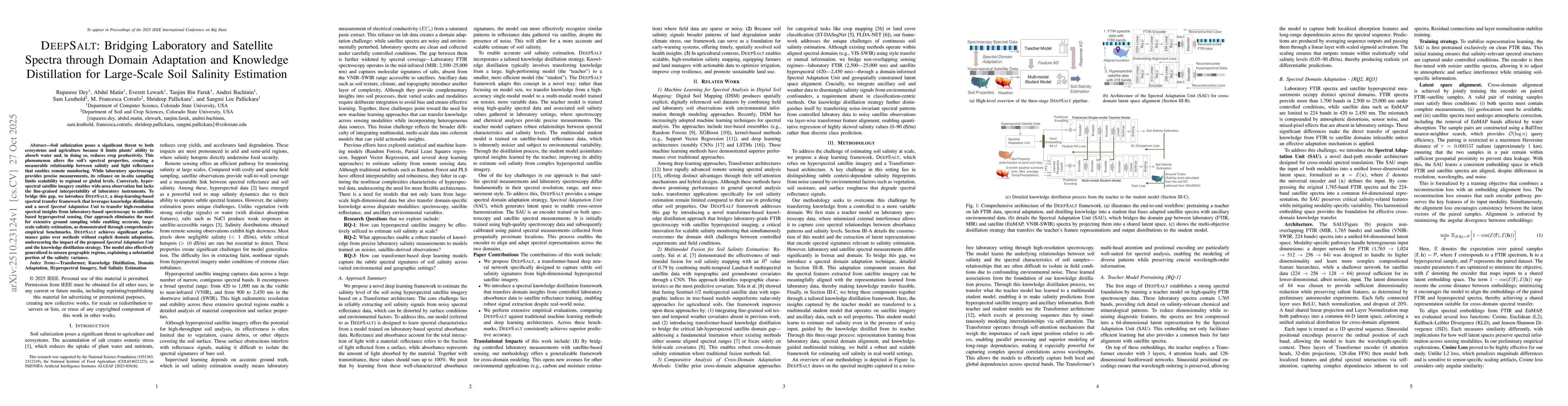
Soil salinization poses a significant threat to both ecosystems and agriculture because it limits plants' ability to absorb water and, in doing so, reduces crop productivity. This phenomenon alters th...
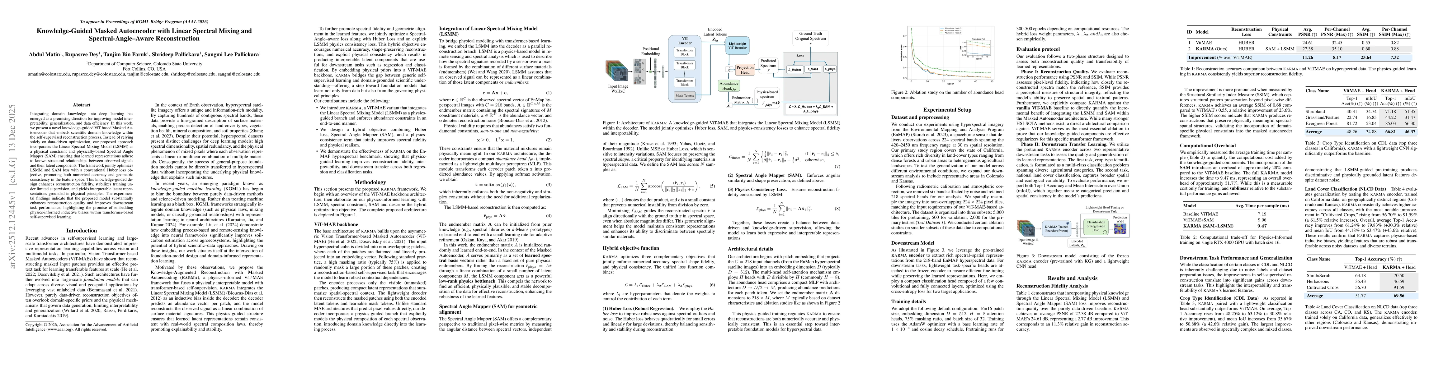
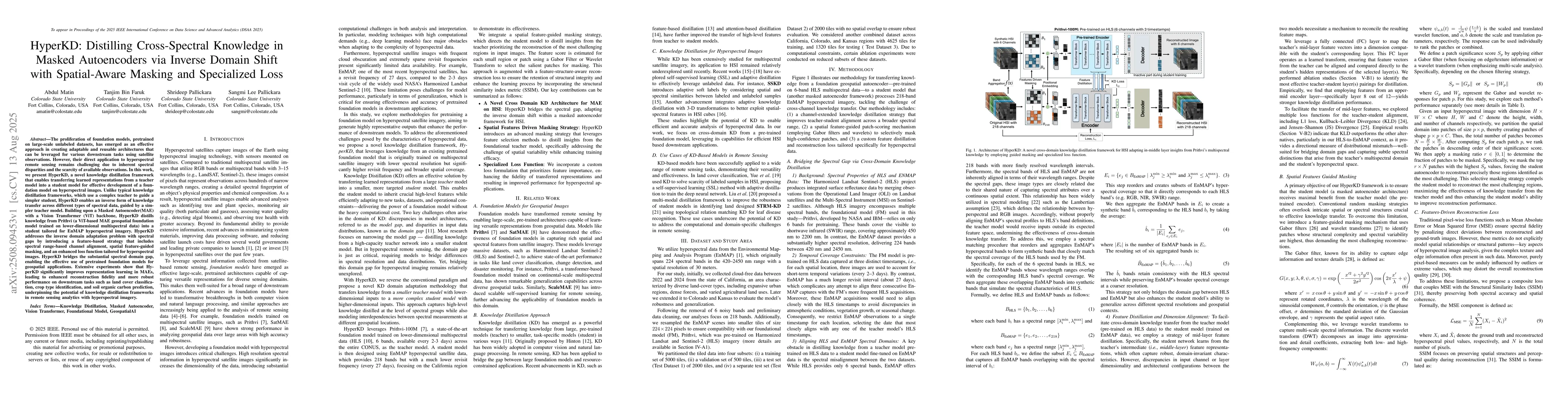
Integrating domain knowledge into deep learning has emerged as a promising direction for improving model interpretability, generalization, and data efficiency. In this work, we present a novel knowled...
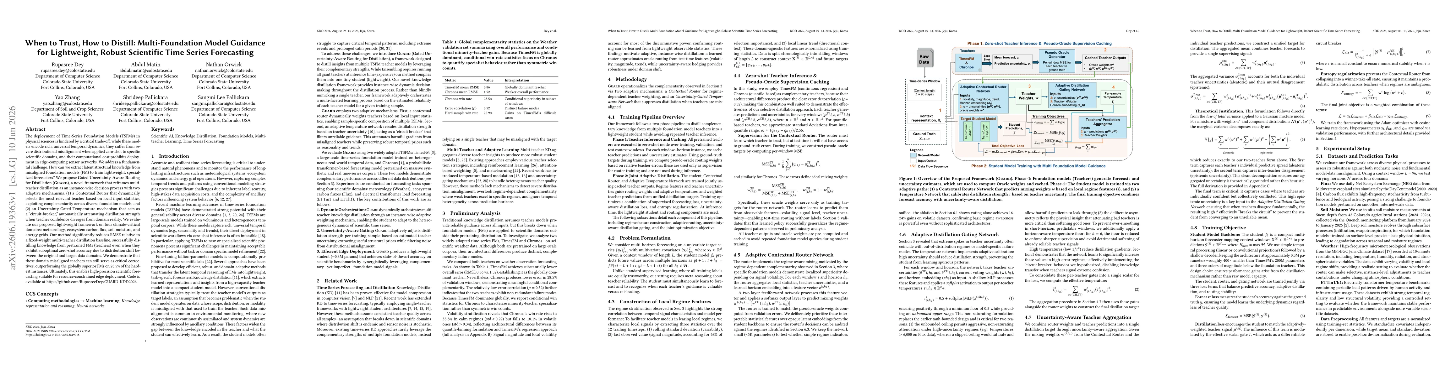
The deployment of Time-Series Foundation Models (TSFMs) in physical sciences is hindered by a critical trade-off: while these models encode rich, universal temporal dynamics, they suffer from severe d...