Academic Profile
Statistics
Similar Authors
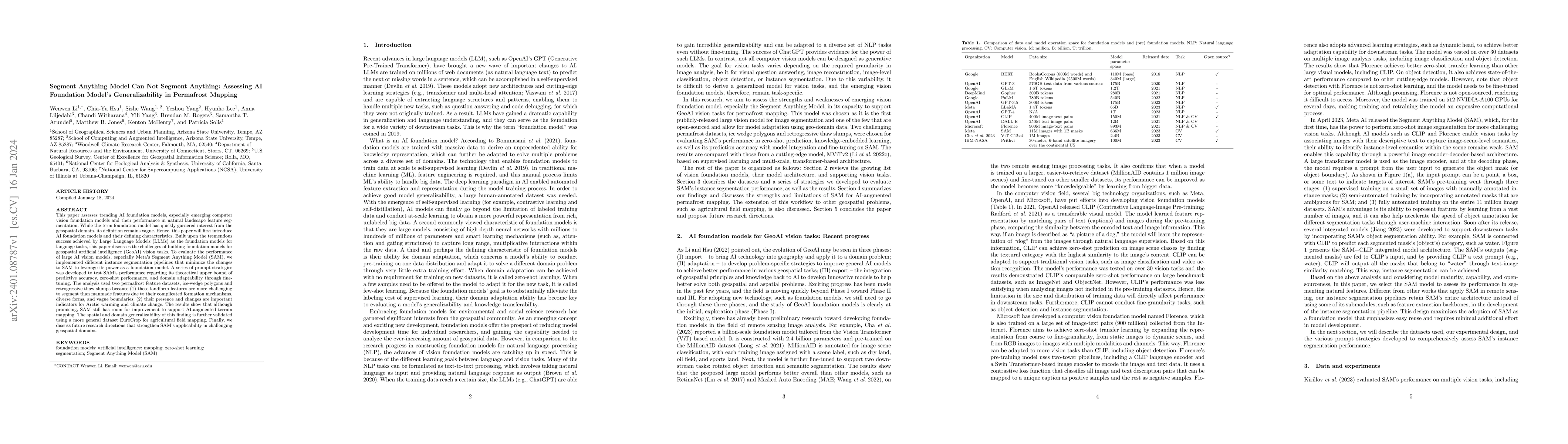
Papers on arXiv
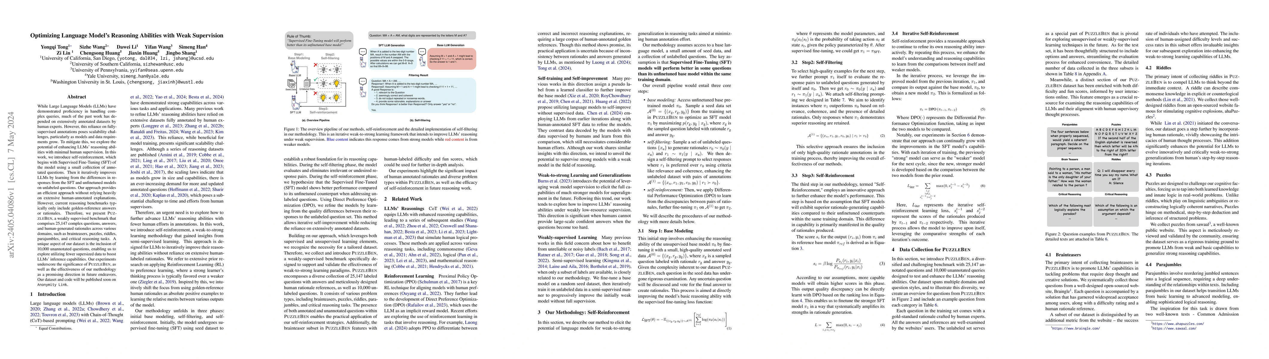
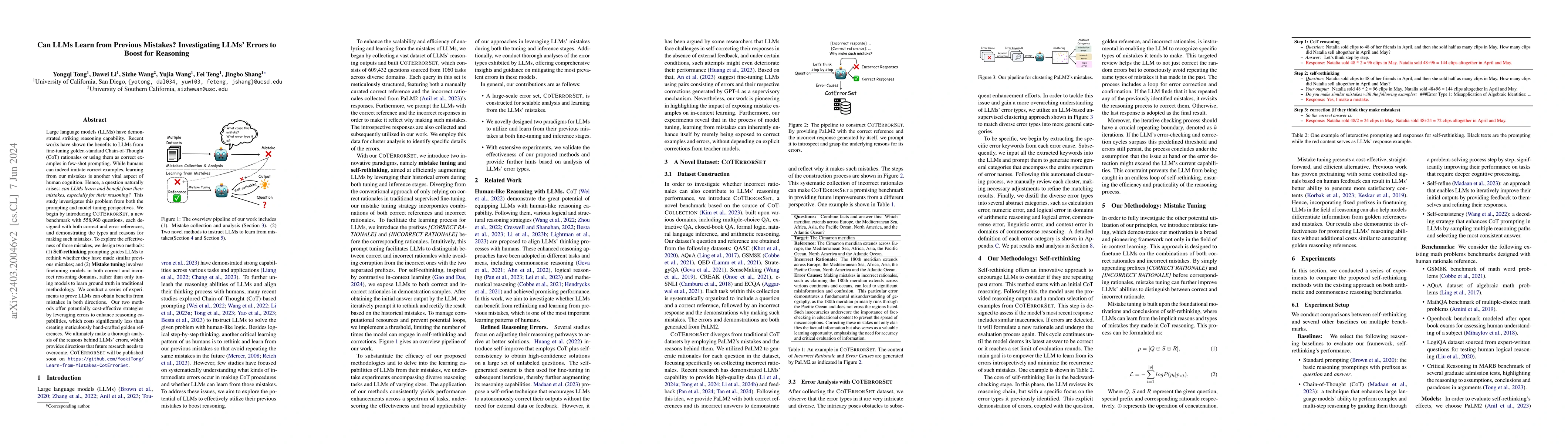
While Large Language Models (LLMs) have demonstrated proficiency in handling complex queries, much of the past work has depended on extensively annotated datasets by human experts. However, this rel...
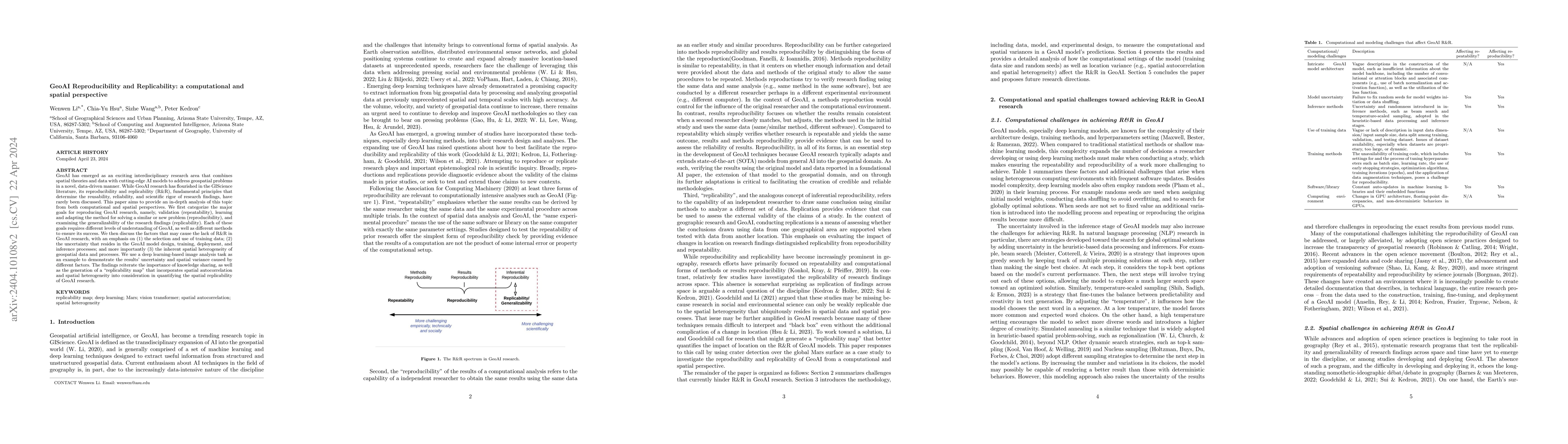
GeoAI has emerged as an exciting interdisciplinary research area that combines spatial theories and data with cutting-edge AI models to address geospatial problems in a novel, data-driven manner. Wh...
Recent works have shown the benefits to LLMs from fine-tuning golden-standard Chain-of-Thought (CoT) rationales or using them as correct examples in few-shot prompting. While humans can indeed imita...
Big earth science data offers the scientific community great opportunities. Many more studies at large-scales, over long-terms and at high resolution can now be conducted using the rich information ...
This paper assesses trending AI foundation models, especially emerging computer vision foundation models and their performance in natural landscape feature segmentation. While the term foundation mo...
Chain-of-Thought(CoT) prompting and its variants explore equipping large language models (LLMs) with high-level reasoning abilities by emulating human-like linear cognition and logic. However, the h...
Vision foundation models are a new frontier in Geospatial Artificial Intelligence (GeoAI), an interdisciplinary research area that applies and extends AI for geospatial problem solving and geographi...
Large language models (LLMs) have demonstrated exceptional performance in various natural language processing tasks, yet their efficacy in more challenging and domain-specific tasks remains largely ...
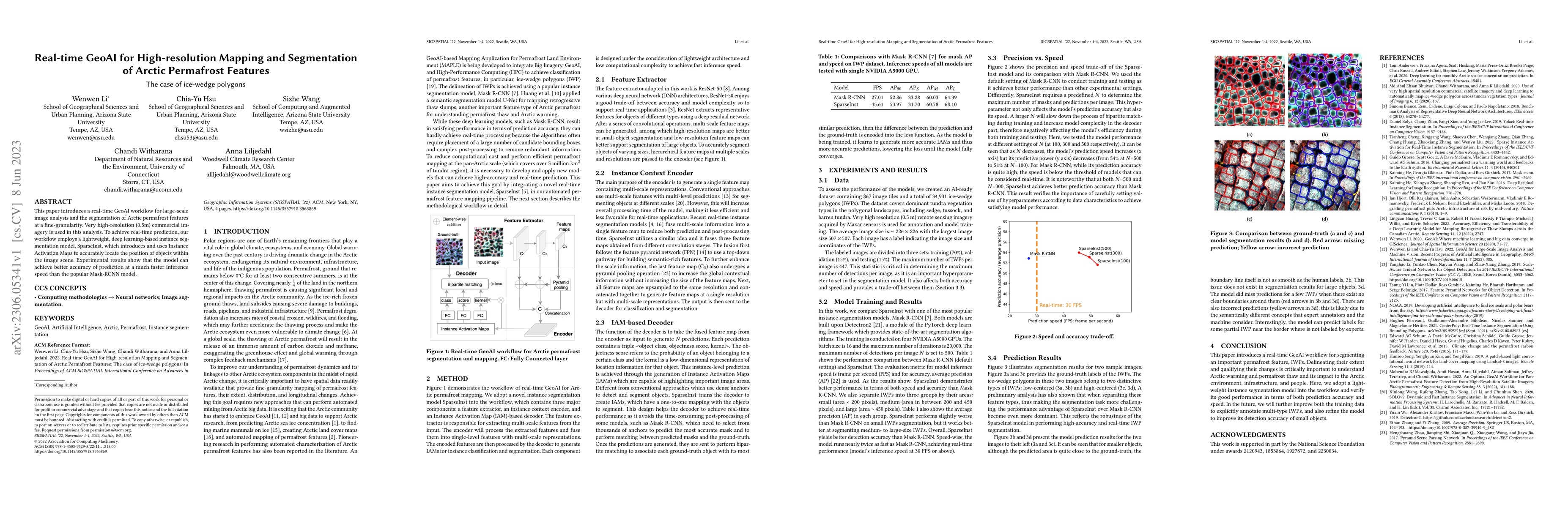
This paper introduces a real-time GeoAI workflow for large-scale image analysis and the segmentation of Arctic permafrost features at a fine-granularity. Very high-resolution (0.5m) commercial image...
Initiated by the University Consortium of Geographic Information Science (UCGIS), GIS&T Body of Knowledge (BoK) is a community-driven endeavor to define, develop, and document geospatial topics rela...
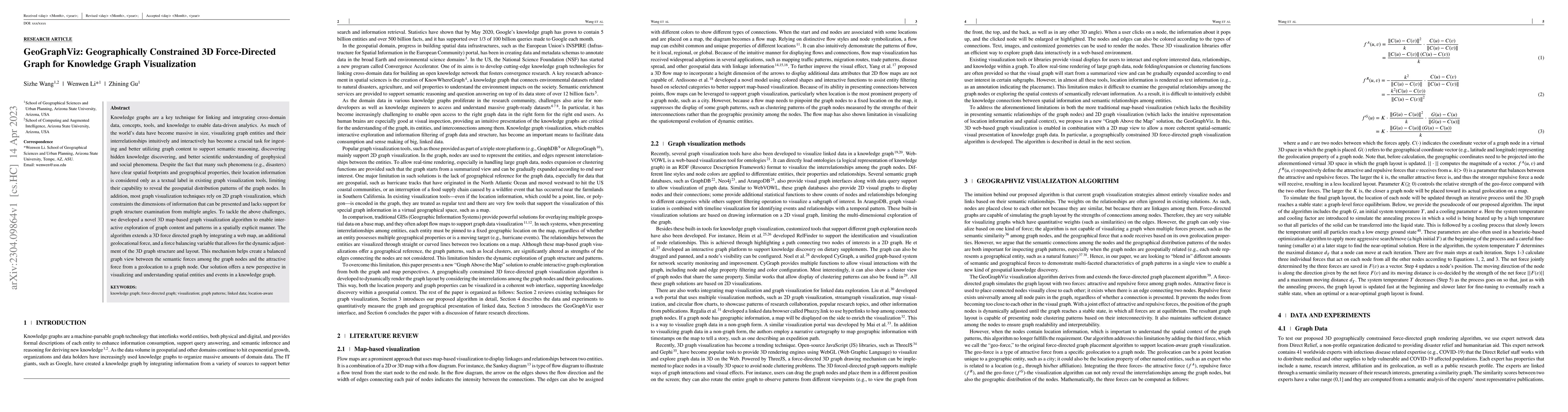
Knowledge graphs are a key technique for linking and integrating cross-domain data, concepts, tools, and knowledge to enable data-driven analytics. As much of the worlds data have become massive in ...
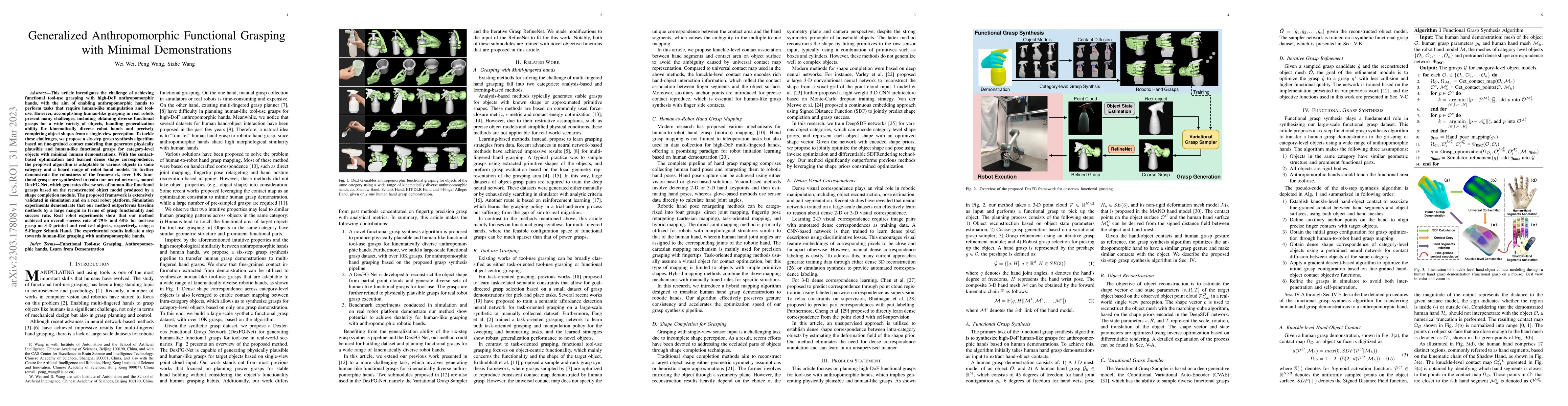
This article investigates the challenge of achieving functional tool-use grasping with high-DoF anthropomorphic hands, with the aim of enabling anthropomorphic hands to perform tasks that require hu...
Research on geospatial foundation models (GFMs) has become a trending topic in geospatial artificial intelligence (AI) research due to their potential for achieving high generalizability and domain ad...
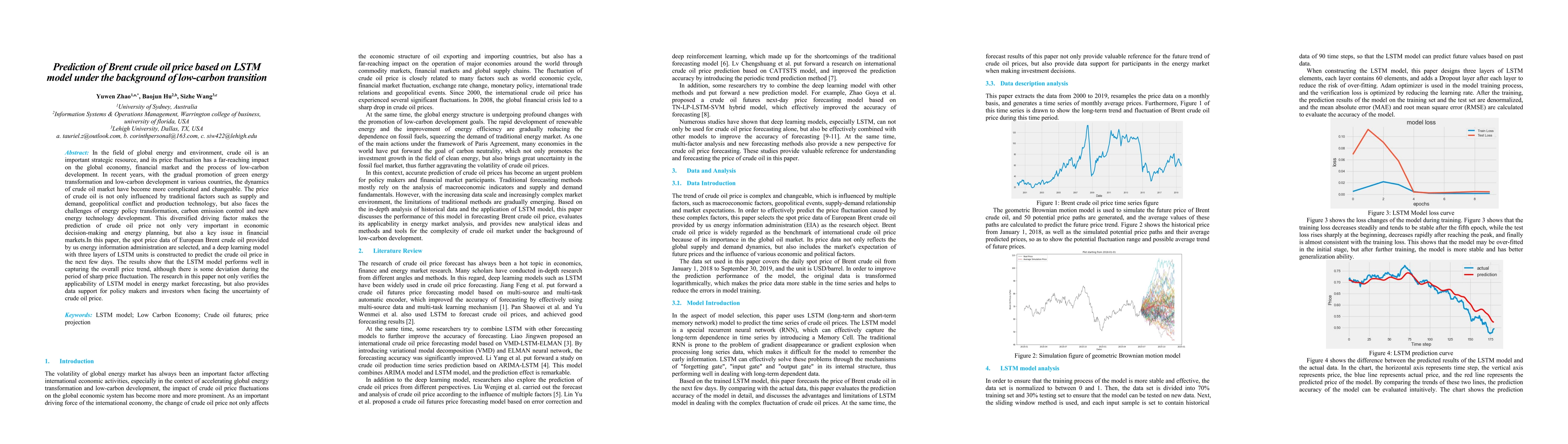
In the field of global energy and environment, crude oil is an important strategic resource, and its price fluctuation has a far-reaching impact on the global economy, financial market and the process...
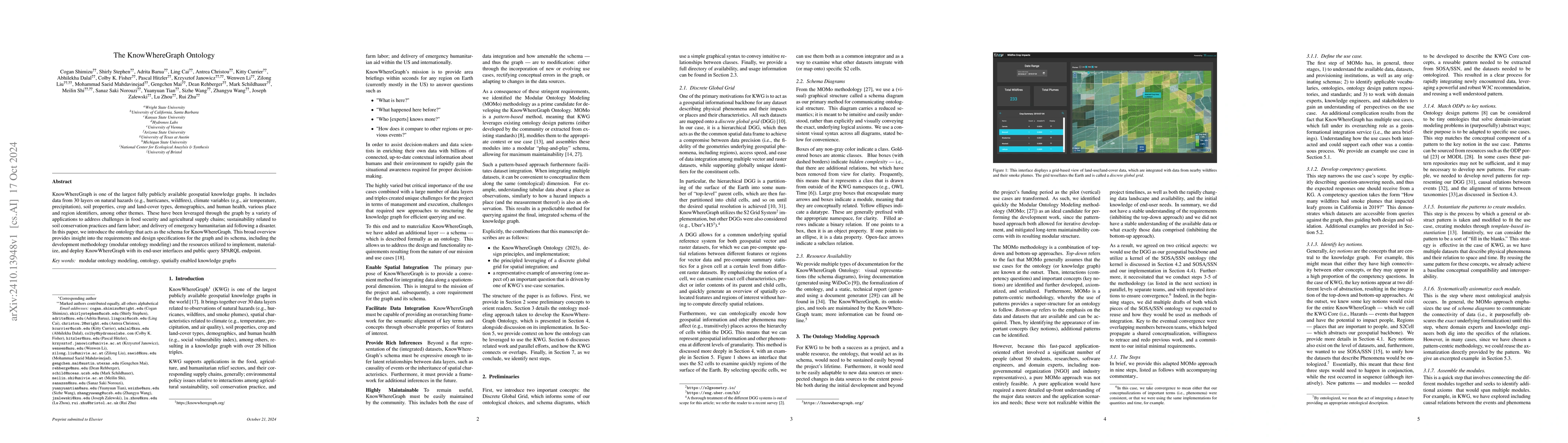
KnowWhereGraph is one of the largest fully publicly available geospatial knowledge graphs. It includes data from 30 layers on natural hazards (e.g., hurricanes, wildfires), climate variables (e.g., ai...
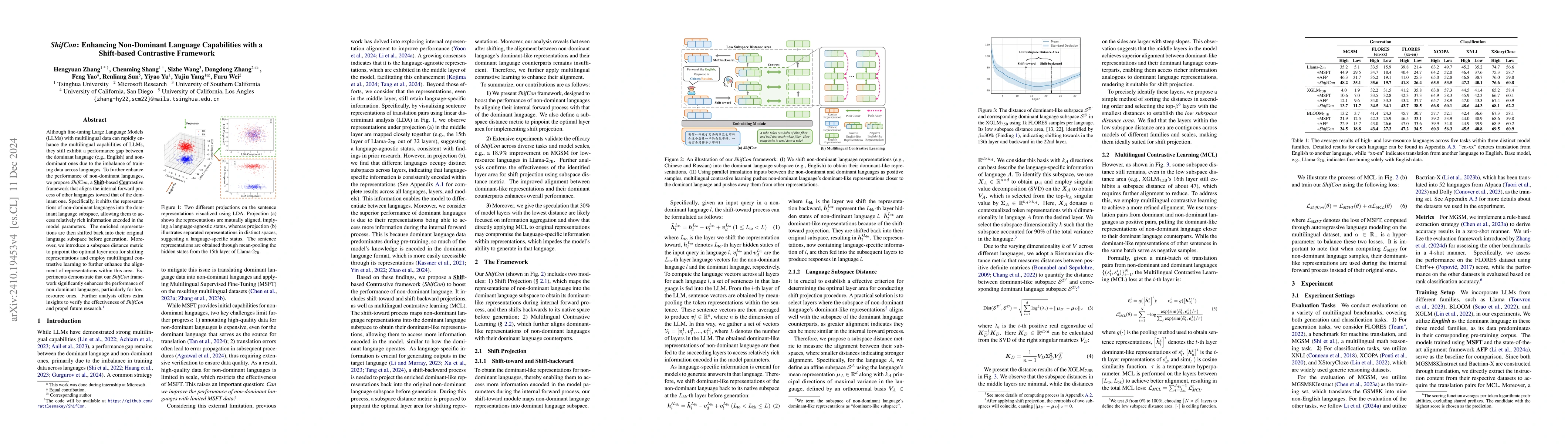
Although fine-tuning Large Language Models (LLMs) with multilingual data can rapidly enhance the multilingual capabilities of LLMs, they still exhibit a performance gap between the dominant language (...
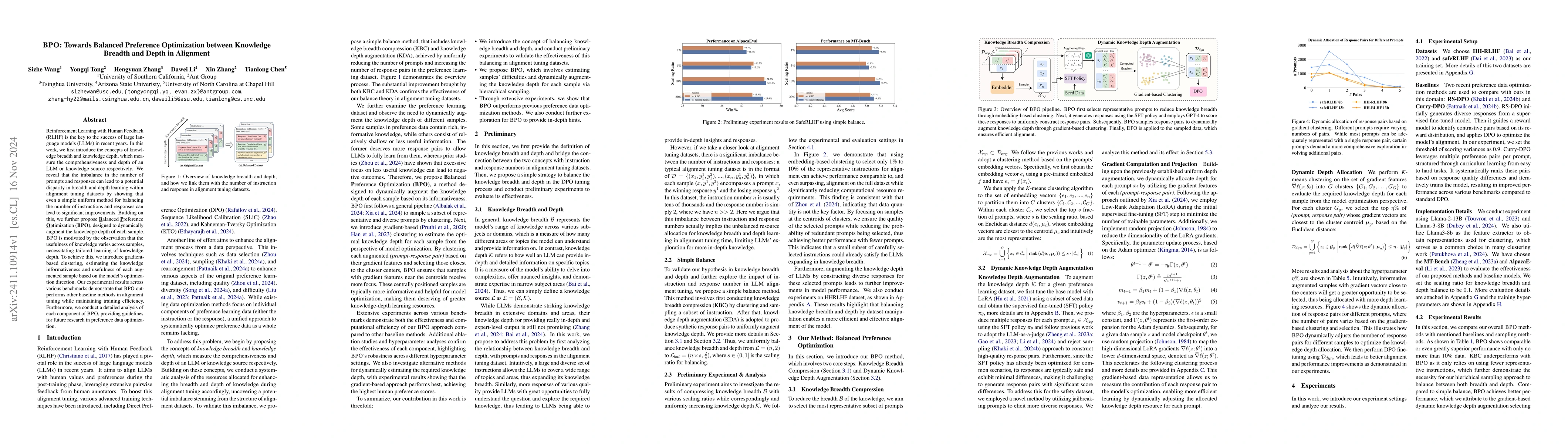
Reinforcement Learning with Human Feedback (RLHF) is the key to the success of large language models (LLMs) in recent years. In this work, we first introduce the concepts of knowledge breadth and know...
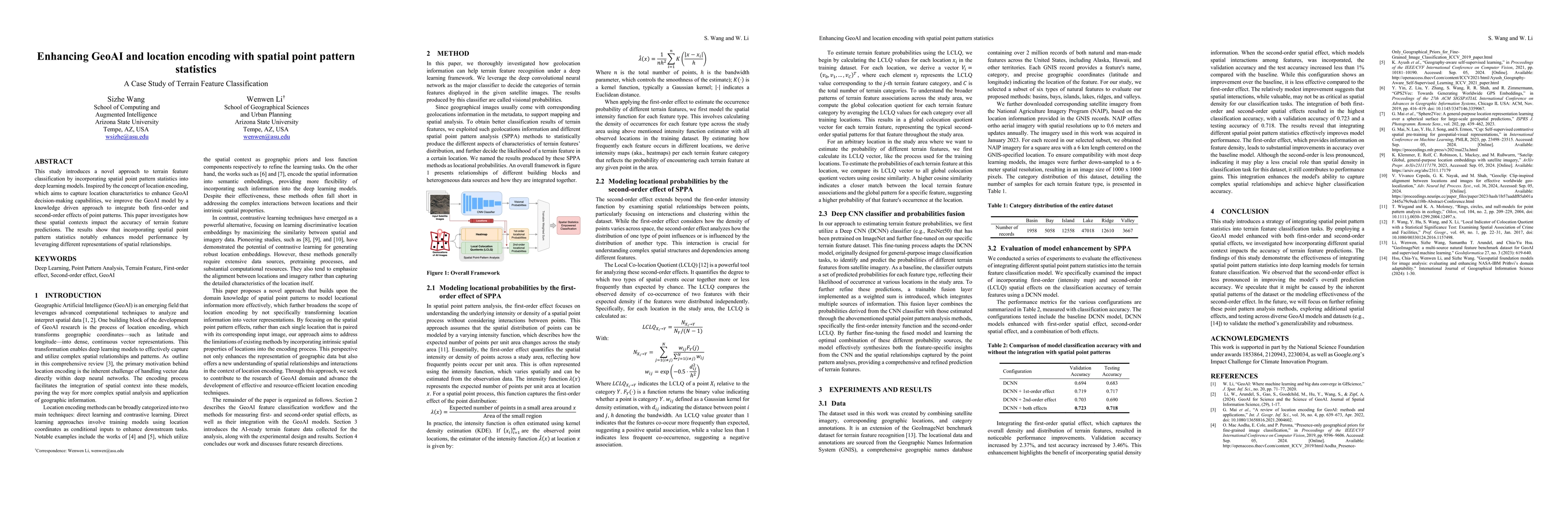
This study introduces a novel approach to terrain feature classification by incorporating spatial point pattern statistics into deep learning models. Inspired by the concept of location encoding, whic...
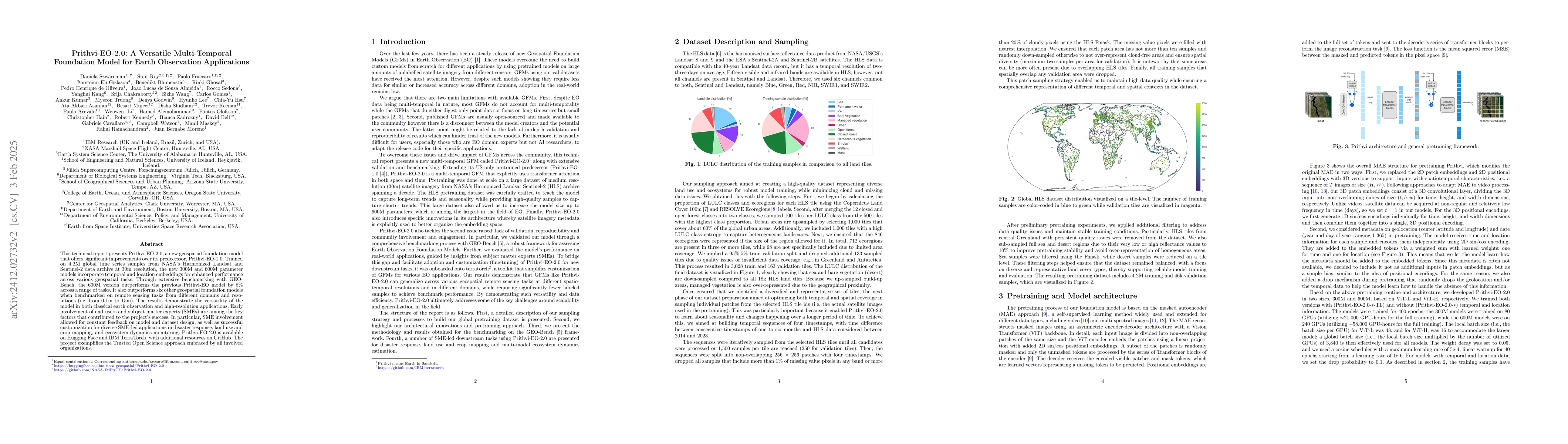
This technical report presents Prithvi-EO-2.0, a new geospatial foundation model that offers significant improvements over its predecessor, Prithvi-EO-1.0. Trained on 4.2M global time series samples f...
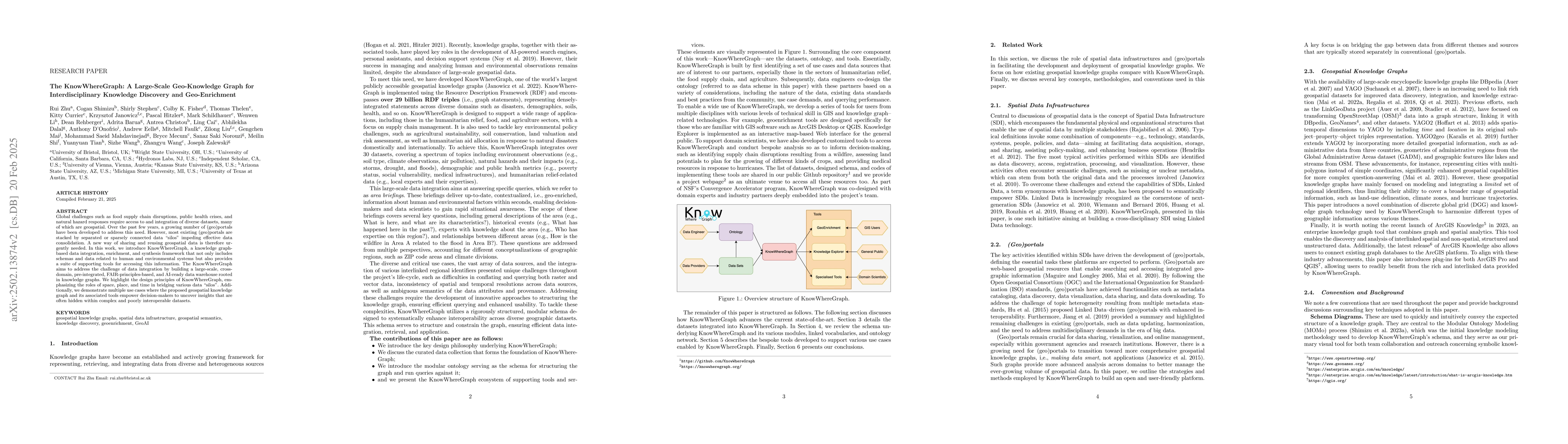
Global challenges such as food supply chain disruptions, public health crises, and natural hazard responses require access to and integration of diverse datasets, many of which are geospatial. Over th...
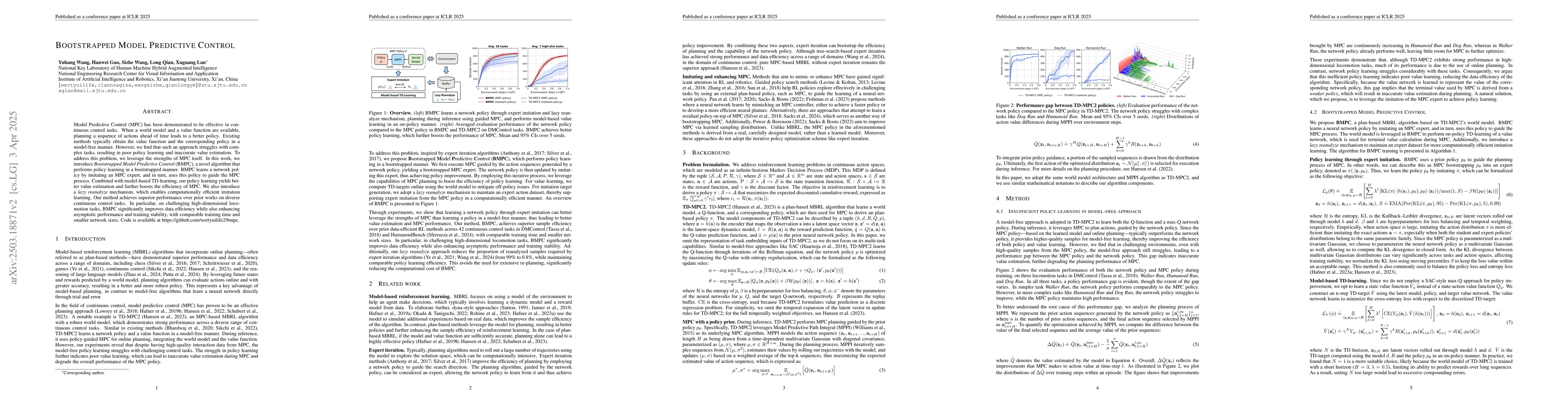
Model Predictive Control (MPC) has been demonstrated to be effective in continuous control tasks. When a world model and a value function are available, planning a sequence of actions ahead of time le...

Real world development demands code that is readable, extensible, and testable by organizing the implementation into modular components and iteratively reuse pre-implemented code. We term this iterati...
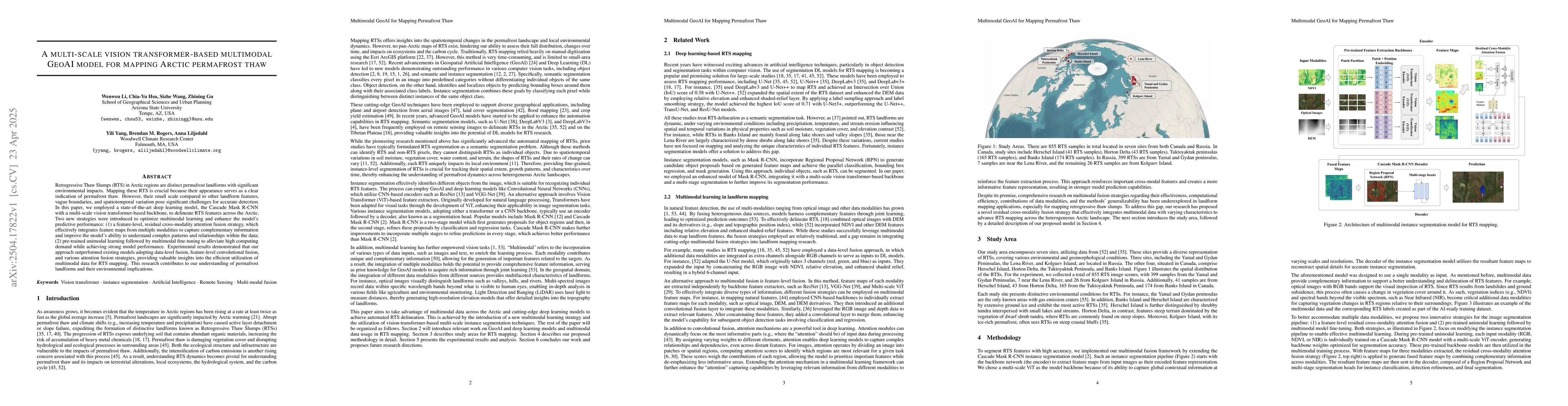
Retrogressive Thaw Slumps (RTS) in Arctic regions are distinct permafrost landforms with significant environmental impacts. Mapping these RTS is crucial because their appearance serves as a clear indi...
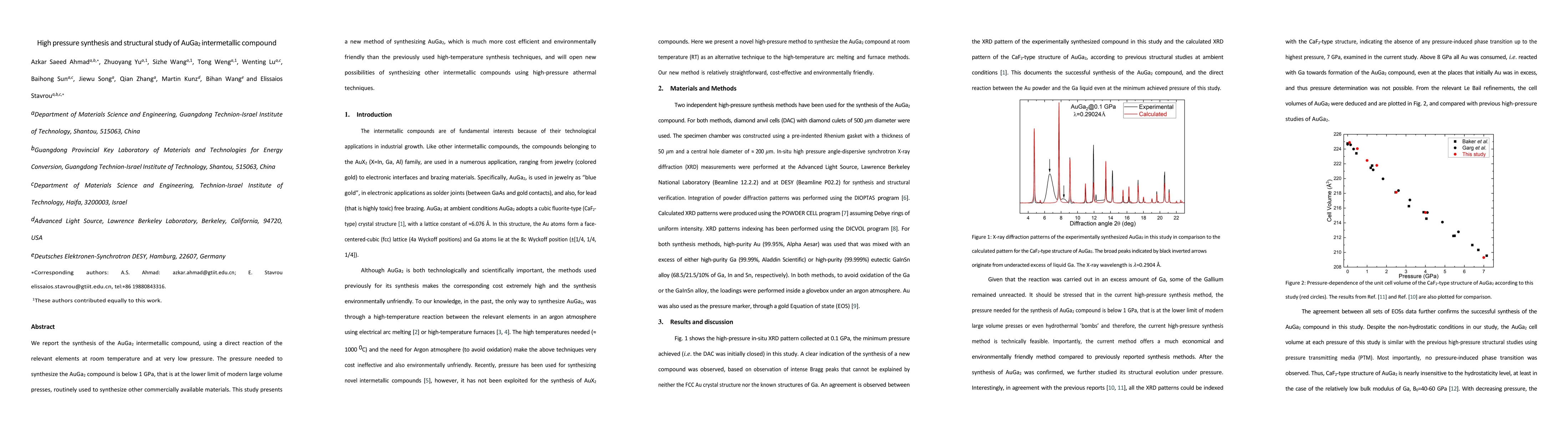
We report the synthesis of the AuGa2 intermetallic compound, using a direct reaction of the relevant elements at room temperature and at very low pressure. The pressure needed to synthesize the AuGa2 ...
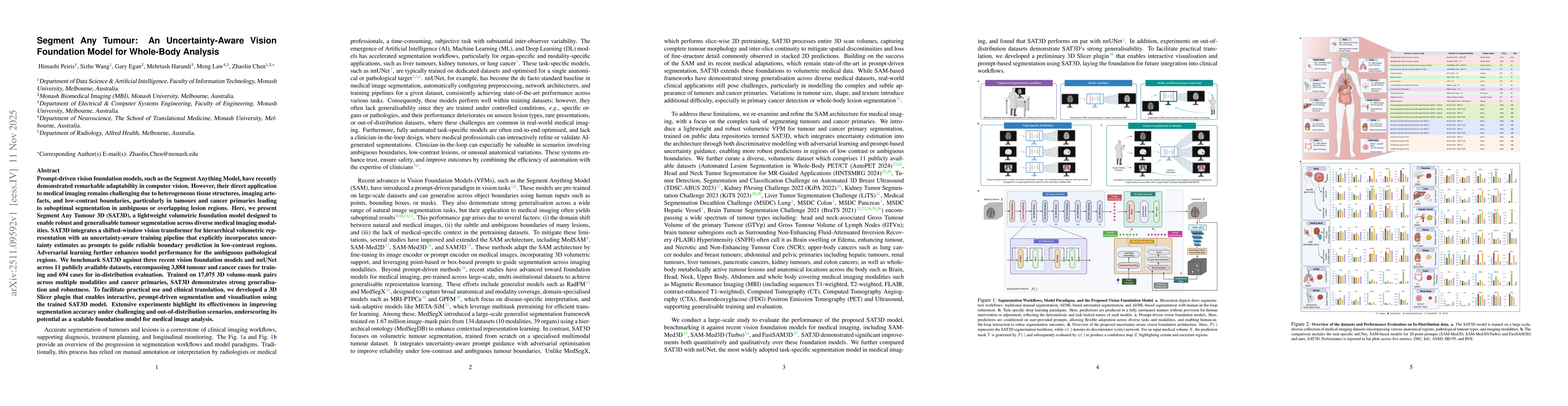
Prompt-driven vision foundation models, such as the Segment Anything Model, have recently demonstrated remarkable adaptability in computer vision. However, their direct application to medical imaging ...
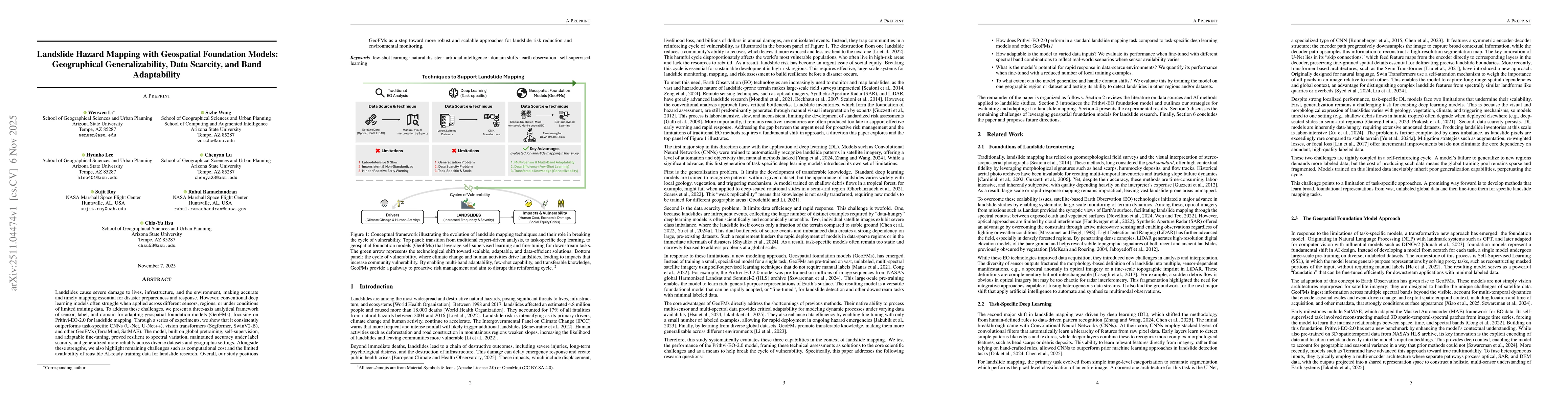
Landslides cause severe damage to lives, infrastructure, and the environment, making accurate and timely mapping essential for disaster preparedness and response. However, conventional deep learning m...
Mobility management in cellular networks, especially the handover (HO) process, plays a key role in providing seamless and ubiquitous Internet access. The wide-scale deployment of 5G and the resulting...
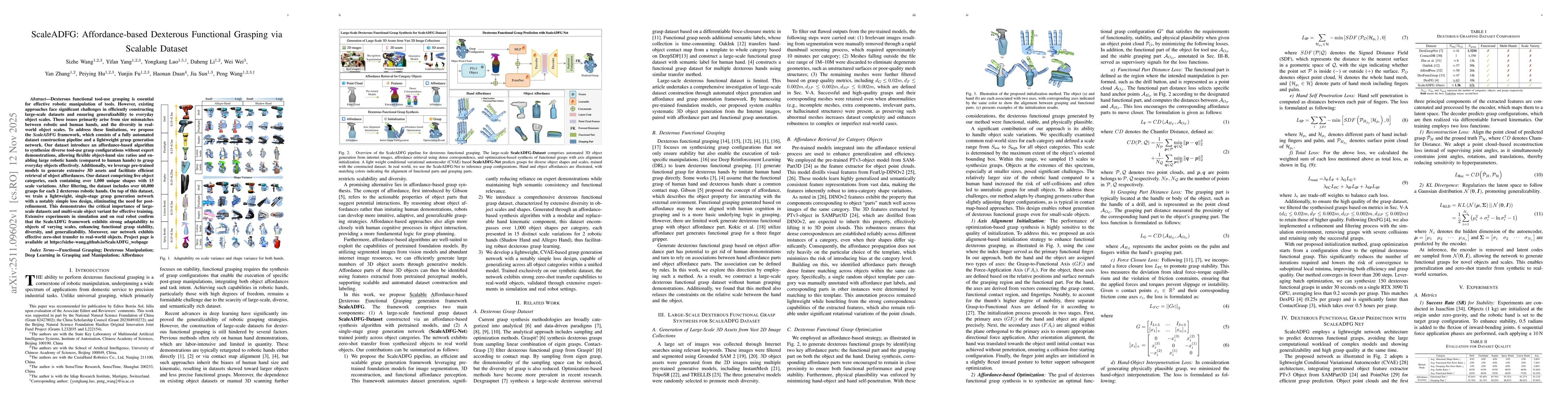
Dexterous functional tool-use grasping is essential for effective robotic manipulation of tools. However, existing approaches face significant challenges in efficiently constructing large-scale datase...
Understanding how interdisciplinary research teams converge on shared knowledge is a persistent challenge. This paper presents a novel, multi-layer, AI-driven analytical framework for mapping research...
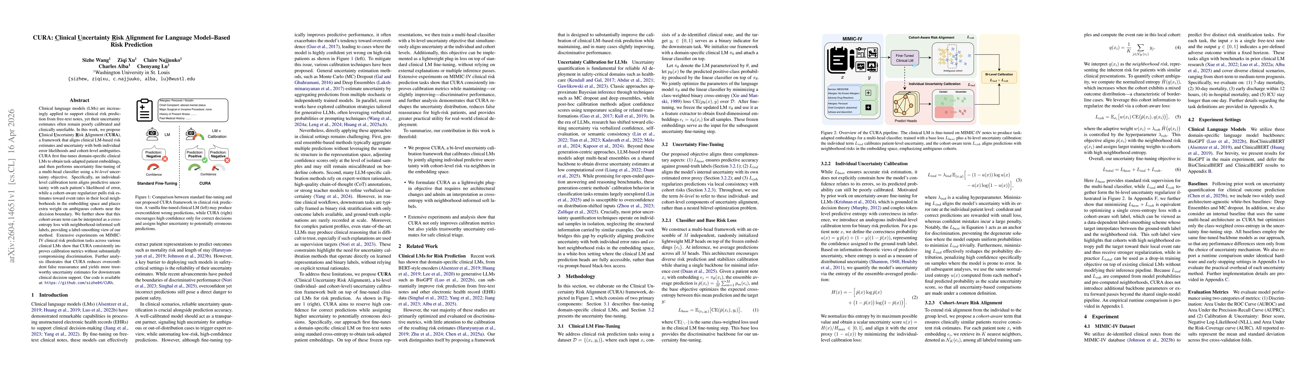
Clinical language models (LMs) are increasingly applied to support clinical risk prediction from free-text notes, yet their uncertainty estimates often remain poorly calibrated and clinically unreliab...
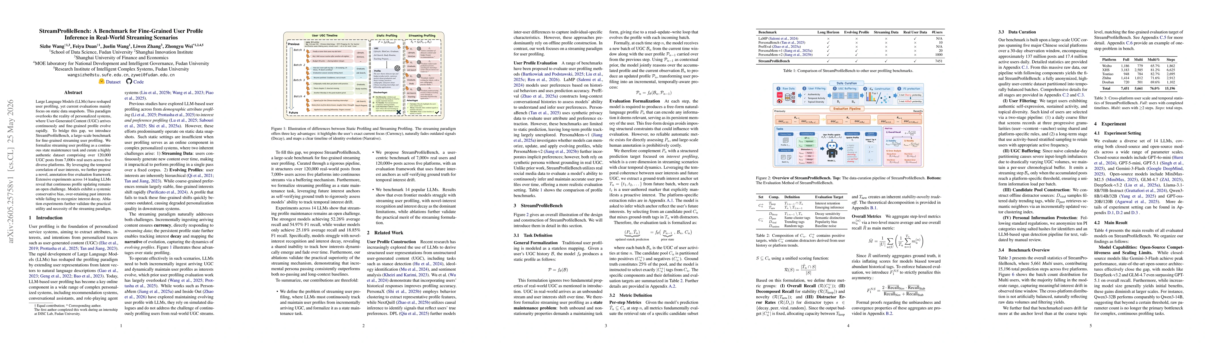
Large Language Models (LLMs) have reshaped user profiling, yet current evaluations mainly focus on static data snapshots. This paradigm overlooks the reality of personalized systems, where User-Genera...