Academic Profile
Statistics
Similar Authors
Papers on arXiv
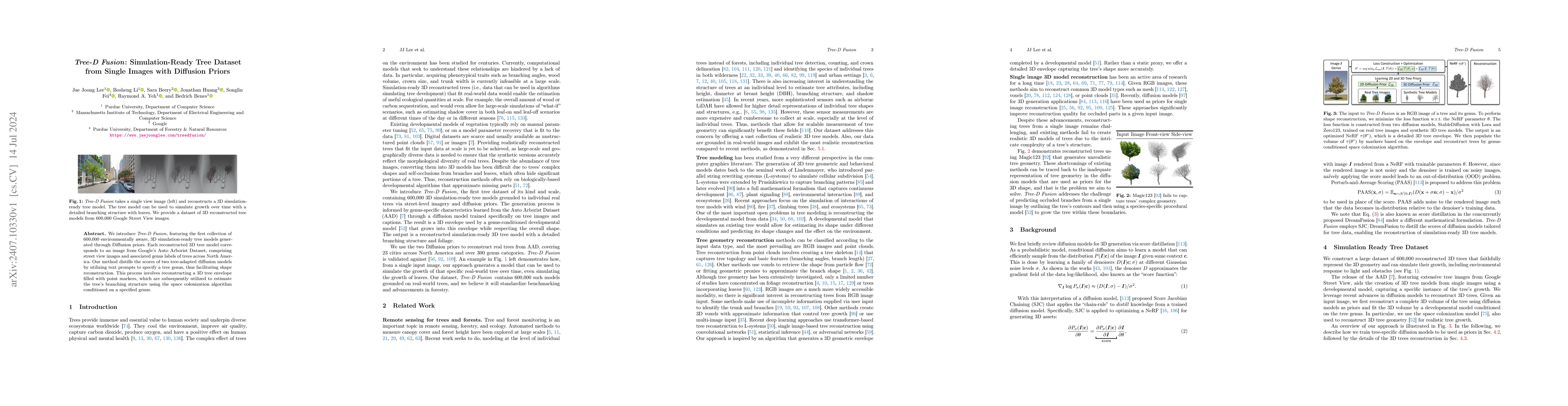
We introduce Tree D-fusion, featuring the first collection of 600,000 environmentally aware, 3D simulation-ready tree models generated through Diffusion priors. Each reconstructed 3D tree model corres...
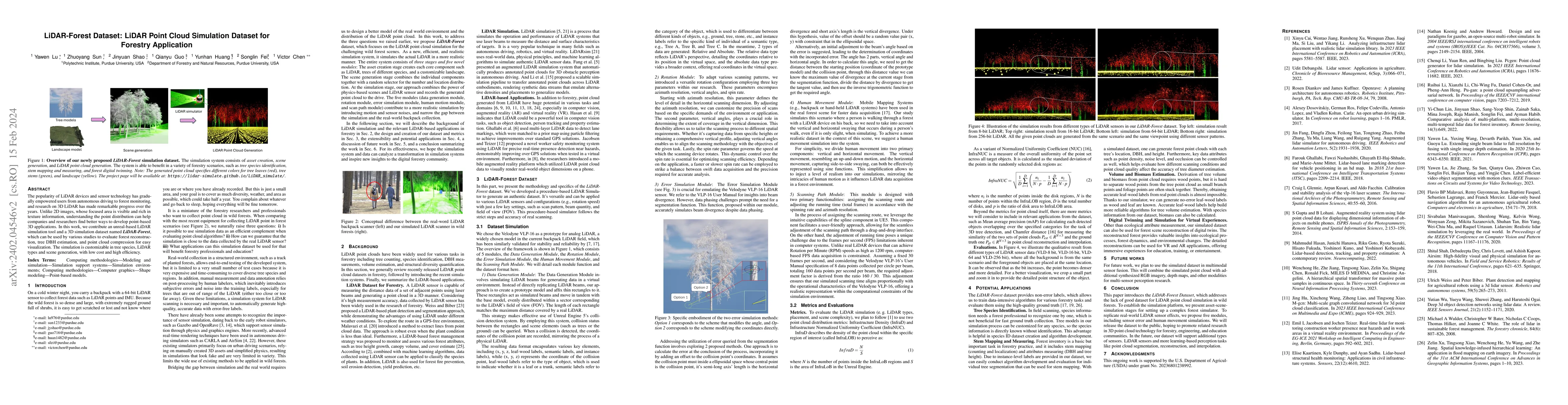
The popularity of LiDAR devices and sensor technology has gradually empowered users from autonomous driving to forest monitoring, and research on 3D LiDAR has made remarkable progress over the years...
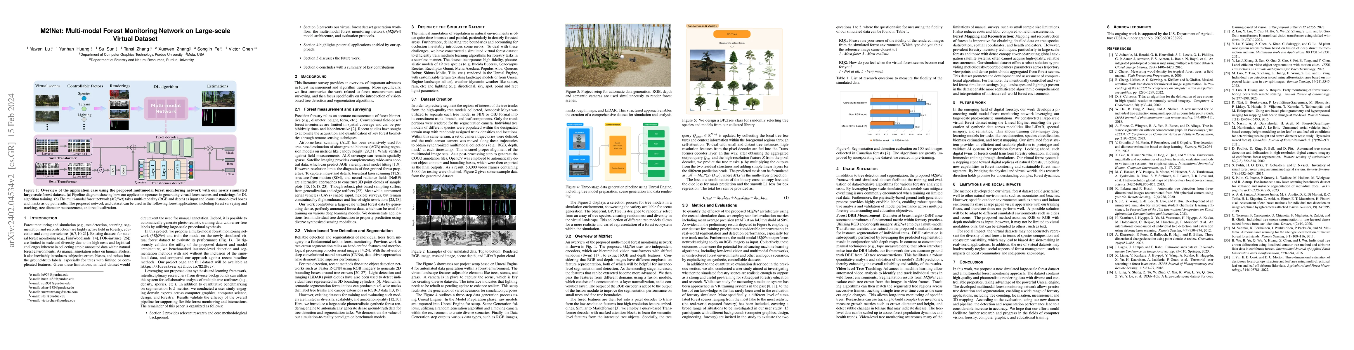
Forest monitoring and education are key to forest protection, education and management, which is an effective way to measure the progress of a country's forest and climate commitments. Due to the la...
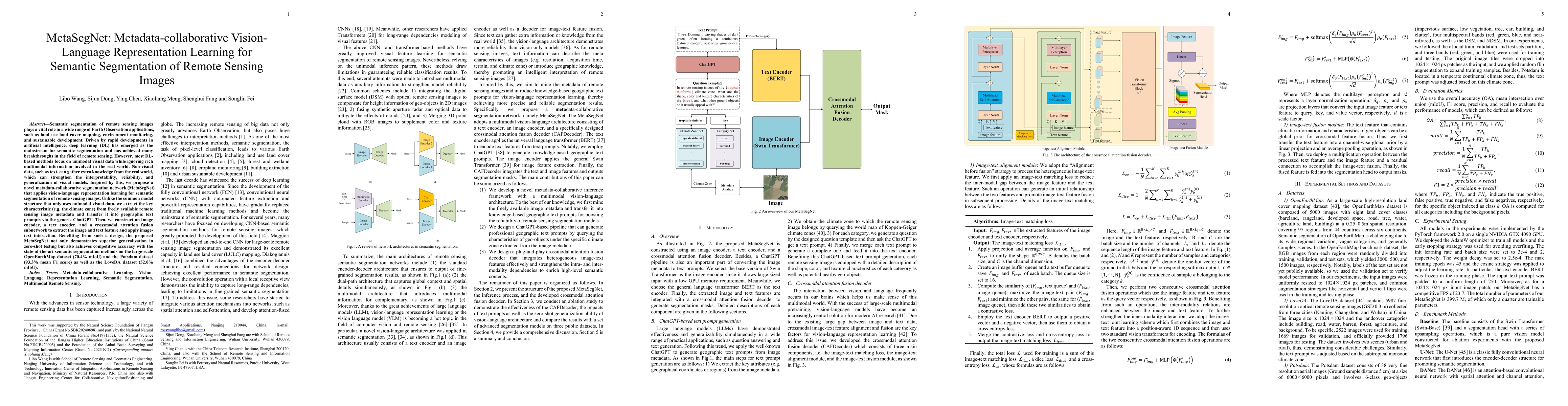
Semantic segmentation of remote sensing images plays a vital role in a wide range of Earth Observation (EO) applications, such as land use land cover mapping, environment monitoring, and sustainable...
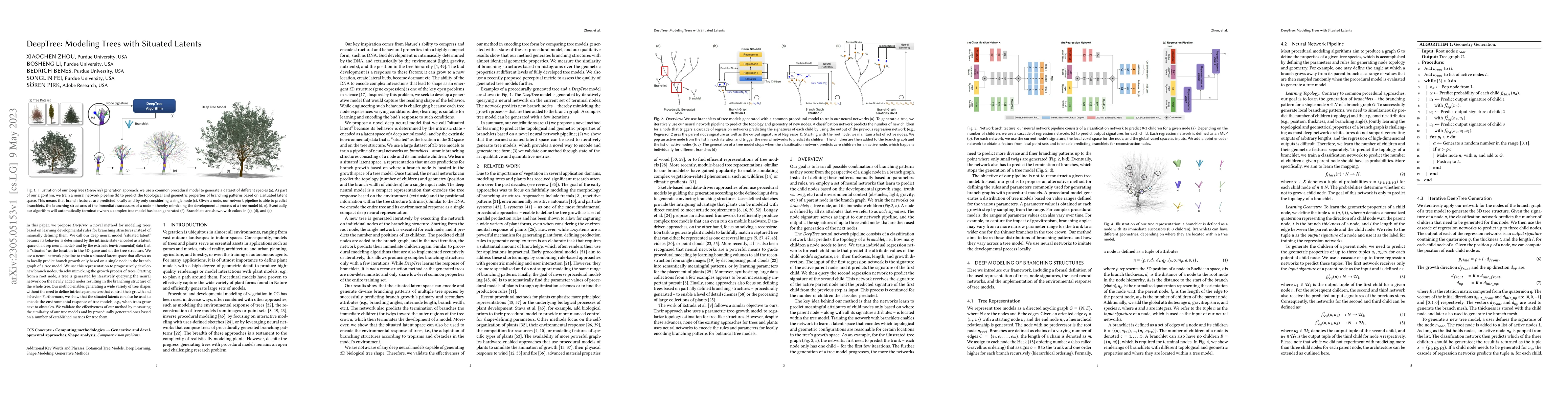
In this paper, we propose DeepTree, a novel method for modeling trees based on learning developmental rules for branching structures instead of manually defining them. We call our deep neural model ...
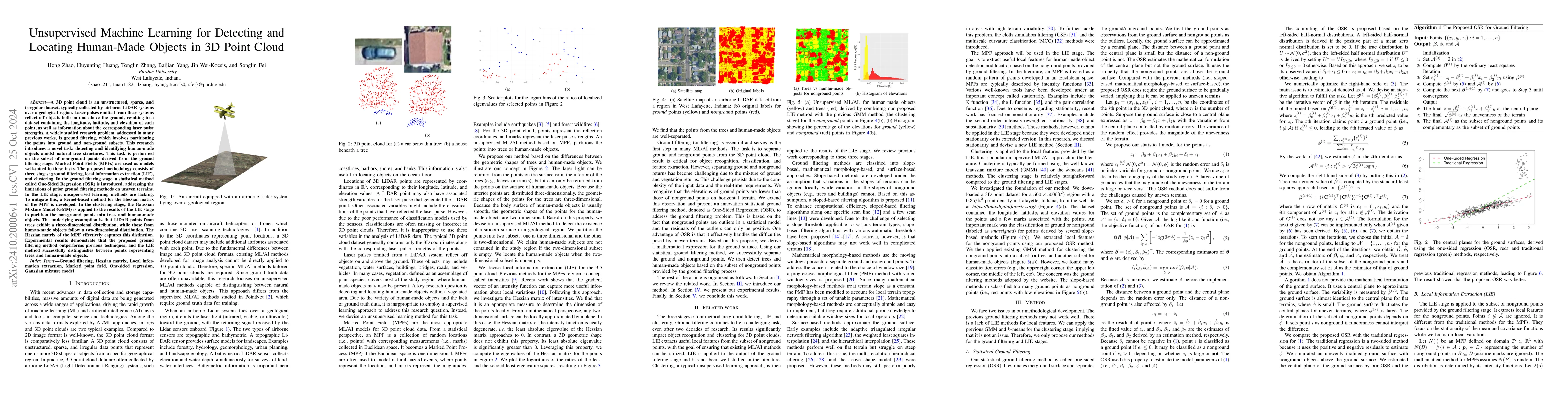
A 3D point cloud is an unstructured, sparse, and irregular dataset, typically collected by airborne LiDAR systems over a geological region. Laser pulses emitted from these systems reflect off objects ...
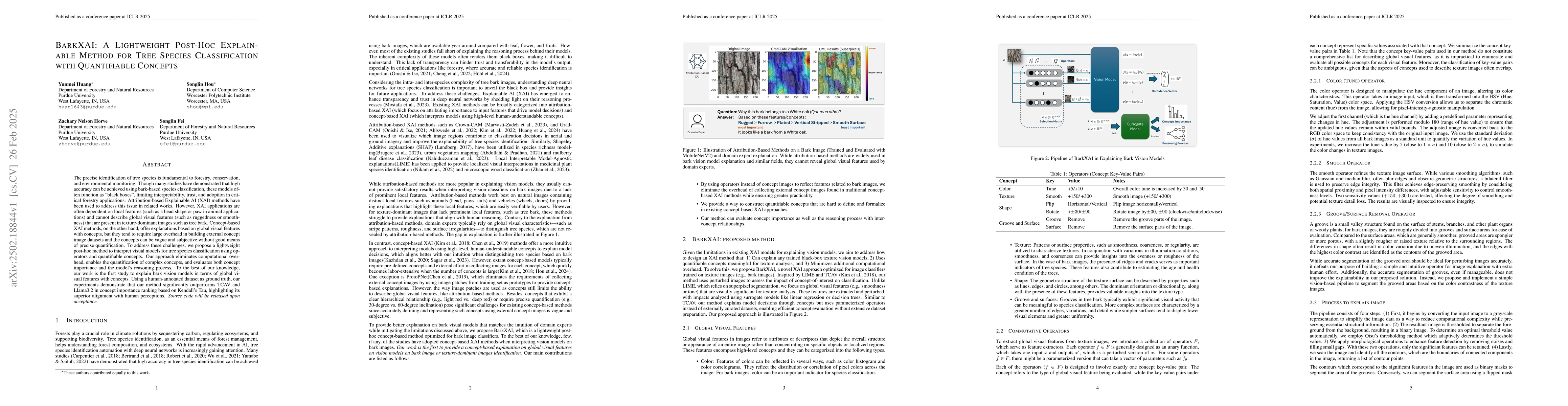
The precise identification of tree species is fundamental to forestry, conservation, and environmental monitoring. Though many studies have demonstrated that high accuracy can be achieved using bark-b...
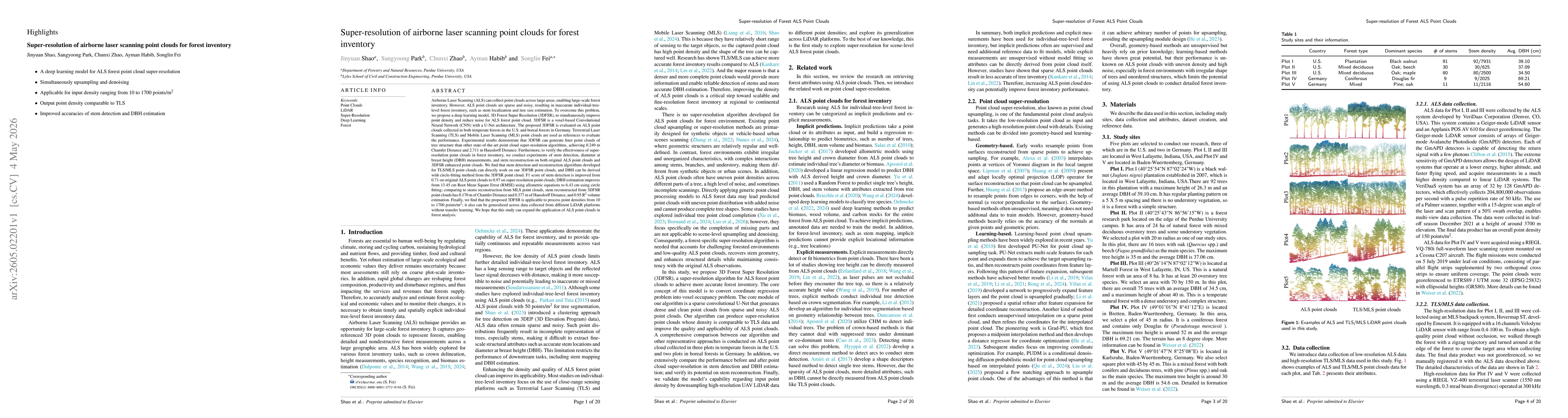
Airborne Laser Scanning (ALS) can collect point clouds across large areas, enabling large-scale forest inventory. However, ALS point clouds are sparse and noisy, resulting in inaccurate individual-tre...
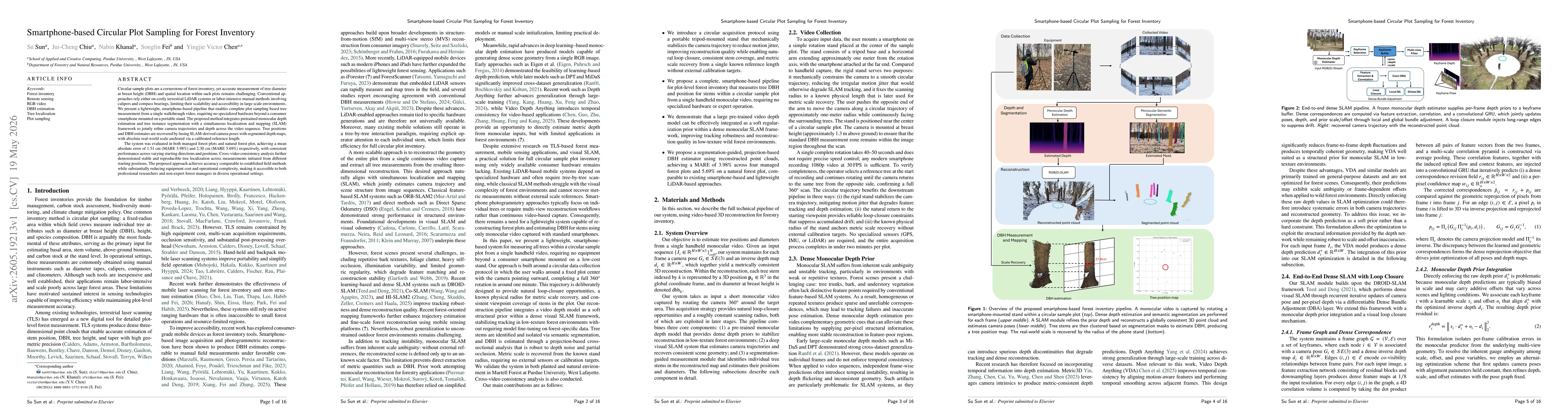
Circular sample plots are a cornerstone of forest inventory, yet accurate measurement of tree diameter at breast height (DBH) and spatial location within such plots remains challenging. Conventional a...