Academic Profile
Statistics
Similar Authors
Papers on arXiv
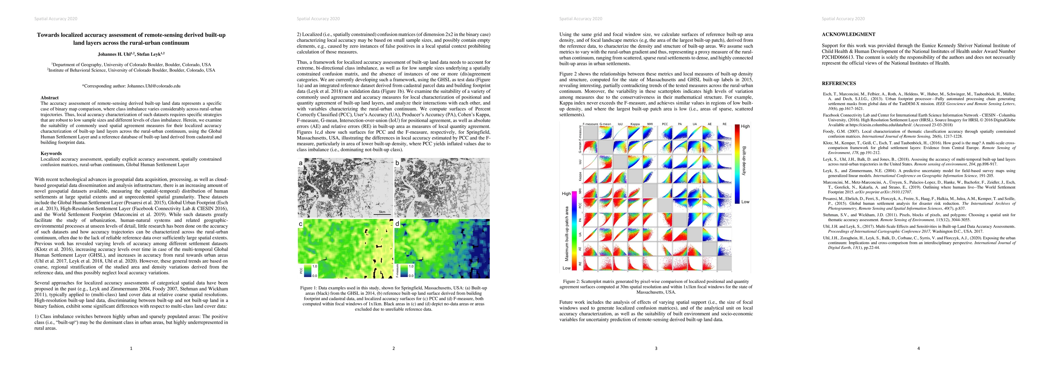
The accuracy assessment of remote-sensing derived built-up land data represents a specific case of binary map comparison, where class imbalance varies considerably across rural-urban trajectories. T...
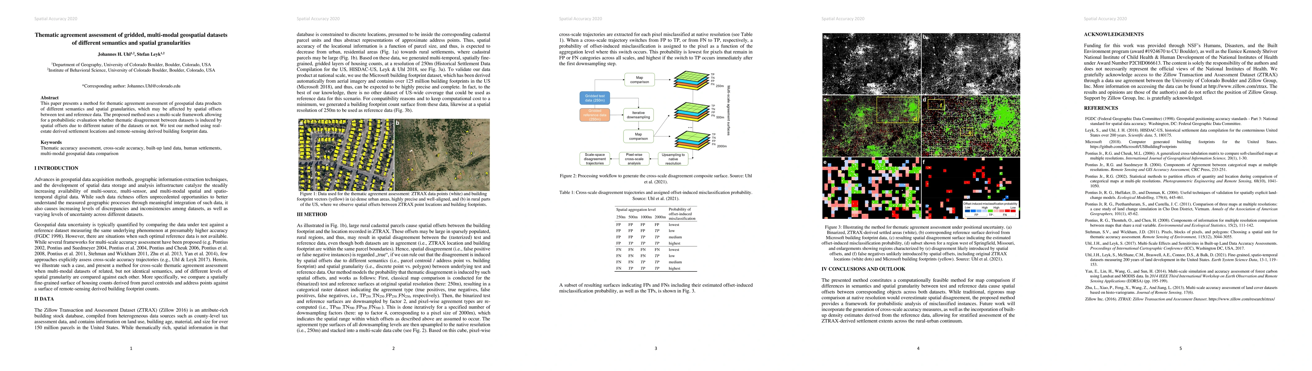
This paper presents a method for thematic agreement assessment of geospatial data products of different semantics and spatial granularities, which may be affected by spatial offsets between test and...
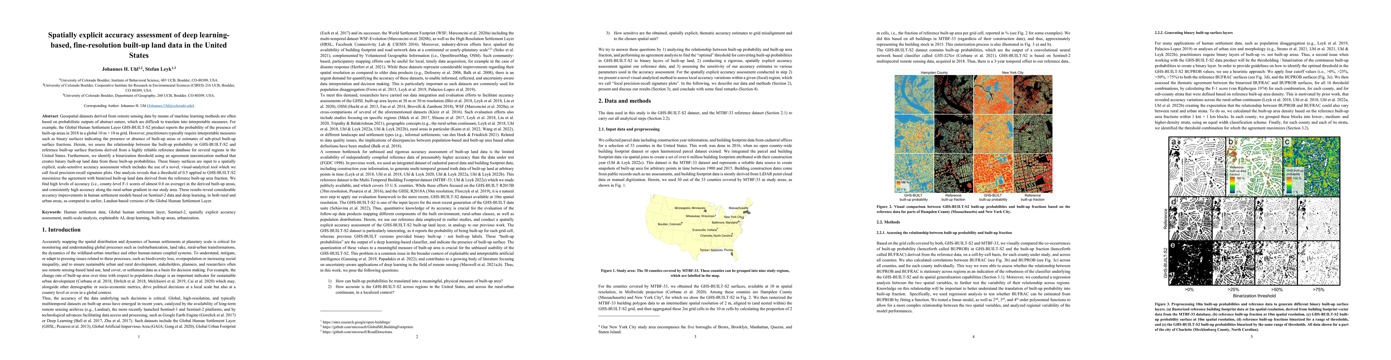
Geospatial datasets derived from remote sensing data by means of machine learning methods are often based on probabilistic outputs of abstract nature, which are difficult to translate into interpret...
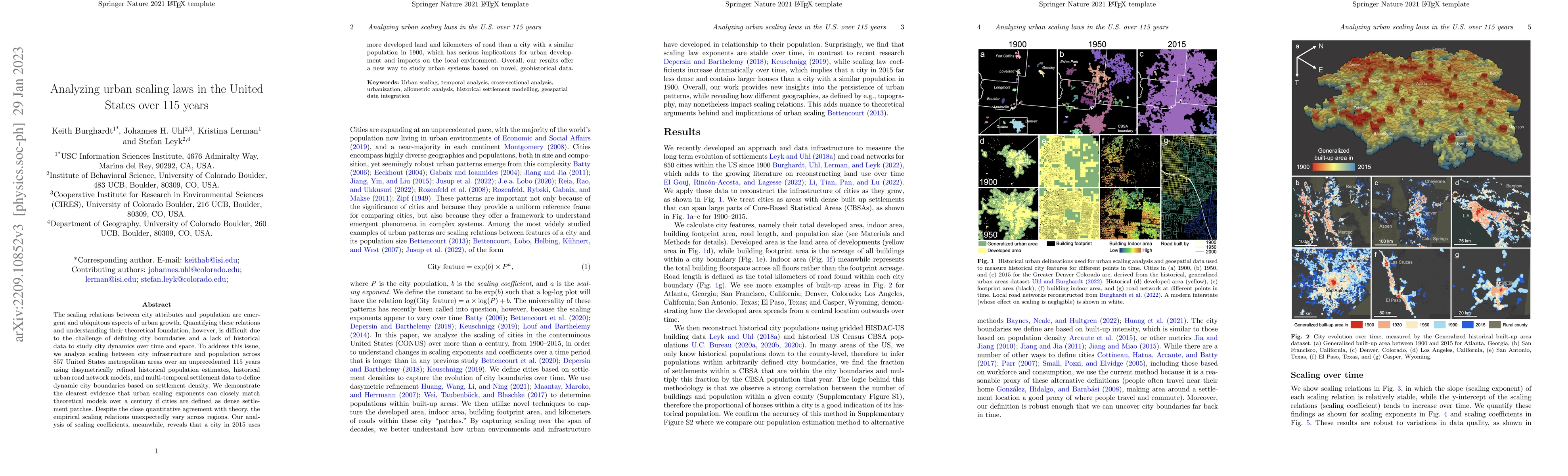
The scaling relations between city attributes and population are emergent and ubiquitous aspects of urban growth. Quantifying these relations and understanding their theoretical foundation, however,...
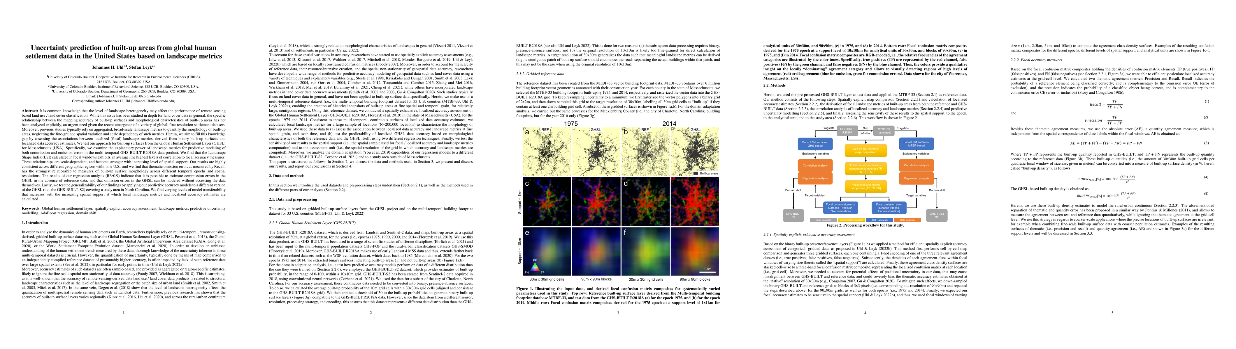
The level of landscape heterogeneity may affect the performance of remote sensing based land use / land cover classification. However, the relationship between mapping accuracy of built-up surfaces ...
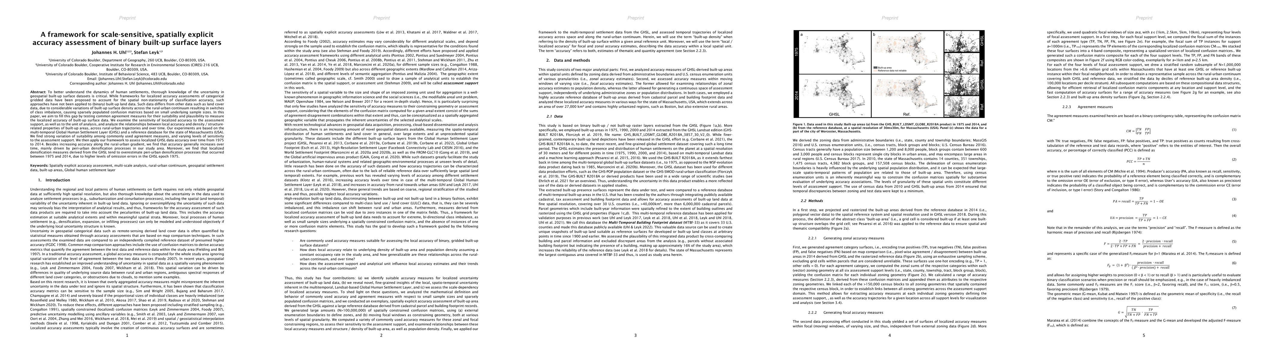
To better understand the dynamics of human settlements, thorough knowledge of the uncertainty in geospatial built-up surface datasets is critical. While frameworks for localized accuracy assessments...
Despite abundant data on the spatial distribution of contemporary human settlements, historical data on the long-term evolution of human settlements at fine spatial and temporal granularity is scarc...
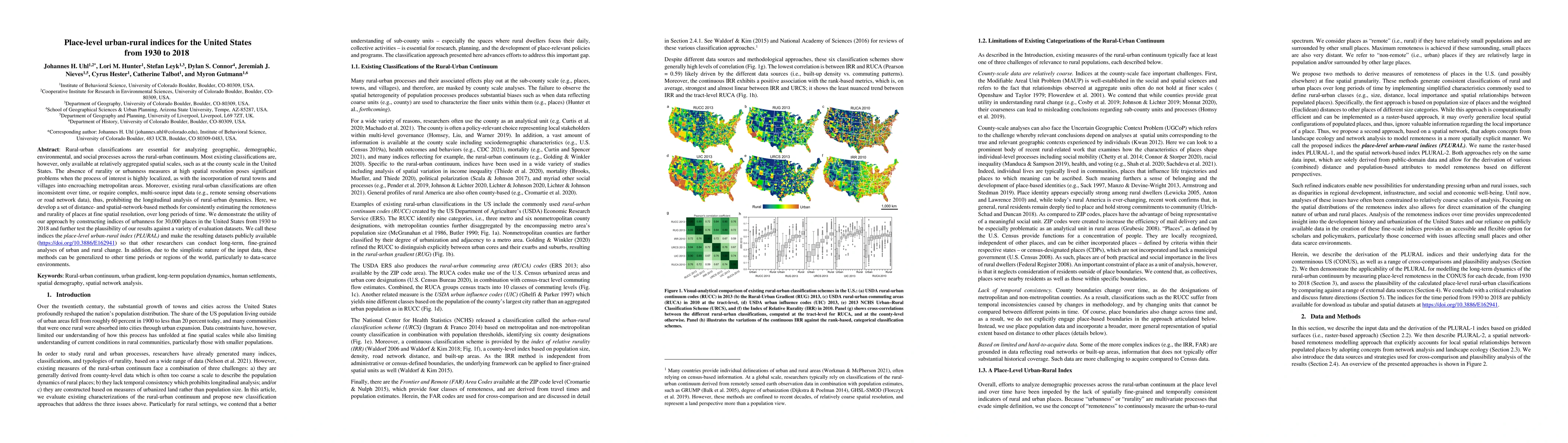
Rural-urban classifications are essential for analyzing geographic, demographic, environmental, and social processes across the rural-urban continuum. Most existing classifications are, however, onl...
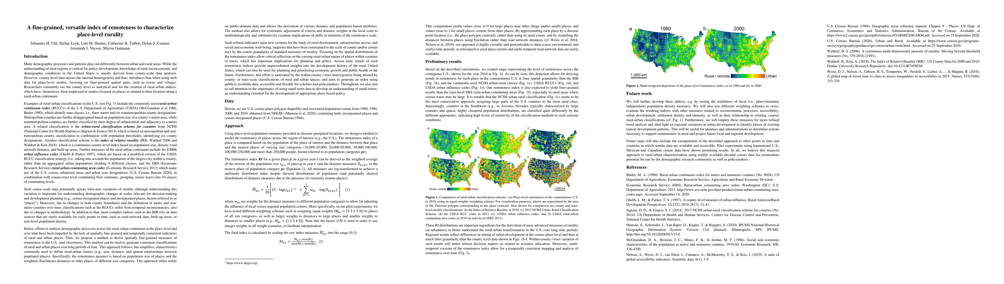
Rural-urban classifications are essential for analyzing geographic, demographic, environmental, or socioeconomic processes across the rural-urban continuum. However, existing county-level classifica...
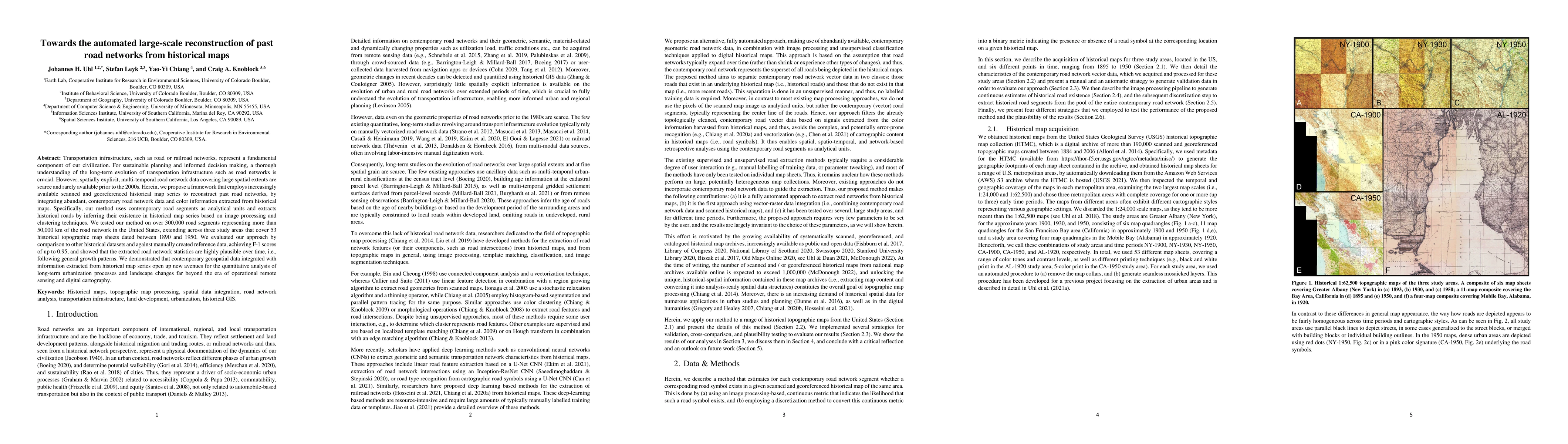
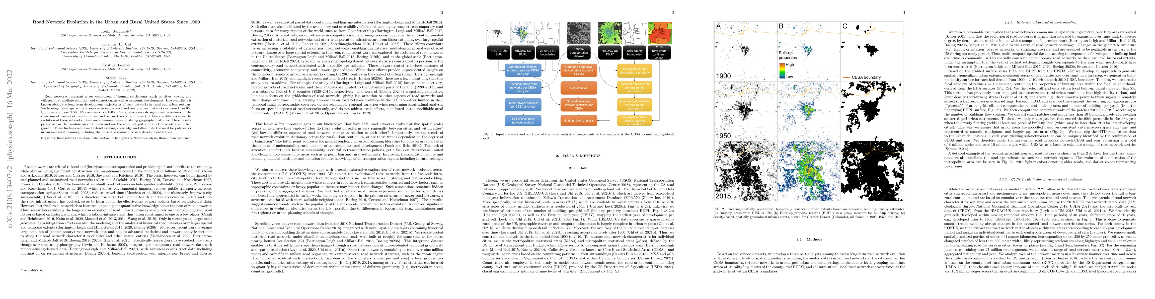
Transportation infrastructure, such as road or railroad networks, represent a fundamental component of our civilization. For sustainable planning and informed decision making, a thorough understandi...
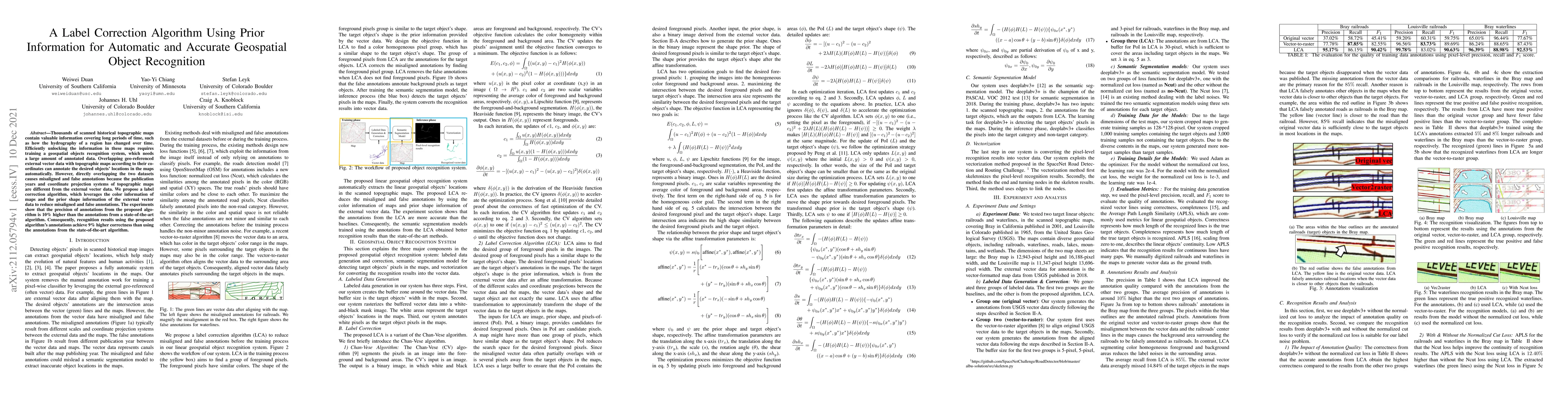
Thousands of scanned historical topographic maps contain valuable information covering long periods of time, such as how the hydrography of a region has changed over time. Efficiently unlocking the ...
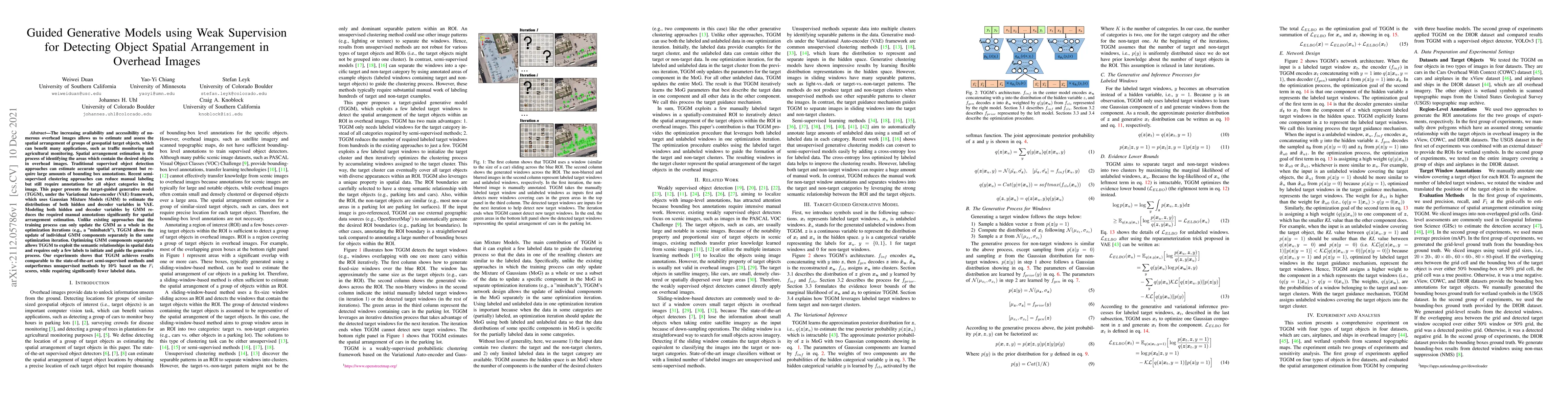
The increasing availability and accessibility of numerous overhead images allows us to estimate and assess the spatial arrangement of groups of geospatial target objects, which can benefit many appl...
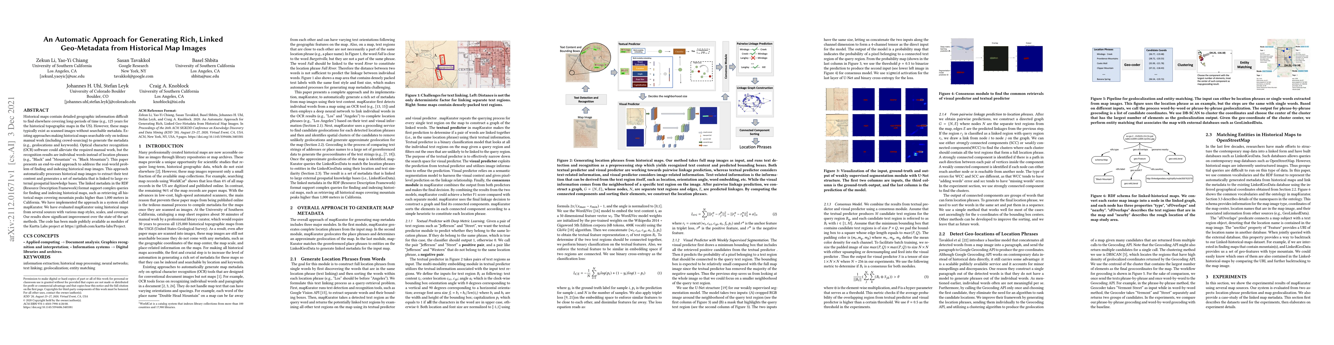
Historical maps contain detailed geographic information difficult to find elsewhere covering long-periods of time (e.g., 125 years for the historical topographic maps in the US). However, these maps...
Road networks represent a key component of human settlements, such as cities, towns, and villages, that mediate pollution and congestion, as well as economic development. However, little is known ab...
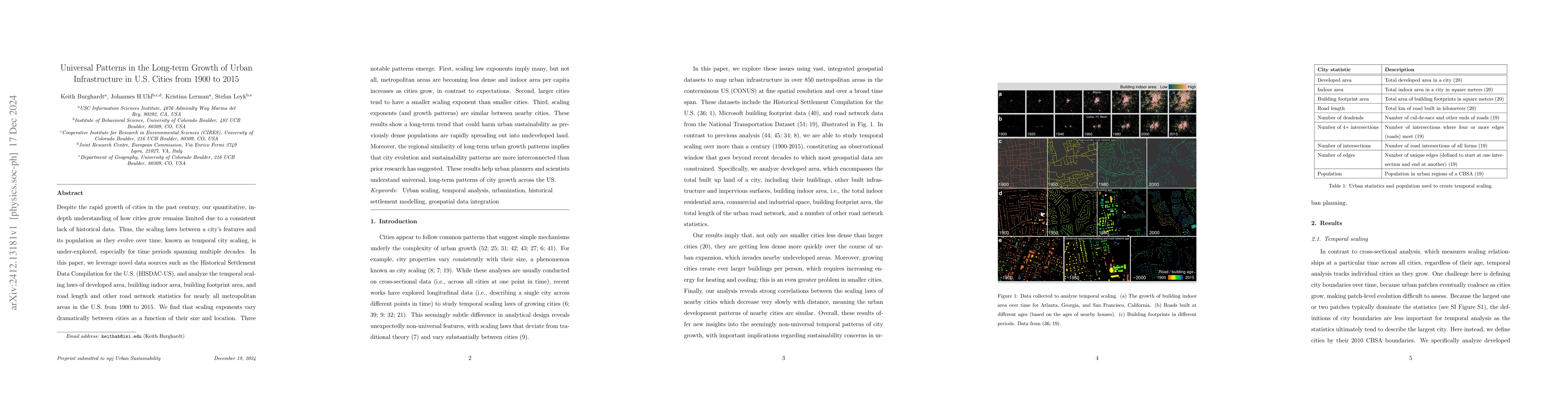
Despite the rapid growth of cities in the past century, our quantitative, in-depth understanding of how cities grow remains limited due to a consistent lack of historical data. Thus, the scaling laws ...
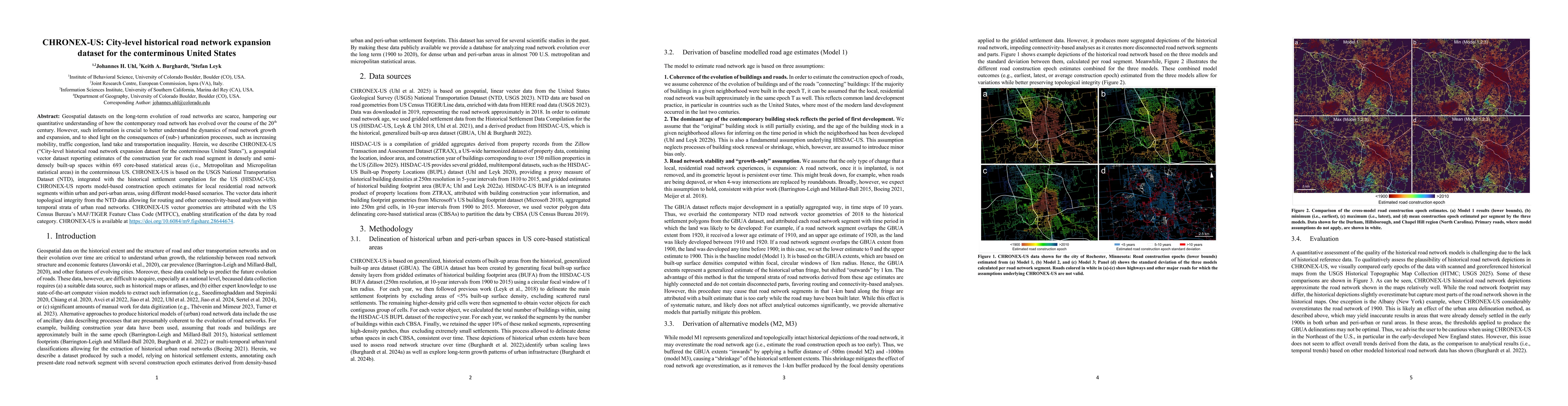
Geospatial datasets on the long-term evolution of road networks are scarce, hampering our quantitative understanding of how the contemporary road network has evolved over the course of the 20th centur...
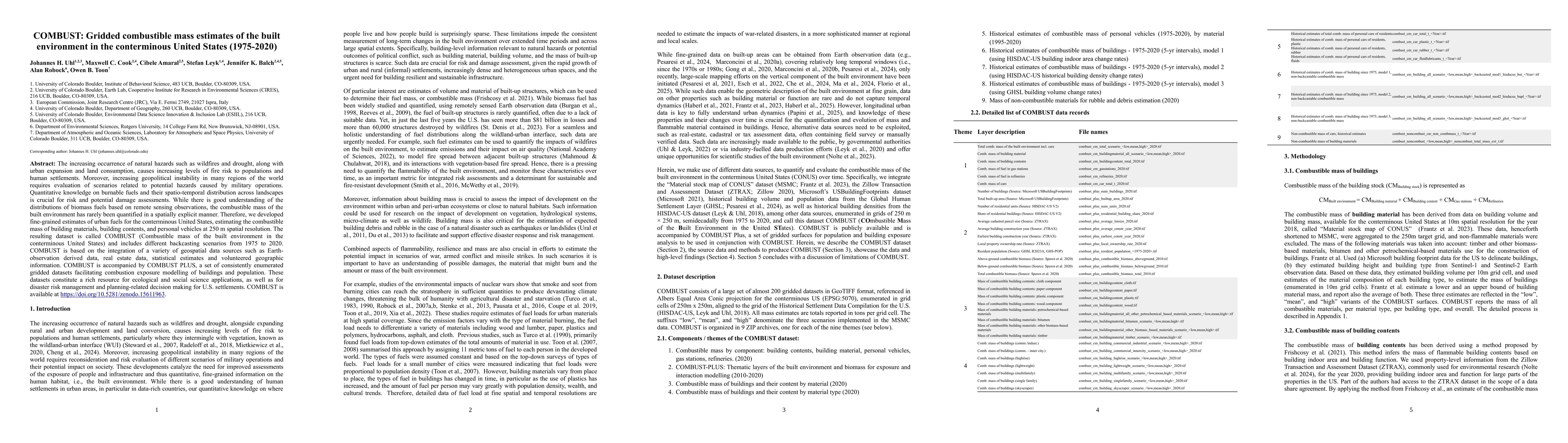
The increasing occurrence of natural hazards such as wildfires and drought, along with urban expansion and land consumption, causes increasing levels of fire risk to populations and human settlements....