Academic Profile
Statistics
Similar Authors
Papers on arXiv
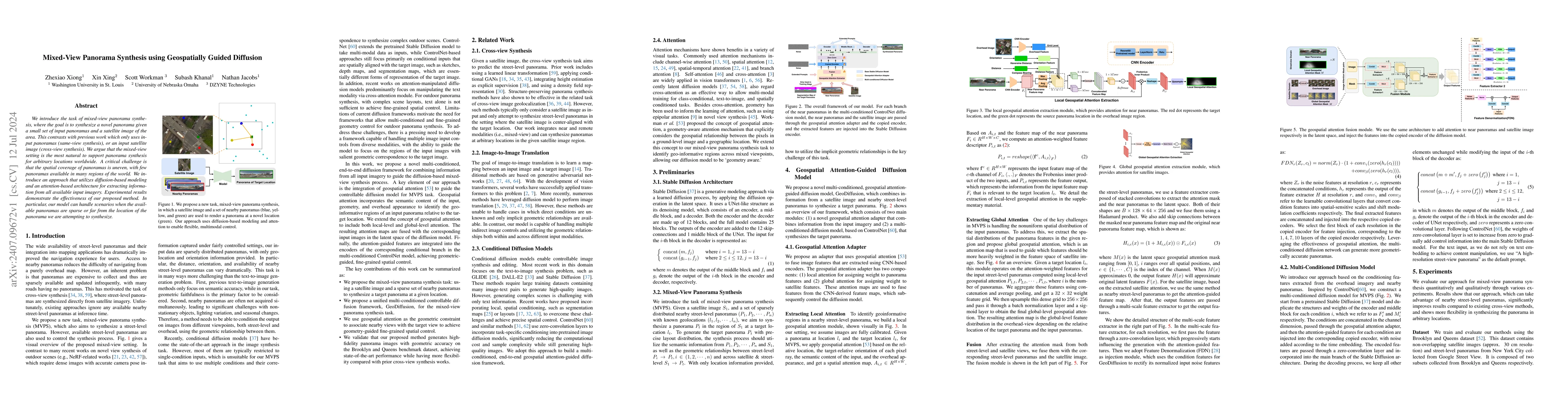
We introduce the task of mixed-view panorama synthesis, where the goal is to synthesize a novel panorama given a small set of input panoramas and a satellite image of the area. This contrasts with pre...
In remote sensing, we are interested in modeling various modalities for some geographic location. Several works have focused on learning the relationship between a location and type of landscape, ha...
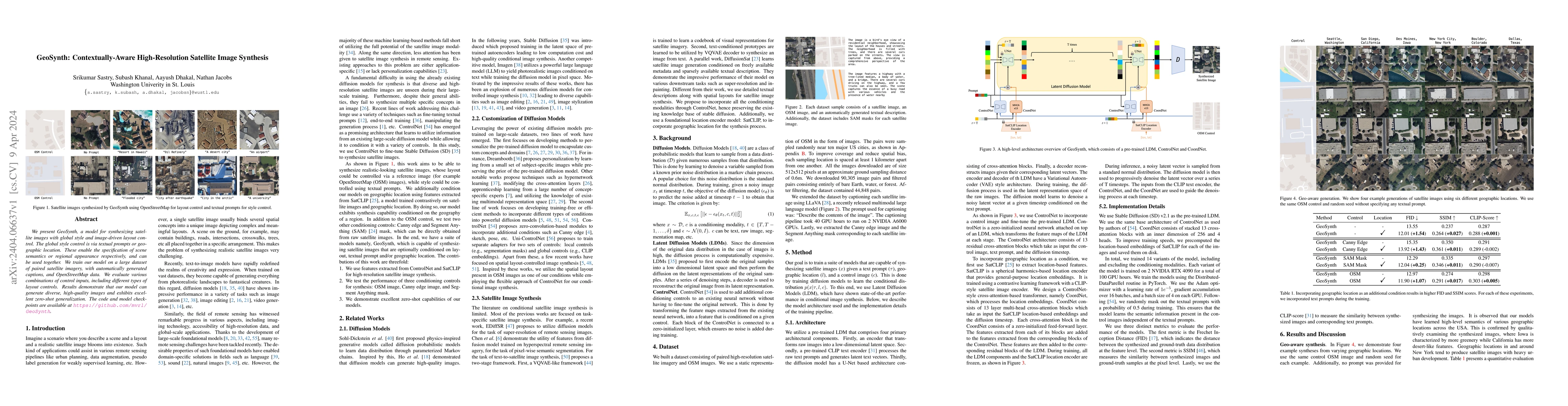
We present GeoSynth, a model for synthesizing satellite images with global style and image-driven layout control. The global style control is via textual prompts or geographic location. These enable...
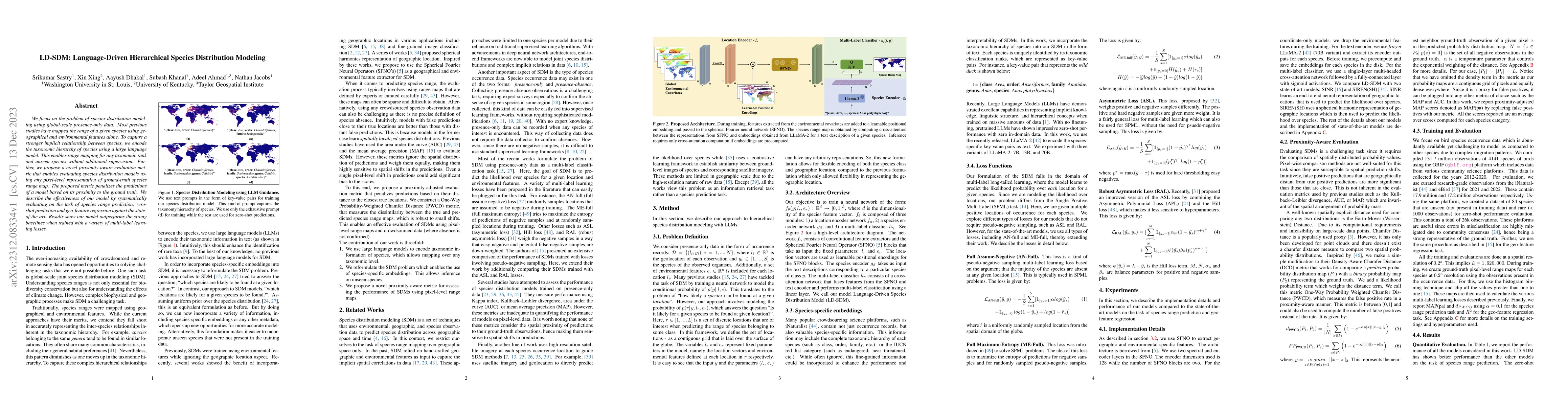
We focus on the problem of species distribution modeling using global-scale presence-only data. Most previous studies have mapped the range of a given species using geographical and environmental fe...
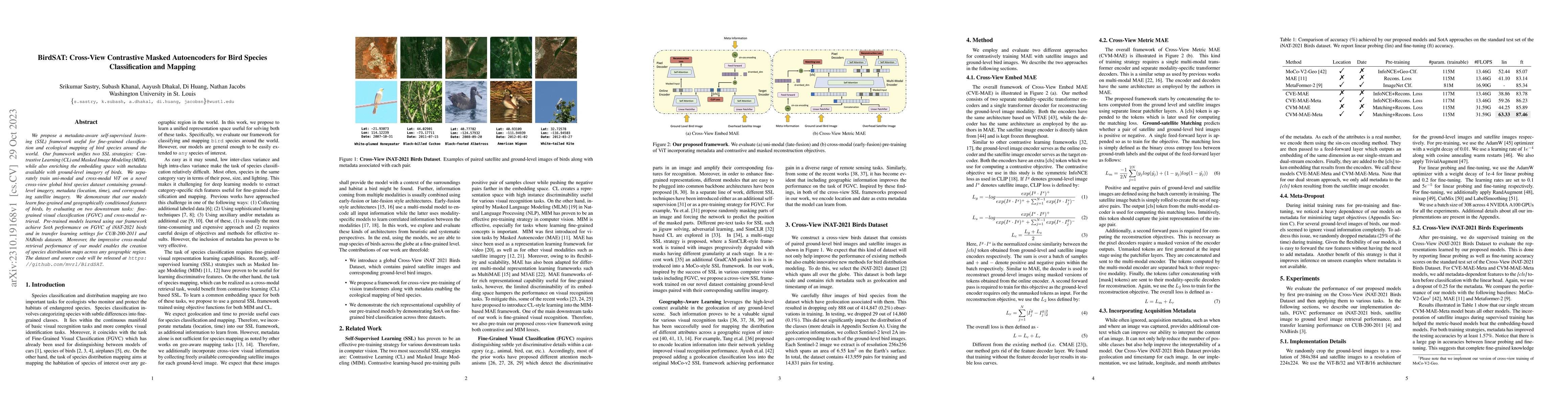
We propose a metadata-aware self-supervised learning~(SSL)~framework useful for fine-grained classification and ecological mapping of bird species around the world. Our framework unifies two SSL str...
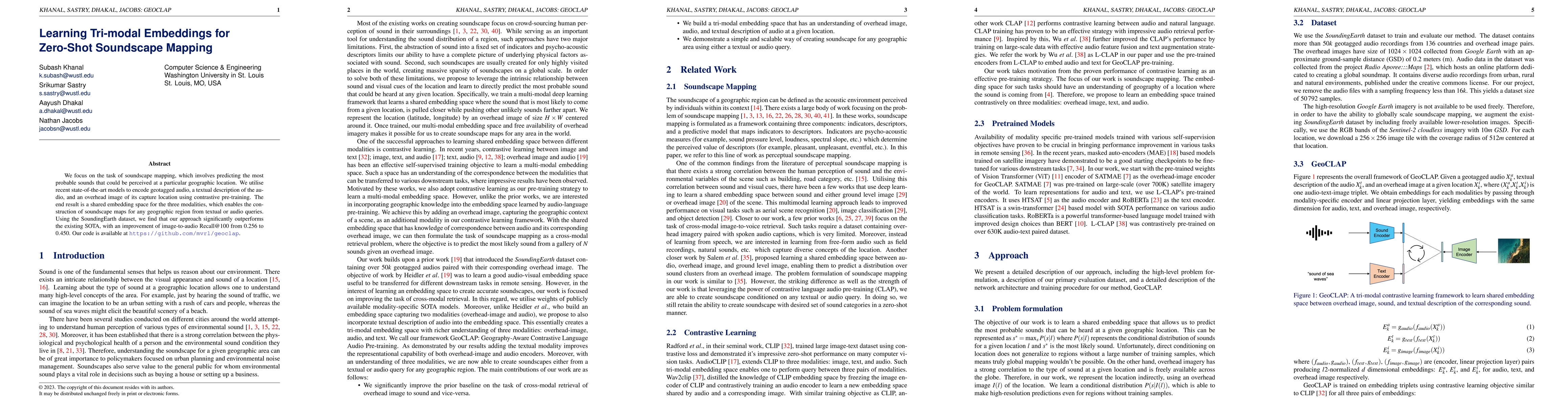
We focus on the task of soundscape mapping, which involves predicting the most probable sounds that could be perceived at a particular geographic location. We utilise recent state-of-the-art models ...
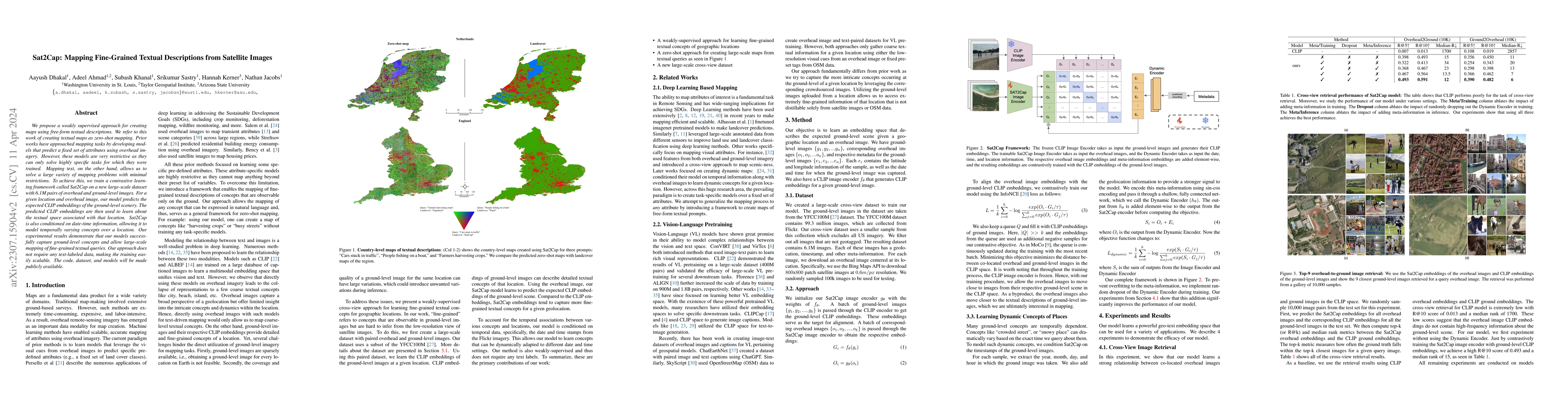
We propose a weakly supervised approach for creating maps using free-form textual descriptions. We refer to this work of creating textual maps as zero-shot mapping. Prior works have approached mappi...
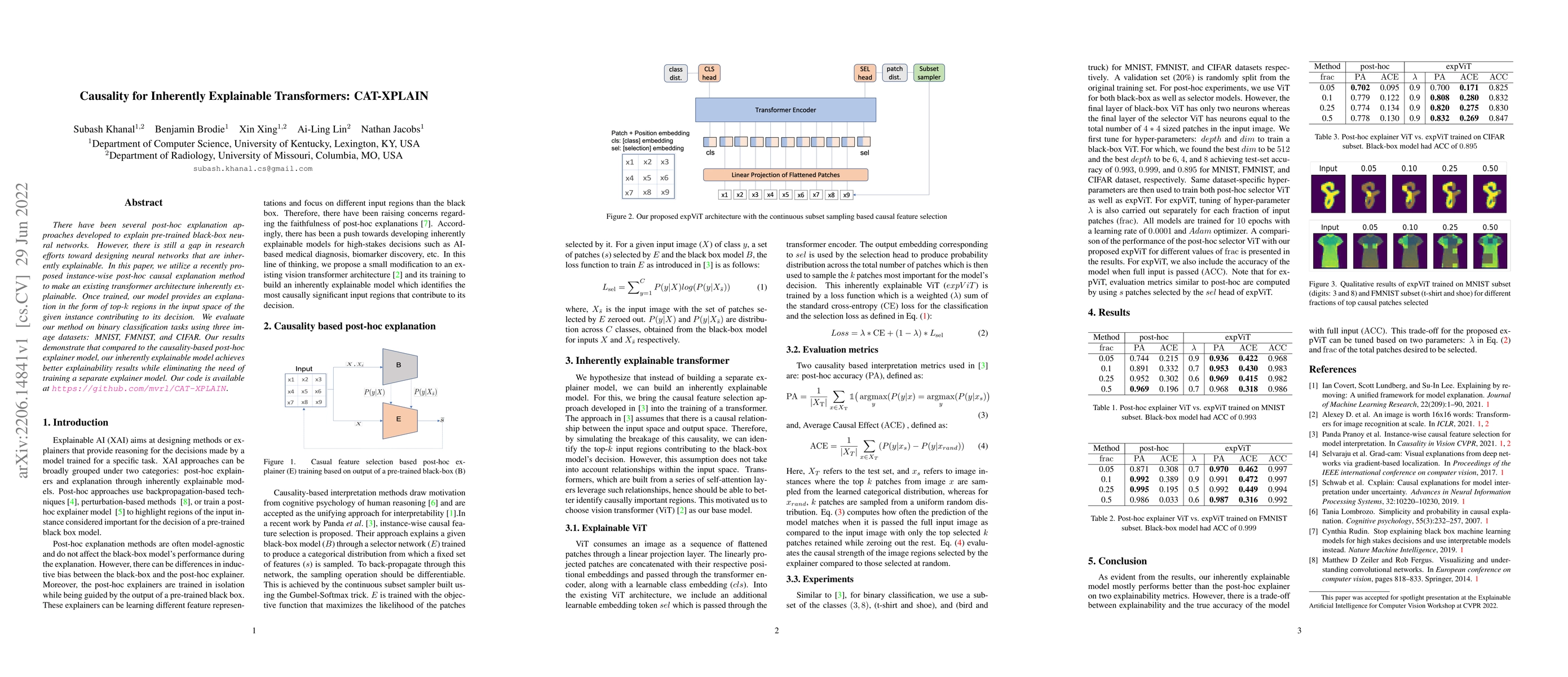
There have been several post-hoc explanation approaches developed to explain pre-trained black-box neural networks. However, there is still a gap in research efforts toward designing neural networks...
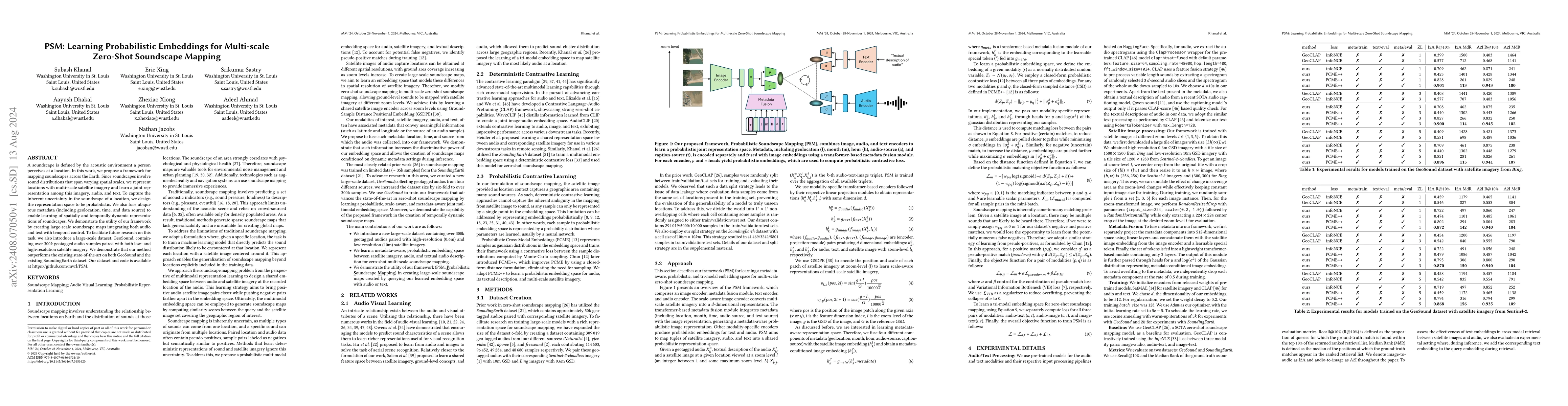
A soundscape is defined by the acoustic environment a person perceives at a location. In this work, we propose a framework for mapping soundscapes across the Earth. Since soundscapes involve sound dis...
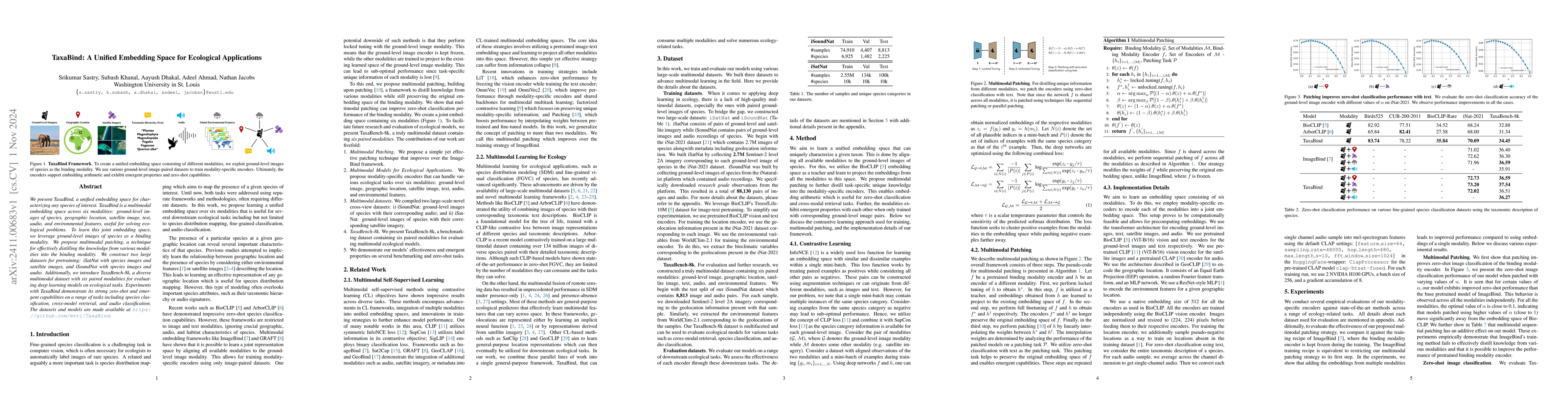
We present TaxaBind, a unified embedding space for characterizing any species of interest. TaxaBind is a multimodal embedding space across six modalities: ground-level images of species, geographic lo...
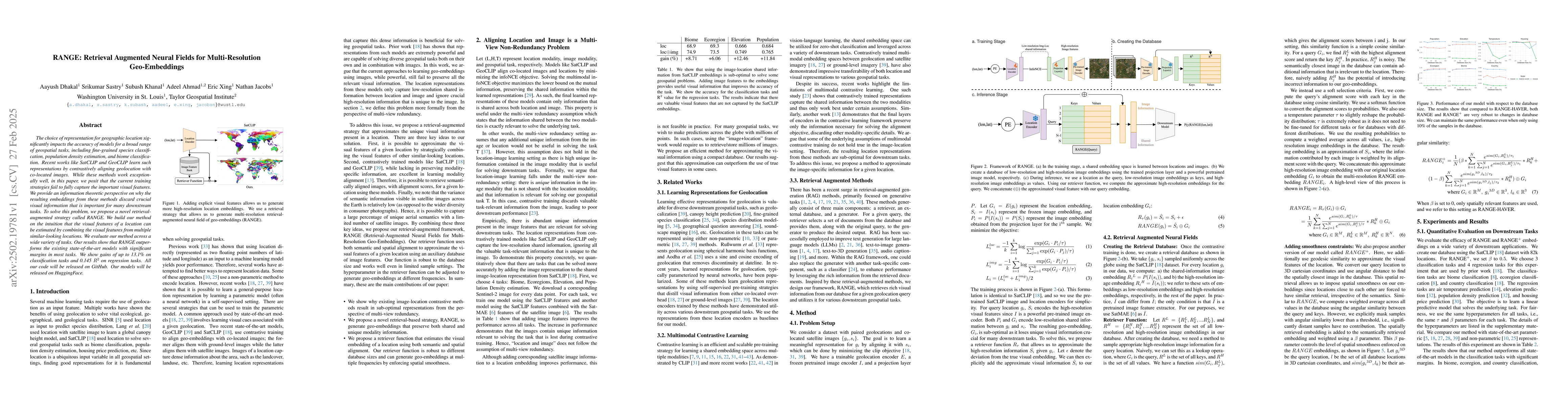
The choice of representation for geographic location significantly impacts the accuracy of models for a broad range of geospatial tasks, including fine-grained species classification, population densi...
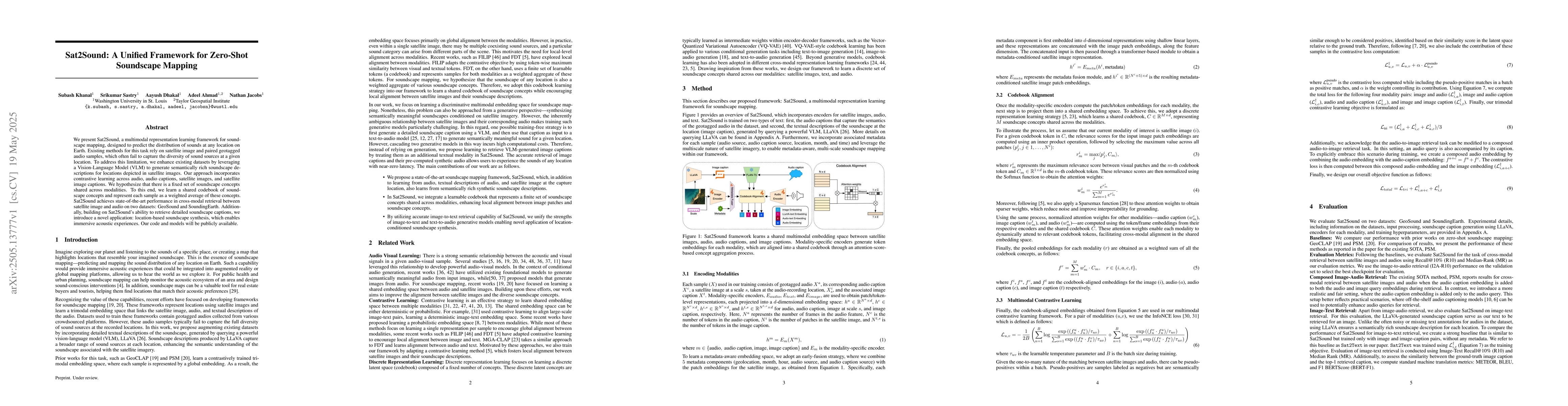
We present Sat2Sound, a multimodal representation learning framework for soundscape mapping, designed to predict the distribution of sounds at any location on Earth. Existing methods for this task rel...
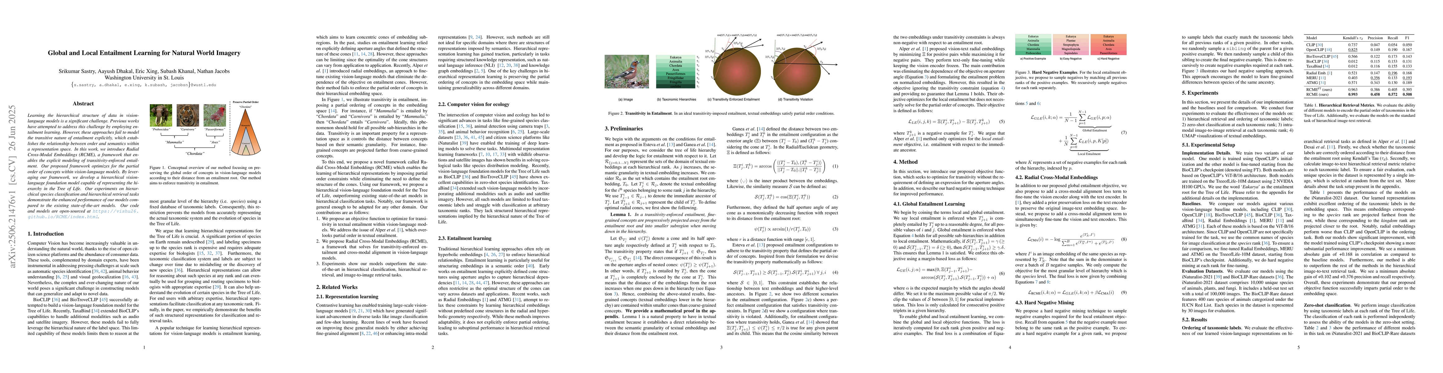
Learning the hierarchical structure of data in vision-language models is a significant challenge. Previous works have attempted to address this challenge by employing entailment learning. However, the...
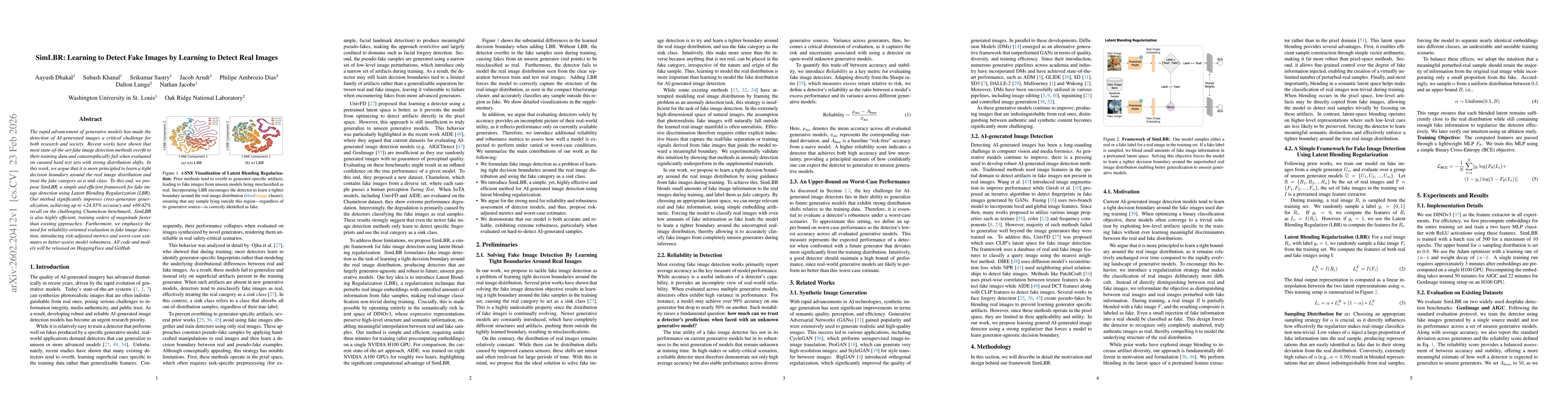
The rapid advancement of generative models has made the detection of AI-generated images a critical challenge for both research and society. Recent works have shown that most state-of-the-art fake ima...
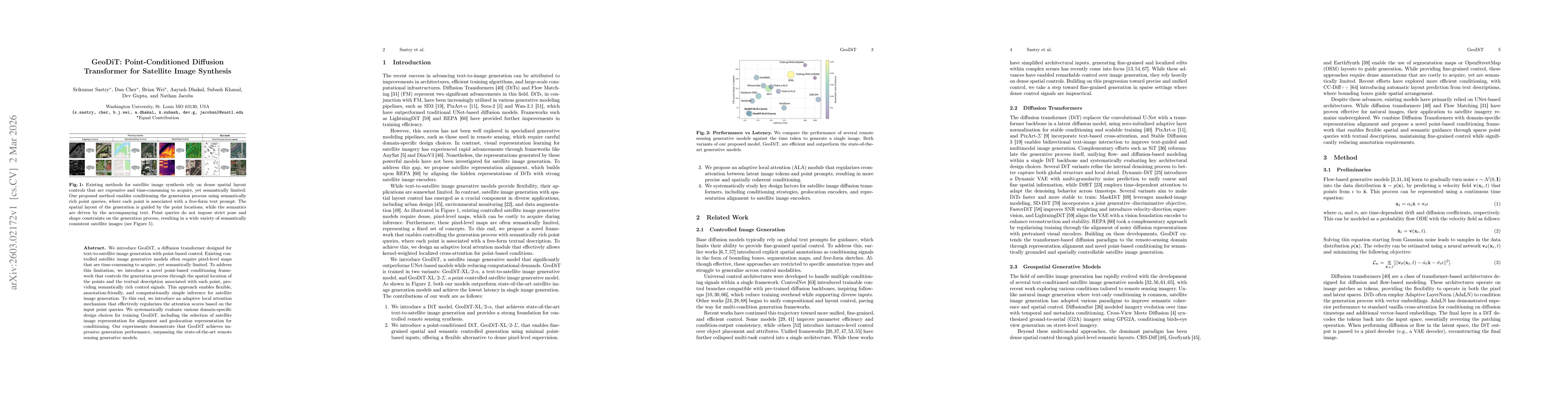
We introduce GeoDiT, a diffusion transformer designed for text-to-satellite image generation with point-based control. Existing controlled satellite image generative models often require pixel-level m...
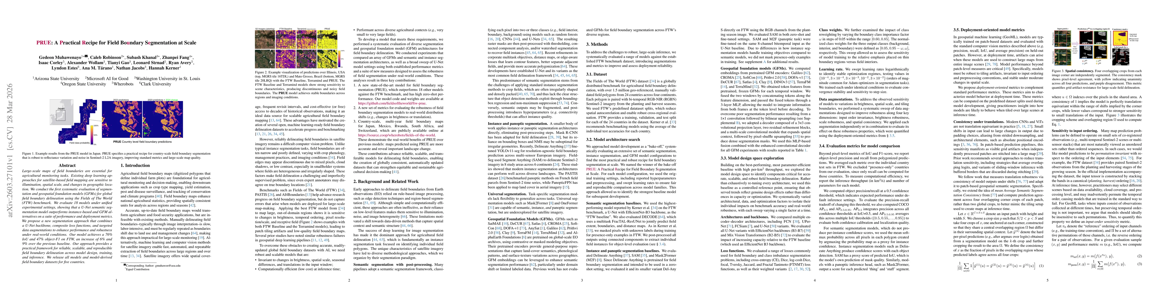
Large-scale maps of field boundaries are essential for agricultural monitoring tasks. Existing deep learning approaches for satellite-based field mapping are sensitive to illumination, spatial scale, ...
The agricultural field is the natural unit at which crops are planted, managed, regulated, and reported, yet most global remote-sensing products for agriculture are only available at the pixel level. ...