Academic Profile
Statistics
Similar Authors
Papers on arXiv
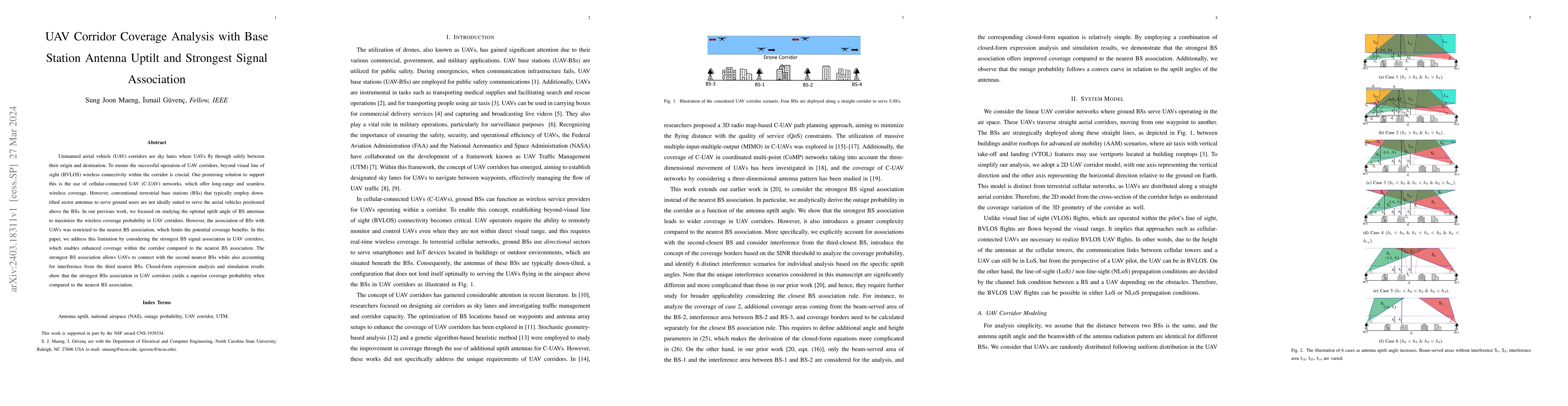
Unmanned aerial vehicle (UAV) corridors are sky lanes where UAVs fly through safely between their origin and destination. To ensure the successful operation of UAV corridors, beyond visual line of s...
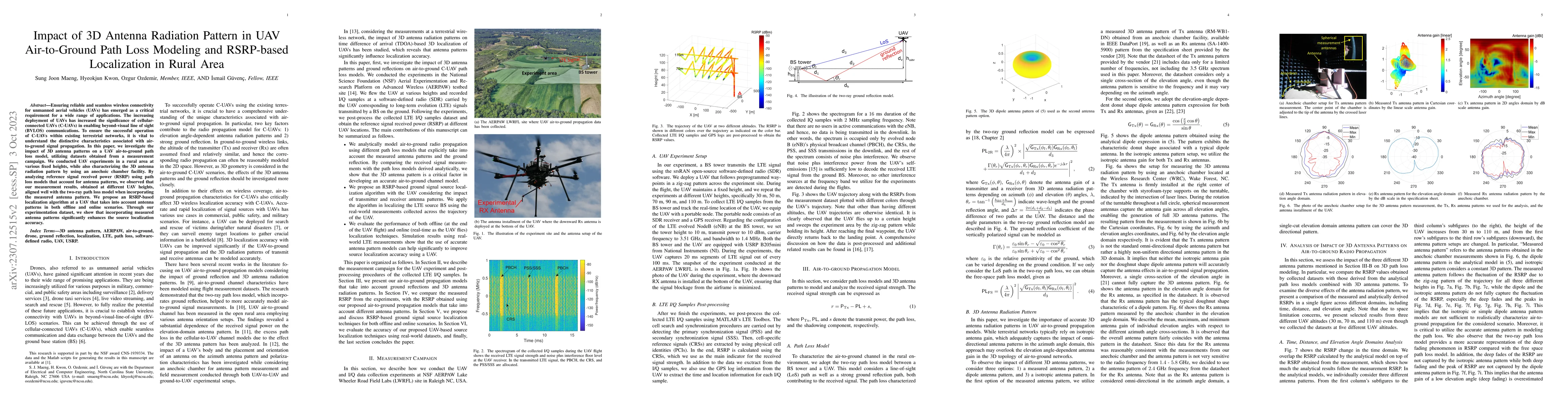
Ensuring reliable and seamless wireless connectivity for unmanned aerial vehicles (UAVs) has emerged as a critical requirement for a wide range of applications. The increasing deployment of UAVs has...
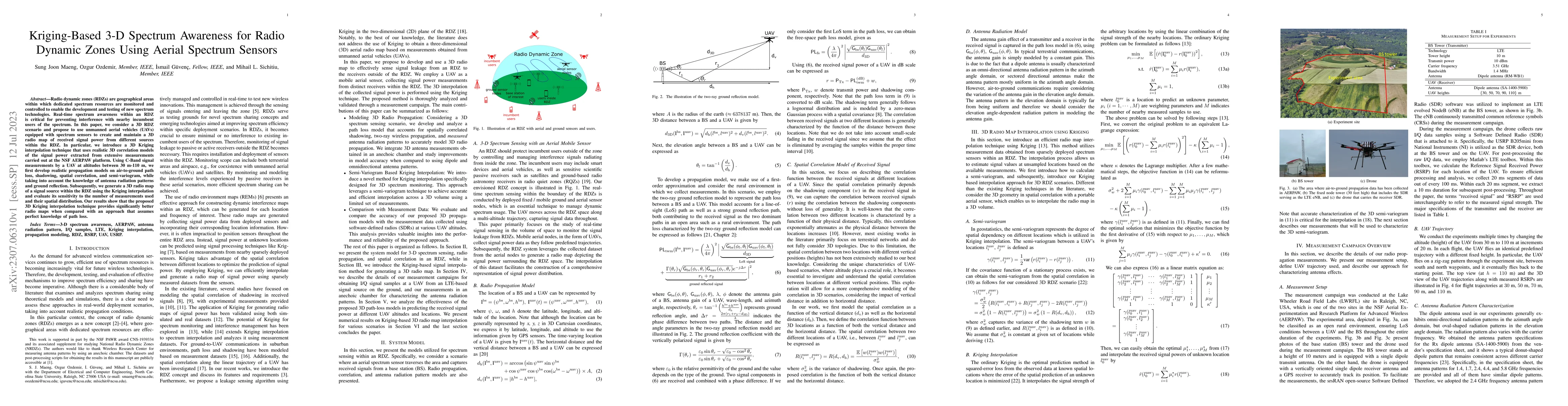
Radio dynamic zones (RDZs) are geographical areas within which dedicated spectrum resources are monitored and controlled to enable the development and testing of new spectrum technologies. Real-time...
Advancements in unmanned aerial vehicle (UAV) technology have led to their increased utilization in various commercial and military applications. One such application is signal source search and loc...
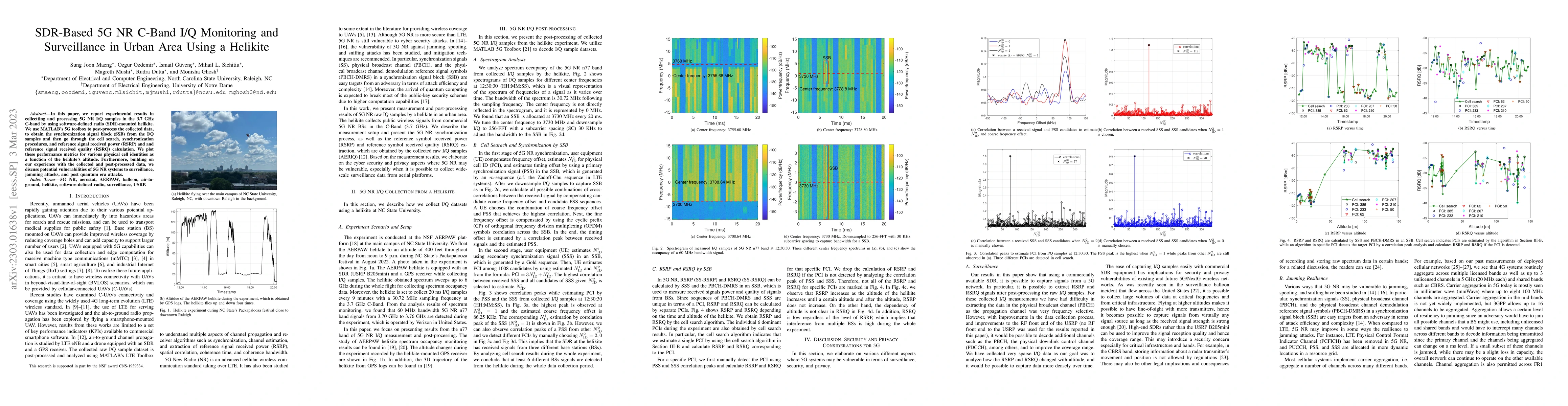
In this paper, we report experimental results in collectting and processing 5G NR I/Q samples in the 3.7~GHz C-band by using software-defined radio (SDR)-mounted helikite. We use MATLAB's 5G toolbox...
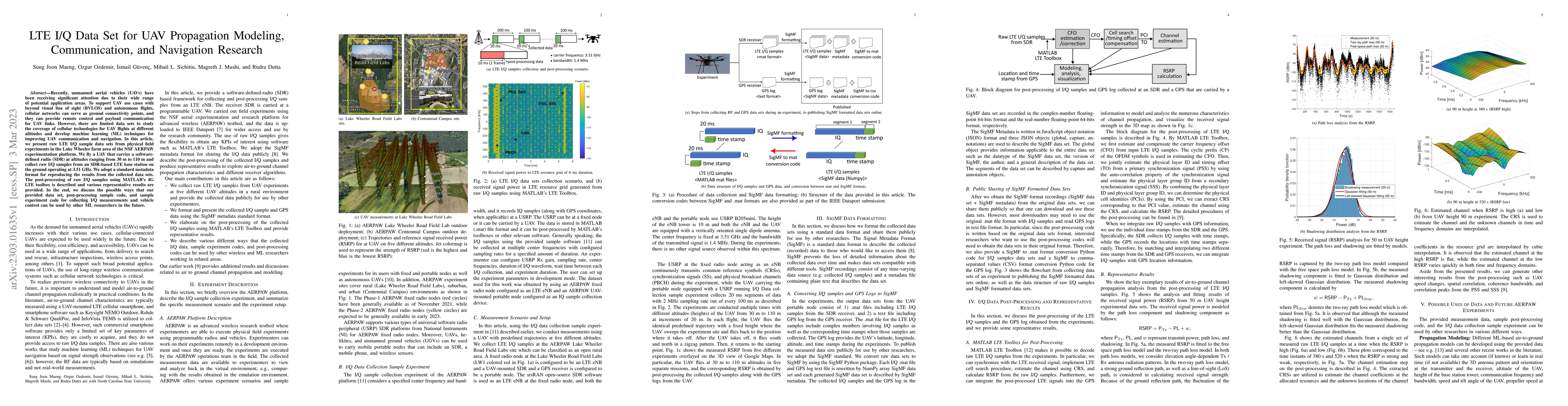
Recently, unmanned aerial vehicles (UAVs) have been receiving significant attention due to their wide range of potential application areas. To support UAV use cases with beyond visual line of sight ...
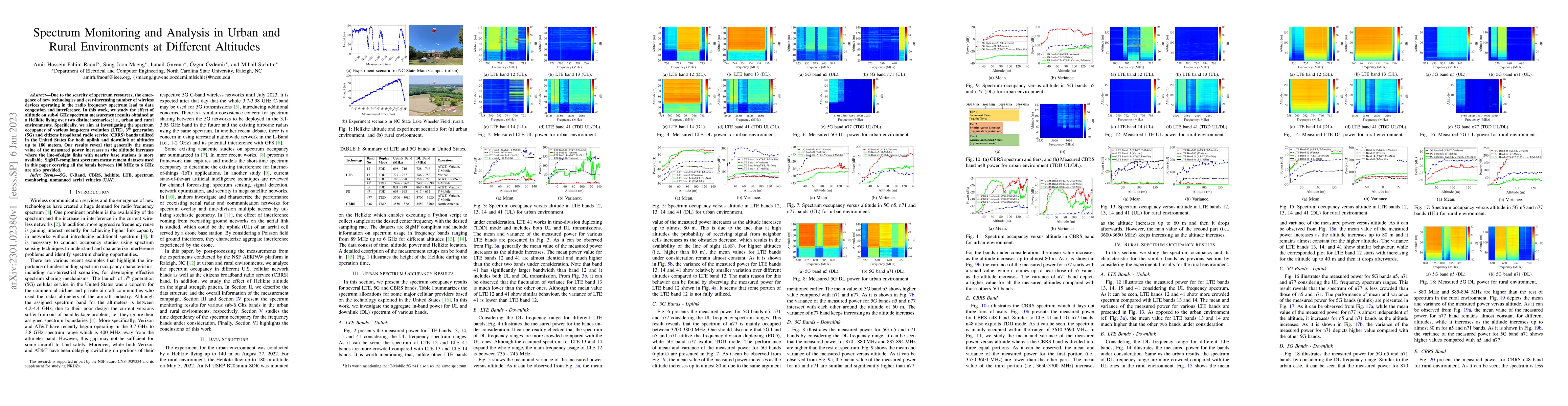
Due to the scarcity of spectrum resources, the emergence of new technologies and ever-increasing number of wireless devices operating in the radio frequency spectrum lead to data congestion and inte...
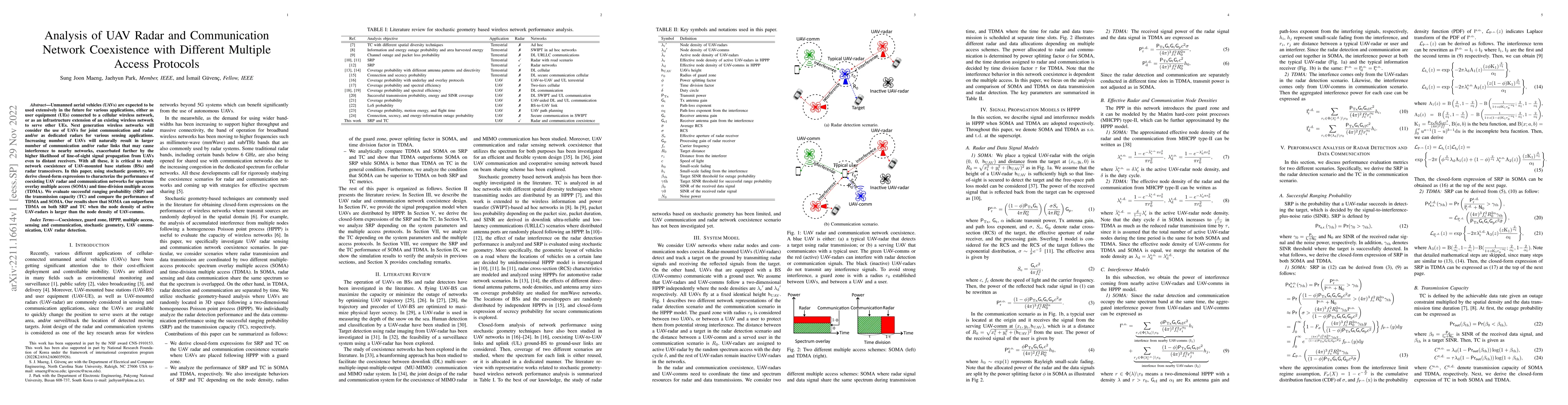
Unmanned aerial vehicles (UAVs) are expected to be used extensively in the future for various applications, either as user equipment (UEs) connected to a cellular wireless network, or as an infrastr...
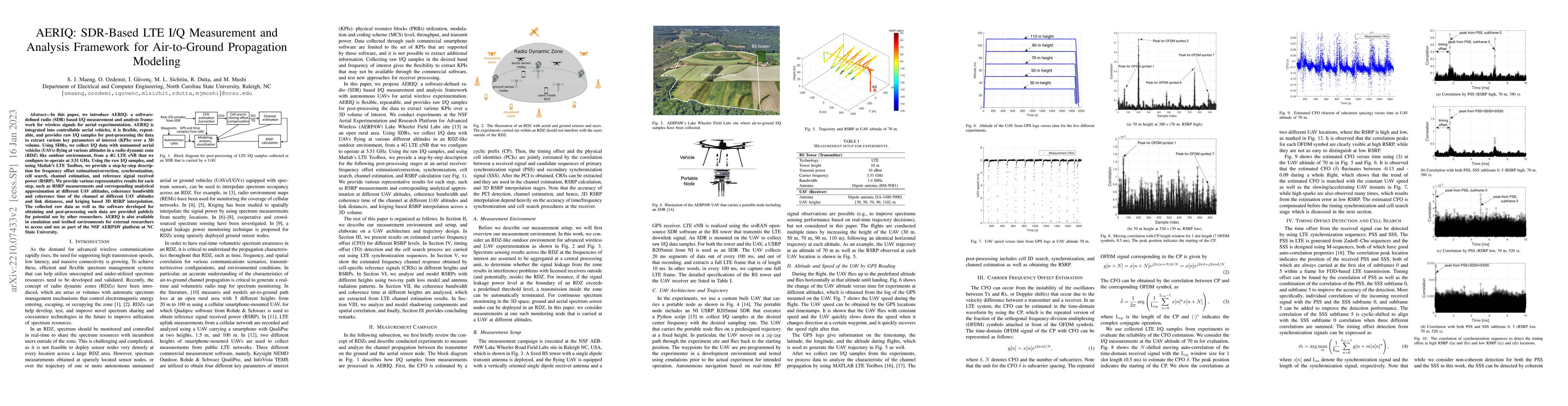
In this paper, we introduce AERIQ: a software-defined radio (SDR) based I/Q measurement and analysis framework for wireless signals for aerial experimentation. AERIQ is integrated into controllable ...
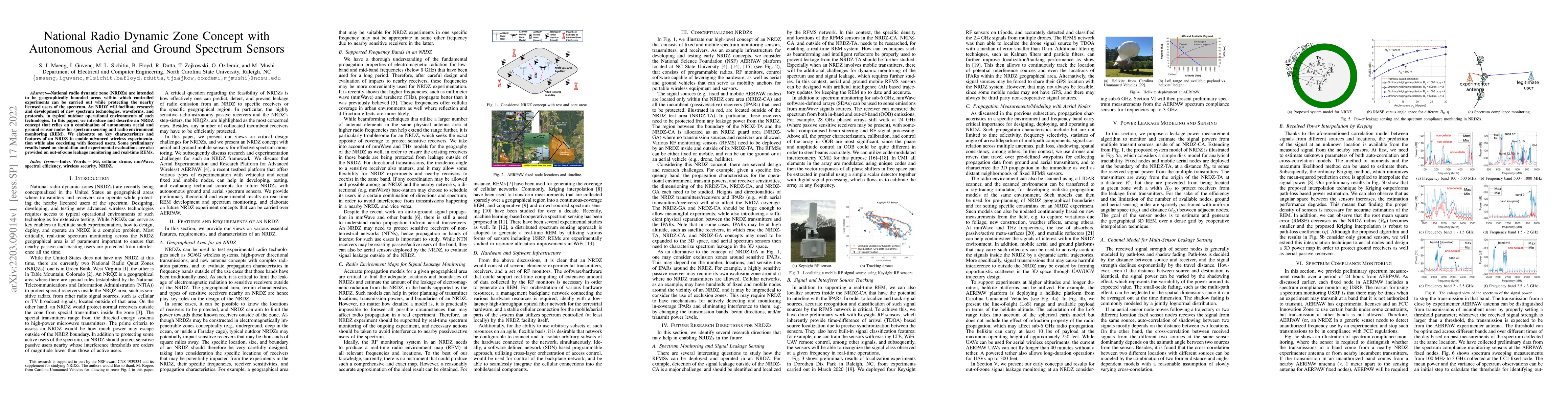
National radio dynamic zone (NRDZs) are intended to be geographically bounded areas within which controlled experiments can be carried out while protecting the nearby licensed users of the spectrum....
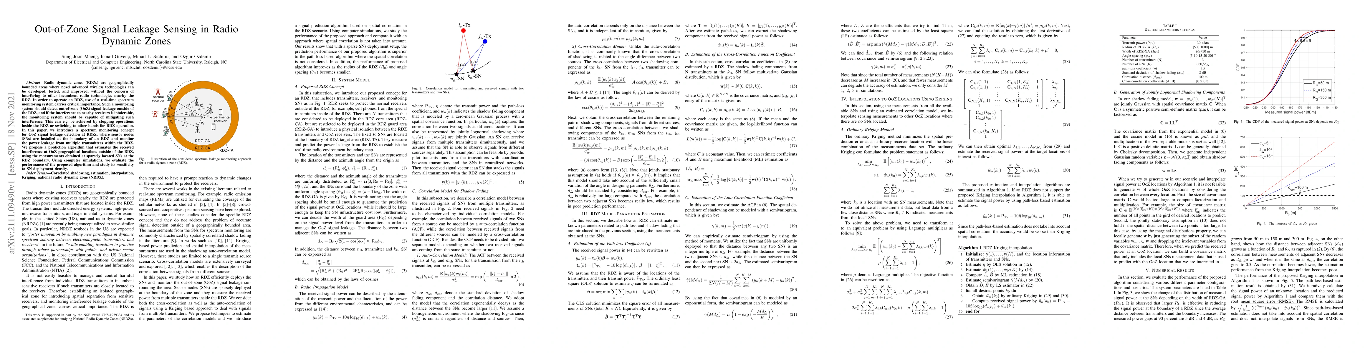
Radio dynamic zones (RDZs) are geographically bounded areas where novel advanced wireless technologies can be developed, tested, and improved, without the concern of interfering to other incumbent r...
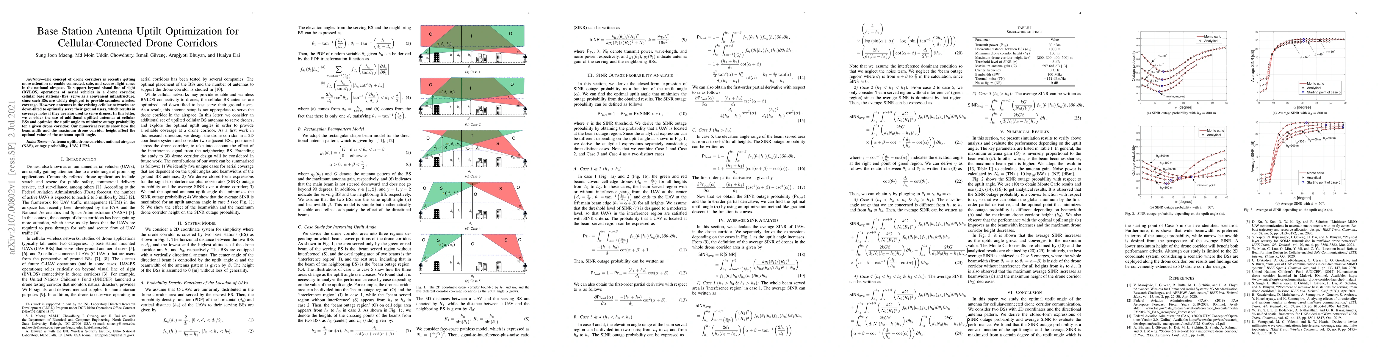
The concept of drone corridors is recently getting more attention to enable connected, safe, and secure flight zones in the national airspace. To support beyond visual line of sight (BVLOS) operatio...
Supporting reliable and seamless wireless connectivity for unmanned aerial vehicles (UAVs) has recently become a critical requirement to enable various different use cases of UAVs. Due to their wide...
Physical layer security (PLS) techniques can help to protect wireless networks from eavesdropper attacks. In this paper, we consider the authentication technique that uses fingerprint embedding to d...
Partially-overlapping tones (POT) are known to help mitigate co-channel interference in uncoordinated multi-carrier networks by introducing intentional frequency offsets (FOs) to the transmitted sig...
The integration of unmanned aerial vehicles (UAVs) into the terrestrial cellular networks is envisioned as one key technology for next-generation wireless communications. In this work, we consider t...
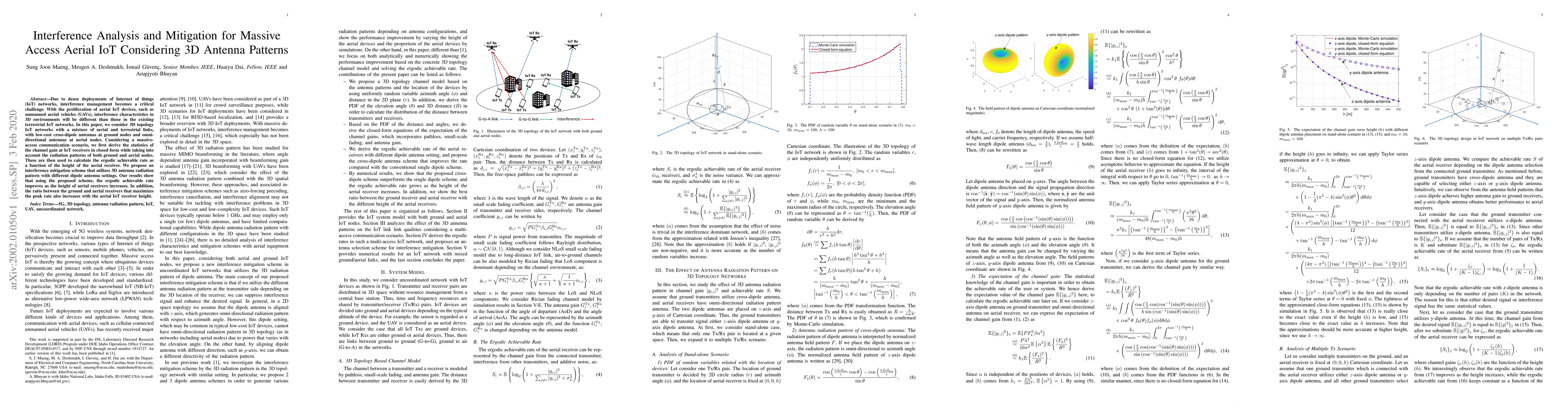
Due to dense deployments of Internet of things (IoT) networks, interference management becomes a critical challenge. With the proliferation of aerial IoT devices, such as unmanned aerial vehicles (U...
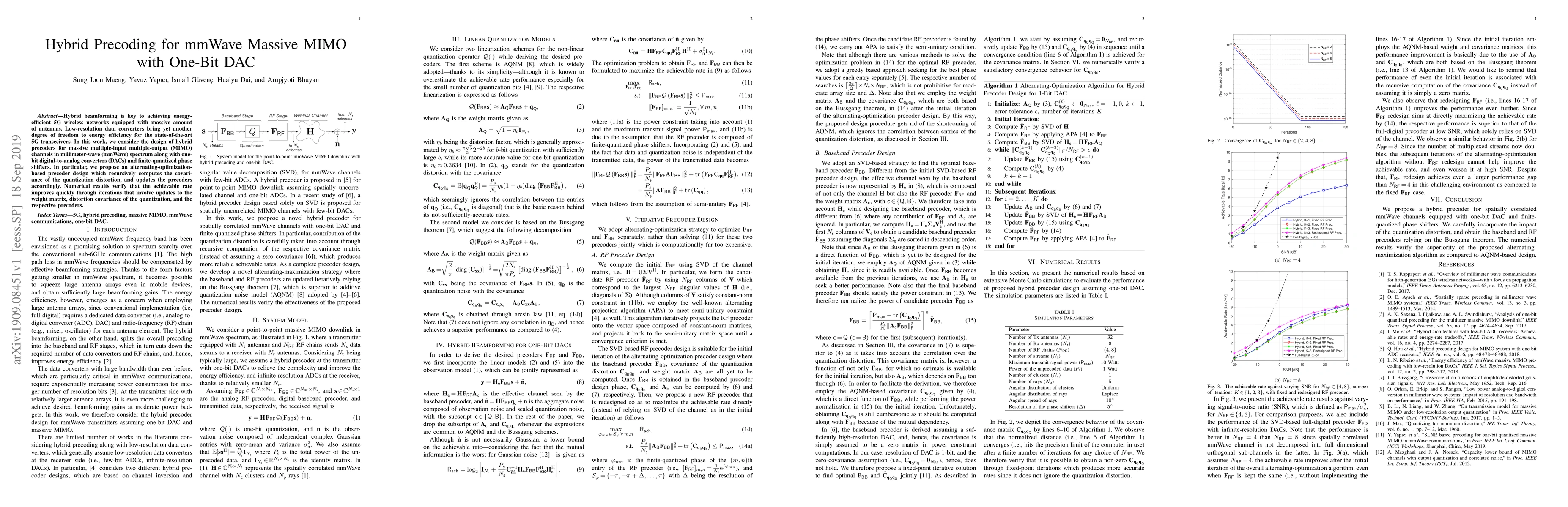
Hybrid beamforming is key to achieving energy-efficient 5G wireless networks equipped with massive amount of antennas. Low-resolution data converters bring yet another degree of freedom to energy ef...
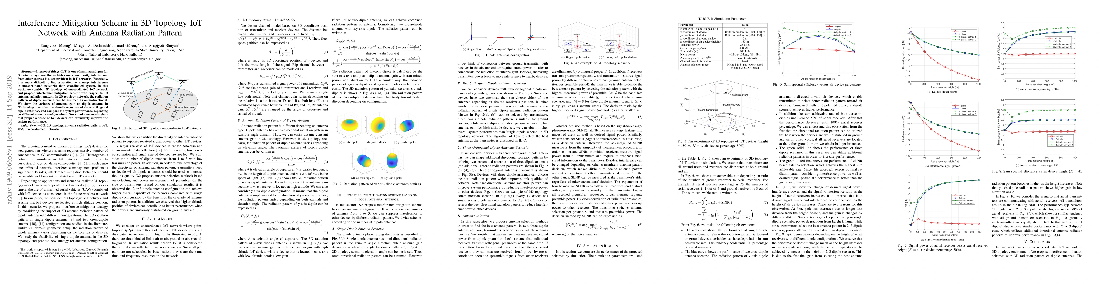
Internet of things (IoT) is one of main paradigms for 5G wireless systems. Due to high connection density, interference from other sources is a key problem in IoT networks. Especially, it is more di...
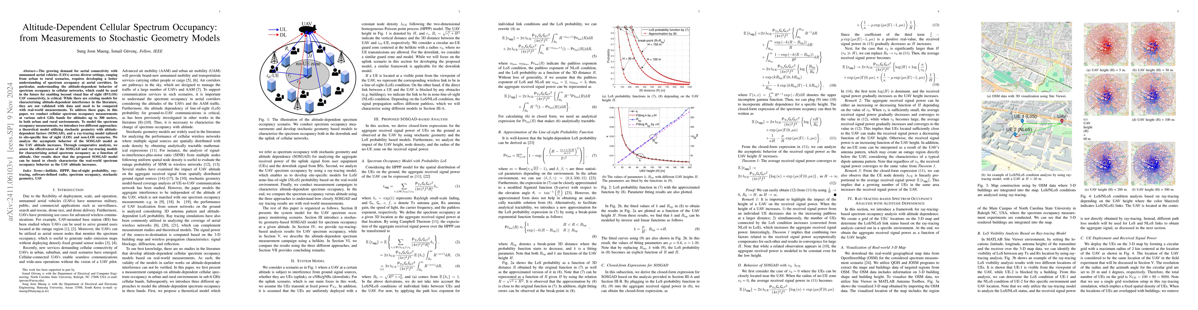
The growing demand for aerial connectivity with unmanned aerial vehicles (UAVs) across diverse settings, ranging from urban to rural scenarios, requires developing a better understanding of spectrum o...
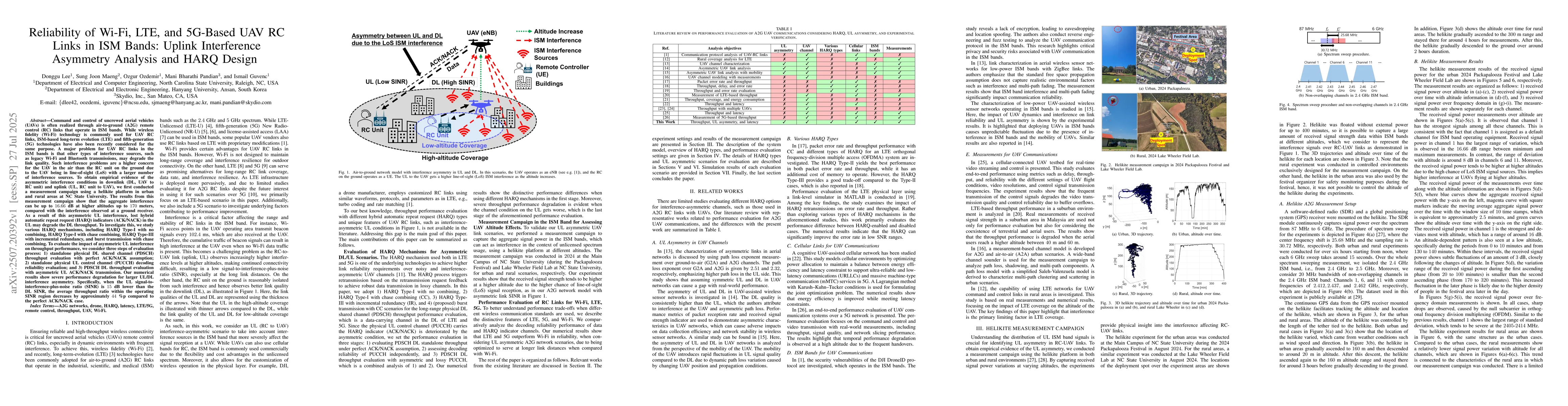
Command and control of uncrewed aerial vehicles (UAVs) is often realized through air-to-ground (A2G) remote control (RC) links that operate in ISM bands. While wireless fidelity (Wi-Fi) technology is ...
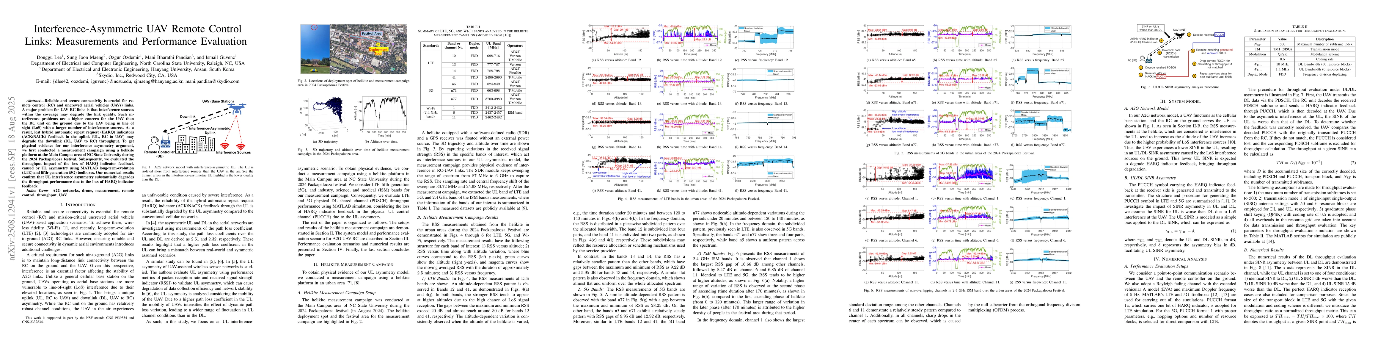
Reliable and secure connectivity is crucial for remote control (RC) and uncrewed aerial vehicles (UAVs) links. A major problem for UAV RC links is that interference sources within the coverage may deg...
The integration of unmanned aerial vehicles (UAVs) into 5G-Advanced and future 6G networks presents a transformative opportunity for wireless connectivity, enabling agile deployment and improved LoS c...
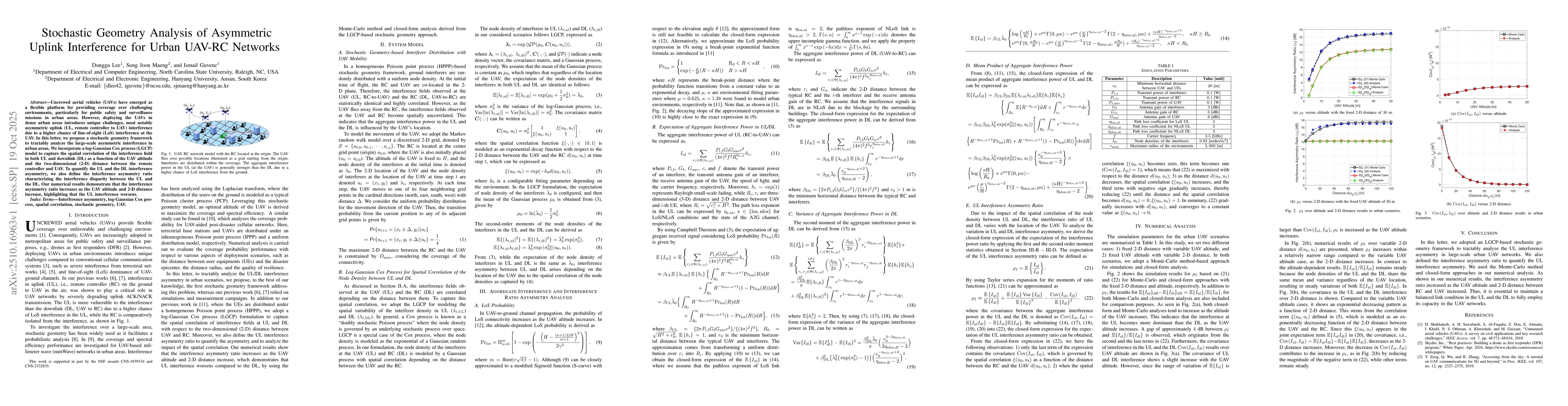
Uncrewed aerial vehicles (UAVs) have emerged as a flexible platform for providing coverage over challenging environments, particularly for public safety and surveillance missions in urban areas. Howev...
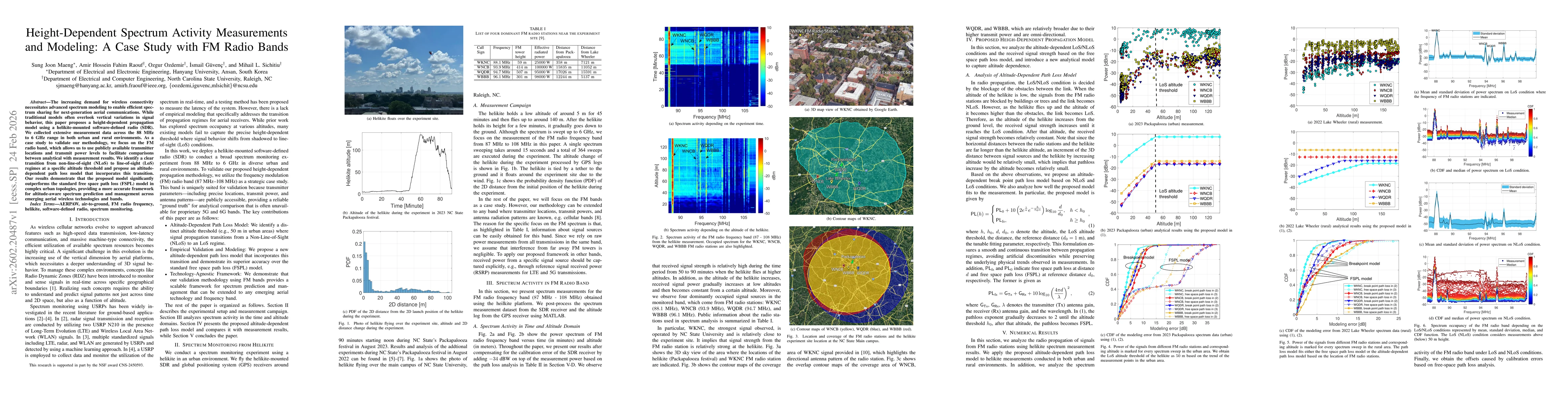
The increasing demand for wireless connectivity necessitates advanced spectrum modeling to enable efficient spectrum sharing for next-generation aerial communications. While traditional models often o...
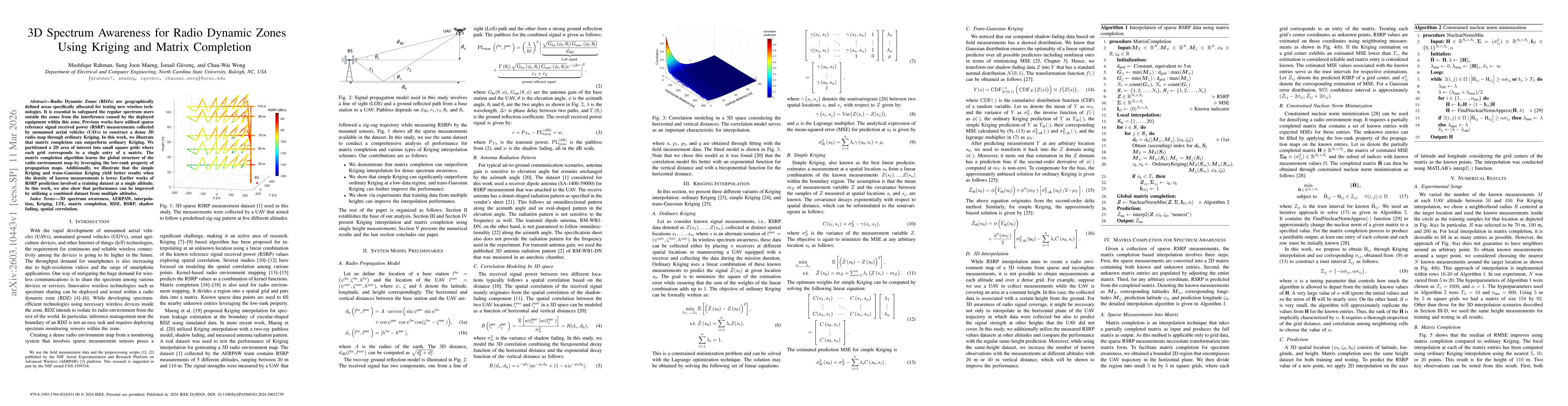
Radio Dynamic Zones (RDZs) are geographically defined areas specifically allocated for testing new wireless technologies. It is essential to safeguard the regular spectrum users outside the zones from...
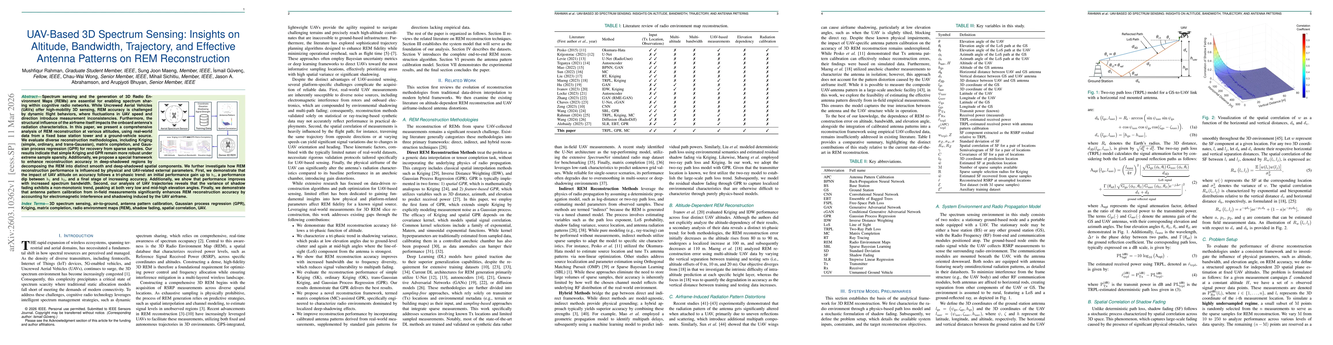
Spectrum sensing and the generation of 3D Radio Environment Maps (REMs) are essential for enabling spectrum sharing within cognitive radio networks. While Uncrewed Aerial Vehicles (UAVs) offer high-mo...