Academic Profile
Statistics
Similar Authors
Papers on arXiv
Accurately assessing building damage is critical for disaster response and recovery. However, many existing models for detecting building damage have poor prediction accuracy due to their limited ca...
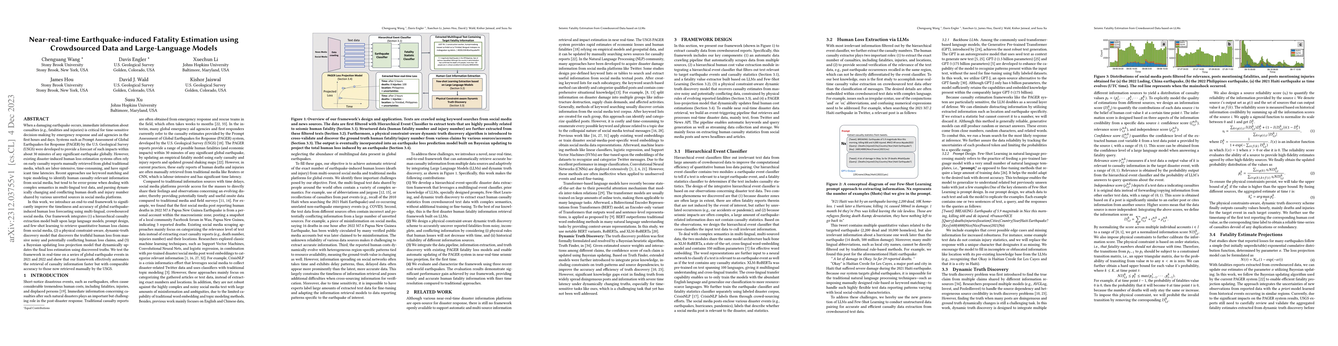
When a damaging earthquake occurs, immediate information about casualties is critical for time-sensitive decision-making by emergency response and aid agencies in the first hours and days. Systems s...
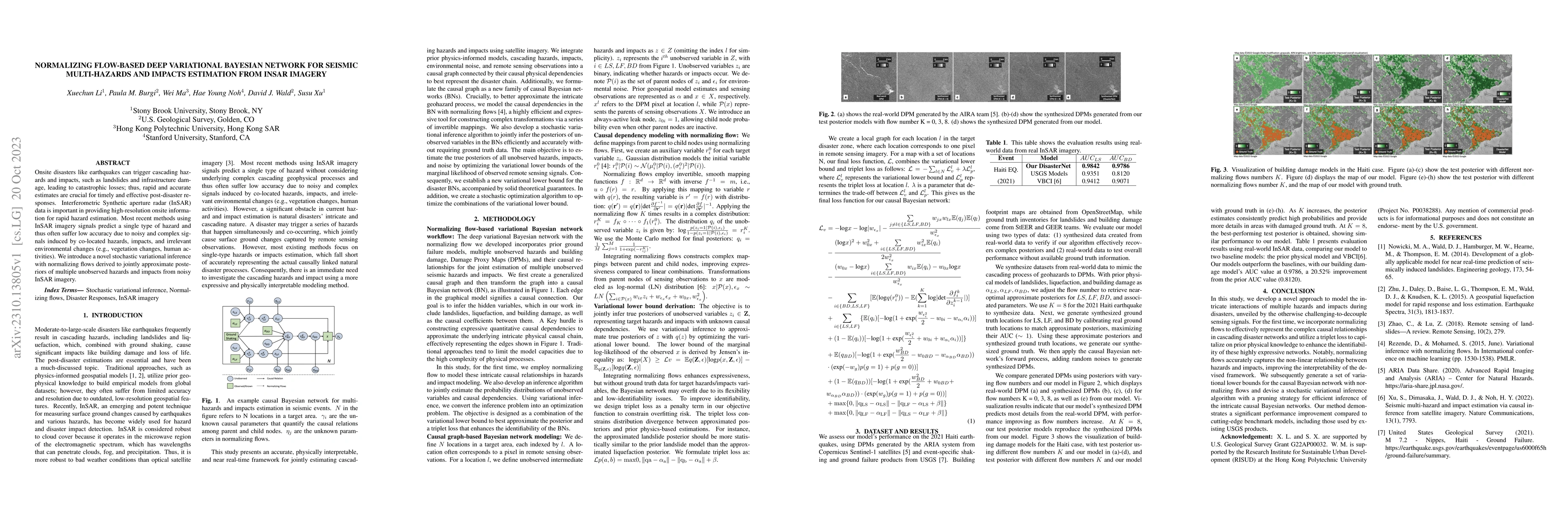
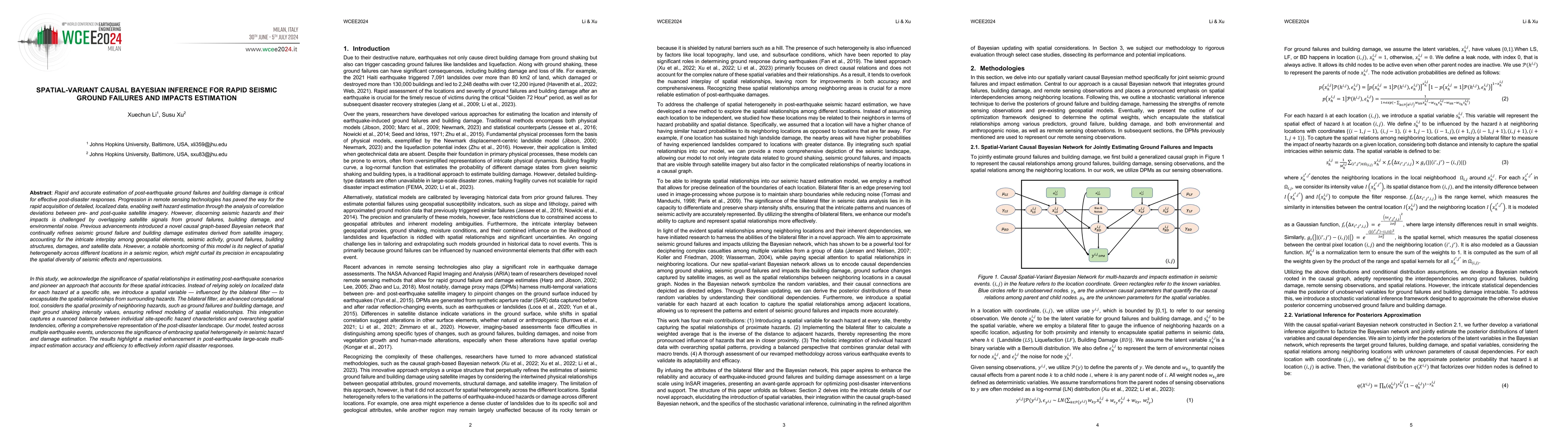
Onsite disasters like earthquakes can trigger cascading hazards and impacts, such as landslides and infrastructure damage, leading to catastrophic losses; thus, rapid and accurate estimates are cruc...
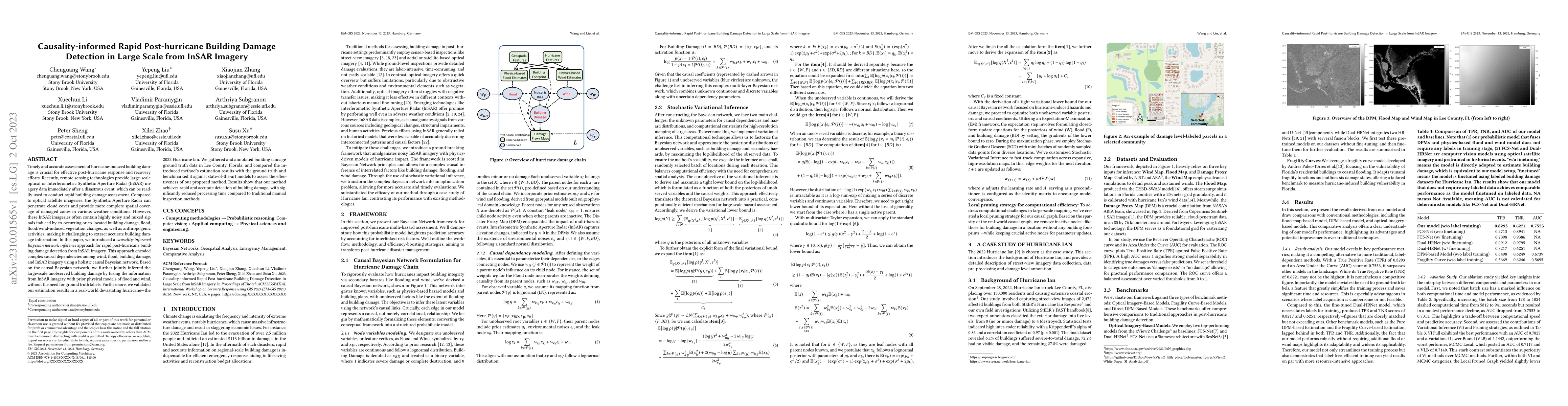
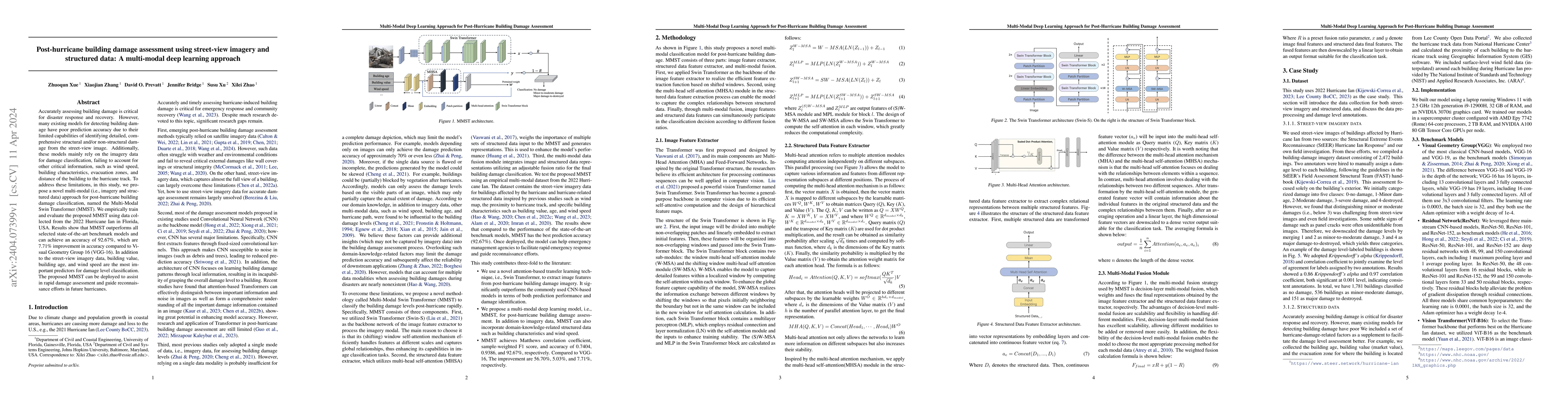
Timely and accurate assessment of hurricane-induced building damage is crucial for effective post-hurricane response and recovery efforts. Recently, remote sensing technologies provide large-scale o...
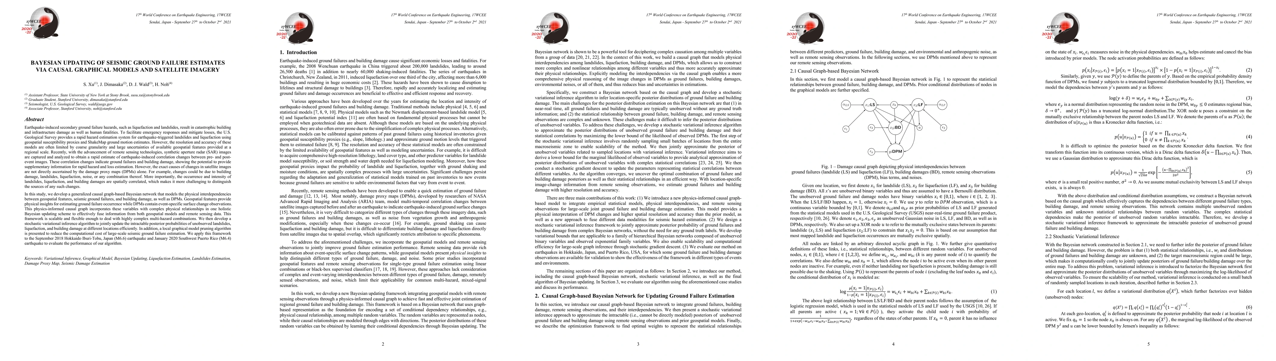
Earthquake-induced secondary ground failure hazards, such as liquefaction and landslides, result in catastrophic building and infrastructure damage as well as human fatalities. To facilitate emergen...
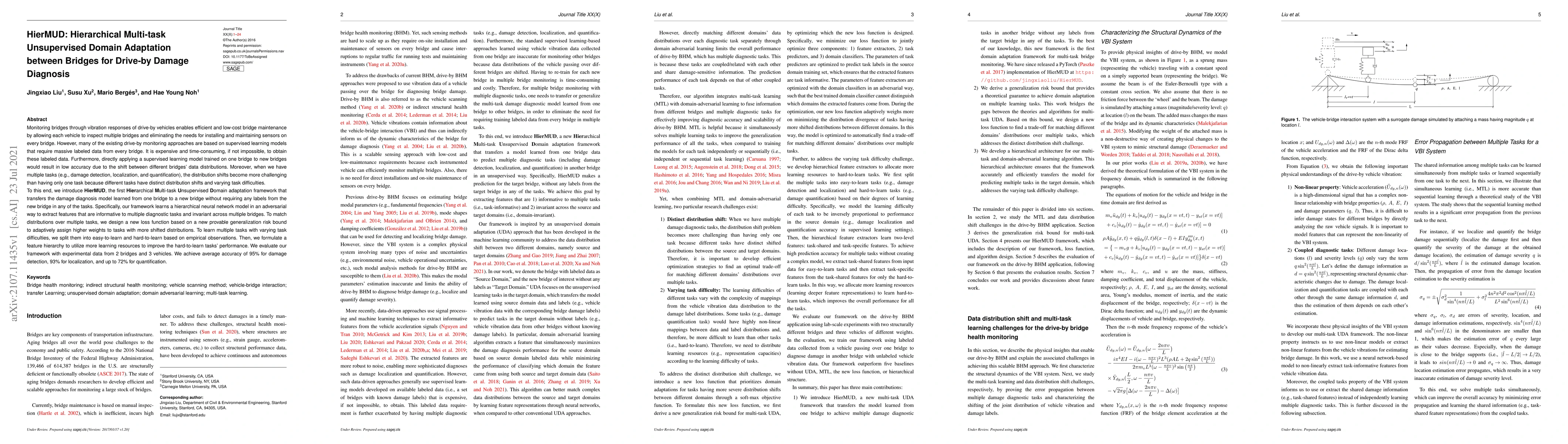
Monitoring bridge health using vibrations of drive-by vehicles has various benefits, such as no need for directly installing and maintaining sensors on the bridge. However, many of the existing driv...
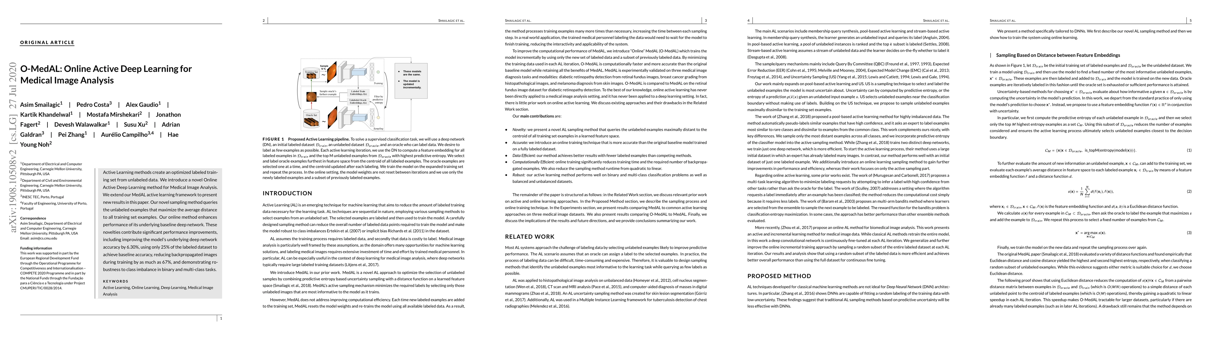
Active Learning methods create an optimized labeled training set from unlabeled data. We introduce a novel Online Active Deep Learning method for Medical Image Analysis. We extend our MedAL active l...
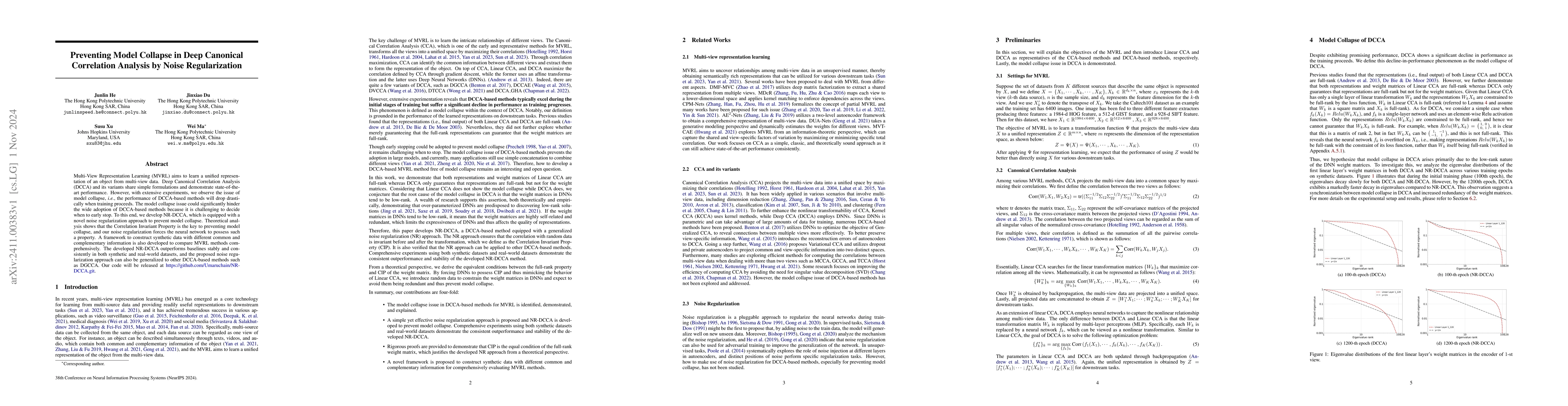
Multi-View Representation Learning (MVRL) aims to learn a unified representation of an object from multi-view data. Deep Canonical Correlation Analysis (DCCA) and its variants share simple formulation...
Rapid and accurate estimation of post-earthquake ground failures and building damage is critical for effective post-disaster responses. Progression in remote sensing technologies has paved the way for...
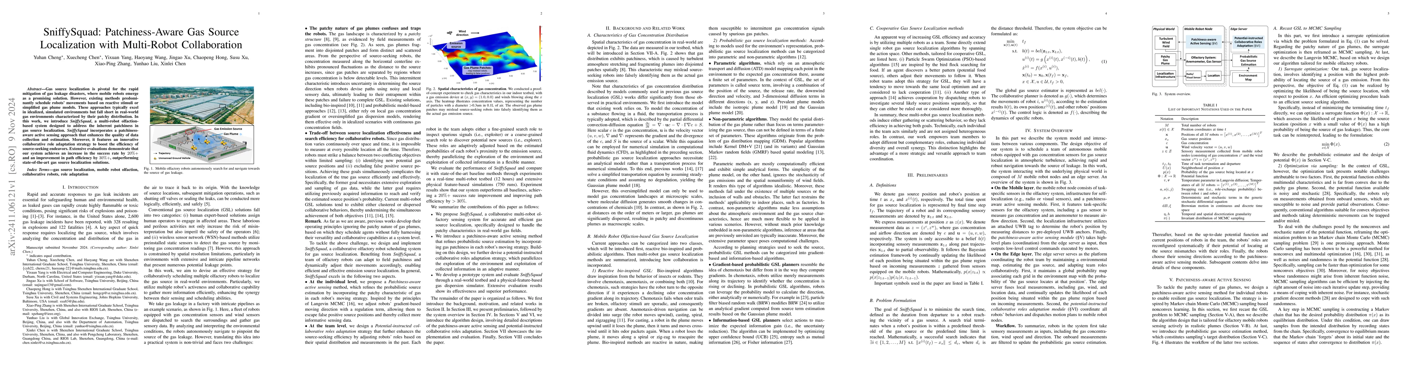
Gas source localization is pivotal for the rapid mitigation of gas leakage disasters, where mobile robots emerge as a promising solution. However, existing methods predominantly schedule robots' movem...
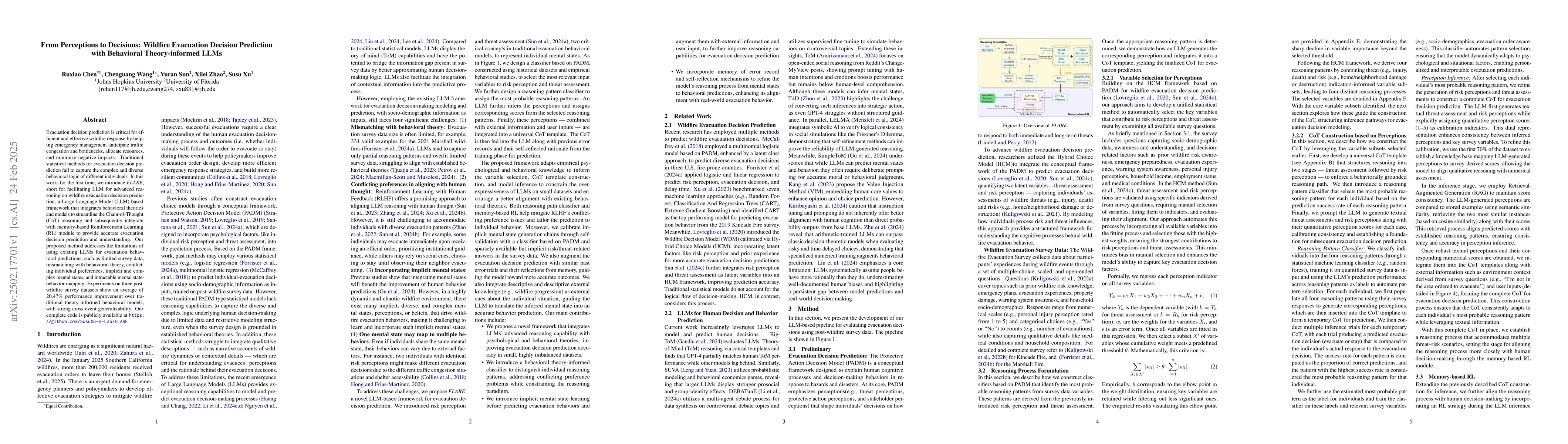
Evacuation decision prediction is critical for efficient and effective wildfire response by helping emergency management anticipate traffic congestion and bottlenecks, allocate resources, and minimize...
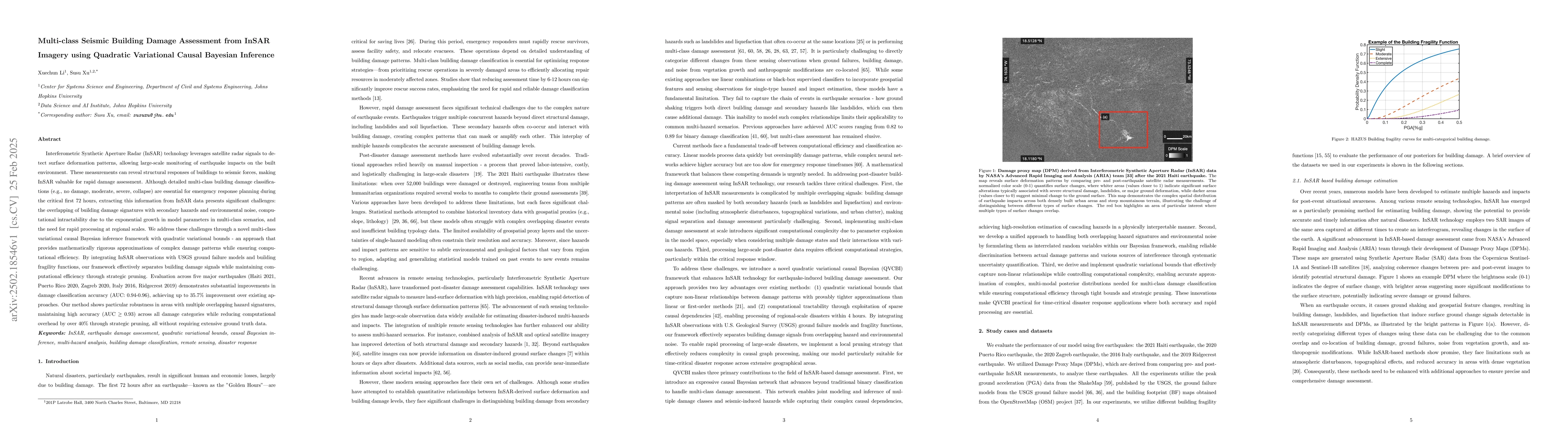
Interferometric Synthetic Aperture Radar (InSAR) technology uses satellite radar to detect surface deformation patterns and monitor earthquake impacts on buildings. While vital for emergency response ...
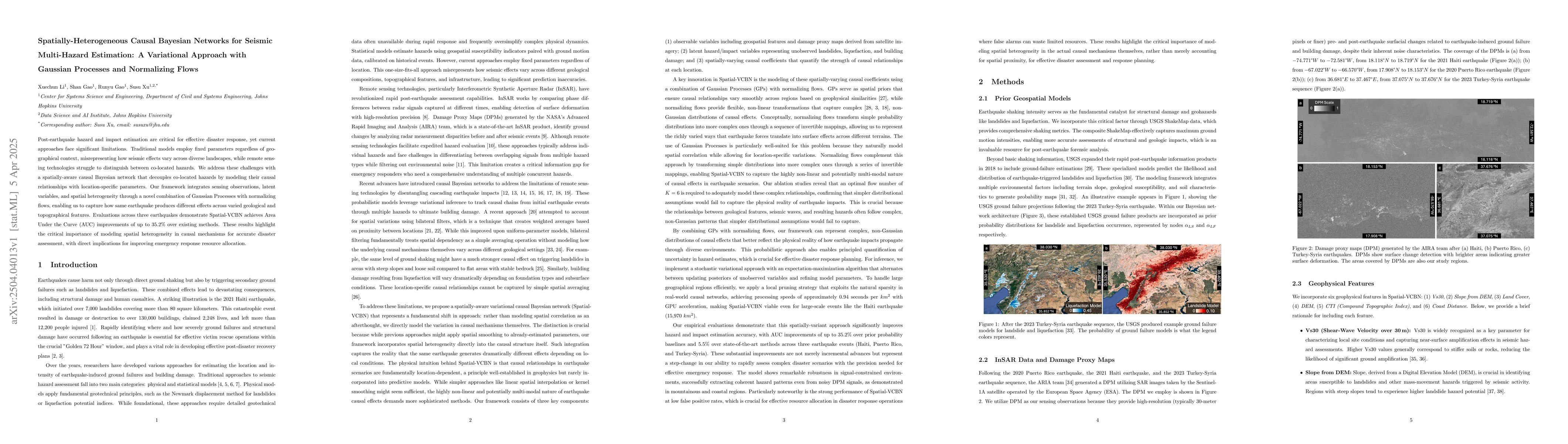
Post-earthquake hazard and impact estimation are critical for effective disaster response, yet current approaches face significant limitations. Traditional models employ fixed parameters regardless of...
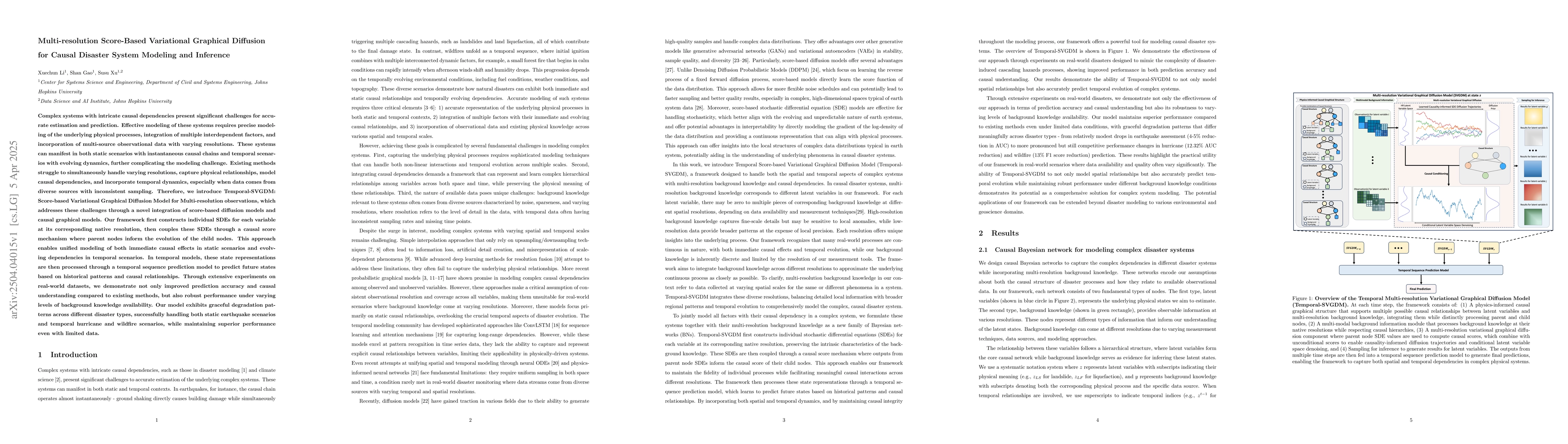
Complex systems with intricate causal dependencies challenge accurate prediction. Effective modeling requires precise physical process representation, integration of interdependent factors, and incorp...
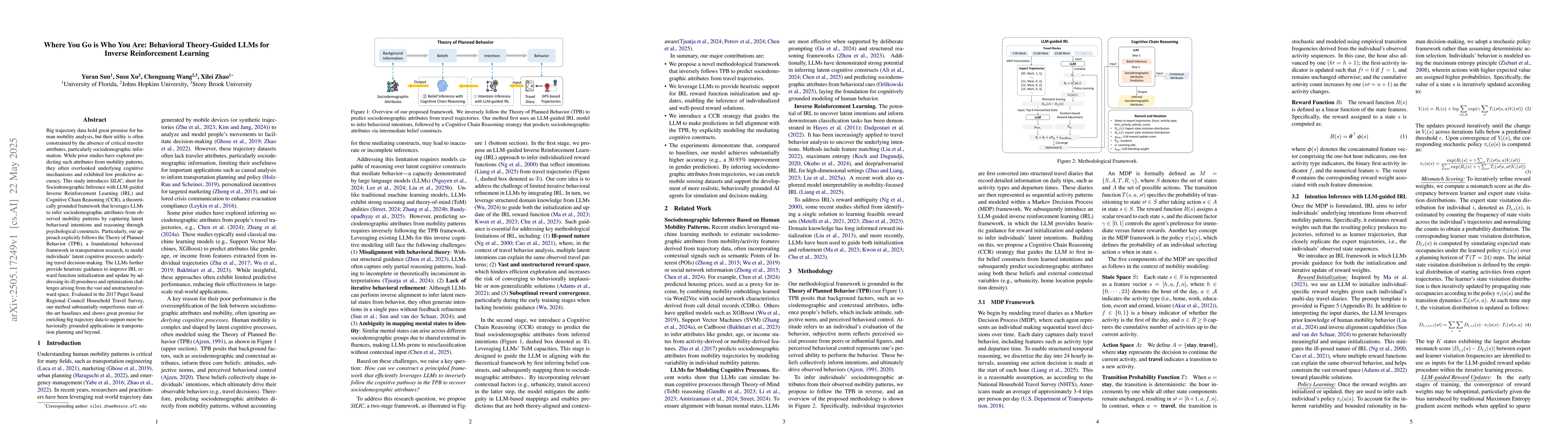
Big trajectory data hold great promise for human mobility analysis, but their utility is often constrained by the absence of critical traveler attributes, particularly sociodemographic information. Wh...
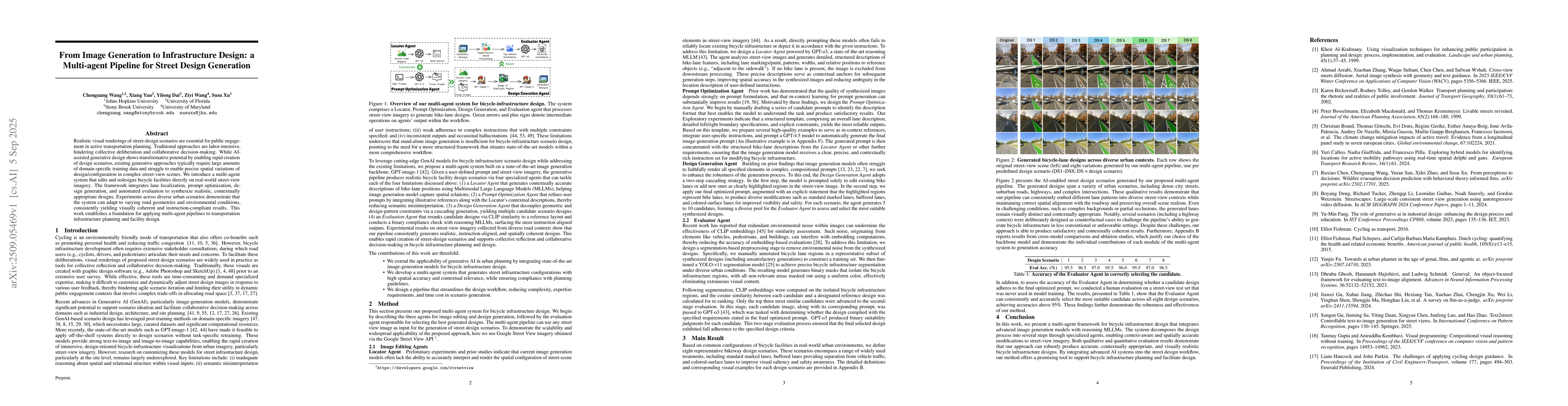
Realistic visual renderings of street-design scenarios are essential for public engagement in active transportation planning. Traditional approaches are labor-intensive, hindering collective deliberat...
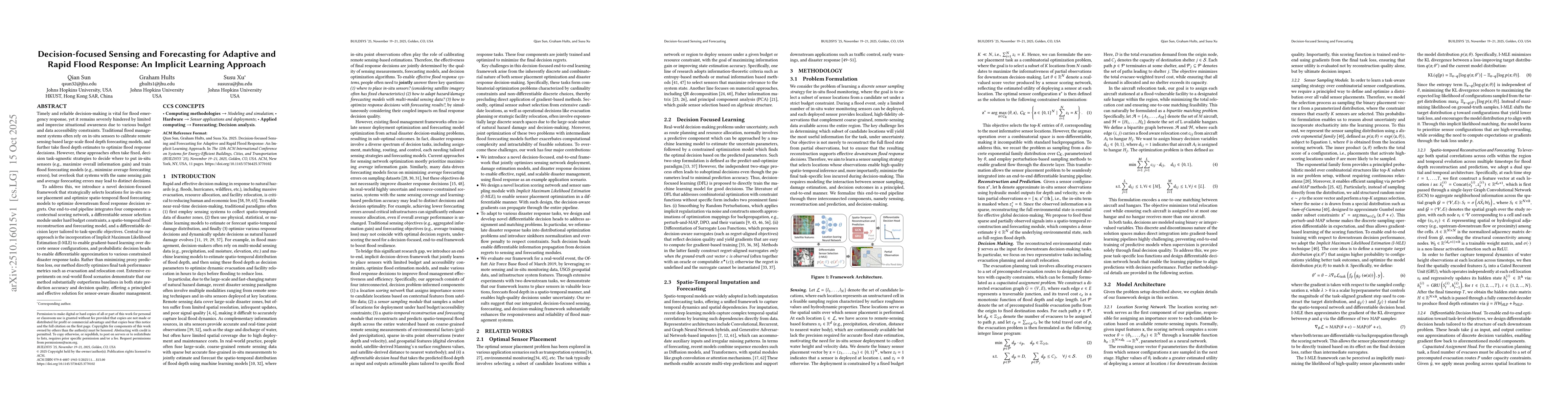
Timely and reliable decision-making is vital for flood emergency response, yet it remains severely hindered by limited and imprecise situational awareness due to various budget and data accessibility ...
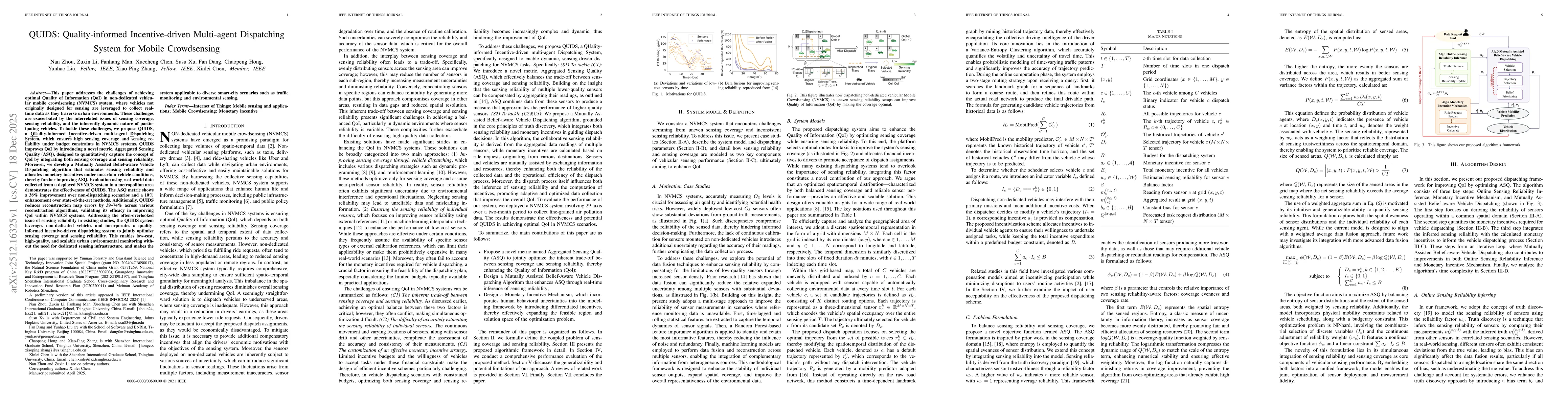
This paper addresses the challenge of achieving optimal Quality of Information (QoI) in non-dedicated vehicular mobile crowdsensing (NVMCS) systems. The key obstacles are the interrelated issues of se...
The growing frequency and intensity of wildfires pose serious threats to communities in wildland-urban interface regions. Understanding evacuation behavior is critical for effective emergency planning...
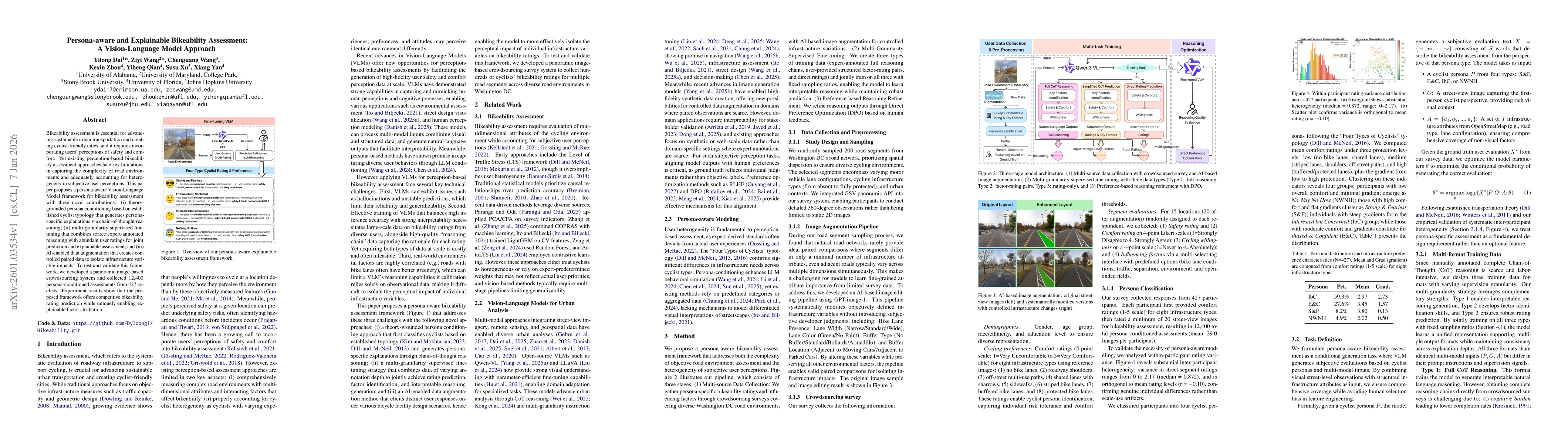
Bikeability assessment is essential for advancing sustainable urban transportation and creating cyclist-friendly cities, and it requires incorporating users' perceptions of safety and comfort. Yet exi...
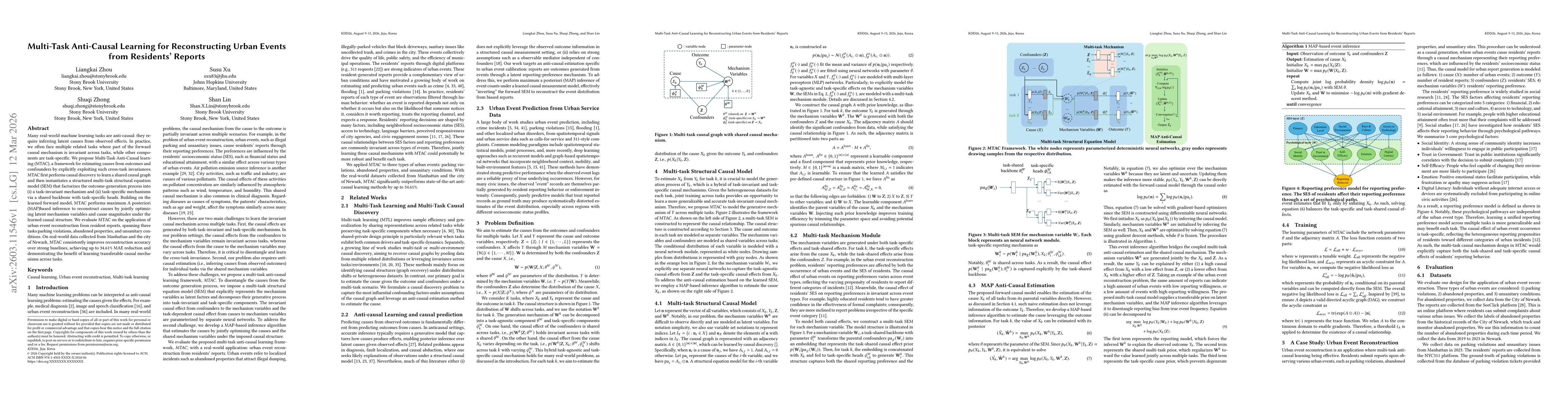
Many real-world machine learning tasks are anti-causal: they require inferring latent causes from observed effects. In practice, we often face multiple related tasks where part of the forward causal m...
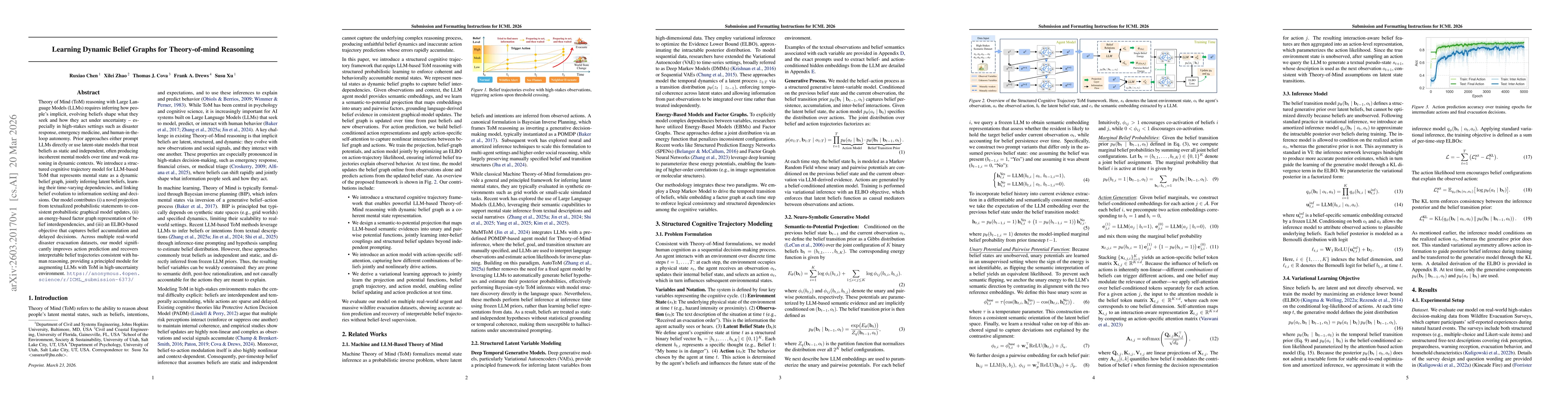
Theory of Mind (ToM) reasoning with Large Language Models (LLMs) requires inferring how people's implicit, evolving beliefs shape what they seek and how they act under uncertainty -- especially in hig...