Academic Profile
Statistics
Similar Authors
Papers on arXiv
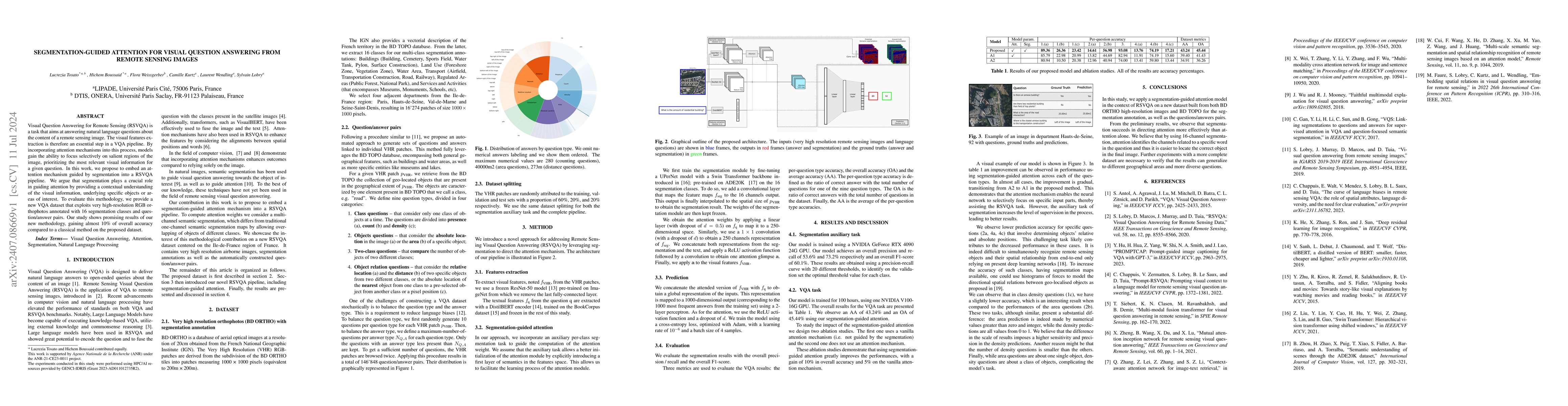
Visual Question Answering for Remote Sensing (RSVQA) is a task that aims at answering natural language questions about the content of a remote sensing image. The visual features extraction is therefor...
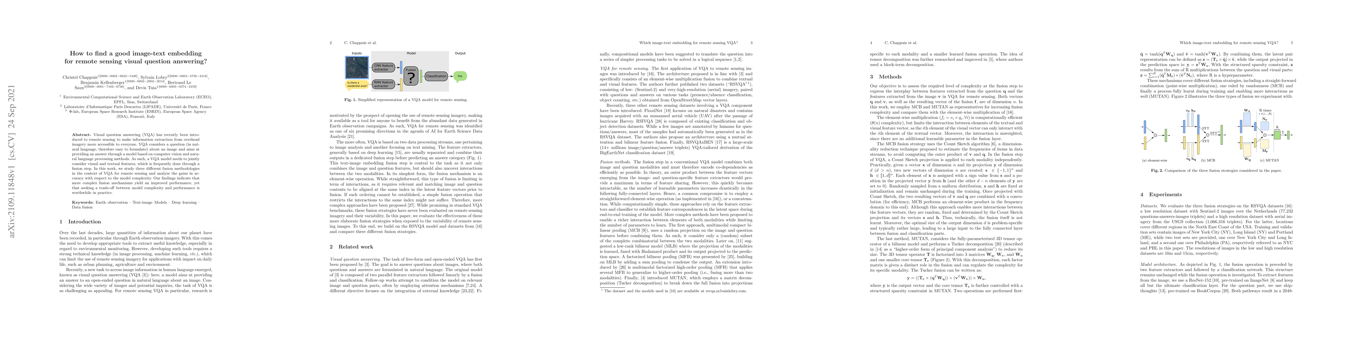
Remote sensing visual question answering (RSVQA) opens new opportunities for the use of overhead imagery by the general public, by enabling human-machine interaction with natural language. Building ...
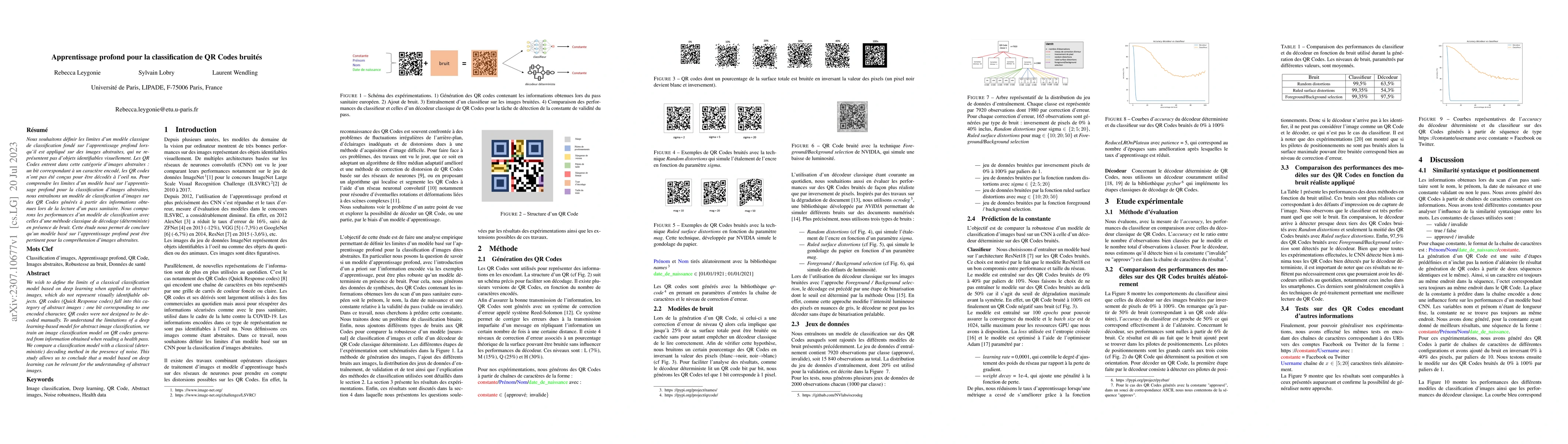
We wish to define the limits of a classical classification model based on deep learning when applied to abstract images, which do not represent visually identifiable objects.QR codes (Quick Response...
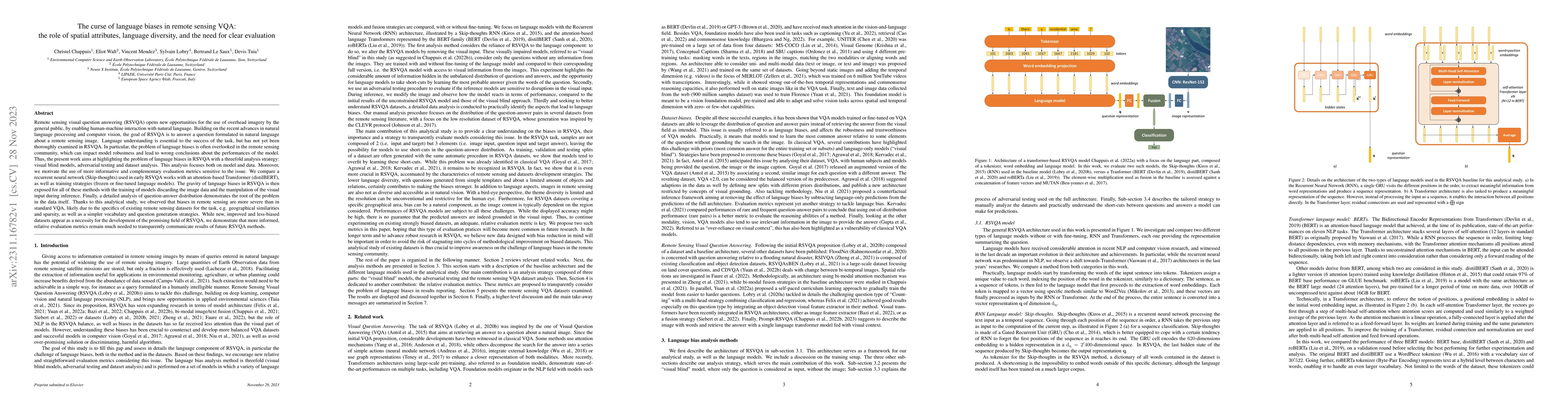
Visual question answering (VQA) has recently been introduced to remote sensing to make information extraction from overhead imagery more accessible to everyone. VQA considers a question (in natural ...
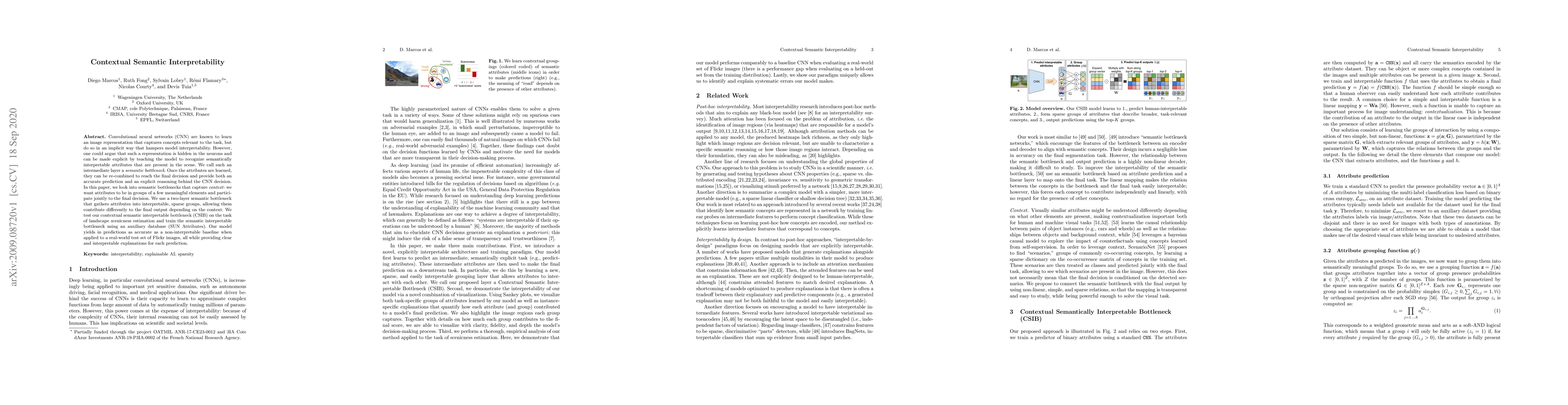
Convolutional neural networks (CNN) are known to learn an image representation that captures concepts relevant to the task, but do so in an implicit way that hampers model interpretability. However,...
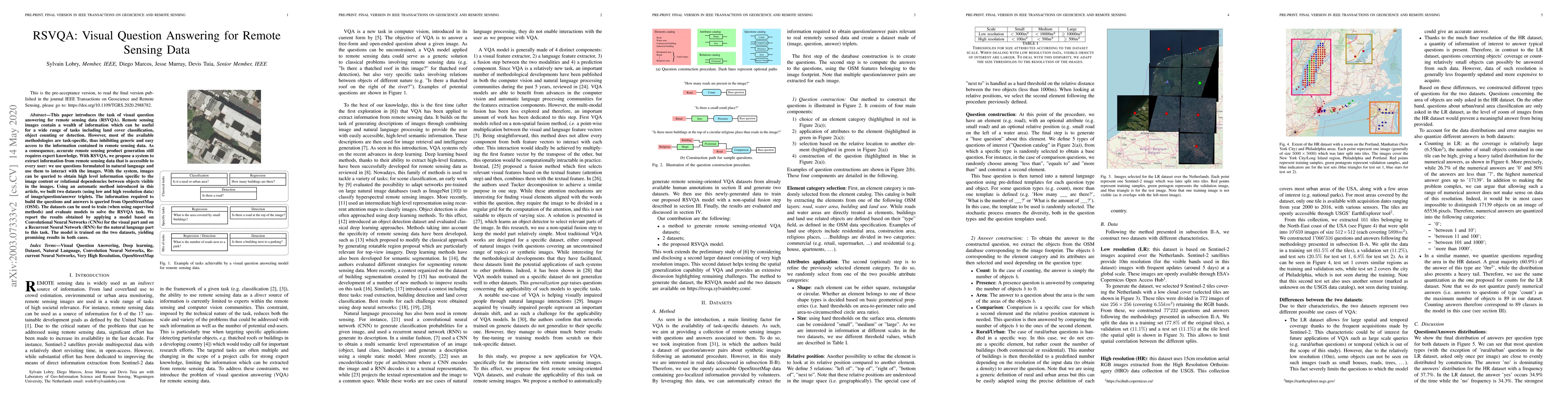
This paper introduces the task of visual question answering for remote sensing data (RSVQA). Remote sensing images contain a wealth of information which can be useful for a wide range of tasks inclu...
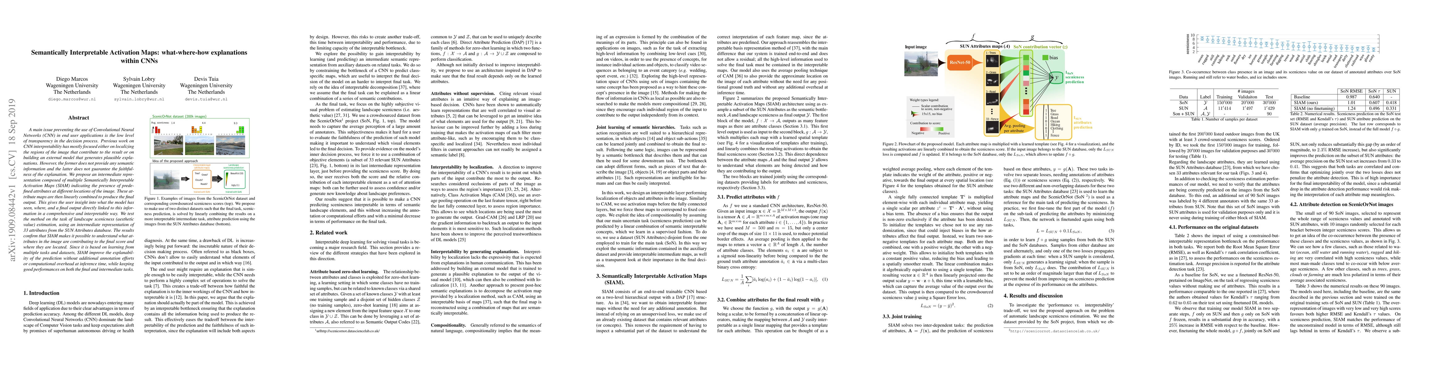
A main issue preventing the use of Convolutional Neural Networks (CNN) in end user applications is the low level of transparency in the decision process. Previous work on CNN interpretability has mo...
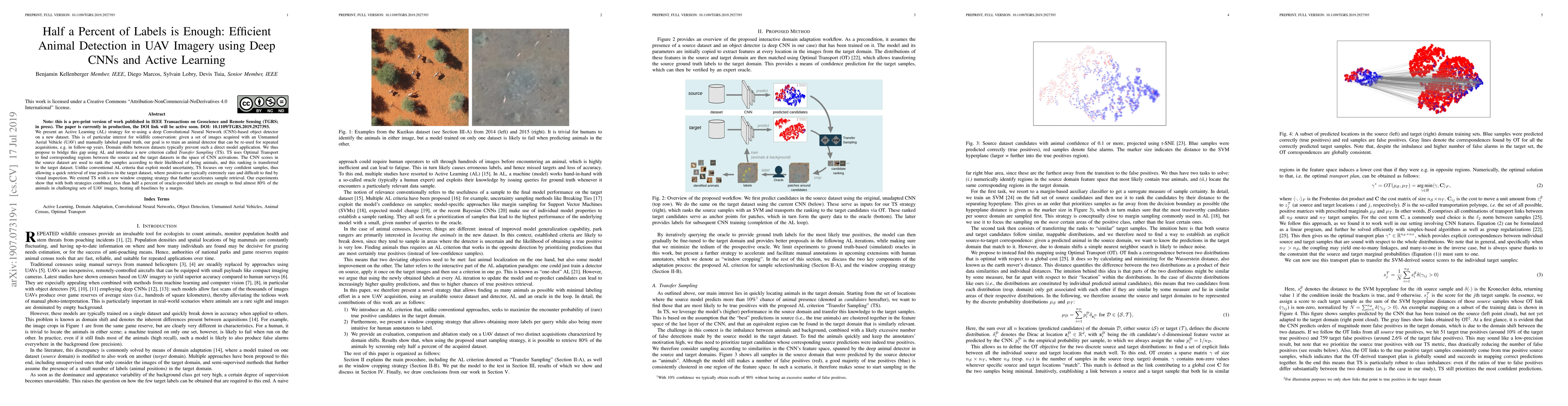
We present an Active Learning (AL) strategy for re-using a deep Convolutional Neural Network (CNN)-based object detector on a new dataset. This is of particular interest for wildlife conservation: g...
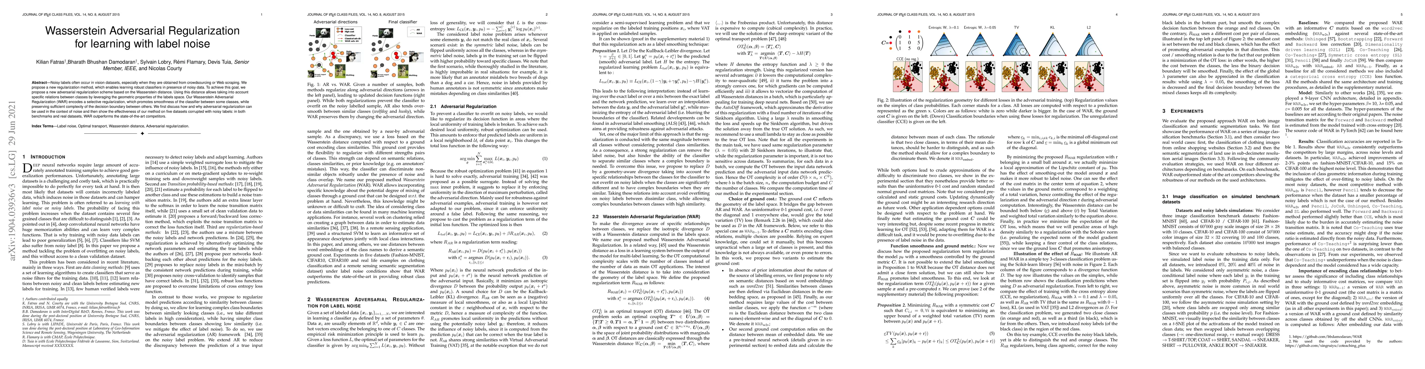
Noisy labels often occur in vision datasets, especially when they are obtained from crowdsourcing or Web scraping. We propose a new regularization method, which enables learning robust classifiers i...
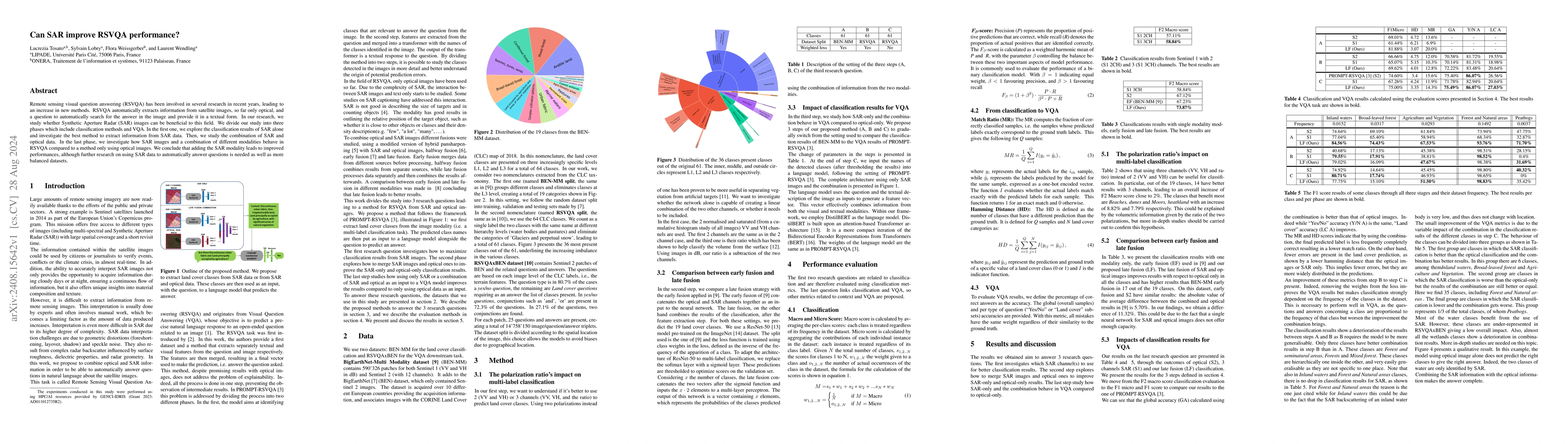
Remote sensing visual question answering (RSVQA) has been involved in several research in recent years, leading to an increase in new methods. RSVQA automatically extracts information from satellite i...
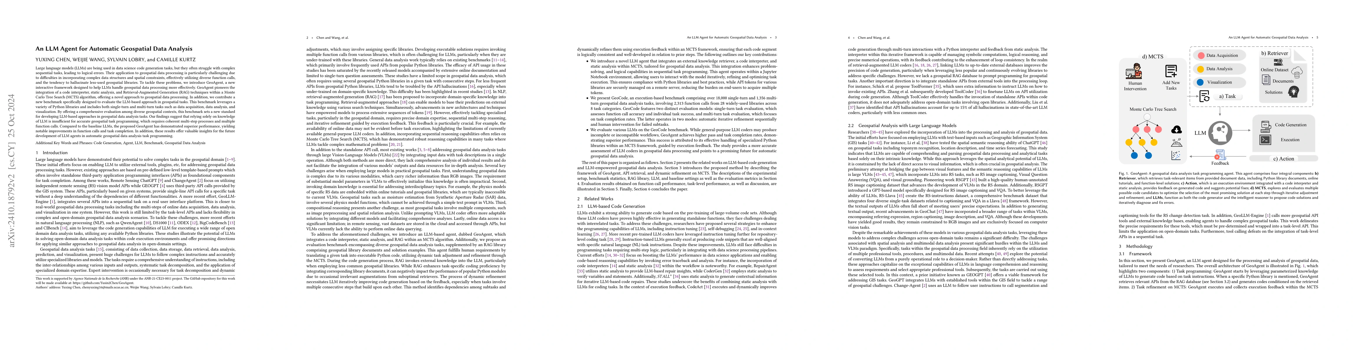
Large language models (LLMs) are being used in data science code generation tasks, but they often struggle with complex sequential tasks, leading to logical errors. Their application to geospatial dat...
Remote sensing visual question answering (RSVQA) is a task that automatically extracts information from satellite images and processes a question to predict the answer from the images in textual form,...
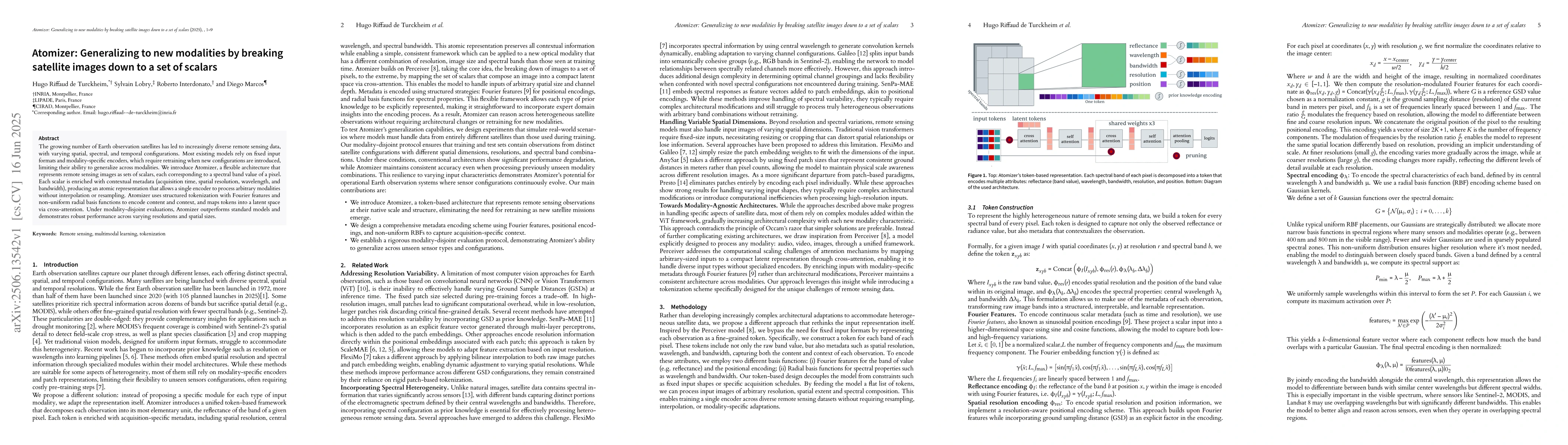
The growing number of Earth observation satellites has led to increasingly diverse remote sensing data, with varying spatial, spectral, and temporal configurations. Most existing models rely on fixed ...
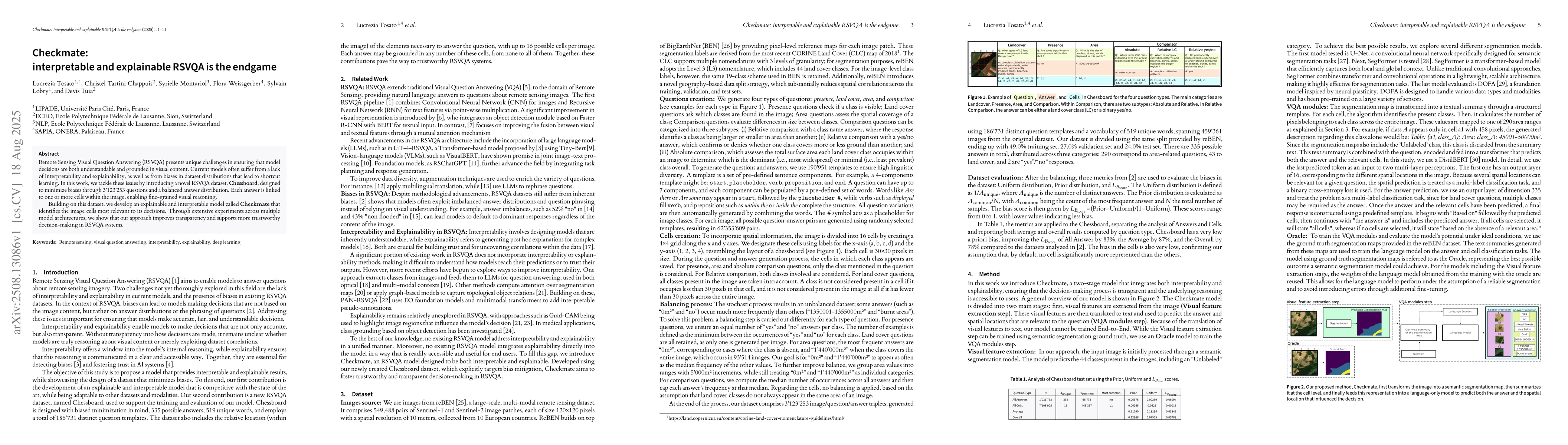
Remote Sensing Visual Question Answering (RSVQA) presents unique challenges in ensuring that model decisions are both understandable and grounded in visual content. Current models often suffer from a ...

Earth observation (EO) data spans a wide range of spatial, spectral, and temporal resolutions, from high-resolution optical imagery to low resolution multispectral products or radar time series. While...
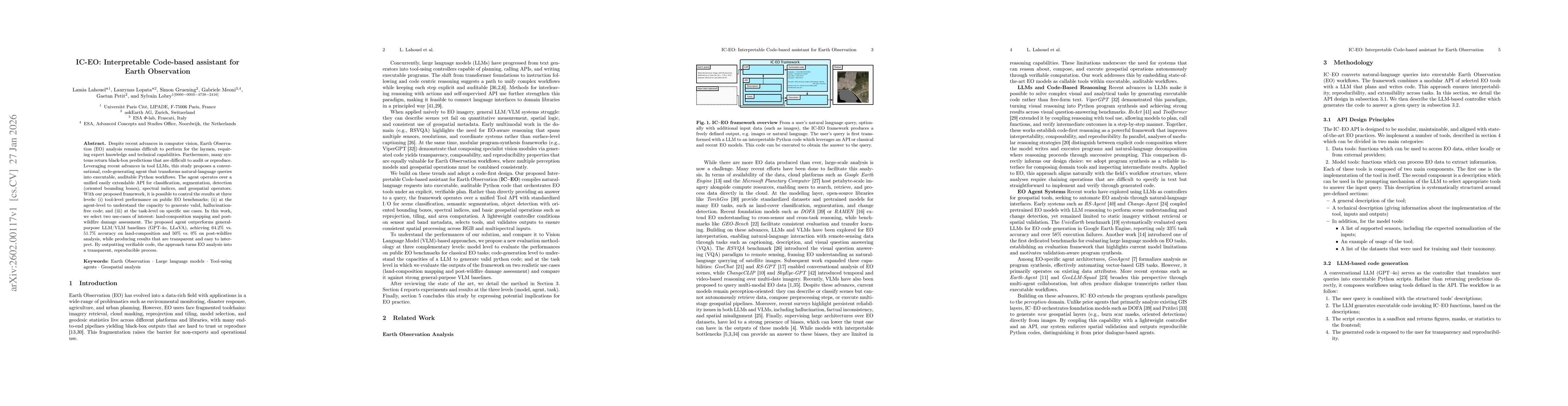
Despite recent advances in computer vision, Earth Observation (EO) analysis remains difficult to perform for the laymen, requiring expert knowledge and technical capabilities. Furthermore, many system...
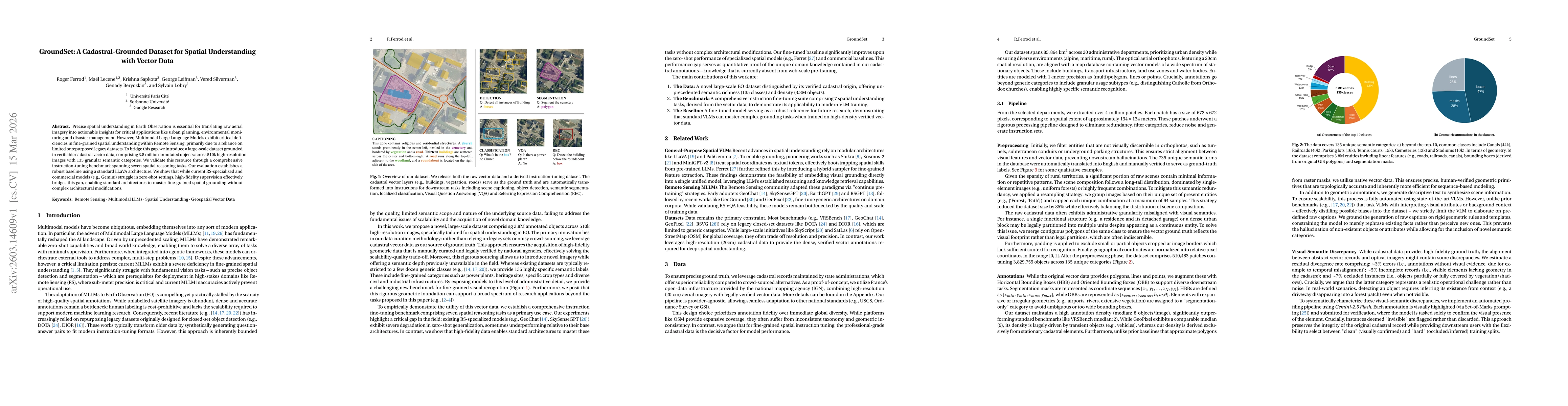
Precise spatial understanding in Earth Observation is essential for translating raw aerial imagery into actionable insights for critical applications like urban planning, environmental monitoring and ...