Academic Profile
Statistics
Similar Authors
Papers on arXiv
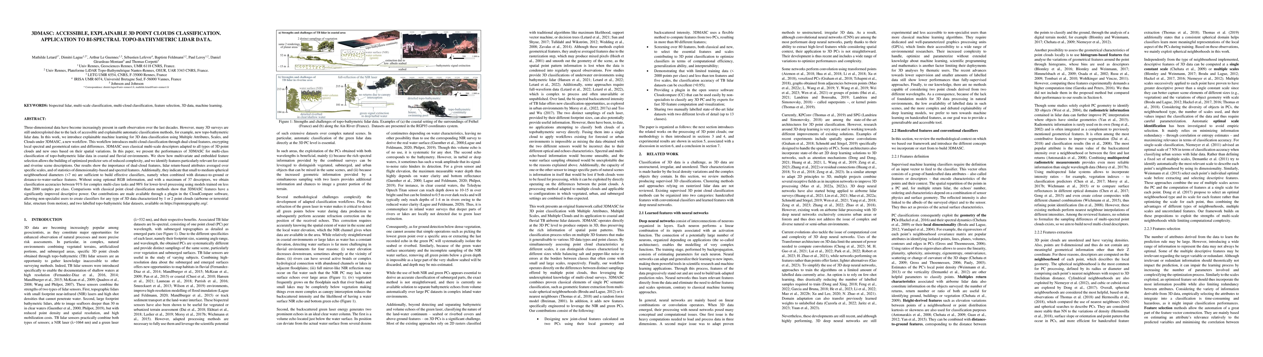
Three-dimensional data have become increasingly present in earth observation over the last decades. However, many 3D surveys are still underexploited due to the lack of accessible and explainable au...
Light Detection and Ranging (LiDAR) are fast emerging sensors in the field of Earth Observation. It is a remote sensing technology that utilizes laser beams to measure distances and create detailed ...
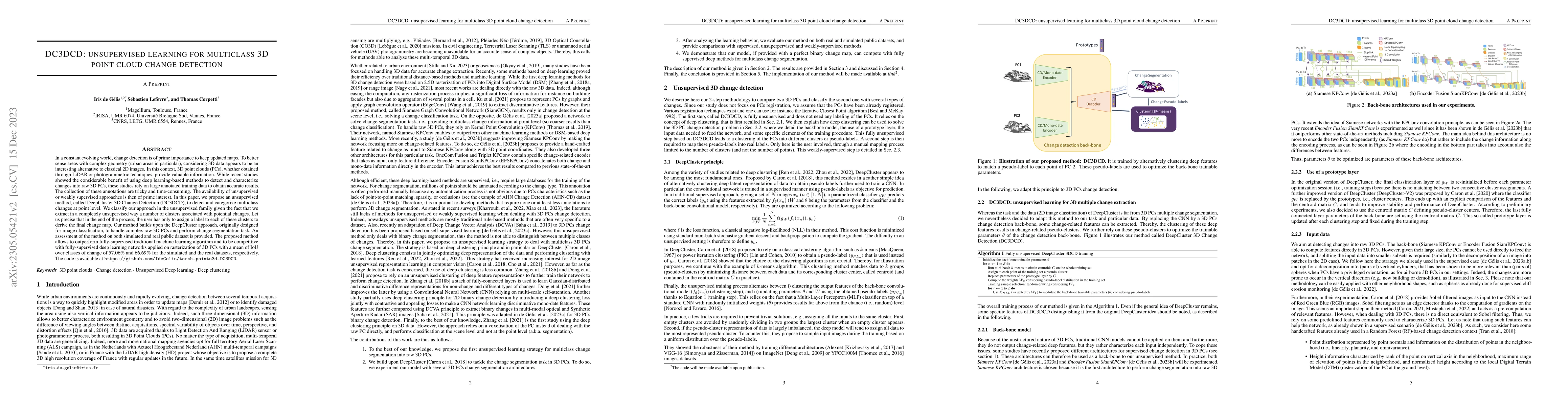
In a constant evolving world, change detection is of prime importance to keep updated maps. To better sense areas with complex geometry (urban areas in particular), considering 3D data appears to be...
Change detection from traditional \added{2D} optical images has limited capability to model the changes in the height or shape of objects. Change detection using 3D point cloud \added{from photogram...
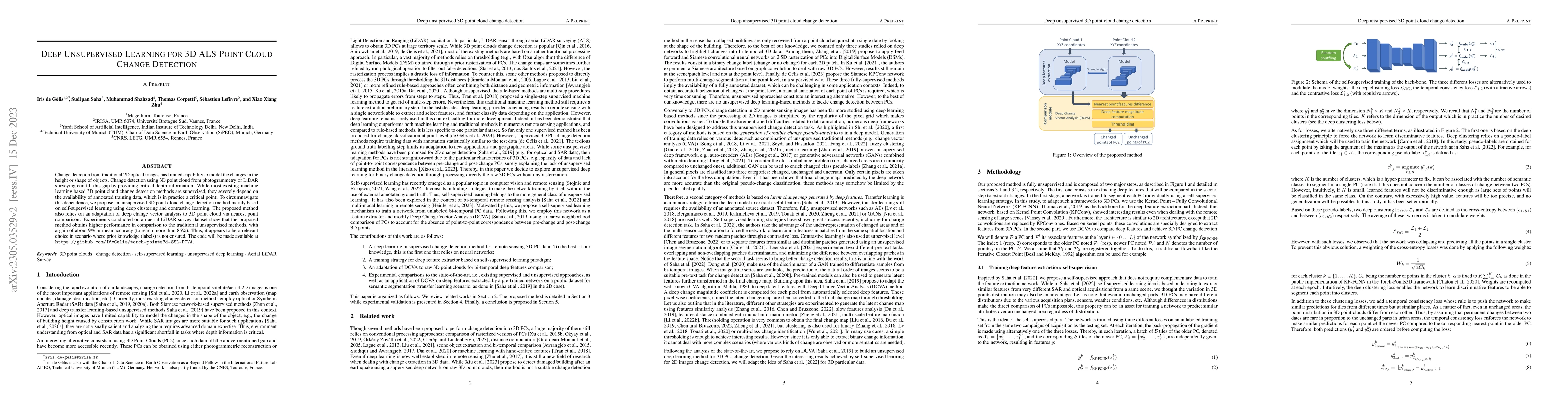
Change detection is an important task that rapidly identifies modified areas, particularly when multi-temporal data are concerned. In landscapes with a complex geometry (e.g., urban environment), ve...
Despite the popularity of deep neural networks in various domains, the extraction of digital terrain models (DTMs) from airborne laser scanning (ALS) point clouds is still challenging. This might be...
Nowadays, thermal infrared satellite remote sensors enable to extract very interesting information at large scale, in particular Land Surface Temperature (LST). However such data are limited in spat...
Underwater acoustic cameras are high potential devices for many applications in ecology, notably for fisheries management and monitoring. However how to extract such data into high value information...
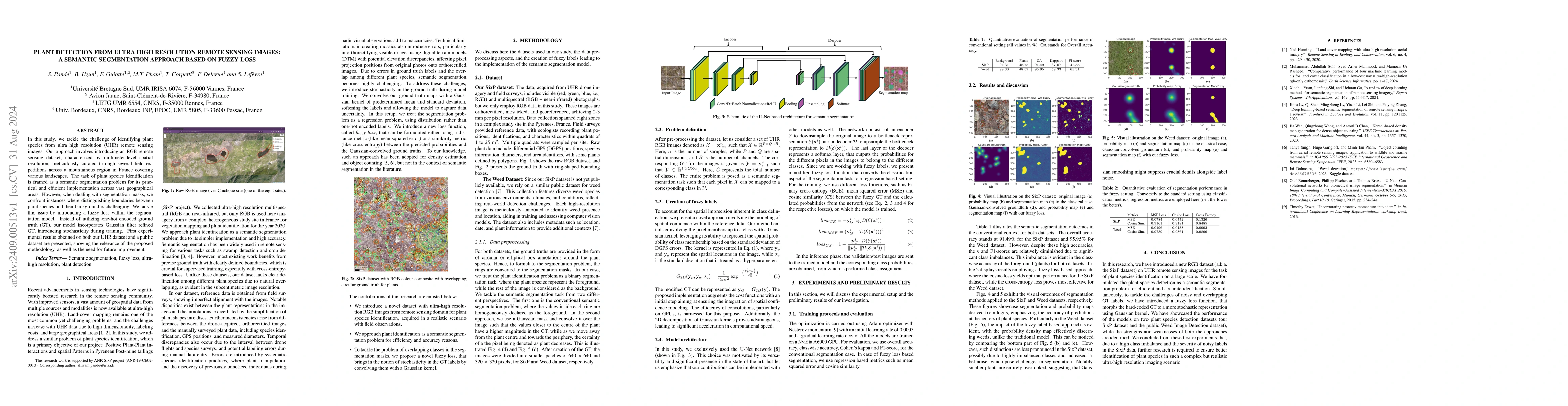
In this study, we tackle the challenge of identifying plant species from ultra high resolution (UHR) remote sensing images. Our approach involves introducing an RGB remote sensing dataset, characteriz...
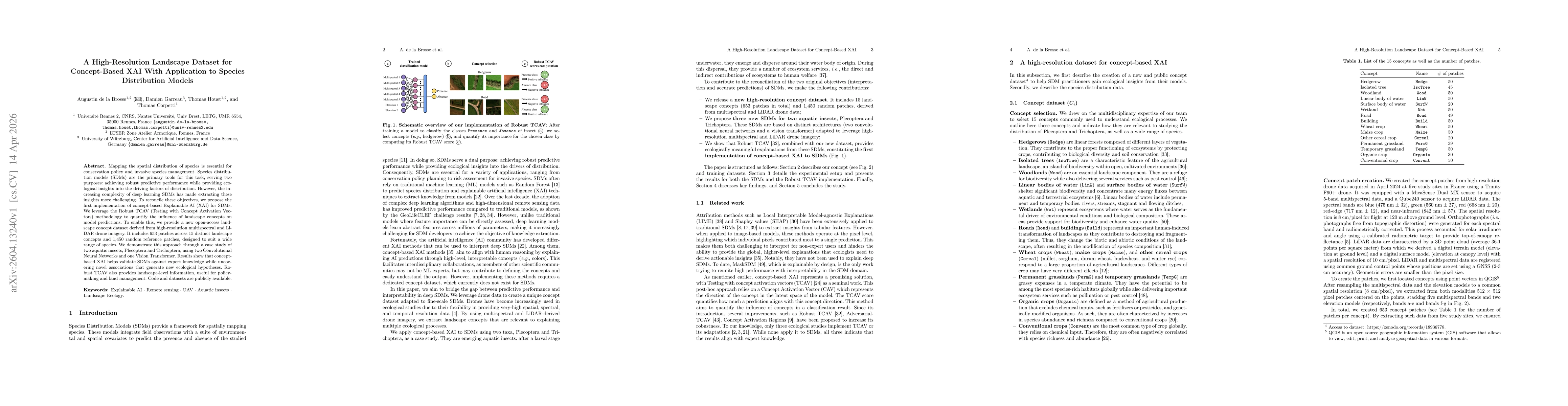
Mapping the spatial distribution of species is essential for conservation policy and invasive species management. Species distribution models (SDMs) are the primary tools for this task, serving two pu...